By Mark Hilton, April 6, 2019
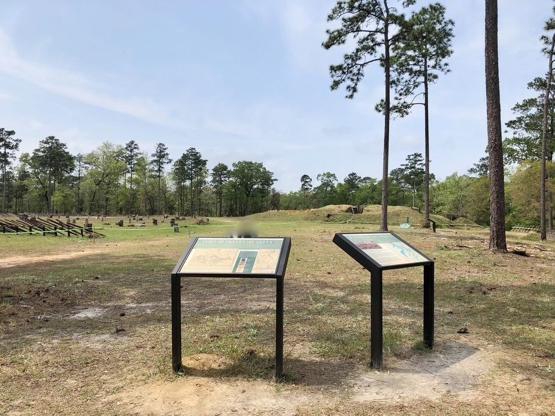
Fort Blakeley Marker with Redoubt #4 in background.
| Near Battlefield Road, 0.3 miles east of Green Street, on the right when traveling east. |
| On Battlefield Road, 0.3 miles east of Green Street. |
| Near Fort Morgan Road (Alabama Route 180) 2 miles west of Dune Drive, on the left when traveling west. |
| Near Fort Morgan Road (Alabama Route 180) 2 miles west of Dune Drive, on the right when traveling west. |
| On Fort Morgan Road (Alabama Route 180) 2 miles west of Dune Drive, on the right when traveling west. |
| On Fort Morgan Road (Alabama Route 180) 2 miles west of Dune Drive, on the left when traveling west. |
| Near Fort Morgan Road (Alabama Route 180) 2 miles west of Dune Drive, on the right when traveling west. |
| On Dixie Graves Parkway near Alabama Route 180 W. |
| On Fort Morgan Road (Alabama Route 180) 1.2 miles west of Dune Road, on the right when traveling west. |
| Near Fort Morgan Road, 1.4 miles Dune Road, on the left when traveling west. |
| Near Fort Morgan Road (Alabama Route 180) 1.6 miles west of Dune Road, on the right when traveling west. |
| On Fort Morgan Road (Road 180) 1.7 miles west of Dune Drive, on the right when traveling west. |
| Near Fort Morgan Road (State Road 180) 1 mile west of Dune Drive, on the left when traveling west. |
| On Fort Morgan Road (State Road 180) 1.7 miles west of Dune Drive, on the right when traveling west. |
| Near Fort Morgan Road (State Road 180) 1.7 miles west of Dune Drive. |
| Near Fort Morgan Road (Alabama Route 180) 1.7 miles west of Dune Drive when traveling west. |
| On Dixie Graves Highway, on the right when traveling south. |
| On Fort Morgan Road (Alabama Route 180) west of Pontoon Lane, on the right when traveling west. |
| Near Fort Morgan Road (State Road 180) 1 mile west of Dune Drive, on the left when traveling west. |
| Near Fort Morgan Road (Alabama Route 180) 1.2 miles west of Dune Road, on the right when traveling west. |
| Near Fort Morgan Road (State Highway 180) 1.7 miles west of Dune Drive. |
| Near Fort Morgan Road (Alabama Route 180) 1.7 miles west of Dune Drive when traveling west. |
| On Fort Morgan Road (State Road 180) 1.7 miles west of Dune Drive, on the left when traveling west. |
| On Fort Morgan Road (State Road 180) 1.7 miles west of Dune Drive, on the right when traveling west. |
| On Speckle Trout Route, 0.1 miles north of General Canby Drive, in the median. |
| On General Gibson Road, 0.1 miles west of Lancers Lane, on the right when traveling east. |
| On Artillery Range Street north of Yankee Trove, on the right when traveling north. |
| On Confederate Drive, on the right when traveling north. |
| On Spanish Main Street south of Cannonade Boulevard, on the right when traveling south. |
| On Spanish Main Street south of Cannonade Boulevard, on the right when traveling south. |
| On Lancers Lane east of Spanish Main Street, on the left when traveling west. |
| On Larry Dee Cawyer Drive at Old Spanish Trail (U.S. 98), on the left when traveling north on Larry Dee Cawyer Drive. |
| On Spanish Main Street north of Spanish Fort Boulevard (U.S. 31), on the right when traveling north. |
| Near Spanish Fort Boulevard at Blakeley Way (County Road 72). |
| On Patrician Drive South west of Patrician Drive East, on the right when traveling south. |
| On Fort Mims Road north of Boatyard Road (County Route 80), on the right. |
| Near Alabama Route 225, on the left when traveling north. |
| On Boatyard Road (County Road 80) at Fort Mims Road, on the left when traveling west on Boatyard Road. |
| Near Fort Sims Road, 0.3 miles north of Boatyard Road (County Road 80). |
| On Woody Johnson Road, 0.1 miles east of County Route 79, on the left when traveling east. |
| On U.S. 82 close to County Road 79, on the left when traveling west. |
| On Pineapple Highway (Alabama Route 10) 0.8 miles west of Bibb Road (County Road 5), on the right when traveling west. |
| On Sherling Lake Road (Road 44) 0.4 miles north of Ridge Road (County Road 54), on the right when traveling north. |
| On Fort Dale Road (Alabama Route 185) 0.3 miles north of Sherling Lake Road, on the right when traveling south. |
| On County Route 99 at County Route 95, on the right when traveling north on County Route 99. |
| On Rockville Road (County Road 15) at Suel Road, on the right when traveling south on Rockville Road. |
| On Bird Jackson Road (County Road 35) 5.9 miles south of Simmons Creek Road, on the left when traveling south. |
| On Fort Sinquefield Road west of U.S. 84. |
| On Berrys Chapel Road, 0.7 miles north of Winn Road (Route 3), on the right when traveling north. |
| On Old Federal Road (County Road 5) south of County Road 42, on the left when traveling south. |
| On Painter Avenue, on the right when traveling south. |
| On Lapsley Road at Buckeye Avenue, on the right when traveling south on Lapsley Road. Reported permanently removed. |
| On Summerfield Road at Battery Avenue, on the right when traveling south on Summerfield Road. |
| On Summerfield Road at Highland Avenue (U.S. 80), on the right when traveling south on Summerfield Road. Reported missing. |
| Near 4th Street near Gault Avenue South (Alabama Route 35) when traveling east. |
| On Gault Avenue North (U.S. 11) east of 4th Street, on the right when traveling east. |
| Near Interstate 59, 1 mile north of County Road 140, on the right when traveling south. |
| On West Fort Toulouse Road, 0.3 miles south of Jackson Park Road, on the right when traveling south. |
| Near West Fort Toulouse Road, 0.3 miles west of Jackson Park Road, on the right when traveling west. |
| On Shoffner Street (County Road 22) at Weaver Street, on the right when traveling east on Shoffner Street. |
| On Hartford Road (Alabama Route 10) 0.6 miles east of County Road 46, on the left when traveling east. |
| On City Park Road south of Kentucky Avenue (Alabama Route 17), on the left when traveling south. |
| On East Mobile Street south of North Royal Avenue, on the left when traveling south. |
| On East Mobile Street at North Royal Avenue, on the left when traveling south on East Mobile Street. |
| On Veterans Drive at South Magnolia Street, on the right when traveling east on Veterans Drive. |
| On Martin Luther King Drive (County Road 83) at County Road 82, on the right when traveling south on Martin Luther King Drive. |
| On Lee Highway (U.S. 72) 0.2 miles west of Wright Road, on the right when traveling west. |
| On Browns Ferry Street (County Road 29) west of Allyn Street, on the right when traveling west. |
| Near East Market Street west of South Clinton Street, on the right when traveling east. |
| On Elkmont Road/North Jefferson Street (Alabama Route 127) 1.2 miles south of Morris Road, on the right when traveling south. |
| On Easter Ferry Road south of Morris Road (County Road 49), on the right when traveling south. Reported missing. |
| On U.S. 43, 0.2 miles north of Richie Road, on the right when traveling north. |
| Near Bienville Boulevard east of Albatross Street, on the right when traveling east. |
| Near Bienville Boulevard east of Albatross Street, on the right when traveling east. |
| Near Bienville Boulevard east of Albatross Street, on the right when traveling east. |
| Near Bienville Boulevard east of Albatross Street, on the right when traveling east. |
| Near Bienville Boulevard east of Albatross Street, on the right when traveling east. |
| On Government Street, 0.1 miles east of South Royal Street, in the median. |
| Near Virginia Street, 0.1 miles east of South Ann Street. |
| On South Royal Street at Church Street, on the right when traveling south on South Royal Street. |
| On Theatre Street, 0.1 miles west of South Royal Street, on the right when traveling west. |
| On Church Street west of South Royal Street, on the right when traveling west. |
| On South Royal Street at Theatre Street, on the right when traveling south on South Royal Street. |
| Near South Royal Street just south of Church Street, on the right when traveling south. |
| On Military Road (County Road 96) at Old Highway 43, on the left when traveling east on Military Road. |
| On Old Military Road East (Alabama Route 96) 0.1 miles Old Military Road South (Alabama Route 96), on the right when traveling north. |
| On Superintendents Drive at Coy Smith Highway (Alabama Route 96), on the right when traveling west on Superintendents Drive. |
| On Old Highway 43 at Military Road (County Road 96), on the left when traveling south on Old Highway 43. |
| On U.S. 84 at Grain Elevator Road and Lena Landegger Highway, on the left when traveling west on U.S. 84. |
| On U.S. 84 at Old Fort Claiborne Road, on the right when traveling west on U.S. 84. |
| On Bank Street at Vine Street Northwest, on the right when traveling south on Bank Street. |
| On Lafayette Street Northwest at Railroad Street, on the right when traveling west on Lafayette Street Northwest. |
| On Unnamed road, 0.2 miles east of Alabama Route 165, on the right when traveling east. |
| Near Old Federal Road east of Alabama Route 165, on the left when traveling east. |
| On Alabama Route 165, on the right when traveling north. |
| On Alabama Route 165 at Terminal Road (Route 54), on the right when traveling north on State Route 165. |
| On South Railroad Street west of Holland Court, on the right when traveling west. |
6479 entries matched your criteria. The first 100 are listed above.
Next 100 ⊳