After filtering for California, 2596 entries match your criteria. Entries 101 through 200 are listed.⊲ Previous 100 — Next 100 ⊳
Settlements & Settlers Topic
By Syd Whittle, July 31, 2006
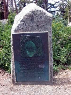
Kit Carson Marker
| 101 ► California, Alpine County, Kirkwood — 315 — Kit Carson — |
| Near Carson Pass Scenic Byway (State Highway 88), on the right. | |||
| 102 ► California, Alpine County, Kirkwood — 378 — Memorial to Pioneer Odd Fellows — |
| Near Carson Pass Scenic Byway (State Highway 88). | |||
| 103 ► California, Alpine County, Kirkwood — 661 — Old Emigrant Road |
| On Carson Pass Scenic Byway (State Highway 88), on the right when traveling east. Reported missing. | |||
| 104 ► California, Alpine County, Kirkwood — 662 — Old Emigrant Road — |
| On Carson Pass Highway (California Route 88) at Mud Flat Road, on the right when traveling east on Carson Pass Highway. | |||
| 105 ► California, Alpine County, Kirkwood — Snowshoe Thom(p)son — (John Tostensen) — A True Pioneer — |
| On Carson Pass Scenic Byway (State Highway 88), on the right when traveling east. | |||
| 106 ► California, Alpine County, Markleeville — Alpine Hotel — |
| On State Highway 4/89 at Montgomery Street, on the right when traveling south on State Highway 4/89. | |||
| 107 ► California, Alpine County, Markleeville — Beautiful Hot Springs Valley — draws people now as it has for thousands of years — |
| Near Hot Springs Road. | |||
| 108 ► California, Alpine County, Markleeville — 318 — Ebbetts Pass — Historical Landmark — |
| On Ebbetts Pass Scenic Byway (State Highway 4), on the left when traveling east. | |||
| 109 ► California, Alpine County, Markleeville — Hangman's Bridge & Vigilante Justice — |
| On School Street. | |||
| 110 ► California, Alpine County, Markleeville — Historic Silver Mountain City — (Kongsberg) — |
| On The Ebbetts Pass Scenic Byway (State Highway 4), on the right when traveling east. | |||
| 111 ► California, Alpine County, Markleeville — 240 — Jacob Markley — |
| Near Alpine State Highway (California Route 89) south of Water Street, on the left when traveling south. | |||
| 112 ► California, Alpine County, Markleeville — Markleeville General Store — |
| 113 ► California, Alpine County, Markleeville — Snowshoe Thompson — |
| On Diamond Valley Road, 3 miles east of California Highway 89, on the right when traveling west. | |||
| 114 ► California, Alpine County, Markleeville — Snowshoe Thompson Home — |
| On Diamond Valley Road, 3 miles east of California Highway 89, on the right when traveling west. | |||
| 115 ► California, Alpine County, Markleeville — The Lost Whiskey of Raymond — |
| On School Street. | |||
| 116 ► California, Alpine County, Meyers — LP-3 — Luther Pass Trail - Came to Grass Lake — |
| On Luther Pass Road (California Route 89) 4 miles north of California Route 88, on the left when traveling north. | |||
| 117 ► California, Alpine County, Meyers — LP-2 — Luther Pass Trail - Luther Pass — |
| Near Luther Pass Road (California Route 89), on the left when traveling north. | |||
| 118 ► California, Alpine County, Picketts Junction — CR-40 — Carson Trail - Hope Valley — |
| On Burnside Road, on the right when traveling south. | |||
| 119 ► California, Alpine County, Picketts Junction — C.R.R.27 — Emigrant Trail - Carson River Route — |
| On Burnside Road, on the right when traveling south. | |||
| 120 ► California, Alpine County, Picketts Junction — LP-1 — Luther Pass Trail - Leaving the Carson Trail — |
| On Burnside Road, on the right when traveling south. | |||
| 121 ► California, Alpine County, Sorensens — LP-1 — Luther Pass Trail - Leaving the Carson Trail — |
| On Burnside Road south of Carson Pass Highway (California Route 88), on the right when traveling south. | |||
| 122 ► California, Alpine County, Woodfords — 805 — Woodfords Station — |
| On Old Pony Express Way (California Route 88) east of California Route 89, on the left when traveling east. | |||
| 123 ► California, Amador County, Amador City — Amador City Cemetery — Est. 1851 — |
| Near Church Street. | |||
| 124 ► California, Amador County, Drytown — New Chicago — Est. 1877 — |
| On New Chicago Road at Old Drytown Plymouth Road on New Chicago Road. | |||
| 125 ► California, Amador County, Fiddletown — 35 — Fiddletown — |
| On Fiddletown Road, on the right when traveling east. | |||
| 126 ► California, Amador County, Fiddletown — 35 — Fiddletown-Oleta — |
| On Fiddletown Road, on the left when traveling east. | |||
| 127 ► California, Amador County, Fiddletown — H. C. Farnham House 1855 — |
| On Jibboom Street near Ostrom Road, on the left when traveling east. | |||
| 128 ► California, Amador County, Ione — Buena Vista Store — |
| On Buena Vista Road at Jackson Valley Road on Buena Vista Road. | |||
| 129 ► California, Amador County, Ione — 788 — Daniel Stewart Co. Store — |
| On East Main Street, on the right when traveling west. | |||
| 130 ► California, Amador County, Ione — Ione's Chinatown — |
| On East Main Street at Eldorado Street, on the right when traveling west on East Main Street. | |||
| 131 ► California, Amador County, Ione — 30 — Lancha Plana — (No. 30 California Historical Landmark) — |
| Near Camanche Road. | |||
| 132 ► California, Amador County, Ione — Quincy - Ione's Sister City — |
| Near Michigan Bar Road (California Route 104) 1.5 miles East Plymouth Highway (California Route 124). | |||
| 133 ► California, Amador County, Ione — Scully Ranch — |
| Near Five Mile Drive - Old Stockton Rd. (name changes) near West Marlette St.. | |||
| 134 ► California, Amador County, Jackson — Anthony Caminetti — |
| On State Highway 49 (California Route 49), on the right when traveling south. | |||
| 135 ► California, Amador County, Jackson — Archimandrite Sebastian Dabovich — |
| On North Main Street, on the right when traveling north. | |||
| 136 ► California, Amador County, Jackson — 786 — Argonaut and Kennedy Mines — |
| Near State Highway 49. | |||
| 137 ► California, Amador County, Jackson — Jackson — |
| Near State Highway 49. | |||
| 138 ► California, Amador County, Jackson — St. Sava Serbian Orthodox Church — |
| 139 ► California, Amador County, Jackson — The Old Spring — |
| Near Water Street, on the left when traveling west. | |||
| 140 ► California, Amador County, Jackson — V. S. Garbarini, Sr. — Mechanical Engineer — 1859 – 1931 — |
| Near Main Street when traveling south. | |||
| 141 ► California, Amador County, Jackson — NR07000507 — William J. Paugh House — |
| On Center Street near State Highway 88, on the right when traveling north. | |||
| 142 ► California, Amador County, Kirkwood — 28 — Maiden's Grave — |
| On Carson Pass Scenic Byway (State Highway 88), on the right when traveling east. | |||
| 143 ► California, Amador County, Kit Carson — Plasse Resort — Since 1853 — |
| On Plasse Road near Carson Pass Scenic Byway (California Highway 88). | |||
| 144 ► California, Amador County, Kit Carson — Plasse’s Trading Post — |
| Near Plasse Road near Carson Pass Scenic Byway (California Route 88). | |||
| 145 ► California, Amador County, Pine Grove — 37 — Clinton — |
| On Clinton Road at Ponderosa Road / East Clinton Road, on the left when traveling south on Clinton Road. | |||
| 146 ► California, Amador County, Pine Grove — 38 — Pine Grove — |
| On State Highway 88 east of Irishtown Road, on the right when traveling east. | |||
| 147 ► California, Amador County, Pioneer — 141-17 — Ham's Station — |
| On Amador/Nevada Highway (State Highway 88) 0.6 miles Panther Creek Road, on the right when traveling east. | |||
| 148 ► California, Amador County, Plymouth — City of Plymouth — |
| Near Main Street east of Mineral Street. | |||
| 149 ► California, Amador County, Plymouth — Forest Home — 1850's — Stage and Freight Stopover — |
| On Jackson Road (State Highway 16) 0.2 miles west of Forest Home Road, on the left when traveling east. | |||
| 150 ► California, Amador County, Plymouth — Shenandoah Valley — Since 1852 — |
| On Plymouth Shenandoah Road at Shenandoah School Road, on the left when traveling east on Plymouth Shenandoah Road. | |||
| 151 ► California, Amador County, Singleton Springs — CR-55 — Carson Trail - Leek Springs — Carson Trail — |
| On Mormon Emigrant Trail (NF-5), 1 mile west of 88 (California Route 88), on the right when traveling west. | |||
| 152 ► California, Amador County, Sutter Creek — 1854 · Amador County · 1954 — |
| On Sutter Hill Road at Eureka Road, on the right when traveling west on Sutter Hill Road. | |||
| 153 ► California, Amador County, Sutter Creek — 8 — Emerson Shaft — |
| On Cole Street. | |||
| 154 ► California, Amador County, Sutter Creek — Leland Stanford, Sr. — 1824 – 1893 — |
| On Gopher Flat Road, on the left when traveling east on Gopher Flat Road. | |||
| 155 ► California, Amador County, Sutter Creek — Mahoney Mine — On top of the Hill — |
| Near Gopher Flat Road. | |||
| 156 ► California, Amador County, Sutter Creek — Miners' Bend Park — A Historic Gold Mining Park — |
| On Old Route 49 (Main Street), on the left when traveling south. | |||
| 157 ► California, Amador County, Sutter Creek — 8 — Pine Woods — |
| On Church Street, on the left when traveling east. | |||
| 158 ► California, Amador County, Sutter Creek — Robert Carlton Downs — 1828 – 1905 — |
| On Main Street (Old Highway 49) at Fiefield Street, on the left when traveling north on Main Street (Old Highway 49). | |||
| 159 ► California, Amador County, Sutter Creek — Sutter Creek — |
| On Main Street (Old California Route 49), on the right when traveling north. | |||
| 160 ► California, Amador County, Sutter Creek — Sutter Creek United Methodist Church — |
| On Main Street (Old Highway 49) near Church Street, on the right when traveling north. | |||
| 161 ► California, Amador County, Sutter Creek — Wildman Mine — Powder House — |
| Near Gopher Flat Road. | |||
| 162 ► California, Amador County, Volcano — Moose Milk — |
| Near Main Street at St. George Street. | |||
| 163 ► California, Amador County, Volcano — Soldier Gulch — |
| On Main Street at Consolation Street, on the left when traveling north on Main Street. | |||
| 164 ► California, Amador County, Volcano — St. George Hotel — |
| 165 ► California, Amador County, Volcano — Volcano — |
| On Main Street at Consolation Street, on the left when traveling north on Main Street. | |||
| 166 ► California, Amador County, Volcano — 29 — Volcano — |
| On Main Street at Consolation Street, on the right when traveling north on Main Street. | |||
| 167 ► California, Butte County, Chico — General John and Annie K. Bidwell Gravesite — |
| Near Mangrove Avenue near 881 Mangrove Avenue. | |||
| 168 ► California, Butte County, Chico — The Life and Times of John Bidwell — An Amazing Life and Legacy — |
| Near Esplanade near Memorial Way. | |||
| 169 ► California, Butte County, Concow — Yankee Hill — Est. 1856 — |
| On Yankee Hill Road, on the right when traveling north. | |||
| 170 ► California, Butte County, Durham — Samuel Neal — 1816 – 1859 — |
| Near Oroville-Chico Hwy. | |||
| 171 ► California, Butte County, Magalia — Dogtown — |
| On Old Skyway Road near Kraus Court, on the left when traveling north. | |||
| 172 ► California, Butte County, Magalia — Lovelock — Square-Nail Town Smith — |
| On Skyway Highway near Lovelock Road. | |||
| 173 ► California, Butte County, Oroville — 330 — Bidwell's Bar — 1853 – 1856 — |
| On Bidwell Canyon Road. | |||
| 174 ► California, Butte County, Oroville — Braselton Home Site — |
| On Foothill Boulevard near Oro-Bangor Highway/Foothill Boulevard, on the left when traveling north. | |||
| 175 ► California, Butte County, Oroville — Cherokee — |
| On Cherokee Road, 1.5 miles east of North General Sherman Way, on the left when traveling north. | |||
| 176 ► California, Butte County, Oroville — 770 — Chinese Temple — |
| On Broderick Street, on the right when traveling east. | |||
| 177 ► California, Butte County, Oroville — Completion of 4th Railroad in California — Middletown — |
| On Myers Street (Business California Route 70) at Kitrick Avenue, on the right when traveling south on Myers Street. | |||
| 178 ► California, Butte County, Oroville — BUT-012 — Long's Bar — |
| Near Cherokee Road. | |||
| 179 ► California, Butte County, Oroville — 807 — Oregon City — |
| On Oregon Gulch Road at Oregon City Trail, on the left when traveling south on Oregon Gulch Road. | |||
| 180 ► California, Butte County, Paradise — Nelsons Bar — |
| Near Nelson Bar Boat Ramp Road. | |||
| 181 ► California, Butte County, Paradise — Old Paradise — |
| On Clark Road at Elliott Road, on the right when traveling north on Clark Road. | |||
| 182 ► California, Butte County, Paradise — Paradise Pioneers — |
| On Pearson Road near Mallan Lane, on the right when traveling east. | |||
| 183 ► California, Butte County, Stirling City — Stirling City — |
| On Skyway Highway near Retson Road. | |||
| 184 ► California, Butte County, Thermalito — Hamilton — 1851 – 1853 — |
| Near Larkin Road at East Hamilton Road, on the left when traveling south. | |||
| 185 ► California, Calaveras County, Altaville — 288 — Altaville Foundry & Machine Works — Founded by J.M. Wooster — Est. 1854 — |
| Near State Highway 49. | |||
| 186 ► California, Calaveras County, Altaville — 735 — Prince-Garibardi Building — |
| On South Main Street (State Highway 49) near Demarest Street, on the right when traveling south. | |||
| 187 ► California, Calaveras County, Angels Camp — A. Brosemer Building — 1889 — |
| On South Main Street, on the right when traveling north. | |||
| 188 ► California, Calaveras County, Angels Camp — 287 — Angels Camp — Home of the Jumping Frog — Romance - Gold - History — |
| On Main Street (State Highway 49) at State Highway 4, on the right when traveling south on Main Street. | |||
| 189 ► California, Calaveras County, Angels Camp — 274 — Carson Hill — |
| On State Highway 49, 3.7 miles south of State Highway 4, on the left when traveling south. | |||
| 190 ► California, Calaveras County, Angels Camp — Giovanni Lavagnino — Pioneer Craftsman — |
| On Monte Verda Street. | |||
| 191 ► California, Calaveras County, Avery — Avery Hotel — Formerly Half-Way House — |
| On Moran Road at Avery Hotel Road, on the left when traveling east on Moran Road. | |||
| 192 ► California, Calaveras County, Avery — The Avery Hotel — |
| Near Moran Road near Avery Hotel Road. | |||
| 193 ► California, Calaveras County, Burson — 254 — Camanche — |
| Near Camanche Parkway South. | |||
| 194 ► California, Calaveras County, Calaveritas — 255 — Calaveritas — |
| On Calaveritas Road at Costa Road, on the right when traveling east on Calaveritas Road. | |||
| 195 ► California, Calaveras County, Copperopolis — 296 — Copperopolis — State Registered Landmark No.296 — |
| On Main Street, on the left when traveling south. | |||
| 196 ► California, Calaveras County, Copperopolis — Copperopolis Armory — |
| On Main Street, on the left when traveling south. | |||
| 197 ► California, Calaveras County, Copperopolis — Copperopolis Historical Plaza — |
| On Main Street, on the right when traveling north. | |||
| 198 ► California, Calaveras County, Copperopolis — Madame Josephine Felix — |
| On Rock Creek Road, 4.2 miles north of California Highway 4. | |||
| 199 ► California, Calaveras County, Copperopolis — 281 — O'Byrne Ferry — |
| On O'Byrne Ferry Road (State Highway 49), on the right when traveling south. | |||
| 200 ► California, Calaveras County, Copperopolis — Thomas McCarty — 1827 – 1886 — Native of New York — |
| Near Reeds Turnpike. | |||
2596 entries matched your criteria. Entries 101 through 200 are listed above. ⊲ Previous 100 — Next 100 ⊳