After filtering for Arkansas, 464 entries match your criteria. The first 100 are listed. ⊳
US Civil War Topic
By Mark Hilton, August 26, 2017
Four guns...opened on us and a thousand rifles from the pits Marker
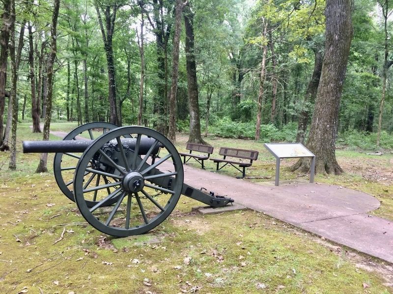
| 1 ► Arkansas, Arkansas County, Arkansas Post National Memorial — Four guns...opened on us and a thousand rifles from the pits — Dyer Hitchcock, private, 23rd Wisconsin Infantry — Arkansas Post National Memorial — |
| Near Old Post Road, 0.4 miles south of State Route 169. | |||
| 2 ► Arkansas, Arkansas County, Arkansas Post National Memorial — On they come like an irresistible thunder bolt — William Heartsill, sergeant, 2nd Texas Cavalry — Arkansas Post National Memorial — |
| Near Old Post Road, 0.5 miles south of State Route 169. | |||
| 3 ► Arkansas, Arkansas County, Arkansas Post National Memorial — Our ironclads and gunboats knocked the fort to pieces — David D. Porter, rear admiral — |
| On Old Post Road, 0.5 miles south of State Route 169, on the left when traveling south. | |||
| 4 ► Arkansas, Arkansas County, Arkansas Post National Memorial — 38,000 Reasons to Fight — Arkansas Post National Monument — National Park Service, U.S. Department of the Interior — |
| Near Old Post Road, 0.4 miles south of State Route 169. | |||
| 5 ► Arkansas, Arkansas County, Arkansas Post National Memorial — American Townsite — 1805 — 1840 — Frontier Settlement and Territorial Capitol — |
| Near Old Post Road, 0.8 miles south of State Route 169. | |||
| 6 ► Arkansas, Arkansas County, Arkansas Post National Memorial — The Arkansas Posts — 1686 — 1863 — Two Centuries of Settlement on the Arkansas River — |
| Near Old Post Road, 0.8 miles south of State Route 169. | |||
| 7 ► Arkansas, Arkansas County, Arkansas Post National Memorial — Where is Fort Hindman? — |
| Near Old Post Road, 0.5 miles south of State Route 169. | |||
| 8 ► Arkansas, Arkansas County, Crocketts Bluff — Captain Alf Johnson's Spy Company — |
| On Arkansas Route 153, 1 mile north of Arkansas Route 1, on the left when traveling north. | |||
| 9 ► Arkansas, Arkansas County, Crocketts Bluff — Crocketts Bluff |
| On Arkansas Route 153 north of Starks Lane, on the right when traveling north. Reported permanently removed. | |||
| 10 ► Arkansas, Arkansas County, Gillett — 10 — Battle of Arkansas Post — |
| On U.S. 165 at State Route 169, on the right when traveling north on U.S. 165. | |||
| 11 ► Arkansas, Arkansas County, St. Charles — Engagement at St. Charles — |
| On Belnap Avenue at NCC Camp Road, on the right when traveling east on Belnap Avenue. | |||
| 12 ► Arkansas, Arkansas County, St. Charles — St. Charles Battle Monument — |
| On West Broadway Avenue at Arkansas Street, in the median on West Broadway Avenue. | |||
| 13 ► Arkansas, Arkansas County, Stuttgart — Camp Mitchell — |
| On North Buerkle Street (U.S. 63/165) just north of Madison Street, on the left when traveling north. | |||
| 14 ► Arkansas, Ashley County, Hamburg — 98 — Ashley County in the Civil War / 3rd Arkansas Infantry Regiment — |
| On East Jefferson Street east of North Oak Street, on the left when traveling east. | |||
| 15 ► Arkansas, Baxter County, Mountain Home — 68 — Skirmishes Near Mountain Home — |
| On South Main Street (Business U.S. 62) at East 7th Street, on the right when traveling north on South Main Street. | |||
| 16 ► Arkansas, Benton County, Avoca — Dunagin's Farm — |
| On N. Old Wire Road (County Road 1703) 0.4 miles north of Smith Ridge Turnoff, on the left when traveling north. | |||
| 17 ► Arkansas, Benton County, Avoca — Sesquicentennial Trail of the Centuries — Benton County Arkansas Sesquicentennial Monument 1836 - 1986 — Arkansas Sesquicentennial 1836 - 1986 — |
| On Hudson Road (U.S. 62) south of Rose Street, on the right when traveling north. | |||
| 18 ► Arkansas, Benton County, Bella Vista — Medal of Honor — |
| 19 ► Arkansas, Benton County, Bella Vista — The War Between the States — |
| 20 ► Arkansas, Benton County, Bella Vista — United States Commanders in Chief — |
| 21 ► Arkansas, Benton County, Bella Vista — United States Commanders in Chief — |
| 22 ► Arkansas, Benton County, Bentonville — Camp Stephens — |
| On Arkansas Route 72 at Sugar Creek Road, on the right when traveling north on State Route 72. | |||
| 23 ► Arkansas, Benton County, Bentonville — Col. Samuel W. Peel House — |
| Near South Walton Boulevard (Business U.S. 71) 0.1 miles north of Southwest I Street, on the left when traveling north. | |||
| 24 ► Arkansas, Benton County, Bentonville — Confederate Memorial |
| On West Central Avenue at North Main Street, on the left when traveling east on West Central Avenue. Reported permanently removed. | |||
| 25 ► Arkansas, Benton County, Bentonville — Eagle Hotel — |
| On SW A Street at West Central Avenue, on the right when traveling north on SW A Street. | |||
| 26 ► Arkansas, Benton County, Bentonville — Terry Block — |
| On Central Avenue (State Highway 72) at Main Street, on the right when traveling west on Central Avenue. | |||
| 27 ► Arkansas, Benton County, Bentonville, Downtown Bentonville — The Henry House — |
| On Southeast 2nd Street at Southeast B Street, on the right when traveling east on Southeast 2nd Street. | |||
| 28 ► Arkansas, Benton County, Garfield — "Dat De Shpot, Sergent!" — Pea Ridge National Military Park — National Park Service, U.S. Department of the Interior — |
| On Military Park Road (County Road 65), on the right when traveling south. | |||
| 29 ► Arkansas, Benton County, Garfield — A Crisis in Command — Pea Ridge National Military Park — National Park Service, U.S. Department of the Interior — |
| On Military Park Road (County Road 65), on the left when traveling north. | |||
| 30 ► Arkansas, Benton County, Garfield — A Fierce Tangle in Morgan's Woods — Pea Ridge National Military Park — National Park Service, U.S. Department of the Interior — |
| On Military Park Road (County Road 65), on the right when traveling north. | |||
| 31 ► Arkansas, Benton County, Garfield — A Long, Cold Hungry March — Pea Ridge National Military Park — National Park Service, U.S. Department of the Interior — |
| On Military Park Road (County Road 65), on the right when traveling east. | |||
| 32 ► Arkansas, Benton County, Garfield — A Perfect Storm of Shot and Shell — Pea Ridge National Military Park — National Park Service, U.S. Department of the Interior — |
| On Military Park Road (County Road 65), on the right when traveling south. | |||
| 33 ► Arkansas, Benton County, Garfield — A Reunited Soldiery Monument — |
| On Military Park Road (County Road 65), on the right when traveling south. | |||
| 34 ► Arkansas, Benton County, Garfield — A Village Full of Wounded Men — Pea Ridge National Military Park — National Park Service, U.S. Department of the Interior — |
| On Military Park Road (County Road 65), on the left when traveling west. | |||
| 35 ► Arkansas, Benton County, Garfield — City of Soldiers — Pea Ridge National Military Park — National Park Service, U.S. Department of the Interior — |
| On Military Park Road (County Road 65), on the right when traveling west. | |||
| 36 ► Arkansas, Benton County, Garfield — Confederate Sunset — Pea Ridge National Military Park — National Park Service, U.S. Department of the Interior — |
| On Military Park Road (County Road 65), on the left when traveling south. | |||
| 37 ► Arkansas, Benton County, Garfield — Disastrous Retreat — March 8, 1862 - Afternoon — Pea Ridge National Military Park — |
| Near Military Park Road (County Road 65), on the left when traveling south. | |||
| 38 ► Arkansas, Benton County, Garfield — Elkhorn Tavern Taken — March 7, 1862 - Early Afternoon — Pea Ridge National Military Park — |
| Near Military Park Road (County Road 65), on the left when traveling south. | |||
| 39 ► Arkansas, Benton County, Garfield — Fiery Finale on Ruddick's Field — Pea Ridge National Military Park — National Park Service, U.S. Department of the Interior — |
| Near Military Park Road (County Road 65), on the right when traveling south. | |||
| 40 ► Arkansas, Benton County, Garfield — Getting Ready To Fight — March 6, 1862 - Late Afternoon — Pea Ridge National Military Park — |
| On Military Park Road (County Road 65), on the right when traveling west. | |||
| 41 ► Arkansas, Benton County, Garfield — Hard Fighting Near Leetown — Pea Ridge National Military Park — National Park Service, U.S. Department of the Interior — |
| Near Military Park Road (County Road 65), on the right when traveling south. | |||
| 42 ► Arkansas, Benton County, Garfield — It was the Grandest Thing I Ever Saw... — Pea Ridge National Military Park — National Park Service, U.S. Department of the Interior — |
| Near Military Park Road (County Road 65), on the right when traveling south. | |||
| 43 ► Arkansas, Benton County, Garfield — Leetown — |
| Near Military Park Road (County Road 65), on the left when traveling west. | |||
| 44 ► Arkansas, Benton County, Garfield — Lifeline for Two Armies — Pea Ridge National Military Park — National Park Service, U.S. Department of the Interior — |
| On Military Park Road (County Road 65), on the left when traveling south. | |||
| 45 ► Arkansas, Benton County, Garfield — Night Moves — Pea Ridge National Military Park — National Park Service, U.S. Department of the Interior — |
| Near Military Park Road (County Road 65), on the right when traveling south. | |||
| 46 ► Arkansas, Benton County, Garfield — Pea Ridge Confederate Monument — |
| On Military Park Road (County Road 65), on the right when traveling south. | |||
| 47 ► Arkansas, Benton County, Garfield — Potts' Hill — |
| On N. Old Wire Road (County Road 67) 1.5 miles north of Gann Ridge Road, on the right when traveling north. | |||
| 48 ► Arkansas, Benton County, Garfield — Remembrance and Reunion — Pea Ridge National Military Park — National Park Service, U.S. Department of the Interior — |
| On Military Park Road (County Road 65), on the right when traveling south. | |||
| 49 ► Arkansas, Benton County, Garfield — Save the Cannon! — March 7, 1862 - Mid-Morning — Pea Ridge National Military Park — |
| On Military Park Road (County Road 65), on the left when traveling north. | |||
| 50 ► Arkansas, Benton County, Garfield — Slaughter in the Rocks — March 8, 1862 - Morning — Pea Ridge National Military Park — |
| Near Military Park Road (County Road 65), on the right when traveling south. | |||
| 51 ► Arkansas, Benton County, Garfield — Stand to Your Posts! — March 7, 1862 - Mid-Morning — Pea Ridge National Military Park — |
| On Military Park Road (County Road 65), on the right when traveling north. | |||
| 52 ► Arkansas, Benton County, Garfield — That Beautiful Charge — March 8, 1862 - Mid-Morning — Pea Ridge National Military Park — |
| On Military Park Road (County Road 65), on the right when traveling south. | |||
| 53 ► Arkansas, Benton County, Garfield — The Enemy Is Behind Us! — March 7, 1862 - Mid-Morning — Pea Ridge National Military Park — |
| On Military Park Road (County Road 65), on the right when traveling west. | |||
| 54 ► Arkansas, Benton County, Garfield — Two Armies Collide — Pea Ridge National Military Park — National Park Service, U.S. Department of the Interior — |
| On Military Park Road (County Road 65), on the left when traveling north. | |||
| 55 ► Arkansas, Benton County, Garfield — U.S. Army Headquarters 1862 — |
| On U.S. 62, on the right when traveling east. | |||
| 56 ► Arkansas, Benton County, Garfield — Vulnerable in Victory — March 7, 1862 - Mid-Night — Pea Ridge National Military Park, National Park Service, U.S. Department of the Interior — |
| Near Military Park Road (County Road 65), on the left when traveling south. | |||
| 57 ► Arkansas, Benton County, Garfield — Where I Knew I Might Make the Best Fight — Pea Ridge National Military Park — National Park Service, U.S. Department of the Interior — |
| On Sugar Creek Road (County Road 44), on the right when traveling east. | |||
| 58 ► Arkansas, Benton County, Gentry — Gentry Grand Army of the Republic Monument — |
| On Pioneer Lane, 0.2 miles south of Mockingbird Lane, on the left when traveling south. | |||
| 59 ► Arkansas, Benton County, Gravette — 144 — Camp Jackson / Confederate Dead — |
| On Georgia Flat Road (County Road 503) at Kane Road (County Road 422), on the left when traveling west on Georgia Flat Road. | |||
| 60 ► Arkansas, Benton County, Gravette — Georgia Cemetery — 4th Arkansas Infantry C.S.A. — “Camp Jackson” Benton County, Arkansas — |
| Near Georgia Flat Road (County Road 503) south of Kane Road (County Road 422), on the left when traveling south. | |||
| 61 ► Arkansas, Benton County, Lowell — 107 — Mudtown — |
| On Jackson Place north of McClure Avenue (County Road 923), on the left when traveling north. | |||
| 62 ► Arkansas, Benton County, Lowell — Original Site of Bloomington (Mudtown) Arkansas — |
| On Jackson Place at McClure Avenue (Route 923), on the left when traveling north on Jackson Place. | |||
| 63 ► Arkansas, Benton County, Lowell — Rev. James M. Ingram — (abt. 1826 - Sept. 4, 1870) — |
| On Primrose Road at Phillips Road, on the left when traveling south on Primrose Road. | |||
| 64 ► Arkansas, Benton County, Maysville — Camp Walker — |
| On Arkansas Route 72 at Busse Road, on the left when traveling north on State Route 72. | |||
| 65 ► Arkansas, Benton County, Maysville — The Battle of Maysville — |
| On State Highway 43 near State Highway 72, on the right when traveling south. | |||
| 66 ► Arkansas, Benton County, Pea Ridge — Texas Memorial — |
| On N. Curtis Avenue at E. Pickens Road, on the right when traveling north on N. Curtis Avenue. | |||
| 67 ► Arkansas, Benton County, Rogers — 59 — Camp Halleck at Osage Springs — |
| On West New Hope Road at South Osage Springs Drive, on the right when traveling west on West New Hope Road. | |||
| 68 ► Arkansas, Benton County, Rogers — Cross Hollows — |
| On South Old Wire Road (County Road 83) 0.2 miles north of Dogwood Drive/Cross Hollow Road (County Road 1189), on the left when traveling north. | |||
| 69 ► Arkansas, Benton County, Rogers — Cross Hollows — |
| On South Old Wire Road (County Road 83) 0.2 miles north of Dogwood Drive/Cross Hollows Road (County Road 1189), on the left when traveling north. | |||
| 70 ► Arkansas, Benton County, Rogers — 83 — Van Winkle's Mill — |
| On State Highway 12, 0.1 miles west of Van Winkle Place Road, on the left when traveling west. | |||
| 71 ► Arkansas, Benton County, Rogers — War Eagle Mill — 1832 ~ 1838 ~ 1873 ~ 1973 — |
| On War Eagle Road (County Route 98) at Bettis Hill Road (County Route 1059), on the left when traveling west on War Eagle Road. | |||
| 72 ► Arkansas, Benton County, Siloam Springs — Grand Army of the Republic Memorial — |
| On South Maxwell Street near E Twin Springs Street, on the right when traveling south. | |||
| 73 ► Arkansas, Benton County, War Eagle — War Eagle Mills — |
| On High Sky Inn Road (State Highway 303) 0.2 miles west of Bettis Hill Road, on the right when traveling north. | |||
| 74 ► Arkansas, Boone County, Everton — 31 — Skirmish at Rolling Prairie — |
| On Rally Hill Road, 0.1 miles east of Meeks Creek Road South, on the right when traveling east. | |||
| 75 ► Arkansas, Boone County, Harrison — Boone County Confederate Memorial — |
| On North Main Street north of West Stephenson Avenue, on the left when traveling north. | |||
| 76 ► Arkansas, Boone County, Harrison — 26 — Boone County Men Served Both Armies / Military Activity in Boone County — |
| On North Main Street south of West Rush Avenue, on the right when traveling south. | |||
| 77 ► Arkansas, Calhoun County, Hampton — 123 — Calhoun County in the Civil War — |
| On West Main Street (U.S. 278) at Hunt Street, on the right when traveling north on West Main Street. | |||
| 78 ► Arkansas, Carroll County, Berryville — 17 — Berryville In The Civil War — |
| On South Main Street (U.S. 62) south of West Church Avenue, on the left when traveling north. | |||
| 79 ► Arkansas, Carroll County, Carrollton — "Old" Carrollton — |
| On U.S. 412 at County Road 917, on the right when traveling north on U.S. 412. | |||
| 80 ► Arkansas, Carroll County, Eureka Springs — 94 — 1st Arkansas Cavalry (U.S.) |
| On State Highway 187 at Mockingbird Lane, on the right when traveling south on State Highway 187. Reported missing. | |||
| 81 ► Arkansas, Carroll County, Eureka Springs — 18 — Civil War Healing — |
| On Main Street (State Highway 23) south of Spring Street, on the right when traveling south. | |||
| 82 ► Arkansas, Carroll County, Eureka Springs — Clayton-Becker House — |
| On Spring Street north of Hillside Avenue, on the right when traveling north. | |||
| 83 ► Arkansas, Carroll County, Green Forest — 22 — Skirmish At Yocum Creek — |
| On Tommy Ratzlaff Avenue south of East Main Street (U.S. 62), on the right when traveling south. | |||
| 84 ► Arkansas, Chicot County, Lake Village — Chicot County Confederate Monument — CSA — 1861 - 1865 — |
| On North Lakeshore Drive (State Highway 144) at Main Street, in the median on North Lakeshore Drive. | |||
| 85 ► Arkansas, Chicot County, Lake Village — 79 — Lakeport in the Civil War — |
| Near State Highway 142, 0.9 miles east of Robert Mazzanti Road (Parish Road 505). | |||
| 86 ► Arkansas, Chicot County, Lake Village — Saunders-Pettit-Chapman-Cook Plantation Home — |
| On U.S. 278, 0.4 miles east of U.S. 65, on the right when traveling east. | |||
| 87 ► Arkansas, Chicot County, Lake Village — The Battle at Ditch Bayou — |
| On U.S. 82 at Pugh Circle, on the right when traveling west on U.S. 82. | |||
| 88 ► Arkansas, Chicot County, Lake Village — The Casualties at Ditch Bayou June 6, 1864 — |
| On U.S. 82, 0.1 miles west of Pugh Circle, on the right when traveling west. | |||
| 89 ► Arkansas, Clark County, Arkadelphia — Arkadelphia Courthouses — |
| On Main Street at South 6th Street (U.S. 67), on the right when traveling west on Main Street. | |||
| 90 ► Arkansas, Clark County, Arkadelphia — Clark County Confederate Memorial — C. S. A. — 1861 — 1865 — |
| On Clay Street at Court Street, on the right when traveling east on Clay Street. | |||
| 91 ► Arkansas, Clark County, Arkadelphia — Skirmish at Bozeman's House — |
| On Arkansas Route 26 west of Armstrong Lane, on the right when traveling west. | |||
| 92 ► Arkansas, Clark County, Caddo Valley — 65 — Confederate Manufacturing / The Military Road — |
| On Valley Street (U.S. 67) 0.1 miles south of Malvern Road, on the left when traveling south. | |||
| 93 ► Arkansas, Clark County, Okolona — 124 — Skirmishes at Okolona / Fighting at Elkins' Ferry — |
| On South Main Street (Arkansas Route 51) south of East 4th Street, on the left when traveling south. | |||
| 94 ► Arkansas, Clay County, St. Francis — Chalk Bluff in the Civil War — Raids of March-April 1863 — |
| On County Road 347. | |||
| 95 ► Arkansas, Clay County, St. Francis — Chalk Bluff in the Civil War — Battle of May 1-2, 1863 — |
| On County Route 347. | |||
| 96 ► Arkansas, Clay County, St. Francis — Chalk Bluff in the Civil War — Skirmish of May 15, 1862 — |
| Near County Road 347. | |||
| 97 ► Arkansas, Cleburne County, Heber Springs — 49 — The Civil War in Cleburne County / Troops Raised in Cleburne County — |
| On West Main Street at South 4th Street, on the left when traveling west on West Main Street. | |||
| 98 ► Arkansas, Cleveland County, New Edinburg — 76 — Battle of Marks' Mills / Marks Family Experience — |
| On Old Camden Road, 0.8 miles south of Marks Cemetery Road, on the left. | |||
| 99 ► Arkansas, Cleveland County, New Edinburg — E-27 — Cleveland County Battle of Mark's Mill — |
| On Old Camden Road, 0.4 miles south of Marks Cemetery Road, on the right when traveling south. | |||
| 100 ► Arkansas, Cleveland County, New Edinburg — 12 — New Edinburg Commercial Historic District — |
| On Arkansas Route 8 north of Banks Road, on the left when traveling north. | |||
464 entries matched your criteria. The first 100 are listed above. Next 100 ⊳