Approaching Marks Mills from the south General Joe Shelby's Missouri Division was ordered to move to the right in order to block the Marks Mills to Mt Elba Road preventing The Union forces from escaping across the Saline River.
Guided by . . . — — Map (db m121660) HM
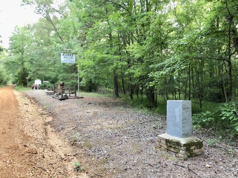
Early on the morning of April 25, the Confederates blocked the Pine Bluff Road near the Marks family home and mills. The first Union wagons arrived around 9:30 a.m. The Confederates shot the horses and driver of the lead Union wagon and launched the . . . — — Map (db m121327) HM
Facts
After getting in the neighborhood of the supply train Gen. Shelby was ordered on the road leading to Mount Elba to intercept the train and attack the front. Cabell's Brigade moved up to the road leading direct to Marks' Mills. As they . . . — — Map (db m121658) HM
Front
Fought here on April 25, 1864
was a complete Confederate victory
General James F. Fagan's Division of Confederate
cavalry surprised and captured a Union supply
train of 2000 men and 240 wagonloads of supplies.
General . . . — — Map (db m121310) HM WM
In March of 1864, the Union Army began the Red River Campaign, a plan to subdue Arkansas and Louisiana and capture Texas cotton for northern mills. By mid-April, the Arkansas arm of the campaign was stalled in Camden. A Union foraging party and . . . — — Map (db m121311) HM
So many horses and soldiers were killed that Salty Branch ran red with blood.
In 1864, Camden was a large town on the Ouachita River, as was Pine Bluff on the Arkansas River. Moro Bay, to the south, was the largest cotton shipping point . . . — — Map (db m121330) HM
John P. McCown was born Aug. 19, 1815, in Sevierville, Tenn. An 1840 graduate of West Point, he served in the Mexican and Seminole wars before resigning from the U.S. Army on May 17, 1861. McCown joined the Confederate army, rising to the rank of . . . — — Map (db m121139) HM
During the Civil War, first Confederate units and later Union units occupied and fought at and near Lewisburg. Confederate units included the Co. A of the 17th Arkansas Infantry, which was enlisted at Lewisburg in Oct. 1861, and the 18th Arkansas . . . — — Map (db m237032) HM
While a Confederate unit, the Conway Mounted Rifles, formed at Lewisburg in May 1861, the town was a Union base for much of the war. A garrison was established Sept. 28, 1863, and Col. Abraham H. Ryan recruited the 3rd Arkansas Cavalry (U.S.) there. . . . — — Map (db m170456) HM
Side 1
Conway County in the Civil War
Conway County men served in both the Union and Confederate armies in the Civil War. Co. I, 1st Arkansas Mounted Rifles, Co. B, Carroll’s Cavalry, Co. I, 36th Arkansas Infantry, . . . — — Map (db m96451) HM
On June 17th 1862, the First Wisconsin Cavalry, US saw action against 30th Ark Inf. and 6th MO Militia CSA. The overall commanders were Confederate General M. Jeff Thompson and US Colonel Edward Daniels. Federal forces bivouacked at Jonesboro . . . — — Map (db m221048) HM
The last Confederate veteran living in Arkansas, William Murphy Loudermilk, is buried here in Keller’s Chapel Cemetery. Private Loudermilk, who was born Oct. 17, 1847, joined a North Carolina regiment in the Army of Tennessee at age 16 and fought at . . . — — Map (db m116195) HM
The Battle of Jonesboro took place at the Craighead County Court House in Jonesboro, Arkansas, on August 2, 1862. Company I, 30th Arkansas Infantry of the Fifth Trans-Mississippi Confederate army, under the command of Captain Mitchel A. Adair, . . . — — Map (db m116608) HM
Several companies were raised in Craighead County for the Confederate army. Co. I of the 13th Arkansas Infantry – the “Confederate Grays” – formed in 1861. A company of the 23rd Arkansas Infantry and Co. I of the 30th . . . — — Map (db m116186) HM
The companies of soldiers that came out
of Van Buren were formed at this historic
landmark. It is also the site where some
infantry and Calvary units camped and
drilled. There were nine different
companies that were formed in . . . — — Map (db m96864) HM
[Northwest face]
1899
Furled but not forgotten
1861 C.S.A. 1865
Erected by the Mary Lee Chapter
United Daughters of the Confederacy
[Southwest face]
Battles
Oak Hill – Aug. 10, 1861.
Elk Horn – March 6 to 8, 1862. . . . — — Map (db m236850) WM
On this lawn
was erected our first
Courthouse in 1841 and
has been the scene for many
events during the wars
in which Crawford County boys fought.
Mexican War, 1846.
War Between the States, 1861-1865.
Spanish American War, 1898. . . . — — Map (db m96859) WM
The Battle of Prairie Grove was a grim moment for the Confederate Army. This conflict severed all chances for the South to use Northwest Arkansas as a route to invade Missouri. The shattered and defeated soldiers retreated from Prairie Grove to Van . . . — — Map (db m96617) HM WM
Erected in memory of
our Confederate soldiers
from Ark., Tex., La., Mo., and
Indian territory,
who lost their lives in the
Battles of Oak Hill, Elk Horn,
and Prairie Grove. — — Map (db m96632) WM
The residents of Log Town were witness to the retreat of the Rebel army through Van Buren and onward through their settlement. High on Log Town Hill the community watched as masses of Southern soldiers crowded the hill trying desperately to reach . . . — — Map (db m96614) HM
Brig. General Francis J. Herron
Herron was Blunt's aggressive and bold subordinate, "they
cooperate well, and handle the rebels without gloves," declared
a Union officer. He led the Second and Third (Missouri) Divisions,
and was ready . . . — — Map (db m243979) HM
Sunday, December 28, 1862
The day started like any other cold December Sunday, by nightfall, Van Buren's citizens would know everything had changed. The Civil War had come home.
As they came out of church and made their way toward home . . . — — Map (db m243975) HM
After the Dec. 7, 1862, Battle of Prairie Grove, the Union Frontier Division set out to strike Confederate forces on the Arkansas River. On Dec. 27, 8,000 Union troops headed south through the Boston Mountains. They hit Van Buren on Dec. 28 and . . . — — Map (db m119954) HM
Named for Adolphus Fountain
Crawford
Born Aug. 15, 1848
Died Feb. 21, 1876
Confederate soldier of Arkansas,
he fought under Gen. Price. — — Map (db m116177) HM
This granite marker on the south lawn was erected by Crittenden County United Daughters of the Confederacy, and dedicated October 4, 1936, as a memorial to those who served with Confederate military during the War Between the States. The magnolia . . . — — Map (db m116781) HM
First Highway constructed in Arkansas, Hopefield
to Little Rock, extended to Fort Smith and into Indian Territory, (Oklahoma). Built by the United States under supervision of the Quartermasters Department of the United States Army. Survey was . . . — — Map (db m116549) HM
On April 27, 1865, the steamboat Sultana exploded on the Mississippi River. She was heading north, dangerously overloaded with some 2,200 passengers, most of them freed Union prisoners of war from the Andersonville and Cahaba camps. A . . . — — Map (db m116352) HM
Early on April 27, 1865, the overcrowded steamboat Sultana exploded on the Mississippi River near Marion, Arkansas. The vast majority of the Sultana's passengers, believed to number over 2000, were Federal soldiers, recently released . . . — — Map (db m116356) HM
News of the assassination of Abraham Lincoln on April 14, 1865 overshadowed the tragedy of the Sultana, which happened two weeks later.
The actual number of casualties from the SS Sultana is unknown, but some estimates are as high as 1,800. . . . — — Map (db m242015) HM
An old river town, once located on the banks of the Mississippi River, deriving its name from Indian mounds. Federal troops burned it January 15, 1863. — — Map (db m221342) HM
After Arkansas seceded from the Union in May 1861, Confederate officers began to recruit in the Wittsburg area. Companies B, D, F and K of the 5th Arkansas Infantry Regiment were organized at Wittsburg June 12-14, 1861. David Cross, for whom Cross . . . — — Map (db m116179) HM
Road to Marks' Mills
Gen. Frederick Steele’s Union army set out from Little Rock on March 23, 1864, to join a second army in Louisiana and invade Texas. He made it as far as modern-day Prescott before turning toward Camden in hopes of . . . — — Map (db m121222) HM
Front
Gen. Frederick Steele’s Union army left Camden on April 26, 1864, starting a retreat to Little Rock. Confederate pursuers caught up with them on April 29 on the Jenkins’ Ferry Road and began skirmishing. Union gunners of the 2nd . . . — — Map (db m121168) HM
Arkansas Military Institute
The state legislature chartered the Arkansas Military Institute in 1850, and the school was built on Chapel Ridge in Tulip. Cadets had to be over 14 and at least 4 feet 9 inches tall. Classes included Latin, . . . — — Map (db m121218) HM
In mid-February 1863, Confederate troops at Cypress Bend fired on Union transports on the Mississippi River. On Feb. 19, a force of Union cavalry and mule-mounted infantry set out in pursuit. The Union troops drove off enemy pickets before . . . — — Map (db m107693) HM
(side 1)
Sixteen Confederate companies were raised in Drew County during the Civil War. Two, the "Confederate Stars" and "Selma Rifles," joined the 3rd Arkansas Infantry and fought with the Army of Northern Virginia. Three, the "Cut-off . . . — — Map (db m85087) HM
To the
Confederate
Soldiers
of Drew County.
1861—1865
Furl that banner! True,
'tis gory,
yet 'tis wreathed around
with glory,
and 'twill live in song
and story,
though its folds are
in the dust.
Father Ryan . . . — — Map (db m85093) WM
Confederate forces used Cadron as a base in the war’s early years, and Union troops were here after taking Little Rock in September 1863. The site was valuable for the saw and grist mills nearby, the telegraph line that ran to Little Rock, and the . . . — — Map (db m96452) HM
1861-65
Dedicated to the memory
of our Confederate soldiers
the bravest of the brave
Erected by
Robert E. Lee Chapter
No. 718, U.D.C.
Oct. 1925 — — Map (db m237103) WM
Faulkner County had divided loyalties during the Civil War. Soon after the war started, Col. A.R. Witt helped organize several companies for the 10th Arkansas Infantry (C.S.). After fighting at Shiloh, the 10th was captured at Port Hudson, La. . . . — — Map (db m119987) HM
On March 29, 1864, troops of the 30th Texas Cavalry and local partisans attacked the Union post at Roseville south of here, burning 133 bales of cotton and two cotton gins. They returned in force on May 4 and drove the defending troops of the 2nd . . . — — Map (db m119956) HM
Civil War in Fulton CountyFulton County men fought on both sides in the Civil War, and some were arrested in 1861 as members of the Unionist Peace Society. U.S. troops marched through in April 1862 during the Pea Ridge Campaign. Fulton County . . . — — Map (db m179988) HM
In 1890, the first Reunion of the Blue and Gray was held at Mammoth Spring, attracting Civil War veterans on both sides from Northern Arkansas and Southern Missouri. It quickly became a popular August event, with most participants arriving . . . — — Map (db m192166) HM
This U.S. Model 1861 4.5-inch Ordnance Rifle was known locally as "The Big Gun." The annual Reunion of the Blue and Gray, held at Mammoth Spring, became so popular the U.S. War Department furnished this cannon in 1893. During reunion week, it . . . — — Map (db m192167) HM
The first Lamar opened in 1888, the final year that Georgia-born Lucius Quintus Cincinnatus Lamar (1825-1891) — a former Confederate officer, overseas ambassador for the Confederacy, and U.S. Representative and Senator for Mississippi — served as . . . — — Map (db m211200) HM
Site of
The State Capitol of Arkansas
July 2-14-1862
When Federal troops
advanced on Little Rock,
Governor Henry Massie Rector
moved his staff and records here.
Erected by the Garland County Association
of the
Arkansas . . . — — Map (db m122573) HM
On July 5, 1864, a battalion of the 4th Arkansas Cavalry (U.S.) left Little Rock on a scouting mission toward Caddo Gap. They fought small bands of Confederate soldiers each day before arriving at Farr’s Mill, where Gulpha Creek hits the Ouachita . . . — — Map (db m170440) HM
Early in 1862 Governor Henry
Rector feared that Federal
troops were planning an attempt
to seize Little Rock and decided
to move the capitol of the state
to Hot Springs. The movement of
the government to Hot Springs
was the highlight of the . . . — — Map (db m211077) HM
Erected in memory of the soldiers of the Confederacy, who gave their lives for the cause at the Battle of Jenkins Ferry, April 30, 1864, Dedicated September 19, 1928, by the James F. Fagan and Jenkins Ferry Chapters of the United Daughters of the . . . — — Map (db m37303) HM
Confederate Headquarters
Confederate Gen. Edmund Kirby Smith led troops from Louisiana on a forced march to attack Gen. Frederick Steele’s Union army as it crossed the Saline River to retreat to Little Rock. He arrived here on April 29, . . . — — Map (db m121215) HM
General Samuel Rice
Samuel A. Rice, then Iowa’s attorney general, organized the 33rd Iowa Infantry Regiment in the summer of 1862 and was named its colonel. Stationed in Helena, Rice played a prominent role in the July 4, 1863 battle there . . . — — Map (db m121203) HM
Jenkins Ferry
In 1846, Thomas Jenkins paid the Saline County clerk $1 to register to “keep a ferry” and charge travelers to cross the Saline near the mouth of Cox’s Creek when the river was at flood stage. Gen. Frederick . . . — — Map (db m121204) HM
Officers Killed
Gen. J.G. Walker’s Texas Division made the final Confederate attack in the April 30, 1864, battle of Jenkins’ Ferry. Its three brigades, led by Gen. William Read Scurry, Gen. Thomas N. Waul and Col. Horace Randal, charged . . . — — Map (db m121207) HM
Tablet #1 Jenkins' Ferry State Park Act 10 of 1961 authorized this 37-acre state park as a commemorative site and recreation area. The park includes the ferry site where you are standing. The ferry was operated by the Jenkins' family . . . — — Map (db m37304) HM
Refugee Children
Many African Americans fleeing slavery were with Gen. Frederick Steele’s Union army as it retreated to Little Rock. As army wagons became stuck in the thick mud, so too did wagons with refugee children. Some were . . . — — Map (db m121183) HM
Front
Both Union and Confederate cavalry moved north of Jenkins’ Ferry on April 29, 1864. Lt. Col. Benjamin Elliott’s 1st Missouri Cavalry Battalion had been sent to Princeton on the 28th to seek Gen. Frederick Steele’s army as it . . . — — Map (db m121182) HM
In memory of Union Soldiers who lie in unmarked graves at Jenkins Ferry battlefield Union Commander Major General Frederick Steele 4 Divisions 9 Brigades estimated casualties 700 — — Map (db m227590) WM
In memory of Confederate Soldiers who lie in unmarked graves at Jenkins Ferry Battlefield
Battle of Jenkins Ferry
Grant County Arkansas Confederate Commander General Edmund Kirby Smith
3 Divisions
7 Brigades
Estimated . . . — — Map (db m227588) WM
The 5th Arkansas Infantry Regiment was organized on June 28, 1861, at Gainesville about 7 miles northwest of modern-day Paragould. Men from Greene County served in Companies C, D, E and H. The soldiers trained and camped near the springs at Camp . . . — — Map (db m170413) HM
The culmination of the Camden, AR. and the Red River, LA. campaigns was to capture Texas. Two Union armies were to join at Shreveport and move West. Gen. Steele was defeated in AR. and Gen. Banks in LA. The wounded from the Battle of Prairie De Ann . . . — — Map (db m246084) HM
When Union troops occupied Little Rock on Sept. 10, 1863, Arkansas's Confederate government relocated to Washington, using the 1836 Hempstead County Courthouse as their Capitol building. The legislature met here Sept. 22 to Oct. 2, 1864, and the . . . — — Map (db m245665) HM
(Left Side)
True to their native soil. They gave their lives to a cause that was lost. Their survivors will never suffer their memory to perish.
(Right Side)
Erected by our citizens to the memory of the Confederate . . . — — Map (db m245989) WM
More than 19 companies formed in Hempstead County to fight for the Confederacy, starting with the "Hempstead Rifles," who mustered in on May 4, 1861. These local men served in the Confederate Congress - Grandison D. Royston and Rufus K. Charles . . . — — Map (db m245848) HM
"Let the broad mantle of Masonic charity be thrown over their errors, whatever the may have been, and may their virtues be cherished in the memory of those who survive."
Grand Master Elbert H. English 1859-1868
Erected by the most . . . — — Map (db m245567) WM
Military Road
The Military Road, following part of the route of the old Southwest Trail, passed through the heart of Hot Spring County and the Midway community. Now known as Midway Road, the primitive pathway served as a major thoroughfare . . . — — Map (db m178623) HM
Gen. Frederick Steele led a Union army from Little Rock on March 23, 1864, to join an invasion of Texas. Confederate skirmishers harassed the army as it reached Rockport March 27. An inflatable pontoon bridge, in 34 wagons and served by men of the . . . — — Map (db m121148) HM
Near this spot in 1837 Robert Messer built the first house in Center Point. A few years later John Russey opened the first store. Center Point acquired its name and post office in 1848, and became an incorporated town in 1859.
Held by the . . . — — Map (db m121163) HM
At least four Confederate companies were recruited in what is now Howard County, including three serving in the 19th Arkansas Infantry, which trained near Center Point. The 19th Arkansas was part of the garrison at Arkansas Post when it was . . . — — Map (db m121146) HM
[North face]
In memory of
the sons of Independence County
who served in the
Confederate army,
their mothers, wives, sisters and daughters
who, with patriotic devotion
remained steadfast to their cause,
during the war period. . . . — — Map (db m221187) WM
Union soldiers occupied Batesville twice during the Civil War. Gen. Samuel Curtis's Army of the Southwest camped near this site in May 1862 while threatening Little Rock. Union troops were impressed with the town's culture and appearance, saying . . . — — Map (db m70557) HM
In the harsh winter of 1862-63 Col. J.O. Shelby, a brigade commander of three Missouri cavalry regiments under Gen. John S. Marmaduke's Confederate cavalry command, arrived in this area from a raid into southern Missouri. He quartered his troops on . . . — — Map (db m162720) HM
Elisha Baxter (1827-1899), 10th Governor of Arkansas, was born in Rutherford County, North Carolina. He came to Batesville in 1852, opened a mercantile business and was elected mayor in 1853. Baxter served two terms as state representative . . . — — Map (db m221210) HM
Military Activity at Calico Rock
While no battles were fought at Calico Rock, the area saw considerable military activity. The 4th Missouri Cavalry (C.S.) and 1st Illinois Cavalry skirmished at Calico Rock Landing on May 26, 1861. Following . . . — — Map (db m170196) HM
Union troops passed through the Wild Haws area many times during the Civil War. Gen. Samuel Curtis was here with cavalry, artillery and Illinois infantry on May 1, 1862. Fifth Kansas Cavalry troops rode through on July 6, 1862, as did a company of . . . — — Map (db m170462) HM
[South face] The Jackson Guards were organized at Jacksonport, Jackson County, Arkansas, by Capt. A. B. Pickett, a prominent lawyer of Jacksonport, Sunday morning, May 5, 1861. The company was marched to the Presbyterian Church and there . . . — — Map (db m221231) HM WM
Cannon's History
Although this cannon was used by the Union Army during the Civil War far from its present location, it is a unique piece of Jackson County history.
The barrel is a Model-1861, Number 349, made in 1862 by the Phoenix Iron . . . — — Map (db m221224) HM
Jacksonport was one of the main mustering points for the Confederate army in Arkansas. Throughout the war both armies contended for possession of this strategic port located at the center of the White and Black river trade. The Confederate attack on . . . — — Map (db m116206) HM
In spring 1862, Confederate Gen. Thomas Hindman sent the C.S.S. Maurepas under Capt. Joseph Fry up the White River to destroy Union supplies at Jacksonport and Grand Glaize. Fry arrived on June 2, 1862, and began shelling Jacksonport. Union . . . — — Map (db m116187) HM
Here on June 5, 1865 Confederate General Jeff Thompson formally surrendered the army of Northern Arkansas to Union military authorities. More than five thousand officers and enlisted men who served under Thompson were paroled here, as were . . . — — Map (db m116199) HM
Jacksonport's unique location at the meeting of the Black and White Rivers shaped its history and natural resources. Founded as a river port town in the mid-19th century, it thrived on the steamboat trade. This traffic made the town a center of . . . — — Map (db m221244) HM
During the morning and early afternoon of October 25, 1863, Colonel Powell Clayton commander of federal troops occupying Pine Bluff, successfully repulsed a three-pronged confederate attack of forces of General John S. Marmaduke. Cotton bales . . . — — Map (db m30578) HM
Boone-Murphy House
Following the Union capture of Little Rock on Sept. 10, 1863, citizens of Pine Bluff asked that a Union garrison be stationed there for their protection. Gen. Frederick Steele sent the veteran 5th Kansas Cavalry and 1st . . . — — Map (db m170444) HM
Clarksville in the Civil War
Clarksville was a key point in the defense of the Arkansas River Valley during the Civil War. Confederate troops occupied the town several times before Union forces took Little Rock and Ft. Smith, gaining . . . — — Map (db m96447) HM
Skirmish near Smithville
After the March 1862 Battle of Pea Ridge, Union troops moved into northern Arkansas. The 5th Illinois Cavalry under Maj. A.H. Seley occupied Smithville. On June 17, a local woman warned a patrol of the 5th that . . . — — Map (db m170473) HM
The Civil War in Lawrence County
Smithville was the Lawrence County seat in 1861, and while most residents supported secession, others stayed loyal to the Union. At least 17 Confederate companies were raised in the county. Other troops . . . — — Map (db m170478) HM
In memory of
The Men of the 7th AR Volunteer
Infantry Regiment CSA
organized here at Smithville on
June 16, 1861
The unit when organized
contained 1,250 men making it
one of the largest units
organized.
Their sacrifice, . . . — — Map (db m170760) WM
The site of Marianna was acquired through a deed from Mary Ann Harland and the heirs of her first husband, Daniel Martin. The town was named in her memory. She was born in Kentucky May 6, 1802: died October 25, 1857. The first court house in Lee . . . — — Map (db m116135) HM
South face
“Fidelis
Fortissimus.”
1861
1865
Erected by
D. G. Govan Chapter
U. D. C.
In loving memory, of
Lee County's
Confederate
Soldiers.
______
"No braver bled for a
brighter land . . . — — Map (db m117504) WM
Moro in the Civil War
The town of Moro was established in 1850 and about 700 people lived here and nearby when the Civil War began in 1861. Union troops from the 1st Indiana, 1st Missouri, 9th Illinois, 5th Kansas, 2nd Wisconsin, and 3rd . . . — — Map (db m116247) HM
(side 1)
The first tracts of South Bend Plantation, originally known as the Jordan Place, were purchased in 1840 by Dr. John Augustus Jordan. In 1852, Jordan and Irene Johnson married and built a stately southern Georgian mansion on the . . . — — Map (db m210445) HM
[southwest panel] In memory of our Confederate heroes 1861—1865 [southeast panel] Lincoln County remembers the faithfulness of her sons and commends their example to future generations [northeast panel] Erected by Capt. J. . . . — — Map (db m238099) WM
In 1861, John G. Gibson recruited a company at Tyro, Ark., that would become Co. H, 3rd Arkansas Infantry, nicknamed the Orphan Company, in the Army of Northern Virginia. Thirty-three Arkansas men joined in 1861, 22 in ’62, and one in ’63. . . . — — Map (db m107698) HM
Confederate Camp at Richmond
On Aug. 28, 1864, Confederate Gen. Sterling Price led an army from Camden on a raid that took them through Missouri, Kansas and the Indian Territory before they returned to Arkansas at Laynesport in Little . . . — — Map (db m121143) HM
In late September 1863, Confederate Col. J.O. Shelby's cavalry headed north to raid into Missouri. On Sept. 27, 1863, Shelby's scouts found Co. H, 1st Arkansas Infantry (U.S.) camped at Haguewood Prairie near present-day Paris. The Union troops . . . — — Map (db m129518) HM
As the Civil War began, the Caroline Home Guard formed at Austin on June 29, 1861. The “Austin Rifles” became Co. I, 5th Arkansas Infantry, C.S.A. Both Union and Confederate troops camped at Austin during the war and Federal troops tore . . . — — Map (db m116330) HM
Thousands of Arkansas and Texas Confederates were camped near this spot in 1862. The camp, named in honor of Brigadier General Allison Nelson, was stricken by disease resulting in 1,500 deaths including Nelson. The dead were buried among these hills . . . — — Map (db m211554) HM
On Aug. 24, 1864, Confederate Gen. J.O. Shelby and his men, wearing captured Union uniforms, attacked a series of forts protecting hay-cutting operations between modern-day Carlisle and Hazen. Confederate artillery blasted the forts held by the 54th . . . — — Map (db m96453) HM
464 entries matched your criteria. Entries 101 through 200 are listed above. ⊲ Previous 100 — Next 100 ⊳