Ancient Valley Cultures
Their homes may now be less visible than the cliff dwellings of their Mesa Verde neighbors, but the ancient farmers of southwestern Colorado were far more numerous. By the twelfth century perhaps 12,000 people tilled . . . — — Map (db m153392) HM
Clockwise, from top left:
Six ancestral Puebloan villages dating to around A.D. 1200 can be visited at Hovenweep National Monument although only Square Tower Sites are easily reached. The other sites are more remote and are not . . . — — Map (db m153391) HM
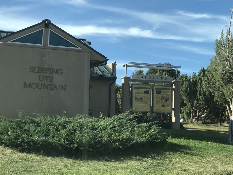
Dryland Farming
The first workable system for farming Colorado's dry southwestern plateau emerged near here some 2,000 years ago. Over the next twelve centuries, ancient farmers gradually developed a series of techniques — water storage, . . . — — Map (db m153389) HM
Surrounded by deep canyons, villages here seem isolated, cut off from people on other mesas. Look closely at these cliffs and imagine hand and toe trails pecked into the sheer sandstone. These vertical trails were the Anasazi’s highways; steep . . . — — Map (db m71206) HM
Adapting to Alcoves To level the sloping alcove floor, the Anasazi filled in behind retaining walls. The altered floor not only supported rooms but also provided working space and a safe play area for children.
Oak Tree House appears to . . . — — Map (db m71209) HM
There is an enormous gap between identifying pithouse features—the hollows and scattered stones—and visualizing the inhabitants’ daily lives. Set in the four corner post holes, timbers supported a ceiling that was probably head-high. . . . — — Map (db m71203) HM
Imagine this mesa top in A.D. 1150 with fields of corn, beans, and squash; supplemented with wild plants such as amaranth, tubers, and sunflowers. Children could be seen watering corn with clay water jars (ollas), and young men could be seen cutting . . . — — Map (db m71901) HM
Dance Plaza
Though the large alcove below is filled with Puebloan construction, there is no evidence of any habitation. The central pit – too large for domestic cook fires – held layer upon layer of ashes. Fire Temple’s size . . . — — Map (db m72559) HM
Creative inspiration
The Ancestral Puebloans may have worked hard to survive here, but their lives were adorned with beauty and creativity. Intricately woven baskets, ornately decorated
pottery, and colorfully plastered interiors speak of . . . — — Map (db m153344) HM
Montezuma Valley (below you) and Mesa Verde (where you now stand) were once part of the Ancestral Pueblo homeland. Between 600 and 1280 CE*, hundreds of villages and farming communities thrived on the mesas, plateaus, and canyons that form this . . . — — Map (db m153343) HM
Although silent today, Cliff Palace is a reflective reminder of a people who settled
among these cliffs, canyons, and mesa tops for a time, and then migrated to establish
new communities and neighborhoods further south. Here, for 700 years, they . . . — — Map (db m153355) HM
The Spanish empire's influence on the American southwest began long before the 1776 journey of Dominguez and Escalante. Indeed, Spanish conquistadors, in search of gold and silver, explored the region as early as 1540. Santa Fe, the capital of New . . . — — Map (db m120221) HM
As Father Escalante so appropriately recorded in his diary, the
Dominguez Escalante expedition was made “in behalf of the Light."
Dominguez and Escalante were Franciscan priests, and their religion
strongly influenced the course of their . . . — — Map (db m120222) HM
It took bold men to ride into a bold land—a land of raging rivers,
burning deserts, towering mountains, and rugged canyons.
The land of the Southwest through which Dominguez and
Escalante travelled in 1776 was awesome in beauty and . . . — — Map (db m120226) HM
The Dominguez-Escalante Expedition
Just south of here on August 27, 1776, the Spanish explorers Dominguez and Escalante met a Ute Indian whom they called El Surdo (The Deaf One). They were seeking a route west, the two Spaniards . . . — — Map (db m120219) HM
They called themselves "Nuche," meaning "the people." The Ute Indian people lived in a land of diversity - from dry desert-scrub to verdant river valleys, from dense forests to high mountain meadows. To survive, they had to know where to find plants . . . — — Map (db m186957) HM
The Utes
An Abundant Earth
The bountiful food resources of the Uncompahgre Valley normally allowed the Tabeguache Utes a life free from hunger. Elk and deer ranged through the valley in profusion, as did antelope, mountain sheep, beaver, . . . — — Map (db m120289) HM
For hundreds of years, American Indians were virtually the sole inhabitants of western Colorado. Isolated by the towering mountain peaks and rugged canyons and plateaus, members of the Ute Indian tribe lived relatively undisturbed here until their . . . — — Map (db m120148) HM
We have here a happy intermixture of nations and languages. French, Spanish, Indian and English salute your ears at one and the same time, and I am often at my wit's end to understand all the appeals made to me by such a Babel-tongued . . . — — Map (db m191922) HM
The Arkansas River sustains a
tree-lined swath across the grasslands.
Making use of the trees and plants
available to them was key to the
survival of people on the Plains.
Groves of cottonwood trees offered shade for
people and . . . — — Map (db m180872) HM
Over the centuries, people living in and
traveling through the Arkansas River
Valley have used the natural resources
of the area to build their homes
and shelters.
Native peoples used bison skins to make tepees.
These cone-shaped . . . — — Map (db m180896) HM
The land surrounding the Arkansas River teemed with wildlife. Most numerous were the bison or buffalo. They were the dominant species of the high plains, the emblem of the prairie. The fortunes of Bent's Fort and the neighboring tribes were tied to . . . — — Map (db m192001) HM
When the Bents first traveled to this area they may have encountered elk, bighorn sheep, pronghorn, deer, grizzly bears, wolves, beaver, river otters, and the huge herds of bison that once lived here. Bison especially, provided the region's native . . . — — Map (db m180856) HM
For centuries, the Arkansas River Valley has been an important travel corridor that has shaped our nation’s history.
Long before the fort was built, wildlife, native peoples, European explorers, trappers, and traders traveled through this river . . . — — Map (db m71851) HM
Nineteenth-Century Newspapers
At one point in the 1880s, Ouray newspaper publisher David Day had forty-two libel suits pending against him-and he wore them like a row of combat medals. Day's broadsheet, the Solid Muldoon, placed less emphasis . . . — — Map (db m186909) HM
At the center of Colorado, the Hartsel area served as a summer hunting ground for the Mountain Utes and other American Indian tribes.
After 1860, fields of irrigated hay replaced native grasses, domestic cattle and sheep replaced the bison, and . . . — — Map (db m107886) HM
This memorial is the
property of the State of Colorado
Spread before you lies the famous
South Park
Entered by Kenosha Pass, elevation 10,000 feet
The Bayou Salado of early trappers.
Favorite Indian . . . — — Map (db m152980) HM
South Park has long served as a crossroads and a destination for people from other places.
American Indians who came to hunt, collect natural salts, and soak in hot springs established routes through the landscape as they traveled between their . . . — — Map (db m153262) HM
This landscape tells countless stories of human journeys, building homes and lives on the land.
People have always been drawn here for the natural resources: wild game, water. salt, timber, minerals, open spaces, and sweeping mountain views. . . . — — Map (db m153277) HM
The Utes and their ancestors migrated into South Park annually, arriving in the spring and staying into late fall.
They traveled a regular circuit, following the large game herds until the mountain seeds and berries ripened. During the winter, . . . — — Map (db m153282) HM
In 1886, James W. Price homesteaded here & in 1889 built the Grandview Hotel. In 1900 he & the Colo. & Southern Railway developed Shawnee & built Shawnee Lodge which burned in 1929. In 1900 Price built the Shawnee Mercantile Co. Store & moved the . . . — — Map (db m152982) HM
The Ute Indians
The Rocky Mountains are the center of the Ute's world. According to legend, the Ute were the mountains' first people. They spent their lives migrating with the seasons and following the animals that fed them, clothed them, and . . . — — Map (db m152908) HM
An area along the Arkansas River bottoms, 45 miles westward from a point 20 miles east of Lamar was known as “The Big Timbers” during the “Building of the West.” Big Timbers received its name from giant cottonwoods which flanked both banks of the . . . — — Map (db m213689) HM
Indian Artifacts Our artifacts date from Paleo Indians to the last of the Cheyenne and Arapaho in the region. The Sand Creek collection includes bullets, arrowheads, cannonball fragments and campsite artifacts. It is the largest display . . . — — Map (db m213692) HM
Location, Location, Location
Thousands of caravans used the Santa Fe Trail between 1821 and 1880. The trail clung close to the Arkansas River for hundreds of miles across the open plains. The Arkansas Valley offered gentle terrain . . . — — Map (db m106937) HM
The Santa Fe Trail passed through present Lamar a quarter-mile south of this sign. In 1821 it became America's first international commercial highway, and for sixty years it was one of the nation's great routes of commerce and westward expansion. . . . — — Map (db m213700) HM
Bent's New Fort links the continuous story of
southeastern Colorado-from the development of the
Santa Fe Trail, to the occupation of Bent's Old Fort, to
the construction of Fort Wise, to the disintegration of
human relationships following the . . . — — Map (db m181871) HM
In the 1700s, this area of southern Colorado became a significant cultural crossroads for the Indian tribes of the high plains. Apaches and Kiowas, Utes and Comanches all pressed in to take advantage of the abundant buffalo and other game. This . . . — — Map (db m187029) HM
In the early 19th century, the Santa Fe and Taos trails became the most renowned trading rouses in the West. For 60 years, American and Mexican traders drove great caravans of prairie schooner across a sweeping sea of grass - an 800-mile route that . . . — — Map (db m188275) HM
The Buffalo Symbol
The buffalo symbol, displayed in the walkways of this plaza, has been developed to symbolize the great importance that this animal had in Plains Indian cultures. For peoples such as the Arapahos and Cheyennes, who moved . . . — — Map (db m188267) HM
This memorial commemorating the Old Pueblo Fort Site erected by The Arkansas Valley & Pueblo Chapters, Daughters of the American Revolution. Dedicated Nov. 17, 1923.
On Christmas Day, 1854, a massacre occurred at Fort Pueblo on the . . . — — Map (db m64755) HM
By 1700 Comanches moved south from the northern Rockies onto the plains of southern Colorado and northern New Mexico. They raided the Apaches and Spanish settlements from the late 1600s until 1779 when the Governor of New Mexico, Don Juan Bautista . . . — — Map (db m64775) HM
Following the Meeker Massacre, Gen. Wesley Merritt established at this site his “Camp on White River,” 1879. After withdrawal of the garrison in August, 1883, the town of Meeker was founded by the following pioneers: George S. Allsebrook, Charles . . . — — Map (db m163871) HM
The Meeker area is rich in history — that of the Ute Indians, who were the first people in the area, and that of the white settlers who began homesteading, ranching, and farming here in the late 1800s. The county seat of Rio Blanco County, . . . — — Map (db m163889) HM
This Native Granite Stoneerected by the citizens of Rio Blanco County, Colorado 1927 and dedicated to the memory of Nathan C. Meeker United States Indian Agentwho, with his government employees, was massacred by the Ute Indians . . . — — Map (db m163886) HM
”My people roamed all over this country… over these mountain passes. They gathered to hunt buffalo and went back to the lower country when winter was approaching.” ~Eddie Box Senior Southern Ute Tribe At the dawn of history, . . . — — Map (db m163893) HM
They called themselves the Nuche, a Ute word that means “the people.” For generations they lived in “the shining mountains” of Colorado, southern Wyoming, northern New Mexico, and western Utah. The Ute comprised . . . — — Map (db m163896) HM
1. Some 10,500 years ago, the San Juan Mountains were well-known to post-ice age hunters. The Folsom culture, as they are now called, hunted bison and gathered plants in high mountain valleys.
2. More recently, Ute Indians lived in this area and . . . — — Map (db m153322) HM
”Back to their springs, like the rain shall fill them full of refreshment.” —Longfellow The most fragrant of the springs is the Sulphur Spring, with it odiferous sulphur gas, regarded by the native Indian tribes as . . . — — Map (db m155854) HM
For hundreds of years before the first settlers’ arrival in the valley, the Yampatika Utes enjoyed the beauty and resources of the Yampa Valley for their summer hunting. In the early 1800s, trappers began arriving, calling the area The Big Bend . . . — — Map (db m155800) HM
Located at 9,318 feet above sea level, Silverton is the "Mining Town that Never Quit". Once the hub of four railroads, Silverton was the Queen City of the San Juan's. Captain Charles Baker led a party into this wide valley in 1860 in search of . . . — — Map (db m176652) HM
Cheyenne, Arapaho and Sioux warriors burned the first Julesburg in early 1865. The second Julesburg was formed here, just outside the Fort Sedgwick Military Reservation. At its peak, the community included a store, blacksmith shop, billiards saloon, . . . — — Map (db m47340) HM
The senseless slaughter of peaceful Cheyenne on November 29, 1864, at Sand Creek in Southeastern Colorado united the Cheyenne, Sioux and Arapaho Indians.Near here on January 7, 1865, a small band of Cheyenne Dog Soldiers attacked a stagecoach and . . . — — Map (db m47344) HM
For thousands of years, these grasslands have supported tens of millions of buffalo, from the giant species of ancient times to the smaller version of today. As North America's largest land animal, buffalo dominated life on the Great Plains. In . . . — — Map (db m47319) HM
Colorado's vast plains, rugged mountains, and grand plateaus, so magnificent in their beauty and variety, seem at times to overshadow the state's history and people. But look closely. The story of Colorado is every bit as dramatic as the physical . . . — — Map (db m47324) HM
Native American hunters on the trail of bison and other game found a favorite river crossing and campsite here where the South Platte River and Lodgepole Creek come together. After burning the first Julesburg in 1865, Indian raiders camped here . . . — — Map (db m47362) HM
Pre-Mining Landscape
This valley once held beaver ponds, wet meadows, shrub thickets and open grasslands. Fires started by Native Americans supported herds of mountain bison and favored growth of grasses and wildflowers on the valley floor. . . . — — Map (db m58592) HM
These stone structures appear to be the remains of historic labor camps. Occupied during the late 19th Century, they were used as temporary dwellings by immigrant workers completing railroad construction in Ten Mile Canyon.
The architecture . . . — — Map (db m120009) HM
Living Artifacts
Prayer Trees — One of dozens of ponderosa pine trees bent and tied parallel to the ground, marking places of prayer on the Pilgrimage trail (now named Cedar Mountain Road) to Pikes Peak from Crystal Peak. Many . . . — — Map (db m153231) HM
Pikes Peak backcountry was a hunter's paradise, and the native Ute people were
constantly challenged by the Plains Indians for possession. Fierce warriors, the Utes
endured and are the only tribe based in their Colorado homeland. Kit Carson . . . — — Map (db m153222) HM
1865 Indian War In November 1864, in southeastern Colorado, U.S. Volunteer troops attacked Black Kettle's peaceful band of Cheyenne Indians at Sand Creek. In retaliation for the massacre and mutilation of 163 Cheyenne men, women, and children, . . . — — Map (db m199956) HM
Last Days of the Buffalo
For thousands of years, the grasslands supported staggering numbers of bison, from the giant species of 10,000 years ago to the smaller animals of today. As North America's largest land animal, the buffalo dominated . . . — — Map (db m199982) HM
This memorial is the
property of the state of Colorado.
—
Two Hundred feet due east
of this point stood
Fort Junction
a sod enclosure erected in 1864
by the pioneers of Boulder and
St. Vrain Valleys . . . — — Map (db m119519) HM
This memorial is the
property of the State of Colorado
—
Due west ¼ mile is the site of
Fort Lupton
Established in 1836 by
Lieut. Lancaster P. Lupton
A rendezvous of the early . . . — — Map (db m119520) HM
Established in 1837 by Louis Vasquez and Andrew W. Sublette.
Maintained until 1842 as a post for trade in buffalo robes and beaver skins with Arapahoes and Cheyennes. Rendezvous of early trappers. Emigrant station on Platte River Trail after . . . — — Map (db m89597) HM
On these widespread plains blown clean by the wind and rains large herds of buffalo roamed and gained in number. Then the warriors of Indian tribes hunted them for food and skins. Later white men came to trap beaver in the prairie channels and the . . . — — Map (db m119615) HM
Troops H & I, 10th Calvary {sic}, Buffalo Soldiers, were dispatched from what is now, Cheyenne Wells, Co. Troop H arrived on September 25, 1868 to the relief of the Forsyth Scouts, who were known to be in danger of total . . . — — Map (db m131269) HM
In September 1868 fifty civilian scouts left Fort Wallace, Kansas, to fight Cheyenne and Sioux warriors, on the theory that experienced frontiersmen could defeat any enemy force. On September 17 the scouts approached the Arikaree River, twenty-five . . . — — Map (db m201049) HM
Yuma takes its name from a teamster who died while working on the Chicago, Burlington & Quincy Railroad and was buried beside the tracks. He never saw the town, which rose in 1886 as a cattle and shipping center. But homesteaders started fencing the . . . — — Map (db m201050) HM
169 entries matched your criteria. Entries 101 through 169 are listed above. ⊲ Previous 100