On Sussex Drive (Route 93) north of St. Patrick Street (Route 44), on the right when traveling north.
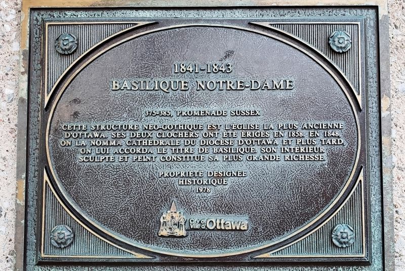
Français: Cette structure néo-gothique est l'église la plus ancienne d'Ottawa. Ses deux clochers ont été érigés en 1858. En 1848, on la nomma Cathédrale du diocèse d'Ottawa et plus tard, on lui accorda le titre de Basilique. Son . . . — — Map (db m151573) HM
On Bruyère Street east of Sussex Drive (Route 93), on the right when traveling west.
English:
In the 1840s, Bytown (Ottawa) was a growing timber-trade village with a substantial French-Canadian population but no Catholic schools and few social services. In February of 1845 the Sisters of Charity of Montreal (Grey . . . — — Map (db m141392) HM
On Bruyère Street just west of Parent Avenue, on the right when traveling west.
Français:
L’Hôpital Élisabeth-Bruyère a ouvert ses portes sur la rue Bruyère, à une époque où il portait le nom d’Hôpital général d’Ottawa. L’immeuble a été construit en plusieurs étapes entre 1907 et 1959. Pionnières en matière . . . — — Map (db m141295) HM
On Bruyère Street at Sussex Drive (Route 93), on the right when traveling west on Bruyère Street.
English: Under the leadership of Sister Elizabeth Bruyère, the Sisters of Charity took up residence in Bytown in february 1845 to care for the poor and the sick and to educate the young. The oldest section of the convent, designed . . . — — Map (db m149196) HM
On Sussex Drive (Route 93) at Bruyère Street, on the right when traveling north on Sussex Drive.
English: In 1845, Mère Élisabeth Bruyère founded the Congregation of the Sisters of Charity at Ottawa (Grey Nuns of the Cross). In 1849, she began the construction of the building at this corner. Français: En 1845, . . . — — Map (db m149197) HM
On Sussex Drive (Route 93) just north of St. Patrick Street (Route 44), on the right when traveling north.
English:
First planned as a parish church in 1839, Notre-Dame was transformed as it achieved the status of cathedral for the new Catholic Diocese of Bytown in 1847, mother church of the Archdiocese of Ottawa, and basilica in 1879. . . . — — Map (db m140471) HM
On Sussex Drive (Route 93) north of St. Patrick Street (Route 44), on the right when traveling north.
English: On Dec 18 1999 the most reverend Marcel A. Gervais, Archbishop of Ottawa officially reopened Notre Dame Cathedral. The Cathedral had been closed for renovations since the beginning of 1999 and work continued into the year . . . — — Map (db m151574) HM
On Sparks Street, on the right when traveling east.
The first church on this site, erected
in 1832, was replaced in 1872 by the
present structure, designed by King Arnoldi. It became the cathedral
church of the new diocese in 1895.
En 1872 on démolit une église . . . — — Map (db m178164) HM
On Wellington Street (Route 34) just west of Kent Street (Route 83), on the left when traveling west.
English: The first St. Andrew's kirk, erected here in 1828 by masons who built the Rideau Canal, was demolished in 1872. The present church, designed by W.T. Thomas, was built 1872-74. Français: La première église . . . — — Map (db m150895) HM
On Wellington Street (Route 34) just west of Kent Street (Route 83), on the left when traveling west.
English: This Gothic Revival church was designed by W.T. Thomas of Montreal, one of Canada’s most significant architects of his generation. It replaced an earlier church built when the parish was established in 1828. Designated . . . — — Map (db m150893) HM
The building at 489 Sussex Drive was originally composed of five commercial
structures built between 1846 and 1876 when Sussex Street was at the centre of Ottawa's
commercial activity. The Sisters of the Jeanne d'Arc Institute, one of the few . . . — — Map (db m201398) HM
In 1912, members of the Association canadienne-francaise d'education de l'Ontario and the Missionary Oblates of Mary Immaculate - a religious order of the Catholic Church - gathered in Ottawa to discuss the founding of a newspaper to . . . — — Map (db m195969) HM
On St. Patrick Street, on the right when traveling west.
This plaque is in thankful memory of Sister Elisabeth Bruyere and those who helped her establish on this site, on May 10, 1845, the first general hospital in Ottawa where care would be given to the ill without distinction of age, sex, language, race . . . — — Map (db m197457) HM
On Laurier Ave E at Chapel Street, on the left when traveling south on Laurier Ave E.
All Saints' was founded by Sir Henry Newell Bate, pre-eminent local grocer and first chairman of the Ottawa Improvement Commission (now the National Capital Commission) 1899-1917. Former prime minister Sir Robert Borden's state funeral . . . — — Map (db m178379) HM
On Laurier Avenue East, on the left when traveling east.
This institution was established in 1848 by Bishop Joseph-Eugene Guiges and placed under the direction of the Oblates of Mary Immaculate. Incorporated by Act of Parliament on May 30, 1849 as the College of Bytown, it occupied a three-storey frame . . . — — Map (db m178225) HM
This handsome stone church, in the style of the early
Gothic Revival, was built by A. Thomas Christie on land
donated by John Cavanagh, one of Huntley township's earliest
landholders, Aided by a substantial contribution from Colonel
Arthur . . . — — Map (db m200122) HM
On Dundas West (Provincial Highway 2) at Church Street, on the right when traveling west on Dundas West.
This plaque commemorates the 150th Anniversary of St. John's Church, which was constructed with local field stones and the labour of the parishioners. This original carriage alighting stone has welcomed all visitors through the years. — — Map (db m75952) HM
On Dundas Street, 0.1 kilometers east of Oxford Road 59, on the right when traveling west.
This church was completed in 1834 shortly after the
founding of the community. It was financed through the
efforts of Admiral Henry Vansittart and constructed under
the direction of his agent, Captain Andrew Drew R.N. The
Admiral also pledged . . . — — Map (db m231153) HM
On Dundas Street East at Cawthra Road, on the right when traveling west on Dundas Street East.
Constructed of stone from the nearby Etobicoke River, this
building, also known as the Stone Chapel, is a rare surviving example of a "union" chapel from the settlement period of Upper Canada. It was erected in 1837 through the
efforts of John . . . — — Map (db m242978) HM
Presbytère de l'église catholique (1870) Le premier presbytère fut construit en
1847. Dans la foulée de la construction d'une nouvelle église, Mgr Guigues
évêque d'Ottawa, a permis de bâtir un nouveau presbytère en 1870. De nombreux . . . — — Map (db m203248) HM
On Queen Street, on the right when traveling east.
Eglise catholique St-Jean-Baptiste
St-Jean-Baptiste Catholic Church
La première église catholique en pierre remonte à 1829; elle est démolie quelques
années plus tard, après avoir été jugée instable. En 1851, le curé Bourassa, dresse un
nouveau . . . — — Map (db m203060) HM
On Montreal Road, on the left when traveling east.
Co-Cathedral of the Nativity of the Blessed Virgin Mary
Between 1851 and 1881, Cornwall experienced a large scale industrial expansion which in turn led to an influx of workers and tradesmen from Quebec. The city saw its . . . — — Map (db m227369) HM
On Sydney Street, 0.1 kilometers north of Fourth Street East, on the right when traveling north.
Born in Scotland, Strachan came to Kingston in 1799. Ordained in 1803, he became rector of Cornwall and taught at its grammar school until named rector of York in 1812. In 1839 he was made the first Anglican Bishop of Toronto. A central figure in . . . — — Map (db m103614) HM
On Second Street West, 0.1 kilometers west of Augustus Street, on the right when traveling west.
This pioneer clergyman, legislator and teacher was born in 1778 in Aberdeen, Scotland, and in 1799 came to Kingston as a tutor. In 1803, after entering the Church of England, he was ordained and appointed missionary at Cornwall. Here in . . . — — Map (db m103641) HM
On Second Street East, 0.1 kilometers east of Pitt Street, on the right when traveling east.
Founded in 1787 by the well known Scot, the Reverend John Bethune, St. John's Presbyterian Church and its people played an important role in the preservation of Canadian land and territorial claim during the war of 1812. Their first church building . . . — — Map (db m103631) HM
On Algonquin Avenue (County Highway 2) close to Avonmore Rd, on the left when traveling west.
To the south at approximately one-half kilometre, lies Moulinette, once a village of 300 residence. Adam Dixson, of Moulinette's prominent family, built the first dam across to Sheek Island and part of the Cornwall Canal, near the village. Christ . . . — — Map (db m205346) HM
On Fran LaFlamme Drive (Ault Park Road), on the right when traveling west.
Sandtown Advent Christian Church
The Sandtown Advent Christian
Church did not come from a "lost
village", but instead came from the
Township of Osnabruck. Originally built
as an Orange Lodge around 1860, it was
converted to a church in . . . — — Map (db m202511) HM
On Kenyon Concession 19, 0.1 kilometers west of Highland Road (County Route 20), on the right when traveling west.
This log structure, completed in 1837, is the oldest remaining chapel in Ontario built by Congregationalists. Its first minister, the Reverend William McKillican (1776-1849), emigrated to Canada from Scotland in 1816, and settled in Glengarry the . . . — — Map (db m76781) HM
On Highland Road (County Route 20) 0.1 kilometers south of Kenyon Concession 19, on the right when traveling south.
Born at Indian Lands (St. Elmo), Gordon was ordained a Presbyterian minister in 1890. He served as a missionary in the North West Territories until 1893 and the following year was called to St. Stephens in Winnipeg. A chaplain during the War of . . . — — Map (db m76736) HM
On County Road 2 at County Road 8, on the right when traveling east on County Road 2.
Top Row — left, small Pres built 1831 purchased by Catholics 1845 present Catholic cen. left 1968 — — old & present Presbyterian 1873 located in Dunbar — — United Church in Williamsburg former Presbyterian 1866 — . . . — — Map (db m150218) HM
On Riverside Drive, on the right when traveling west.
The first Lutheran minister to settle in this province, Schwerdtfeger was born in Burgbernheim, Bavaria, and studied theology at the University of Erlangen. Emigrating to America in 1753, he served as pastor of congregations in Pennsylvania, . . . — — Map (db m86847) HM
On County Road 18 (County Highway 18), on the right when traveling east.
Born in Scotland and educated for the priesthood, Macdonell
obtained land in Glengarry County and, in 1804, brought many
soldiers from his disbanded Highland Regiment to join the
Loyalists already in Upper Canada. Having helped raise . . . — — Map (db m201612) HM
On County Road 18, on the right when traveling east.
The extraordinary ruins of this church recall the early history of Roman Catholicism in Upper Canada. Begun in 1815, St. Rafael's Church originally served as the centre of the colony's largest and most important parish, and the . . . — — Map (db m201626) HM
On County Road 18 (County Highway 18), on the right when traveling east.
On this site stood the Blue Chapel. The Blue Chapel, so named because of
the painted blue ceiling, was the first church of St. Raphael's Parish.
It was a sturdy little building of weathered logs.
The chapel was built in 1789 by Father . . . — — Map (db m201624) HM
Near Frog Hollow Road, on the left when traveling east.
Established by the Reverend Alexander Macdonell, father of
Roman Catholic education in Upper Canada and later Bishop
of Kingston, the College of lona was opened in 1826 in a log
building near this site. The central portion of the . . . — — Map (db m201670) HM
On County Highway 18, on the right when traveling east.
Early in September, 1786, a group of some 500 Scottish
Highlanders, the majority of whom were Macdonells, arrived
at Quebec. They were led by their parish priest from
Knoydart, Glengarry, the Reverend Alexander MacDonell
(Scotus). Forced to . . . — — Map (db m201618) HM
On County Road 18 at Frog Hollow Road, on the right when traveling east on County Road 18.
A mission for the Roman Catholic Highlanders of the Raisin
River settlement was begun in 1786 by the Reverend Alexander
Macdonell (Scotus) and later a small frame church, called the
"Blue Chapel", was built. St. Raphael's parish was . . . — — Map (db m201619) HM
On Mission Road just north of Back Street, on the right when traveling north.
In 1849 two priests of the Society of Jesus, Father Jean-Pierre Choné and Father Nicholas Frémiot, established the Mission of the Immaculate Conception on the Kaministiquia River. From there the Jesuits travelled the north shore of Lake Superior on . . . — — Map (db m199599) HM
On 2nd Street just east of Newton Street, on the right when traveling east.
The first church in Nipigon, St. Mary the Virgin, was built in 1888, under the guidance of Reverend Robert Renison. Local people contributed about $250 toward construction, and tourists and visitors donated as well. Its solid log foundation has . . . — — Map (db m244509) HM
On 2nd Street just west of Riverview Street, on the right when traveling west.
The Hudson’s Bay Company sold this property to the Diocese of Algoma, Church of England in 1908 for the sum of two dollars so that a house could be built for the Anglican minister. Using balloon construction with British Columbia fir and nine-foot . . . — — Map (db m244544) HM
On 1st Street just east of Newton Street, on the left when traveling east.
This house built in French Provincial style using a post and beam construction may well be the oldest residence in Nipigon. All the ceilings, walls, and floors are made with tongue-and-groove hardwood. The original insulation was birch bark and . . . — — Map (db m222201) HM
On 2nd Street just east of Front Street, on the right when traveling east.
Although this structure looks like a typical office building, it began its history as the Nipigon Presbyterian Church in 1899. William McKirdy built the wooden pews, and his wife Georgina played the organ, taught Sunday school and formed a Ladies . . . — — Map (db m244589) HM
On 2nd Street just west of Riverview Street, on the left when traveling west.
This picturesque little church dates back to 1906 when it was the first Catholic Church in Nipigon. The main body of the church seats about 70 people and a small gallery holds about 15 more. Its original location was the southwest corner of Second . . . — — Map (db m244792) HM
Near Waverley Street just east of Banning Street, on the right when traveling east.
It was here on June 11, 1923, that the General Assembly of The Presbyterian Church in Canada, after two days of vigorous debate, voted decisively in favour of the Presbyterians uniting with the Methodists and the Congregationalists to form the . . . — — Map (db m227975) HM
On Red River Road just east of Algoma Street North, on the left when traveling east.
A.L. McGovern • R.H. Clarke • C. Vincent • B. Clavet • J. Jeffs • J. Heffernan • J. Morrison • C. King • J. Bougie • W. Jeffs • E. J. McCartney • J. Audray • H. Nadon • M. Sauve • P.J. Moriarty • R. Taylor • J. Deagle • A. Pariseau • W. Malott • N. . . . — — Map (db m244104) WM
On Red River Road at Algoma Street North, on the right when traveling west on Red River Road.
Born in Carlisle, England, Baxter came to Canada as a child. He studied in Toronto and at the Sulpician College in Montreal before becoming, reputedly, the first English-speaking Jesuit novice in Canada. After his ordination in New York in 1854, he . . . — — Map (db m107065) HM
On Waverly Street just west of Algoma Street South, on the right when traveling east.
A century ago, in November 1871, upon part of this site in what was then known as Prince Arthur’s Landing, Methodism came into existence in this area by the establishment of Providence Methodist Church, the first Protestant church in the territory. . . . — — Map (db m199600) HM
On Waverley Street just west of Algoma Street South, on the right when traveling east.
The city of Port Arthur’s first Methodist Church was built on this site in 1871. The present church, built in 1905 as the “Methodist Church,” was renamed “Trinity Methodist Church” in 1908. Architects were Langly-Langly from Toronto who designed . . . — — Map (db m244202) HM
On Queen's Park Crescent East just north of Grosvenor Street, on the left when traveling north.
[English] The first university in this province, King's College was chartered in 1827 through the efforts of the Reverend John Strachan. This site was acquired by the College the following year. Sectarian and political criticism of . . . — — Map (db m207856) HM
After the Toronto Island parish was established in 1875 Bishop Arthur Sweatman was the prime mover in the building of this Anglican church. Designed by Arthur R. Denison, architect, the Early English Gothic style frame church was opened at the . . . — — Map (db m35520) HM
On Queen Street East just east of Bond Street, on the left when traveling east.
This "Cathedral of Methodism" was designed by Henry Langley in the High Victorian Gothic style. The cornerstone was laid by the Rev. Egerton Ryerson, D.D., in 1870 and the church was dedicated in 1872. It replaced an earlier structure at the . . . — — Map (db m207898) HM
On Richmond Street East at Yonge Street, on the left when traveling west on Richmond Street East.
The first Jewish congregation in Canada West, (now Ontario), was established on this site in 1856 (Jewish calendar 5615). Services were held in a rented hall on the upper floor over Coombe’s Drug Store on the corner of Yonge and Richmond Streets. . . . — — Map (db m217697) HM
On King Street West at Emily Street, on the right when traveling east on King Street West.
St. Andrew’s was begun in 1874 to serve a Church of Scotland congregation organized in 1830. An outstanding example of Romanesque Revival architecture, this massive church was designed by William Storm (1826-92), a noted Toronto architect. The . . . — — Map (db m199996) HM
On Front Street West close to University Avenue, on the right when traveling west.
On this site stood the "Bishop's Palace", residence of Bishop John Strachan (1778-1867), built in 1817-18 while he was the incumbent of St. James' Church. Born in Scotland, he came to Upper Canada in 1799 where he achieved prominence as an educator . . . — — Map (db m83662) HM
On Adelaide Street East just east of George Street, on the left when traveling east.
Designed by Toronto architect Henry Langley, this building was constructed as a boys school operated by the Brothers of the Christian Schools, a Catholic teaching order. The Brothers had purchased the former Bank of Upper Canada building to the . . . — — Map (db m217698) HM
On King Street East just east of Church Street, on the left when traveling east.
York's first church was built here in 1803-07 with the aid of public subscriptions and a government grant. That frame building was enlarged in 1818-19 and replaced by a larger one in 1831. The first incumbent was the Rev. George Okill Stuart, who . . . — — Map (db m199499) HM
On Church Street just north of King Street East, on the right when traveling north.
In 1796 the first Anglican priest arrived from England to minister to the citizens of York. The following year the province set aside this piece of land for the building of a church. The present cathedral, the fourth church erected on this site, . . . — — Map (db m217444) HM
On Young Street at Duke Street West, on the right when traveling north on Young Street.
Founded in 1857, St. Mary's is the oldest Roman Catholic parish in Kitchener (previously Berlin) The early congregation was largely German and Polish. Father George Laufhuber, S.J., was the first pastor.
Father Edward Glowacki, C.R. was appointed . . . — — Map (db m244291) HM
On King Street East, 0.1 kilometers Sterling Avenue North, on the left when traveling east.
Born in Lancaster County, Pennsylvania, Eby came to Upper Canada in 1806 and purchased extensive lands in this vicinity on which he settled the following year. He was ordained a minister of the Mennonite Church in 1809 and in 1812 was made a bishop. . . . — — Map (db m244322) HM
On King Street East, 0.1 kilometers east of Stirling Avenue North, on the left when traveling east.
Site of the
First Church in Waterloo County
Built of logs in 1813
by Benjamin Eby, a bishop
of the Mennonite church
Replaced by frame building, 1834
The present church was built in 1902
Tablet placed by
the Waterloo Historical . . . — — Map (db m244305) HM
On Albert Street, 0.1 kilometers north of Bricker Avenue, on the right when traveling north.
On this site stands the first Lutheran seminary in Canada. This plaque commemorates the gift of five acres of land by the Board of Trade on behalf of the citizens of Waterloo on October 30, 1911, to the Evangelical Lutheran Seminary of Canada. The . . . — — Map (db m244140) HM
On Albert Street, 0.1 kilometers north of Bricker Avenue, on the right when traveling north.
Founded in 1911 as the Evangelical Lutheran Seminary of Canada, and situated on land donated by the Board of Trade of Waterloo, this institution was originally established to train homegrown Lutheran pastors. It was expanded in 1914 with . . . — — Map (db m244132) HM
On Yonge Street, on the right when traveling south.
Settlers came to this district about 1794 after the construction
of Yonge Street north from York (Toronto). The settlement
prospered as a way station for travellers. Known as Mount
Pleasant, the community was renamed, following a . . . — — Map (db m235928) HM
165 entries matched your criteria. Entries 101 through 165 are listed above. ⊲ Previous 100