After filtering for Ontario, 166 entries match your criteria. Entries 101 through 166 are listed.⊲ Previous 100
Churches & Religion Topic
By William Fischer, Jr., September 29, 2023
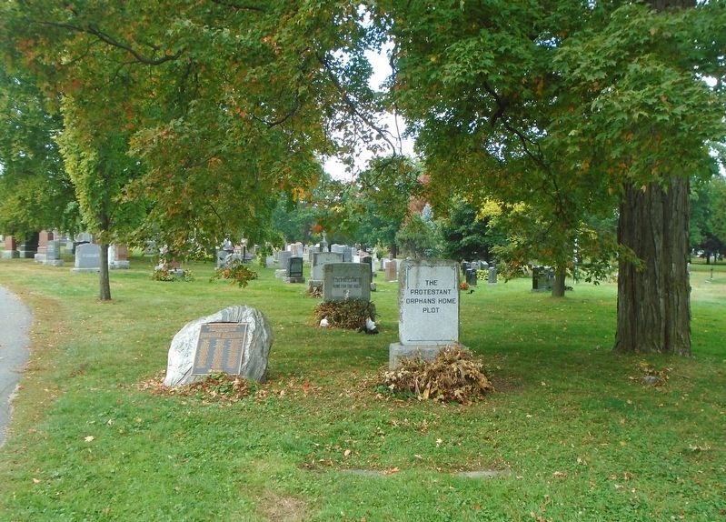
Indigent Plots / Complots d'indigents and Marker
| 101 ► Ontario, Ottawa — Indigent Plots / Complots d'indigents — |
| 102 ► Ontario, Ottawa, Byward Market - Parliament Hill — Basilique Notre-Dame / Notre Dame Basilica — 1841-1843 — 375-385, promenade Sussex / 375-385 Sussex Drive — |
| On Sussex Drive (Route 93) north of St. Patrick Street (Route 44), on the right when traveling north. | |||
| 103 ► Ontario, Ottawa, Byward Market - Parliament Hill — Élisabeth Bruyère — 1818-1876 — |
| On Bruyère Street east of Sussex Drive (Route 93), on the right when traveling west. | |||
| 104 ► Ontario, Ottawa, Byward Market - Parliament Hill — Hôpital Élisabeth Bruyère / Élisabeth Bruyère Hospital — |
| On Bruyère Street just west of Parent Avenue, on the right when traveling west. | |||
| 105 ► Ontario, Ottawa, Byward Market - Parliament Hill — Mother House, Sisters of Charity / Maison Mère, Sœurs de la Charité — 1849 — |
| On Bruyère Street at Sussex Drive (Route 93), on the right when traveling west on Bruyère Street. | |||
| 106 ► Ontario, Ottawa, Byward Market - Parliament Hill — Motherhouse, Sisters of Charity at Ottawa — La Maison Mère des Sœurs de la Charité d’Ottawa — |
| On Sussex Drive (Route 93) at Bruyère Street, on the right when traveling north on Sussex Drive. | |||
| 107 ► Ontario, Ottawa, Byward Market - Parliament Hill — Notre-Dame Cathedral Basilica / Basilique cathédrale Notre-Dame — |
| On Sussex Drive (Route 93) just north of St. Patrick Street (Route 44), on the right when traveling north. | |||
| 108 ► Ontario, Ottawa, Byward Market - Parliament Hill — The Historic Notre Dame Cathedral Restoration — La restauration historique de la cathédrale Notre-Dame — |
| On Sussex Drive (Route 93) north of St. Patrick Street (Route 44), on the right when traveling north. | |||
| 109 ► Ontario, Ottawa, Downtown Ottawa — Christ Church Cathedral / La cathédrale Christ Church — |
| On Sparks Street, on the right when traveling east. | |||
| 110 ► Ontario, Ottawa, Downtown Ottawa — St. Andrew's Church / L’église St. Andrew's — |
| On Wellington Street (Route 34) just west of Kent Street (Route 83), on the left when traveling west. | |||
| 111 ► Ontario, Ottawa, Downtown Ottawa — St. Andrew's Presbyterian Church — 1872-1874 — |
| On Wellington Street (Route 34) just west of Kent Street (Route 83), on the left when traveling west. | |||
| 112 ► Ontario, Ottawa — 489 Sussex Drive — |
| On Sussex Dr., on the right when traveling north. | |||
| 113 ► Ontario, Ottawa — Le Droit — |
| On York Street, on the left when traveling east. | |||
| 114 ► Ontario, Ottawa — Site of the First Hospital in Ottawa — |
| On St. Patrick Street, on the right when traveling west. | |||
| 115 ► Ontario, Ottawa, Sandy Hill — 1900 All Saints' Anglican Church — |
| On Laurier Ave E at Chapel Street, on the left when traveling south on Laurier Ave E. | |||
| 116 ► Ontario, Ottawa, Sandy Hill — University of Ottawa — |
| On Laurier Avenue East, on the left when traveling east. | |||
| 117 ► Ontario, Ottawa, Stittsville - Basswood — Christ Church 1838 — |
| On Carp Road, on the right when traveling north. | |||
| 118 ► Ontario, Oxford County, Thamesford — St. John's Anglican Church — 1861 - 2011 — |
| On Dundas West (Provincial Highway 2) at Church Street, on the right when traveling west on Dundas West. | |||
| 119 ► Ontario, Oxford County, Woodstock — St. Paul’s Church 1834 — |
| On Dundas Street, 0.1 kilometers east of Oxford Road 59, on the right when traveling west. | |||
| 120 ► Ontario, Peel Region, Mississauga, Dixie — Dixie Union Chapel — |
| On Dundas Street East at Cawthra Road, on the right when traveling west on Dundas Street East. | |||
| 121 ► Ontario, Prescott and Russell United Counties, L'Orignal — Presbytère de l'église catholique / Rectory of the Catholic Church — |
| On Queen Street, on the left when traveling west. | |||
| 122 ► Ontario, Prescott and Russell United Counties, L'Orignal — St Jean-Baptiste Catholic Church — |
| On Queen Street, on the right when traveling east. | |||
| 123 ► Ontario, Stormont, Dundas and Glengarry United Counties, Cornwall — Co-Cathedral of the Nativity of the Blessed Virgin Mary — Cocathédrale de la Nativité de la Bienheureuse Vierge Marie — |
| On Montreal Road, on the left when traveling east. | |||
| 124 ► Ontario, Stormont, Dundas and Glengarry United Counties, Cornwall — Right Reverend John Strachan — 1778-1867 — |
| On Sydney Street, 0.1 kilometers north of Fourth Street East, on the right when traveling north. | |||
| 125 ► Ontario, Stormont, Dundas and Glengarry United Counties, Cornwall — The Rev. John Strachan in Cornwall — |
| On Second Street West, 0.1 kilometers west of Augustus Street, on the right when traveling west. | |||
| 126 ► Ontario, Stormont, Dundas and Glengarry United Counties, Cornwall — War of 1812 — St. John's Presbyterian Church — |
| On Second Street East, 0.1 kilometers east of Pitt Street, on the right when traveling east. | |||
| 127 ► Ontario, Stormont, Dundas and Glengarry United Counties, Long Sault — Moulinette — Lost Villages Historical Society — |
| On Algonquin Avenue (County Highway 2) close to Avonmore Rd, on the left when traveling west. | |||
| 128 ► Ontario, Stormont, Dundas and Glengarry United Counties, Long Sault — Sandtown Advent Christian Church — |
| On Fran LaFlamme Drive (Ault Park Road), on the right when traveling west. | |||
| 129 ► Ontario, Stormont, Dundas and Glengarry United Counties, Maxville — Glengarry Congregational Church — 1837 — |
| On Kenyon Concession 19, 0.1 kilometers west of Highland Road (County Route 20), on the right when traveling west. | |||
| 130 ► Ontario, Stormont, Dundas and Glengarry United Counties, Maxville — The Rev. Charles W. Gordon — 1860-1937 — |
| On Highland Road (County Route 20) 0.1 kilometers south of Kenyon Concession 19, on the right when traveling south. | |||
| 131 ► Ontario, Stormont, Dundas and Glengarry United Counties, Morrisburg — Churches of South Dundas — Dundas Murals — |
| On County Road 2 at County Road 8, on the right when traveling east on County Road 2. | |||
| 132 ► Ontario, Stormont, Dundas and Glengarry United Counties, Morrisburg — The Rev. Johann Samuel Schwerdtfeger — 1734 - 1803 — |
| On Riverside Drive, on the right when traveling west. | |||
| 133 ► Ontario, Stormont, Dundas and Glengarry United Counties, St. Raphael's — Bishop Alexander Macdonell — (1762-1840) — |
| On County Road 18 (County Highway 18), on the right when traveling east. | |||
| 134 ► Ontario, Stormont, Dundas and Glengarry United Counties, St. Raphael's — St. Raphaels' Ruins — |
| On County Road 18, on the right when traveling east. | |||
| 135 ► Ontario, Stormont, Dundas and Glengarry United Counties, St. Raphael's — The Blue Chapel — |
| On County Road 18 (County Highway 18), on the right when traveling east. | |||
| 136 ► Ontario, Stormont, Dundas and Glengarry United Counties, St. Raphael's — The College of Iona / Le College d'Iona — |
| Near Frog Hollow Road, on the left when traveling east. | |||
| 137 ► Ontario, Stormont, Dundas and Glengarry United Counties, St. Raphael's — The Glengarry Emigration of 1786 — |
| On County Highway 18, on the right when traveling east. | |||
| 138 ► Ontario, Stormont, Dundas and Glengarry United Counties, St. Raphael's — The Parish of St. Raphael — |
| On County Road 18 at Frog Hollow Road, on the right when traveling east on County Road 18. | |||
| 139 ► Ontario, Thunder Bay District, Fort William First Nation — The Mission of the Immaculate Conception 1849 — |
| On Mission Road just north of Back Street, on the right when traveling north. | |||
| 140 ► Ontario, Thunder Bay District, Nipigon — Anglican Church and Cemetery — |
| On 2nd Street just east of Newton Street, on the right when traveling east. | |||
| 141 ► Ontario, Thunder Bay District, Nipigon — First Anglican Rectory — |
| On 2nd Street just west of Riverview Street, on the right when traveling west. | |||
| 142 ► Ontario, Thunder Bay District, Nipigon — Flanagan House — |
| On 1st Street just east of Newton Street, on the left when traveling east. | |||
| 143 ► Ontario, Thunder Bay District, Nipigon — Hydro Building / United Church — |
| On 2nd Street just east of Front Street, on the right when traveling east. | |||
| 144 ► Ontario, Thunder Bay District, Nipigon — Ukrainian Catholic Church — |
| On 2nd Street just west of Riverview Street, on the left when traveling west. | |||
| 145 ► Ontario, Thunder Bay District, Thunder Bay — Historic Church — |
| Near Waverley Street just east of Banning Street, on the right when traveling east. | |||
| 146 ► Ontario, Thunder Bay District, Thunder Bay — In Memory of Our Catholic Boys Who Fell in the Great War — 1914 — 1918 — |
| On Red River Road just east of Algoma Street North, on the left when traveling east. | |||
| 147 ► Ontario, Thunder Bay District, Thunder Bay — The Reverend Richard Baxter, S.J., 1821-1904 — |
| On Red River Road at Algoma Street North, on the right when traveling west on Red River Road. | |||
| 148 ► Ontario, Thunder Bay District, Thunder Bay — Trinity Centennial — 1871-1971 — |
| On Waverly Street just west of Algoma Street South, on the right when traveling east. | |||
| 149 ► Ontario, Thunder Bay District, Thunder Bay — Trinity United Church — Designated Heritage Property — Ontario Heritage Act 1974 — |
| On Waverley Street just west of Algoma Street South, on the right when traveling east. | |||
| 150 ► Ontario, Toronto, Bay-Cloverhill — King's College — |
| On Queen's Park Crescent East just north of Grosvenor Street, on the left when traveling north. | |||
| 151 ► Ontario, Toronto, Centre Island — St. Andrew By-The-Lake — |
| Near Cibola Avenue. | |||
| 152 ► Ontario, Toronto, Downtown Yonge East — Metropolitan United Church — |
| On Queen Street East just east of Bond Street, on the left when traveling east. | |||
| 153 ► Ontario, Toronto, Downtown Yonge East — Original Site of Toronto Hebrew Congregation Holy Blossom — |
| On Richmond Street East at Yonge Street, on the left when traveling west on Richmond Street East. | |||
| 154 ► Ontario, Toronto, Entertainment District — St. Andrew's Church — |
| On King Street West at Emily Street, on the right when traveling east on King Street West. | |||
| 155 ► Ontario, Toronto, Entertainment District — The Bishop’s Palace 1818 — |
| On Front Street West close to University Avenue, on the right when traveling west. | |||
| 156 ► Ontario, Toronto, Financial District — The First Methodist Church in Toronto — |
| On Jordan Street at King Street West, on the left when traveling north on Jordan Street. | |||
| 157 ► Ontario, Toronto, Old Town — De La Salle Institute Building — 1871 — |
| On Adelaide Street East just east of George Street, on the left when traveling east. | |||
| 158 ► Ontario, Toronto, Old Town — St. James' Cathedral — |
| On King Street East just east of Church Street, on the left when traveling east. | |||
| 159 ► Ontario, Toronto, Old Town — The Cathedral Church of St. James — |
| On Church Street just north of King Street East, on the right when traveling north. | |||
| 160 ► Ontario, Waterloo Region, Kitchener, City Commercial Core — St. Mary Our Lady of the Seven Sorrows Roman Catholic Parish — |
| On Young Street at Duke Street West, on the right when traveling north on Young Street. | |||
| 161 ► Ontario, Waterloo Region, Kitchener, King East — Bishop Benjamin Eby, 1785-1853 — |
| On King Street East, 0.1 kilometers Sterling Avenue North, on the left when traveling east. | |||
| 162 ► Ontario, Waterloo Region, Kitchener, King East — Site of the First Church in Waterloo County — |
| On King Street East, 0.1 kilometers east of Stirling Avenue North, on the left when traveling east. | |||
| 163 ► Ontario, Waterloo Region, Waterloo — The First Lutheran Seminary in Canada — |
| On Albert Street, 0.1 kilometers north of Bricker Avenue, on the right when traveling north. | |||
| 164 ► Ontario, Waterloo Region, Waterloo — Wilfred Laurier University/ Université Wilfred Laurier — |
| On Albert Street, 0.1 kilometers north of Bricker Avenue, on the right when traveling north. | |||
| 165 ► Ontario, Wellington County, Guelph — Guelph Salvation Army — |
| On Wyndham Street North just north of Quebec Street, on the left when traveling north. | |||
| 166 ► Ontario, York Region, Richmond Hill — The Founding of Richmond Hill — |
| On Yonge Street, on the right when traveling south. | |||
166 entries matched your criteria. Entries 101 through 166 are listed above. ⊲ Previous 100