On Dulaney Valley Road, 0.2 miles north of Surrey Road, on the right.
Patented to Richard Smith, Jr. 10th August 1684 for 2500 acres. Daniel Dulaney acquired 1250 acres of this tract 19th November 1724, after which it was called “Dulaney’s Valley.” — — Map (db m2080) HM
On Dulaney Valley Road, 0.1 miles north of Chapelwood Lane, on the right when traveling north.
Built in 1759 by Charles Ridgely (the Elder) of Hampton and two sons, the iron foundry operated for 70 years on Spring Branch of Patterson’s Run. It furnished cannon and shot for the Revolution as well as other supplies: “300 kettles” were ordered . . . — — Map (db m2079) HM
On Saters Lane, 0.4 miles west of Falls Road (Maryland Route 25), on the right.
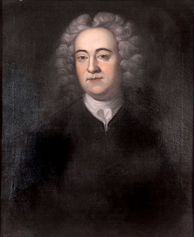
Pioneer of the Maryland Baptist denomination. Only eternity, interpeted by God, can make known the moral, mental and spiritual work of the “Mother Church” of the Baptists of Maryland. Founded by Henry Sater 1690–1754. Resolute and . . . — — Map (db m2278) HM
On Falls Road (Maryland Route 25) at Saters Lane, on the left when traveling north on Falls Road.
On land granted by the Fifth Lord Baltimore, Henry Sater, gentleman planter, founded this first church of Baptists in Maryland. To the congregation he deeded a plot and chapel “forever to the end of the world.” — — Map (db m2276) HM
On Gunpowder Road, 0.2 miles north of Hoffmanville Road, on the right when traveling north.
The first paper maker in Maryland was William Hoffman. In 1775 he built his first mill on Gunpowder Falls a quarter mile upstream from the present Hoffmanville Bridge. In September 1776 Congress adopted watermarked paper for its currency. . . . — — Map (db m1871) HM
East of this point is mile stone 46 on the line marked by English surveyors and astronomers Charles Mason and Jeremiah Dixon. From 1763-1768 Mason and Dixon used innovative methods to settle a boundary dispute between the colonial proprietors. Each . . . — — Map (db m96072) HM
The base of the original mile stone 46, carved in Portland, England, and set by Charles Mason and Jeremiah Dixon in 1766, is located 480 feet east of this stone.
This replica stone was set by the Maryland Society of Surveyors in 2015. — — Map (db m115246) HM
Near Marshy Point Road, 0.6 miles south of Eastern Avenue (Maryland Route 150), on the left when traveling south.
The wild turkey has a long history of importance to people living in the Americas. Turkey meat was an important food source to Native American people, who also used their feathers as adornments. Wild turkeys were also hunted by European . . . — — Map (db m189132) HM
Legend relates that the name originated with an Indian attempt to plant gunpowder in the hope that a crop could be raised.
Big Gunpowder Falls flows through Baltimore County, joins the Little Gunpowder Falls at Day’s Island to form Gunpowder . . . — — Map (db m115247) HM
Near Marshy Point Road, 0.6 miles south of Eastern Avenue (Maryland Route 150), on the left when traveling south.
1608: Early Exploration
Oysters in the Chesapeake Bay were so abundant that reefs (oyster bars) would be exposed at low tides and even presented a potential navigational hazard, leading John Smith to observe that they "lay as thick as . . . — — Map (db m189115) HM
On Carroll Road, 0.1 miles north of Glencoe Road, on the left when traveling south.
Surveyed April, 1705 for Charles Carroll, Lord Baltimore’s Attorney-General of his Province of Maryland 1688. In 1822 Henry Carroll, great-great grandson of Charles Carroll built Clynmalira house. — — Map (db m49267) HM
Sometimes called "Lord Baltimore's Gift"
Surveyed 26 August, 1713
and granted by Charles 2d Lord Baltimore
to his fourth and last consort Margaret,
Baroness of Baltimore, Daughter of
Thomas Charleton of Hexham, Esq.,
with all the . . . — — Map (db m15110) HM
On Monkton Road, 0.1 miles north of Old York Road, on the right when traveling north.
In 1713 Charles Calvert, third Lord Baltimore gave to his wife, Margaret 10,000 acres known as My Lady's Manor. In 1731, Thomas Brerewood was engaged to manage the land. During the Revolution the property was confiscated by Maryland and in 1782 sold . . . — — Map (db m70923) HM
On Old York Road just north of Old York Road, on the right when traveling north.
Established 1750 as a Chapel of Ease in the Parish of St. John’s of Joppa. In a brick chapel 60 x 30 feet, now the transept, was finished on this site “in the fork of the Gunpowder River” at the cost of 790 pounds. In 1770 by Act of the . . . — — Map (db m2054) HM
Near Village Queen Drive, 0.1 miles west of Cradock Lane, on the left when traveling west.
"...preservation is simply having the good sense to hold on to things that are well designed, that link with our past in a meaningful way, and that have plenty of good use left in them."
Richard Moe, National Trust for Historic . . . — — Map (db m143009) HM
On Philadelphia Road (Maryland Route 7) 0.1 miles north of Forge Road, on the left when traveling north.
During the Colonial Period this was one of the most navigable stretches of the Gunpowder Falls. A Ferry operated here between 1754 and 1759. The Nottingham Forge and Gunpowder Furnace built metal products and battleship parts from 1759 to 1858, when . . . — — Map (db m152190) HM
On Belair Road (U.S. 1) 2.4 miles north of Forge Road, on the right when traveling north.
The founder of Perry Hall, Gough owned a 1,300 acre estate that bordered the Gunpowder Falls. He dominated commerce in Northeast Baltimore County during the colonial period. An active supporter of the Methodist church, he sheltered Francis Asbury . . . — — Map (db m9611) HM
On Honeygo Boulevard at East Joppa Road, on the right when traveling west on Honeygo Boulevard.
The founder of Perry Hall, Gough and his wife Prudence sheltered Methodist leaders at the Perry Hall Mansion between 1775 and 1808. — — Map (db m18235) HM
On Honeygo Boulevard at Belair Road (U.S. 1), on the right when traveling north on Honeygo Boulevard.
One of the largest houses in Maryland. Begun in 1773 by Corbin Lee. Completed in 1776 by Harry Dorsey Gough. East wing of the Mansion partially burned in 1824. Repaired by Harry Dorsey Gough Carroll ca. 1825. Restored by the owners in 1967. — — Map (db m213339) HM
On Belair Road near U.S. 1, on the right when traveling north.
The Baltimore Embroidery Company
Established by John Tanner and his wife, Lina Barth, circa 1914, manufactured a variety of lace and embroidery products on this site until 1997, including U.S. Armed Forces insignia, U.S. Olympic emblems and . . . — — Map (db m212587) HM
On Jarrettsville Pike (Maryland Route 146) 0.7 miles north of Dulaney Valley Road, on the right when traveling north.
Part of the Valley of Jehosaphat, now Dulaney Valley, patented August 10, 1684. Walter Dulaney acquired half, 1747, and remainder, 1767. His lands were confiscated and sold at the end of the Revolutionary War. Thomas Marsh obtained “The Eagle’s . . . — — Map (db m213918) HM
On Garrison Farm Court, 0.1 miles Garrison Farms Road, on the left when traveling east. Reported missing.
Built about 1695 as headquarters for a troop of mounted rangers to patrol paths from the Patapsco to the Susquehanna as a protection against hostile Indians. It was nine miles from nearest white inhabitants when built. — — Map (db m2265) HM
On Reisterstown Road (Maryland Route 140) 0.1 miles south of Old Court Rd, on the right when traveling south.
Originally an Indian trail, then used by the Rangers from the Garrison Fort to keep back the Indians. Later used as a road to the Court at Joppa Town, the County Seat of Baltimore County from 1712 to 1768 and the rival of Baltimore. — — Map (db m2270) HM
Mt. Paran Church was incorporated September 18, 1841. The chruch was called Soldier’s Delight prior to 1841 and that congregation began circa 1776. The oldest legible tombstone is that of Robert Gilchrist, dated October 17, 1767. The oldest known . . . — — Map (db m122235) HM
On Butler Road (Route 128) at Longnecker Road, on the left when traveling east on Butler Road.
Patented for 4200 acres, August 6, 1719, to William Nicholson, gentleman of Anne Arundel County. Subdivided into 1757 into four equal parts by Byron Philpot, Junior, Corbin Lee, Kinsey Johns and Roger Boyce. — — Map (db m2077) HM
The jewel of Hampton’s cultural landscape and the focus of Ridgely family horticultural pursuits for 150 years is the Falling Garden. Constructed under Charles Ridgely “The Builder” in the 1780s, the Falling Garden was one of the . . . — — Map (db m78625) HM
Slave/Workers Quarters, ca 1855 To our eyes, the stone facades and decorative woodwork that adorn these buildings seem at odds with their use as slave quarters. But the entire farm site—based on a popular European architectural concept called . . . — — Map (db m78687) HM
Near Hampton Lane, 0.2 miles east of Hampton Garth, on the right when traveling east.
At Hampton’s height, hundreds of workers labored to make this a self-sufficient and profitable estate. Slaves and servants who worked in the mansion carried out their daily chores in this yard and also had living quarters in this area (see . . . — — Map (db m78624) HM
Builder of Hampton and owner Northampton Iron Works. Supplier to American Revolutionary Forces. — — Map (db m78632) HM WM
231 ► Maryland, Baltimore County, Towson — Corn Culture — Mule Barn, constructed 1855, Corncrib, ca. 1845, destroyed by fire, 1989 — Hampton National Historic Site, National Park Service, U.S. Department of the Interior —
Near Hampton Lane, 0.1 miles west of Stone Barn Road, on the right when traveling west.
There were lots of mouths to feed on a large plantation like Hampton and this made corn an all-important crop. Hard or “dent “corn was used as feed for livestock and ground into cornmeal for slaves as well as for the Ridgelys’ pantry. . . . — — Map (db m78633) HM
On Hampton Lane, 0.5 miles east of Dulaney Valley Road, on the right when traveling east.
Estate of the Ridgely Family from 1745 to 1948. Home of Charles Carnan Ridgely, Govenor of Maryland 1816–1819. One of the largest Georgian Houses in the United States. Now a National Historic Site.
Open to the public. — — Map (db m198047) HM
Near Hampton Lane, 0.2 miles east of Hampton Garth, on the right when traveling east.
This land was once part of one of the largest estates in Maryland---and one of the most impressive. The Ridgley family owned Hampton Plantation for more than 200 years, and their home and many farm buildings have changed little since the mid-19th . . . — — Map (db m78481) HM
On Joppa Road at Old Court Road, on the right when traveling east on Joppa Road.
First meeting house built on this site 1780. Previously met in Phineas Hunt’s House, still standing on Joppa Road. His grave is nearby. The present church building was erected in 1874. — — Map (db m2281) HM
Orangery, originally constructed ca. 1830s. Destroyed by fire 1926, reconstructed 1976.
It was not possible to grow fresh oranges and lemons’ outside in Maryland, as delicate fruit trees could not survive the winter. The Ridgely family, however, . . . — — Map (db m78631) HM
Hampton is the "show-place" of Maryland. There is certainly nothing like it south of the Mason and Dixon's line J.C. Carpenter, from Appletons' Journal, May 8, 1875
The Mansion, completed 1790. When Captain . . . — — Map (db m78485) HM
On Joppa Road at Edgeclift Road, in the median on Joppa Road.
Originally an Indian trail used in 1695 by a troop of Rangers from the Garrison Fort to keep back the Indians. Later the high road to Joppa Town, the County Seat of Baltimore County from 1712 to 1768 and the rival of Baltimore. — — Map (db m2302) HM
The Hampton Farm, as it might have looked ca. 1850-1870
From this part of the farm, you have an ideal view of the Ridgely mansion. The imposing structure on the hill would have inspired different emotions among the various people on the . . . — — Map (db m188721) HM
Near Hampton Lane, 0.2 miles east of Hampton Garth, on the right when traveling east.
Hampton National Historic Site preserves the core of a large estate owned by the Ridgely family from the Colonial era until 1948. During the early 1800s, it formed the hub of a vast agricultural and industrial enterprise numbering over 25,000 acres. . . . — — Map (db m144060) HM
On Dover Road, 0.1 miles east of Hanover Road (Maryland Route 30).
Believed to be the oldest existing Lutheran Congregation in Baltimore County. It was begun as a Union Church in the early 1700’s. The reformed congregation worshiping in the same building. The first recorded communion was in 1794. The first house of . . . — — Map (db m2058) HM
On The Boardwalk, 0.1 miles east of B Street, on the right when traveling north.
The present location of what is now known as Bay Front Park encompasses the boardwalk and the beach. Bay Front Park was affectionately called and is still referred to as Brownie's Beach by long-time residents. Its name was taken from the Brown . . . — — Map (db m162774) HM
On H.G. Trueman Road (Maryland Route 765) 0.8 miles north of Cove Point Road (Maryland Route 497), on the right when traveling north.
Founded, 1684, as a chapel of ease in Christ Church parish and named for Middleham, Yorkshire, England. The site has been used for worship since the founding, but the chapel was rebuilt in 1748. The bell, given by John Holdsworth, is dated 1699. — — Map (db m3436) HM
On Sollers Wharf Road at Wohlgemuth Road, on the right when traveling south on Sollers Wharf Road.
The tract, originally known as Morgan’s Fresh, was granted, 1651, to Philip Morgan, a captain in the Puritan militia. The house, which overlooks St. Leonard Creek, was built before 1670 and served as a lookout station in the War of 1812 and the . . . — — Map (db m3437) HM
On Pardoe Road (Maryland Route 765) at Solomons Island Road (Maryland Route 2/4), on the right when traveling west on Pardoe Road.
Home of Richard Preston, Commander of the North Bank of the Patuxent River 1649. Seat of the Puritan Government of Maryland where the colonial records were kept 1653–1657. — — Map (db m3462) HM
On Bay Avenue at 3rd Street, on the right when traveling north on Bay Avenue.
The Town of North Beach, Calvert County's northernmost municipality, was originally called "North Chesapeake Beach" when it was first developed for summer cottages in 1900. Before then, this view of the beach itself had changed relatively little . . . — — Map (db m138545) HM
On Bay Avenue at 1st Street, on the right when traveling north on Bay Avenue.
The Cliffs of Calvert dominate the shoreline for 30 miles along the coast of Calvert County. They are as impressive a sight today as they were in 1608 when Captain John Smith came upon them "Rickard Cliffs". The cliffs were formed over 15 million . . . — — Map (db m138550) HM
On Southern Maryland Boulevard (Maryland Route 4) at Chaneyville Road, on the right when traveling south on Southern Maryland Boulevard.
Established as Patuxent County in 1654, it was given Lord Baltimore’s family name in 1658. Now the state's smallest county, it once encompassed most of Prince George’s County and parts of Anne Arundel and St. Mary’s counties. A narrow peninsula with . . . — — Map (db m3415) HM
On Lower Marlboro Road (Maryland Route 262) 4.1 miles Southern Maryland Boulevard (Maryland Route 4), on the right when traveling west.
Originally Cox Town, named for early settlers Thomas and Henry Cox (1663). Changed to Marlborough to honor Duke for defeating French at Battle of Blenheim (1704), which reduced French and Indian attacks on the colonies. An early port of entry . . . — — Map (db m3418) HM
On Broomes Island Road (Route 264) 0.4 miles south of Solomons Island Road (Route 2 / 4), on the left when traveling south.
One of the original parishes of the Province of Maryland and Calvert County’s oldest continuously worshipping congregation, Christ Church began with a log church standing as early as 1672. Christ Church parish, 1692, included all the land south of . . . — — Map (db m3441) HM
On Broomes Island Road (Maryland Route 264) at Mackall Road (Maryland Route 265), on the left when traveling south on Broomes Island Road.
James Veitch, born 1628 in Roxburghshire, Scotland. Settled at Veitch’s Cove, later known as Veitch’s Rest, an original land patent granted by Lord Baltimore in 1649. Sheriff of Calvert County 1653–1657. Died 1685. — — Map (db m3443) HM
On Dares Beach Road (Maryland Route 402) 0.5 miles east of Solomons Island Boulevard (Maryland Route 2/4), on the left when traveling east.
Arthur Storer (c. 1642–1686), the first astronomer in the American Colonies, came to Calvert County from Lincolnshire, England. He was among the first observers to sight and record data describing Haley's comet on its return in 1682. His . . . — — Map (db m3450) HM
On Solomons Island Road (Maryland Route 2) at Lore Road, on the right when traveling south on Solomons Island Road.
Established as Patuxent County in 1654, it was given Lord Baltimore’s family name in 1658. Now the state's smallest county, it once encompassed most of Prince George’s County and parts of Anne Arundel and St. Mary’s counties. A narrow peninsula with . . . — — Map (db m3416) HM
Near Solomons Island Road South (Maryland Route 2) just south of Thomas Johnson Road, on the left when traveling south.
During the early colonial period, boatbuilders were in short supply. As most settlements were built along the Chesapeake's rivers and creeks, there was a great need for small boats of any kind. Colonists, using metal-edged tools, were able to refine . . . — — Map (db m138584) HM
Here, where St. Leonard Creek meets the Patuxent River, people lived and events took place that helped shape the region’s — and America’s — history.
Look downriver towards Solomons and see the Governor Thomas Johnson Bridge in the . . . — — Map (db m94695) HM
Emphasizing functional requirements as well as traditional Chesapeake Tidewater architecture, Gertrude Sawyer designed 26 Colonial Revival buildings for Patterson’s Point Farm from 1932 to 1955. A graduate of the first class (1919) of the . . . — — Map (db m80972) HM
On Parran Road at Solomons Island Road (Maryland Route 2/4), on the right when traveling west on Parran Road.
Birthplace of Thomas Johnson (1732–1819), member of Continental Congress 1774. Nominated Washington as Commander-in-Chief Continental Army 1775. First elected Governor of Maryland 1777. Associate Justice United States Supreme Court 1791. — — Map (db m3467) HM
For more than 300 years, farmers have grown crops in this field. In the 1980s, archaeologists noticed historic objects on the surface in one area of the plowed field. To learn more about early rural life in Maryland, they carefully collected the . . . — — Map (db m80921) HM
On Parran Road at Solomons Island Road (Maryland Route 2/4), on the right when traveling west on Parran Road.
Town of St. Leonard was originally, in 1663, at mouth of St. Leonard Creek. By 1706, when chartered by Maryland General Assembly as a port of entry, it had been moved to head of creek near here. British forces burned its wharves and warehouses July . . . — — Map (db m3464) HM
Information about the people who lived here comes from the items that they left behind, such as objects discarded or lost. People also leave behind the remains of their buildings, as well as evidence of some of their daily activities. Archaeologist . . . — — Map (db m80904) HM
Before excavations began, archaeologist collected artifacts from the surface of the plowed field to determine the site’s size and age. Based on the location of these objects, researchers developed a plan to gain the maximum amount of information . . . — — Map (db m80915) HM
Enter another world one that had existed in the Chesapeake Bay region long before Europeans came to settle here. Follow this trail to a re-created Native American Village, where you will learn about the Eastern Woodland people who lived . . . — — Map (db m80922) HM
Welcome to Jefferson Patterson Park and Museum (JPPM), State Museum of Archaeology, where we explore the changing cultures and environment of the Chesapeake Bay region over the past 12,000 years.
You can investigate the thousands of years of human . . . — — Map (db m80923) HM
As wooden building posts decay in the ground, they form distinctly-colored soils that archaeologists call post molds. The location and spacing of post molds provide important clues about the size of a building, the arrangements of its rooms, and how . . . — — Map (db m80906) HM
Between 1767 and 1773, two neighbors-Thomas Johnson (father of Maryland’s first state governor) and Walter Smith-twice went to court to settle a dispute about the boundary of Smith’s plantation of St. Leonard. Many local residents were called to . . . — — Map (db m80954) HM
You are now standing on the house site of Richard Smith, Sr., who in 1657 was appointed to fill the newly created office of Attorney General for Maryland.
The following year, this plantation---“St. Leonard’s---was used by the colonial General . . . — — Map (db m80970) HM
The main house probably had two rooms on the first floor, a sleeping loft upstairs, a chimney made of mud and brick, and a shed facing the river. Archaeologists speculate that a room for storing dairy foods was located off the north side. By looking . . . — — Map (db m80913) HM
On Solomons Island Road (Maryland Route 2) at Southern Maryland Boulevard (Maryland Route 4), on the right when traveling south on Solomons Island Road.
All Saints, one of the original parishes of Maryland, included all the land north of Hunting Creek in Calvert County. The present church was started in 1774 by exchange of tobacco under the rectorship of Reverend Thomas John Clagett, later the first . . . — — Map (db m3470) HM
On Lower Marlboro Road (Maryland Route 262) 0.2 miles Southern Maryland Boulevard (Maryland Route 4), on the right when traveling east.
Authorized in 1692 by the Maryland Assembly the first All Saints (log) Church was built near this site "at the cross-roads of the Severn Ridge Path and the road leading to Coxtown" on land donated by early French Huguenot settler Thomas Hilleary . . . — — Map (db m3471) HM
On Shore Highway (Maryland Route 404) near the State Line, on the right when traveling east.
This monument commemorates the completion in 1976 of the resurvey by the U.S. Department of Commerce of the north-south boundary between the State of Maryland and the State of Delaware known historically as the Mason and Dixon Line. The original . . . — — Map (db m88751) HM
On Market Street near Between 1st and 2nd Streets, on the right when traveling west.
Caroline County-established, 1773, from parts of Queen Anne's and Dorchester Counties — held its early courts at seven different locations until 1797 when its first courthouse was built on this site, once known as Pig Point.
The 1895 . . . — — Map (db m3388) HM
On 5th Street at South 6th Street, on the right when traveling north on 5th Street.
Originally called "Edenton" for Robert Eden, Maryland's last Colonial Governor.
Caroline County
was named in honor of his wife Caroline Calvert, a sister of Frederick, the last Lord Baltimore. — — Map (db m3391) HM
On Denton Road, 0.2 miles north of Laurel Grove Road, on the left when traveling north.
Exeter
Exeter is one of the oldest remaining structures in the southern part of Caroline County. According to land records, the Reverend Thomas Dill (Dell) was granted a survey certificate and patent for 50 acres of land in Dorchester . . . — — Map (db m137763) HM
On East Sunset Avenue (Maryland Route 314) at Greensboro Road (Maryland Route 313), on the right when traveling west on East Sunset Avenue.
Founded 1732 as Bridge-Town, then in Queen Anne's and Dorchester Counties. Named Greensboro 1791. Sessions of Caroline County Court held here November, December, 1778; June 1779; march, 1780. Choptank Bridge, the first across the river built near . . . — — Map (db m3395) HM
On Church Street at Maple Avenue, on the right on Church Street.
Established 1748 at nearby Tuckahoe Bridge in Queen Anne's County. Congregation built church here in 1768, but it fell into decline as influence of Methodism grew on Eastern Shore. Under guidance of Rev. Robert William Goldsborough, present Gothic . . . — — Map (db m3393) HM
On Choptank Road at Maryland Ave., on the left when traveling south on Choptank Road.
Before 1679, Indians had a settlement here. Present village stands on parts of tracts once known as Paradise, Belmont, Huntington and Gore. Community was "Leonard's Wharf" c. 1855 and "Medford's Wharf" later. In 1883 Choptank Post Office was . . . — — Map (db m3375) HM
On Maryland Route 331 at Linchester Road, on the right when traveling south on State Route 331.
Since the establishment of Hunting Creek Grist Mill prior to 1681, a mill on this site has served farmers. Known during the Revolutionary War as Murray’s Mill, it supplied provisions to the Continental Army. Linchester also was a Colonial Port of . . . — — Map (db m3366) HM
On Hanover Pike (Maryland Route 30) 0.2 miles north of Manchester Road (Maryland Route 27), on the left when traveling north.
Near here was located a place of worship described as the "Evangelical Lutheran and, according to God's word, reformed, and on both sides, protestant congregations called the German Churche." Continuous worship for 200 years on this site marks it as . . . — — Map (db m3490) HM
The Pioneer Preacher of American Methodism purchased from John England, Sr. this house and farm March 2, 1773. A part of England's Chance and Brother's Inheritance, on which he had lived for 13 years since his coming to American 1760. Here he . . . — — Map (db m81102) HM
On Strawbridge Lane, 0.2 miles south of Wilt Road, on the left when traveling west.
Wife of Robert Strawbridge, mother, farmer, and witness for Jesus Christ.
Born in Terryhugan, Ireland. Active in Wesleyan movement immigrated with her husband, and settled on Sams Creek.
Died C. 1791, buried beside her husband in the . . . — — Map (db m188478) HM
First convert lived here 1764–1827, first class met here 1768–1809, first preacher Robert Strawbridge, first bishop Francis Asbury, preached here.
Bicentenary of Methodism, 1962. — — Map (db m3022) HM
On Wakefield Valley Road at New Windsor Road (Maryland Route 31), on the right when traveling east on Wakefield Valley Road.
The first preacher of Methodism in America. He formed at his house (still standing, 1938) one-half mile east of here the first Class and the first Society of American Methodism. He built the first log meeting house (1764) for Methodists in America . . . — — Map (db m3561) HM
On Strawbridge Lane, 0.2 miles west of Wilt Road, on the left when traveling west.
First preacher of Wesleyan Methodism in America
Robert and Elizabeth Piper Strawbridge immigrated from Ireland to this area about 1760. His preaching soon led many to Christ. Her witness won the first convert, John Evans.
Robert . . . — — Map (db m188476) HM
Here Robert Strawbridge formed the first Methodist class in America about 1763. Nearby he built the first log meeting house. Although without official sanction American Methodists first received Baptism and Holy Communion by his hand. Named national . . . — — Map (db m3021) HM
On Marston Road (Maryland Route 407) 0.3 miles east of New Windsor Road (Maryland Route 31), on the right when traveling west.
Built in 1764 by Robert Strawbridge, the first Methodist place of worship erected in America. Successors are Stone Chapel (1783) 3 miles northeast, and Bethel (1821) 1 mile south.
← — — Map (db m3020) HM
On Stone Chapel Road near Bowersox Rd, on the left when traveling north.
Near here on Nicodemus Road stood the farmstead of Andrew Poulson. Robert Strawbridge, founder of Methodism in America, preached there under a massive oak tree and formed the second class of Methodism. He performed baptisms at a nearby stream. . . . — — Map (db m219997) HM
On Quaker Hill Road, 0.2 miles south of Ladiesburg Road, on the left when traveling south.
About 1735 William Farquhar and Ann his wife held a Friends (Quaker) Meeting at his house. In 1771 he deeded two acres of land on which the Meeting House and burying ground are located. Ex-President Hoover’s ancestors were members of this Meeting. — — Map (db m3015) HM
Near Farm Museum Road, 0.2 miles south of South Center Street, on the right when traveling south.
Chickens have been part of the American diet since the days of the Spanish explorers. Since that time, different breeds have been developed to provide meat and eggs. The American Poultry Association began defining breeds in 1873. Breed standards . . . — — Map (db m188416) HM
Near Farm Museum Road, 0.2 miles south of South Center Street, on the right when traveling south.
In Colonial America, farmers used methods that had changed little since Roman times. But, with the advent of the Industrial Revolution, the farmer's life and tools changed dramatically. Work was still long and hard, but new methods and machinery . . . — — Map (db m188426) HM
On E. Main Street at Manchester Avenue, on the right when traveling west on E. Main Street.
At the rear of this property there is a green stone marking the starting point for the patent of White's Level of September 27, 1738, and for the survey of the town of Westminster made by William Winchester in 1764, and shown on the plat recorded by . . . — — Map (db m148316) HM
On Brick Meeting House Road, 0.2 miles west of Maryland Route 272, on the right when traveling west.
William Penn set aside lot no. 30 (500 acres) of the “Nottingham Lots” in 1702 for a “common” and site of a “meeting house” as a bold move in the boundary line dispute with Lord Baltimore. It has been continuously used since the first log meeting . . . — — Map (db m189238) HM
On Telegraph Road (Maryland Route 273) at Rosebank Road, on the right when traveling east on Telegraph Road.
40-acre grant from William Penn in 1701 on which present East Nottingham Friends Meeting House built, 1724, with stone addition completed in 1752. Used as American army hospital in 1778. Cross Keys Tavern, built in 1744, was mid-way on Old . . . — — Map (db m145437) HM
On W. Main Street (Maryland Route 282) west of Bohemia Avenue (Maryland Route 213), on the right when traveling west.
The town of Cecilton owes its existence to Augustine Herman, a 1633 immigrant to America. A wealthy merchant, diplomat, cartographer, and explorer, he also proposed the creation of the Chesapeake and Delaware Canal a century before it was . . . — — Map (db m155453) HM
On Augustine Herman Highway (Maryland Route 213) 1 mile north of Main Street, on the left when traveling south.
Georgian Manor House, built in the mid 1700’s on a 750 acre tract patented to John and Mary Ward in 1674, is noted for its architectural purity, fine paneling and woodwork. The Ward burying ground nearby also contains graves of Lusbys and Pascaults, . . . — — Map (db m1569) HM
948 entries matched your criteria. Entries 201 through 300 are listed above. ⊲ Previous 100 — Next 100 ⊳