After filtering for Colorado, 128 entries match your criteria. The first 100 are listed. ⊳
Roads & Vehicles Topic
By Cosmos Mariner, July 18, 2021
Public Transportation Marker
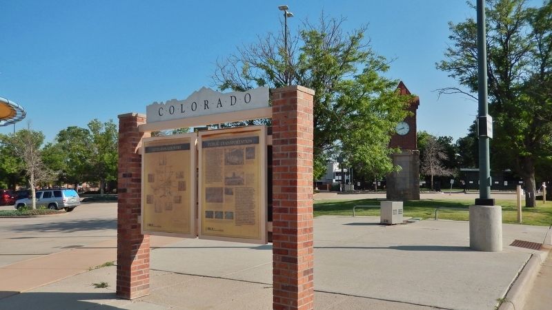
| 1 ► Colorado, Arapahoe County, Littleton — Public Transportation — |
| Near South Prince Street south of West Alamo Avenue, on the left when traveling south. | |||
| 2 ► Colorado, Baca County, Springfield — Baca County Trails — |
| On Main Street (U.S. 287) north of East 8th Avenue, on the right when traveling north. | |||
| 3 ► Colorado, Bent County, Hasty — Santa Fe Trail — Travelers through Time — |
| Near County Highway HH near County Highway 24. | |||
| 4 ► Colorado, Bent County, Hasty — Santa Fe Trail — |
| On County Highway HH near County Highway 24. | |||
| 5 ► Colorado, Bent County, Las Animas — From Trail to Town — Santa Fe National Historic Trail — Boggsville Historic Site — |
| Near Colorado Route 101, 1 mile south of County Road 10.75. | |||
| 6 ► Colorado, Bent County, Las Animas — Santa Fe Trail — 1822 — 1872 — |
| On U.S. 50 at County Road 13, on the right when traveling west on U.S. 50. | |||
| 7 ► Colorado, Bent County, Las Animas — Welcome to Bent County — |
| Near Carson Avenue (Colorado Route 101) north of 8th Street, on the right when traveling north. | |||
| 8 ► Colorado, Boulder County, Boulder — L-02-1 — The Holiday Drive-In Marquee 1953 — |
| On 28th Street (U.S. 36) at Lee Hill Rd., on the right when traveling south on 28th Street. | |||
| 9 ► Colorado, Boulder County, Superior — The Denver-Boulder Turnpike — |
| On U.S. 36 north of Colorado Highway 170, on the right when traveling north. | |||
| 10 ► Colorado, Chaffee County, Buena Vista — Stagecoach Road to Riches — |
| On U.S. 24, 1 mile east of County Highway 397, on the left when traveling east. | |||
| 11 ► Colorado, Cheyenne County, Cheyenne Wells — 207 — Trails West — |
| On U.S. 40 at milepost 463.5, on the left when traveling east. | |||
| 12 ► Colorado, Clear Creek County, Georgetown — The Story of the Eisenhower-Johnson Memorial Tunnels — We went by the book, but the mountain couldn't read — R.C. (Rube) Hopper, 1972 — |
| Near Argentine Street. | |||
| 13 ► Colorado, Clear Creek County, Idaho Springs — Drexel Lacey — |
| 14 ► Colorado, Conejos County, Antonito — Cumbres Pass — |
| On State Highway 17, 12 miles south of County Road 128, on the left when traveling north. | |||
| 15 ► Colorado, Custer County, Greenwood — Frontier Pathways Scenic and Historic Byway — |
| On Colorado 96, 0.4 miles west of County Road 387, on the right when traveling west. | |||
| 16 ► Colorado, Delta County, Delta — Fort Uncompahgre — |
| Near North Palmer Street north of Confluence Drive, on the right when traveling north. | |||
| 17 ► Colorado, Delta County, Hotchkiss — West Elk Loop — Scenic and Historic Byway — |
| On County Highway 92 at Doc Maloney Way, on the right when traveling south on County Highway 92. | |||
| 18 ► Colorado, Denver County, Denver, Central — 15th / Wazee Street — 1865-1875 — Lower Downtown Walking Tour — |
| On 15th Street at Wazee Street, on the left when traveling north on 15th Street. | |||
| 19 ► Colorado, Denver County, Denver, Central — Larimer Street — Lower Downtown Historic District — Established 1988 — |
| On Larimer Street at 15th Street on Larimer Street. | |||
| 20 ► Colorado, Denver County, Denver, Central Business District — 17e — 17th’S 25th Anniversary — Wall Street of the Rockies — Seventeenth Street Denver, Colorado |
| Near 17th Street at Glenarm Place, on the left when traveling south. Reported missing. | |||
| 21 ► Colorado, Denver County, Denver, Central Business District — 8w — Bonfils — Wall Street of the Rockies — Seventeenth Street Denver, Colorado — |
| Near 17th Street at Champa Street, on the right when traveling south. | |||
| 22 ► Colorado, Denver County, Denver, Central Business District — 21w — Gridlock — Wall Street of the Rockies — Seventeenth Street Denver, Colorado — |
| Near 17th Street at Court Place, on the right when traveling south. | |||
| 23 ► Colorado, Denver County, Denver, Central Business District — 13w — Misery — Wall Street of the Rockies — Seventeenth Street Denver, Colorado — |
| Near California Street at 17th Street. | |||
| 24 ► Colorado, Denver County, Denver, Central Business District — 40 — Smoky Hill Trail — |
| On Broadway at Colfax on Broadway. | |||
| 25 ► Colorado, Denver County, Denver, Central Business District — 15e — Welton Street — Wall Street of the Rockies — Seventeenth Street Denver, Colorado — |
| Near 17th Street at Welton Street, on the left when traveling south. | |||
| 26 ► Colorado, Denver County, Denver, Elyria-Swansea — Platte River Trail — |
| On Brighton Boulevard (State Highway 265) at York Street, on the right when traveling north on Brighton Boulevard. | |||
| 27 ► Colorado, Douglas County, Castle Rock — Good Roads in Colorado / The Great North-South Highway — |
| On Wilcox Street, on the right when traveling south. | |||
| 28 ► Colorado, El Paso County, Colorado Springs, Cascade — Ute Pass — |
| On Pike's Peak Highway, on the left when traveling south. | |||
| 29 ► Colorado, El Paso County, Colorado Springs, Cascade — Welcome to America’s Mountain — Crowe Gulch — |
| On Pike's Peak Toll Road. | |||
| 30 ► Colorado, El Paso County, Manitou Springs, Cascade — 13 — Ute Pass — |
| On Manitou Avenue (Business U.S. 24), on the right when traveling north. | |||
| 31 ► Colorado, Elbert County, Kiowa — 272 — Trail Under Siege / Rising to the Challenge — |
| On Colorado Street (County Route 86), on the right when traveling west. | |||
| 32 ► Colorado, Fremont County, Cañon City — The Gold Belt Tour National Scenic Byway — Travel historic roads to riches — |
| On Royal Gorge Boulevard east of South 3rd Street, on the right when traveling east. | |||
| 33 ► Colorado, Fremont County, Cotopaxi — 269 — Rainbow Route / Western Fremont County — |
| On U.S. 50, on the right when traveling west. | |||
| 34 ► Colorado, Fremont County, Penrose — Corrections Capital |
| On U.S. 50, 0.2 miles east of Phantom Canyon Road (County Road 67), on the right when traveling west. Reported damaged. | |||
| 35 ► Colorado, Garfield County, Glenwood Springs — Building Interstate 70 Through Glenwood Canyon — |
| Near Interstate 70 Frontage Road at milepost 121. | |||
| 36 ► Colorado, Garfield County, Glenwood Springs — CCC Men Built Improvements for Glenwood — |
| On 8th Street east of Grand Avenue, on the right when traveling east. | |||
| 37 ► Colorado, Garfield County, New Castle — Jolley Trail — |
| On U.S. 6 west of Burning Mountain Avenue, on the right when traveling west. | |||
| 38 ► Colorado, Garfield County, No Name — A Grand Boulevard — |
| Near Interstate 70 Frontage Road at milepost 119 east of No Name Lane (County Road 129). | |||
| 39 ► Colorado, Gilpin County, Black Hawk — Fick’s Carriage Shop — |
| On Main Street (Mt, Thomas Drive). | |||
| 40 ► Colorado, Grand County, Grand Lake — Automobiles Come to Grand Lake — |
| On Vine Street north of Lake Avenue, on the left when traveling north. | |||
| 41 ► Colorado, Grand County, Grand Lake — The Smith Eslick Cottage Court — |
| On Vine Street north of Lake Avenue, on the left when traveling north. | |||
| 42 ► Colorado, Grand County, Grand Lake — Why Did They Come? — |
| On Vine Street north of Lake Avenue, on the left when traveling north. | |||
| 43 ► Colorado, Grand County, Winter Park — Berthoud Pass — |
| Near U.S. 40 at milepost 240,, 5.8 miles west of Henderson Mine Road, on the right when traveling west. | |||
| 44 ► Colorado, Gunnison County, Gunnison — Rainbow Route Sign — |
| On Tomichi Avenue (U.S. 50) at Adams Street, on the right when traveling east on Tomichi Avenue. | |||
| 45 ► Colorado, Gunnison County, Sapinero — Crossing the Canyon — |
| On U.S. 50, on the right when traveling west. | |||
| 46 ► Colorado, Jefferson County, Golden — Transportation — |
| On Washington Avenue Bridge, on the right when traveling north. | |||
| 47 ► Colorado, Jefferson County, Golden — Windy Saddle Park / Connecting to the Past — |
| On Lariat Loop Road. | |||
| 48 ► Colorado, Jefferson County, Golden, Golden Gate Canyon — Golden Gate Toll Road — |
| On Golden Gate Canyon Road (County Highway 70) 1.1 miles west of Highway 93, on the right when traveling west. | |||
| 49 ► Colorado, Jefferson County, Morrison — West Alameda Parkway / Dinosaur Ridge — Works Progress Administration — 1937 — |
| On Hog Back Road (County Road 93) at West Alameda Parkway, on the right when traveling north on Hog Back Road. | |||
| 50 ► Colorado, Jefferson County, Morrison — What is the Historical Significance of this Site? — |
| On West Alameda Parkway/Dinosaur Ridge, 0.5 miles south of South Rooney Road (County Road 53), on the right when traveling south. | |||
| 51 ► Colorado, La Plata County, Durango — Trails to Rails — Routes to Southwest Colorado 1 — |
| On Main Avenue at East 5th Street, on the left when traveling south on Main Avenue. | |||
| 52 ► Colorado, La Plata County, Durango — Trails to Rails — Routes to Southwest Colorado 2 — |
| On Main Avenue at East 5th Street, on the left when traveling south on Main Avenue. | |||
| 53 ► Colorado, La Plata County, Hesperus — The Old Spanish Trail — |
| On U.S. 160, 0.8 miles west of Cherry Creek Road, on the left when traveling west. | |||
| 54 ► Colorado, Lake County, Climax — Fremont Pass — |
| On State Highway 91, on the right when traveling south. | |||
| 55 ► Colorado, Lake County, Climax — Highway in the Sky — |
| Near State Highway 91, 11 miles south of Interstate 70, on the right when traveling south. | |||
| 56 ► Colorado, Larimer County, Estes Park — The Woodpecker Army — Rocky Mountain National Park — |
| On Fall River Road (U.S. 34) 0.2 miles north of Trail Ridge Road (U.S. 36), on the left when traveling south. | |||
| 57 ► Colorado, Larimer County, Estes Park — Trail Ridge Road at Rock Cut — |
| On Trail Ridge Road, on the right when traveling north. | |||
| 58 ► Colorado, Larimer County, Laporte — In 1862 This Log House was Used as a Station House — |
| On North Overland Trail Road, 0.3 miles south of US 287B Highway, on the right when traveling south. | |||
| 59 ► Colorado, Larimer County, Livermore — Site of Log Cabin, Colorado — 1888-1942 — |
| On Red Feather Lakes Rd (County Road 74E at milepost 16) at Boy Scout Rd (County Road 68C), on the right when traveling south on Red Feather Lakes Rd. | |||
| 60 ► Colorado, Larimer County, Livermore — Virginia Dale — |
| On U.S. 287 at County Route 43F, on the right when traveling north on U.S. 287. | |||
| 61 ► Colorado, Larimer County, Livermore — 244 — Virginia Dale — Trails West — Welcome To Colorado — |
| On U.S. 287 near High Lonesome Road, on the left when traveling north. | |||
| 62 ► Colorado, Larimer County, Rocky Mountain National Park — Old Fall River Road — |
| On Old Fall River Road near Trail Ridge Road (U.S. 34). | |||
| 63 ► Colorado, Las Animas County, Model — The Santa Fe Trail — |
| On U.S. 350 at milepost 15, on the right when traveling north. | |||
| 64 ► Colorado, Las Animas County, Trinidad — 10 — Raton Pass — Between Colorado and New Mexico — Altitude 7,881 Feet — |
| On Interstate 25 at milepost 0, on the right when traveling north. | |||
| 65 ► Colorado, Las Animas County, Trinidad — 212 — Road to Santa Fe - Over the Pass / Santa Fe Trail Country - "Uncle Dick" Wootton — |
| Near Interstate 25 Frontage Road when traveling north. | |||
| 66 ► Colorado, Las Animas County, Trinidad — Santa Fe Trail — |
| Near Kansas Avenue at San Pedro Street. | |||
| 67 ► Colorado, Las Animas County, Trinidad — The Santa Fe Trail — |
| On West Main Street at North Commercial Street, on the right when traveling west on West Main Street. | |||
| 68 ► Colorado, Las Animas County, Trinidad — Transportation on the Santa Fe Trail — |
| On El Moro Road at County Highway 71.1 on El Moro Road. | |||
| 69 ► Colorado, Lincoln County, Arriba — 245 — Arriba Country — Colorado — |
| Near County Road 63 at Interstate 70. | |||
| 70 ► Colorado, Lincoln County, Hugo — Hugo Country — |
| Near 4th Street (U.S. 287) west of 7th Avenue, on the right when traveling west. | |||
| 71 ► Colorado, Lincoln County, Hugo — Welcome to Lincoln County — |
| Near 4th Street (U.S. 287) west of 7th Avenue, on the right when traveling west. | |||
| 72 ► Colorado, Logan County, Merino — 2 — Fort Wicked — |
| On Grand Army of the Republic Highway (State Highway 6) at County Road 2.5, on the right when traveling east on Grand Army of the Republic Highway. | |||
| 73 ► Colorado, Logan County, Sterling — 227 — The Overland Trail — |
| On County Road 370 at U.S. 6 on County Road 370. | |||
| 74 ► Colorado, Logan County, Sterling — 29 — Valley Station — |
| On Overland Trail close to U.S. 6. | |||
| 75 ► Colorado, Mesa County, Colorado National Monument — Tragedies on Rim Rock Drive — |
| 76 ► Colorado, Mesa County, Colorado National Monument — Upper Serpents Trail — Serpents Trail to Devils Kitchen Trailhead — |
| On Rim Rock Drive, on the left when traveling west. | |||
| 77 ► Colorado, Mesa County, Fruita — Butch Cassidy — In the Grand Valley — |
| Near Interstate 70 Frontage Road (Interstate 70). | |||
| 78 ► Colorado, Mesa County, Grand Junction — Rocky Roads — Colorado National Monument — |
| Near Rim Rock Drive. | |||
| 79 ► Colorado, Mineral County, South Fork — History of a Road — |
| On U.S. 160, 0.2 miles west of County Road 402, on the left when traveling west. | |||
| 80 ► Colorado, Moffat County, Craig — Elkhead Creek — Moffat County — |
| On U.S. 40 at milepost 97.5,, 0.9 miles east of County Road 29, on the right when traveling west. | |||
| 81 ► Colorado, Montezuma County, Cortez — Welcome to the San Juan Skyway — |
| On Mildred Road north of Main Street (U.S. 160), on the left when traveling north. | |||
| 82 ► Colorado, Montezuma County, Mancos — Mesa Verde Country — |
| Near U.S. 160, on the right when traveling west. | |||
| 83 ► Colorado, Montezuma County, Mesa Verde National Park — Knife Edge... — an apt description for this precarious access into Mesa Verde. — |
| Near Mesa Top Ruins Road (State Highway 10). | |||
| 84 ► Colorado, Montezuma County, Mesa Verde National Park — Mancos Valley — |
| Near State Highway 10, 0.4 miles north of Moorefield Campground Road, on the left when traveling south. | |||
| 85 ► Colorado, Montrose County, Montrose — Early Freighting Ventures — |
| On North Rio Grande Avenue north of West Main Street, on the left when traveling north. | |||
| 86 ► Colorado, Montrose County, Montrose — Pageant in the Wilderness — |
| Near Chipeta Road north of U.S. 550, on the right when traveling north. | |||
| 87 ► Colorado, Morgan County, Fort Morgan — Old Fort Morgan — |
| On Riverview Avenue. | |||
| 88 ► Colorado, Otero County, La Junta — Bent's Fort on Santa Fe Trail — |
| On Colorado 194, 0.1 miles east of County Road 35, on the right when traveling east. | |||
| 89 ► Colorado, Otero County, La Junta — Santa Fe Trail — 1822-1872 — |
| On State Highway 194 east of County Highway 35, on the left when traveling west. | |||
| 90 ► Colorado, Otero County, La Junta — Traveling Through History — Bent's Old Fort National Historic Site — |
| On State Highway 194, 0.3 miles east of County Road 35, on the right when traveling east. | |||
| 91 ► Colorado, Otero County, Timpas — Milestone — |
| On State Highway 71 north of U.S. 350, on the left when traveling north. | |||
| 92 ► Colorado, Ouray County, Ouray — San Juan Travel — |
| On Million Dollar Highway (U.S. 550) 0.1 miles south of County Highway 16, on the left when traveling north. | |||
| 93 ► Colorado, Ouray County, Ouray — The Treasury Tunnel — |
| On Million Dollar Highway (U.S. 550) 2 miles south of County Highway 30, on the right when traveling north. | |||
| 94 ► Colorado, Park County, Alma — Hoosier Pass — |
| On Colorado Route 9 at County Road 2, on the left when traveling north on State Route 9. | |||
| 95 ► Colorado, Park County, Lake George — Footpaths to Highways — |
| Near U.S. 24. | |||
| 96 ► Colorado, Pitkin County, Aspen — Early Travel Over the Pass — |
| On Colorado 82, on the left when traveling west. | |||
| 97 ► Colorado, Pitkin County, Aspen — Restoring the "Top Cut" — |
| On Colorado 82, on the left when traveling west. | |||
| 98 ► Colorado, Prowers County, Lamar — Experience the Past on the Santa Fe Trail — |
| Near Main Street (U.S. 50) at E. Beech Street, on the right when traveling north. | |||
| 99 ► Colorado, Prowers County, Lamar — Explore Big Timbers Region — |
| On Scenic U.S. 50/287 at State Highway 196, on the right when traveling west on U.S. 50/287Scenic . | |||
| 100 ► Colorado, Prowers County, Lamar — Madonna of the Trail — |
| On Main Street (U.S. 50) at E. Beech Street, on the right when traveling north on Main Street. | |||
128 entries matched your criteria. The first 100 are listed above. The final 28 ⊳