On S. State Street at Kings Highway SW on S. State Street.
Joseph S. Barbizzi, James C. Beuter, Cleyo E. Blanchard, Benjamin P. Bowings, George B. Buckalew, Sr., John J. Casey, Malcom T. Chandler, Casimir J. Chiczewski, Herbert D. Clifton, E. Hart Davis, James D. Davis, Joel W. Davis, Charles J. Donnelly, . . . — — Map (db m50621) WM
On M.L.K. Jr Boulevard North at Legislative Avenue, on the right when traveling west on M.L.K. Jr Boulevard North.
The first of the dreadnoughts of the United States Navy, the USS Delaware was laid down on November 11, 1907 at Newport News Shipbuilding & Drydock Company, and was the first battleship to have forced lubrication system for engines.
. . . — — Map (db m190725) HM
On Pickering Beach Road (County Road 349) at North Sandpiper Drive, on the right when traveling west on Pickering Beach Road.
Welcome to Pickering Beach Horseshoe Crab Sanctuary
Pickering Beach takes pride in its beautiful location on the Delaware Bay, which is the world's largest spawning ground for horseshoe crabs. Horseshoes crabs are part of the . . . — — Map (db m232938) HM
Near Fisher Avenue, 0.2 miles north of Mispillion Street, on the left when traveling north.
History of Goat Island
This nine-acre island was created in 1927 when the Army Corps of Engineers dug a channel removing the oxbow and straighten the river. At that time, shipbuilding and agriculture were important industries in Milford and . . . — — Map (db m198913) HM
On South Main Street just north of South Dupont Boulevard (U.S. 13), on the right when traveling south.
In memory of
those who perished
December 7th, 1941
"A date which will live in infamy"
Never again
will one generation of veterans
abandon another — — Map (db m174542) WM
Near Buck Jersey Road, 1.2 miles south of Howell School Road, on the right when traveling east.
Lums Pond State Park
The pond has existed since 1735 when St. Georges Creek was dammed to power a sawmill. when the Lum family acquired the mill after 1809, they lent their name to the pond. Some twenty years later, Lums Pond provided water . . . — — Map (db m238407) HM
On Clinton Street, 0.1 miles south of Harbor Street when traveling south.
Although the idea of a waterway crossing the upper Delmarva peninsula was suggested in the 1600s, the canal did not become a reality until 1829. Over 2,600 workers, including many Irish immigrant and African-American laborers, dug the canal with . . . — — Map (db m174514) HM
On Clinton Street at Harbor Street, on the right when traveling north on Clinton Street.
The British attack on Lewes, Delaware, during the War of 1812 demonstrated the need for forts to protect the Delaware River and the ports of Wilmington and Philadelphia. The War Department recognized Pea Patch Island's strategic location and . . . — — Map (db m174520) HM
On Canal Street at Hamilton Street, on the right when traveling north on Canal Street.
In the years prior to WW II, many of the local citizens were watermen and made their living from the river. If a boat crew was in distress and needed assistance, other boat owners from town would navigate their craft to make the needed rescue. . . . — — Map (db m189888) HM
On Clinton Street, 0.1 miles north of Front Street, on the right when traveling north.
The river marshes around Delaware City provided the ideal habitat for fishes, waterfowl and muskrats. In the 1800s, local residents thought this wildlife would always be available and abundant.
The harvesting of fish and birds in excessive . . . — — Map (db m174497) HM
On Officers Row, 0.1 miles west of Wingate Road, on the right when traveling west.
As operations at Fort Dupont continued to expand, so did the need for additional housing.
The solution? Utilize surplus housing from nearby Fort Mott, New Jersey, which was in caretaker status. In December 1931, the 1st Engineers rolled . . . — — Map (db m174451) HM
On Clinton Street at Harbor Street, on the left when traveling north on Clinton Street.
Just a half-mile off Delaware City's Battery Park, Pea Patch Island is home to a large colony of herons in America. While Fort Delaware occupies the southern end of the island, nine species of wading birds have settled on the marshy, forested . . . — — Map (db m189915) HM
Delaware City’s story begins in 1801 when the Newbold brothers, Barzilla, Clayton, and John, of New Jersey, acquired 1600 acres of land on the Delaware River, John Newbold built a wharf that became a center for trading and shipping grain, giving . . . — — Map (db m189478) HM
Near Michael N. Castle Trail, 0.4 miles south of 5th Street (Delaware Route 9), on the right when traveling south.
The African American community known today as Polktown is one of the earliest remaining free black settlements in Delaware and has been continuously occupied for nearly two centuries. It extended on both sides of the historic branch canal and . . . — — Map (db m244709) HM
In the late 1890s, when the fort was being modernized, these generators were installed to provide back-up power for the lights, elevators, and the firing of the twelve-inch guns. An electrical service ran under the Delaware River to supply the . . . — — Map (db m174813) HM
On Clinton Street at Harbor Street, on the right when traveling north on Clinton Street.
The Chesapeake and Delaware Canal offered easy passage between Philadelphia and Baltimore for both freight and passengers. By reducing the miles traveled between the two cities, the canal improved access to Pennsylvania's Susquehanna Valley and . . . — — Map (db m174515) HM
On Clinton Street, on the right when traveling north.
Made in Philadelphia 1839 for the Chesapeake and Delaware Canal Company, it was used as an air chamber for workmen to make underwater repairs on the lock gates. The canal was opened in 1829 and was operated until the sea level canal was opened at . . . — — Map (db m189476) HM
On Clinton Street, 0.1 miles north of Front Street, on the right when traveling north.
This earthbound rectangle of water before you was once the eastern gateway to the Chesapeake and Delaware Canal, one of four locks that regulated water depth along the canal to allow vessels to make the 14-mile journey between the Delaware River . . . — — Map (db m174502) HM
On Clinton Street at Harbor Street, on the right when traveling north on Clinton Street.
This quiet waterfront promenade was once part of a busy, noisy commercial district that included coal wharves, a steamboat dock, sheds and stores, and broad staging areas for local produce destined for markets in Philadelphia and Baltimore. Piers . . . — — Map (db m174518) HM
On Lighthouse Road, 0.7 miles north of Edgemoor Road.
1640
Native people welcomed the early explorers
Before the arrival of the first Europeans, this area was occupied by Lenape Indians, who depended on the forests, river valleys and waterways for their survival. When the early Dutch . . . — — Map (db m191668) HM
On Pulaski Highway (U.S. 40) east of South College Avenue (Delaware Route 896), on the right when traveling west. Reported damaged.
The majority of the United States population in the early 1800s resided in the Mid-Atlantic area north and south of Delaware. Travelers along the east coast from higher populated areas such as New York and Philadelphia had to pass through . . . — — Map (db m238429) HM
On Saint Augustine Road (Delaware Route 9) just north of Farm Lane, on the right when traveling north.
Augustine Beach was named after Augustine Herman (c 1621-1686), an explorer and cartographer who mapped the region for Lord Cecil Calvert. Adam Diehl built the brick Augustine Beach Hotel in about 1814. In 1867, owner Simeon Lord expanded the hotel, . . . — — Map (db m205497) HM
On US 13, 0.5 miles south of Del. 896, on the right when traveling south.
Early home of Commodore Thomas Macdonough. Hero of Battle of Lake Champlain 1814. Born 1783. Died 1825. Commodore 1813. Assisted Commodore Decatur in capturing and burning the "Philadelphia" off the coast of Tripoli, 1804. Original name of village . . . — — Map (db m10305) HM
Near Delaware Street south of The Strand, on the left when traveling south.
The Delaware River, a mighty highway of commerce, has also been a formidable barrier to travel. Ferries operated sporadically from New Castle from very early days. Modern ferry service didn't begin until 1925 to meet the increasing needs of . . . — — Map (db m191495) HM
Near Cherry Lane at New Castle Avenue (Delaware Route 9).
Left Side of Marker
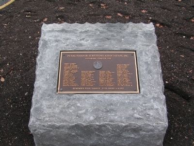
U.S. Submarine Veterans
World War II
52 United States Submarines
On Eternal Patrol
U.S. Navy Submarines Paid Heavily for their success in World War II.
374 Officers and 3131 Men are on board these . . . — — Map (db m146109) WM
On Delaware Street at The Strand on Delaware Street.
The original landing was started during the 17th century of stone filled wood cribs, being enlarged several times. The city acquired ownership from the New Castle Frenchtown Railroad Co. in 1914, and rebuilt the wharf with a concrete face on new . . . — — Map (db m57133) HM
This imaginative 1857 painting by Edward Moran depicts New Castle Harbor at its height. The fishing boat (right center) represents New Castle's critical fishing industry. The tall-masted U.S. Navy brig to its left demonstrations the national . . . — — Map (db m191496) HM
On Kirkwood Highway (Delaware Route 2) at Old Possum Park Road, on the right when traveling west on Kirkwood Highway.
In the late 18th century a paper mill was established by Thomas Meeteer on the banks of nearby White Clay Creek. In later years Thomas was succeeded in business by his sons Samuel and William. the property on which this house stands was purchased by . . . — — Map (db m154972) HM
On Dayett Mills Road south of Old Baltimore Pike, on the right when traveling south.
What is Milling?
Milling is a process of taking whole bulbs, tubers, nuts, seeds, grains or other foods from its original size to a smaller size by pounding, grinding or rolling it until it is the consistency of a meal, flour or powder. . . . — — Map (db m156797) HM
On South Old Baltimore Pike, on the right when traveling west.
Generals Washington, Greene and Lafayette came to Iron Hill, August 26, 1777 in hope of viewing British army then landing along Elk River. Only a few tents could be seen. A heavy storm coming up, they spent the night in a nearby farm house. — — Map (db m9778) HM
Near Liberty Street, on the right when traveling north.
Left Panel The European Markets Port Penn once figured prominently in world markets. As the supply of beaver fur in the American West declined, European demand for quality fur remained high. Toward the end of the 19th century, muskrat . . . — — Map (db m10435) HM
On St. Augustine Road Rt. 9, on the right when traveling north.
In 1875, Congress approved funding to build several lighthouses along this segment of the Delaware River. This site was purchased in April 1876, and by December the Port Penn Front Range Light was completed. Constructed under the direction of the . . . — — Map (db m10536) HM
On Market Street at Liberty Street, on the right when traveling west on Market Street.
The W.B. & J.S. Zacheis, Inc. cannery operation stood across the street from the schoolhouse from the early 1900s until after World War II. When the Chesapeake and Delaware Canal and the railroad diverted most commercial shipping away from the . . . — — Map (db m10396) HM
On Congress St. at Market Street, on the right when traveling north on Congress St..
In 1834, Joseph Cleaver built this house near the river and what was then the region's biggest port. He called it Linden Hall. As one of Port Penn's best-known merchants, he hoped to dominate the trade between the Delaware River and the farmlands . . . — — Map (db m10388) HM
Port Penn is a community connected to its wetland landscape. Seasonal changes bring about changes in the lifestyles of Port Penners themselves. Autumn waterfowl hunting and winter muskrat trapping lead into spring shad runs and summer sturgeon . . . — — Map (db m10438) HM
"The Rocks," a natural landing on the Christina River, was critical to Wilmington's Underground Railroad network. Captain James Watson Fountain outfitted a schooner to secretly carry freedom-seekers north from North Carolina and Virginia. Black . . . — — Map (db m226518) HM
On Northern Delaware Greenway Trail, on the right when traveling north.
A geological oddity
Many people call the huge rocks you see along this trail "blue granite" or "blue rock." This is because when they are broken, the fresh exposed rock is a brilliant blue color. Continued exposure to air soon gives them . . . — — Map (db m240819) HM
Near South Park Drive east of Lovering Avenue, on the right when traveling north.
On a mild winter day, two young boys run along the bank of the Brandywine River. Above them, a train rattles across the B & O Railroad Bridge. — — Map (db m216045) HM
On South Park Drive east of North West Street, on the right when traveling west.
the Lower Dam and North Short Millrace are two, mid-to-late 18th century structures associated with Wilmington's early industrial development. The structures supplied water power to a collection of commercial flour mills downstream known as the . . . — — Map (db m240740) HM
On North Park Drive north of North Van Buren Street, on the left when traveling north.
The sweet acorns were a very important Native American food. The wood is so strong it protected the U.S.S. Constitution "Old Ironsides" from the cannonballs of the Revolutionary War. — — Map (db m216044) HM
On N. Market Street (Business U.S. 13) at Race Street, on the right when traveling north on N. Market Street.
Around 1740 water-powered mills began to appear in this area where the Brandywine River ends its journey falling 124 feet in its final five miles. Small vessels carrying grain from nearby farms sailed directly to the mills. Other ships laden with . . . — — Map (db m235147) HM
The Swedes Landing Trail, which highlights “Wilmington’s Waterfront Heritage” theme reflects the maritime heritage of the first permanent Swedish settlement in the United States. The one mule trail includes land along the northern bank of the . . . — — Map (db m64625) HM
On N. Franklin Street at West 11th Street on N. Franklin Street.
The Cool Spring Reservoir was designed by consulting civil engineer William E. Morris of Philadelphia and others as an open air reservoir formed by an earthen embankment and bordered by 10th and Van Buren Streets. Work on the Reservoir began in . . . — — Map (db m173923) HM
On 10th Street at Van Buren St., on the right when traveling west on 10th Street.
With the completion of Cool Spring Reservoir in 1877, an adjoining parcel of unused land was reserved for park purposes. Formally designated as Cool Spring Park, the grounds were managed by the Wilmington Water Department until 1967, when the . . . — — Map (db m10917) HM
Near North Franklin Street at West 11th Street, on the right when traveling north.
Ancient History
4000 BC
Ancient Sanskrit and Greek writings recommend water treatment methods, including filtering through charcoal, exposing water to sunlight, boiling, and straining.
1500 BC
To clarify water, Egyptians . . . — — Map (db m216060) HM
On North Van Buren Street north of West 10th Street, on the right when traveling north.
Rain Garden
Shaped like a bowl, a rain garden captures rainwater that flows across the ground during big storms (stormwater runoff) and the water naturally filters into the ground. Here in Wilmington this stormwater is frequently . . . — — Map (db m216082) HM
Near North Franklin Street at West 11th Street, on the right.
The greatest depth of the pond at Cool Spring Reservoir Plaza is 10 feet.
24 species of aquatic plants are planted around the pond's shelf.
The City of Wilmington celebrated a new public space when the Cool Spring Reservoir . . . — — Map (db m216059) HM
On North Van Buren Street north of West 10th Street, on the right when traveling north.
Stormwater Planters
These stormwater basin planters were planted in 2020 as a way to reduce the stormwater running off Van Buren St. These planters will catch stormwater flow, which is then absorbed by the plants before it enters . . . — — Map (db m216079) HM
Near North Van Buren Street at West 10th Street, on the left when traveling north.
The Cool Spring Pump House was constructed in 1876 to move water from the Brandywine River by steam-powered pumps to Cool Spring Reservoir. In 1901, a 12-inch water main was installed from Cool Spring to the newly constructed Rockford Water . . . — — Map (db m216074) HM
On East 7th Street west of Wilmington Industrial Park, on the right when traveling east.
A black man named Anthony was among the first permanent settlers of New Sweden. He came to the colony from the West Indies in 1639 aboard the Swedish ship Vogel Grip. Records indicate that Black Anthony became a free man named Antoni Swart, an . . . — — Map (db m228037) HM
On Lighthouse Road, 0.9 miles north of Ellerslie Road, on the right when traveling north.
The Delaware estuary is the second largest freshwater port in the United States. It hosts the country's second largest concentration of petrochemical facilities. Shipping of petrochemicals and other products has revitalized ports along the . . . — — Map (db m191845) HM
On Lighthouse Road, 0.9 miles north of Ellerslie Road, on the right when traveling north.
The history of Fox Point has been rich and varied with each generation leaving its indelible influence on the area. Gertrude Dunlap, historian of the Fox Point Association, fondly recorded the memories of long time residents of the Fox Point . . . — — Map (db m191846) HM
On Lighthouse Road, 1 mile north of Ellerslie Road, on the right when traveling north.
Fox Point State Park is unique in Delaware's system of state parks. The park and its surroundings have a colorful history. As home to the Lenape Indians, the Swedes, Dutch, and English, it has been a hunting ground, farmland, a resort, and an . . . — — Map (db m191848) HM
On North Dupont Street at Delaware Avenue, on the right when traveling south on North Dupont Street.
A special system to reduce the water in our storm drains is hidden in this parking lot. Can you see it?
When Trolley Square was first built, pipes were installed under the street to carry both rainwater and sewage out to the Brandywine . . . — — Map (db m216058) HM
On Hagley Creek Road, on the left when traveling south.
Founded by E.I. du Pont, the Brandywine Mills became the largest maker of explosive black powder in the United States. That success resulted directly from the firm's pioneering use of gunpowder processing machinery driven by water wheels and . . . — — Map (db m231885) HM
On Hagley Creek Road at Stone Block Row, on the left when traveling north on Hagley Creek Road.
Located at this site on land purchased by French immigrant Elueuthere Irenee du Pont in 1802, the du Pont Powder Mills manufactured black powder at three sites along the Brandywine Creek north of Wilmington. E.I. du Pont de Nemours & Company . . . — — Map (db m240854) HM
On Hagley Creek Road, on the right when traveling north.
In March of 1890 the DuPont Company purchased this state-of-the-art water turbine from the Holyoke Machine Company in Massachusetts. At that time, this turbine represented cutting edge technology that increased the efficiency and output of the . . . — — Map (db m193728) HM
On Hagley Creek Road, on the left when traveling south.
The Brandywine River drops 33 feet from the upper dam at Eleutherian Mills to the dam visible here. This potential power led E. I. du Pont to locate his gunpowder works here. The du Ponts built dams and raceways to carry water to waterwheels and . . . — — Map (db m231883) HM
Near Hagley Creek Road south of Blacksmith Hill Road, on the right when traveling north.
Incorporating is a crucially important process in making powder. Here, under roll wheels weighing sixteen tons, sulphur and charcoal are forcibly ground together with the saltpeter. How well this is done determines the quality of the powder. . . . — — Map (db m240859) HM
On Hagley Creek Road, on the right when traveling north.
The greatest attraction of this location as an industrial site was the power of the falling Brandywine River. In the early decades of the DuPont Company, mills were located close to the Brandywine, where waterpower could be directly harnessed. As . . . — — Map (db m231874) HM
On South Park Drive east of North West Street, on the right when traveling west.
In this photo from about 1913, park visitors enjoy the ice along with their dogs. A series of cold winters made ice skating on the Brandywine River a popular pastime. The dam pictured is the remnant of an early mill in Wilmington. — — Map (db m131163) HM
On South Park Drive at West Street, on the right when traveling west on South Park Drive. Reported permanently removed.
Skating on West Street Dam
Though it is not done today, ice skating on the Brandywine River used to be quite popular. In this photo from about 1913, park visitors enjoy the ice with their dogs! — — Map (db m173698) HM
On Newport Road, 0.1 miles north of Kiamensi Road, on the right when traveling north.
From September 4-9, 1777, approximately 11,000 men under the command of George Washington encamped on the grounds of what later became Delcastle Technical High School. The American army occupied a strong defensive position on the east side of Red . . . — — Map (db m240841) HM
Near River Place east of Justison Street, on the left when traveling east.
"Iron Steam Shops, Steam Boats & Iron Sailing Vessels Completed in Every Particular"
Harlan & Hollingsworth & Co., Wilmington, Delaware, 1878
To comply with federal law protecting historic sites, the U.S. Army Corps of Engineers, . . . — — Map (db m130502) HM
On Jack A. Markell Trail, 0.1 miles north of Chase Boulevard, on the right when traveling north.
In recognition of the vision, dedication and leadership of Michael S. Purzycki as the first Executive Director,
Riverfront Development Corporation
of Delaware
1996 - 2016 — — Map (db m191283) HM
On Jack A. Markell Trail, 0.2 miles south of New Sweden Street, on the right when traveling north.
Governor of Delaware, 1969 - 1973
President, National Audubon Society, 1979 - 1985
Defender of the Environment
His vision inspired the
redevelopment of the riverfront — — Map (db m196630) HM
Near South Market Street (Business U.S. 13) south of South Shipley Street, on the right when traveling south.
"...the undertaking has resulted in great convenience to the traveling community..."
Reminisces of Wilmington, by Elizabeth Montgomery, 1851
Market Street has long been a major gateway into the city of Wilmington, but there . . . — — Map (db m130492) HM
Near East 7th Street just east of Swedes Landing Road, on the right when traveling east.
A black man named Anthony was among the first permanent settlers of New Sweden. He came to the colony from the West Indies in 1639 aboard the Swedish ship Vogel Grip. Records indicate that Black Anthony became a free man named Antoni Swart, an . . . — — Map (db m228255) HM
On East 7th Street just east of Swedes Landing Road, on the right when traveling east.
The monument, designed and executed by the Swedish-American sculptor, Carl Milles, is an irregular hexagon of black Swedish granite. Bas reliefs show contacts between settlers and Indians, Queen Christina on horseback, Governor Johan Printz, the . . . — — Map (db m174429) HM
Near East 7th Street just east of Swedes Landing Road, on the right when traveling east.
The park was created by the State of Delaware for the tercentenary in 1938. It was designated a National Historic Landmark by the U.S. Department of the Interior March 29, 1963 in the presence of Prince Bertil of Sweden, Vice President Lyndon B. . . . — — Map (db m174432) HM
On Pennsylvania Avenue at North Franklin Street, on the right when traveling north on Pennsylvania Avenue. Reported permanently removed.
side one Born circa 1451, in Genoa, Italy, at the start of the Renaissance, Christopher Columbus proposed to reach the rich trading lands of Asia by sailing west across unchartered seas. This revolutionary idea was finally accepted by Queen . . . — — Map (db m69347)
This peaceful glen features a waterfall that empties into a series of ponds stocked with koi. Originally designed as a rock garden in the late 1920s by landscape architect Marian Coffin, it required 135 tons of imported limestone. Since then, the . . . — — Map (db m231944) HM
As a child, Lynn Williams spent her summers among the rural landscapes of her native New York. There she discovered what would become a lifelong appreciation and love of nature. Lynn brought that love of nature with her to Delaware, where she has . . . — — Map (db m180667) HM
On Pennsylvania Avenue (Local Road 51) at First Street, on the right when traveling south on Pennsylvania Avenue.
Completed July 8, 1910, the Loop Canal marked the end of a long journey for vacationers traveling to Bethany Beach in the town’s early days. Arriving in Rehoboth by railroad, travelers would continue their voyage by boat, crossing Rehoboth and . . . — — Map (db m37155) HM
Near Access Road A, 0.2 miles north of Coastal Highway (Delaware Route 1) when traveling north.
Surf fishing is a Delaware tradition older than the beach parks themselves.
Decades of cooperation between surf anglers, DNREC Division of Parks and Recreation, elected officials, and other concerned citizens have created perfect conditions . . . — — Map (db m206352) HM
On Turn Point Road (Local Road 50A) west of South Inlet Road, on the right when traveling west.
The Indian River Inlet has not always existed in its current location. This barrier beach environment is dynamic, and the opening to the inlet has opened and closed at different locations.
When the inlet closed, navigation, water quality, . . . — — Map (db m206345) HM
Near Access Road A, 0.2 miles north of Coastal Highway (Delaware Route 1), on the right when traveling north.
There is an ocean current that moves sand parallel to the coast known as the "littoral drift" or "longshore current." Along most of coastal Delaware, this current moves in a northward direction. As it moves north, it moves sand. There is so much . . . — — Map (db m206344) HM
On Delaware Route 1 at milepost 12 at Savages Ditch Rd., on the right when traveling south on State Route 1.
The Faithful Steward, bound from Londonderry, Ireland to Philadelphia, ran aground on a shoal September 1, 1785 with 249 passengers aboard. Stormy weather drove the vessel toward shore where it became stranded in 4 fathoms (24 feet) of water within . . . — — Map (db m108226) HM
On Main Street (County Road 493), on the right when traveling south.
With the incorporation of the Lewisville Marine Railway Company in 1871, Bethel’s reputation as a center for ship repair and construction was firmly established. Approximately 40 vessels were built here before the last ship was launched in 1918. . . . — — Map (db m60463) HM
In memory of the skilled shipcarpenters and gallant seamen who built and sailed the wooden schooners and rams of Lewisville now Bethel, Delaware — — Map (db m245050) HM
Near Inlet Road, 0.6 miles south of Coastal Highway (Delaware Route 1), on the left when traveling south.
The Indian River Inlet has not always existed in its current location. This barrier beach environment is dynamic, and the opening to the inlet has opened and closed at different locations.
When the inlet closed, navigation, water quality, . . . — — Map (db m150130) HM
Near Inlet Road, 0.6 miles south of Coastal Highway (Delaware Route 1), on the left when traveling south.
There is an ocean current that moves sand parallel to the coast known as the "littoral drift" or "longshore current." Along most of coastal Delaware, this current moves in a northward direction. As it moves north, it moves sand. There is so much . . . — — Map (db m150128) HM
Built from 1939 to 1942, the 11 concrete observation towers along Delaware's coast were built to protect the shores during World War II - and to last about 20 years. They are still standing after 60 years. The towers were the eyes for the guns of . . . — — Map (db m68875) HM
Near Inlet Road, 0.6 miles south of Coastal Highway (Delaware Route 1), on the left when traveling south.
In the 1870s, the United States Life-Saving Service (USLSS) was established to aid the victims of shipwrecks on American shores. The service featured a network of stations, with seven or eight men — called surfmen — who . . . — — Map (db m150127) HM
On Lighthouse Road (146th Street), on the right when traveling west. Reported permanently removed.
On December 29, 1858, the Lighthouse Board issued the following announcement:
“Notice to Mariners
New Light-House
at
Fenwicks Island, Delaware”
Notice is hereby given that the new tower at Fenwicks Island, Delaware, is finished, . . . — — Map (db m63345) HM
On 146th Street at Lighthouse Ave, on the left when traveling east on 146th Street.
The Fenwick Island Lighthouse
Erected 1858
In operation from 1859 to 1978
as an official aid to navigation
Transferred to Delaware, 1981
Restored, 1982 – 1983, by The Friends of
the Fenwick Island Lighthouse under the
leadership of . . . — — Map (db m3027) HM
On Lighthouse Road, on the right when traveling west. Reported permanently removed.
The Fenwick Island Lighthouse was listed in the National Register of Historic Places by the Department of Interior in 1979 in recognition of its significance of the rich maritime history of Delaware.
In 1852, responding to pressure to . . . — — Map (db m63347) HM
On Main Street (County Road 54) at Reed Street, on the right when traveling west on Main Street.
After adventurous service as a sea captain during the late 19th and early 20th centuries, Captain Ebe Townsend Chandler returned to his hometown of Frankford and purchased what is now known as the Captain Chandler House in 1918. Built by Captain . . . — — Map (db m190329) HM
On Wootten Road, 0.1 miles east of Trussum Pond Road, on the right when traveling east.
Trussum Pond
Tranquil waters trapped by a grist mill dam in the early nineteenth century made Trussum Pond a haven for the bald cypress. However, the trees now seen dotting the pond's surface are all that remain of a once extensive . . . — — Map (db m4540) HM
188 entries matched your criteria. The first 100 are listed above. The final 88 ⊳