From Ironworks to Gristmills
Many of the ponds in this area, including Trap Pond, were created in the late 1700s. The earliest dams were built to produce waterpower for ironworks. The waterpower ran bellows for furnaces that created iron . . . — — Map (db m198864) HM
Trap Pond was created in the late 1700s to power a small water mill.
Today the pond is a prime feature of this park—Delaware's first state park. Spanning about 3,800 acres, the park protects part of the ancient Great Cypress Swamp and . . . — — Map (db m198860) HM
Last Stop: Lewes Station!
The Junction & Breakwater Railroad's (J&BRR) Lewes Station once stood near where the Lewes Public Library is now located. The railroad station served as a stop on the J&BRR route to and from Georgetown and . . . — — Map (db m244756) HM
Bridging History
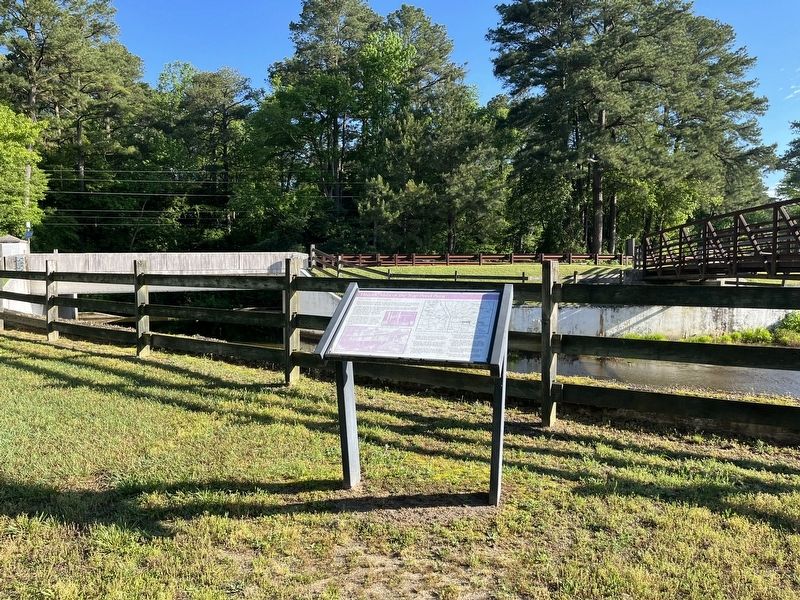
The Junction & Breakwater Railroad (J&BRR) was founded in 1857 but because it was built in stages, it took more than a decade for the railroad to link Harrington with Lewes, with trains finally running to Lewes in early . . . — — Map (db m244426) HM
Bridge Mechanics
The Lewes Swing Bridge (Bridge 3-928R) was a center-bearing bobtail swing bridge. The bobtail name comes from the bridge span's asymmetrical design, where the span's longer "arm" extended approximately 60 feet while the . . . — — Map (db m244433) HM
Preservation of the Bridge
The federal government is frequently engaged with projects that affect historic properties. Sometimes these projects result in the deconstruction or altering of properties. In 1966 Congress established the . . . — — Map (db m244447) HM
Guns such as these were used as field artillery. There were four 155mm guns placed at Fort Miles and four more placed across the Delaware Bay at Cape May, NJ to limit access to the bay. The concrete pads the were placed on were called "Panama . . . — — Map (db m150111) HM
When Fort Miles was completed, its two 16-inch guns were some of the largest artillery ever engineered by the United States and were placed here to defend the coastline from enemy battleships.
This particular gun barrel is Barrel 371, . . . — — Map (db m150114) HM
The gun before you is a 6-inch pedestal-mounted deck gun. This gun could fire two types of rounds, a 105-lb. armor-piercing round and a 90 lb. high-explosive round.
The model 1903-A2 guns that were at Fort Miles would have been mounted on . . . — — Map (db m150115) HM
The 8-inch guns placed at Fort Miles were each mounted on a railcar, making the large guns very mobile and easy to position for firing. The gun was able to turn in a 360° circle at an elevation of 45°. This made them difficult targets for enemy . . . — — Map (db m150112) HM
Long ago, this area was a freshwater marsh. It lay protected from ocean storms by the Great Dune and barrier beaches. As sea levels rose, saltwater marshes replaced freshwater marshes.
Starting in the 1800s, locals extracted salt from . . . — — Map (db m232983) HM
The guns in this park serve as representations of the artillery that was here throughout Fort Miles' World War II years; these are not the actual guns and not the same models as the guns that were placed here.
Fort Miles was part of the . . . — — Map (db m150109) HM
The piece of steel before you is a 48-inch section of armor plate that is 17.5 inches thick. The hole in it was created by a Mark 8, 16-inch armor piercing shell weighing 2,700 lbs. fired at point blank range. Firing shells at a piece of . . . — — Map (db m150113) HM
Built from 1939 to 1942, the 11 concrete observation towers along Delaware's coast were built to protect the shores during World War II - and to last about 20 years. They are still standing after 60 years. The towers were the eyes for the guns of . . . — — Map (db m232986) HM
For more than 150 years, the Cape Henlopen Lighthouse guided ships into Delaware Bay on their way to the ports of Wilmington and Philadelphia.
The Cape Henlopen Lighthouse had its beginnings in 1761. Philadelphia merchants and ship owners . . . — — Map (db m79167) HM
This stretch of shoreline is known to many as "Whiskey Beach." The history behind that name is a little cloudy. Some say that during Prohibition days in the 1920s, this was a rendezvous for rumrunners. Such an isolated site could have been an . . . — — Map (db m232978) HM
Block House Pond, a natural spring-fed pond, has provided fresh water, ice, and recreation to the City of Lewes for several centuries. The pond was likely named for a nearby blockhouse built to protect Lewes in the 1670s, where the town residents . . . — — Map (db m232744) HM
All Aboard!
Chartered in 1857, the Junction & Breakwater Railroad (J&BRR) ran the 38 miles from a junction with the Delaware Railroad in Harrington to the Delaware Breakwater in Lewes. The portion of the line from Georgetown . . . — — Map (db m198907) HM
Otis Smith was born in Brooklyn, NY, on December 6, 1909. During his lifetime, he became a "captain of industry" whose complex of family companies extended along the east coast of the US and as far away as Peru and Chile. He was motivated to come . . . — — Map (db m198891) HM
Two massive breakwaters shield Lewes Harbor from the punishing seas where Delaware Bay and the Atlantic Ocean meet. They create an 800-acre anchorage that is nearly empty now, but in the early 1900s it was capable of sheltering 1,000 vessels from . . . — — Map (db m39380) HM
Honorable Christopher J. Christie, Governor of New Jersey
Honorable Jack A Markwell, Governor of Delaware
Celebrating the Cap May-Lewes Ferry's 50 years of continuous
service and to the men and women who have volunteered their . . . — — Map (db m176162) HM
Located on the eastern end of the Delaware Breakwater, this brown conical structure was built in 1885. The tower is composed of four tiers of cast iron plates lined with two feet of brick. It is twenty-two feet in diameter at the base and is set . . . — — Map (db m39378) HM
Marine pilots know the shoals, lumps, and ledges of the Delaware intimately. They know the bends of the dredged channel, the characteristics of every lighthouse and range light, and the location of wrecks. They understand tides and currents and . . . — — Map (db m39379) HM
A temporary light was established on the south end of the recently completed National Harbor of Refuge Breakwater on January 1, 1902. It was replaced in 1908 by a three-story frame lighthouse. A series of storms damaged the structure, resulting in . . . — — Map (db m39374) HM
Lewes has been a Port-of-Call and a Harbor-of-Refuge since the 17th century. For generations during the ages of sail, a public burial ground in this immediate locality became the final resting place for hundred of sailors who lost their lives and . . . — — Map (db m176163) HM
Originally built in Pilottown c. 1800, one of the few remaining Dutch-styled homes typical of 18th c. Lewes. Named for George Peter Chambers, renowned sea captain and early resident. — — Map (db m190355) HM
Serving Lewes with a general store and its harbor
as ship chandlers, the Dodd family occupied this
site from the latter part of the 18th Century until
it was acquired in 1929 by Benjamin Ableman of
Georgetown from one Joseph Frank Dodd, the . . . — — Map (db m37099) HM
Built on the banks of the Lewes Canal, this original cottage has a corner fireplace, floor timbers made from salvaged shipwrecks, and an original, and an original cypress shingle exterior. Also, much of the interior is original.
Likely a . . . — — Map (db m190354) HM
On May 25, 1798 at 4:00 pm, H.M. Brig DeBraak capsized and sank off the coast of Cape Henlopen, Delaware during a sudden squall. This memorial honors the thirty-three members of the eighty-five man crew who were lost at sea.
James . . . — — Map (db m38436) HM
John Penrose Virden, Delaware River Pilot, built this house in 1888. He was a co-founder & the first President of the Pilots Association. Virden died in 1934 and is buried across the street in St. Peters Cemetery. — — Map (db m49591) HM
Used to take Del. Bay and River Pilots
from pilot boat Philadelphia and
pilot boat Delaware
to and from ships in Del. Bay
before World War II
Rowed by 4 apprentice pilots
Built by
Dave Watson
Lewes
Master Small Boat . . . — — Map (db m114550) HM
The Lewes-Rehoboth Canal connecting Rehoboth Bay and Delaware Bay was authorized by the U.S. River and Harbor Act of 1912. Initially, the canal was envisioned as a means of access to the sea for farmers and saw mills along the Indian River and Bay. . . . — — Map (db m19307) HM
The United States Life Saving Service (U.S.L.S.S.) was commissioned to rescue shipwrecked mariners along our nation's coast. Established in 1876 and 1884, respectively, the Cape Henlopen and Lewes stations worked together to save thousands of . . . — — Map (db m38472) HM
Lightship LV-118
Overfalls
has been designated a
National Historic Landmark
This vessel possesses national significance in commemorating the history of the United States of America
Used from 1820 to 1983, lightships . . . — — Map (db m232749) HM
Responsible for establishing aids for the navigation of our nation’s waterways, the United States government initiated the use of manned lightships or “floating lighthouses" in 1820. These vessels addressed many needs. They could be placed in . . . — — Map (db m19312) HM
The Atlantic Menhaden is a small herring-like fish found in the coastal waters of the Eastern United States. Used by Native Americans to fertilize crops, these oily fish were also used by European settlers to produce fuel for lamps. In the mid-19th . . . — — Map (db m19428) HM
The Monomoy story and the story of the Lightship Overfalls are about saving the lives of seamen. The twenty-six foot Monomoy rowboat is constructed of oak and cedar and was designed in the perilous days of early WWII. Then, in the greatest . . . — — Map (db m232753) HM
In Honor of Otis H. Smith
Entrepreneur, Civil Servent
Mayor, City of Lewes
1950-1968
Otis H. Smith was the founder and President of
Fish Products Co., one of the country's largest
menhaden processing operations.
During his long . . . — — Map (db m38597) HM
The Lightship Overfalls is one of the 179 ships that served as floating lighthouses on America's three coasts and the Great Lakes between 1820 and 1985. Lightships were used where it was not feasible to build a lighthouse, possibly because the . . . — — Map (db m38840) HM
For nearly 200 years, towns along the Delaware Bay were renowned for shipbuilding centers.
In Lewes, one of the earliest-known shipcarpenters was William Beverly in 1683. Among the last were John and Peter Maull, whose final boat left their . . . — — Map (db m232845) HM
Known as the “Great White Hurricane,” the Blizzard of 1888 was one of the most devastating weather events in recorded history. Affecting coastal states from Virginia to Maine, this paralyzing storm resulted in widespread death and destruction. With . . . — — Map (db m19316) HM
In March of 1813, the Royal Navy established a blockade of the Delaware Bay and River. The British squadron, under the command of Commodore John P. Beresford, RN, took up stations off Lewes and the Delaware Capes, and began to conduct raids along . . . — — Map (db m19308) HM
In March 1813, the Royal Navy under the command of Commodore John P. Beresford established a blockade of the Delaware Bay and River, conducting raids along the coast to disrupt maritime commerce and shipping. On this location was one of two . . . — — Map (db m244907) HM
The War of 1812 had a major impact on the town of Lewes and surrounding area. The naval blockade that was initiated by the British in March of 1813 lasted for most of the next two years. With maritime commerce limited, the local economy suffered. . . . — — Map (db m30358) HM
The Lightship Overfalls LV-118/WAL-539 had a long, distinguished career marking the shoal waters and guiding ships to safe harbor on the East Coast. After decommissioning, the Coast Guard donated her to the Lewes Historical Society (LHS) and she . . . — — Map (db m232751) HM
During the War of 1812, British vessels blockaded the mouth of Delaware Bay in an effort to disrupt shipping patterns and supply lines and cause economic hardship in the Mid-Atlantic. But when crews attempted to land at Lewes to replenish their . . . — — Map (db m38598) HM
The Zwaanendael Museum was built in 1931 to commemorate the 300th anniversary of the first European settlement in Delaware. The building is a careful adaptation of the town hall in Hoorn, Holland which was constructed in 1613. Exhibits in the museum . . . — — Map (db m198896) HM
Two of the many lighthouses that have guided mariners on Delaware Bay for nearly 250 years can be seen from Lewes beach.
The rust-colored Delaware Breakwater East End Lighthouse was built in 1885. It replaced an earlier lighthouse that was . . . — — Map (db m38524) HM
The University of Delaware (UD) has been involved with marine research since 1950, when a group of local fishermen became alarmed by drastic decline in Delaware Bay fisheries approached the Delaware General Assembly for help. The legislators . . . — — Map (db m113700) HM
Four-masted, 162 ft. cargo sailing schooner launched from Abbott's shipyard in 1900. John C. Davis, Captain. Lost in Bahamas storm in 1911. — — Map (db m150092) HM
Founded in 1896 by Wilson M. Vinyard, the Vinyard Shipbuilding Company was the first Milford shipyard to build motorized vessels. The shipyard built numerous ships for the government including Navy subchasers and Coast Guard patrol boats. In 1927, . . . — — Map (db m142577) HM
Welcome to Prime Hook Beach Horseshoe Crab Sanctuary
According to Prime Hook National Wildlife Refuge, Prime Hook is translated from the Dutch word "Priume Hoek" meaning Plum Point. Prime Hook was named by European settlers in the 17th . . . — — Map (db m244948) HM
In 1711, the Colony of Maryland authorized Colonel William Whittington to survey a tract of 1000 acres near this location for a reservation for the Indian River Indians, who ere remnant groups of the Assateague and Nanticoke Indians. The Indian . . . — — Map (db m190344) HM
Before Dutch control of what is now Sussex County. Native American Iwatama Socuum held "Long Reach," now Bullseye-Ferry Landing Preserve. After 1674, when the Dutch left, it was held by the Waples family and later, the Faucett family. In 1696, Peter . . . — — Map (db m245054) HM
With the expansion of the nation’s maritime commerce following the Civil War, the need for improved methods of assisting ships in distress was apparent. Built in 1876 by the United States Life-Saving Service, the Indian River Life-Saving Station was . . . — — Map (db m37068) HM
A native and lifelong resident of this area, Samuel Paynter was born at Drawbridge on the Broadkill River on August 24, 1768. He was a successful merchant, farmer, and mill-owner, whose prosperity was closely linked to the commerce of the river. . . . — — Map (db m37562) HM
Like the Native Americans before them, the European settlers of the 17th and 18th centuries utilized the Broadkill River as a means of transportation. Clearing of lands resulted in an abundance of grain and wood products. To transport these . . . — — Map (db m37397) HM
The first vessel of record constructed on the river was the shallop BROAD KILL, which was registered in Philadelphia in 1737. Like many of the early products of local shipyards, it was an open boat designed for sailing the sheltered water of rivers . . . — — Map (db m37398) HM
Welcome to Broadkill Beach Horseshoe Crab Sanctuary
The beach, waters of the Delaware Bay, and the natural surroundings of Broadkill Beach have been beckoning people to enjoy its bounties since colonial times.
Welcome to the Historic Village in Ocean View!
The Tunnell-West House was built around 1860 by John and Sarah Vaughn Tunnell of Muddy Neck. We assume they built it for a tenant farmer to use while taking care of the Tunnell's . . . — — Map (db m206358) HM
The Cape Henlopen Lighthouse stood on the Great Dune near Lewes from 1765 through 1926. The lighthouse was a widely-recognized landmark in the region and in 1924, a realtor built a replica of it at his Rehoboth Beach office. The Village Improvement . . . — — Map (db m150120) HM
The Great March Storm of 1962 significantly damaged homes, businesses and roads along the Delaware coast. Following the storm, the Village Improvement Association (VIA) used the wood from nearby damaged buildings and the Rehoboth . . . — — Map (db m150117) HM
The canal carried a variety of items including building materials, farm products, oysters, fish and ice. Shortly after it opened, however, there was a huge increase in the use of trucks to bring goods to market. A corresponding increase in the . . . — — Map (db m198886) HM
Lake Comegys and Silver Lake are natural freshwater remnants of receding glaciers from the last Ice Age and are notable for their close proximity to the Atlantic ocean. The Nanticoke Tribe held summer encampments around Silver Lake to gather . . . — — Map (db m108375) HM
The Lewes Rehoboth Canal is ten miles long and connects the Delaware Bay with Rehoboth Bay. It was built so that agricultural products could be shipped from the area around Rehoboth Bay to the Delaware Bay and then on to Baltimore and . . . — — Map (db m198885) HM
Spanish gold doubloon and silver "pieces of eight" can be found from the many Spanish ships that wrecked along our shore entering the Delaware Bay. — — Map (db m232968) HM
In 2002, the horseshoe crab was named the official marine animal of the state of Delaware. The world's largest population of horseshoe crabs is found in the Delaware Bay. — — Map (db m162151) HM
Boating along the canal has always been popular. In the early days, locals used the flat-bottomed barges to travel and see the sights. Today, locals and tourists frequently used private boats on the canal especially during the summer . . . — — Map (db m198883) HM
When at the beach, women of the early 20th century wore woolen bathing attire that covered most of their bodies. When wet, the suits were heavy, and it became difficult to leave the surf and get back onto the beach without help. The women of the . . . — — Map (db m198811) HM
Built for Rev. R.H. Adams in 1895, the house was one of several structures that comprised a "Camp Meeting" area on Baltimore Avenue. Owned by Anna Hazzard beginning in 1927, the house was eventually inherited by Ronald and Gladys James, who . . . — — Map (db m150119) HM
The founders of Rehoboth Beach designed the end of Rehoboth Avenue to be wide, allowing expansive views of the ocean. The plot of land evolved quickly to become a grassy oval around which horse drawn carriages would traverse on dirt avenues, . . . — — Map (db m198887) HM
TC grew up a lifeguard for his family and friends, with the Atlantic Ocean forever and always reflected in his eyes. TC wore the red trunks of the Rehoboth Beach Patrol beginning in 1971. For 36 years, he watched over swimmers and found lost . . . — — Map (db m198879) HM
In the mid-1800s, Sussex County was mostly farmland, and carts led by goats or oxen traveled to the downtown area. Later, horse-drawn carriages ferried visitors from the railroad station in Lewes, Delaware, about 7 miles away. Passengers . . . — — Map (db m198882) HM
Walk the Boards
The first Rehoboth Beach boardwalk was 1,000 yards long and consisted of 8-foot-wide oak planks laid on the sand. Built in 1873, it was replaced in 1884 with a new boardwalk 8 feet wide and 1.25 miles long. . . . — — Map (db m198889) HM
In memory
of our comrades who served with us in the Great War, and who have gone on ahead: we dedicate this piece.
3" Davis Gun - Used during 1917-1918
on Submarine Patrol Boat 629 of the Baltic Patrol — — Map (db m150123) HM WM
Isaac and Betty Cannon began operating a ferry here on Nanticoke River, Feb. 2, 1793. Their sons continued it, built stores and warehouses in the hamlet named for them.
The ferry became property of Sussex County following the brothers' death . . . — — Map (db m4538) HM
In October 1856, famed Underground Railroad conductor Harriet Tubman organized what is considered by Tubman scholars to be "one of her most complicated and clever escape attempts." Working at the request of a fiancé who had escaped to Canada, Tubman . . . — — Map (db m138271) HM
This body of water was created in 1816, when a
grist mill was established on Clear Brook Branch
at this location by Nathaniel Ross. Known by
various names, most notebly those of two early
owners, William Cannon and William Ross, the
mill was . . . — — Map (db m60975) HM
Pilot Town is the section of the Hamlet of Concord where many free black families have lived in harmony with the white families since around 1765. It was so named for the many Negro pilots who lived in the area and piloted vessels down the Nanticoke . . . — — Map (db m38662) HM
While this vehicle is not a "tank", it has been adapted with so many types of weapons and upgraded with steel plating, it has been used aggressively. There is usually a 3 man crew and it can carry 11 fully loaded and equipped troops into combat. For . . . — — Map (db m164968) HM WM
By the 1740s a ferry service was being regularly operated at this location by James Cannon. He was succeeded by his son Jacob, who constructed a much-needed causeway on this side of the river for the improvement of the family's ferry service . . . — — Map (db m198836) HM
Welcome to Slaughter Beach Horseshoe Crab Sanctuary
In April of 2004, the Town of Slaughter Beach and its residents voted to declare our town a Horseshoe Crab Sanctuary and to ban harvesting of horseshoe crabs from our beaches.
We did . . . — — Map (db m232902) HM
1952: Mr. & Mrs. Richard Hall purchase 130 acres and name it South Bethany
1952: Construction of the South Bethany canals begins and lasts until 1962
1959: Property owners number 500
1962: "The Perfect Storm" aka . . . — — Map (db m150152) HM
[This markers shares stories of South Bethany wish a series of photos. The captions are noted below:]
Circa 1900 – the Assawoman Canal bordering the west side of South Bethany
Circa 1940 – The McCabe Family played a . . . — — Map (db m150155) HM
On June 2, 1608, Captain John Smith and fourteen English colonists left the fledgling Jamestown settlement to explore the Chesapeake Bay and its tributaries. One week later they entered the Kuskarawaok (or Nanticoke) River, where they spent three . . . — — Map (db m245614) HM
By the 1740s a ferry service was being regularly operated at this location by James Cannon. He was succeeded by his son Jacob, who constructed a much-needed causeway on this side of the river for the improvement of the business. Threatened by . . . — — Map (db m168149) HM
188 entries matched your criteria. Entries 101 through 188 are listed above. ⊲ Previous 100