A Part of History
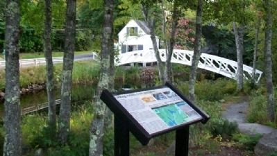
Both Native Americans and early settlers enjoyed abundant harvests along this coastal shore. Each spring, thousands of adult alewives made an upstream pilgrimage, moving from salt water into the Mill Pond and up Somes Brook . . . — — Map (db m54520) HM
In the 1800s when ship building, quarrying and mining thrived, enterprising businessmen built boarding houses and hotels to house the many laborers. Blacksmith shops, livery stables, grocery and feed stores, and a meat shop flourished as well. . . . — — Map (db m54711) HM
With the help of steamship & train travel in the late 1800s, summer tourism peaked. But within a few short decades, the age of the auto and better roads to Bar Harbor - plus closing mines and quarries - led to decades of gradual economic . . . — — Map (db m54709) HM
All the mountains that you see are part of Acadia National Park
The Age of Sail lingered into the 1900s as sailing ships proved more economical than steamships for carrying heavy cargos such as granite.
Generations of watercraft ply . . . — — Map (db m54707) HM
Bass Harbor Head Light stands at the southern most tip of Mount Desert Island and marks the entrance to Blue Hill Bay and Bass Harbor. Since 1858 it has warned mariners of navigation hazards along this rocky shore.
In the nineteenth century, the . . . — — Map (db m102500) HM
Directly across Frenchman Bay... the beautiful group of islands, which, like stepping stones, form a connecting line to Mount Desert... Pennsylvania Railroad Company's Summer Excursion Book, 1891 Water was the primary . . . — — Map (db m184514) HM
Winter Harbor Light (active 1856-1930)
For years the staunch little sentinel beacon on Mark Island guarded the entrance to Winter Harbor Sound, lighting the way for ships and small craft to the safety of snug Winter Harbor. The Coast Guard . . . — — Map (db m184638) HM
For over 200 years, this site has anchored a span over the Kennebec River. Construction of the first bridge began in May 1797 by the Proprietors of the Kennebec Bridge, which owned and subsequently operated the bridge. Completed on . . . — — Map (db m110811) HM
The Pilgrims' trading post at Cushnoc had enjoyed a monopoly of fur trade with local Abenaki since 1628. In the spring of 1634 a vessel commanded by John Hocking of Portsmouth challenged that monopoly. Arriving at Cushnoc, Hocking . . . — — Map (db m110824) HM
Six of the seven batteries of mounted light artillery raised by the State of Maine beginning in 1861 were mustered into service and trained in Augusta. They encamped in an expanse of high ground immediately southwest of the State . . . — — Map (db m186062) HM
In the golden years of wooden shipbuilding, Maine-built ships carried American goods worldwide-and Augusta was no exception! Master William Jones' shipyard was located here in the 1840s & 1850s. From 1837 to 1856, 37 vessels were . . . — — Map (db m153160) HM
Steamboats debuted on the Kennebec in 1818. By 1823, the Kennebec Steam Navigation Company operated the Waterville between Bath and Augusta. A nationwide economic decline later forced them out of business, but the organization . . . — — Map (db m111161) HM
The Kennebec River is the largest river in Maine. Originating from Moosehead Lake, the river flows 190 miles through Somerset, Kennebec and Sagadahoc Counties to the Gulf of Maine at Popham Beach. The Kennebec was a primary travel route for . . . — — Map (db m125013) HM
The Kennebec River is the largest river in Maine. Originating from Moosehead Lake, the river flows 190 miles through Somerset, Kennebec and Sagadahoc Counties to the Gulf of Maine at Popham Beach. The Kennebec was a primary travel route for Native . . . — — Map (db m125019) HM
Land purchased from heirs of
Nathaniel Merryman
by the United States of America
November 22, 1824
Contractors - Jeremiah Berry
Robert Foster, Ballard Green
Beacon Installed - Winslow Lewis
1st Lightkeeper - Isaac Stearns
First . . . — — Map (db m52323) HM
How Did Owl's Head Get Its Name?
For centuries, people have wondered how Owl's Head received its name. According to Native American legend, the head of an owl can be identified in this rocky cliff that the Indians called . . . — — Map (db m52332) HM
(panel 1)
Welcome to Owls Head Light Station
“Owl's Head ushers at once upon a scene almost too beautiful to profane with speech when we are looking at it; impossible to find language to do it justice when memory would . . . — — Map (db m116036) HM
This historic Coast Guard Bell from Portland Head Light is being loaned to the City of Rockland (a Coast Guard City) for their outstanding support of the men and women of the United States Coast Guard — — Map (db m55370) HM
Construction of this 4,300-foot long breakwater began in April 1881. Eighteen years, $750,000 and over 732,277 tons of granite later, it was completed on November 24, 1899. The lighthouse dates from 1902 and was placed on the National Register of . . . — — Map (db m55361) HM
[Historical Excerpt Transcribed]
General Information
The Rockland Harbor Trail is easy to follow. Allow you and your imagination enjoy the Harbor sights along the way. The trail is approximately 5.5. mile[s] from beginning to end, . . . — — Map (db m52340) HM
[Historical Excerpt Transcribed]
General Information
The Rockland Harbor Trail is easy to follow. Allow you and your imagination enjoy the Harbor sights along the way. The trail is approximately 5.5. mile[s] from beginning to end, . . . — — Map (db m55360) HM
[Historical Excerpt Transcribed]
General Information
The Rockland Harbor Trail is easy to follow. Allow you and your imagination enjoy the Harbor sights along the way. The trail is approximately 5.5. mile[s] from beginning to end, . . . — — Map (db m55393) HM
This flagpole was erected as a memorial to the Builders, the Captains and the Seamen of Thomaston Ships by those who take pride in their accomplishments — — Map (db m55529) HM
To commemorate the voyage of
Captain George Waymouth
to the Coast of Maine
in 1605
His discovery and exploration of the
St. Georges River
and planting a Cross on the
northerly shore of this harbor
where the river "trended . . . — — Map (db m54665) HM
Welcome to Thomaston, Maine, the town that went to sea
Thomaston is known for its historic white houses. Both Main and Knox Streets are on the National Historic Register. Of the slightly more than 700 homes in town, approximately . . . — — Map (db m55531) HM
Who was born and grew to young manhood at Christmas Cove. Bred in the tradition of the sea, he was swift to volunteer when his country entered the Great War. He won a commission for meritorious service and gave his life in heroic performance of his . . . — — Map (db m126922) HM WM
( left panel ) For about a century and a half the upper Damariscotta River enjoyed an exciting period of its history in the construction of wooden sailing vessels. Nearby forests provided ideal timber resources, such as ash, pine, spruce . . . — — Map (db m205102) HM
The Bell House was built in 1897 to contain the two Shipman fog-signal engines which operated the fog bell. In 1899 these engines were replaced by a Stevens Striking Machine and a wooden tower was built to accommodate the weights which activated . . . — — Map (db m55423) HM
The Oil House was built in 1896 to hold the oil which fueled the lighthouse lamps. A tender would sail as close to the rocks as possible, send a heavy line ashore and transfer the oil. — — Map (db m55449) HM
Near this site on August 14, 1635,
John Cogswell and family from
Westbury Leigh, Wiltshire, England,
first set foot in America.
They arrived on the ship Angel Gabriel,
which was wrecked here on the
following day in a . . . — — Map (db m35442) HM
Near this site on August 15, 1635
Ralph Blaisdell and family
were shipwrecked.
The ship was the Angel Gabriel
bound from Bristol, England
to Pemaquid.
From here the family
went to York, Maine
and later to . . . — — Map (db m35441) HM
Long before the arrival of the first settlers, this area of the Kenduskeag served as a travel route and encampment site for Native Americans, hunters, trappers and explorers, and the young village of Condeskeag grew in the late 18th century . . . — — Map (db m110593) HM
Killed near the mouth of the
Red River, Louisiana, while
in the service of his country,
commanding U.S. Gunboat Gazelle
Nov. 26, 1864,
Aged 27 Years. — — Map (db m110698) WM
Near this spot
in the year 1604
Samuel de Champlain
Gallant pioneer
and intrepid explorer
made a landing on his voyage
up the Penobscot River — — Map (db m110599) HM
To the memory of
the Soldiers and Sailors
of
the Spanish-American War
1898
—————————
Shield and Scrolls
recovered from wreckage
of U.S.S. Maine
Blown up Havana Harbor, Cuba . . . — — Map (db m110559) WM
The white-painted steel structure in front of you is a sculpture representing the bow and stern of the six-mast schooner Wyoming, the largest wooden vessel built in the United States. The sculpture stands where the schooner was built in . . . — — Map (db m52033) HM
The white-painted steel structure in front of you is a sculpture representing the six-mast schooner Wyoming, the largest wooden vessel built in the United States. The sculpture stands where the schooner was built in 1909, but somewhat closer . . . — — Map (db m52038) HM
Known locally as "BIW" or "The Yard," Bath Iron Works has been building ships on the same site since 1890. Over 420 vessels have been built there, including cargo vessels, fishing vessels, yachts, tugs, barges, and naval vessels. Between 1984 and . . . — — Map (db m52032) HM
In 1920, the Percy & Small shipyard did its last significant ship work. The steamer Winapie, built in New Hampshire during World War One, visited for conversion into a tank barge. The shipyard removed this three-compartment deckhouse, . . . — — Map (db m52056) HM
This major waterway, although in places still undeveloped, remains an important artery for water traffic. The river flows 164 miles from its source at Moosehead Lake to the Atlantic Ocean, 12 miles south of here at Popham. Kennebec is a Wabanaki . . . — — Map (db m52051) HM
Launching featured tradtion, ritual, spectators, and celebration. But it also brought technical challenge and danger to workers and vessel alike.
In preparation, a launching crew built a pair of sliding (or launching) ways beneath the . . . — — Map (db m52059) HM
This sturdy industrial building housed a sawmill for cutting and shaping ship timbers and planks, and a joiner shop for the finer woodworking that went into vessels' cabins, deckhouses, railings, and interiors.
In 1909, the shed addition on . . . — — Map (db m52084) HM
William T. Donnell married Henry P. Hitchcock's daughter Clara in 1860, and bought this house and shipyard from Clara's mother in 1869. The proximity of residence to workplace was unusual. From this house, W. T. Donnell overlooked his shipyard, . . . — — Map (db m52082) HM
The blacksmith shop was the first building constructed by Percy & Small after they purchased the old Blaisdell shipyard site from William Donnell in 1896. It was furnished with forges, bellows, and anvils for fabricating large quantities of . . . — — Map (db m52095) HM
Two building slips, or ways, were important features of the shipyard. The North Ways were prepared as a second building slip, on land purchased in a 1901 expansion. They measured at least 350' long by 50' wide - the largest wooden shipbuilding . . . — — Map (db m52053) HM
A good shipbuilding site has a natural 4° to 12° slope down to deep water.
Using this grade, building slips (ways) were constructed on cleared and graded areas. These were wooden foundations to accommodate the hull under construction and the . . . — — Map (db m52036) HM
This workshop was built in 1899 for Charles Oliver and his caulking gang. Here they stored their tools and some of the miles of oakum and cotton yard needed to make vessels' seams watertight. From the steps, Mr. Oliver could keep an eagle eye on . . . — — Map (db m52031) HM
At the fitting-out pier new vessels received their equipment and finishing work. This pier had a ramp built into its southern side, to land the large timbers and spars that were floated down the river from the railroad yards.
The original 1898 . . . — — Map (db m52048) HM
Design is the first step in shipbuilding, and it took place in a mould loft. Skilled modelers shaped the schooner's hull in miniature by carving a half-model. They scaled the model's lines full-size on the loft floor, then transferred these lines . . . — — Map (db m51988) HM
Caulkers used huge quantities of pitch to pay (or seal) the vessels' deck seams. In the kettles set into this freestanding brick oven, they melted crystallized pine resin over scrap-wood fires, which they carried in buckets to the decks of the . . . — — Map (db m52007) HM
The Percy & Small shipyard was electrified from its establishment in 1896. In 1909, the Sagadahoc Power & Light Company began delivering higher-voltage power to the shipyard on a separate industrial line. The transformer stepped down the voltage . . . — — Map (db m52083) HM
Since before Columbus discovered the New World, the Kennebec River has been the scene of settlement and conflict. While Fort Halifax represents the most northern military outpost in the region, it is only one of more than twenty forts that have . . . — — Map (db m52195) HM
1. Joseph Berry's Fort - West Bath; 2. Col. Noble's Fort - Pleasant Cove, built in 1734, a stockade with a guard house at each corner and another within the enclosure. "Without its protection the farmers did not dare work their fields."; 3. Clarke . . . — — Map (db m52199) HM
This tablet marks the place where Colonel Benedict Arnold with his soldiers left the Kennebec River October 1775 and marched from the west shore in a north-westerly direction to Dead River on their way to Quebec.
— — Map (db m102371) HM
Despite the decline in ship building, the port of Belfast remained busy at the turn of the 20th century. Rapid industrial development took place all along the west side waterfront, and steamships and railroads became the primary . . . — — Map (db m59508) HM
A brief shipbuilding boom following WWI put the shipyard owned by the Mathews Brothers woodworking mill back in business. The building of the Jennie Flood Kreger, Belfast's largest and only five-masted ship, was overseen by . . . — — Map (db m59549) HM
Steamboats first made scheduled stops in Belfast in 1824, carrying passengers and freight along the coast. The Eastern Steam Ship Company of Boston built the wharf pictured here in 1888. The "Great White Flyer" steamer Belfast . . . — — Map (db m59550) HM
The abundant lumber, steam-powered sawmills and stretches of wide, flat beach, Belfast became a ship building center with shipyards lining the waterfront. In 1793, Robert and James Miller built the schooner Jenny Miller, the . . . — — Map (db m59531) HM
Today's peaceful view of the Penobscot River and the community of Bucksport holds few hints of the early conflicts that plagued the area. For nearly two centuries, the river served as a border between clashing interests - French and English, Native . . . — — Map (db m55132) HM
For 40 years Clara sailed, first with her father at age nine, then with her husband, Captain William Blanchard, aboard 13 vessels in all. She enjoyed one of the longest documented lives at sea and sailed to all parts of the world. . . . — — Map (db m59280) HM
Until 1800, Settlers in the area were occupied in establishing themselves on the land. At the same time trade up and down the coast and with Massachusetts was by water in sloops and small schooners. These coastal farmers were as much . . . — — Map (db m46659) HM
Captain Freeman McGilvery (1824-1864) captained two ships prior to the Civil War. At age 38, at sea, he learned of the "Southern Insurrection" and returned to Maine to offer his services to the governor. Assigned to command the 6th . . . — — Map (db m46661) HM
Fort Point Light — An Early River Beacon Established in 1836 to aid the growing number of ships navigating the Penobscot between Bangor and Castine, Fort Point Light Station was built as the first river light in Maine. In 1857, the . . . — — Map (db m170845) HM
"...I set out from Ste. Croix on September 2...with twelve sailors and two Indians to serve us as guides to the places with which they were acquainted."
Samuel Champlain Journal, 1604 (translation)
In late summer Pierre . . . — — Map (db m125217) HM
"The Sieur de Mons decided to remove elsewhere...to escape the cold and dreadful winter..."
Samuel Champlain Journal, 1605 (translation)
After the terrible winter, Pierre Dugua, Sieur de Mons, ordered his men to take down . . . — — Map (db m125245) HM
"...His Majesty commanded the Sieur de Mons to prepare a fresh expedition..."
Samuel Champlain Journal, 1604 (translation)
The newcomers who landed on the island offshore came from France. Their leader was Pierre Dugua, . . . — — Map (db m125161) HM
In 1604, this was the land of the Passamaquoddy. In June, several families would have been camped here harvesting fish and shellfish. Nobody knows what the residents thought when a large ship landed at a nearby island. We do know they helped the . . . — — Map (db m125159) HM
Share the dramatic story of Saint Croix Island. In 1604, over a hundred artisans, soldiers, and gentlemen sailed here from France in a bold attempt to establish a European colony north of Florida. They built a settlement on an island offshore and . . . — — Map (db m125121) HM
By: Samuel Bartlett Wadsworth (9/1/1791- 10/2/1874)
Son of: General Peleg Wadsworth
Uncle to: Henry Wadsworth Longfellow
★ Formerly Located: Central Wharf 1818- 1976 ★
(left plaque)
This property has been placed on . . . — — Map (db m207785) HM
This anchor symbolizes the historic ties that Machias people have with the sea, and their commitment to liberty as exemplified in the first naval battle of the American Revolution fought in Machias Bay between the British ship Margaretta and the . . . — — Map (db m55066) HM WM
This tablet marks the landing place of the company which made the first permanent English settlement in this town, May 20, 1763. The little band consisted of Samuel and Sylvanus Scott, Timothy George, and David Libby, John and Solomon Stone, Daniel . . . — — Map (db m54739) HM
Native Americans called the falls next to this sign Machias, the popular translation of which is "bad little falls." The name Machias now applies to the nearby towns and rivers. South of Bad Little Falls, river water mixes with sea water brought in . . . — — Map (db m54743) HM
Brook Trout, Bass, Salmon, Togue, & White Perch
Seasonally, fishing changes a great deal here in the Lakes. Winter brings ice-fishing for Salmon and Togue (Lake Trout). Ice-out is Salmon fishing time. In June, as surface water warms, people . . . — — Map (db m125303) HM
Looking East into New Brunswick: The International Boundary runs directly through East Grand Lake and the Chiputneticook Lakes below you. The deepest parts of the lakes define the border between the U.S. and Canada.
Glaciers carved vast . . . — — Map (db m125291) HM
Long before the Romans built their network of roads across Europe, Native Americans developed a vast natural network of canoe routes connecting the Atlantic to the great rivers, lakes, and forests of the lands we now call Maine and the . . . — — Map (db m125284) HM
Welcome to Biddeford
An early Industrial Revolution site, Biddeford was settledin 1630 by proprietors John Oldham and Richard Vines. They received their land grant as payment for services to the Plymouth Company in 1629. John . . . — — Map (db m186151) HM
Welcome to Biddeford
An early Industrial Revolution site, Biddeford was settledin 1630 by proprietors John Oldham and Richard Vines. They received their land grant as payment for services to the Plymouth Company in 1629. John . . . — — Map (db m186168) HM
The Water Street area once had several shipyards. The painting is of the Mt. Washington clipper ship done while in Canton Harbor, China. Built in 1867 at the height of the China trade, the ship was the largest built on the Saco . . . — — Map (db m186152) HM
The first mill in Biddeford was the Laconia Compny founded by Samuel Batchelder in 1841. Production of cloth began in 1845. Some twelve million bricks were used in the construction. A large machine shop and foundry were constructed . . . — — Map (db m186156) HM
This quartet of buildings, which now forms the Brick Store Museum, was operated as separate businesses throughout the decades. The brick building was erected in 1825 by wealthy merchant and ship owner, William Lord. In 1936 Lord's . . . — — Map (db m186324) HM
The Hugh McCulloch home was actually built in 1787 for Tomas Wiswell. The home ha a massive center chimney and three upstairs bedrooms have hinged walls which can be swung upward and secured to the ceiling to create a large ballroom. . . . — — Map (db m186345) HM
Welcome to Kennebunk
The Native American word “Kennebunk” means “long cut bank” and likely refers to Great Hill at the mouth of the Mousam River which would have been an important landmark to those traveling the coast in their . . . — — Map (db m186306) HM
Welcome to Kennebunk
The Native American word “Kennebunk” means “long cut bank” and likely refers to Great Hill at the mouth of the Mousam River which would have been an important landmark to those traveling the coast in their . . . — — Map (db m186327) HM
More than 20 vessls were built on the Mousm River between the years of 1760 and 1790. Most vessels were built here at what was then "The John Butland Shipyard." The largest vessel weighed nearly 240 tons. Many of the earliest . . . — — Map (db m186348) HM
The depression in the bank across the street is one of the last visible remains of a once thriving shipbuilding industry which existed along the western banks of the Kennebunk River. Prior to 1790, most shipbuilding was done on the . . . — — Map (db m186344) HM
It is believed that the Mousam River takes its name from an Indian word, but the true meaning of the word has long been lost. Some speculate that “Mousam” means “Moose”. The face of the river front has changed over the years, as is . . . — — Map (db m186302) HM
The upper section of Summer Street was settled by wealthy ship builders and business men, many belonging to the Lord and Thompson families. It became known as "Zion's Hill" in 1833 when the sale of liquor was debated by the . . . — — Map (db m186334) HM
On 10 April, 1963, all 129 U.S. Navy sailors and civilian workers aboard the USS Thresher perished when the nuclear attack submarine sank more than 200 miles off the New England Coast. The Thresher was designed and build at the Portsmouth Naval . . . — — Map (db m96374) HM
The Shipyard Mall has been a gathering area since the Civil War when Shipyarders took their oath of allegiance here. The shipyard flagpole stands majestically in its center and numerous monuments are located throughout the park. The sail of the USS . . . — — Map (db m31696) HM
In memory of the Continental sloop of War Ranger launched from this island May 10, 1777 Sailed for France November 1777 John Paul Jones, Captain with dispatches of Burgoyne’s surrender received February 14, 1778 The first salute to the Stars and . . . — — Map (db m85419) HM
Farmhands cut blocks of ice from a nearby mill pond, packed them in sawdust, and stored them in this building. Ice was vital for keeping the evening's milk and cream fresh for summer morning deliveries.
Even after automobiles became . . . — — Map (db m186470) HM
After glaciers retreated from our region 6,000 years ago, Native Americans settling along the coast flourished on its rich resources. When Europeans arrived about 400 years ago and began establishing settlements, they also favored coastal . . . — — Map (db m186467) HM
This tower stored water for livestock. It was fed by a hydraulic ram and electric pumps, marvels of technology unusual for a family farm. Water to fill the tank came from the Merriland River near the bridge on today's Skinner Mill Road. . . . — — Map (db m186471) HM
Erected in 1879 by the United States Light House Service to protect mariners from the "Savage Rock."
Sohier Park
William Davies Sohier
1858-1938
Mr. Sohier generously donated this site of four acres to the York Beach Village Corporation . . . — — Map (db m55593) HM
Cape Neddick Light Station
43° 9' 45" N. Lat.
70° 35' 30" W. Long.
Constructed 1879 • Automated 1987
The booming of a bell like this warned mariners of the "savage rocks" surrounding this tip of Cape Neddick. It hung from a . . . — — Map (db m55640) HM
200 entries matched your criteria. Entries 101 through 200 are listed above. ⊲ Previous 100