By Jason Armstrong, July 3, 2022
Stella Friends Academy Marker
| On State Highway 11 west of County Road 630, on the left when traveling west. |
| On Mendenhall Street (County Route 12) 0.1 miles north of Panhandle Street (U.S. 64), on the right when traveling north. |
| On County Highway 1230 at County Highway 2000, on the left when traveling west on County Highway 1230. |
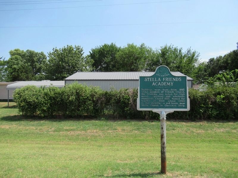
| On U.S. 66, on the left when traveling east. |
| On Bank X Road at Bank 19 Road on Bank X Road. |
| On North 4th Street (U.S. 283) at Elm Avenue, on the right when traveling north on North 4th Street. |
| On U.S. 70, 0.1 miles east of Ballpark Road, on the right when traveling west. |
| On Buffalo Street (State Highway 22) west of Main Street, on the right when traveling east. |
| On U.S. 281, 0.1 miles north of Wichita Lane, on the right when traveling north. |
| On State Highway 152, 1.5 miles east of U.S. 281, on the right when traveling east. |
| On D Street NW north of 9th Avenue NW, on the right when traveling north. |
| Near South Keeler Drive, 0.3 miles south of East Willis Road (County Route D0790), on the left when traveling south. |
| On North 4200 Road west of Old Spring Road, on the left when traveling west. |
| On U.S. 70 east of N4310 Road (State Route 147), on the right when traveling west. |
| On J. Willis Stovall Drive, 0.1 miles east of Chautauqua Avenue, on the right when traveling east. |
| On Ganahl Road at Back Access Road, on the left when traveling north on Ganahl Road. |
| On West Canadian Avenue at South Smith Street, on the right when traveling west on West Canadian Avenue. |
| On North Chestnut Street south of East 10th Avenue, on the right when traveling north. |
| On West Gary Boulevard (Business Interstate 40) 0.1 miles south of West Modelle Avenue (Oklahoma Highway 73), on the right when traveling south. |
| On Oklahoma Route 30 south of E1530 Road, on the right when traveling north. |
| On County Road 210 at East 1600 Road, on the right when traveling north on County Road 210. |
| On Main Street (Oklahoma Route 5) east of Parrish Avenue, on the right when traveling east. |
| On County Road N2890 at County Road E2080, on the left when traveling south on County Road N2890. |
| On South Main Street at West College Avenue, on the right when traveling south on South Main Street. |
| On U.S. 77 at State Line Road, on the right when traveling south on U.S. 77. |
| On Brill Road north of Washunga Drive, on the right when traveling west. |
| On Main Street (U.S. 77) at 8th Street, on the right when traveling north on Main Street. |
| On Summers Place south of East Hartford Avenue, on the right when traveling south. |
| On State Highway 33 at N 2920 Road, on the right when traveling west on State Highway 33. |
| On South Main Street at East Broadway Avenue, on the right when traveling north on South Main Street. |
| On State Highway 33 at Bowman Avenue, on the left when traveling west on State Highway 33. |
| On U.S. 183 north of County Road E1420, on the right when traveling north. |
| On Talimena National Scenic Byway (Scenic Highway 1) 5 miles east of Camp Tom Hale Road, on the right when traveling east. |
| On State Highway 63, 1 mile west of County Highway 4580, on the right when traveling west. |
| On South 2nd Street north of West Harrison Avenue, on the right when traveling south. |
| On County Highway N4335, 1.5 miles west of County Highway E6100, on the right when traveling south. |
| On County Highway N4330, 1.5 miles east of County Highway E600, on the right when traveling south. |
| On West Main Street at South Second Avenue, on the right when traveling east on West Main Street. |
| On U.S. 70 east of Oklahoma Highway N4450. |
| On Business U.S. 69 north of Border Street, on the left when traveling north. |
| On South Boulevard at East 2nd Street (U.S. 77), in the median on South Boulevard. |
| On North Broadway at West Hurd Street, on the right when traveling south on North Broadway. |
| On East 2nd Street (U.S. 77) west of South Boulevard, on the right when traveling east. |
| On North Stonewall Avenue south of Northeast 113th Street, on the right when traveling south. |
| On West Main Street west of North Broadway Avenue, on the right when traveling east. |
| Near Nazih Zuhdi Drive west of North Laird Avenue. |
| Near Nazih Zuhdi Drive west of North Laird Avenue. |
| On Robinson Avenue at NW 7th Street, on the left when traveling north on Robinson Avenue. |
| Near Nazih Zuhdi Drive west of North Laird Avenue. |
| On North Stonewall Avenue at NE Park Place, on the right when traveling north on North Stonewall Avenue. |
| Near Nazih Zuhdi Drive west of North Laird Avenue. |
| Near Nazih Zuhdi Drive west of North Laird Avenue. |
| On South Mickey Mantle Drive north of Johnny Bench Drive, on the right when traveling north. |
| On North Phillips Avenue north of NE 13th Street, on the right when traveling north. |
| On North Stonewall Avenue north of NE 10th Street, on the right when traveling north. |
| On North Stonewall Avenue north of NE 10th Street, on the right when traveling north. |
| On North Phillips Avenue north of NE 13th Street, on the right when traveling north. |
| On North Stonewall Avenue at NE 10th Street, in the median on North Stonewall Avenue. |
| On North Lindsay Avenue south of Stanton L Young Boulevard, on the left when traveling south. |
| On Northeast 10th Street east of North Phillips Avenue, on the right when traveling east. |
| On North Stonewall Avenue south of NE 13th Street, on the right when traveling south. |
| On West Main Street (U.S. 60) at Farrell Avenue, on the right when traveling west on West Main Street. |
| On Mickey Mantle Boulevard (U.S. 69), on the right when traveling south. |
| On Main Street (Route 66) (U.S. 69) south of 2nd Avenue NW, on the right when traveling south. |
| On Main Street (Route 66) (U.S. 69) south of 2nd Avenue NW, on the right when traveling south. |
| On Carl Albert Parkway east of 3rd Street, on the right when traveling west. |
| On State Highway 2, 0.6 miles north of County Road 1640, on the right when traveling north. |
| On County Road 4355 north of County Road 4358, on the left when traveling north. |
| Near North 4355 Road, 1.2 miles north of U.S. 271. |
| On Camden Street near Will Rogers Boulevard (State Highway 88), on the left when traveling west. |
| On State Highway 59 west of Local Road 3540, on the right when traveling west. |
| On Mendenhall Street (County Highway 12) 0.1 miles U.S. 64, on the right when traveling north. |
| On North Main Street, on the right when traveling south. |
| On South 129th East Avenue, on the right when traveling south. |
| On John Hope Franklin Boulevard east of Elgin Avenue, on the right when traveling east. |
| On East Admiral Place at South Sheridan Avenue, on the right when traveling east on East Admiral Place. |
| On Cincinnati Avenue at 9th Street, on the right when traveling south on Cincinnati Avenue. |
| On Elgin Avenue north of Mathew B. Brady Street, on the left when traveling north. |
| On David L. Boren Boulevard, in the median. |
| On East 47th Street south of East 41st Street, on the right when traveling south. |
| Near East 47th Street south of East 41st Street, on the left when traveling south. |
| On East 11th St (U.S. 66), on the right when traveling west. |
| On 18th Street at Cheyenne Avenue, on the right when traveling west on 18th Street. |
| On 18th Street at Cheyenne Avenue, on the left when traveling west on 18th Street. |
| On South Yale Avenue at East 11th Street (Old U.S. 66), on the left when traveling north on South Yale Avenue. |
| On State Highway 51 east of S 305th E Street, on the right when traveling east. |
| On Cherokee Street (State Highway 51) at Casaver Avenue, on the left when traveling east on Cherokee Street. |
| On Old U.S. 66, 0.3 miles east of County Road N2080, in the median. |
| On East 3rd Street at North Glenn L. English Street, on the right when traveling east on East 3rd Street. |
| On East 3rd Street at North Glenn L. English Street (U.S. 183), on the right when traveling east on East 3rd Street. |
| On State Highway 152 at N2190 Road, on the right when traveling west on State Highway 152. |