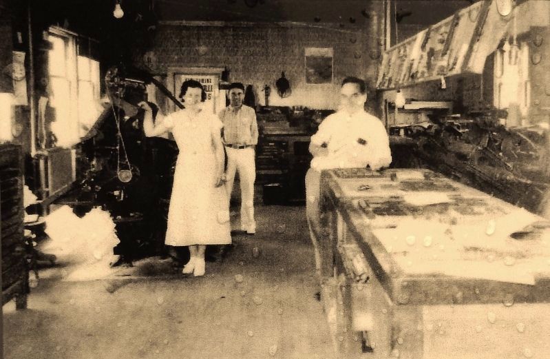
The first issue of the Alcona County Review was published on April 27, 1877 by publisher James K. Fairchild. Nine publishers and 140 years later, the Review is the oldest continuously run business in Alcona County. Throughout all of those years, . . . — — Map (db m121971) HM
Circa 1845, William Hill established a fishery at this place,
which was called The Cove. He had five fishing boats and a
lodging house. The settlement became the village of Alcona.
In the 1860s and 1870s, Johnston, Haynes & Company built
a saw . . . — — Map (db m233580) HM
The sculpture to the right replicates a rock carving as made in 1820 by a French trapper and guide who accompanied Lewis Cass, governor of the Michigan Territory. Cass was on an expedition along the south shore of Lake Superior on his way to what . . . — — Map (db m154477) HM
Bay Furnace is all that remains of Onota, an iron-making settlement destroyed by fire in 1877.
Signs along the trail tell the story of this historic blast furnace. length: 1/8 Mile loop — — Map (db m226620) HM
Pioneer iron-makers built here because the curving shoreline and offshore islands create a protected harbor for ships. The logs you see along the beach remain from a dock that was once 1,200 feet long. The surrounding maple and beech trees . . . — — Map (db m226623) HM
Bay Furnace was abandoned in 1877. Over the next century the upper portion crumbled and the unique arches were in danger of collapse. The USDA Forest Service stabilized the remaining ruins in 1992 to prevent additional damage. "Time takes a . . . — — Map (db m226635) HM
White pine, cedar, and hardwood logging led to early development of the region. The Upper Peninsula logging industry of the late 1800's and early 1900's has been romanticized in lore and story, in written and oral histories. Men like Wellington . . . — — Map (db m226824) HM
What Does Miners Castle Mean to You?
It may depend on who you are...
Anishnabeg or Ojibwa people have lived in this area thousands of years. The Pictured Rocks cliffs hold great spiritual significance as a place where the Manitous . . . — — Map (db m226703) HM
In the Ojibwa language, Munising is "Kitchi-Minissing" or "place of the island." Grand Island, the largest on Lake Superior's south shore, has a rich history.
From here, you can see "the thumb" and the eastern side of the main portion of the . . . — — Map (db m226652) HM
Yesterday The Schoolcraft Blast Furnace manufactured pig iron at this site for nearly ten years, beginning in 1868. Steam engines powered by water from Munising Creek provided the "blast" (hot
air) needed to turn iron ore, limestone, and . . . — — Map (db m226604) HM
With the discovery of iron ore in Marquette County in 1844 and the opening of the Sault Locks in 1855, commerce and travel boomed on Lake Superior. Munising served not only as a port, but also as a harbor of refuge during storms. The first . . . — — Map (db m143346) HM
Surveyed in 1839, the village of Pier Cove was once hailed as "the busiest port between St. Joseph and Muskegon." Before the Civil War, Pier Cove was a bustling community and a major point for lumber distribution, with ships departing daily carrying . . . — — Map (db m73498) HM
On its winding path to Lake Michigan, the Kalamazoo River separates the land of Saugatuck and Douglas. While the north bank pioneer settlements of Saugatuck and Singapore got their start in the 1830's, it was not until the 1850's that the opposite . . . — — Map (db m73643) HM
1825 - Trading post established by Louis Campau (a Frenchman) at the mouth of the Rabbit River approximately one mile upstream from what is now New Richmond.
1825 - Mack’s Landing trading post established where Purdy’s Landing is now . . . — — Map (db m73571) HM
New Richmond got its start in 1836, when three eastern investors, led by John Allen of Ann Arbor, arranged to found a city here. John Allen, a Virginian by birth, purchased 2240 acres in Allegan County on the north side of the Kalamazoo River just . . . — — Map (db m73573) HM
The early settlement that eventually became Fennville was established where two log roads crossed at a low place along the town line road between Manlius and Clyde Townships. Early maps show a church and sawmill on the high ground to the west of . . . — — Map (db m73526) HM
Jonathan Olin Round built the first log cabin in the area known as Hopkinsburg in 1837. His family came to join him in 1838. Other settlers soon followed. They settled in Hopkinsburg due to the good farmland the creek flowing through, providing . . . — — Map (db m74604) HM
Dr. Samuel Foster and his family built the first frame structure just west of here on the banks of the Kalamazoo River in the fall of 1831. First called “Allegan,” the name was changed officially to Otsego in 1835 when land developer Horace . . . — — Map (db m73761) HM
Plainwell, formerly know as Plainfield, became an incorporated municipality in 1869, and later became designated as a city on March 12, 1934. The community is nestled along the banks of the Kalamazoo River and the Mill Race giving it the unique . . . — — Map (db m74530) HM
On January 26, 1886. twenty-five
businessmen founded the Michigan
Paper Company. Daniel Albertson, a
mill designer from Kalamazoo, built
the mill complex using slow-burn
construction methods. Supports were
made of concrete, steel or timber. . . . — — Map (db m230023) HM
Roger E. Reed, whose father was a blacksmith and carriage maker, built this structure in 1905. The front of the building housed an office and carriages, while the back was a stable of 25 stalls. Here travelers boarded stages bound for Holland, Grand . . . — — Map (db m45238) HM
The village of Saugatuck built this structure in 1904
to house the community’s first water pumps. The
building’s construction cost about $720.
The pumps were part of a water system designed by
John W. Alvord, an engineer from Chicago. The
two . . . — — Map (db m154313) HM
You are near the center of Historic Saugatuck Township in River Bluff Park. The first settlers came here to a howling wilderness in the early 1830's. Within the township, Saugatuck is a half-mile to the west on the Old Allegan Road. Across the . . . — — Map (db m73604) HM
It is hard to imagine now, but 200 years ago, the place we know as Wayland was densely forested and the people who lived here, the Match-E-Be-Nash-She-Wish Band of the Pottawatomi, lived in settled villages, farming, hunting, and gathering the rich . . . — — Map (db m73677) HM
Shipbuilding forever changed with the transition from wooden hulls to those built of iron and steel. The first iron-hulled freighter on the Great Lakes, the Onoko, debuted in 1881. At 287 feet long, she was a giant of her day. Just five years . . . — — Map (db m122196) HM
At the time of the U.S. Civil War, thousands of sailing ships worked the Great Lakes. Despite their impressive numbers, these sailing vessels struggled hardly able to keep pace with the enormous demands for bulk cargos generated by America's . . . — — Map (db m122215) HM
Launched in 1891, the Grecian symbolizes an era of unprecedented industrial growth and dramatic changes in technology. Newspapers heralded the steamer and her five sister ships as “fast steel flyers.” A marvel of efficiency at . . . — — Map (db m126625) HM
In 1874, the 60-foot wooden harbor tug E.H. Miller began a 45-year career operating out of Alpena, escorting vessels on the Thunder Bay River and assisting those in distress. The tug was not without her own share of mishaps. In her first . . . — — Map (db m122200) HM
In 1916 the Monarch
Milling Company, a grist
and flour mill, began
operations in this
building, which was
constructed in 1914. By
1920 it was known as the
Alpena Flour Mills,
producing “Leader” and
“Velvo” brand flour. The
mill closed in . . . — — Map (db m233604) HM
Life on the frontier Great Lakes was dangerous when the sidewheeler Vermilion went into service in 1838. In 1842, the 151-foot steamer burned to the waterline, killing several people. A year later, with immigration booming and the economy . . . — — Map (db m122429) HM
Sailing ships first appeared on the Great Lakes when French explorer Rene Robert Cavalier, Sieur de La Salle built the Griffon in 1679. By 1870, over two thousand sailing ships plied the Great Lakes. Most of these sailing ships were . . . — — Map (db m122194) HM
Steam power first appeared on the Great Lakes in 1818. The earliest "steamers" were expensive to build and operate. Constructed of wood, the vessels had shallow bottoms and were powered by large sidewheels.
For a time, these "sidewheelers" . . . — — Map (db m121957) HM
In November of 1856, George N. Fletcher assisted a survey crew in laying the footprint for the city of Alpena. Appreciative of the area's dense forest and the Thunder Bay River's ability to help transport raw materials, finished products, and fuel, . . . — — Map (db m122228) HM
The Civil War created an insatiable demand for copper. At a time when Michigan's Upper Peninsula produced the majority of America's supply, vessels like the Pewabic played a critical role in the war effort. On a typical trip between lakes . . . — — Map (db m121896) HM
Located across the river from where you are standing is an area known historically as Alpena's Third Ward. The first dwellings there were erected in 1858 or '59 at the river's edge, while the majority of the land remained woods and swampland. The . . . — — Map (db m121894) HM
From the time of Alpena's inception it was divided by the Thunder Bay River, although most of the community was centered on the south side. A wooden scow served as a ferry, connecting Second Avenue on the south side with Dock Street on the north; it . . . — — Map (db m121890) HM
The first known fishing camp near Alpena was established on Thunder Bay Island in 1835. By the 1840s, both Thunder Bay Island and nearby Sugar Island served as a base for the area's fishing fleet, comprised entirely of sailing vessels. In 1846, . . . — — Map (db m121897) HM
From 1858 to 1926, Thunder Bay served as a major center of the Great Lakes lumber trade. Schooners and steamers shipped lumber around the Great Lakes and to eastern cities. Beginning in 1845, Thunder Bay Island also served as a "wooding," or fueling . . . — — Map (db m121895) HM
Shipping on the Great Lakes has always been seasonal. The poor visibility, heavy seas and ice that came each year with the gales of November prompted ship owners and captains in the 1800s to "lay up" their ships. Every winter ice choked docks and . . . — — Map (db m121892) HM
Portland cement, so-called because
it resembles in color stone from
the Isle of Portland, in the British
Isles, was first produced in the
United States in 1871, in Michigan
in 1896. Because of Alpena’s location
in the midst of immense . . . — — Map (db m233611) HM
Located across the river from where you are standing is an area
known historically as Alpena’s Third Ward. The first dwellings
were erected in 1858 or ’59 at the river’s edge, while the majority
of the land remained woods and swampland. In 1867, . . . — — Map (db m235736) HM
This sculpture series represents the history of industry in Alpena and the surrounding region of Northeast Michigan. It is dedicated to
the people who made livelihoods for themselves, their families and their communities throughout time.
While . . . — — Map (db m235657) HM
In this photo you are standing on the other side of the Elk River and to the left side of the photograph. This picture of Elk Rapids is from the 1890s and the view is from the top of the Elk Rapids Iron Company's Furnace. What is left of this . . . — — Map (db m98173) HM
In 1856 Dexter and Noble Company began building an empire with their sawmill and mercantile business. In 1872 they built an iron smelting plant, one of the largest charcoal furnaces in the country. At each step of their building that empire, . . . — — Map (db m98125) HM
As shown in the above photograph taken in c1910, the Elk River and Chain of Lakes provided a means of transporting logs to the Dexter & Noble sawmill and a shoreline site where cord wood was made into charcoal fuel for the iron furnace. This . . . — — Map (db m98151) HM
It has often been asked, "Why the stumps in the river?"
In a way, the stumps tell the story of Elk Rapids. In the beginning the trees grew there while the land was still dry. As one can see in the photograph of the blast furnace, which was . . . — — Map (db m98135) HM
At the beginning of 1901, a
reporter visiting Essex noted thirty to forty houses, a
large sawmill. a stave factory, a shingle mill, one store,
a telephone office, a blacksmith shop, a livery stable
and a post office. A 1902
Central Lake Torch . . . — — Map (db m234152) HM
On November 10, 1881, the Antrim County Herald ran an advertisement about the village of Wetzell that read: "New Town, New Store; Everything New!" Earlier that year the Wetzell brothers had platted the village and opened a sawmill. As the . . . — — Map (db m215768) HM
This churchlike white frame structure with its graceful cupola was built in 1890 as the second Arenac County Courthouse. The first courthouse on this site burned the previous year. Omer had been a part of Bay
County until Arenac was organized in . . . — — Map (db m70969) HM
This region's history is long and rich. Father Ménard, the Jesuit missionary, wintered near what is now L'Anse in 1660-1661. Near here Father Baraga set up his mission in 1843. He and the head of the neighboring Methodist mission, the Rev. J. . . . — — Map (db m76282) HM
Hastings City Bank began its corporate existence on October 26, 1886, when
state bank charter number eleven was granted by the State of Michigan. The
bank's first quarters were above a hardware store on State Street. In 1890, a
new bank building . . . — — Map (db m216358) HM
Hastings City Bank began its corporate existence on October 26, 1886, when
state bank charter number eleven was granted by the State of Michigan. The
bank's first quarters were above a hardware store on State Street. In 1890, a
new bank . . . — — Map (db m216609) HM
On April 5, 1885, the Michigan Mutual Tornado, Cyclone, and Windstorm Insurance Company became the first mutual windstorm company incorporated by the state of Michigan. Starting in a one-room office above Grant's store, the company occupied and . . . — — Map (db m33250) HM
In 1850 George Thomas operated a sawmill here, and in the next decade as settlers began to arrive he built a gristmill. The new village, also known as Gull Lake, was a few miles south of the Reverend Leonard Slater’s Baptist Indian mission. Thomas . . . — — Map (db m191508) HM
In 1867 Ionia County native John Carveth (1841-1910) settled in Middleville to read law. In 1868, after the completion of his studies, he was admitted to the bar and established a practice in Middleville. Carveth served one term as state senator . . . — — Map (db m216346) HM
Settlement began here in the mid-1830s, and in 1850 a post office known as Gun Lake was established. The village, never over 100 population, contained a sawmill, general store, blacksmith shop, and several other businesses. E. H. Bowen constructed . . . — — Map (db m216624) HM
This village was settled in the mid-nineteenth century, and in 1857 a post office was opened. By 1860 a town of several blocks was established, and the businesses included a gristmill, hotel, and sash factory. The gristmill, run by Melatiah J. . . . — — Map (db m216525) HM
Near here once stood one of the most famous inns west of Detroit. It was run by “Yankee Bill” Lewis, a New Yorker who came here in 1836. His establishment, located on the main road from Grand Rapids to Battle Creek and Kalamazoo, was an unimposing . . . — — Map (db m216617) HM
The introduction of chicory into Bay County, at the beginning of the twentieth century brought a ___ industry into the area and provided the farmers with a profitable cash crop. Chicory was a popular beverage in Europe at the time. The chicory root, . . . — — Map (db m180656) HM
George began as a laborer in his father James' lumber business, eventually managing what became Shearer Brothers when his brother James B. joined the firm. The lumber, real estate and insurance company operated out of the Shearer Brothers Block at . . . — — Map (db m131779) HM
This plaque is issued by the Historical Society of Michigan in recognition of Keit’s Florist founded in 1856 for more than 100 years of continuous operation in service to the people of Michigan and for contributing to the economic growth and . . . — — Map (db m131787) HM
The Midland Street Commercial District comprises fifty buildings in a four-block area that was the business hub of West Bay City. Prior to 1830 the area was occupied by Sauk and Chippewa Indians. In response to depleted eastern timberlands resulting . . . — — Map (db m163221) HM
Spend some time wandering around Bay City and you'll notice a few names appearing time and time again...on buildings, streets and parks. Some identify the person responsible without a hint of their accomplishments. Others reflect the early . . . — — Map (db m182354) HM
This bay derives its name from the Sauk Indians who once dwelt by its shores. Adrien Jolliet, on his voyage down Lake Huron’s western shore in 1669, first made it known to the white man. In the late 1800's an immense lumber industry flourished in . . . — — Map (db m182360) HM
The first successful beet sugar factory in Michigan was built in 1898 by the Michigan Sugar Company on Woodside Avenue in Essexville. A year later the Bay City Sugar Company built a competing factory across the street. The two plants merged in 1903 . . . — — Map (db m163255) HM
Relocated and constructed on this site 1967-1968 by authority of Benton Harbor City Commission, as of June 20, 1968.
This agricultural marketing facility was originally created by the city of Benton Harbor in 1870 at its original location at . . . — — Map (db m85364) HM
Because of Lake Michigan's moderating effect, a narrow coastal strip from Indiana to Grand Traverse Bay, 300 miles north, is blessed by a climate uniquely suited to fruit growing. This fact was observed by the 1840's when peaches already were being . . . — — Map (db m64812) HM
Commerce and Industry have characterized the Buchanan Downtown Historic District since mill owner Charles Cowles settled here in the 1830s. McCoy's Creek supplied millraces for fifteen mills. The circa 1840 Day and Hamilton Race supported William . . . — — Map (db m155293) HM
This Historic District has served as the city's commercial, civic and cultural center since Buchanan's 1830s founding, and includes properties from as early as the 1840s.
In 1862, a fire leveled half of Buchanan's mostly wooden downtown, between . . . — — Map (db m155294) HM
(side 1)
At the turn of the twentieth century, deep ruts and sand made West Michigan roads nearly impassable. In 1911 the West Michigan Lakeshore Highway Association was founded to promote the construction of the first improved highway . . . — — Map (db m60839) HM
The Four Flags Hotel opened with much fanfare on July 6, 1926. The newly formed Niles Hotel Corporation had raised $350,000 to build a hotel on the site of the Pike House hostelry. Chicago architect Charles W. Nicol designed the hotel, which was . . . — — Map (db m1629) HM
John and Horace Dodge.
Auto barons John (1864–1920) and Horace (1868–1920) Dodge were born and raised in Niles. During the 1830s, their grandfather, Ezekiel, had migrated from Massachusetts to Niles, where he ran a steam engine . . . — — Map (db m1707) HM
The St. Joseph River and the Sauk Trail (now U.S. 12) were major transportation routes for Indians, French voyagers, missionaries, military and early settlers through Niles. Nile's first railroad, the Michigan Central Railroad arrived October 1, . . . — — Map (db m68537) HM
The Chapin House.
This Queen Anne style house, completed in 1884, was the Henry A. Chapin family home until 1902. In 1932, when the City of Niles bought the property at auction for $300, the Chapin children stipulated that it be used only for . . . — — Map (db m1706) HM
St. Joseph and Benton Harbor once ranked among the nation's leading boatbuilding centers. From 1892 to 1955, waterfront facilities of the Truscott Boat Manufacturing Company, Dachel-Carter Shipbuilding Corporation, and Robinson Marine Construction . . . — — Map (db m68202) HM
William Burnett, an American patriot from New Jersey, established a trading post on the bank of the St. Joseph River immediately east of this point between 1775 and 1782. He was the first permanent white resident of this area. He married Kakima, . . . — — Map (db m64855) HM
Commercial fishing was one of St. Joseph's earliest maritime trades. Native Americans and the settlers who followed found the river and lake full of trout, whitefish, sturgeon, and perch. By the 1900s, family-run fisheries became major contributors . . . — — Map (db m68224) HM
Schooners rigged for sailing and steam-driven freighters were once common sights at St. Joseph and Benton Harbor. Fruit, lumber, and manufactured goods made up much of the port's early trade. By the 1870s, vessels were regularly carrying thousands . . . — — Map (db m68217) HM
During the late nineteenth and early twentieth centuries, local river captains, mill owners, merchants and other professionals built homes in this neighborhood. Over one hundred of their homes remain. They exemplify popular architectural styles . . . — — Map (db m64856) HM
With a ready supply of lumber and a thriving port, St. Joseph and Benton Harbor offered a natural setting for shipbuilding. As early as the 1830s, sailing and steam-powered vessels were built here for lake and river navigation.
Shipbuilders . . . — — Map (db m68204) HM
Two historic waterways, Lake Michigan and the St. Joseph River, meet here. Opportunities for maritime trade, transportation, industry and recreation led to the founding of St. Joseph and Benton Harbor. Explore the Maritime Heritage Trail and . . . — — Map (db m68151) HM
Two historic waterways, Lake Michigan and the St. Joseph River, meet here. Opportunities for maritime trade, transportation, industry and recreation led to the founding of St. Joseph and Benton Harbor. Explore the Maritime Heritage Trail and . . . — — Map (db m68203) HM
(Obverse Side)
Branch County
Branch County, named for John Branch, President Andrew Jackson's secretary of the navy, was one of thirteen counties established by the Michigan Territorial Legislature in 1829. The village of Branch, . . . — — Map (db m66759) HM
This impressive Second Empire style home with mansard roof was constructed in 1875 for Jay M. Chandler (1850-1884) and his young bride Frances. On this site from 1847-1871 had stood the Parrish flouring mill. Jay, the fourth son of locally prominent . . . — — Map (db m66761) HM
The Blue Star Veteran’s Park Memorial up and to the left was once the site of one of Union City’s most important industries. Established in 1901, Caille Richards Co. was part of a large international company with headquarters in Detroit and . . . — — Map (db m95219) HM
In August of 1966, Arnold “Jack” and Rosemary Shaffer
purchased from Mae and Blanche Miller & Ray Chivas Chivas Grocery, which had stood on this corner for more than 30 years with a barbershop on the 2nd floor. Whitlock Shoes occupied the . . . — — Map (db m95228) HM
In the 1800s, Union City was the head to 170 miles of busy commerce on the St. Joe. Large freight barges poled by 8 men as well as steamers carried grain, pork, whiskey, flour, hides, furs, pig iron and
other goods manufactured along its banks . . . — — Map (db m95227) HM
There was a trestle here for a narrow gauge railway from Turtle Lake, 2 miles to the north, to the cement factory in the SE corner of town for transporting marl. The railway crossed both the St. Joe and Coldwater Rivers. Peerless Portland Cement . . . — — Map (db m95167) HM
Early surveying parties sent out
on the Washtenaw trail, which
became M-60, took back glowing accounts of the potential for
water power at the junction of the two rivers and this quick stretch named the Coldwater Rapids.
The first race was . . . — — Map (db m95207) HM
Built in the early 1870s near the depot on Railroad St., the Riverside Hotel was first known as the Johnson House. It was moved to this location by teams of horses and oxen while rolling on logs. The two long verandas were then added. Before its . . . — — Map (db m95221) HM
Late in the seventeenth century, early French voyageurs made use of the entire length of the St. Joe in their push westward. The French built forts on the river at St. Joseph (1679) and Niles (1691) as strongholds for the fur trade. A memoir to the . . . — — Map (db m95224) HM
In 1833 just behind this home a livery was first
deeded to feed and stable local horses. In 1913 it was known as Bell Livery Stable. In 1937, Mr. Densmore converted the livery to The St. Joe Tavern after moving the bar business from the Riverside . . . — — Map (db m95397) HM
The Titlow House
was built on this site in 1845, originally
containing a store
and meat market
before the conversion
to a hotel in 1867. In 1915, it was razed to make way for Spoore’s Ford Garage. It was subsequently owned by Engle . . . — — Map (db m95206) HM
The Union City Creamery was established in July 1901 as a
co-operative enterprise between fifty local farmers and a handful of businessmen on capitol stock of $10,000. In 1902, the model plant managed by Mrs. C. B. Spoor averaged milk
receipts . . . — — Map (db m95401) HM
On March 17, 1847, the Union City Iron Company was incorporated with leading citizens of the town as stockholders. The company was formed to produce iron from the bog and kidney iron ore deposits in Union and neighboring townships. A furnace was . . . — — Map (db m65808) HM
The small backwater to the left represents the exit of the millrace that was dug diagonally from the Coldwater River and powered saw and grist mills from the first settler in 1834 to 1949 when the 111 year old Randall Mill (below) caught fire. Six . . . — — Map (db m95223) HM
Michigan Centennial Business
This plaque is issued by the
Historical Society of Michigan
In recognition of
Homestead Savings &
Loan Association, F.A.
Founded in 1889
For more than 100 years of
Continuous operation in service . . . — — Map (db m184109) HM
Orlando C. and Adeline Gale erected this house in 1862. Built in the Italianate style, the house reflects the Gale´s prominence. Orlando and his father and brothers owned a succession of hardware and farm implement businesses in Moscow, Jonesville, . . . — — Map (db m177131) HM
The Battle Creek House, a stagecoach stop and the social and political hub of the settlement from 1836 to 1866, stood here. The balconied three-story inn was destroyed by a fire late in the 1860’s. In 1870 Daniel Reily put up a “solid brick” . . . — — Map (db m177277) HM
1208 entries matched your criteria. The first 100 are listed above. Next 100 ⊳