By the end of the Revolutionary War, the center of town had moved to several blocks south of this point. From 1820 to 1850 the Blackstone Canal and Providence and Worcester Railroad were built along the western edge of this plot, and Canal Street . . . — — Map (db m106872) HM
There is no National Memorial to Roger Williams here [in Washington], unlike the monuments to other national heroes like Washington, Jefferson, and Lincoln. Our National Memorial is in Rhode Island, where he lived and left us a philosophical . . . — — Map (db m115205) HM
This intersection was the earliest center of colonial Providence. A grist mill stood just north, at the falls of Moshassuck River, and a tannery and taverns were nearby across the street. In 1676 the natives of many tribes united against the New . . . — — Map (db m56152) HM
Providence’s Downtown was not always located in its present location across the river.
The first town center was located along the Moshassock River and North Main Street near St. John’s Episcopal Church.
The second Downtown was located around . . . — — Map (db m107762) HM
Near this spot the men and women of Providence showed their resistance to the unfair taxation by burning British Taxed tea in the night March 2nd 1775 — — Map (db m56349) HM
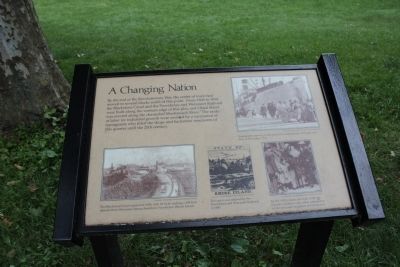
Providence has changed dramatically since its founding in 1636, from the early settlement enriched by farmland, to the town competing with Newport for trade, to the thriving capital it is today. This evolution can be evaluated through a case . . . — — Map (db m151732) HM
Members of the Afro-American community met in the vestry of this historic church in 1819 to establish the 1st African Meeting House in Rhode Island. — — Map (db m57750) HM
This memorial plaque is presented
by the
American Baptist Churches USA
to
First Baptist Church in America
Providence, Rhode Island
On the Occasion of its 375th Anniversary
1638 - 2013
Who from its founding by Roger . . . — — Map (db m122521) HM
Near this spot lived Gabriel Bernon a Huguenot Refugee
Born Larochelle France April 6, 1644
Died Providence February 1, 1736
Merchant Colonizer Churchman — — Map (db m56148) HM
In the great gale of September 23, 1815 the wind driven waters around the walls of this building rose to the level of this line. Eleven feet and one fourth inches above mean high water — — Map (db m245626) HM
Upon this corner stood Sabin Tavern in which on the evening of June 9th 1772 the party met and organized to destroy the H.R.M. schooner Gaspee, in the destruction of which was shed the first blood in the American Revolution. — — Map (db m56292) HM
In honor of Luigi Scala Grand Venerable, Order Sons of Italy 1934 — 1971 Editor, bank president, counselor to immigrants, Italian historian, radio commentator, a man of rare culture and learning. He nobly furthered love for America . . . — — Map (db m193070) HM
From this armory there went for service at the
front, during the War for the Union 1861-1865,
First Battery: Captain Charles H. Tompkins
Battery A • Captain William H. Reynolds
Battery B • Captain Thomas F. Vaughan
Battery C • . . . — — Map (db m122517) HM
Rhode Island and Providence Plantations Preservation Preservation & Heritage Commission
[The left half of this section has been removed and makes the section illegible]
Rhode Island Historical Society
A short distance from here . . . — — Map (db m151714) HM
Roger Williams said there was no amount of money that could have purchased Providence.
In 1636, Williams and the Narragansett tribal leaders, or Sachems, Cononicus and Miantonomo, negotiated for the land that became Providence. Together, they . . . — — Map (db m115211) HM
In the decade before the Revolutionary War, the British were enforcing revenue laws by stationing maritime law enforcement vessels in Newport Harbor and Narragansett Bay. In 1769, Newport citizens burned the British sloop in protest of violations . . . — — Map (db m151735) HM
No lapse of time • No distance of space • Shall cause you to be forgotten
Everett
Yours has the suffering been • The memory shall be ours
Longfellow
We are grateful to the ninety six thousand
Rhode . . . — — Map (db m151721) WM
A turning point in the American Revolution came in February 1780, when the King of France approved a plan to send an army to help the Americans. A French fleet carrying thousands of soldiers arrived five months later in Newport, where they spent . . . — — Map (db m189624) HM
Welcome to the birthplace of religious freedom in the United States. Roger Williams, fleeing religious persecution in England and Massachusetts Bay Colony, founded Providence here in 1636. The original inhabitants, the Narragansett and Wampanoag, . . . — — Map (db m115217) HM
Built by publisher John Carter in 1772 to house the printing press of the Providence Gazette, the post office and a bookshop as well as Carter's growing family, this is one of the oldest three-story structures in Providence. So named for the . . . — — Map (db m56034) HM
Battery A R.I.N.G.
Mexican Border
June 28 - October 10 1916
———————————
1917 • YD • 1919
World War I
103rd Field Artillery
26th, Yankee Division, A.E.F.
In . . . — — Map (db m122515) WM
For gallant conduct at Petersburg, VA
April 2, 1865
SGT Archibald Malbourne • SGT John H. Havron
CPL James A. Barber • CPL Samuel E. Lewis
PVT John Corcoran • PVT Charles D. Ennis
PVT George W. Potter
Dedicated by the
Providence Marine . . . — — Map (db m122516) WM
In the 1700's, the open shoreline on the west side of the street gradually filled with shops and houses. Stores backed onto the cove and often had docks extending into the water for easy loading of wares in the flourishing colonial trade. Between . . . — — Map (db m76655) HM
Market Square and the Weybossett Bridge became the head of navigation in the Old Harbor with the construction of a fixed type bridge in 1816. Ships docked along the northern portion of South Water Street (now Memorial Park) and were serviced from . . . — — Map (db m151741) HM
Founded by
Roger Williams
A.D. 1638
The oldest
Baptist Church
in America
The oldest church in this state
This meeting house erected
A.D. 1773 — — Map (db m56032) HM
The First Baptist Meeting House is locate one block east of this bridge at 75 North Main Street. Founded in 1638 by Roger Williams, the First Baptist Church is the oldest Baptist congregation in America and has held continuous services since . . . — — Map (db m151712) HM
Saint Johns Lodge Number One
F. & A. M. of Providence
Added and used third story of
this building
Dedicated by Grand Master Jabez Brown
December 27, 1797
Meeting Place of
The most Worshipful Grand Lodge
F. & A. M. of Rhode Island . . . — — Map (db m193110) HM
adapted from The Civic and Architectural Development of Providence by John Hutchins Cady
Just to the north of where you are now standing the first bridge across the Providence River was erected in 1660, connecting the shore of the Neck with . . . — — Map (db m56466) HM
The hurricane of September 21, 1938 driven by a wind velocity of 95 M.P.H. caused tidal waters to reach a new level as indicated below. 13 feet 8 1/4 inches above mean high water. One foot eleven and one fourth inches higher than previous record . . . — — Map (db m245624) HM
Top Marker The Hurricane of September 21st 1938 driven by a wind velocity of 95 MPH max caused tidal waters to reach a new level as indicated below
13 feet 8½ inches
above mean high water
one foot eleven and one fourth inches higher . . . — — Map (db m56293) HM
Erected 1773 • Joseph Brown • Architect
John Hutchins Cady • Architect of the alteration • 1950
The City of Providence, by deed signed by Mayor Dennis j. Roberts dated May 27, 1948, transferred this building to the School for its . . . — — Map (db m222497) HM
This building was erected in 1769 as a public school house by the town and proprietors.
Occupied by Brown University in 1770.
One of the four first free public school buildings in 1800.
Occupied by a school for colored children for . . . — — Map (db m56049) HM
Forced worship stinks in God's nostrils.
Roger Williams, in a letter to Connecticut
Governor Thomas Prence (1670)
The steeple in front of you is the First Baptist Church in America, gathered by Roger Williams in 1638. Williams was . . . — — Map (db m122503) HM
If this building could speak, it would tell the remarkable tale of a city’s transformation.
The Antram-Gray House, the oldest surviving commercial building in Providence, was built around 1730 as a residence and distillery.
It soon found . . . — — Map (db m107736) HM
By this memorial the city of Providence commemorates the loyal courage and fidelity of all her citizens who served in the World War whose high example still summons us to love and serve our country — — Map (db m56294) HM
The rivers in Providence, 14 years after Roger Williams founded the city, were crossed by fording at low tide.
As time passed, some of the long narrow house lots became streets named after the owners of the lots. The stream ending in Mile . . . — — Map (db m222677) HM
The first bridge across the Providence River was 40 years old by this time. The first wharf was built behind Towne Street (later named South Main Street). The center of town was established in what is now called Moshassuck Square. — — Map (db m222679) HM
The First Baptist Church in America relocated to its present site. Market House and University Hall were five years old. "Weybosset" Bridge had been rebuilt and a ferry boat operated from Cowpen Point. Many more wharfs appeared behind Towne Street . . . — — Map (db m222711) HM
Wharfs began to develop on the west side of the river. Shipping and commerce caused the center of town to move south and across the river.
The merchant fleet had grown to 120 ships and surpassed Newport's. John Brown's East India trade fleet . . . — — Map (db m222710) HM
A second bridge spanned the river. A causeway across the northern part of the Cove created a turning basin for the new Blackstone Canal. More wharfs and quays appeared on the west side of the river. The wharfs on the east side, destroyed by the . . . — — Map (db m222684) HM
In 1843, Weybosset Bridge was widened. The Blackstone Canal could not compete with the railroads and was abandoned after only 20 years of use. By 1847, the railroads were firmly established and the shipping industry began to decline. A cove basin . . . — — Map (db m222686) HM
1873 With the building of the Crawford Street Bridge, the "World's Widest Bridge" was created. A fire station and trolley depot were also constructed over the river. By 1897, the Cove Basin had been filled in to make space for a larger . . . — — Map (db m222691) HM
1982 Forty-two years had passed since the last bridge had been built over the river and nearly a century had lapsed since the Cove Basin was filled in by the railroad. The Capital Center Railroad Relocation Project started . . . — — Map (db m222693) HM
In 1906, the Soldiers and Sailors Monument was moved to the center of Exchange Place, half way between City Hall and the rising Federal Building. Debate over Exchange Place continued until 1912, when the City Council approved creation of the . . . — — Map (db m222717) HM
1846 Great Salt Cove is partially filled, beginning the transformation from water to land transportation in what is now Kennedy Plaza.
1848 Union Passenger Rail Station is completed and Exchange Place is christened. . . . — — Map (db m222718) HM
The Great Salt Cove, a tidal pond, once filled the area that has become, over the past 160 years, the city's center for transportation, civic life, and commercial activity. Formed between 3800 and 2700 years ago, it was a major Native American . . . — — Map (db m222721) HM
Though uninhabited on the eve of its settlement by Europeans, this area already had a 7000 year history of activity by native Americans. In 1636, this land was the low, marshy shoreline of a large saltwater cove to the west, along the eastern side . . . — — Map (db m56175) HM
…at last to proclaim a true and absolute Soul-Freedom to all the people of the land impartially, so that no person be forced to pray nor pay, otherwise than as his Soul believeth and consenteth.
Roger Williams, from Butler's . . . — — Map (db m115209) HM
In 1636, Roger Williams bought land from the Narragansett chiefs and established a colony here near the site of a fresh water spring. Naming the town for God's providence to him, Williams declared the settlement a shelter for the persecuted of all . . . — — Map (db m56176) HM
Abraham
Lincoln
On February 28,
1860, spoke in
Railroad Hall
located on
this site.
The previous night he had delivered his famous address at Cooper Union in New York. To please New England supporters and to visit his son Robert . . . — — Map (db m222620) HM
In the 18th century the west side of the Providence River, now Downtown Providence and the Financial District, was known as the Weybosset Side after the name of its first street. With the dawn of the 19th century, development surged on the . . . — — Map (db m151701) HM
In 1959, Annye came to Providence from Montgomery, Alabama. She'd answered an advertisement in the newspaper, placed by an East Side widower who was looking for a live-in caretaker for his children.
On this spring evening, ready to have her . . . — — Map (db m151645) HM
The junction of five Native American trails once occupied this stretch of North Main Street, between College Street and the Y-intersection at Mill Street. The Narragansett Trail or Pequot Path, as well as the Louquassuck, Pawtucket, Wampanoag, . . . — — Map (db m223303) HM
Umberto (Bert) Crenca is a multidisciplinary artist with long exhibition and performance history. His work appears in the permanent collections of the Rhode Island School of Design and Newport Art Museums, and in numerous private collections in . . . — — Map (db m222623) HM
Arthur is a Brooklyn native who is currently based in Providence's Oineyville neighborhood. His art has typically been portrait focused, but in the wake of the pandemic and protest movement in 2020, he began working on public murals, using the . . . — — Map (db m222624) HM
Organized in 1743 under the leadership of Joseph Snow Sr. as ruling elder. First minister Rev Joseph Snow Jr. 1743-1793. Original meeting house built on this site 1744-6. Present building dedicated in 1810. Vestry and Chancel remodeled and present . . . — — Map (db m56338) HM
As a young child, my love for cooking was born from my favorite babysitter, Julia Child. This would begin the love I have for cooking and the restaurant business to this day.
At 15 years old I found myself washing dishes at a popular late . . . — — Map (db m222627) HM
This area was historically important for its role in maritime commerce and whaling from the 1780s through the 1890s. Waterfront shipping activities continued as late as the 1930s. The land you are standing on now is entirely manmade and was once . . . — — Map (db m222626) HM
In 1830, the area around you was bustling with activity that dramatically changed the landscape of the Blackstone Valley. The Blackstone Canal, across Canal Street from where you stand, was an economic lifeline. The canal linked Providence's . . . — — Map (db m122505) HM
Look around you. Along the west side of Empire Street, where you can see a small park and office building today, you would have found the center of Providence's Chinese community, who settled in tenements here in the 1890s.
Although Chinese . . . — — Map (db m223032) HM
This monument commemorates the members of the 1st Rhode Island Regiment and the 14th Rhode Island Regiment Heavy Artillery (Colored) who fought and died in the War of the Rebellion — — Map (db m222297) HM WM
The area that would become Providence's West Side, including Central Wharf, was former tidal marshlands on the west side of the Providence River. Native Americans used the area as hunting and fishing grounds before Roger Williams' arrival in . . . — — Map (db m222612) HM
This plaque commemorates the one-hundredth anniversary of Ireland's 1916 Easter Rising. During that armed insurrection in Dublin and other parts of the country, against British colonial rule, Ireland was proclaimed a sovereign, independent . . . — — Map (db m151749) HM
In 1998 the Woonasquatucket River was designated by President Clinton as one of 14 American Heritage Rivers. The river has contributed mightily to the historic and industrial legacy and growth of the City.
The Environmental Protection . . . — — Map (db m222675) HM
Originally the U.S. Courthouse
Constructed 1908
Clark and Howe, Architects
Entered on the National Register of Historic Places, April 13, 1872. This property makes a significant architectural contribution to the nation's cultural . . . — — Map (db m198175) HM
Established 10 April 1821 at Westminster and Union Streets.
Third Sanctuary dedicated, 20 November 1872.
Founding member, Rhode Island State Council of Churches, 1937.
Organizing member, Providence Intown Churches Association, 1974. . . . — — Map (db m151643) HM
When we secured our most high-profile location yet for our mural program, we wanted an equally high-profile artist to paint it. Baltimore-based Gaia is an internationally renowned street artist who has created large-scale works in cities around the . . . — — Map (db m223019) HM
Dedicated to Rhode Island service members who made the ultimate sacrifice during operations in support of the Global War on Terrorism since September 11, 2001
Sgt. Gregory A. Belanger, Army Reserve •
SSg. Joseph Camara, Army National . . . — — Map (db m222488) WM
Roger Williams died in Providence early in 1683, and was buried with a simple ceremony behind his home, near today's intersection of Benefit St. and Bowen St. Remains at the site were exhumed in 1860 and removed to the Old North Burying Ground. In . . . — — Map (db m56154) HM
Originally the U.S. Custom House
Constructed 1856
Ammi B. Young, Architect
Entered on the National Register of Historic Places, April 13, 1972. This property makes a significant architectural contribution to the nation's cultural . . . — — Map (db m222616) HM
If this were the year 1828 you could climb aboard the barge Lady Carrington and travel by water all the way to Worcester.
It was October 8, 1828 and the Blackstone Canal had opened for passenger and cargo service between Providence and Worcester. . . . — — Map (db m56470) HM
Lionel Smit's Morphous is an exploration of hybrid identity and its ever-changing nature within South Africa's social landscape and evokes a question of time, of past and future, and the balance point at which his country found itself at the . . . — — Map (db m222294) HM
During the early history of Providence, hurricanes were known as gales. The first recorded gale occurred on the night of October 24, 1761. A hard gale brought the highest tide into the harbor of Providence that had been known in the memory of man . . . — — Map (db m151702) HM
Rhode Island's Tribute to
Major Henry Harrison Young
for valor, during the Civil War,
1861 - 1865.
Major Second R.I. Volunteers Inf'.
Brevet Lieut. Col. U.S. Vols.
Chief of Scouts to Gen. Sheridan.
The site of an 18th century seaport village where seafaring merchants participated in the African slave trade. In the 20th century this port was used by Cape Verdeans who came to live in America. — — Map (db m233864) HM
1600s
Imagine you are here in 1636, when Providence looked very different.
Providence Harbor was full of ships, an active hub for fishing and trade. It played an important role as the city grew.
1700s
In the 1700s, the . . . — — Map (db m151649) HM
These rivers were named by the Narragansett & Wampanoag peoples before Roger Williams came to Rhode Island. Woonasquatucket means "The River Where the Tide Ends". Moshassuck means "The River Where the Moose Water". — — Map (db m223078) HM
On this site Providence R.I. July 5th 1999 in conjunction with the 22nd general Synod of the United Church of Christ a group of church and community people gathered in an act of repentance for African American slavery and in celebration of human . . . — — Map (db m56283) HM
Rise of the Gangways
1704-1844
Providence was transformed in the 1700s from a rural hamlet to a seaport busily trading with other colonies, England, the West Indies and Africa. Tall masted ships docked as far north as Hall's Wharf (now . . . — — Map (db m151724) HM
History
During the late 1970's, planners began to focus on some of the longstanding urban design issues in Downtown Providence. Elevated railroad tracks and parking lots divided Downtown from the State House and Smith Hill. The . . . — — Map (db m151743) HM
Upriver from this place, the granite-clad pedestrian bridge marks the beginning of the original Providence River Relocation Project, which extends 1½ miles around the Financial District, then west to Waterplace and the Providence Place Mall. . . . — — Map (db m151746) HM
148 entries matched your criteria. The first 100 are listed above. The final 48 ⊳