705 entries match your criteria. The first 100 are listed. Next 100 ⊳
Lewis & Clark Expedition Historical Markers
Sent by Jefferson to explore the far west, the Corps of Discovery left Pittsburgh August 31st, 1803 and reached the mouth of the Columbia River in the Pacific Northwest on November 15th, 1805.
The Lewis & Clark Expedition was accomplished by Captain Meriwether Lewis, Captain William Clark, and their fellow explorers, and was the visionary journey of President Thomas Jefferson. The journey was to become one of America’s greatest . . . — — Map (db m91477) HM
As an infant in 1805, he accompanied his parents Toussaint Charbonneau and Sacagawea, as they guided the Lewis & Clark Expedition. He lived along the American River Canyon, at Murderer’s, Buckner’s, Rattlesnake & Manhattan Bars between 1848 and . . . — — Map (db m44067) HM
Born, Charlestown, N.H. Aug. 24, 1778; Died Franklin, Mar. 6, 1865 Last surviving member of the Lewis and Clark Expedition. He kept a journal and gave valuable service as a gunsmith. — — Map (db m10520) HM
Somewhere in the adjacent cemetery lies the unmarked grave of Peter Pond, a veteran of the French and Indian War, fur trader, explorer and cartographer born in Milford. He helped organize expeditions west of the Great Lakes. He became . . . — — Map (db m54721) HM
Lewis & Clark Expedition
1803
President Thomas Jefferson picks Meriwether Lewis to
explore Louisiana Purchase and unknown spaces west
of the Mississippi River. Q
Lewis picks former army comrade William Clark to
share . . . — — Map (db m198633) HM
Sacajawea and Pomp
Sacajawea was a Lemhi Shoshoni Indian born near Salmon, Idaho around 1790. She was the only Idaho native, and the only female, to be a member of the famed Lewis and Clark "Corps of Discovery" expedition that opened up the . . . — — Map (db m73205) HM
You are nearing the junction of historic Highway 11, now designated as Gold Rush Historic Byway.
Winding its way through spectacular scenery, it passes through the traditional homeland of the Nez Perce Indians on the Weippe Prairie and the National . . . — — Map (db m109758) HM
The brass monument nearby is provided by the Idaho Society of Professional Land Surveyors in cooperation with the National Geodetic Survey to commemorate the “Lewis and Clark” Corps of Discovery campsite at Canoe Camp, Idaho.
. . . — — Map (db m110468) HM
Lewis and Clark called this place Canoe Camp.
For 11 days in 1805 the Corps of Discovery camped here in the company of Nez Perce while building five canoes for the journey to the Pacific.
For thousands of years before that, this riverbank was . . . — — Map (db m110465) HM
Guided by Twisted Hair and several other Nez Perce, Capt. William Clark selected this as a camp site because of the many large ponderosa pines that grew here then. The canoe makers chopped out small portions of the pine logs, then used fire or . . . — — Map (db m109875) HM
Welcome to
Canoe Camp
One of 38 sites of Nez Perce National Historical Park
These grounds have been inhabited for thousands of years by the Nez Perce people, but are best known as the place where the Lewis and Clark . . . — — Map (db m109872) HM
After more than a month’s search, they finally had reached a westward river where they could use canoes.
From here they continued another 16 miles with their pack horses before they found a campsite with trees suitable for making canoes.
But at . . . — — Map (db m109757) HM
Low mounds and depression in the ground here give only the faintest impression of villages that stood on both banks of the river. These are the remains of pit houses, built 1,500 to 2,000 years ago. Imagine the scene then: people spearing fish, . . . — — Map (db m109876) HM
After the hardships of the mountain passage, the Weippe Prairie was a place of relief for the Corps of Discovery. The Nez Perce befriended them and renewed their hope of reaching the Pacific Ocean.
"the pleasure I now felt in having tryumphed . . . — — Map (db m121438) HM
The brass monument nearby is provided by the Idaho Society of Professional Land Surveyors to commemorated the "Lewis and Clark" Corps of Discovery campsite near Weippe Prairie, Idaho.
Datum NAD 83 and NAVD88
Latitude N 46º21' 00" Latitude . . . — — Map (db m121581) HM
I Set out early and proceeded ... to a Small Plain in which I found maney Indian lodges ... I met 3 Indian boys, when they saw me they ran and hid themselves. -- Capt. William Clark, September 20, 1805
After Lewis and Clark's Corps of . . . — — Map (db m121582) HM
In late September of 1805, three young Nez Perce spied several men dressed in strange clothes and hats coming from the ridge to the southeast. The boys hid, but the men discovered two of them in the area behind this sign. The boys led these men to . . . — — Map (db m232854) HM
Journeying toward the Clearwater, 6 men under Clark met the Nez Perce Indians not far from here, September 20, 1805.
Clark first saw 3 frightened Indian boys who hid in the grass. Finding two, he reassured them with small presents and "Sent . . . — — Map (db m121439) HM
This marker was dedicated
1957
to commemorate the arrival of the Lewis and Clark Expedition at Weippe Prairie, Idaho, Sept. 23, 1805. Also to honor the memory of Dr. J.T. Moser who pioneered here in the 1890's and to honor the memory of his . . . — — Map (db m121440) HM
Welcome to Weippe Prairie
This has always been a traditional gathering place for the Nez Perce people where camas bulbs are harvested and baked each year. The blue flower of the camas lily grow so thick here in the spring time that from . . . — — Map (db m121610) HM
On May 31, 1806, Sgt. John Ordway and Pvts. Frazer and Weiser began the return trip from Lewis’s (sic) River (Snake River) with salmon for Camp Chopunnish (Kamiah). The men crossed the Camas Prairie near here on their way to rejoin the Corps . . . — — Map (db m121141) HM
The Lewis and Clark Expedition passed through the valley of Hungery Creek in late September 1805, and on their return journey in late June, 1806. Five of the party's campsites are located in this valley to the south. Here you can see the extent of . . . — — Map (db m140826) HM
Arriving here in late September 1805, Captain Lewis and a contingent of the Corps of Discovery were cold and hungry. Wearing only worn moccasins, they had struggled over rough, hilly terrain. Climbing over fallen trees and through log strewn creek . . . — — Map (db m140834) HM
On June 17, 1806, the Lewis and Clark Expedition left their camp in Hungery Creek to ascend into the mountains. The party encountered deep snow at the top of the ridge and was forced to turn back. Captain Lewis wrote, "...this is the first time . . . — — Map (db m140829) HM
In June 1806, the Lewis and Clark Expedition members were in good spirits as they began their journey home over the Lolo Trail. Although the men were well fed, rested an had 66 horses to ride and carry their gear, the trails were still very slippery . . . — — Map (db m140832) HM
"The country is thickly covered with a very heavy growth of pine of which I have ennumerated 8 distinct species." Capt. Meriwether Lewis, September 19, 1805
The landscape today may look very similar to the one Lewis and Clark described, . . . — — Map (db m140828) HM
(Three panels outline the history of Tolo Lake)
The Nez Perce name for this lake is Tipahxlee’whum (Tepahlewam or Split Rocks). In early June 1877, five bands of Nimiipuu gathered here for their last taste of freedom before . . . — — Map (db m121267) HM
In May and June, they camped across the river from present-day Kamiah near the railroad bridge.
With their Nez Perce friends, they hunted, traded and played games.
They showed the Nez Perce “the power of magnetism, the spye glass, compass, . . . — — Map (db m109771) HM
Look north to the ridgeline behind you and see what Lewis and Clark and the Corps of Discovery faced on the morning of September 15, 1805. At 7 a.m. the Corps left their Colt Killed Camp near what is now the Powell Ranger Station.
Hoping for a . . . — — Map (db m123161) HM
President Thomas Jefferson, driven by a life-long passion for scientific exploration and study, instructed Meriwether Lewis to record details about the flora, fauna, geology and people of the land between the Missouri River and the Pacific Ocean. As . . . — — Map (db m123162) HM
In September of 1805 and again in June of 1806, Lewis and Clark traveled and mapped this area.
Their purpose was to explore the land, communicate with the Indians and establish the claim of the United States to the vast Pacific Northwest.
. . . — — Map (db m110304) HM
(Four historical panels are located at the kiosk:)
The Lewis and Clark Expedition
The Lewis and Clark expedition known as the Corps of Discovery, passed through this area in September and October of 1805, on its way to find . . . — — Map (db m121344) HM
Route of September 15, 1805.
The Lewis and Clark Expedition passed through this area on their westward journey following a route used by the Indians to reach Salmon fishing grounds in the Lochsa River. The Indian trail they were following left . . . — — Map (db m123215) HM
Captain Lewis recorded on June 29, 1806: "...at noon we arrived at the quamas flatts (sic) on the Creek of the same name and halted to graize (sic) our horses and dine having traveled 12 miles. We passed our encampment of the (13th) September at 10 . . . — — Map (db m123219) HM
Over one and one-half centuries have passed since Lewis and Clark crossed the Bitterroot Mountains.
This country was then a vast, challenging wilderness.
Immediately across the river from you, at this point, is the Selway – Bitterroot . . . — — Map (db m110320) HM
(This marker is composed of two panels and is presented here as if the panels were joined.)
The land today looks much the same as it did to Lewis and Clark. Today, as stewards of this beautiful land, we have an opportunity to leave a . . . — — Map (db m123213) HM
38 ► Idaho, Idaho County, Lolo — 334 — Lolo Trail Crossing — When Lewis and Clark came up this ridge June 29, 1806 — they ran into "a shower of rain, with hail, thunder and lightning, that lasted about an hour" —
But they got out of deep Lolo Trail snow after they reached Rocky Point (directly across from here) and descended to Crooked Fork, below this turnout.
They reported that then they “ascended a very steep acclivity of a mountain about 2 . . . — — Map (db m109787) HM
On their westbound journey, Lewis and Clark crossed here, September 15, 1805 after camping 4 miles upstream at Powell.
Their Shoshoni guide had brought them down an old trail from Lolo Pass to a Lochsa fishery he knew about. To continue west, . . . — — Map (db m109782) HM
The Lewis and Clark party crossed this pass Sept. 13, 1805, westbound for the Pacific after a long detour to the south.
From the headwaters of the Missouri they had crossed the mountains to the Salmon. Finding that river impassable, they traded . . . — — Map (db m27120) HM
The Lewis and Clark Expedition passed this site in late September, 1805. On their return journey in June 1806, they camped on the open hillside. The party has been traveling on top of several feet of snow in most areas so the grassy feed found here . . . — — Map (db m140792) HM
"...This trail so old it used from time of creation by Nez Perce people to go to Montana to hunt Buffalo and some time to war other tribes of Indians, when Red Bear come to Indians Post Office on this trail, he tell Lewis - Clark and all, stop . . . — — Map (db m140783) HM
Aided by six Nimiipuu (sic) (Nez Perce) guides, the Lewis and Clark Expedition moved quickly across the Lolo Trail in June, 1806. Even though the snow was nearly seven feet deep on most to the trail, the party was able to find their way.
Smoking . . . — — Map (db m140789) HM
1866 - Gold discovered at Leesburg by Elijah Mulkey, Wm. Smith, F.B. Sharkey, Jos. Rapp, & Ward Girton.
Mining has continued in Lemhi Co. with production of $30 Mil. in gold & nearly $35 Mil. in copper, lead, tungsten, silver, etc. 63 . . . — — Map (db m109670) HM
Leading packhorses, the Lewis and Clark Expedition followed their Shoshone guide Toby up Tower Creek on August 31, 1805. The Indian road went northwest from here across the foothills to the North Fork of the Salmon.
Behind the Corps of . . . — — Map (db m123682) HM
"On August 21, 1805, Captain Clark and party camped near this spot. Clark wrote "crossed the river and went over a point of high land and struck it again near a bluff on the right side...those two men joined me at my camp on the right side below the . . . — — Map (db m123673) HM
Clark's "Pirimids" are lessons in erosion and deposition. Looks closely at the columns to see layers of sediment: sandstone, gravel, and larger rocks that were eroded from ancient hills and deposited in valleys millions of years ago. Time and . . . — — Map (db m123683) HM
Sept. 2, 1805 Lewis and Clark proceeded with much difficulty up the North Fork, they camped on the west side of the river in this vicinity. Clark wrote "...we were obliged to cut a road, over rocky hill Slides where our horses were in peteal danger . . . — — Map (db m59864) HM
On their way north searching for a route over Idaho's mountain barrier, Lewis and Clark left this canyon and ascended a high ridge to reach Bitterroot Valley, September 3-4, 1805. No Indian trail came this way, but Tobe, their experienced Shoshoni . . . — — Map (db m59798) HM
Two adjacent markers which complement each other are treated as one marker.
Lost Trail Pass
“hills high & rockey on each Side, in the after part of the day the high mountains closed the Creek on each Side and . . . — — Map (db m109641) HM
This marker consists of three panels: one map and two historical. Before the Roads
Shoshone Homeland
Native Americans were the first to travel over this rugged country. Most of the year they spent traveling from place . . . — — Map (db m109403) HM
The historic Lewis and Clark Expedition travelled along this river in 1805. As the first white men to document this region, their maps, diaries, and encounters with different cultures forever changed the western landscape.
Cold, wet and hungry, . . . — — Map (db m59754) HM
In commemoration of
Old Toby
the Shoshone Indian
who guided the Lewis & Clark expedition from the Salmon to the Bitterroot Valley after he had shown Captain Clark that the Salmon River Canyon was impassable. Old Toby served this famous . . . — — Map (db m59632) HM
Clark explored the first few miles of the rugged canyon of the Salmon below here late in August 1805. His small advance party camped here with poor but friendly Indians. Clark reported that the Salmon "is almost one continued rapid," and that . . . — — Map (db m59847) HM
Three panels make up this marker.
Salmon River Encounter
... a Small river at the mouth of Which Several families of Indians were encamped and had Several Scaffolds of fish & buries drying we allarmed (sic) them verry . . . — — Map (db m109645) HM
After crossing the Continental Divide southeast of here, Aug. 12, 1805, Lewis camped with a Shoshoni band near here, Aug. 13-14.
Lewis had to obtain Indian horses so his men could get from the upper Missouri to a navigable stream flowing to . . . — — Map (db m109599) HM
Born in the Lemhi River Valley around 1788, Sacajawea, an Agaidika Shoshone, was the only female member of the Lewis and Clark "Corps of Discovery". She joined the expedition at the Knife River Mandan Village in North Dakota and traveled to the . . . — — Map (db m109671) HM
Returned to her homeland in this valley in 1805 as an interpreter for Lewis and Clark when they explored these mountains.
When she was only about 14 years old, she had been captured by Indians in Montana, where her people were out hunting . . . — — Map (db m109600) HM
Inscribed on his collar:
"The greatest traveler of my species. My name is Seaman, the dog of Captain Meriwether Lewis, whom I accompanied to Pacifick Ocean through the interior of the continent of North America."
This statue is . . . — — Map (db m59654) HM
Captain Clark, after viewing the Continental Divide on August 22, 1805, remarked, “… we set out early passed a small creek on the right at 1 mile and the points of four mountains verry steep, high, and rockey. The assent of three was so steep . . . — — Map (db m109666) HM
Sixty million years ago, you wouldn't have recognized this place. There were no high mountains, no deep canyons. Streams meandered through a landscape of broad valleys and low hills that may have resembled Kentucky's Cumberland Valley.
The rocks, . . . — — Map (db m109669) HM
Near this site, on August 20, 1805, the Lewis and Clark Expedition first contacted waters flowing to the Pacific assuring the success of their efforts and guaranteeing title to the Northwest for the United States of America. They camped here, . . . — — Map (db m109587) HM
William Clark's reconnaissance party camped here on their way down the Salmon River on August 21. They returned on the 25th, convinced that the canyon was impassable. Clark's hunters saw deer and elk, but not close enough to chance a shot.
"Old . . . — — Map (db m109668) HM
Filling in the Blanks
The maps of North America carried by Lewis and Clark showed only a vast, uncharted space between the Mandan villages of the Missouri Rier and the Pacific Coast. The mountains separating the Missouri and Columbia . . . — — Map (db m109507) HM
Two days before reaching the Continental Divide, Meriwether Lewis speculated that the Columbia River would not have the same moderate character as the Missouri.
“I do not beleive (sic) that the world can furnish an example of a . . . — — Map (db m109542) HM
First Taste of the Columbia
"we proceeded on to the top of the dividing ridge from which I discovered immence ranges of high mountains still to the West of us with their tops partially covered with snow. I now decended the mountain . . . — — Map (db m109543) HM
High Point of the Journey
"thus far I had accomplished one of those great objects on which my mind has been unalterably fixed for many years.," wrote Meriwether Lewis, 456 days after setting out from St. Louis.
Lewis, George . . . — — Map (db m109504) HM
On Monday August 12, 1805, Lewis,with three men as an advance party, crossed the Lemhi Pass and spent their first night in Idaho near this spot. Lewis wrote, "...after a short halt of a few minutes we continued our march along the Indian road which . . . — — Map (db m109545) HM
The salmon runs that fed the Lemhi Shoshone in summer had almost ended: it was time to leave for the fall buffalo hunt on the Missouri River. Cameaghwait and his people would hunt with their allies, the Montana Salish, for mutual defense against . . . — — Map (db m109440) HM
Who passed this way?
In August of 1805 members of the Lewis and Clark Expedition and Shoshone Indians crossed Lemhi Pass six times in 15 days.
• Monday, the 12th --- Lewis, McNeal, Drouillard & Shields --- headed west
• . . . — — Map (db m110838) HM
Cameahwait's band of 400 Lemhi Shoshone dried berries, seeds, roots, and salmon in summer, but it was not enough. To survive the long winter, they would need about fifteen tons of bison jerky. The fall bison hunt in Montana was risky because enemies . . . — — Map (db m109582) HM
After crossing through Lemhi Pass, 12 miles east of here, Lewis unfurled the American flag for the first time west of the Rockies.
Meriwether Lewis met with 3 Shoshoni Indians near here on August 13, 1805. "....leaving my pack and rifle I . . . — — Map (db m109409) HM
Captain Meriwether, interpreter George Drouillard, and privates Hugh McNeal and John Shields crossed Lemhi Pass on the afternoon of August 12, 1805. The Indian road they were traveling climbed north out of the narrow Agency Creek Canyon at the foot . . . — — Map (db m109581) HM
When Lewis learned that Clark had found the Salmon River un-navigable, buying more horses became a top priority. He'd already bought fifteen, but he needed twice that many to carry the Expedition's baggage.
But enemy raiders had stolen many Lemhi . . . — — Map (db m109441) HM
The Corps of Discovery were the first U.S. citizens to reach the Northwest by land, strengthening the American claim established in 1792 when mariner Robert Gray discovered the Columbia River.
When Lewis unfurled the Stars and Stripes, he made . . . — — Map (db m109463) HM
Lewis and Clark fans love the sturdy the overland portion of the Trail in Montana and Idaho. There's little question about the route on the Missouri or Columbia rivers, but the mountains present challenges to explorers then and now.
The evidence . . . — — Map (db m109478) HM
(Two panels share a common support.)
Meriwether Lewis identified, described and collected plants that were new to science and observed how the Shoshone used local plants. These species can be found in this area:
• Syringa or Mock . . . — — Map (db m109584) HM
Lewis and Clark gave Sacajawea a miracle: a return home for the first time since her kidnapping several years earlier. She gave them as much: a Lemhi Shoshone interpreter and an advocate for the Expedition in buying Lemhi horses.
It was a . . . — — Map (db m109445) HM
There were many heroes in this band of intrepid explorers, there was but one heroine. Denied in life and after that recognition which was due her, it is fitting that we meet here today to dedicate this spot in honor of that heroine." R.F. . . . — — Map (db m109482) HM
On May 27, 1806, Sgt. John Ordway and Pvts. Frazer and Weiser were dispatched from Camp Chopunnish (Kamiah) to Lewis’ River (Snake River) to obtain salmon. Guided by Nez Perce Indians, the men crossed the Camas Prairie near here. On May 29, at a . . . — — Map (db m121213) HM
The Lolo Trail winds its way along ridges of the Bitterroot Mountains from the Weippe Prairie in Idaho to the Bitterroot Valley at Lolo Montana.
This ancient travel route had served as a “Land Bridge” for a continental trade system used . . . — — Map (db m109776) HM
This park links a series of widely separated sites of deep significance to the Nez Perce – historic villages, battlefields, and legend sites.
The park experience involves a journey across both time and territory.
Although firmly . . . — — Map (db m109994) HM
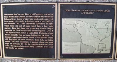
The Corps of Discovery reached the confluence of the Snake and Clearwater Rivers on October 10, 1805.
In his map of the site, William Clark included a small island he observed “at the point of union” of the channels.
The island . . . — — Map (db m110632) HM
No Tents?
By the time members of the Lewis & Clark Expedition reached the Snake River, their night-time shelter consisted of buffalo robes and other skins.
They left St. Louis with tents of oiled canvas, but by the summer of 1805, those . . . — — Map (db m110578) HM
Seasonal Migrations
The Nimi’ipuu migrated throughout the region of the Snake River and its tributaries.
They traveled seasonally to take advantage of the food sources: camas bulbs, berries, deer, elk, bear, and salmon.
Their mobility . . . — — Map (db m110541) HM
”This river is remarkably clear and crowded with salmon in maney places…
Salmon may be seen at the depth of 15 or 20 feet…
The number…
Is remarkable to say.”
~Captain Wm. Clark
The Nimi’ipuu relied upon . . . — — Map (db m110687) HM
Lewis and Clark camped on the North Bank of Lewis's or Snake River October 10, 1805
Erected October 1955
by Alice Whitman Chapter D.A.R. — — Map (db m23267) HM
The first white men to cross this country and reach the Pacific Ocean via Lolo Pass and present site of Lewiston. They came and returned the way that leads you are now on the Lewis and Clark Highway along the Clearwater River - the . . . — — Map (db m121815) HM
“…one canoe in which Sergt. Gass was Stearing
And was nearle turning over, she Sprung
A leak or Split open on one side and
Bottom filled with water & Sunk on the rapid…”
~Captain Wm. Clark,
October 8, . . . — — Map (db m110634) HM
Petroglyphs
The earliest ‘writings’ along the Snake River were petroglyphs carved into the rocks.
At the Buffalo Eddy and Captain John sites, located 20 miles upriver from here, some of the petroglyphs are four to six thousand years . . . — — Map (db m110688) HM
In November, 1803, Meriwether Lewis and William Clark and their growing contingent of "Corps of Discovery" men, spent five days here teaching each other celestial navigation and surveying skills. Using a sextant, octant, artificial horizon, and . . . — — Map (db m19393) HM
The beginning of the Third Principal Meridian is located in the Ohio River 1,735 feet directly north of this point. In November, 1803, this was the mouth of the Ohio River. At this location, the Lewis and Clark Corps of Discovery encamped for six . . . — — Map (db m19415) HM
Charting the Confluence On November 14, 1803, at the confluence of the Ohio and Mississippi Rivers, the Corps of Discovery stayed for six days, one of the longest stops made by the expedition. Here, they saw the Mississippi for the first time, . . . — — Map (db m19413) HM
On November 14, 1803, Meriwether Lewis, William Clark and their party landed at the confluence of the Ohio and Mississippi Rivers, the site of the present day Cairo. They spent nearly a week here, learning how to determine longitude and latitude, a . . . — — Map (db m19419) HM
The Newfoundland dog who accompanied the Corps of Discovery to the Pacific and back bought by Meriwether Lewis for $20 in Pittsburgh in 1803. He was "praised much for his docility and qualifications generally for my journey". A quote by Lewis, "He . . . — — Map (db m161201) HM
The beginning of the Third Principal Meridian is located in the Ohio River 1,810 feet directly north of this point. In November, 1803, this was the mouth of the Ohio River. At this location, the Lewis & Clark Corps of Discovery encamped for six . . . — — Map (db m19420) HM
York was the first known African American to cross the American continent. In the company of the Lewis and Clark Corps of Discovery, from 1803-1806, he shared equally with them the rigors of the journey, but when the corps was honored, he received . . . — — Map (db m41063) HM
In November of 1803, Meriwether Lewis, William Clark and their party camped on the slate rock bank of the Mississippi River near here. They found moving the boats up river very difficult and traveled only about one mile per hour against the strong . . . — — Map (db m161185) HM
Lewis and Clark made their first entry into the "Illinois Country" as it was known in 1803, near this location. The primary purpose for the stop was to procure a supply of salt for their journey. Here they would have encountered the "squatters" . . . — — Map (db m155031) HM
705 entries matched your criteria. The first 100 are listed above. Next 100 ⊳