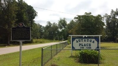
On South Autauga Street at Academy Street, on the right when traveling south on South Autauga Street.
Robert Ripley's world-wide syndicated Believe It Or Not! column for July 31, 1935 read: "C. D. Abbott is the first citizen of the U.S.A. He is first alphabetically in Autaugaville, the first town in Autauga, the first county in Alabama, the . . . — — Map (db m68839) HM
On East Sixth Street 0.4 miles east of North Northington Street, on the right when traveling west.
Known as Fair Road, Sixth Street from Northington Street to the big curve was called “Happy Hollow”. The road went to the Fair home place but also curved right, into Warren Circle. Here stood a small frame church where the congregation’s . . . — — Map (db m70800) HM
On Maple Street at Pletcher Street, on the right when traveling west on Maple Street.
The plank road was constructed of large pine logs, sawed lengthwise and laid round-side down. Daniel Pratt built the road for public benefit and to provide transportation from the Pratt Cotton Gin Factory to Washington on the Alabama River. Over . . . — — Map (db m27983) HM
The Eastern Shore Trail is a 24-mile pedestrian/bike trail from US Hwy 98 at Gator Alley in Daphne to Weeks Bay on Scenic Hwy 98. Teko Wiseman, founder of the Baldwin County Trailblazers-the organization responsible for the trail's . . . — — Map (db m128881)
By the 1750s, French colonists were living on family farms on the shores of Mobile Bay. One group of settlements, known as ‘The Village', was located here along on the bluffs of the eastern shore of the bay. The colonists raised cattle, pigs, and . . . — — Map (db m291606) HM
On Jack Springs Road at Lottie Road (County Road 61), on the right when traveling south on Jack Springs Road.
Front
Lottie has the highest elevation in Baldwin County. A ridge forms a divide where waters to the east flow into Pensacola Bay and waters to the west flow into Mobile Bay. Pine Log Creek begins in Lottie. Pine Log Ditch, used to . . . — — Map (db m122349) HM
On Orange Beach Boulevard (State Highway 161) at Catman Road, on the right when traveling south on Orange Beach Boulevard.
Transportation into Orange Beach was difficult in the early 1900’s. The First ‘real road’ into the area came through Gulf State Park. It was built about 1948, during the administration of Gov. Jim “Big Jim’ Folsom. It was called a ‘Farm to Market . . . — — Map (db m299165) HM
On Caisson Trace at Spanish Main Street, on the left when traveling west on Caisson Trace.
A trail used in early times by Indians, Spanish Explorers, French Settlers and later by soldiers during the battle of Spanish Fort 1865. At one time a stream driven train paralleled this trace. Its ancient road bed can still be seen south of this . . . — — Map (db m100877) HM
On Boatyard Road (County Road 80) 0.5 miles west of Burnt Car Road, on the right when traveling west.
The Old Federal Road
The Old Federal Road ran parallel to this present road and on the same course in many areas for centuries this was a walking path used by native Americans. In 1805, the U. S. Government negotiated with the Creek Indians to . . . — — Map (db m247489) HM
On Springhill Road north of U.S. 82, on the right when traveling north.
This stretch of road between Eufaula and the Bullock County line was reconstructed thro the initiative and assistance of Edward Trippe Comer, of Savannah, GA. Its perpetual upkeep is insured by a fund of $100,000.00 set up in trust by him in 1919. . . . — — Map (db m163247) HM
This road marks the entrance into Eufaula of Federal Troops on April 29, 1865. Lee had surrendered at Appomattox, Virginia on April 9. General Benjamin H. Grierson was advancing with four thousand cavalry from Mobile and was then about at . . . — — Map (db m82872) HM
On Dallas Loop Road 0.1 miles north of Alabama Highway 79, on the left when traveling north.
The Dallas Community in Blount County was settled in the mid-1800s
after the Second Creek War (1836-1837). Settlers built general
merchandise stores, a blacksmith shop, a Methodist Church, and
a cemetery later known as Bethlehem Cemetery. Local . . . — — Map (db m307414) HM
On State Highway 79 at Hornet Drive, on the right when traveling south on State Highway 79.
Member Constitutional Convention 1819
First Senator of Blount County
Brigadier General,
Alabama Militia
County road and court
systems organized
at his house 1820. — — Map (db m32484) HM
On U.S. 29 at County Road 19, on the right when traveling south on U.S. 29.
Built by U.S. Army engineers over the summer of 1824, Three Notch Road has served as Bullock County’s major transportation route throughout its history. It was constructed to facilitate military communication between Pensacola in Florida and Ft. . . . — — Map (db m89638) HM
On U.S. 82 at County Road 35, on the right when traveling west on U.S. 82.
Side 1
Built by U.S. Army engineers over the summer of 1824, Three Notch Road has served as Bullock County’s major transportation route throughout its history. It was constructed to facilitate military communication between Pensacola . . . — — Map (db m89637) HM
On Mobile Road (U.S. 31) 1.4 miles south of Solomon Hill Road (County Road 28), on the right when traveling south.
Early Native Americans in Butler County
Native Americans lived in the land that would become Alabama
for thousands of years before settlers arrived. They included
the Creeks, a multiethnic confederacy of tribes descended from
the . . . — — Map (db m261217) HM
On Sherling Lake Road (County Road 44) 1 mile west of Braggs Road (State Route 263), on the right when traveling west.
William Bartram, America's first great naturalist, passed through northwest Butler County in July 1775. He described the "limestone rocks" and "banks of various kinds of sea shells" left by oceans that covered this area millions of years ago, and . . . — — Map (db m120937) HM
On Fort Dale Road (Alabama Route 185) 0.3 miles north of Sherling Lake Road, on the right when traveling south.
The Federal Road and the Palings
The Federal Road was built in 1806 as a shorter route from Washington to New Orleans and the new Louisiana Territory. The road entered Alabama at Fort Mitchell, Georgia and passed through Butler County near this . . . — — Map (db m130050) HM
On East 10th Street, on the right when traveling east.
When seven injured "Freedom Riders" arrived at the Hospital on
this date, the mob that had attacked them earlier in the day
followed. The Riders were testing desegregation of public
transportation in the South by riding buses. The bus they . . . — — Map (db m106647) HM
On Albert P. Brewer Highway (State Highway 202) west of Old Birmingham Highway, on the right when traveling east.
On May 14, 1961, a Greyhound bus left Atlanta, GA carrying among its passengers seven members of the Congress of Racial Equality (CORE), a.k.a. the “Freedom Riders,” on a journey to test interstate bus segregation. The bus was met by an angry mob . . . — — Map (db m35737) HM
On East 10th Street west of Kirkwood Avenue, on the left when traveling east.
Outstanding local industrialist as President, Kilby Steel Company; Chairman, Board of Directors, Alabama Pipe Company; President, City National and Anniston National Banks. Served as Mayor of Anniston (1905-09); State Senator (1911-15); Lieutenant . . . — — Map (db m35758) HM
On Gurnee Avenue north of West 10th Street, on the right when traveling north.
Front
This was the site of the Greyhound bus terminal where on May 14, 1961, a bus carrying black and white Civil Rights Activists known as "Freedom Riders" was attacked by a mob of whites who were protesting desegregation of public . . . — — Map (db m106621) HM
Near Gurnee Avenue south of West 11th Street, on the left when traveling south.
The violence reached a crescendo when a flaming bundle of rags was thrown into one of the broken windows. Within seconds, the bundle exploded, sending dark gray smoke throughout the bus.
Three of the Riders found open windows, dropping to the . . . — — Map (db m217417) HM
Near Gurnee Avenue south of West 11th Street, on the left when traveling south.
Prelude: 12 p.m.- 12:54 p.m.
Just before this picture of the Greyhound Bus Depot at 1031 Gurnee (below left) was taken, approximately 75 men had gathered in front of it. They quickly dispersed as free-lance photographer for The Anniston Star, . . . — — Map (db m217412) HM
Near Gurnee Avenue south of West 11th Street, on the left when traveling south.
Pursuit: 1:25 p.m. - 1:35 p.m.
Heading to Birmingham, the battered bus turned south on Gurnee from the station and west on 10th St. while men rushed to their cars to follow. Police escorted the bus to the city limits where they turned back, . . . — — Map (db m217416) HM
Near Gurnee Avenue south of West 11th Street, on the left when traveling south.
Rescue
Once there, all of the injured were treated at the urging of an FBI agent on the scene. In the meantime, the crowd outside the hospital grew larger and more menacing, with some Klansmen threatening to burn the building to the ground. At . . . — — Map (db m217420) HM
Near Gurnee Avenue south of West 11th Street, on the left when traveling south.
The Ambush: 12:54 p.m. - 1:10 p.m.
The silence didn't last long. Anniston Klansman William Chappell and a screaming mob of about 50 white men surrounded the bus. An 18-year-old Klansman, Roger Couch, lay on the pavement in front of the bus to . . . — — Map (db m217413) HM
Near Gurnee Avenue south of West 11th Street, on the left when traveling south.
While the Riders awaited rescue, the bus continued to burn. The Anniston Fire Department extinguished the flames and administered oxygen. A state trooper called an ambulance, but it took Cowling to force the driver to carry the injured black Riders . . . — — Map (db m217419) HM
Near Gurnee Avenue south of West 11th Street, on the left when traveling south.
The Rides began in May 1961 when the Congress of Racial Equality (CORE) decided to test a 1960 U. S. Supreme Court ruling that outlawed segregation in depot restaurants and restrooms serving interstate passengers.
Previously, CORE had organized a . . . — — Map (db m217406) HM
Near Gurnee Avenue south of West 11th Street, on the left when traveling south.
The most famous photograph of the Freedom Rides and one of the most iconic of the Civil Rights movement was taken by a freelance photographer for The Anniston Star. Joe Postiglione, called “Little Joe” by his friends, was tipped off by the . . . — — Map (db m217422) HM
Near Gurnee Avenue south of West 11th Street, on the left when traveling south.
The Alabama Knights of the Ku Klux Klan had known about the Freedom Ride since mid-April and had detailed information on the city-by-city itinerary, thanks to FBI memos forwarded to the Birmingham Police Department. In a series of secret meetings in . . . — — Map (db m217411) HM
Near Gurnee Avenue south of West 11th Street, on the left when traveling south.
CORE leadership solicited applicants for the Ride from outside the organization as well as CORE veterans. They tried to achieve a reasonably balanced mixture of black and white, young and old, religious and secular. The only deliberate imbalance was . . . — — Map (db m217410) HM
On Noble Street at East 9th Street, on the right when traveling north on Noble Street.
1st Panel
Two busloads of Freedom Riders arrived in Alabama on Sunday, May 14, 1961, bound for New Orleans. It was an organized effort by the Congress of Racial Equality (CORE) to challenge the South's continued defiance of U. S. . . . — — Map (db m106721) HM
On Noble Street at 9th Street, on the right when traveling north on Noble Street.
Throughout the first half of the 20th century, race relations in the South were dominated by local "Jim Crow" laws. Although in 1960 the Supreme Court ruled that racial segregation violated the Interstate Commerce Act, local laws persisted. . . . — — Map (db m106605) HM
Near Gurnee Avenue south of West 11th Street, on the left when traveling south.
But the Ride didn't end. The national newspaper and television coverage of what had happened galvanized the Nashville Student Movement, which already had experience successfully challenging segregationist practices through lunch counter sit-ins, . . . — — Map (db m217421) HM
Near Gurnee Avenue south of West 11th Street, on the left when traveling south.
In Atlanta, the Riders separated into two integrated groups to board two different buses; the seven who were on the Greyhound bus destined for Anniston included:
• Albert Bigelow, 55 white male from Connecticut (a retired naval officer, . . . — — Map (db m217409) HM
Boiling Springs Road once provided a vital transportation link
across Choccolocco Creek for residents of the valley. The road
received its name from the Boiling Spring (pictured below and to
the right) located across the creek at this location. . . . — — Map (db m145023) HM
On U.S. 431 0.1 miles south of County Route 222, on the right when traveling south.
In 1885, Five Points was named because of five roads converging at a single point. Before this, the post office was known as Lystra, operated by Postmaster W.C. Smith. The town was incorporated in 1915, making the town Chambers County's oldest . . . — — Map (db m195788) HM
On Old Line Road (County Road 35) 2 miles north of U.S. 84, on the right when traveling north.
Here passed the Old Indian Trail used as a dividing line between the Choctaw and Creek Tribes.
General Andrew Jackson and his troops rested here for the night in 1813. — — Map (db m47633) HM
On Old Line Road (County Road 35) at U.S. 84, on the left when traveling south on Old Line Road.
Commences at the Cut-Off, or the first high ground in that vicinity, follows the watershed between the Alabama and Tombigbee Rivers, and ends at Choctaw Corner. Established in 1808 by the Creek and Choctaw Indians as the dividing line between their . . . — — Map (db m47628) HM
Near Natchez Trace Parkway (at milepost 327.3), 1 mile north of N. Pike (County Road 21).
This scene would have occurred far below the surface of the lake you see now. From 1802 to 1819, George Colbert operated a ferry across the quarter-mile breadth of the powerful Tennessee River. The ferry carried mail, militia, settlers, Indians and . . . — — Map (db m84705) HM
Near Natchez Trace Access Road (at milepost 320.3), 0.4 miles north of Natchez Trace Parkway (U.S. 72), on the left when traveling north.
Levi Colbert, a Chickasaw Chief, operated a stand near here that served Old Trace travelers in the early 1800's. Adjacent to this area was a spring which provided an abundant water supply. — — Map (db m84708) HM
Near Natchez Trace Parkway (at milepost 327.3), 1.6 miles east of N Pike (County Route 21), on the left when traveling east.
In the early 1800s, ferries like the one George Colbert ran near here on the Tennessee River linked segments of the Natchez Trace. Ferries carried people across the river—for a fee. Post riders, Kaintucks, military troops, casual travelers, . . . — — Map (db m107258) HM
On Natchez Trace Access Road (at milepost 320.3), 0.4 miles north of Natchez Trace Parkway.
Inns, or stands, provided occasional shelter for travelers along the Natchez Trace. These stands offered flood to eat and food for thought: local news, information, and ideas. The ever-changing mix of diverse populations—whites, American . . . — — Map (db m107263) HM
Near Natchez Trace Parkway (at milepost 327.3), 1.3 miles east of N Pike (County Route 21), on the left when traveling east.
Frontier America once walked along the Natchez Trace.
The Chickasaw and Choctaw used the Trace for transportation and trade. After 1801, with tribal permission, post riders who rode the Trace connected isolated settlements in Mississippi and . . . — — Map (db m107257) HM
On Main Street at King Street (Old Route 20), on the right when traveling north on Main Street.
FrontByler Road
Pioneer's settled path to new lands, agriculture, transport and commerce that began in Northwest Alabama.
140 mile corridor/route designated on December 19th, 1819 by the State Legislature. This was . . . — — Map (db m205287) HM
On Main Street at King Street, on the right when traveling north on Main Street.
Side 1
Leighton developed at the intersection of the Byler Road (1819) and
the Tuscumbia - Courtland Stage Road (1820), where the Jeffers/Gregg
Tavern served the needs of travelers as early as 1810. Leighton was
named for William . . . — — Map (db m153259) HM
Marker Front:
Muscle Shoals City was incorporated on April 24, 1923. Among the leading developers were New York realtors A.L. Howell and C.T. Graves. Their interest in Muscle Shoals was inspired by the vision of Henry Ford to use power from . . . — — Map (db m28580) HM
The Muscle Shoals National Recreational Trail complex is a 17-mile paved and primitive trail and bikeway for public use located on TVA’s Muscle Shoals Reservation. This National Recreation Trail System connects numerous historical sites including . . . — — Map (db m106117) HM
The Military Road was built from 1816 to 1820 as a pioneer settlement shortcut from Nashville to the Southwest Territories / New Orleans, proceeding through the Shoals. A ferry crossed the River here in the vicinity of York Bluff settlement, . . . — — Map (db m288629) HM
Near Ashe Boulevard 0.4 miles north of NE 16th Street.
In 1832, the Alabama legislature authorized the Florence Bridge Company to construct this bridge across the Tennessee River. In 1840, it opened as a toll bridge. Twice damaged by storms, it was reopened in 1858 as a double-decked bridge by the . . . — — Map (db m40596) HM
On South Dickson Street at East 7th Street, on the right when traveling south on South Dickson Street.
After the Battle of New Orleans in 1815, General Andrew Jackson proposed this road as a shorter and improved route for military movements between Nashville and New Orleans. The U.S. War Department authorized Jackson to appoint an engineer and . . . — — Map (db m83401) HM
On County Road 5 at County Road 20, on the right when traveling north on County Road 5.
Near Bermuda was the home of Jeremiah Austill, who won fame in the canoe fight on the Alabama River during the Creek Indian War. His first wife, Sarah, died of injuries from falling off a fence during an Indian raid. — — Map (db m81280) HM
On County Road 1 at State Route 83, on the right when traveling south on County Road 1.
For a few months between 1811—1818 the nationally infamous highwayman, Joseph Thompson Hare, operated with his gang along the Federal Road. They headquartered at Turk's Cave near Brooklyn in Conecuh County. In his confession he referred to the . . . — — Map (db m81282) HM
On Old Federal Road (County Road 5) south of County Road 42, on the left when traveling south.
Site of Fort Warren, built in 1816 by Colonel Richard Warren, who owned considerable land in this vicinity. This facility was used as a refuge for settlers who feared for their lives in the early days of the aftermath of the Creek Indian Wars of . . . — — Map (db m47689) HM
On County Road 5 0.2 miles south of County Road 37, on the right when traveling south.
Duncan MacMillan’s stage stop was located near here. According to traveler James Stuart in 1830, he (Duncan) “did not taste fermented liquor” and “thought coffee was the best stimulant.” Mr. McMillan came from Scotland and like many early settlers . . . — — Map (db m81278) HM
On Three Notch Street at Central Street, on the right when traveling east on Three Notch Street.
[Side A:]
Three Notch Road
Established 1824
The Three Notch Road was a 90-mile section of a 230-mile military road to connect Pensacola with Fort Mitchell in Russell County on the Chattahoochee River. Capt. Daniel E. . . . — — Map (db m83456) HM
On Vine Street at Capitol Avenue, on the right when traveling north on Vine Street. Reported permanently removed.
Vine Street was Cahawba's business district. Stores, offices and hotels were tightly packed together along these three blocks. Homes were scattered over an entire square mile. Nearly every house had a yard of one or two acres. — — Map (db m83520) HM
On McCurdy Avenue North (State Highway 75) at Main Street (State Highway 35), on the right when traveling south on McCurdy Avenue North.
Built in 1931 by the McCurdy family, the home's interior was lined completely with cedar wood and the floor made of hand selected quarter-sawed oak. Beveled glass was in the windows and doors. Home to a delicatessen in the 1980s, plans were being . . . — — Map (db m156252) HM
Near Interstate 59 1 mile north of County Road 140, on the right when traveling south.
Hernando De Soto brought his 700-man army to Alabama in the fall of 1540. This was the first major European expedition to the interior of the southeastern United States. The De Soto expedition had landed at Tampa Bay, Florida, in the spring of . . . — — Map (db m213362) HM
On 5th Avenue Northeast (U.S. 431) at Cleveland Avenue, on the right when traveling south on 5th Avenue Northeast.
For thousands of years, two important Indian trade routes ran across what was to become Etowah County. The “High Town Path” ran from Charlestown, S.C. west to the Mississippi River, near Memphis, TN. The “Creek Path” begins . . . — — Map (db m39226) HM
On County Road 132 0.1 miles west of U.S. 43, on the left when traveling west.
The state's completion of the Byler Road opened
the land to settlers. As people populated the area,
the need for post offices grew. One of the first
post offices in Fayette County stood here and had
three different names. Green M. Strong served . . . — — Map (db m310064) HM
On Alabama 18 0.2 miles west of County Road 67, on the right when traveling west.
The first settlers in the town of Bylor, named for
the Byler Road, were Jacob Hellums, William M.
Strong and Littleton Cole. The community grew with
the Georgia Pacific Railroad (later called Southern
Railroad), which was completed in 1883. The . . . — — Map (db m310068) HM
On County Road 93 0.2 miles north of Highway 13, on the left when traveling north.
In nearly 50 years of serving the community along
the Byler Road, Handy Post Office retained only
three postmasters. All three postmasters shared
the last name of Fowler. William Fowler served as
the first postmaster when the post office . . . — — Map (db m310073) HM
On Selman Road 1 mile south of County Road 44, on the left when traveling south.
Wiley and JM Killingsworth owned and operated the
sawmill located on Boxes Creek just off the Byler
Road. In August 1903, the Killingsworths added a
cotton gin. On October 19, 1903, 6 year-old Sam
Killingsworth was involved in a gin accident in . . . — — Map (db m310091) HM
On New Liberty Road 0.1 miles north of Highway 102, on the left when traveling north.
Located along the Byler Road, the earliest known
burial in New Liberty Cemetery is that of William
Smith in 1874. Established in 1901, charter members
for New Liberty Church were Thomas "Bud" Fowler,
Columbus Lonzo Fowler, William . . . — — Map (db m310077) HM
On County Road 93 at Zion Road, on the left when traveling north on County Road 93.
Zion Church was organized in the 1830s, not long
after the Byler Road was built. Samuel Blankenship
deeded three acres to 7 trustees of the church on
March 1, 1861. Formed in 1941, the Zion Church and
Cemetery Association constructed a . . . — — Map (db m310070) HM
On Old Stage Coach Road 0.3 miles west of Highway 13, on the right when traveling south.
On March 31, 1846, the Dublin Post Office was established on the Byler Road in Fayette County to continue mail service when the Eldridge Post Office temporarily closed. Surley Dublin served as its first postmaster and was the office's namesake. . . . — — Map (db m310410) HM
On County Road 44 0.1 miles west of Selman Road, on the left when traveling west.
Located on the Byler Road, the origins of New River
Baptist Church can be traced to a meeting held
on March 25, 1826, at John Hellums' residence.
John Canterbery, Nathan Roberts, and James Barnes
also attended the meeting. During this . . . — — Map (db m310090) HM
On Old Stage Coach Road 0.3 miles west of Highway 13, on the right when traveling south.
According to the inscriptions on the cemetery's
headstones, the first burial in Tidwell Cemetery,
located beside the Byler Road, was Sarah Tidwell,
born and died in 1862. The home of Sarah's family,
including her brother, Peter Tidwell, born in . . . — — Map (db m310105) HM
On Temple Avenue South at 1st St SE, on the left when traveling south on Temple Avenue South.
People living along the Byler Road came to
Fayette to watch movies at the Roxy Theatre,
located on this street. Originally called the
New Richards Theatre, the Roxy opened in 1935.
Lucille Cobb - a member of the family that founded
Cobb . . . — — Map (db m302619) HM
On State Highway 13 north of Arthur Smith Road, on the left when traveling north.
Established along the Byler Road, the Dobbs community
dates to the early 20th century. Thomas Lafayette
"Bud" Fowler served as the only postmaster for the
Dobbs Post Office, established on May 27, 1901. The
community founders almost named the . . . — — Map (db m310074) HM
On County Line Road (County Road 99) at County Road 343, on the right when traveling north on County Line Road.
Beginning in Lauderdale County where it connected to Jackson's Old Military Road, Byler's Turnpike ran to Tuscaloosa. Only days after Alabama's statehood 14 Dec 1819, this first state road was approved by the legislature. Laid out along portions of . . . — — Map (db m153263) HM
On North Jackson Avenue at Lawrence Street West, on the right when traveling south on North Jackson Avenue.
Incorporated on November 27, 1819, three weeks before Alabama achieved statehood, Russellville was platted around the intersection of two historic roads.
Edmund Pendleton Gaines began work on the road that would bear his name on December 26, . . . — — Map (db m83750) HM
On County Route 21 1 mile east of Route 79, on the right when traveling east.
This critical five-mile road connected Cumberland Mountain to the river valleys of the Paint Rock and the Tennessee. A feat of engineering and determination, its construction was part of a New Deal-era project to aid Jackson County residents left . . . — — Map (db m274334) HM
On 20th Street North at 5th Avenue North, on the right when traveling north on 20th Street North.
Temple Wilson Tutwiler, II
“Tutwiler Green”, this section of Birmingham Green was so named in a resolution passed by the Birmingham City Council to honor the life and work of Temple Tutwiler II, who contributed greatly to the . . . — — Map (db m27525) HM
Near Valley View Drive west of Richard Arrington Jr Boulevard South. Reported unreadable.
The WPA (Works Progress Administration) funded the design and construction of Vulcan Park in the late 1930s. This was done in conjunction with the Alabama Highway Department’s improvement of U.S. Highway 31, the major north/south route that runs . . . — — Map (db m69022) HM
On 19th Street North at 7th Avenue North, on the right when traveling south on 19th Street North.
Built 1950 (Remodeled in the 1970s), 618 19th St. N.
The Greyhound bus station was a stop of the 1961 Freedom Riders, a
group of Blacks and Whites who rode buses together across state
lines to disobey segregation laws in the Deep South. A . . . — — Map (db m187718) HM
On 4th Avenue North west of 17th Street North, on the right when traveling west.
Built 1949, 1622 4th Ave. N.
This small, one-story, brick commercial taxi stand building was
constructed after the passage of a 1930 City of Birmingham
ordinance that required separate taxi services for Blacks
and Whites. Rev. George . . . — — Map (db m188185) HM
On North 19th Street at 4th Avenue North, on the right when traveling north on North 19th Street.
Built in the 1940S, 4th Ave. N. & 19th St. N.
On Mother's Day in 1961, the Freedom Riders, Black and White
members of the Congress for Racial Equality (CORE), arrived at
Birmingham's Trailways bus station. Though integrated . . . — — Map (db m187994) HM
On Roebuck Boulevard, on the left when traveling east.
In 1850 George James Roebuck and his wife Ann Hawkins Roebuck built a log cabin at the mouth of Roebuck Spring. His Influence and leadership led to the area around it to be known as Roebuck. In 1900 Alabama Boys Industrial School was located . . . — — Map (db m26688) HM
On Cumberland Drive east of 4th Avenue South, on the right when traveling east.
Roebuck Springs was the first large residential suburb in Birmingham where planning and development were tied to the automobile, and the first community in the city associated with a golf course development. The 1910 land plan was designed to . . . — — Map (db m26684) HM
On Lakeshore Drive at University Park East, on the right when traveling east on Lakeshore Drive.
The developers of the Town of Edgewood, Stephen Smith and Troupe Brazelton, built the beautiful 117.4 acre lake and clubhouse in 1913-15. Amenities included a swimming pool, dance pavilion, fishing, boating and parking for hundreds of automobiles. . . . — — Map (db m26963) HM
On Hollywood Boulevard at Laprado Place, on the right when traveling east on Hollywood Boulevard.
Clyde Nelson, born in Columbiana, Alabama, was only 26 when he began development of the Town of Hollywood in 1926. With a sales force of 75 and the slogan "Out of the smoke zone, into the ozone" his beautiful community soon took shape. Homes were . . . — — Map (db m27091) HM
On Hollywood Blvd at Union Hill Drive, on the left when traveling east on Hollywood Blvd.
This cemetery is the final resting place of many of Shades Valley's pioneer residents. A few of the earliest headstones date from the mid-1850s. Descendants of these settlers helped mold the cities of Mountain Brook and Homewood. Located on property . . . — — Map (db m26294) HM
On Shades Crest Road (County Road 97) at Park Avenue, on the right when traveling north on Shades Crest Road.
Indian, Wagon Trail, now Shades Crest Road, led to popular chalybeate springs. Summit, now Bluff Park, was a resort known for its view, cool air and healing mineral water. In 1899 school / church was built. In 1909 Bluff Park Hotel, built on land . . . — — Map (db m27311) HM
On Shades Crest Road east of Mimosa Lane, on the right when traveling east.
Indian, Wagon Trail, now Shades Crest Road, led to popular chalybeate springs. Summit, now Bluff Park, was a resort known for its view, cool air and healing mineral water. In 1899 school / church was built. In 1909 Bluff
Park Hotel, built on land . . . — — Map (db m28517) HM
On Tannehill Road 0.6 miles north of Tannehill Park, on the right when traveling south.
This historic roadway, originally connecting to Eastern Valley Road, was a much-traveled access route to the John Wesley Hall Gristmill beginning in 1867.
During the Civil War, this route was used by the 8th Iowa Cavalry to attack the Tannehill . . . — — Map (db m215727) HM
On County Route 47 at Cox Creek Parkway on County Route 47.
Construction of this road, as ordered by General Andrew Jackson, began in May 1817 by troops of the U.S. Army for national defense purposes. Beginning near Nashville, Tennessee and continuing to Madison, Louisiana, it shortened the distance from . . . — — Map (db m80321) HM
On Church Street (County Road 30) at Church Road and Bailey Spring Road, on the right when traveling east on Church Street.
On December 16, 1819, two days after Alabama became a state, the Alabama state legislature authorized construction of the Byler Road. Captain John Byler supervised the construction of the road, built between 1820-1823. The Byler Road began here, . . . — — Map (db m305269) HM
On Military Road at Hermitage Drive on Military Road.
Built by Andrew Jackson, 1816~1820. Shortened by 200 miles the route from Nashville to New Orleans for movement of supply wagons and artillery.
Built with U.S. funds and troops.
Followed in part Doublehead's Road from Columbia, Tenn., to Muscle . . . — — Map (db m65290) HM
Two hundred feet from where you are, in 40 feet of water, are the remains of Lock Six, the headquarters for a locking system of 9 locks that provided river traffic around the rapids and shoals. The river fall of 136 feet in about 37 miles prevented . . . — — Map (db m141979) HM
On County Road 568 at County Road 51, on the left when traveling west on County Road 568.
The home-place of Bettie Anne Springer-Thornton lies 1.6 miles north on the east side of Lauderdale County Road 51. This home was originally a one-room log cabin, built between 1892 and 1894 by Levi Patrick Thornton. Two rooms and a dog-trot were . . . — — Map (db m141966) HM
On Lee Highway (U.S. 72) 0.4 miles east of County Route 113, on the right when traveling east.
(side 1)
Covington/Second Creek
Goodsprings Church
This site, one mile east of Elgin, has been referred to as “The Indian Mound.” There were white landowners here as early as 1833. Prior to 1936, there was a . . . — — Map (db m79914) HM
On Wheeler Street/Lambs Ferry Road (Alabama Route 207) south of Lee Street (County Route 66), on the left when traveling south.
(Side 1)
From about 1775 until his death on August 9, 1807, Chickamauga Cherokee Chief Doublehead controlled the Muscle Shoals of the Tennessee River. Two major Indian trails, Sipsie Trail and an east-west trail, intersected in the . . . — — Map (db m99972) HM
On Alabama Route 101 at County Route 646, on the right when traveling north on Alabama Route 101.
(side 1)
Springfield Community 1810
Springfield Community is believed to have been among the earliest settlements in Lauderdale County. It was laid out as a town and considered as the location for the county seat. As early as 1810, . . . — — Map (db m100604) HM
Side A
Tennessee Street along the north side of the square was originally part of Gaines’ Trace, a horse path laid out in 1807 under the direction of Capt. Edmund Pendleton Gaines of the U. S. Army. From Melton’s Bluff on the Tennessee . . . — — Map (db m29056) HM
Wyatt Cheatham (1769-1856) was one of the early settlers of Lawrence County and bought land near Wren in 1818. The Alabama Legislature on 14 Dec 1824 authorized him, "to open out and make a road leading from at or near the Gum Pond in said county . . . — — Map (db m84310) HM
11715 entries matched your criteria. The first 100 are listed above. Next 100 ⊳