THE HISTORICAL
MARKER DATABASE
“Bite-Size Bits of Local, National, and Global History”


11747 entries match your criteria. The first 100 are listed.                                               Next 100 ⊳


Roads & Vehicles Topic

 
By Mark Hilton, August 26, 2013
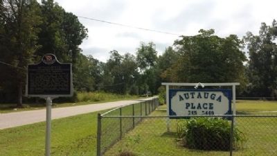
Autaugaville Marker
1 ► Alabama, Autauga County, Autaugaville — Autaugaville — Intersection of Autauga and Academy Streets — "America's First Crossroad" —
On South Autauga Street at Academy Street, on the right when traveling south on South Autauga Street.
2 ► Alabama, Autauga County, Prattville — Happy Hollow —
On East Sixth Street 0.4 miles east of North Northington Street, on the right when traveling west.
3 ► Alabama, Autauga County, Prattville — Old Plank Road — Circa 1840's —
On Maple Street at Pletcher Street, on the right when traveling west on Maple Street.
4 ► Alabama, Baldwin County, Daphne — The Eastern Shore Trail —
On N Main St.
5 ► Alabama, Baldwin County, Daphne — The Village —
On Main Street south of U.S. 89.
6 ► Alabama, Baldwin County, Lottie — History of Lottie, Alabama —
On Jack Springs Road at Lottie Road (County Road 61), on the right when traveling south on Jack Springs Road.
7 ► Alabama, Baldwin County, Orange Beach — Hugh S. Branyon Backcountry Trail System —
On Orange Beach Boulevard (State Highway 161) at Catman Road, on the right when traveling south on Orange Beach Boulevard.
8 ► Alabama, Baldwin County, Spanish Fort — Caisson Trace —
On Caisson Trace at Spanish Main Street, on the left when traveling west on Caisson Trace.
9 ► Alabama, Baldwin County, Tensaw — The Old Federal Road / The Black Crossing —
On Boatyard Road (County Road 80) 0.5 miles west of Burnt Car Road, on the right when traveling west.
10 ► Alabama, Barbour County, Eufaula — Eufaula-Montgomery Roadway —
On Springhill Road north of U.S. 82, on the right when traveling north.
11 ► Alabama, Barbour County, Eufaula — General Grierson’s March —
On West Broad Street, in the median.
12 ► Alabama, Blount County, Dallas — Dallas Historic District/Dallas Loop Road — Blount County —
On Dallas Loop Road 0.1 miles north of Alabama Highway 79, on the left when traveling north.
13 ► Alabama, Blount County, Locust Fork — Gabriel Hanby, 1786-1826 — ← Grave and Homesite 300 Yards —
On State Highway 79 at Hornet Drive, on the right when traveling south on State Highway 79.
14 ► Alabama, Bullock County, Blues Old Stand — Three Notch Road —
On U.S. 29 at County Road 19, on the right when traveling south on U.S. 29.
15 ► Alabama, Bullock County, Midway — Jefferson Davis Highway —
On Old Broadway Street (U.S. 82) at State Route 51, on the right when traveling south on Old Broadway Street.
Paid Advertisement
16 ► Alabama, Bullock County, Three Notch — Three Notch Road —
On U.S. 82 at County Road 35, on the right when traveling west on U.S. 82.
17 ► Alabama, Butler County, Chapman — Early Native Americans in Butler County / Indian Trails and Travelers in Butler County —
On Mobile Road (U.S. 31) 1.4 miles south of Solomon Hill Road (County Road 28), on the right when traveling south.
18 ► Alabama, Butler County, Greenville — Bartram's Trail —
On Sherling Lake Road (County Road 44) 1 mile west of Braggs Road (State Route 263), on the right when traveling west.
19 ► Alabama, Butler County, Greenville — The Federal Road and The Palings / Fort Dale 1818 —
On Fort Dale Road (Alabama Route 185) 0.3 miles north of Sherling Lake Road, on the right when traveling south.
20 ► Alabama, Calhoun County, Anniston — 7 — Anniston Memorial Hospital — May 14, 1961 — Anniston Civil Rights Trail —
On East 10th Street, on the right when traveling east.
21 ► Alabama, Calhoun County, Anniston — Freedom Riders —
On Albert P. Brewer Highway (State Highway 202) west of Old Birmingham Highway, on the right when traveling east.
22 ► Alabama, Calhoun County, Anniston — Governor Thomas E. Kilby — 1865-1943 —
On East 10th Street west of Kirkwood Avenue, on the left when traveling east.
23 ► Alabama, Calhoun County, Anniston — 3 — Greyhound Bus Station Protest, May 14, 1961 — Anniston Civil Rights Trail —
On Gurnee Avenue north of West 10th Street, on the right when traveling north.
24 ► Alabama, Calhoun County, Anniston — Horror and Disbelief — 1:55 p.m. - 2:30 p.m. — Freedom Riders National Monument —
Near Gurnee Avenue south of West 11th Street, on the left when traveling south.
25 ► Alabama, Calhoun County, Anniston — Prelude / Arrival — Freedom Riders National Monument —
Near Gurnee Avenue south of West 11th Street, on the left when traveling south.
26 ► Alabama, Calhoun County, Anniston — Pursuit / Trapped — Freedom Riders National Monument —
Near Gurnee Avenue south of West 11th Street, on the left when traveling south.
27 ► Alabama, Calhoun County, Anniston — Rescue / Escape — Freedom Riders National Monument —
Near Gurnee Avenue south of West 11th Street, on the left when traveling south.
28 ► Alabama, Calhoun County, Anniston — The Ambush / The Police — Freedom Riders National Monument —
Near Gurnee Avenue south of West 11th Street, on the left when traveling south.
29 ► Alabama, Calhoun County, Anniston — The Burning Bus — Freedom Riders National Monument —
Near Gurnee Avenue south of West 11th Street, on the left when traveling south.
30 ► Alabama, Calhoun County, Anniston — The Freedom Rides — Freedom Riders National Monument —
Near Gurnee Avenue south of West 11th Street, on the left when traveling south.
31 ► Alabama, Calhoun County, Anniston — The Photograph — Freedom Riders National Monument —
Near Gurnee Avenue south of West 11th Street, on the left when traveling south.
Paid Advertisement
32 ► Alabama, Calhoun County, Anniston — The Segregationists — Freedom Riders National Monument —
Near Gurnee Avenue south of West 11th Street, on the left when traveling south.
33 ► Alabama, Calhoun County, Anniston — The Selection Process — Freedom Riders National Monument —
Near Gurnee Avenue south of West 11th Street, on the left when traveling south.
34 ► Alabama, Calhoun County, Anniston — Trailways Attack — Seeking Justice —
On Noble Street at East 9th Street, on the right when traveling north on Noble Street.
35 ► Alabama, Calhoun County, Anniston — 2 — Trailways Bus Station Attack — May 14, 1961 — Anniston Civil Rights Trail —
On Noble Street at 9th Street, on the right when traveling north on Noble Street.
36 ► Alabama, Calhoun County, Anniston — Triumph — Freedom Riders National Monument —
Near Gurnee Avenue south of West 11th Street, on the left when traveling south.
37 ► Alabama, Calhoun County, Anniston — Who Were the Riders? — Freedom Riders National Monument —
Near Gurnee Avenue south of West 11th Street, on the left when traveling south.
38 ► Alabama, Calhoun County, Ohatchee — Jackson Trace —
On Jackson Trace Road east of Road 77, on the right when traveling south.
39 ► Alabama, Calhoun County, Oxford — Boiling Springs Road — Choccolocco Park Interpretive Trail —
Near Leon Smith Parkway.
40 ► Alabama, Chambers County, Five Points — Five Points, Alabama: Town of Five —
On U.S. 431 0.1 miles south of County Route 222, on the right when traveling south.
41 ► Alabama, Clarke County, Whatley — Old Indian Trail —
On Old Line Road (County Road 35) 2 miles north of U.S. 84, on the right when traveling north.
42 ► Alabama, Clarke County, Whatley — Old Line Road —
On Old Line Road (County Road 35) at U.S. 84, on the left when traveling south on Old Line Road.
43 ► Alabama, Colbert County, Cherokee — Colbert Ferry —
Near Natchez Trace Parkway (at milepost 327.3), 1 mile north of N. Pike (County Road 21).
44 ► Alabama, Colbert County, Cherokee — Levi Colbert Stand —
Near Natchez Trace Access Road (at milepost 320.3), 0.4 miles north of Natchez Trace Parkway (U.S. 72), on the left when traveling north.
45 ► Alabama, Colbert County, Cherokee — Safe Crossing — Natchez Trace Parkway — National Park Service, U.S. Department of the Interior —
Near Natchez Trace Parkway (at milepost 327.3), 1.6 miles east of N Pike (County Route 21), on the left when traveling east.
46 ► Alabama, Colbert County, Cherokee — Something to Chew on — Natchez Trace Parkway — National Park Service, U.S. Department of the Interior —
On Natchez Trace Access Road (at milepost 320.3), 0.4 miles north of Natchez Trace Parkway.
47 ► Alabama, Colbert County, Cherokee — Trace Travelers — Natchez Trace Parkway —
Near Natchez Trace Parkway (at milepost 327.3), 1.3 miles east of N Pike (County Route 21), on the left when traveling east.
Paid Advertisement
48 ► Alabama, Colbert County, Leighton — Alabama's Historic Byler Road — Alabama's First Road —
On Main Street at King Street (Old Route 20), on the right when traveling north on Main Street.
49 ► Alabama, Colbert County, Leighton — History of Leighton —
On Main Street at King Street, on the right when traveling north on Main Street.
50 ► Alabama, Colbert County, Muscle Shoals — Howell & Graves School —
On S. Wilson Dam Highway 1 mile Kimberley Drive.
51 ► Alabama, Colbert County, Muscle Shoals — Muscle Shoals National Recreational Trail —
Near Reservation Road.
52 ► Alabama, Colbert County, Sheffield — Jackson Military Road-Jackson Crossing —
On Gordon Drive north of E 13th Street.
53 ► Alabama, Colbert County, Sheffield — Old Railroad Bridge —
Near Ashe Boulevard 0.4 miles north of NE 16th Street.
54 ► Alabama, Colbert County, Tuscumbia — Jackson's Military Road —
On South Dickson Street at East 7th Street, on the right when traveling south on South Dickson Street.
55 ► Alabama, Conecuh County, Bermuda — Old Federal Road —
On County Road 5 at County Road 20, on the right when traveling north on County Road 5.
56 ► Alabama, Conecuh County, Midway — Old Federal Road —
On County Road 1 at State Route 83, on the right when traveling south on County Road 1.
57 ► Alabama, Conecuh County, Pine Orchard — Old Federal Road — Fort Warren —
On Old Federal Road (County Road 5) south of County Road 42, on the left when traveling south.
58 ► Alabama, Conecuh County, Repton — Old Federal Road —
On County Road 5 0.2 miles south of County Road 37, on the right when traveling south.
59 ► Alabama, Covington County, Andalusia — Three Notch Road / Hank and Audrey Williams —
On Three Notch Street at Central Street, on the right when traveling east on Three Notch Street.
60 ► Alabama, Dallas County, Cahaba — Vine Street
On Vine Street at Capitol Avenue, on the right when traveling north on Vine Street. Reported permanently removed.
61 ► Alabama, DeKalb County, Rainsville — McCurdy House —
On McCurdy Avenue North (State Highway 75) at Main Street (State Highway 35), on the right when traveling south on McCurdy Avenue North.
62 ► Alabama, DeKalb County, Sulphur Springs — The De Soto Trail — Hernando De Soto In Alabama —
Near Interstate 59 1 mile north of County Road 140, on the right when traveling south.
63 ► Alabama, Etowah County, Attalla — “The Junction” — Attalla —
On 5th Avenue Northeast (U.S. 431) at Cleveland Avenue, on the right when traveling south on 5th Avenue Northeast.
Paid Advertisement
64 ► Alabama, Fayette County, Bankston — A Post Office with Three Names — Fayette County —
On County Road 132 0.1 miles west of U.S. 43, on the left when traveling west.
65 ► Alabama, Fayette County, Bankston — Bankston — Fayette County —
On Alabama 18 0.2 miles west of County Road 67, on the right when traveling west.
66 ► Alabama, Fayette County, Bankston — Handy Post Office — Fayette County —
On County Road 93 0.2 miles north of Highway 13, on the left when traveling north.
67 ► Alabama, Fayette County, Bankston — Killingsworth Gin / Dry Creek Post Office — Fayette County —
On Selman Road 1 mile south of County Road 44, on the left when traveling south.
68 ► Alabama, Fayette County, Bankston — New Liberty Church and Cemetery / O'Possum Trot School — Fayette County —
On New Liberty Road 0.1 miles north of Highway 102, on the left when traveling north.
69 ► Alabama, Fayette County, Bankston — Zion Church & Byler Road — Fayette County —
On County Road 93 at Zion Road, on the left when traveling north on County Road 93.
70 ► Alabama, Fayette County, Eldridge — Dublin Post Office — Fayette County —
On Old Stage Coach Road 0.3 miles west of Highway 13, on the right when traveling south.
71 ► Alabama, Fayette County, Eldridge — New River Baptist Church — Fayette County —
On County Road 44 0.1 miles west of Selman Road, on the left when traveling west.
72 ► Alabama, Fayette County, Eldridge — Tidwell Cemetery — Fayette County —
On Old Stage Coach Road 0.3 miles west of Highway 13, on the right when traveling south.
73 ► Alabama, Fayette County, Fayette — Roxy Theatre/ Fayette's Newspapers — Fayette County —
On Temple Avenue South at 1st St SE, on the left when traveling south on Temple Avenue South.
74 ► Alabama, Fayette County, Fowlers Crossroads — Dobbs, Alabama — Fayette County —
On State Highway 13 north of Arthur Smith Road, on the left when traveling north.
75 ► Alabama, Franklin County, Russellville — Byler's Old Turnpike —
On County Line Road (County Road 99) at County Road 343, on the right when traveling north on County Line Road.
76 ► Alabama, Franklin County, Russellville — Russellville —
On North Jackson Avenue at Lawrence Street West, on the right when traveling south on North Jackson Avenue.
77 ► Alabama, Jackson County, Scottsboro — Cumberland Mountain Road —
On County Route 21 1 mile east of Route 79, on the right when traveling east.
78 ► Alabama, Jefferson County, Birmingham, Central City — Temple Wilson Tutwiler, II / Tutwiler Hotel — March 22, 1923 - March 1, 1982 —
On 20th Street North at 5th Avenue North, on the right when traveling north on 20th Street North.
79 ► Alabama, Jefferson County, Birmingham, Five Points South — The Works Progress Administration
Near Valley View Drive west of Richard Arrington Jr Boulevard South. Reported unreadable.
Paid Advertisement
80 ► Alabama, Jefferson County, Birmingham, Fountain Heights — C29 — Greyhound Bus Station — Destination — Birmingham Civil Rights Heritage Trail —
On 19th Street North at 7th Avenue North, on the right when traveling south on 19th Street North.
81 ► Alabama, Jefferson County, Birmingham, Fountain Heights — C14 — Taxi Stand — Destination — Birmingham Civil Rights Heritage Trail —
On 4th Avenue North west of 17th Street North, on the right when traveling west.
82 ► Alabama, Jefferson County, Birmingham, Fountain Heights — C21 — Trailways Bus Station — Destination — Birmingham Civil Rights Heritage Trail —
On North 19th Street at 4th Avenue North, on the right when traveling north on North 19th Street.
83 ► Alabama, Jefferson County, Birmingham, Roebuck — Roebuck Spring —
On Roebuck Boulevard, on the left when traveling east.
84 ► Alabama, Jefferson County, Birmingham, South Roebuck — Roebuck Springs Historic District —
On Cumberland Drive east of 4th Avenue South, on the right when traveling east.
85 ► Alabama, Jefferson County, Homewood — Edgewood Lake (Drained 1940's) Birmingham Motor & Country Club / Edgewood Country Club — (Demolished 1930's) —
On Lakeshore Drive at University Park East, on the right when traveling east on Lakeshore Drive.
86 ► Alabama, Jefferson County, Homewood — Hollywood / Hollywood Town Hall / Hollywood Country Club —
On Hollywood Boulevard at Laprado Place, on the right when traveling east on Hollywood Boulevard.
87 ► Alabama, Jefferson County, Homewood — Union Hill Cemetery, Union Hill Methodist Episcopal Church, Union Hill School —
On Hollywood Blvd at Union Hill Drive, on the left when traveling east on Hollywood Blvd.
88 ► Alabama, Jefferson County, Hoover — Shades Crest Road Historical District —
On Shades Crest Road (County Road 97) at Park Avenue, on the right when traveling north on Shades Crest Road.
89 ► Alabama, Jefferson County, Hoover — Shades Crest Road Historical District —
On Shades Crest Road east of Mimosa Lane, on the right when traveling east.
90 ► Alabama, Jefferson County, McCalla — Gristmill Trail — ca 1830 —
On Tannehill Road 0.6 miles north of Tannehill Park, on the right when traveling south.
91 ► Alabama, Lauderdale County, Florence — Andrew Jackson's Military Road — 1817 —
On County Route 47 at Cox Creek Parkway on County Route 47.
92 ► Alabama, Lauderdale County, Florence — Byler Road Begins / Chief Doublehead’s Trail — Lauderdale County —
On Church Street (County Road 30) at Church Road and Bailey Spring Road, on the right when traveling east on Church Street.
93 ► Alabama, Lauderdale County, Florence — Jackson's Military Road —
On Military Road at Hermitage Drive on Military Road.
94 ► Alabama, Lauderdale County, Killen — Killen and the Canal System —
On 6 Pence Rd.
95 ► Alabama, Lauderdale County, Rogersville — Bettie Anne Highway —
On County Road 568 at County Road 51, on the left when traveling west on County Road 568.
Paid Advertisement
96 ► Alabama, Lauderdale County, Rogersville — Covington/Second Creek / Wheeler Dam/Lake —
On Lee Highway (U.S. 72) 0.4 miles east of County Route 113, on the right when traveling east.
97 ► Alabama, Lauderdale County, Rogersville — Lamb’s Ferry Road —
On Wheeler Street/Lambs Ferry Road (Alabama Route 207) south of Lee Street (County Route 66), on the left when traveling south.
98 ► Alabama, Lauderdale County, Rogersville — Springfield Community / Springfield Church and School — 1810 / —
On Alabama Route 101 at County Route 646, on the right when traveling north on Alabama Route 101.
99 ► Alabama, Lawrence County, Courtland — Early Roads / One of the South's First Railroads 1832 —
On College St..
100 ► Alabama, Lawrence County, Moulton — Cheatham Road —
On County Route 33.

11747 entries matched your criteria. The first 100 are listed above. Next 100 ⊳

 
 
CeraNet Cloud Computing sponsors the Historical Marker Database.
This website earns income from purchases you make after using our links to Amazon.com. We appreciate your support.
Paid Advertisement
Oct. 20, 2026