465 entries match your criteria. The first 100 are listed. ⊳
Paleontology Topic
By Mark Hilton, August 20, 2013
Impact Crater Area Effects
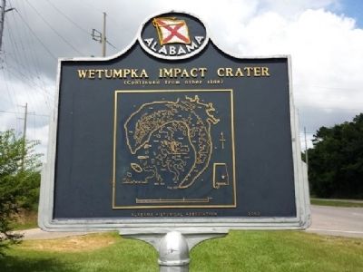
1 ► Alabama, Elmore County, Wetumpka — Wetumpka Impact Crater —  |
| On U.S. 231 at East South Boundary Street, on the right when traveling west on U.S. 231. | |||
| 2 ► Alaska, Matanuska-Susitna Borough, Sutton-Alpine — Geology — |
| On Glenn Highway (State Highway 1 at milepost 61.6) east of Chickaloon Way, on the left when traveling east. | |||
| 3 ► Alaska, Matanuska-Susitna Borough, Sutton-Alpine — Petrified Wood — |
| On Glenn Highway (State Highway 1 at milepost 61.6) east of Chickaloon Way, on the left when traveling east. | |||
| 4 ► Arizona, Apache County, Adamana — Metoposaur Genesis Supreme — Petrified Forest — National Park Service, U.S. Department of the Interior — |
| On Blue Mesa Scenic Road 2.5 miles east of Petrified Forest Road, on the right when traveling east. | |||
| 5 ► Arizona, Apache County, Adamana — Pioneers of Paleontology — Petrified Forest — National Park Service, U.S. Department of the Interior — |
| On Petrified Forest Road 1.6 miles north of Blue Mesa Scenic Road, on the right when traveling north. | |||
| 6 ► Arizona, Apache County, Adamana — The Funky Worm — |
| On Blue Mesa Scenic Road 2.5 miles east of Petrified Forest Road, on the right when traveling north. | |||
| 7 ► Arizona, Apache County, Adamana, Petrified Forest National Park — First Impressions — Petrified Forest — National Park Service, U.S. Department of the Interior — |
| On Jasper Forest Road. | |||
| 8 ► Arizona, Apache County, Chambers — Painted Desert / Finding Fossils |
| On Park Road, on the right when traveling west. Reported missing. | |||
| 9 ► Arizona, Apache County, Petrified Forest National Park — When Crystal Forest Was a Forest — Petrified Forest — National Park Service, U.S. Department of the Interior — |
| On Crystal Forest Trail. | |||
| 10 ► Arizona, Coconino County, Page — Dinosaur Tracks — |
| Near U.S. 89. | |||
| 11 ► Arizona, Coconino County, Page — Saurischia Dinosaur Tracks — |
| On Lake Powell Boulevard at Navajo Drive, on the right when traveling north on Lake Powell Boulevard. | |||
| 12 ► Arizona, Navajo County, Holbrook — Agate Bridge — |
| On Petrified Forest Road, on the right when traveling north. | |||
| 13 ► Arizona, Navajo County, Holbrook — An Ice Age Encampment at Rainbow Forest — |
| On Petrified Forest Road. | |||
| 14 ► Arizona, Navajo County, Shonto — Canyons in Time — Navajo National Monument — |
| On Arizona Route 564. | |||
| 15 ► Arizona, Navajo County, Shonto — Dinosaur Footprint — Navajo National Monument — |
| On Arizona Route 564. | |||
| 16 ► Arizona, Navajo County, Shonto — Sweathouse — Navajo National Monument — |
| On Arizona Route 564. | |||
| 17 ► Arizona, Navajo County, Shonto — Upside-down Mountain — Navajo National Monument — |
| On Arizona Route 564. | |||
| 18 ► Arkansas, Conway County, Winrock — Two Dominant Fossils of the Area — |
| Near Petit Jean Mountain Road. | |||
| 19 ► California, Alameda County, Fremont, Cameron Hills — East View — |
| On Quema Drive at Paseo Padre Parkway, on the right when traveling east on Quema Drive. | |||
| 20 ► California, Alameda County, Fremont, Cameron Hills — In Search of Fossils — |
| Near Via Orinda near Castillejo Way. | |||
| 21 ► California, Alameda County, Fremont, Cameron Hills — Land Mammals of the Irvingtonian Age — |
| Near Via Orinda near Castillejo Way. | |||
| 22 ► California, Alameda County, Fremont, Cameron Hills — Sabercat Historical Park — City of Fremont — Via Orinda Entrance — |
| On Via Orinda at Castillejo Way, on the right when traveling east on Via Orinda. | |||
| 23 ► California, Alameda County, Fremont, Cameron Hills — West View — |
| On Quema Drive near Paseo Padre Parkway, on the right when traveling east. | |||
| 24 ► California, Alameda County, Fremont, Mission San Jose District — Sabercat Historical Park — Paseo Padre Entrance — City of Fremont — |
| Near Paseo Padre parkway at Quema Drive. | |||
| 25 ► California, Alameda County, Fremont, Old Mission San Jose District — Sabercat Historical Park — Pine Street Entrance — City of Fremont — |
| On Pine Street east of Excelso Drive, on the right when traveling west. | |||
| 26 ► California, Contra Costa County, Danville — Turritella Snail Bed — Fossil Snails Tell Their Story in These Rocks — |
| Near Wall Point Road, on the left when traveling south. | |||
| 27 ► California, Contra Costa County, El Cerrito — El Cerrito Hills — |
| On San Pablo Avenue at Carlson Boulevard, on the left when traveling north on San Pablo Avenue. | |||
| 28 ► California, Contra Costa County, Walnut Creek — Blackhawk Ranch Quarry — A Paleontological Treasure — |
| On Southgate Road, on the left when traveling south. | |||
| 29 ► California, Humboldt County, Orick — Big Diamond — A Circus Elephant — Not a Humboldt Mastodon — |
| Near Redwood Highway (State Highway 101) at Hufford Road, on the right when traveling south. | |||
| 30 ► California, Kern County, McKittrick — 498 — McKittrick Brea Pit — |
| On State Highway 58 at State Highway 33, on the left when traveling west on State Highway 58. | |||
| 31 ► California, Los Angeles County, Arcadia — Cycads — Jurassic Period — 200 Million Years Ago — |
| Near Baldwin Avenue 0.3 miles south of Colorado Boulevard, on the right when traveling south. | |||
| 32 ► California, Los Angeles County, Los Angeles, Miracle Mile — 1,000 Feet Above an Underground Oil Field — La Brea Tar Pits — |
| Near 6th Street east of Fairfax Avenue, on the right when traveling east. | |||
| 33 ► California, Los Angeles County, Los Angeles, Miracle Mile — Chester Stock Ph.D. — Observation Pit — La Brea Tar Pits — |
| Near Wilshire Boulevard west of South Curson Street. | |||
| 34 ► California, Los Angeles County, Los Angeles, Miracle Mile — Death Trap for Meat-Eaters — La Brea Tar Pits — |
| Near Wilshire Boulevard east of Fairfax Avenue, on the left when traveling east. | |||
| 35 ► California, Los Angeles County, Los Angeles, Miracle Mile — Death Trap for Meat-Eaters — |
| Near West 6th Street, on the right when traveling east. | |||
| 36 ► California, Los Angeles County, Los Angeles, Miracle Mile — Different Types of Fossils — La Brea Tar Pits — |
| Near Wilshire Boulevard east of Fairfax Avenue, on the left when traveling east. | |||
| 37 ► California, Los Angeles County, Los Angeles, Miracle Mile — How Did 27 Columbian Mammoths Fit in This Small Pit? — |
| Near 6th Street east of Fairfax Avenue, on the right when traveling east. | |||
| 38 ► California, Los Angeles County, Los Angeles, Miracle Mile — Imagining Ice Age L.A. — La Brea Tar Pits — |
| On Wilshire Boulevard at Curson Avenue, on the right when traveling west on Wilshire Boulevard. | |||
| 39 ► California, Los Angeles County, Los Angeles, Miracle Mile — La Brea Tar Pits — Lake Pit — |
| On Wilshire Boulevard at Curson Avenue, on the right when traveling west on Wilshire Boulevard. | |||
| 40 ► California, Los Angeles County, Los Angeles, Miracle Mile — Pit 13 — La Brea Tar Pits — |
| Near West 6th Street, on the right when traveling east. | |||
| 41 ► California, Los Angeles County, Los Angeles, Miracle Mile — Pit 13 — La Brea Tar Pits — |
| Near West 6th Street, on the right when traveling east. | |||
| 42 ► California, Los Angeles County, Los Angeles, Miracle Mile — Pit 9 — La Brea Tar Pits — |
| Near 6th Street east of Fairfax Avenue, on the right when traveling east. | |||
| 43 ► California, Los Angeles County, Los Angeles, Miracle Mile — Pit 9 — La Brea Tar Pits — |
| Near 6th Street east of Fairfax Avenue, on the right when traveling east. | |||
| 44 ► California, Los Angeles County, Los Angeles, Miracle Mile — Pit 91 — La Brea Tar Pits — |
| Near Wilshire Boulevard east of Fairfax Avenue, on the left when traveling east. | |||
| 45 ► California, Los Angeles County, Los Angeles, Miracle Mile — Pits 3, 4, 61/67 — These Three Tar Pits Are Ages Apart — La Brea Tar Pits — |
| Near Wilshire Boulevard east of Fairfax Avenue, on the left when traveling east. | |||
| 46 ► California, Los Angeles County, Los Angeles, Miracle Mile — Pits 3, 4, 61/67 — La Brea Tar Pits — |
| Near Wilshire Boulevard east of Fairfax Avenue, on the left when traveling east. | |||
| 47 ► California, Los Angeles County, Los Angeles, Miracle Mile — Project 23 — Millions of New Fossils Found — La Brea Tar Pits — |
| Near 6th Street east of Fairfax Avenue, on the right when traveling east. | |||
| 48 ► California, Los Angeles County, Los Angeles, Miracle Mile — Project 23: Who, What, Why, Where, and How? — |
| Near 6th Street east of Fairfax Avenue, on the right when traveling east. | |||
| 49 ► California, Los Angeles County, Los Angeles, Miracle Mile — Rancho La Brea — National Natural Landmark — |
| Near Wilshire Boulevard, on the left when traveling east. | |||
| 50 ► California, Los Angeles County, Los Angeles, Miracle Mile — Tar seeps form Ice Age time capsules — |
| Near Wilshire Boulevard east of Fairfax Avenue, on the left when traveling east. | |||
| 51 ► California, Los Angeles County, Los Angeles, Miracle Mile — What's in the crates? — |
| Near 6th Street east of Fairfax Avenue, on the right when traveling east. | |||
| 52 ► California, Los Angeles County, Los Angeles, Miracle Mile — When Mammoths Walked on Wilshire — |
| Near Wilshire Boulevard at Curson Avenue, on the left when traveling north. | |||
| 53 ► California, Los Angeles County, Los Angeles, West Los Angeles — 522 — Tongva Springs — Serra Springs — Wounded Deer Springs — |
| Near Barrington Boulevard 0.3 miles south of Wilshire Boulevard, on the right when traveling south. | |||
| 54 ► California, Los Angeles County, Pearblossom — The Devil's Punchbowl — Department of Parks & Recreation, County of Los Angeles — |
| Near County Route N6 8 miles south of Pearblossom Highway. | |||
| 55 ► California, Napa County, Calistoga, The Petrified Forest Park — Robert Louis Stevenson Tree — |
| Near Petrified Forest Road east of Porter Creek Road, on the right when traveling west. | |||
| 56 ► California, Orange County, Aliso Viejo — Mixocetus Baleen Whale — Plaza de La Paz |
| Near Plaza De La Paz west of La Paz Road. Reported unreadable. | |||
| 57 ► California, Orange County, Laguna Hills — Costeau Pit — |
| Near Costeau Street, on the left. | |||
| 58 ► California, Orange County, Laguna Hills — 28 — Fossil Reef — |
| On Via Lomas, on the left when traveling east. | |||
| 59 ► California, Orange County, Laguna Niguel — Plaza de La Paz — |
| Near La Paz Road at Plaza de La Paz, on the right when traveling south. | |||
| 60 ► California, Orange County, Laguna Niguel — The City Seal: Pre-Historic Past — |
| On Crown Valley Parkway. | |||
| 61 ► California, Orange County, Mission Viejo — Fossil — Whale Exhibit — |
| On Christiana Road, on the right when traveling north. | |||
| 62 ► California, Orange County, Mission Viejo — Oso Creek Trail — |
| On Veterans Way. | |||
| 63 ► California, Orange County, Mission Viejo — Whale Fossil — |
| On Christiana Road, on the right when traveling north. | |||
| 64 ► California, Orange County, Rancho Mission Viejo — Topanga Formation — |
| On Ribera just west of Ascenso Avenue, on the right when traveling east. | |||
| 65 ► California, San Bernardino County, Baker — A Lost Lake — |
| On Zzyzx Road 5 miles south of Interstate 15, on the left when traveling south. | |||
| 66 ► California, San Francisco City and County, San Francisco, Embarcadero — 20,000 Years Ago — |
| Near The Embarcadero near Folsom Street, on the right when traveling west. | |||
| 67 ► California, San Mateo County, Redwood City — Pleistocene Period — 2.6 Million - 11,700 Years Ago — Stanford | Redwood City — |
| On Broadway near Warrington Avenue, on the left when traveling west. | |||
| 68 ► California, Sonoma County, Calistoga — 915 — Petrified Forest — |
| Near Petrified Forest Road near Porter Creek Road, on the left when traveling east. | |||
| 69 ► California, Sonoma County, Calistoga — 915 — Petrified Forest — |
| Near Petrified Forest Road 0.7 miles east of Porter Creek & Calistoga Roads. | |||
| 70 ► California, Sonoma County, Calistoga — To Commemorate..."Petrified Charlie" — |
| Near Petrified Forest Road near Porter Creek Road, on the left when traveling east. | |||
| 71 ► Colorado, Bent County, Hasty — Santa Fe Trail — Travelers through Time — |
| Near County Highway HH near County Highway 24. | |||
| 72 ► Colorado, El Paso County, United States Air Force Academy — An Ancient Geologic Past — United States Air Force Academy — |
| Near Academy Drive. | |||
| 73 ► Colorado, Fremont County, Cañon City — The Cleveland-Delfs Quarry — Garden Park Fossil Area — |
| On Garden Park Road (County Road 9) 3.1 miles Field Avenue, on the right when traveling north. | |||
| 74 ► Colorado, Fremont County, Cañon City — The Morrison Formation — Garden Park Fossil Area — |
| On Garden Park Road (County Road 9) 3.1 miles north of Field Avenue, on the right when traveling north. | |||
| 75 ► Colorado, Fremont County, Cañon City — Where Have The Fossils Gone? — Garden Park Fossil Area — |
| On Garden Park Road (County Road 9) 3.1 miles north of Field Avenue, on the right when traveling north. | |||
| 76 ► Colorado, Gunnison County, Gunnison — If You Only Knew — |
| On U.S. 50, on the right when traveling west. | |||
| 77 ► Colorado, Jefferson County, Golden — Bone Deposition — |
| Near West Alameda Parkway. | |||
| 78 ► Colorado, Jefferson County, Golden — Brontosaur Bulges — |
| Near Hog Back Road. | |||
| 79 ► Colorado, Jefferson County, Golden — Cretaceous Time — |
| Near County Road 93. | |||
| 80 ► Colorado, Jefferson County, Golden — Theropod Track — |
| Near West Alameda Parkway. | |||
| 81 ► Colorado, Jefferson County, Golden — Triceratops Trail — |
| On 6th Avenue (U.S. 6) 0.5 miles south of 19th Street, on the right when traveling north. | |||
| 82 ► Colorado, Jefferson County, Golden, Lakota Hills — Bird Track — |
| Near Triceratops Trail 0.5 miles 19th Street (U.S. 6). | |||
| 83 ► Colorado, Jefferson County, Golden, Lakota Hills — Palm Fronds — |
| Near Triceratops Trail 0.5 miles 19th Street (U.S. 6). | |||
| 84 ► Colorado, Jefferson County, Golden, Lakota Hills — Triceratops Tracks — |
| Near Triceratops Trail 0.5 miles 19th Street (U.S. 6). | |||
| 85 ► Colorado, Jefferson County, Morrison — Dinosaur Ridge — Designated as part of the Dakota Hogback Natural Area — |
| Near West Alameda Parkway 0.1 miles west of Colorado Highway 470, on the right when traveling west. | |||
| 86 ► Colorado, Jefferson County, Morrison — Front Range Foothills — |
| Near Plains View Road. | |||
| 87 ► Colorado, Jefferson County, Morrison — Morrison Fossil Area — National Natural Landmark — |
| On West Alameda Parkway 0.1 miles south of Hog Back Road (County Road 93), on the left when traveling south. | |||
| 88 ► Colorado, Jefferson County, Morrison — West Alameda Parkway/Dinosaur Ridge — Works Progress Administration — 1937 — |
| On Hog Back Road (County Road 93) at West Alameda Parkway, on the right when traveling north on Hog Back Road. | |||
| 89 ► Colorado, Jefferson County, Morrison — What is the Historical Significance of this Site? — |
| On West Alameda Parkway/Dinosaur Ridge 0.5 miles south of South Rooney Road (County Road 53), on the right when traveling south. | |||
| 90 ► Colorado, Las Animas County, Kim — Life at Dinosaur Lake — |
| Near no nearby street. | |||
| 91 ► Colorado, Las Animas County, Kim — The Largest Tracksite in North America — |
| Near no nearby street. | |||
| 92 ► Colorado, Las Animas County, Kim — The Site from the Sky — |
| Near no nearby street. | |||
| 93 ► Colorado, Mesa County, Colorado National Monument — The Shape of Independence — |
| Near Rimrock Drive. | |||
| 94 ► Colorado, Mesa County, Fruita — Dinosaur Diamond — A Dual-State National Scenic Byway — |
| Near Colorado 340. | |||
| 95 ► Colorado, Teller County, Florissant — Ancient Clones — Florissant Fossil Beds National Monument — National Park Service, U.S. Department of the Interior — |
| Near County Road 1. | |||
| 96 ► Colorado, Teller County, Florissant — Ancient Forest Diversity — |
| Near County Road 1. | |||
| 97 ► Colorado, Teller County, Florissant — Changes Within Habitats — |
| Near Ponderosa Loop. | |||
| 98 ► Colorado, Teller County, Florissant — Charlotte Hill — Early Citizen-Scientist — |
| Near County Route 1 south of County Route 421. | |||
| 99 ► Colorado, Teller County, Florissant — Dawn of the Recent Past — |
| Near County Road 1. | |||
| 100 ► Colorado, Teller County, Florissant — Delicate Impressions — |
| Near County Road 1. | |||
465 entries matched your criteria. The first 100 are listed above. Next 100 ⊳