By Tom Bosse, December 31, 2023
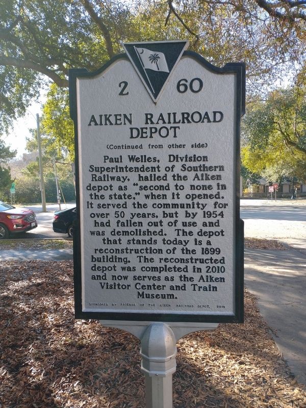
Aiken Railroad Depot Marker
| On Park Avenue SE at Union Street SE, on the right when traveling west on Park Avenue SE. |
| On Two Notch Road Southeast at Mead Avenue, on the left when traveling south on Two Notch Road Southeast. |
| On Laurens Street NW (State Highway 19) at Edgefield Avenue NW, on the left when traveling south on Laurens Street NW. |
| On Laurens Street Southwest at Hayne Street Southwest, in the median on Laurens Street Southwest. |
| On South Boundary Avenue Southwest west of Laurens Street Southwest, on the right when traveling west. |
| On Laurens Street NW, on the right when traveling south. |
| On Newberry Street Southwest north of First Avenue Southwest, on the right when traveling south. |
| On Chesterfield Street NE near Richland Avenue (U.S. 78), in the median. |
| Near Union Street SE north of Sea Lane SE, on the left when traveling south. |
| On Gregg Avenue north of Augustus Drive, on the right when traveling north. |
| Near Union Street SE north of Sea Lane SE, on the left when traveling south. |
| On Coker Springs Road SW, on the left when traveling west. |
| On South Boundary Avenue SE at Newberry Street, on the right when traveling east on South Boundary Avenue SE. |
| Near York Street NE (U.S. 1) near Richland Avenue (U.S. 78). |
| On Laurens Street SW at Hoods Lane SW, on the right when traveling north on Laurens Street SW. |
| Near Newberry Street Southwest north of New Lane Southwest, on the right when traveling south. |
| On South Boundary Avenue Southwest at Laurens Street Southwest, on the right when traveling west on South Boundary Avenue Southwest. |
| Near Union Street SE north of Sea Lane SE, on the left when traveling south. |
| On Barnwell Avenue Northwest near Laurens Street, NW (State Road 19), on the right when traveling west. |
| On Park Avenue Southwest east of Laurens Street Southwest, in the median. |
| Near Newberry Street Southwest. |
| On Richland Avenue East at Kershaw Street SE, on the right when traveling east on Richland Avenue East. |
| On Richland Avenue East at Kershaw Street SE, on the right when traveling east on Richland Avenue East. |
| On Richland Avenue East (U.S. 78) at Gaston Road, on the right when traveling east on Richland Avenue East. |
| On Richland Avenue West (U.S. 78) 0.1 miles west of Newberry Street North West, in the median. |
| On Highland Park Drive near Highland Park Terrace SW, in the median. |
| On Laurens Street SW near S Boundry Avenue SW. |
| On Laurens St SW, on the right when traveling south. |
| On Newberry Street Southwest north of South Boundary Avenue Southwest, on the right when traveling north. |
| Near Union Street SE north of Sea Lane SE, on the left when traveling south. |
| On South Boundary Avenue Southwest west of Laurens Avenue Southwest, on the left when traveling west. |
| On Highland Park Avenue Southwest at Highland Park Terrace Southwest, on the left when traveling west on Highland Park Avenue Southwest. |
| On Park Avenue, on the right when traveling east. |
| On Richland Avenue (U.S. 78) at Gregg Avenue, on the left when traveling east on Richland Avenue. |
| On Newberry Street Southwest at New Lane Southwest, on the right when traveling south on Newberry Street Southwest. |
| On Laurens Street Southwest at Downing Street Southwest, on the right when traveling south on Laurens Street Southwest. |
| On South Boundary Avenue Southwest west of Laurens Street Southwest, on the right when traveling west. |
| On Richland Avenue West at Newberry Street Southwest, on the right when traveling east on Richland Avenue West. |
| On East Pine Log Road (State Highway 302) at Notch Road Southeast, on the right when traveling east on East Pine Log Road. |
| On South Boundary Avenue Southwest west of Laurens Street Southwest, on the left when traveling west. |
| On Newberry Street SW at Richland Avenue West (U.S. 1), in the median on Newberry Street SW. |
| On South Boundary Avenue Southwest west of Laurens Street Southwest, on the left when traveling west. |
| Near Scholar Loop south of College Station Drive, on the right when traveling south. |
| On South Boundary Avenue Southwest west of Laurens Street Southwest, on the right when traveling west. |
| On Laurens Street Southwest at Hoods Lane Southwest, on the right when traveling north on Laurens Street Southwest. |
| On Mead Avenue east of Magnolia Street Southeast, on the right when traveling east. |
| On South Boundary Avenue Southwest west of Laurens Street Southwest, on the left when traveling west. |
| On Robert M. Bell Parkway (State Highway 19,118) near Trolley Line Road, on the right when traveling north. |
| On York Street Southeast at Park Avenue Southeast, on the right when traveling south on York Street Southeast. |
| On Kershaw Street NW, on the right when traveling north. |
| On Laurens St. SW near Park Ave SW, on the right when traveling south. |
| On Park Avenue Southwest at Laurens Street Southwest, in the median on Park Avenue Southwest. Reported permanently removed. |
| On Richland Avenue SW (U.S. 78) at Newberry Street NW, on the right when traveling west on Richland Avenue SW. |
| On Pendleton Street SW (U.S. 1) at Hayne Avenue, on the right when traveling south on Pendleton Street SW. |
| On Laurens Street Southwest at Park Avenue Southwest, on the right when traveling north on Laurens Street Southwest. |
| On Laurens Street Southwest at Hayne Avenue Southwest, in the median on Laurens Street Southwest. |
| On Laurens Street Southwest at Park Avenue Southwest, on the right when traveling north on Laurens Street Southwest. |
| On Richland Avenue, East (US 1) (U.S. 78), on the right when traveling east. |
| Near South Boundary Avenue SW near Newberry Street SW. |
| On South Boundary Avenue Southwest west of Laurens Street Southwest, on the right when traveling west. |
| On Newberry Street Southwest at Park Avenue Southwest, in the median on Newberry Street Southwest. |
| Near Newberry Street Southwest at New Lane Southwest, on the right when traveling south. |
| On South Boundary Avenue Southwest west of Laurens Street Southwest, on the right when traveling west. |
| On South Boundary Avenue Southwest west of Laurens Street Southwest, on the left when traveling west. |
| Near Newberry St SW near New Lane SW. Reported permanently removed. |
| On South Boundary Avenue Southwest west of Laurens Street Southwest, on the left when traveling west. |
| On South Boundary Avenue Southwest at Newberry Street Southwest, on the right when traveling east on South Boundary Avenue Southwest. |
| On Laurens Street Southwest. |
| On S Boundary Ave SE at Chesterfield St. S, on the right when traveling west on S Boundary Ave SE. |
| On Newberry Street NW, on the left when traveling north. |
| On Magnolia Street Southeast north of Grace Avenue Southeast, on the left when traveling north. |
| On York Street Southeast south of Ray Lane, on the right when traveling south. |
| On Laurens Street Southwest at Park Avenue Southwest, in the median on Laurens Street Southwest. |
| On Laurens Street North West (State Highway 19) north of Jones Avenue, on the right when traveling north. |
| On Laurens Street Southwest south of Augusta Aiken Road (U.S. 78), on the left when traveling south. |
| On Williston Road (U.S. 278) just west of Spann Hammond Road, on the right when traveling west. Reported missing. |
| On Church Road (State Highway 581) west of Spann Hammond Road (State Highway 1139), on the right when traveling west. |
| On Williston Road (U.S. 278) near Hammond Road, on the left when traveling east. |
| Near Redcliffe Road 0.3 miles west of Hammond Road, on the right when traveling west. |
| On Williston Road (U.S. 278) west of Hammond Road (South Carolina Highway 580), on the right when traveling west. |
| On Sandbar Ferry Road (State Highway 28). |
| On Storm Branch Road, on the right when traveling west. |
| On Johnston Highway (State Highway 191) 0.2 miles north of State Highway 19, on the right when traveling south. |
| On Marshall Street near Canal Street, on the right when traveling east. |
| On Canal Street (South Carolina Route 191) at Gregg Highway, on the right when traveling north on Canal Street. |
| On Canal Street (State Highway 191) at Gregg Highway, on the right when traveling north on Canal Street. Reported missing. |
| On Gregg Highway (State Highway 895). |
| On Marshall Street near Canal Street, on the right when traveling east. |
| On Canal Street (State Highway 191) near Aiken Road. |
| On Canal Street (South Carolina Route 191) at Church Street, on the right when traveling north on Canal Street. |
| On Canal Street near Marshall Street, on the right when traveling east. |
| On Gregg Highway (State Highway 859), on the right when traveling east. |
| On Jefferson Davis Highway (U.S. 1), on the right when traveling south. Reported missing. |
| On River North Drive at Jefferson Davis Highway (U.S. 78), on the left when traveling east on River North Drive. |
| On Old Jackson Highway (State Highway 5), on the left when traveling north. |
| On Atomic Road (State Highway 125) near Government 3, on the right when traveling south. |
| Near Silver Bluff Road (County Highway 314) 0.4 miles north of Bluff Landing Road (County Highway 315), on the left when traveling north. |
| On Charleston/Augusta Road (U.S. 78) at Old Tory Trail, on the right when traveling east on Charleston/Augusta Road. |
| On Wagener Road (State Highway 302 / 4) near New Holland Road, on the right when traveling west. |
5380 entries matched your criteria. Entries 101 through 200 are listed above.
⊲ Previous 100 —
Next 100 ⊳
