Near North Blackford Street north of Indianapolis Cultural Trail, on the right when traveling north.
National Old Trail Road in Wayne County is marked by the 18-foot high Madonna of the Trail statue. The National Road was a primary route for immigration into Indiana and provided access to essential eastern markets for Hoosier companies. Two such . . . — — Map (db m238934) HM
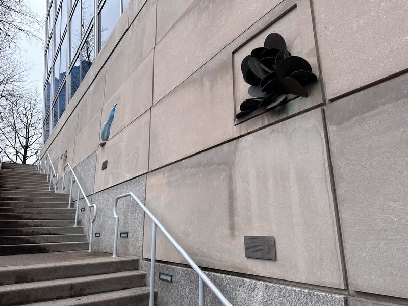
On South Capitol Avenue at West South Street, on the right when traveling east on South Capitol Avenue.
Arabic-speaking Syrian immigrants settled here on Willard St. by 1893 in small, crowded multiple-family row homes. They created a vibrant neighborhood alongside Black Americans and European immigrants. Searching for economic opportunities in the . . . — — Map (db m238603) HM
On West Michigan Street at North Fulton Avenue, on the right when traveling east on West Michigan Street.
The first demographic waves of German immigrants occurred in the 1680s when they settled in Pennsylvania. In the nineteenth century, Germans continued to come to America in waves. Quite a few settled in this area between 1836 and 1840. The most . . . — — Map (db m226796) HM
On Cherry Street at North 5th Street, on the right when traveling west on Cherry Street.
In the early 1900s, Arabic speaking
Christian Syrians established a
community here, part of a
movement of Middle Easterners
contributing to the growth of
cities in Indiana and U.S. Syrians
began their lives in this city as
poor pack peddlers . . . — — Map (db m226133) HM
On West Canal Street east of South Wabash Street (Indiana Route 13), on the left when traveling east.
Dr. James H. Ford
Dr. James H. Ford erected 73 W. Canal in 1887. The first floor was his office and the second was a "carriage repository" for F.M. Beck's harness and buggy stock. Dr. Ford held a medical record in Indiana by assisting the . . . — — Map (db m215049) HM
On South 9th Street (U.S. 27) north of South E Street, on the left when traveling north.
As German immigrants entered the United States in large numbers in the mid 19th century, many found their home in Richmond. Here, the city's trade and industrial opportunities offered a favorable climate for German residents looking to start a new . . . — — Map (db m232949) HM
On South 9th Street (U.S. 27) north of South B Street, on the left when traveling north.
Located south of Richmond's historic downtown, the Old Richmond Historic District encompasses more than 200 acres and 500 buildings associated with the development of Richmond from 1819 to 1935. The district includes the land associated with the . . . — — Map (db m232950) HM
On James Avenue at Park Street, on the right when traveling south on James Avenue.
Dedicated to the Swedish immigrant ancestors who settled in southeast Iowa and to Sandra Harris who has so generously supported the Swedish Heritage Society. September 17, 2014 — — Map (db m238981) HM
Near Houston Avenue north of Lincoln Street, on the right when traveling south.
In 1847, the Dutch band left their farms and homes in the Netherlands because they wanted to worship their own way, and they needed more economic opportunity. Their determination led them to this part of the Iowa prairie. For the first few years of . . . — — Map (db m236388) HM
On Main Street at Huber Street, on the right when traveling south on Main Street.
In the spring of 1847 four sailing vessels carrying 800 freedom-seeking Hollanders landed at Baltimore. They were met by Dominie Henry Peter Scholte, their faithful leader, who led them across the Alleghenies to Pittsburgh and down the Ohio and up . . . — — Map (db m235885) HM
Near Lincoln Street west of Houston Avenue, on the right when traveling west.
The story of the Dutch emigration to Pella started in 1814 when article 133 was included in the first Constitution of the United Netherlands, stating: "The Christian Reformed Religion is that of the Sovereign." This (now called the Dutch Reformed . . . — — Map (db m236381) HM
On Robert D. Ray Drive at Maple Street, on the right when traveling south on Robert D. Ray Drive.
A dark era befell Cambodia when the Khmer Rouge, under the dictator Pol Pot, ruled the country from 1975 to 1979. Pol Pot's genocidal regime led to the deaths of nearly 2 million people out of a population of just 7 million. So many people were . . . — — Map (db m237953) HM
Near Robert D. Ray Drive at E. Center Street, on the right when traveling south.
The Robert D. Ray Asian Garden not only highlights the importance of diversity in our community and acknowledges the contributions that Asian Americans have made to Iowa, but also serves as a lasting monument honoring Governor Ray's visionary . . . — — Map (db m237927) HM
On North Mill Street just north of West Water Street, on the left when traveling north.
Overview Many immigrants found community in churches where people spoke their language and held familiar beliefs. Women played very important roles in building community in Norwegian Lutheran churches, even though they were not allowed to vote . . . — — Map (db m236298) HM
Near North Mill Street just north of West Water Street, on the right when traveling north.
Overview Mikkel and Hage Sennes emigrated from Norway with a variety of skills that helped them eventually thrive in America. They also learned new skills once they settled in the U.S. They built this blacksmith shop on their farm in Minnesota . . . — — Map (db m236609) HM
On West Water Street at River Street, on the right when traveling west on West Water Street.
“All Things to All People” The mercantile has a long history in Decorah. The first mercantile, the Pioneer Store, opened in the Days’ smokehouse shortly after the Days and the Painters founded Decorah in 1849 and William Painter . . . — — Map (db m240300) HM
On West Main Street at Winnebago Street, on the right when traveling east on West Main Street.
The Founding of Luther College Luther College opened in September 1861 in a vacant parsonage at Halfway Creek, Wisconsin, near La Crosse, with 11 students. The Norwegian Synod, the governing body of the Norwegian Lutheran . . . — — Map (db m242101) HM
Near North Mill Street just north of West Water Street, on the right when traveling north.
Overview New immigrants often moved to existing ethnic communities where faith, food, and culture were familiar. Sometimes, these new immigrants would need to navigate shared living space and class differences with strangers along with living . . . — — Map (db m236297) HM
Near North Mill Street just north of West Water Street, on the right when traveling north.
Overview Hans and Anna Haugan were in their fifties when they immigrated to America. Not everyone who immigrated to America stayed. By some estimates, nearly one in five Norwegian immigrants returned home. Some left because they earned enough . . . — — Map (db m236300) HM
Near North Mill Street just north of West Water Street, on the right when traveling north.
Overview Nineteenth century Norwegian farmers grew food for their families instead of for income. Many farms in Norway used small water-powered mills to grind grain, press apples and process cloth. These mills were usually only big enough to . . . — — Map (db m236295) HM
Near North Mill Street just south of Heivly Street, on the right when traveling north.
Overview Northeast Iowa was home to many different Native American groups that utilized the natural resources of this area for thousands of years. After Native Americans were forced out of the region by the U.S. government, European settlers . . . — — Map (db m236400) HM
On North Mill Street just north of West Water Street, on the right when traveling north.
Overview In the mid-19th century, a group of Norwegian immigrants who followed the state church in Norway wanted to create a system of schools associated with the church. Congregation members wanted to send their children to public schools to . . . — — Map (db m236299) HM
Near North Mill Street just north of West Water Street, on the right when traveling north.
Overview Vesterheim was the first institution in the United States to collect and preserve buildings by moving them to a museum setting. The Eriksen-Hansen Stabbur protected grain and meat from pests and moisture by elevating them off the . . . — — Map (db m236399) HM
Near North Mill Street just north of West Water Street, on the right when traveling north.
Overview Native Americans lived in northeast Iowa for thousands of years before being forced off their land by the U.S. government to make room for non-native settlers. Colonizers arrived in this area in 1848 and came from numerous countries in . . . — — Map (db m236608) HM
Near North Mechanic Street at West Day Spring Lane, on the left when traveling north.
Overview Many buildings on farms in Norway were designed to serve one purpose. This building was probably used to dry grain for brewing beer. While many Norwegians and Norwegian Americans brewed their own beer, others fought for temperance. . . . — — Map (db m236672) HM
Near North Mill Street just north of West Water Street, on the right when traveling north.
Overview Norway's population nearly tripled during the 19th century. This increase, combined with restrictive inheritance laws and lack of farmable land, made it extremely difficult to escape rural poverty. Most Norwegian immigrants were from . . . — — Map (db m236296) HM
Near West Water Street just east of North Mill Street, on the left when traveling east.
Look up to see sails. Look down and around you to see the outline of a small ship. Imagine what it would have been like to immigrate to the United States on a sailing ship in the 1800s. The journey may take 6 to 14 weeks. Why are you leaving your . . . — — Map (db m236682) HM
On West Water Street just east of North Mill Street, on the left when traveling east.
Vesterheim explores the diversity of American immigration through the lens of the Norwegian-American experience and showcases the best in historic and contemporary folk arts in the Norwegian tradition.
Near North Mechanic Street just north of West Day Spring Lane, on the left when traveling north.
Overview The Homestead Act of 1862 made government land taken from Native Americans available for free if it was used for five years. This law allowed millions of European immigrants to settle in the prairies and woodlands of the central . . . — — Map (db m236673) HM
On West 6th Street just west of State Street, on the left when traveling west.
Mary Mullen was born to Mary Ann Mullen in 1899 in New York City. As an infant, she was taken to the New York Foundling Hospital, to be cared for by the Sisters of Charity. Soon, she was selected for placement in a Western home, and traveled to . . . — — Map (db m212528) HM
Near Lincoln Street (U.S. 81) 0.2 miles south of East 20th Street, on the right when traveling south.
Walter White was the son of George and Annie, both English immigrants and parents of eight children. In 1905, the family lived in Mid-Town Manhattan, George worked as a coachman in Central Park, and the oldest daughter Mary, worked as a cash-girl. . . . — — Map (db m212471) HM
The Jean Charles Germain Bergeron House, one of the oldest surviving Acadian dwellings in Louisiana, was moved to the Rural Life Museum in 2005 from the east bank of Bayou Lafourche, three miles from Labadieville in Lafourche Parish.
The . . . — — Map (db m92483) HM
On San Antonio Avenue (Louisiana Route 6) at Church Street when traveling north on San Antonio Avenue.
Established 1871. Present church built in 1922 in the Spanish architectural style to honor the early settlers of Sabine from 1865 to 1870. The original Catholic community was served by a missionary priest, Father Francois Le Vezouet. Native of . . . — — Map (db m214305) HM
On Main Street just west of Franklin Street, on the left when traveling west.
This park is dedicated to Israel Shevenell, (1826-1912) one of the first Franco-American immigrants to Biddeford. Shevenell walked to this town from Canada in 1845. — — Map (db m186163) HM
Near College Avenue (Maryland Route 450) south of King George Street (Maryland Route 450), on the right when traveling south.
Max and Elke Schiff were Jewish immigrants from Minsk who settled in Annapolis in 1913. Their goal in coming to America was to provide a complete education for their seven children.
These direct descendants of Max and Elke attended St. . . . — — Map (db m232488) HM
On West Lexington Street west of North Eutaw Street, on the right when traveling west.
The merchant mix at Lexington Market has always included large numbers of immigrant-owned businesses, dating back to the Market's founding. Early records depict a melting pot of business owner nationalities—from German-owned butcher shops to Italian . . . — — Map (db m243487) HM
On North Paca Street (Maryland Route 129), on the left when traveling north.
In 1791, at the invitation of Bishop John Carroll, the first bishop in the United States, Sulpician priests came to Baltimore from France to found St. Mary's Seminary, the nation's oldest Catholic seminary. After establishing the seminary in a . . . — — Map (db m219570) HM
Near West Cold Spring Lane west of North Charles Street (Maryland Route 139), on the right when traveling west.
Born into an affluent family in Haiti, Mary Elizabeth Lange fled to escape a revolution. She settled in Baltimore, where by 1818 she was educating black children in her own home. In 1828, Mary Elizabeth helped start the first black . . . — — Map (db m212266) HM
On North Durham Street at East Eager Street, on the right when traveling north on North Durham Street.
In the summer of 1913 at the corner of N. Collington and Ashland Avenues (six blocks east of this park), Baltimore's Painted Screen tradition was born. Grocer William Oktavec, recently arrived from New York via Bohemia (Czechoslovakia), . . . — — Map (db m232414) HM
Near East Biddle Street west of North Wolfe Street, on the right when traveling east.
Where you are standing was open land until the early 1870s when the McDonough Place Land Company constructed blocks of rowhouses for workers drawn to Baltimore by growing industry like canning, shipbuilding, brewing, and the building trades. . . . — — Map (db m232412) HM
On Covington Street at Covington Street, on the left when traveling west on Covington Street.
During the Baltimore Railroad Riots of 1877, the park served as an encampment for the MD 5th Regiment, where they helped guard the South Baltimore rail lines after assisting with the riots downtown. On August 1st the MD 5th put on an exhibition . . . — — Map (db m212920) HM
Making it Work
Located on site were most of the resources necessary to support the production of pig iron, including iron ore, water, and marble stone. Anthracite coal transported on the North Central Railway from Pennsylvania was used as a . . . — — Map (db m219138) HM
During the 1800's, the land now known as the Oregon Ridge Park was an active mining village. Between the years of 1840-1870, The Oregon Mining Company mined iron and marble.
An industrial village was developed to house their Workers . . . — — Map (db m219154) HM
On Belair Road near U.S. 1, on the right when traveling north.
The Baltimore Embroidery Company
Established by John Tanner and his wife, Lina Barth, circa 1914, manufactured a variety of lace and embroidery products on this site until 1997, including U.S. Armed Forces insignia, U.S. Olympic emblems and . . . — — Map (db m212587) HM
On Sweet Air Road, on the right when traveling east.
A group of people, mostly of German
heritage, banded together to establish the
"Dutch” Lutheran church called St. John's of
Sweet Air. The deed is dated January 20, 1855.
The deed called for approximately a half
acre of ground near the center . . . — — Map (db m213196) HM
On W. Main Street (Maryland Route 282) west of Bohemia Avenue (Maryland Route 213), on the right when traveling west.
The town of Cecilton owes its existence to Augustine Herman, a 1633 immigrant to America. A wealthy merchant, diplomat, cartographer, and explorer, he also proposed the creation of the Chesapeake and Delaware Canal a century before it was . . . — — Map (db m155453) HM
On Pershing Drive at Bonifant Street, on the left when traveling west on Pershing Drive. Reported damaged.
This mural tells the stories of 3 refugees who live here in Maryland, who were interviewed for this project. Georges, a former mayor of his city in eastern Congo (DRC), fled with his family when the war came to his region. Mai, from Myanmar (aka . . . — — Map (db m114527) HM
On Toledo Road just west of America Boulevard, on the left when traveling west.
A Nation of Immigrants
America was built on the hopes and the dreams and the sweat of the brows of immigrants who came for a better life — a life free from religious and political strife, prejudice, and persecution.
For forty years, . . . — — Map (db m145914) HM
Near Old Main Street north of Academy Lane, on the right when traveling south.
Some of the world's best soil is right here in the Connecticut River Valley.
The valley's soil made it a location of choice for the Pocumtuck and other Indian peoples who cultivated native maize (corn), beans, squash and tobacco. English . . . — — Map (db m230713) HM
On Ames Street at Broadway, on the left when traveling south on Ames Street.
Past, Present, Future is a mural designed by youth artists in the Teen Public Art Program at The Community Art Center in the fall of 2021. Lead by artist and Teen Public Art Program Manager, Jack O'Hearn, each teen created their own artwork based . . . — — Map (db m215198) HM
Near Massachusetts Avenue (Massachusetts Route 2A) at Holyoke Street, on the right when traveling west.
To Harvard University students faculty staff alumni whose generosity fifty years ago opened doors to student refugees from Nazi persecution. May this tree express in grace and beauty the abiding and heartfelt gratitude of the recipients. — — Map (db m215387) HM WM
Near Massachusetts Avenue (Massachusetts Route 2A) at Peabody Street, on the right when traveling north.
University Hall (1813-1815) was designed by Charles Bulfinch (Harvard Class of 1781) and is a National Historic Landmark. The statue is by Daniel Chester French. It represents John Harvard, of whom no known likeness exists. The model was Sherman . . . — — Map (db m215386) HM
On Massachusetts Avenue (Massachusetts Route 2A) at Garden Street, on the right when traveling south on Massachusetts Avenue.
Beginnings
Cambridge was founded in 1630 as a new settlement meant by the Puritan leaders in Boston to be their permanent capital. The site chosen was a low hill three miles up the Charles River and hence safe from attack by sea. Streets . . . — — Map (db m215376) HM
On Massachusetts Avenue (Route 2A) at Garden Street, on the right when traveling south on Massachusetts Avenue.
Newtowne
One of the Neatest and Best Compacted Towns
So wrote William Wood in New England's Prospect in 1633. At this time, sixty families occupied the first planned community in America, in which the houses were required to . . . — — Map (db m215372) HM
On Ping On Alley at Essex Street, on the left when traveling north on Ping On Alley.
In 1989 Oliver Place was renamed Ping On Alley, "Alley of Peace and Security,” in honor
of Boston's first Chinese immigrants. They
pitched their tents here beginning in 1875, and
since that time this site has been central to the
lives of a . . . — — Map (db m176300) HM
On Mercantile Street at John F. Fitzgerald Surface Road, on the right when traveling west on Mercantile Street.
Boston and the Commonwealth of Massachusetts have offered hope and refuge to immigrants seeking to begin new lives. This park is a gift to the people of the Commonwealth and the City of Boston from the Armenian-American community of . . . — — Map (db m215588) HM WM
On Hanover Street at John F. Fitzgerald Surface Road, on the left when traveling east on Hanover Street.
1600
Native Americans
Native Americans inhabited this area for at least 10,000 years before the arrival of Europeans. Although contact with European explorers and fishermen in the early 1600s resulted in heavy loss of life from European . . . — — Map (db m215646) HM
On Lewis Mall, 0.1 miles north of Marginal Street, on the left when traveling north.
A grant from Boston's Edward Ingersoll Browne Trust Fund made possible the 2012 restoration of the commemorative plaque depicting events at Noddle's Island, the area that eventually became East Boston. The plaque was designed by Theodore Cotillo . . . — — Map (db m215803) HM
On London Street south of Sumner Street, on the right when traveling south.
Beginning with Native Americans, a succession of people have made their homes here as shipbuilding and other industries replaced farming and fishing. East Boston, which was originally five islands, has welcomed immigrants from afar, creating a . . . — — Map (db m215769) HM
On Father Jacobbe Road at Lisbon Street, on the right when traveling east on Father Jacobbe Road.
Beginning with Native Americans, a succession of people have made their homes here as shipbuilding and other industries replaced farming and fishing. East Boston, which was originally five islands, has welcomed immigrants from afar, creating a . . . — — Map (db m215775) HM
On Lewis Street at East Pier Drive, on the right when traveling south on Lewis Street.
Beginning with Native Americans, a succession of people have made their homes here as shipbuilding and other industries replaced farming and fishing. East Boston, which was originally five islands, has welcomed immigrants from afar, creating a . . . — — Map (db m215801) HM
On Lewis Street west of Marginal Street, on the right when traveling east.
Boston Harbor has seen many vessels over time, from canoes transporting Native Americans to the islands and fully-rigged sailing ships bound for ports around the world, to steamships bringing goods and new Bostonians to the docks. The harbor . . . — — Map (db m215784) HM
On Paris Street at Gove Street, on the right when traveling south on Paris Street.
Latin America and the Caribbean
1900s - The second half of the 20th Century has seen a steady rise in population from all the countries of Central and South America, Mexico and the islands of the Caribbean.
Italy
1900s-2000s - . . . — — Map (db m215760) HM
On Commercial Street west of Jackson Avenue, on the right when traveling west.
When waves of Italian immigrants began settling in the North End in the 1880s, they brought the centuries-old game of bocce with them. Bocce provided a tangible link to their past and helped meld a community among those speaking dialects from . . . — — Map (db m215183) HM
On Salem Street south of Jerusalem Place, on the left when traveling north.
Civic Service House, one of several settlement houses in Boston, was founded in 1901 to provide services for local residents and newly-arrived immigrants. In 1905, Frank Parsons, a nationally known social and political reformer, founded the . . . — — Map (db m215651) HM
On Ruggles Street at Ruggles Lower Busway, on the right when traveling south on Ruggles Street.
Roxbury, settled in 1630, is older than Boston. The early town centered around the meetinghouse in Eliot Square, where roads from inland towns merged into the only overland route to Boston.
For two hundred years Roxbury was mainly a rural . . . — — Map (db m214954) HM
On Harborwalk north of Northern Avenue, on the left when traveling north.
Boston Then and Now
Maritime commerce through Boston Harbor was the lifeblood of early New England. Goods and services change with each century, yet the port's economic vitality endures.
By 1900, Boston had successfully transformed . . . — — Map (db m215549) HM
On Causeway Street west of North Washington Street, on the right when traveling east.
The Keany Square Building stands at the northeast corner of historic Mill Pond. A marshy body of water that existed until the early 19th century, Mill Pond's shape is now roughly defined by Merrimac Street, North Washington Street, and . . . — — Map (db m215174) HM
On Autrain Forest Lake Road, 2.2 miles south of State Highway 28, on the right when traveling south.
Swedish pioneer Charles Paulson purchased one hundred acres of land here in 1884 and constructed this cabin for his family home. Built of hand hewn cedar logs securely dovetailed at the corners, the house was occupied by Paulson and his wife until . . . — — Map (db m206179) HM
On East Water Street west of Glenn Avenue, on the right when traveling west.
A native of Ireland and a Protestant, John Johnston (1762-1828) arrived on the Lake Superior frontier in the early 1790s. He married the daughter of a powerful Chippewa chief and settled here in 1793. Johnston's knowledge of the Chippewa and the . . . — — Map (db m213414) HM
Near Brady Avenue, 0.2 miles north of Caspian Avenue, on the right when traveling north.
This sauna from 1900 was originally located on the Alto farm in Beechwood, Michigan, donated by William and Senia Maki and moved to the museum in 1986. This is a traditional Finnish bath house. — — Map (db m213440) HM
Near Bridge Street at Scribner Avenue, on the right when traveling east.
On this site for 114 years stood the historic German-English schoolhouse. Built in 1868 by the German-English School Association, the structure was used as a school and meeting house for the pioneer German families of Grand Rapids. In 1880 it was . . . — — Map (db m240641) HM
On Bridge Street, 0.1 miles west of Broadway Avenue, on the right when traveling east.
During Grand Rapids' growth at the dawn of the 20th century, the west side of the Grand River became home to a large population of Polish and German immigrants. Among those Polish immigrants were Tomasz and Julia Kaicel, parents of Stanley Ketchel . . . — — Map (db m243434) HM
On West Euclid Street east of Lakeshore Drive, on the right when traveling east.
From the late 1860's to the early 1870. there was a critical need
for experienced underground miners.
As large numbers of the Irish labor force in the area had departed for jobs in open pit mining in Colorado, the Cleveland Mining Company went . . . — — Map (db m226659) HM
On West Euclid Street east of Lakeshore Drive, on the right when traveling east.
The Iron Range opened in the 1840s, but it was not until the early 1860s that the first Italians settled the area.
Coming from
Tuscany, Venice, Lombardy, Piedmont, Calabria, Naples,
and Sicily. They settled in Negaunee, Ishpeming, and
Gwinn . . . — — Map (db m226615) HM
On South 4th Street just south of Mather Street, on the left when traveling south.
Frederic Baraga was a lawyer, an artist and a Roman Catholic priest who came to the U.S. from present-day Slovenia in 1830. Baraga (1797-1868) served Native Americans in the Great Lakes region and wrote A Dictionary of the Otchipwe Language . . . — — Map (db m206057) HM
On West Washington Street at South Ashley Street, on the left when traveling west on West Washington Street.
David Allmendinger founded the Ann Arbor Organ Works in 1872 in his home (building on right) on the northwest corner of Washington and First Streets. Allmendinger's reed organs and pianos were sold all over the country until displaced by . . . — — Map (db m236147) HM
On Bagley Street at 21st Street, on the right when traveling west on Bagley Street.
Mexican Detroit
In the late 1910s and early 1920s
Detroit became a hub for Mexican and
Tejano migration. Many came to work
on sugar beet farms before taking
factory jobs. Those born in Texas that
were of Mexican descent identified . . . — — Map (db m239857) HM
Who Lived Here
Thousands of years ago, glaciers and inland seas covered much of North America. These early forces shaped the land to form lakes, rives, soil deposits, and land features. Sandy soil at the southern end of the Rum River . . . — — Map (db m236855) HM
On 1st Street North just south of 3rd Avenue North, on the right when traveling north.
Minnesota Territory 1849-1858On March 3, 1849, during his last hours in office. President James K. Polk signed a bill adding a new name to the American political landscape — Minnesota Territory. A vast land, it stretched from the St. . . . — — Map (db m205213) HM
Near Grimm Road west of Victoria Drive (County Route 11), on the right when traveling west.
"The production of a forage plant so hardy as Grimm Alfalfa is almost without parallel in plant history... It is impossible to compute in dollars and cents what it has meant to the nation."
Everett Edwards, 1938
U.S. Department . . . — — Map (db m212539) HM
Near Grimm Road west of Victoria Drive (County Route 11), on the right when traveling west.
The Brick Farmhouse
The brick farmhouse before you was built by the Grimm family sometime around 1875. It replaced a small log cabin where the family had lived since they first acquired the property in 1857. More than just a new home, this . . . — — Map (db m212381) HM
On Minnesota Avenue West (State Highway 200/371) at 3rd Street, on the right when traveling east on Minnesota Avenue West.
Missionaries were among the first to arrive in the Leech Lake Area and their work had a lasting impact on those who had settled there. Although their primary purpose was to spread the good news of salvation in Jesus Christ, they also served as . . . — — Map (db m235755) HM
On Minnesota Avenue West (State Highway 200/371) at 3rd Street, on the right when traveling east on Minnesota Avenue West.
In 1862, President Abraham Lincoln signed the Homestead Act, which gave an applicant free title to 160 acres of undeveloped federal land west of the Mississippi River. Twelve years later, on August 6, 1874, both Henry Stovall & George LeBorneau . . . — — Map (db m235756) HM
[Panel 1]
View of Almelund, 1902.
Photographer: Seth Cedarholm
Relationships that began in the eastern United States sometimes resulted in two or more families settling together when they reached Minnesota. An example . . . — — Map (db m235615) HM
On W. Lake Street at Hennepin Avenue, on the right when traveling east on W. Lake Street.
Albert Abdallah immigrated to the United States as a teenager from Lebanon, arriving in Minneapolis at the turn of the last century. He entered the confectionary business at a soda fountain in downtown Minneapolis, where he met . . . — — Map (db m241711) HM
On Portland Avenue, on the right when traveling east.
The history of the city and events in our past have determined how we arrived at this point in time, as well as how we make decisions and view the world today.
Mill Ruins Park Public Archaeology Program, . . . — — Map (db m232482) HM
585 entries matched your criteria. Entries 101 through 200 are listed above. ⊲ Previous 100 — Next 100 ⊳