"The Flour City is a good place for the small wage earner and he is prospering so well that he does not hesitate to invest his money in a home with the idea of remaining here forever and a day."
Minneapolis Tribune, . . . — — Map (db m246355) HM
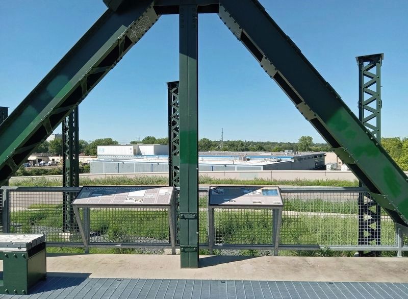
Transportation & Industry
The streetcar system began in 1875. Where tracks were laid, people built homes and businesses. Each night they patiently waited at the corners where every hour they could ride the trolley for work or pleasure. The . . . — — Map (db m232205) HM
Northeast Homes Have Distinct Differences
Northeast Minneapolis housing is distinctly different from that in other parts of the city. The upper-middle class and business owners built the older houses in much of Minneapolis. But in old St. . . . — — Map (db m232206) HM
Charles Ingebretsen came to the United States from Norway, working first in New York City as a dockhand, then as an apprentice meat cutter in Fargo. He arrived in Minneapolis around 1907 and entered the meat-selling business. He owned . . . — — Map (db m213245) HM
Upon their arrival in the United States, many rural Greek immigrants demonstrated a preference for the city and its promise of a better life. Like other newcomers, they quickly established culturally supportive organizations. In 1909 a . . . — — Map (db m213679) HM
Norwegian immigrant sisters Pauline and Thomane Fjelde gained renown for winning a gold medal at the 1893 World's Columbian Exposition in Chicago for embroidering the first Minnesota State Flag, which was used until 1957. Pauline's . . . — — Map (db m234625) HM
New Products for New Consumers
During the 1920s, manufacturers and producers reached mass markets like never before. Newspaper, radio, and billboard advertising urged consumers to buy goods ranging from bread to automobiles. Mail-order . . . — — Map (db m236671) HM
History of Lake Street
When the City of Minneapolis was established in 1856, Lake Street was a mile beyond the southern boundary of the city.
Early Lake Street was home to dance halls, lumberyards, churches, horsesheds, blacksmiths, . . . — — Map (db m213113) HM
George N. Boosalis founded the Town Treat Café in 1940. Boosalis emigrated from Greece in 1914 at age 16, eventually landing in Minneapolis to join the growing number of Greeks working in the restaurant business. He started at his . . . — — Map (db m213171) HM
"I am now ready to supply the citizens of the Territory with Ale and Beer, which will be found equal—yes, superior—to what is brought from below. I am now demonstrating that malt liquors of the very best quality can be manufactured in . . . — — Map (db m231999) HM
Wedged between the Mississippi River and the steep river bluffs, the isolated but legendary district known as Bohemian Flats flourished for nearly 70 years.
English scholar George Tuthill Barrett traveled through Minneapolis in the early . . . — — Map (db m232014) HM
Nearly nine centuries after Leif Ericsson established the first settlement of Europeans in North America, several hundred of his Icelandic countrymen left their native land to make their homes in the Minneota area. First of the Icelanders to . . . — — Map (db m207252) HM
Erected in 1952 to the Memory of Reverend Francis Xavier Pierz "Father of the Diocese of St. Cloud" 1785-1880 By assignment of Bishop Joseph Crétin of St. Paul he came to the Upper Mississippi and its tributaries in 1852 to convert the Indians and . . . — — Map (db m213533) HM
Dr. O. H. Hegge, a native of Biri Parish, Norway, enrolled at the University of Minnesota Medical School in 1890, just two days after arriving in the United States. He later graduated from the University of Illinois School of Medicine in Chicago and . . . — — Map (db m235431) HM
Miguel Garate moved to Austin in 1997 and worked as a supervisor and interpreter for Spanish speaking employees at Quality Pork Processors. In 2000, he began his career at Riverland Community College as Minority-International Student Advisor where . . . — — Map (db m235399) HM
Susan Grove, a graduate of St. Cloud State University, moved to Austin in 1975 and immediately immersed herself in the community as an advocate for life-long learning, immigrants, and women's rights. As an educator and expert at networking, Grove . . . — — Map (db m235436) HM
The Eastside, which makes up a third of Saint Paul, is comprised of many diverse neighborhoods. The earliest were developed as part of a walking city; the later ones came with the streetcars and automobiles. The oldest homes date to the 1850s and . . . — — Map (db m232441) HM
Living on Railroad Island
The small residential neighborhood immediately to the east of here is known as "Railroad Island," named so because it was at one time entirely surrounded by railroads. Railroad Island has long been home to many . . . — — Map (db m232442) HM
Hmong in the Rondo Neighborhood
Lee Pao Xiong
In 1976, Rondo became the home of the first Hmong refugee in Minnesota, Leng Vang. His sponsors, the Dayton Avenue Presbyterian Church and Macalester Plymouth United Church, placed . . . — — Map (db m246200) HM
Karen People in Rondo
Saw Sunshine Timothy
Many Karen families are now living in the Rondo neighborhood. The first Karen Church opened in Rondo in 2007. The majority of Karen refugees in Minnesota are Christians and so churches have . . . — — Map (db m243340) HM
... St. Paul, by the vigilance, energy, enterprise and united action of her leading citizens has succeeded in making herself the railroad center and headquarters of the northwestern region ... Railroads are now-a-days the most . . . — — Map (db m213804) HM
Alexander Faribault, namesake of this community, epitomized cultural coexistence. As the child of a French-Canadian father and a half-Dakota mother, Alex saw the value of multiculturalism and respect across religious lines. At a time when this . . . — — Map (db m212075) HM
The first burial in this cemetery was in 1884. Remains and monuments with death dates older than 1884 were moved here from the old church yard cemetery before the current (third) church was built in 1906. The St. Wenceslaus Cemetery Chapel was . . . — — Map (db m240649) HM
In the late 1600s, the Mdewankanton Dakota moved from Mde Wakaŋ (Mille Lacs Lake) to along the Mnisota Wakpa, later called the Minnesota River. One planting village was located on the north side of the river in the area later called Shakopee. . . . — — Map (db m213090) HM
The first stagecoach arrived at Shakopee on October 6, 1853. In 1936 E. Judson Pond, at age 90, remembered the four-horse led stagecoach arriving. It stopped at the stagecoach barn which was next to the St. Paul Hotel on Fuller and Third Street. . . . — — Map (db m213098) HM
One of the lesser known, but extraordinary legends of ages past is the legend of St. Urho – Patron Saint of the Finnish vineyard workers. Before the last glacial period wild grapes grew with abundance in the area now known as Finland. . . . — — Map (db m209090) HM
The first Swedes arrived in the territory of Minnesota in 1850, settling in Scandia. By 1920 nearly a quarter of Minnesota's foreign-born residents were from Sweden, making it the home of more Swedes than any other state. About half lived in . . . — — Map (db m207127) HM
In memory of Aime Amant Vuille who was born in 1797 in top of the Swiss Alps. He came to America in 1836 and built this settlement house in Valles Mines, St. Francois Co.
After the emancipation of slaves, he sold his 400 acre farm to his . . . — — Map (db m229298) HM
Built around 1840 and said to have been a slave cabin used by a previous owner on a farm in Valle Mines (St. Francois County). Around 1870, Salim Grandjean, a Swiss immigrant, gold miner and wagon maker, purchased the farm from his uncle and . . . — — Map (db m229208) HM
Born: January 5, 1797
Kahla, Saxony, Germany
Died: August 19, 1849
Altenburg, Missouri
Loeber became one of the leading pastors in the Perry County Settlements. Altenburg was named by Loeber after Altenburg in Saxony, Germany. Loeber . . . — — Map (db m213758) HM
Founded by Saxon immigrants from Germany in the year 1839
This marker was placed by Trinity young peoples society on the 100th Anniversary of continuous organized youth work in this congregation July 20, 1951 — — Map (db m213723) HM
Site of second house of worship of St. Paul’s Lutheran Church (Missouri Synod), dedicated to the glory of God on Advent Sunday, 1920. Wittenberg, Missouri (named after Wittenberg in Germany), was one of seven settlements of the Saxon immigration to . . . — — Map (db m214282) HM
Meyer Jewelry was founded in 1834 by Ludwig Meyer, a clockmaker from the Kingdom of Hanover. His family continued in the jewelry business until 1966. During all those years, the clock that Meyer had made in Germany and brought with him aboard the . . . — — Map (db m124851) HM
Before the Civil war, this was the cabinet shop of George Baumann, a young German cabinetmaker. By 1906, it had become the St. Charles Steam Laundry. "Of course a laundry is a washhouse, but when you take into consideration the fact that the St. . . . — — Map (db m124854) HM
In the 1860s, A. R. Huning's Dry Goods store occupied the street level of this shop, and Goebel's Photography occupied the second floor. Rudolph Henry Goebel, a German immigrant, photographed St. Charles and her citizens from 1856 to 1916. . . . — — Map (db m124829) HM
Francis Oberkoetter, a prosperous shoe manufacturer from Hanover, Germany, built this Italianate "Oberkoetter Business House" building in 1867. His son-in-law operated the Mackenzie Hotel and Dining Room on the second floor. After becoming owner of . . . — — Map (db m124857) HM
The decorative façade, with elaborate stone window surrounds and stone quoining, invites comparison to the fancy sugar pastries and candies sold here from 1879 to 1909 by Henry Pfeiffer, a confectioner from Braunschweig, Germany.
Henry . . . — — Map (db m124864) HM
Petit Canada (French Village) was visited by explorers and missionaries in the early 1700's. Later mid-century miners leaving the King's Highway at Bloomsdale established a permanent camp here on their way to Old Mines. The first settlers were . . . — — Map (db m229207) HM
To remind
future generations
of the heroism of the
German-American patriots
of St. Louis and vicinity
in the Civil War of
1861 to 1865
General Franz Sigel — — Map (db m124918) WM
Dr. George Engelmann immigrated to St. Louis from Germany in the 1830s. He was a noted botanist and advisor to Henry Shaw, the Garden's founder. He encouraged Shaw to develop his gardens to be of scientific use. Engelmann was instrumental in . . . — — Map (db m219247) HM
This garden incorporates native flora of Germany and central Europe, as well as plants hybridized or discovered by German botanists. The plants highlight central European species such as the common boxwood, pontic azaeleas, and linden trees, . . . — — Map (db m219451) HM
Henry Shaw grew up in Sheffield, England. His parents sent him to a boarding school, where each student had his own garden. These childhood memories, along with his later travels, inspired Henry to build a garden for his new country home in St. . . . — — Map (db m219513) HM
Please take a moment to look around. It may feel as if you've taken a giant step back in time. Maybe you've spotted the vintage jukebox, the Coca-Cola collectibles or the soda fountain. You might not be aware that Crown Candy Kitchen is one of . . . — — Map (db m219527) HM
Satoko Yamamoto was born in Nikko, Japan. Married Al Mitchell in 1952 & went by the name "Sue". Came to USA knowing only her husband. They raised five children. As a child taught herself to sew when she lived in Japan. She opened Sue's Alteration . . . — — Map (db m232207) HM
The Knobbe House was built in the mid 1800's and owned originally by Bernard Henke. A farmer, Joseph Knobbe, a German immigrant, came to work for the Henke family in 1877 and in 1879 married Bernard's daughter, Mary Anna Henke. The City of . . . — — Map (db m217343) HM
Seventy feet long, thirteen feet wide and following the contours of an uneven slope in Laumeier's Way Field, Robert Stackhouse's St. Louie Bones, 1987, creates a rippling silhouette on the Park's landscape. Conceptually modeled by the . . . — — Map (db m219079) HM
James MacKay settled almost 4,000 acres in this area, at the mouth of Bonhomme Creek, in 1797, which was originally known as St. Andrews. It was under the control of the Spanish government, which granted MacKay land for his service in transporting . . . — — Map (db m241129) HM
This village, which comprises much of Wildwood's commercial core on Old Manchester Road, was originally called St. Friedling and Maple Grove. The first post office was established during the Grover Cleveland Administration and John Brown, the first . . . — — Map (db m241126) HM
The Historic Village of Kelpe was the name given to this small hamlet and post office that was near the intersection of Wild Horse Creek Road and Ossenfort Road, which was settled by this early pioneer family. In 1852, Henry Kelpe (I) left Hanover, . . . — — Map (db m241132) HM
Founded by the Orr Family, from Cowcaddens, Glasgow, Scotland, beginning with the first post office established in 1858. The Orrs sold several tracts of land to families, such as the Eathertons. The Hoppenberg-Fick General Store and Post Office, a . . . — — Map (db m241113) HM
On Saturday, November 2, 1861. Brigadier General Ulysses S. Grant directed Colonel Richard J. Oglesby of the 8th Illinois Infantry Regiment to move from Bird's Point, Missouri. to destroy Brigadier General Jeff Thompson's Confederate forces in . . . — — Map (db m207533) HM
The first homesteads were filed in 1866 by William O. Bussard and William C. Whitaker along the West Fork of the Blue River. Mrs. E. A. Whitaker, the first white woman, came in 1867. The first white children, Emma Whitaker Hall and Arthur Dixon . . . — — Map (db m206666) HM
Many settlers in the area were Catholics of Czech and Irish descent. Services were held in homes before this small chapel was built on the farm of Joseph Kotas in 1874. It served as the first Catholic Church for pioneers in Fillmore and Saline . . . — — Map (db m206999) HM
Many immigrants in Glengary Township and the surrounding area were Catholics of Czech and Irish descent. During the early years few priests were available, so they visited the community whenever possible beginning in 1874. Local parishioners . . . — — Map (db m206996) HM
Since 1868, Seward has, with but few interruptions, sponsored a yearly 4th of July celebration which has gained national attention. This square, the original site of the festival, is today its focal point. Special trains once brought revelers here . . . — — Map (db m101843) HM
A tribute to Siegfried Fischbacher and Roy Horn, known as Siegfried and Roy Masters of the Impossible.
Born in Germany, proud American citizens, as illusionists they brought magic to Las Vegas.
As conservationists, they protect . . . — — Map (db m193114) HM
Although rarely recognized or celebrated, the members of Northern Nevada's Chinese immigrant population have contributed significantly to the state's history and culture through the building of the Northern Nevada railway system, and their vital . . . — — Map (db m218954) HM
This monument is proudly
dedicated to all the
early Greek immigrants
who settled in this
area and strived diligently
for the future of their
families, their adopted
city, state, and country.
Donated by the Nashua Arepa Family
. . . — — Map (db m244921) HM
"Le Parc de Notre Renaissance Française" was named in July 1999 after being selected as the site for the bronze monument commemorating the Franco-American immigrants. The Franco-American community, led by Georgi Laurin Hippauf, co-chair . . . — — Map (db m245441) HM
The City of Burlington is numbered among the oldest and, at one time, the most influential towns in New Jersey. At Holland's behest, Walloon settlers from southern Belgium arrived at present-day Burlington Island in 1624 and their community . . . — — Map (db m220859) HM
"A person who never made a mistake, never tried anything new."
- Albert Einstein
Born: March 14, 1879
Died: April 18, 1955
Lived in: Princeton, New Jersey
Inducted to New Jersey Hall of Fame: . . . — — Map (db m220942) HM
"I think the greatest thing about America is the American Dream."
- Wyclef Jean
Born: October 17, 1969
Lived in: Newark, New Jersey
Inducted to New Jersey Hall of Fame: 2016
Newton Friends Meetinghouse (c 1828) is the oldest religious building in the city of Camden and is listed on the National Register of Historic Places.
Quakers played an important role in the early development of the colony of New Jersey and . . . — — Map (db m220908) HM
Hoboken’s founding father, Colonel John Stevens, designed an iron-clad warship in 1813 that his surviving sons attempter to build starting in 1843 in a drydock just south of Second Street near Hudson Street. Known as the Stevens’ Battery, it was . . . — — Map (db m242216) HM
Two major German passenger lines made Hoboken their American homeport from the 1870s to 1914: Hamburg-America Line and North German Lloyd Steamship Co. Their ocean liners, some of the largest and finest of the era, occupied six piers from Newark . . . — — Map (db m242257) HM
Liberty State Park, across the Morris Canal, features the majestic Central Railroad of New Jersey Terminal, hundreds of acres of green space, and the State's only ferry access to Ellis Island and the Statue of Liberty.
Once Neglected, Now . . . — — Map (db m239443) HM
Died in the World Trade Center:
9/11/01
Donated by his friends: 5/10/02
Boyd Gatton moved to the United States in 1992 and was still discovering new interests in this country as an operations officer at Fiduciary Trust. He was born in . . . — — Map (db m239383) HM WM
The building standing on the other side of the Morris Canal Big Basin is the Central Railroad of New Jersey Terminal. Built in 1889, the complex represented the greatest concentration of rail facilities in the New York Harbor area during that . . . — — Map (db m239445) HM
Joseph Bonaparte, brother of Napoleon, flees Europe and settles in Bordentown, later occupying houses in today’s South Trenton and Hamilton Township — — Map (db m211741) HM
The Crawford Cemetery, the Garden State Arts Center and the New Jersey Vietnam Veterans Memorial are located on land that was a part of a 1219 acre tract granted to John Bowne in 1687 from the King of England.
John Crawford emigrated to . . . — — Map (db m209034) HM
This Interstate roadway which stretches from coast to coast has been named in New Jersey in honor of the "Great Explorer" and the outstanding contributions of the Italian Americans to the development of New Jersey and the nation. — — Map (db m231654) HM
This Interstate roadway, which stretches from coast to coast, has been named, in New Jersey, in honor of the "Great Explorer" and the outstanding contributions of the Italian Americans to the development of New Jersey and the nation. — — Map (db m231643) HM
This Monument Honors
Christopher Columbus
Our First Immigrant
And all our immigrant parent and grandparents who by their prayers, hard work, and perseverance, fashioned a great nation out of a vast wilderness. God grant that we imitate . . . — — Map (db m242856) HM
The Dutch who settled Kinderhook around 1660 were considered some of Europe's most accomplished planters and farmers. These first European settlers applied their agricultural and husbandry skills to the flat terraces that paralleled Kinderhook . . . — — Map (db m244774) HM
Welcome to Columbia County Historical Society's interpretive exhibit exploring the
early heritage of the site, specifically the people, stories and events that shaped the
history and character of northern Columbia County.
The cultural heritage . . . — — Map (db m244315) HM
This playground honors the Van Dyke family, who were among the earliest Dutch settlers of 17th century Brooklyn. Successive generations of the Van Dyck (the original Dutch spelling) family produced magistrates, judges, and landowners who held . . . — — Map (db m242954) HM
This building was erected when this area of Clinton Hill was the center of New York's shoe manufacturing industry, which disappeared during the Great Depression of the 1930s.
Sam Hellerman, an immigrant from Latvia, bought this building from . . . — — Map (db m241436) HM
This building is one of more than thirty cooperative apartment buildings surrounding Sunset Park, which were either built or converted to co-ops by Finnish immigrants in the early 1900s. The neighborhood was known as Finntown into the 1980s. . . . — — Map (db m228635) HM
This building, known as a Finnish co-op, is one of more than thirty cooperative apartment buildings surrounding Sunset Park that were either built or converted to co-ops by Finnish immigrants in the early 1900s. These building were among the . . . — — Map (db m228624) HM
This building, known as a Finnish co-op, is one of more than thirty cooperative apartment buildings surrounding Sunset Park that were either built or converted to co-ops by Finnish immigrants in the early 1900s. These buildings were among the . . . — — Map (db m228626) HM
This Edwardian Baroque building with a Beaux Arts style canopy is one of more than thirty cooperative apartment buildings in Sunset Park. It was designed and built by the architects Eisenia and Carlson in 1914. These grand buildings were . . . — — Map (db m228652) HM
This building is one of more than thirty cooperative apartment buildings surrounding Sunset Park that were either built or converted to co-ops by Finnish immigrants in the early 1900s. It was designed and built by the architects Eisenla and . . . — — Map (db m228649) HM
This building is one of more than 30 cooperative apartment buildings surrounding Sunset Park, that were either built or converted to co-ops by Finnish immigrants in the early 20th century. The neighborhood was known as Finntown into the 1980s. . . . — — Map (db m228632) HM
This building is one of more than thirty cooperative apartment buildings surrounding Sunset Park, which were either built or converted to co-ops by Finnish immigrants in the early 1900s. The neighborhood was known as Finntown into the 1980s. . . . — — Map (db m228634) HM
More than thirty cooperative apartment buildings surrounding Sunset Park were either built or converted to co-ops by Finnish immigrants in the early 1900s. These were among the first co-ops in the United States and served as a model for the . . . — — Map (db m228637) HM
This Edwardian Baroque building with a Beaux Arts style canopy is one of more than thirty cooperative apartment buildings in Sunset Park. It was designed and built by the architects Eisenia and Carlson in 1914. These grand buildings were . . . — — Map (db m228651) HM
This building is one of more than thirty cooperative apartment buildings surrounding Sunset Park that were established as co-ops by Finnish immigrants in the early 1900's. These buildings were among the first co-ops in the United States and served . . . — — Map (db m228653) HM
This building is one of more than thirty cooperative apartment buildings surrounding Sunset Park, that were established as co-ops by Finnish immigrants in the early 1900s. The neighborhood was known as Finntown into the 1980s. These buildings . . . — — Map (db m228654) HM
One of the earliest examples of not-for-profit housing cooperatives in the United States, Riverview Homes was established and constructed by Finnish immigrants who settled in the neighborhood surrounding Sunset Park, creating what became . . . — — Map (db m228630) HM
This building is one of more than thirty cooperative apartment buildings surrounding Sunset Park, which were either built or converted to co-ops by Finnish immigrants in the early 1900s. The neighborhood was known as Finntown into the 1980s. . . . — — Map (db m228596) HM
This building is one of more than thirty cooperative apartment buildings surrounding Sunset Park, which were either built or converted to co-ops by Finnish immigrants in the early 1900s. The neighborhood was known as Finntown into the 1980s. . . . — — Map (db m228622) HM
The site, named Sunset Park from the outset, presumably derives its name from its vantage point on a hill facing west toward Upper New York Bay. The bluff of Sunset Park affords a thrilling view of the harbor, including the rugged skyline of . . . — — Map (db m228642) HM
What was here before?
The site of this playground was acquired by the City of New York for the creation of the Williamsburg Bridge. The space, along with the adjacent Continental Army Plaza, was cleared in 1903.
How did this site . . . — — Map (db m226340) HM
What was here before?
This section of Brooklyn was largely rural from the 1600s to the mid-1800s. At the turn of the century, it was mostly industrial, with chemical, varnish, and iron works, and cable factories. Immigrants from Eastern . . . — — Map (db m241464) HM
What was here before?
This section of Brooklyn was largely rural from the 1600s to the mid-1800s. At the turn of the century, it was mostly industrial, with chemical, varnish, and iron works, and cable factories. Immigrants from Eastern . . . — — Map (db m241455) HM
585 entries matched your criteria. Entries 201 through 300 are listed above. ⊲ Previous 100 — Next 100 ⊳