This strategic point on Lake Champlain was occupied by Native Americans for thousands of years. In 1690 Jacobus deWarm build a small stone fort here. The French build a wooden stockade in 1731, erecting Fort St. Frederic across the lake in 1734. . . . — — Map (db m85414) HM
General John Strong was a Revolutionary War patriot and a prominent early citizen of Addison County. He served as a judge, state legislator and represented Addison at the State Convention, which adopted the Constitution of the United States and . . . — — Map (db m85231) HM
(front)
Addison Remembers
Her Heroes
1771 - Revolutionary War - 1778
[Honor Roll of Veterans]
1812 - War With England - 1814
[Honor Roll of Veterans]
1861 - Civil War - 1865
[Died in Service]
Joseph Arno • Joseph . . . — — Map (db m109277) WM
(side 1)
Middlebury
In The
1861—Civil War—1865
Joseph Alexander • Henry W. Bennett • Merrill Bentley
Bertrand W. Billings • John Brunelle • Michael Burke
John Caffrey • Roderick A. Champlin • . . . — — Map (db m136571) WM
“I have also provided timber for two Blockhouses.” - Col. Anthony Wayne, February 4, 1777 In the summer and fall of 1776 American forces concentrated on fortifying the northern point of the rocky Mount Independence . . . — — Map (db m19321) HM
“Blockhouses, none of them finished.” - Lt. John Starke, Royal Navy, September 1777 After the British captured Mount Independence on July 6, 1777, their military engineers decided to build six new blockhouses to augment . . . — — Map (db m19332) HM
“ . . . this Day there was two men Buried from our Regt.” - Lt. Jonathan Burton, October 4, 1776 This small stone, engraved “N. Richardson of Staddard Eng died 1760,” may mark the only identified grave on . . . — — Map (db m17849) HM
“ . . . a perfect mousetrap.” - Col. Alexander Scammell, September 21, 1777 From here are seen nearly all the powerful forces of nature that made this spot on Lake Champlain the Gibraltar of the North as well as its . . . — — Map (db m17846) HM
This is one of the best-preserved stone foundations on Mount Independence. It was built during the Revolution, but historic maps and documents do not refer to it. Who built it? Did the Americans have time to build it during the two weeks in June . . . — — Map (db m19441) HM
“ . . . the new Hospital . . . 250 long & 24 wide.” - Rev. Enos Hitchcock, June 14, 1777 This shallow, dry-laid stone foundation was for the largest building at Mount Independence – a 250-foot long by 24-foot wide, . . . — — Map (db m19319) HM
“Our men built huts out of boards to protect themselves from the cold weather.” - Lt. Von Hille, October 22, 1777 During the American occupation from July 1776 to July 1777, soldiers constructed a breastwork of logs and . . . — — Map (db m19436) HM
“Some of the intrenchments are still visible.” – John Disturnell, 1857 After the American Revolution, numerous visitors curious to see the places that figured so prominently in the war for independence visited Mount . . . — — Map (db m19501) HM
“ . . . the possession of every thing here depends upon keeping the Command of the Water.” - Maj. Gen. Horatio Gates, July 16, 1776 In front of you is Lake Champlain, at 120 miles long the sixth largest lake in the United . . . — — Map (db m19440) HM
Fortification was begun in June of 1776, and the name Mount Independence was bestowed following the Declaration of Independence. Lieut. Col. Jeduthan Baldwin was the chief construction engineer. Here the exhausted American Army, Northern Department, . . . — — Map (db m9275) HM
After Ethan Allen seized Fort Ticonderoga, the Americans built Fort Mt. Independence, northwest from here on the Lake. Following Burgoyne’s invasion, Gen. St Clair evacuated the Forts, retreating across these hills to Hubbardton. Vermont . . . — — Map (db m9232) HM
This vital American military road to the south of here was built on the September 7, 1776, orders of Gen. Horatio Gates to connect Mount Independence, a new Revolutionary War fortification on Lake Champlain, to Hubbardton, Rutland, and Fort No. 4 . . . — — Map (db m97307) HM
“ . . . some of the officers have good framed houses.” - Dr. Lewis Beebe, September 30, 1776 This fifteen-foot square, well-defined stone foundation may be the remains of quarters for one or more American officers in the . . . — — Map (db m17863) HM
“began the works at 3 places on Mount Independence.” - Col. Jeduthan Baldwin, June 20, 1777 On June, 1777, American Chief Engineer Jeduthan Baldwin wrote in his journal, “in the afternoon went with Col. Kosiusko . . . — — Map (db m19437) HM
This walkway is a loop approximately 0.2 mile long with stairs and gentle slopes. It leads you past the remains of a blockhouse (near the parking area), provides a look at the Mount’s rock formations, and provides a vista of the lake south of the . . . — — Map (db m19536) HM
“ordered a large Stoer House to be built.” - Col. Jeduthan Baldwin, August 17, 1776 At least one of the storehouses constructed on Mount Independence during the Revolution stood in this area. Portions of the remaining . . . — — Map (db m19366) HM
“we are Building a Large & Long Breast work on the South Side.” - Pvt. Thomas Killam, August 19, 1776 When the American Northern Army arrived at Ticonderoga in mid-July 1776, the 300-acre peninsula opposite on the Vermont . . . — — Map (db m19543) HM
“ . . . our Men is clearing the Encamping Ground over the Lake.” - Sgt. Timothy Tuttle, July 23, 1776 In July 1776 Northern Army commander Gen. Horatio Gates organized regiments at Mount Independence and Ticonderoga into . . . — — Map (db m19318) HM
“The Generals have Fix’d on a spot . . . to be fortified.” - Lt. Col. Matthias Ogden, July 19, 1776 On July 5, 1777, Thomas Anburey, who was traveling with British Lt. Gen. John Burgoyne on Lake Champlain, observed as they . . . — — Map (db m19480) HM
Near this spot on the afternoon of October 13, 1776 in the first important naval engagement of the War for Independence BENEDICT ARNOLDafter a battle in which he had displayed great boldness, gallantry and sagacity ran ashore and burned the . . . — — Map (db m76010) HM WM
From Hands Cove northwest from this spot
Ethan Allen with eighty-three Green Mountain Boys
embarked for the capture of Fort Ticonderoga May 10 1775
To commemorate
one of the most heroic adventures of the Revolution
this tablet has been . . . — — Map (db m118290) HM
He lies buried in this cemetery. He walked 64 miles to recruit men to aid Ethan Allen in the capture of Fort Ticonderoga, May 10, 1775. — — Map (db m136470) HM
Site of
Dimick Tavern
where
John Stark
and his New Hampshire Volnteers
camped before the engagement at
Walloomsac Heights
where they led in the winning of a decisive victory . . . — — Map (db m105506) HM
The expedition led by Lieut. Col. Baum sent to seize military stores here, was defeated by volunteer American militia forces from New Hampshire, Massachusetts and Vermont, commanded by General John Stark, aided By Colonels Warner and Herrick, of . . . — — Map (db m13649) HM
Brigadier General John Stark 1728 – 1822 Victor of the Battle at Bennington 1777 “There they are boys! We beat them today Or Molly Stark sleeps A widow tonight!” Design by John Rogers – 1889 Sculpture by Robert Shure Gift . . . — — Map (db m105507) HM
State Highway 9 traverses scenic Hogback Mt. to the Connecticut River Valley. Old Bennington, site of the Battle Monument and Historical Museum, was the meeting place of the Green Mountain Boys. It was the first town chartered by Governor Benning . . . — — Map (db m94427) HM
Whereas, the Old First Church of Bennington was
organized December 3, 1762, and is the Oldest Church
within the present limits of Vermont; and
Whereas, our forefathers met in Prayer in the First
Meeting House for assistance against the . . . — — Map (db m28223) HM
Ethan Allen crossed Lake Champlain to capture Fort Ticonderoga on May 10, 1775 for "America's First Victory." Allen's expedition passed through here on May 5, 1775. Nathan Beman from Manchester guided the expedition into the fort; John Roberts of . . . — — Map (db m78237) HM
A few feet east of this marker stood the house, removed about 1870, in which Lieutenant Colonel Friedrich Baum died. Commander of the enemy forces, he was mortally wounded in the battle of Bennington and died two days later, August 18, 1777.
He was . . . — — Map (db m58451) HM
A Bridge from Past to Present
You are standing at a hub of Vermont history. The Green Mountain Boys were born here. General John Stark and Colonel Seth Warner marched on to victory at the nearby 1777 Battle of Bennington through here. This . . . — — Map (db m193190) HM
A Brief History
The Village of North Bennington established McWaters Park in 2007. The Park is named in honor of Rob and Jean McWaters in recognition of local community involvement. Residents are
creating a perma forest consisting of berry . . . — — Map (db m193197) HM
Forty feet west of this spot
stood the home of
Seth Warner
Colonel of the Green Mountain Boys,
during his residence in Bennington.
Hero of Hubbardton and Bennington
Battles, 1777.
The house was destroyed by fire
in 1858.
Erected . . . — — Map (db m193183) HM
On August 16, 1777, British forces sent by Gen'l Burgoyne to seize supplies at Bennington were turned back by New Englanders under Gen'l John Stark and Vermont's Col. Seth Warner. This 306 foot commemorative shaft planned 100 years later, was . . . — — Map (db m13600) HM
The Warner monument has text on the four sides of the base Born in
Roxbury (then Woodbury) C.T. May 17, 1743
Resided in
Bennington VT. 1765-1784
Died Dec. 26, 1784 at Roxbury CT
Where he was buried with Honors of War
Age 41 . . . — — Map (db m77023) HM
On this site
stood the
Continental Storehouse
Object of
the British attack
that was repulsed
by the Colonial Forces
at the
Battle of Bennington
August 16, 1777 — — Map (db m14828) HM
Erected in honor of Brigadier General John Stark and the 1400 New Hampshire men who came to the defense of Vermont in August 1777. Assembling at Fort Number Four in Charleston, New Hampshire, Stark and his troops crossed the Green Mountains to aid . . . — — Map (db m77022) HM
The Catamount Tavern, which was built in 1767, was originally named the Green Mountain Tavern. The Council of Safety and the “Green Mountain Boys” met here from 1767 to 1775. On May 9, 1775, Ethan Allen and 270 men, 40 whom were . . . — — Map (db m77053) HM
This site commemorates the gateway of Vermont’s earliest Dutch settlement, the Rensselaerwyck Manor settlement. The Diel Homestead, built by Bastion Diel in the early 1700s, is considered the second earliest dwelling in Pownal. The property’s large . . . — — Map (db m157547) HM
Condemned to death by the N.Y. Assembly, Col. Cochran fought the Yorkers for Vermont land grants. Joining the Green Mt. Boys, he was with Ethan Allen at Ticonderoga and Seth Warner at Crown Point. Later he commanded Continental forces in the Mohawk . . . — — Map (db m77947) HM
Jonas Galusha, born in Norwich, CT in 1753, moved his family to Shaftsbury in 1775. During the Revolutionary War he served with Seth Warner's Green Mountain Boys and was at the Battle of Hubbardton and a Captain during the Battle of Bennington. A . . . — — Map (db m27799) HM
The mortal remains of Ethan Allen, Vermont leader, fighter, writer and philosopher, lie in this cemetery beneath the marble statue, but his spirit is in Vermont now. — — Map (db m51646) HM
Putting behind him the martial deeds of a hero, Ethan came here in 1787 to till the soil as a peaceful farmer. On Feb. 12, 1789, he died here after a trip across the ice to South Hero. Memorial Tower was built on Indian Rock, traditional Algonquin . . . — — Map (db m75585) HM
The Battle of Valcour Island
11-13 October 1776
In the fall of 1776 a British Naval force left Canada and embarked onto Lake Champlain in an effort to divide and conquer the rebelling thirteen colonies. Positioned off Valcour Island was a . . . — — Map (db m115264) WM
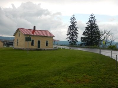
The one-room Schoolhouse was the first structure moved to the Museum. The building has several distinct classical architectural features, including a projecting bell tower, arched door opening, and sash windows. The structure originally stood on . . . — — Map (db m109087) HM
Near this site in 1773 the first settlers Ira Allen and his uncle Remember Baker built of hewed timbers the block house called Fort Frederick as a protection from Indians and Yorkers
It had 32 port holes and in it were held the meetings of . . . — — Map (db m79911) HM
Born in 1742 in West Africa, Boyrereau Brinch was sold into slavery at age 16. Renamed Jeffrey Brace, he fought in the Seven Years War as an enslaved sailor and endured the cruelty of masters in Connecticut. About 1768 he was sold to Mary Stiles, . . . — — Map (db m230581) HM
In 1776, at the request of General Washington, Elisha Sheldon was commissioned by Congress to raise a regiment of cavalry. Named the 2nd Continental Light Dragoons, the unit served with distinction throughout the Revolutionary War. In 1791, Colonel . . . — — Map (db m43774) HM
Here Ethan Allen's cousin, Ebenezer, made the first settlement on South Hero. From his tavern, Ethan, one of the "heroes" for whom the islands were named, started homeward across the ice to Burlington, Feb. 11, 1789. Stricken en route, the Green . . . — — Map (db m86595) HM
Revolutionary War patriot and author of the popular ode "The American Hero," written in celebration of the Battle of Bunker Hill, Nathaniel Niles was an original settler of Fairlee, then founder of West Fairlee, and first minister of this church. He . . . — — Map (db m65091) HM
Conceived, planned, laid out & financed by Newbury founder, Gen. Jacob Bayley 1726–1815, who on Nov. 24, 1775, presented his plan to Gen. George Washington for a shorter military route to Canada. On Washington's orders, Bayley began road in . . . — — Map (db m87961) HM
To the memory of Col. THOMAS JOHNSON an early settler of this state and a brave and efficient officer in the Revolutionary war. His duties as a civil and military officer were performed with unblemished integrity. In private life a faithful friend . . . — — Map (db m89735) HM
One of the first settlers of Newbury, 1762, Influential in organizing the town and state; Revolutionary officer; Aid to General Lincoln at Ticonderoga, 1777, A prisoner in Canada 1781, Elected representative ten times. This marks the location of . . . — — Map (db m87960) HM
{East side} Patriot A pioneer of strong unselfish purpose A patriot of uncompromising fidelity A soldier unstained by personal ambition A citizen ever devoted to the public good {South side} Soldier French and Indian war . . . — — Map (db m88114) HM
Veteran of the Indian Wars, Bayley led a migration of settlers from Newbury, Mass to the rich lands of the Coos here at the Great ox-Bow. A staunch patriot, he bitterly opposed the "Haldimand Negotiations" carried on with Canada by Ethan & Ira . . . — — Map (db m87994) HM
The old court house with jail connected for Gloucester County New York, which became Orange County Vermont. It was used for a meeting house until 1788. The Legislature of 1787 met in this building. A few rods northerly stood the log fort of . . . — — Map (db m48618) HM
Strafford was granted its charter on August 12, 1761. Land near here was chosen for the town's first settlement by its earliest pioneers, Ezekiel Parish and Frederick Smith. Both men with their families established homesteads in this vicinity by . . . — — Map (db m107647) HM
On the Tunbridge hilltop, across the meadow, three hundred Indians, led by the British in the wanning years of the Revolutionary War, laid in wait the night of Oct. 15, 1780. As dawn approached on the 16th, they began their pillaging, reducing . . . — — Map (db m73916) HM
North Face
Names of the soldiers from
the Town of Coventry, Vermont
who served in the Civil War of
1861-1865.
Co. A 2d VT Inf. Vol.
Abby, Daniel
Co. B 3d VT Inf. Vol.
Allen, Levi C.
Bartlett, Enoch K. . . . — — Map (db m155240) WM
A captain in the American Revolution. Born in Southbury, Conn. and came to Vermont in 1790. On this lot overlooking Hinman Pond he built the first house in town in 1794. A log house, rough but solid, thatched with hemlock bark over plank floors. . . . — — Map (db m207861) HM
Hinman Settler Road begins here at Greensboro’s Four Corners, passes through Glover, Barton, Brownington, and ends at the Quebec border in Derby. The road was named after Timothy Hinman, born 1761 in Woodbury, CT. Hinman, one of many Revolutionary . . . — — Map (db m199458) HM
Conflict – Site of Fort Warren 1777 – 1779 Erected under the auspices of Ann Story Chapter Daughters of the American Revolution 1904 — — Map (db m105476) HM
Directly east is the elevation of Fort Warren, built in 1779 for defense of the northern frontier. The road from the north was route of American retreat before Burgoyne, protected by Col. Seth Warner’s rearguard action at the Battle of Hubbardton, . . . — — Map (db m78183) HM
Marking The Meeting Place of Ethan Allen and Benedict Arnold on their Historic March to Fort Ticonderoga May 9, 1775 Dedicated 1941 Vermont Sesquicentennial — — Map (db m105475) HM
Jeffrey Brace was born in West Africa with the name Boyrereau Brinch. At sixteen he was captured by European slave traders, shipped to Barbados, sold to a ship's captain, and eventually arrived in New England. Some years later, while still enslaved, . . . — — Map (db m60663) HM
Here on July 7, 1777 a successful rearguard action by Colonel Seth Warner’s Vermont, Massachusetts, and New Hampshire troops ended British pursuit under Generals Frazer and Reldesel. Thus, General St. Claire’s American army, retreating from Fort . . . — — Map (db m74470) HM
On July 5 and 6, 1777, American forces withdrew from Mount Independence and
Fort Ticonderoga as the British pursued. They traveled over the military road built in the fall of 1776 to connect Mount Independence with sites on the
Connecticut . . . — — Map (db m201705) HM
Directly in front of you stands the majestic Mount Zion. From its summit the whole battlefield can be seen and it may have served as a lookout for Tory and Indian scouts who were surveying the area for the British shortly before the battle. The . . . — — Map (db m11408) HM
After the British attacked Monument Hill, the Americans withdrew to
a position behind a log fence on the east side of the Castleton Road.
As the battle continued, American Colonel
Seth Warner, his men, and others near the
Castleton Road . . . — — Map (db m201955) HM
Directly ahead, through the gap in the hills, ran the Military Road which connected the American garrison at Mount Independence on Lake Champlain with sites on the Connecticut River. American forces used this road as their escape route during . . . — — Map (db m202032) HM
Most of the battle waged back and forth in this field until the Americans were finally forced across the Castleton Road to the east. They took up a position there behind a log and stone fence. After some heavy fighting, Colonel Hale’s 2nd New . . . — — Map (db m202036) HM
The Americans took up
a position behind the
high log and stone fence
across the Castleton
Road to the east, being
forced there by the
British. After heavy
fighting, remnants of
the 2nd New Hampshire
Regiment moved back
across the road, . . . — — Map (db m201993) HM
The only battle fought in Vermont during the Revolution Right side of Monument: This monument erected by citizens of Hubbardton and vicinity July 7, 1859 Back of Monument: Hubbardton Battle fought on this ground July 7, 1777 Bottom of . . . — — Map (db m9230) WM
American Colonel
Ebenezer Francis, his
11th Massachusetts
Regiment, and selected
units from other
regiments encamped
along this hilltop the
night of July 6. Colonel
Seth Warner and his
Green Mountain Boys
made camp to the left,
down the . . . — — Map (db m201746) HM
Colonel Ebenezer Francis and his 11th Continental Regiment from Massachusetts encamped along this hilltop on the night of July 6th. To the left, down the hill toward the Selleck cabin, were Seth Warner and his Green Mountain Boys; to the right was . . . — — Map (db m202031) HM
Vermont is a state of bumpy back roads that lead to wonderful discoveries. Sometimes, a perfect swimming hole, other times a field of rare wildflowers. Hubbardton is such a discovery, a small rural town with a lot of heart and many beautiful . . . — — Map (db m201668) HM
John and Sarah Selleck built their cabin near the Castleton Road when they moved to Hubbardton from Connecticut in 1775. Like many other families, they had come here to farm and raise their families away from the crowding and turmoil in the coastal . . . — — Map (db m202034) HM
In 1775 John and Sarah
Selleck, who moved
to Hubbardton from
Connecticut, built their
cabin here near the
Castleton Road. They
wanted a farm to raise
their family away from
the crowded coastal
area. In the fall of 1776,
the newly built . . . — — Map (db m201992) HM
The only battle fought on Vermont soil during the American Revolution took place on these fields. Viewed as a rear guard action, this battle was important because it slowed the progress of the British and German pursuers long enough for the . . . — — Map (db m202033) HM
Starting here, follow the path to your right to the top of Monument Hill. A series of signs identify battle landmarks and explain the battle action that unfolded here. Enjoy exploring!
On July 5 and 6, 1777, the Northern American Army . . . — — Map (db m201688) HM
Near this location lived "Captain John" Vincent, a member of the Caughnawaga tribe. An admirer of General George Washington, Captain John became a firm friend of the Colonies. He accompanied Benedict Arnold and Richard Montgomery to guide American . . . — — Map (db m78176) HM
Erected in 1780
Stood on this ground
Caleb Houghton
Born Bolton Ms. 1760
Member of Capt. Saffords Co.
Maj. Allen's Detach.
Stationed at this fort
was killed by an Indian
half a mile south
July 15, 1780.
His remains were moved . . . — — Map (db m136551) HM
Ann Story was a pioneer and Rutland settler, a widowed mother of five, and a Revolutionary War spy and hero.
After moving to Salisbury, she supported the Green Mountain Boys, providing food, advice and information.
Fearless in the face of . . . — — Map (db m136573) HM
This monument is dedicated to
the memory of
the Veterans who served
in the following wars
Revolutionary War
(16 names)
War of 1812
(5 names)
Mexican War
(1 name)
Civil War
(19 names) — — Map (db m133953) WM
This American Liberty Elm was named after “The Liberty Tree: Our Country’s first Symbol of Freedom.” On the morning of August 14, 1765, the people of Boston awakened to discover two effigies suspended from an elm tree that became known as “The . . . — — Map (db m193095) HM
Leader of the Green Mountain Boys demanding the surrender of Ticonderoga "in the name of the Great Jehovah and the Continental Congress"Sculptor:Larkin Mead Replica: Aristide J. Piccini — — Map (db m76397) HM
Lafayette’s Tour
On June 28, 1825, Lafayette was led to the State House. He visited Representatives Hall and reviewed troops assembled on the common.
Le Tour De Lafayette
Le 28 Juin 1825, Lafayette fut conduit dans la chambre des . . . — — Map (db m185028) HM
Where Marquis de Lafayette was entertained in 1825 and President Monroe in 1817
Tablet placed by the Marquis de Lafayette Chapter of the Daughters of the American Revolution
1930 — — Map (db m185386) HM
On this former wilderness trail to Canada, the pioneers built old Fort Dummer in 1724 below Brattleboro, then the frontiers most advanced outpost. Guilford, then the largest town in Vermont, was the scene of bitter strife between the "Yorkers" and . . . — — Map (db m108852) HM
(east face)
William French
Shot at Westminster
March 13, 1775,
Erected by the State
Of Vermont in 1873.
(north face)
Daniel Houghton
Shot at Westminster
March 13, 1775,
by an act of the
Vermont Legislature of 1904
These Bronze . . . — — Map (db m98017) WM
108 entries matched your criteria. The first 100 are listed above. The final 8 ⊳