After filtering for Arizona, 218 entries match your criteria. Entries 101 through 200 are listed.⊲ Previous 100 — The final 18 ⊳
Native Americans Topic
By Cosmos Mariner, June 10, 2016
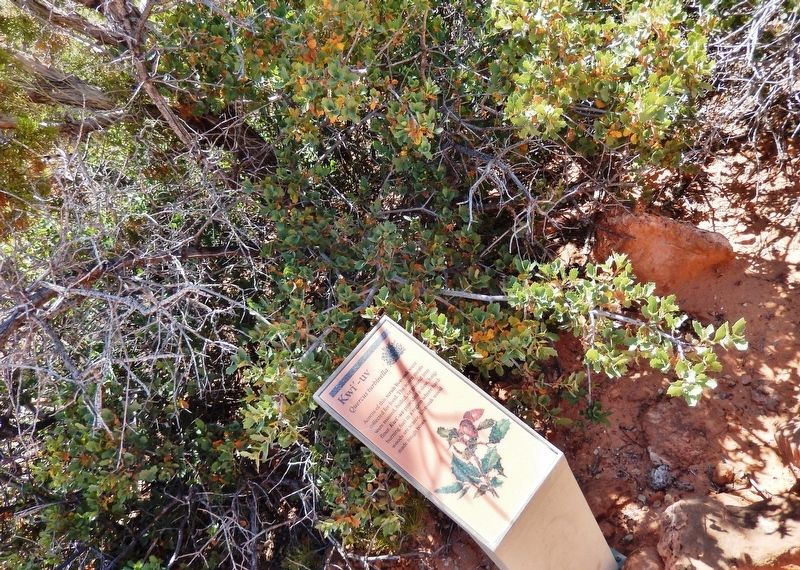
Kwi'-uv Marker
| 101 ► Arizona, Mohave County, Fredonia — Kwi'-uv — Quercus turbinella — |
| Near North Pipe Spring Road, 0.3 miles north of Arizona Route 389, on the left when traveling north. | |||
| 102 ► Arizona, Mohave County, Fredonia — Moamop' — Datura wrightii — |
| Near North Pipe Spring Road, 0.3 miles north of Arizona Route 389, on the left when traveling north. | |||
| 103 ► Arizona, Mohave County, Fredonia — Oos'eev — Yucca kanabensis — |
| Near North Pipe Spring Road, 0.3 miles north of Arizona Route 389, on the left when traveling north. | |||
| 104 ► Arizona, Mohave County, Fredonia — Pipe Spring National Monument — |
| Near North Pipe Spring Road, 0.3 miles north of Arizona Route 389, on the left when traveling north. | |||
| 105 ► Arizona, Mohave County, Fredonia — Plateau Country Trees — Pipe Spring National Monument — |
| Near North Pipe Spring Road, 0.3 miles north of Arizona Route 389, on the left when traveling north. | |||
| 106 ► Arizona, Mohave County, Fredonia — Powell’s Surveyors at Pipe Spring — Pipe Spring National Monument — |
| Near North Pipe Spring Road, 0.3 miles north of Arizona Route 389, on the left when traveling north. | |||
| 107 ► Arizona, Mohave County, Fredonia — Skoomp — Chrysothamnus nauseosus — |
| Near North Pipe Spring Road, 0.3 miles north of Arizona Route 389, on the left when traveling north. | |||
| 108 ► Arizona, Mohave County, Fredonia — Suh-uhv' — Rhus trilobata — |
| Near North Pipe Spring Road, 0.3 miles north of Arizona Route 389, on the left when traveling north. | |||
| 109 ► Arizona, Mohave County, Fredonia — Tup' — Ephedra viridis — |
| Near North Pipe Spring Road, 0.3 miles north of Arizona Route 389, on the left when traveling north. | |||
| 110 ► Arizona, Mohave County, Fredonia — When the Good Grass Goes — Pipe Spring National Monument — |
| Near North Pipe Spring Road, 0.3 miles north of Arizona Route 389, on the left when traveling north. | |||
| 111 ► Arizona, Mohave County, Fredonia — Yoowuv' — Opuntia phaeacantha — |
| Near North Pipe Spring Road, 0.3 miles north of Arizona Route 389, on the left when traveling north. | |||
| 112 ► Arizona, Mohave County, Kingman — Camp Beale Springs Arizona — |
| On Fort Beale Road at Wagon Trail Road, on the left when traveling north on Fort Beale Road. | |||
| 113 ► Arizona, Mohave County, Kingman — Ha' Qa' Muwe: — (Ancestral Home of the Hualapai) — |
| On Fort Beale Road at Wagon Trail Road, on the left when traveling north on Fort Beale Road. | |||
| 114 ► Arizona, Mohave County, Oatman — Olive Ann Oatman Fairchild — (1837-1903) — |
| On Main Street (Route 66) 0.1 miles east of Beacon Hill Road. | |||
| 115 ► Arizona, Mohave County, Peach Springs — Dallas Quasula Sr. — October 28, 1932 - August 27, 2010 — |
| On Historic Route 66 (Arizona Route 66) at Diamond Creek Road, on the right when traveling west on Historic Route 66. | |||
| 116 ► Arizona, Mohave County, Peach Springs — Historic Peach Springs Trading Post — |
| On Historic Route 66 (U.S. 66 at milepost 127), 0.1 miles west of Diamond Creek Road, on the right when traveling west. | |||
| 117 ► Arizona, Navajo County, Fort Apache — Barracks (115) — |
| Near Barracks Row, on the left when traveling west. | |||
| 118 ► Arizona, Navajo County, Fort Apache — Barracks Row — |
| On Scout Street, on the left when traveling north. | |||
| 119 ► Arizona, Navajo County, Fort Apache — Boys' Dormitory (116) — |
| On Barracks Row, on the right when traveling west. | |||
| 120 ► Arizona, Navajo County, Fort Apache — Captain's Quarters (102 and 103) — |
| On General Crook Street, on the left when traveling east. | |||
| 121 ► Arizona, Navajo County, Fort Apache — Commissary Storehouse (113) — |
| On Kinney Road, on the left when traveling south. | |||
| 122 ► Arizona, Navajo County, Fort Apache — First Commanding Officer's Quarters (101) — |
| On General Crook Street at Scout Street, on the left when traveling east on General Crook Street. | |||
| 123 ► Arizona, Navajo County, Fort Apache — Girls' Dormitory (120) — |
| On Barracks Row, on the right when traveling west. | |||
| 124 ► Arizona, Navajo County, Fort Apache — Guard House (114) — |
| On Kinney Road, on the left when traveling south. | |||
| 125 ► Arizona, Navajo County, Fort Apache — Old Guard House (115A) — |
| Near Fort Apache Road, on the right when traveling west. | |||
| 126 ► Arizona, Navajo County, Fort Apache — Parade Ground — |
| On General Crook Street, on the right when traveling east. | |||
| 127 ► Arizona, Navajo County, Fort Apache — T.R. School Cafeteria (119) — |
| On Barracks Row, on the left when traveling west. | |||
| 128 ► Arizona, Navajo County, Fort Apache — T.R. School Teachers' Quarters (112) — |
| On General Crook Street, on the left when traveling east. | |||
| 129 ► Arizona, Navajo County, Fort Apache — Theodore Roosevelt School (118) — |
| On Barracks Row, on the left when traveling west. | |||
| 130 ► Arizona, Navajo County, Holbrook — A Canvas for Ideas — |
| Near Petrified Forest Road, on the right when traveling north. | |||
| 131 ► Arizona, Navajo County, Holbrook — Agate House — A House of Gems — |
| Near Petrified Forest Road, on the right when traveling north. | |||
| 132 ► Arizona, Navajo County, Holbrook — Life in the Village — |
| Near Petrified Forest Road, on the right when traveling north. | |||
| 133 ► Arizona, Navajo County, Holbrook — Meaning of Place — |
| On Petrified Forest Road, on the right when traveling north. | |||
| 134 ► Arizona, Navajo County, Holbrook — Newspaper Rock — |
| Near Newspaper Spur, on the right when traveling west. | |||
| 135 ► Arizona, Navajo County, Holbrook — Newspaper Rock Petroglyphs Archeological District — |
| Near Petrified Forest Road. | |||
| 136 ► Arizona, Navajo County, Holbrook — Summer Solstice Marker — |
| Near Petrified Forest Road, on the right when traveling north. | |||
| 137 ► Arizona, Navajo County, Holbrook — Village on the Rio Puerco — |
| Near Petrified Forest Road, on the right when traveling north. | |||
| 138 ► Arizona, Navajo County, Holbrook — Whispers from the Past — Petrified Forest — National Park Service, U.S. Department of the Interior — |
| On Petrified Forest Road, on the right when traveling north. | |||
| 139 ► Arizona, Navajo County, Holbrook — Wigwam Village #6 — |
| On West Hopi Drive, on the right when traveling east. | |||
| 140 ► Arizona, Navajo County, Overgaard — Can You Read the Rocks....? — Stop 2 — |
| On Black Canyon Road, on the right when traveling west. | |||
| 141 ► Arizona, Navajo County, Overgaard — Imagine Yourself Here Some Nine Hundred Years Ago — Stop 3 — |
| On Black Canyon Road, on the right when traveling north. | |||
| 142 ► Arizona, Navajo County, Shonto — Big Sagebrush — Artemisia tridentata — |
| Near Arizona Route 564 at County Route 221. | |||
| 143 ► Arizona, Navajo County, Shonto — Broadleaf Yucca — Yucca baccata — |
| Near Arizona Route 564 at County Route 221. | |||
| 144 ► Arizona, Navajo County, Shonto — Cliffrose — Cowania mexicana, var. Stansburiana — |
| Near Arizona Route 564 at County Route 221. | |||
| 145 ► Arizona, Navajo County, Shonto — Douglas Fir — Pseudotsuga taxifolia — |
| Near State Highway 564 at County Route 221. | |||
| 146 ► Arizona, Navajo County, Shonto — Gambel Oak — Quercus gambelii — |
| Near State Highway 564 at County Route 221. | |||
| 147 ► Arizona, Navajo County, Shonto — Grizzlybear Pricklypear — Opuntia erinacea — |
| Near Arizona Route 564 at County Route 221. | |||
| 148 ► Arizona, Navajo County, Shonto — Hogan — Navajo National Monument — |
| Near State Highway 564 at County Highway 221. | |||
| 149 ► Arizona, Navajo County, Shonto — Indian Rice Grass — Stipa hymenoides — |
| Near State Highway 564 at County Highway 221. | |||
| 150 ► Arizona, Navajo County, Shonto — Into The Memory — Navajo National Monument — |
| Near Arizona Route 564 at County Route 221. | |||
| 151 ► Arizona, Navajo County, Shonto — Mormon Tea — Ephedra viridis — |
| Near Arizona Route 564 at County Route 221. | |||
| 152 ► Arizona, Navajo County, Shonto — Pinyon Pine — Pinus edulis — |
| Near Arizona Route 564 at County Route 221. | |||
| 153 ► Arizona, Navajo County, Shonto — Prehistoric Pioneers — Navajo National Monument — |
| Near Arizona Route 564 at County Route 221. | |||
| 154 ► Arizona, Navajo County, Shonto — Rabbit Brush — Chrysothamnus nauseosus — |
| Near State Highway 564 at County Route 221. | |||
| 155 ► Arizona, Navajo County, Shonto — Roundleaf Buffaloberry — Shepherdia rotundifolia — |
| Near Arizona Route 564 at County Route 221. | |||
| 156 ► Arizona, Navajo County, Shonto — Sandal Trail — Navajo National Monument — |
| On Arizona Route 564. | |||
| 157 ► Arizona, Navajo County, Shonto — Serviceberry — Amelanchier utahensis — |
| Near State Highway 564 at County Route 221. | |||
| 158 ► Arizona, Navajo County, Shonto — Sweathouse — Navajo National Monument — |
| On Arizona Route 564. | |||
| 159 ► Arizona, Navajo County, Shonto — The Pygmy Conifer Forest - An Indian Store — |
| Near Arizona Route 564 at County Route 221. | |||
| 160 ► Arizona, Navajo County, Shonto — Upside-down Mountain — Navajo National Monument — |
| On Arizona Route 564. | |||
| 161 ► Arizona, Navajo County, Shonto — Utah Juniper — Juniperus osteosperma — |
| Near Arizona Route 564 at County Route 221. | |||
| 162 ► Arizona, Navajo County, Shonto — Voices in the Canyon — Navajo National Monument — |
| Near Arizona Route 564 at County Route 221. | |||
| 163 ► Arizona, Navajo County, Shonto — Wagon — Navajo National Monument — |
| On Arizona Route 564. | |||
| 164 ► Arizona, Navajo County, Shonto — Welcome to the Historic Contact Station — Navajo National Monument — National Park Service, U.S. Department of the Interior — |
| Near County Highway 221 at Tsegi Canyon Road when traveling east. | |||
| 165 ► Arizona, Navajo County, Whiteriver — Kinishba Ruins — |
| 166 ► Arizona, Navajo County, Whiteriver — White Mountain Apache War Memorial — January 11, 1969 — |
| On Chief Avenue (Arizona Route 73) 0.5 miles north of East Fork Road, on the right when traveling north. | |||
| 167 ► Arizona, Navajo County, Winslow — 5 — A City in Motion: The Heyday of the Santa Fe Railway — Journeys to Winslow — |
| Near East 2nd Street, 0.1 miles east of North Kinsley Avenue. | |||
| 168 ► Arizona, Navajo County, Winslow — Central Plaza — Homol'ovi II Archaeological Site — |
| Near Homolovi State Park Entrance Road, 5.4 miles north of Arizona Route 87. | |||
| 169 ► Arizona, Navajo County, Winslow — East Plaza — Homol'ovi II Archaeological Site — |
| Near Homolovi State Park Entrance Road, 5.4 miles north of Arizona Route 87. | |||
| 170 ► Arizona, Navajo County, Winslow — Homol'ovi II — Homol'ovi II Archaeological Site — |
| Near Homolovi State Park Entrance Road, 5.4 miles north of Arizona Route 87. | |||
| 171 ► Arizona, Navajo County, Winslow — Illegal Digging — Homol'ovi II Archaeological Site — |
| Near Homolovi State Park Entrance Road, 5.4 miles north of Arizona Route 87. | |||
| 172 ► Arizona, Navajo County, Winslow — Kiva - Underground House — Homol'ovi II Archaeological Site — |
| Near Homolovi State Park Entrance Road, 5.4 miles north of Arizona Route 87. | |||
| 173 ► Arizona, Navajo County, Winslow — Let It Burn — We built these rooms just to burn them down — Homol'ovi's Experimental Archaeology — |
| Near Homolovi State Park Entrance Road, 2.1 miles west of Arizona Route 87. | |||
| 174 ► Arizona, Navajo County, Winslow — Nuvatukya'ovi — Homol'ovi II Archaeological Site — |
| Near Homolovi State Park Entrance Road, 5.4 miles north of Arizona Route 87. | |||
| 175 ► Arizona, Navajo County, Winslow — Paayu — Homol'ovi II Archaeological Site — |
| Near Homolovi State Park Entrance Road, 5.4 miles north of Arizona Route 87. | |||
| 176 ► Arizona, Navajo County, Winslow — 1 — The First Peoples of the Southwestern Colorado Plateau — Journeys to Winslow — |
| Near East 2nd Street, 0.1 miles east of North Kinsley Avenue. | |||
| 177 ► Arizona, Navajo County, Winslow — 3 — The Railroads Build a Town: Early Days — Journeys to Winslow — |
| Near East 2nd Street, 0.1 miles east of North Kinsley Avenue. | |||
| 178 ► Arizona, Navajo County, Winslow — Typical Room — Homol'ovi II Archaeological Site — |
| Near Homolovi State Park Entrance Road, 5.4 miles north of Arizona Route 87. | |||
| 179 ► Arizona, Navajo County, Winslow — Vandalized Kiva — Homol'ovi II Archaeological Site — |
| Near Homolovi State Park Entrance Road, 5.5 miles north of Arizona Route 87. | |||
| 180 ► Arizona, Navajo County, Winslow — 7 — Winslow Today: Commerce and Employment — Journeys to Winslow — |
| On East 2nd Street, 0.1 miles east of North Kinsley Ave. | |||
| 181 ► Arizona, Navajo County, Winslow — 8 — Winslow Today: Downtown Renaissance and Tourism — Journeys to Winslow — |
| On East 2nd Street, 0.1 miles east of North Kinsley Ave. | |||
| 182 ► Arizona, Pima County, Ajo — 10 — The Mine Manager's House — Ajo, Arizona — |
| Near West Greenway Drive. | |||
| 183 ► Arizona, Pima County, Ajo, Ajo Townsite — A Company Town Designed in Style — |
| On Plaza, on the right when traveling east. | |||
| 184 ► Arizona, Pima County, Tucson, Downtown — Allande Footbridge — Historic Site — |
| Near West Congress Street. | |||
| 185 ► Arizona, Pima County, Tucson, El Presidio — Hugo O'Conor — |
| Near West Paseo Redondo. | |||
| 186 ► Arizona, Pima County, Tucson, El Presidio — Presidio Wall & Pithouse — |
| On North Church Avenue at West Washington Street, on the right when traveling south on North Church Avenue. | |||
| 187 ► Arizona, Pima County, Tucson, Menlo Park — Si We:begi Ha Ñeid — La Primera Vista • The First Sighting — |
| On South Grande Avenue at Mission Road, on the right when traveling south on South Grande Avenue. | |||
| 188 ► Arizona, Pinal County, Bapchule — In Memory of the Men of St. Peter's Mission — |
| Near St. Peters Road, 0.3 miles north of Nelson Road. | |||
| 189 ► Arizona, Pinal County, Coolidge — Those Who Are Gone — |
| On Arizona Route 87 at Arizona Route 287, on the right when traveling north on State Route 87. | |||
| 190 ► Arizona, Pinal County, Florence — John P. Clum House — |
| On North Granite Street, on the left when traveling north. | |||
| 191 ► Arizona, Pinal County, Florence — Levi Ruggles — Founder of Florence — Historic Site — |
| On West Ruggles Avenue, on the right when traveling west. | |||
| 192 ► Arizona, Pinal County, Florence — Poston's Butte — Historic Site — |
| On North Pinal Parkway (State Highway 79) 0.1 miles south of East Hunt Highway, on the left when traveling north. | |||
| 193 ► Arizona, Pinal County, Florence — Walker – Oury House — |
| On East Ruggles Street at Church Street, on the right when traveling east on East Ruggles Street. | |||
| 194 ► Arizona, Pinal county, Gila River — Gila River Indian Reservation — (Established 1859) — |
| Near Interstate 10 at milepost 183. | |||
| 195 ► Arizona, Pinal County, Gila River — Gila River Indian Reservation — (Established 1859) — |
| Near Interstate 10 at milepost 181. | |||
| 196 ► Arizona, Pinal County, Gila River — Gila River Internment Center - Rivers, Arizona — |
| Near Casa Blanca Road, 0.6 miles east of Interstate 10. | |||
| 197 ► Arizona, Pinal County, Picacho — Juan Bautista de Anza National Historic Trail / Camp 21: El Aquituni — |
| 198 ► Arizona, Pinal County, Sacaton — Dedicated to Ira H. Hayes USMC — |
| On Sacaton Road (Arizona Route 87) at Sacaton-Casa Blanca Road, on the right when traveling east on Sacaton Road. | |||
| 199 ► Arizona, Pinal County, Sacaton — Dedicated to the Memory of Matthew B. Juan — Co. K 28th Infantry — First Arizonian Killed in the World War — |
| On Casa Blanca Road at Sacaton Road, (Arizona Route 87), on the right when traveling east on Casa Blanca Road. | |||
| 200 ► Arizona, Pinal County, Sacaton — Honoring Native American Women Veterans — |
| On Sacaton Road (Arizona Route 87) at Casa Blanca Road, on the right when traveling east on Sacaton Road. | |||
218 entries matched your criteria. Entries 101 through 200 are listed above. ⊲ Previous 100 — The final 18 ⊳