By William Fischer, Jr., December 28, 2009
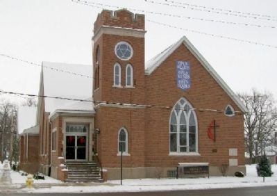
Trinity United Methodist Church and Markers
| On Cullen Street (State Road 114) at Angelica Street, on the right when traveling north on Cullen Street. |
| On State Road 7 at County Road W500N, on the right when traveling north on State Road 7. |
| On North Main Street just north of East Madison Street, on the right when traveling north. |
| On Hart Street west of 1st Street, on the left when traveling west. |
| On Willow Street (Business U.S. 41) 0.1 miles south of S. 10th Street, on the left when traveling south. |
| On West Scott Street, 0.2 miles north of North 1st Street, on the left when traveling north. |
| On South 2nd Street at Main Street when traveling west on South 2nd Street. |
| On Park Street west of Harrison Street, on the right when traveling west. |
| Near North Old Fort Knox Road, 0.1 miles south of Lower Fort Knox Road, on the left when traveling south. |
| On North Shore Drive, 0.5 miles east of North Long Drive, on the right when traveling east. |
| Near N. Long Drive south of E. Northshore Drive, on the right when traveling north. |
| On Eli Lily Road, 0.6 miles east of Warner Road, on the right when traveling east. |
| On Defiance Street (Indiana Route 120) just west of 3rd Street (Indiana Route 120), on the left when traveling west. |
| On County Road N900W at County Road N905W, on the left when traveling north on County Road N900W. |
| On Joliet Street (Road 30) west of Northwinds Drive, on the right when traveling east. |
| On Joliet Street (U.S. 30) west of Northwinds Drive, on the right when traveling east. |
| On Marquette Drive at Oak Avenue, on the left when traveling east on Marquette Drive. |
| On Oak Avenue west of Montgomery Street, on the right when traveling west. |
| On Ripley Street (U.S. 6) 0.1 miles north of East 21st Place, on the right when traveling north. |
| On Van Buren Street at 73rd Avenue (Old Lincoln Highway), in the median on Van Buren Street. Reported missing. |
| On Michigan Avenue south of State Avenue, on the right when traveling south. |
| On Grangemouth Road, 0.1 miles north of Lake Shore Drive, on the right when traveling north. |
| On Liberty Trail at E. 8th Street, on the right when traveling north on Liberty Trail. |
| Near Heisman Harbor west of Franklin Street. |
| On U.S. 20 west of State Road 2, on the right when traveling east. |
| On Indiana's Historic Pathways - North Spur (U.S. 50) 0.4 miles east of Connerly Cemetery Road, on the left when traveling west. |
| On East 9th Street at Madison Street on East 9th Street. |
| Near Mounds Road (Road 232) east of South Rangeline Road. |
| On 10th Street at Moravian Street, on the right when traveling east on 10th Street. |
| On Grandview Drive, 0.1 miles north of Lincoln Drive, on the right when traveling north. |
| On Mounds Road (Indiana Route 232) 1 mile north of Donnelly Road (Local Road E100S), on the right when traveling south. |
| Near Mounds Road (Indiana Route 232) 1 mile north of Donnelly Road (Local Road E100S), on the right when traveling south. |
| On Mounds Road (Indiana Route 232) 1 mile north of Donnelly Road (Local Road E100S), on the right when traveling south. |
| On State Road 38 E, 0.5 miles west of Chesterfield Road (400 E), on the right when traveling west. |
| On West Oak Street (County Road W1150N) just east of County Road N300W, on the right when traveling east. |
| On West State Street just west of North Pendleton Avenue, on the right when traveling west. |
| On N. Pendleton Ave., 0.1 miles north of Fall Creek Parkway, on the right when traveling north. |
| Near County Road 500 S near East Street. |
| On West Washington Street north of Indianapolis Cultural Trail, on the right when traveling north. |
| On West Michigan Street west of Limestone Street, on the right when traveling east. |
| Near North Blackford Street north of Indianapolis Cultural Trail, on the right when traveling north. |
| Near North Blackford Street north of Indianapolis Cultural Trail, on the right when traveling north. |
| Near North Blackford Street north of Indianapolis Cultural Trail, on the right when traveling north. |
| Near North Blackford Street north of Indianapolis Cultural Trail, on the right when traveling north. |
| Near North Blackford Street north of Indianapolis Cultural Trail, on the right when traveling north. |
| Near North Blackford Street north of Indianapolis Cultural Trail, on the right when traveling north. |
| Near North Blackford Street north of Indianapolis Cultural Trail, on the right when traveling north. |
| Near North Blackford Street north of Indianapolis Cultural Trail, on the right when traveling north. |
| Near North Blackford Street north of Indianapolis Cultural Trail, on the right when traveling north. |
| Near North Blackford Street north of Indianapolis Cultural Trail, on the right when traveling north. |
| On Monument Circle north of East Market Street, on the left when traveling north. |
| On Totem Lane at Spring Hollow Road, on the right when traveling south on Totem Lane. |
| On West Georgia Street east of South Capitol Avenue, in the median. |
| On Indiana Route 10 at Queen Road, on the right when traveling east on State Route 10. Reported permanently removed. |
| On Peach Road, on the right when traveling north. |
| On 12th Road west of South Pear Road (a.k.a. - South Peach Road), on the left when traveling west. Reported missing. |
| On West 12th (State Road 17) at Hiawatha on West 12th. Reported missing. |
| On 17th Road, 0.3 miles east of State Road 331, on the right when traveling east. |
| On South Peach Road, 0.2 miles south of Menominee Drive, on the left when traveling south. |
| On State Road 124 at County Road E 100 S on State Road 124. |
| On State Road 124 at County Road E 100 S on State Road 124. |
| On Mississinewa Rd, 0.3 miles south of County Road 300 East. |
| On Mississinewa Dam Road (Local Route E380S) west of Local Road S675E. |
| On U.S. 231 at County Road 1150 S. on U.S. 231. |
| On U.S. 136 at State Road 25, on the left when traveling east on U.S. 136. |
| On West 200 North at North 1150 West on West 200 North. |
| Near State Road 56. Reported permanently removed. |
| Near N. Maple Street (State Road 37) north of County Road 810N, on the right when traveling north. |
| On N. Main Street (State Road 37) north of County Road 810N, on the right when traveling north. |
| On State Road 67 at N. 7th Street, on the right when traveling south on State Road 67. |
| On County Road N600W north of Road W40N, on the left when traveling south. |
| On County Road E780S north of Road S350E, on the left when traveling north. |
| On State Road 47, 1.8 miles U.S. 41, on the right when traveling east. |
| On U.S. 41 at West Mecca Road, on the right when traveling south on U.S. 41. |
| On U.S. 231, 0.3 miles north of State Road 2, on the right when traveling south. |
| On State Road 2&231, 0.2 miles north of Route 2 (State Road 231), on the right when traveling south. |
| On Lincolnway west of Lafayette Street, on the right when traveling west. |
| On South Monticello Street (U.S. 35) at East Main Street, on the right when traveling south on South Monticello Street. |
| On South Vine Street at East Washington Street (U.S. 231), on the right when traveling south on South Vine Street. |
| On U.S. 40 east of County Road S900W, on the right when traveling west. |
| On Indiana Route 1, 0.4 miles south of Indiana Route 28, on the right when traveling south. |
| On Treaty Line Road at U.S. 27, on the left when traveling east on Treaty Line Road. |
| On West Franklin Street west of South Main Street, on the right when traveling west. |
| On South Westport Road, on the left when traveling north. |
| On State Road 31 at Edrington Blvd, on the left when traveling south on State Road 31. |
| On State Road 9, 0.5 miles north of County Road 425N, on the left when traveling north. |
| On South Saint Louis Boulevard at East Wayne Street, on the right when traveling south on South Saint Louis Boulevard. |
| Near Portage Ave at Lathrop St. |
| Near State Road 727, 0.8 miles west of Interstate 69. |
| Near East Bellefontaine Road west of Peninsula Street, on the right when traveling east. |
| On West Cora Lane (Local Road N700E) near Local Road E750N, on the right when traveling south. |
| On State Road 63 at West Market Street, on the left when traveling north on State Road 63. |
| On Indiana Route 154 west of County Road 900W, on the right when traveling east. |
| On State Road 225 at Houston Road on State Road 225. |
| On County Road S 950 W south of County Road W 75 S, on the right when traveling south. |
| On County Road W 500 N west of Road N 225 W, on the right when traveling west. |
248 entries matched your criteria. Entries 101 through 200 are listed above.
⊲ Previous 100 —
The final 48 ⊳