On Franklin Street, 0.4 miles north of Washington Avenue, on the right when traveling west.
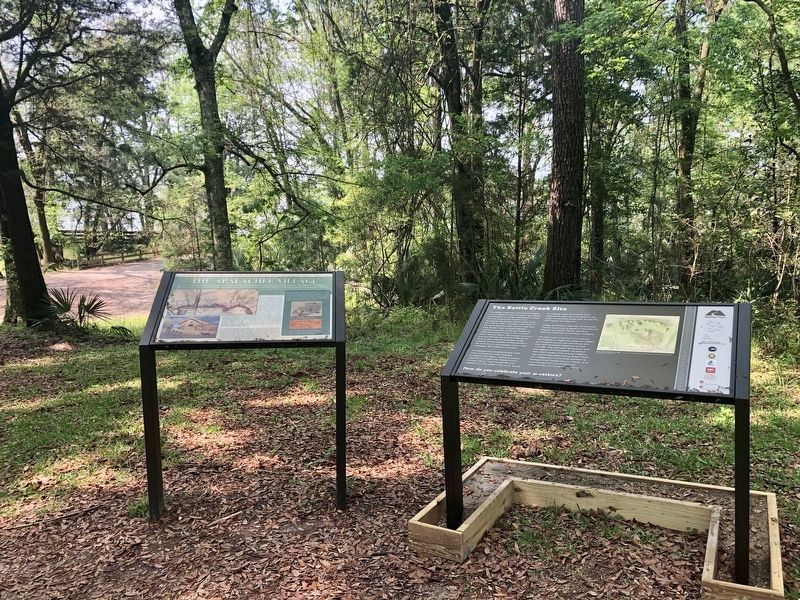
Just a half century prior to the founding of the town of Blakeley, an Apalachee Indian village stood on this spot. The village was founded in the early 1700s by Apalachee refugees fleeing warfare in Florida for the relative safety of French . . . — — Map (db m131851) HM
1540 expedition of Spanish explorer Hernando de Soto was first to penetrate Alabama interior. After advancing down Coosa Valley these adventurers camped nearby at Towasa (TO THE WEST) and then followed river on its southern course. In 1702. . . . — — Map (db m224812) HM
On Connecticut Route 37, 0.1 miles north of Brush Hill Road (Route 39), on the left when traveling north.
They shall not grow old as we that are left grow old. Age shall not weary them, nor the years condemn them.
French & Indian War Samuel Fairchild Militia K.I.A. Aug. 4, 1759 Burmell Barnum Militia K.I.A. Aug. 4, 1761 Civil War Frederick C. . . . — — Map (db m23063) WM
Near Ridgefield Road (Connecticut Route 33) 0.2 miles north of Belden Hill Road, on the left when traveling north.
In Memory Of
Major Samuel Comstock
1739 --- 1824
A Private
In The French and Indian War
A Captain In The Revolutionary War
July 1776 --- June 1783
Serving At
White Plains Germantown Fort Mifflin
Valley Forge Monmouth Yorktown . . . — — Map (db m30471) HM
On Trinity Street south of Jewell Street, on the left when traveling north.
Israel Putnam (1718-1790), the legendary general of the French and Indian and Revolutionary Wars, is considered Connecticut's first authentic folk hero. At the outbreak of the Revolutionary War in 1775, at 57 years old, he is famous for riding 18 . . . — — Map (db m230347) HM
On North Street (Connecticut Route 63) at Elementary Drive, on the right when traveling north on North Street.
[ front ]
Dedicated To Our Comrades Of Goshen
Who Established And Maintained Freedom For Our Country
French And Indian War 1754 - 1763
Dibble, Joel • Doud, John • Gaylord, Timothy • Humphrey, Ashbel • Humphrey, Manna • Humphrey, . . . — — Map (db m30231) HM
On East Main Street (U.S. 1) just east of Cemetery Road, on the right when traveling east.
1. Indian River
At the center of the Colonial settlement, this stream winds south through salt marshes to the harbor. Shipyards stood on its banks in the 18th and 19th centuries. The bridge dates from the 1876, replacing an an earlier . . . — — Map (db m227290) HM
On Millington Road (Connecticut Route 434) 0.1 miles Tater Hill Road, on the left when traveling west.
Side A 1714-1789
Near this Green was the site of
the General’s Farm, Store
and dwelling house
Side B
1714-1789
Officer in the French & Indian
and Revolutionary Wars
Delegate to the Continental Congress . . . — — Map (db m101985) HM
On Boston Post Road (U.S. 1) at Britton Lane, on the left when traveling east on Boston Post Road.
In this Town
On January 6, 1730 was born
Thomas Chittenden
Colonel in the French & Indian Wars
1756-1760
Member of the Connecticut General Assembly
1765-1772
First Governor of Vermont
1778-1789 1790-1797
Died Chittenden County, . . . — — Map (db m245126) HM
Colonel John Haslet-A native of Ulster, Ireland, John Haslet was born circa 1728 and emigrated to America about 1757. After playing an active role in the Pennsylvania militia during the French and Indian War, Haslet eventually settled in the Milford . . . — — Map (db m142542) HM
On West Main Street just north of Flanders Way, on the right when traveling west.
Operated flour mill one-fourth mile south. Was captain in French and Indian War. In American Revolution was member of Boston Relief Committee, colonel of Delaware battalion of famous "Flying Camp," Brigadier General of Delaware militia and first . . . — — Map (db m67210) HM
On Main Street, (Delaware Route 26), (Delaware Route 20) near Canal Street, on the right when traveling north.
Settled at the site of a gristmill on Pepper Creek,
this village was originally known as Blackfoot
Town. The present name of the community is
derived from that of John Dagsworthy. A New
Jersey native who moved to this area in the
mid- 18th . . . — — Map (db m37239) HM
On Constitution Avenue Northwest west of 23rd Street Northwest.
This rock marks the place where Gen. Edward Braddock landed on April 14, 1755 with the British Expeditionary Force. This force was sent from England to fight in the French and Indian War. Shortly after arrival, Gen. Braddock moved his troops into . . . — — Map (db m197126) HM
Near Wisconsin Avenue Northwest, 0.1 miles north of Massachusetts Avenue Northwest, on the right when traveling north.
This memorial was erected in 1907 by the Society of Colonial Wars in the District of Columbia to mark the road over which on April 14, 1755 a division of the British Army under General Braddock marched on its way to Fort Duquesne. — — Map (db m55534) HM
On Bayfront Parkway at South Alcaniz Street, on the right when traveling east on Bayfront Parkway.
Military and naval conflict dominated the 18th century. France, Spain, and Great Britain were aggressors in nearly constant warfare that often extended into North America. Spain established a fledgling colony near what is now the Pensacola Naval Air . . . — — Map (db m130767) HM
Near Florida Route 2, 1 mile east of Timberlake Road, on the right when traveling east.
Creek Town of the Spanish Era
Ekanachatte ("Red Ground") was an important Creek Indian town that stood here at Neal's Landing Park during the latter half of the 18th century and the first two decades of the 19th.
This site was known as . . . — — Map (db m201244) HM
Near Bartlett Street near St Marys Street West, on the left.
These French-speaking refugees were forced to leave their homes in Nova Scotia by the British during the French & Indian War (1754-1763). The descendants of these oppressed Acadians ultimately sought refuge in St. Marys in the late 1790s after . . . — — Map (db m144939) HM
On State Park Drive, 0.1 miles south of Georgia Route 253, on the right when traveling east.
Located in Seminole County, near the forks of the Chattahoochee and Flint Rivers, was a town of Hitchiti-speaking, Lower Creek Indians. A Spanish mission, Santa Cruz de Sabacola el Menor, was established there in 1675. By 1685, English traders from . . . — — Map (db m17834) HM
Near Hardman Farm Road, 1 mile north of Unicoi Turnpike (Georgia Route 17).
The Cherokee once walked through this valley along an ancient trail when traveling from their town of Overhill (Tennessee)to their settlements in the Carolinas and Georgia. Earlier, this north-south trading route existed as one of an extensive . . . — — Map (db m229230) HM
On Bunch Road west of Illinois Route 3, on the right when traveling south.
In 1673 Louis Jolliet and Father Jacques Marquette explored the Illinois country for France. By the 1763 Treaty ending the French and Indian War, this area passed to England. During the American Revolution, George Rogers Clark's men captured it for . . . — — Map (db m161171) HM
On U.S. 150, 0.3 miles north of County Route 2500N, on the right when traveling south.
A few miles west of here on July 18, 1765, Pontiac, an Ottawa Chief, and George Croghan, British Representative, met in a formal peace council which ended the most threatening Indian uprising against the British in North America. Following the . . . — — Map (db m10997) HM
On West Washington Street at North Main Street, on the left when traveling east on West Washington Street.
Pontiac organizer of the conspiracy which bears his name, was born on the Maumee River in what is now Ohio, in 1720. As Chief, he led the Ottawa and Chippewa Indians at Braddocks (sic) defeat July 9, 1755. When France surrendered Canada to the . . . — — Map (db m29751) HM
1500's Spanish Ownership
1702 French trading post and mission
1757 French fortification to block British expansion into Mississippi River, named Fort Massac
1764 French abandoned fort to British
1778 George Rogers Clark . . . — — Map (db m154811) HM
The fertile prairies in Illinois attracted the attention of French trader Louis Jolliet and Father Jacques Marquette as they explored the Mississippi and Illinois Rivers in 1673. France claimed this region until 1763 when it was surrendered to Great . . . — — Map (db m136729) HM
Near Illinois Route 150, 0.2 miles south of Briarhill Road.
Shadrach Bond, first Governor of Illinois (1818-1822), is buried in Evergreen Cemetery in Chester. The first recorded settler in the area was John McFerron who purchased land in 1817 but Samuel Smith, who settled here in 1830, is considered the . . . — — Map (db m161446) HM
Kaskaskia Village was formed in 1703 by Kaskaskia Indians, attended by a French priest and fur traders. It grew to be the center of French life in the Illinois Country.
Occupied by British, 1765. Captured for Virginia by George Rogers Clark, . . . — — Map (db m163787) HM
On Park Road west of Shawneetown Trail (County Route 3), on the right when traveling east.
These mounds are the timeworn remains of a fort designed to protect the village of Kaskaskia. The town, founded in 1703, was the southern anchor of France's colony in the Illinois Country. During the 1730s, French officials planned to replace the . . . — — Map (db m163784) HM
On Market Street just north of Court Street, on the right when traveling north.
The end of the Seven Years' War, better known to the colonists as the French and Indian War, came not by skirmish but by the Treaty of Paris signed February 1763. Through this all of France's possessions East of the Mississippi were ceded to . . . — — Map (db m206192) HM WM
On Market Street at Court Street, on the right when traveling north on Market Street.
"The British are coming” had a much different meaning to the villagers of Prairie du Rocher. The British took control of Fort de Chartres renaming it Fort Cavendish on Oct. 10, 1765. The majority of the residents of the villages of Chartres,
St. . . . — — Map (db m206109) HM
On Market Street at Court Street, on the right when traveling north on Market Street.
As the State of Illinois' second state park, Fort de Chartres, restoration began with the gun powder magazine in 1917. The state had
taken ownership of the grounds in 1913. Further restorative efforts followed through the 1920's by uncovering . . . — — Map (db m206031) HM
Fort de Chartres, seat of civil and military government in the Illinois country for half a century, was first completed in 1720. In 1753-56 it was rebuilt of stone at a cost of 200,000 livres and became one of the strongest forts in North America . . . — — Map (db m163687) HM
Before you stands the partially reconstructed Fort de Chartres, built by the French government between 1753 and 1755.
The stone fort replaced earlier wooden forts by the same name. From 1720 to 1763, these forts served France as the military, . . . — — Map (db m163678) HM
On 2700 N at 500E Edgar County Roads, on the left when traveling west on 2700 N.
Near here, on July 18, A.D. 1765, Colonel George Croghan, Superintendent of Indian Affairs for the British government, made a preliminary treaty of peace with Pontiac, chief of the Ottawas and leader of the great Indian confederacy. By the terms of . . . — — Map (db m74024) HM
On North Main Street south of West Jefferson Street, on the right when traveling north.
This Memorial Hall, the first of its kind in the United States, dedicated to our Veterans of all wars, was completed in the year 1903 with dedication ceremonies on June Third of that year by our twenty-sixth President Theodore Roosevelt with these . . . — — Map (db m95722) HM WM
On Northside Drive at St. Joseph Boulevard, on the right when traveling south on Northside Drive.
Erected, 1750, by Captain Raimond
Surrendered to the British under Lieutenant Butler in 1760.
Ensign Richard Holmes and British garrison massacred by Miami Indians in 1763.
The most severe engagement of battle between Gen. Josiah . . . — — Map (db m21036) HM
On Van Buren Street at Michaels Avenue, on the right when traveling north on Van Buren Street.
The First French Fort
The French lived among the Miami at the Three Rivers as early as 1697 when Jean Baptiste Bissot, Sieur de Vincennes (d. 1719), and Francois Marie Bissot de Vincennes, the son of Jean Baptiste . . . — — Map (db m241262) HM
On Hoagland Road just east of Poplar Drive, on the right when traveling east.
Once an Indian trail directly through these school grounds, the route followed by General Anthony Wayne's army in its departure from the fort in 1794 and the way by which General William Harrison's troops came to the relief of the garrison at Fort . . . — — Map (db m211614) HM
On East Saint Clair Street east of North Meridian Street, on the right when traveling west.
President of the
Continental Congress which framed
the Ordnance of 1787
Governor of the
Territory Northwest of the River Ohio
1788 - 1802
Under his control were laid the
broad foundations of the future Commonwealths of
Ohio · . . . — — Map (db m132853) HM WM
On 7th Street Trafficway (U.S. 69) north of Ann Avenue, on the right when traveling north.
Tablet 1
The Origins of the Wyandots
The story of the Wyandot Nations is both heroic and bitter. Once among the greatest of Indian tribes in northeast America, a warrior race whose influence reached from Canada to Kentucky, the . . . — — Map (db m72957) HM
On North Main Street north of W G L Smith Street, on the left when traveling north.
Morgantown
The county seat of Butler Co., it was originally called Funkhouser Hill. It was renamed Morgan Town in Dec. 1810 to honor Revolutionary War officer Daniel Morgan and was incorporated in 1813. It began as a settlement of . . . — — Map (db m123448) HM
On Court Place at York Street (U.S. 27), on the right when traveling east on Court Place.
Northern Kentucky's first doctor. Born in Oxfordshire, England on July 10, 1737. Graduate of Royal College of Physicians. Served at Quebec with Gen. James Wolfe. In 1765 settled in Virginia; personal physician to Patrick Henry. Chief Surgeon, 1775, . . . — — Map (db m175075) HM
On West Lexington Avenue (U.S. 60) just east of Hospital Drive, on the right when traveling west.
Came from Va. to Boonesborough, 1776. Builder of Strode's Station, 1779, the largest and most important fortified area in Clark County during the early settlements and bloody Indian wars. Indians attacked station 1781, and later. Two men killed . . . — — Map (db m159696) HM
On Richmond Road (Kentucky Route 52) south of Old Railroad Grade Road (County Route 1104), on the left when traveling south.
Side 1:
500 ft. north is site of log fort and stockade built by Lt. Col. Wm. Miller. Born in Virginia, he came to Kentucky with Daniel Boone's party and helped mark a trace to Boonesboro; served with Capt. James Estill in Battle of Little . . . — — Map (db m67835) WM
On Shelbyville Road (U.S. 60) at Whipps Mill Road, on the right when traveling west on Shelbyville Road.
Fort William
Established in 1785 by William Christian and his wife, Anne, a sister of Patrick Henry. On this site one of earliest stone houses in Kentucky was a famous tavern, The Eight Mile House, on Harrods Trace to Falls of the Ohio. From . . . — — Map (db m161983) HM
On Boonesboro Road (Kentucky Route 388) south of Boonesborough Road (Kentucky Route 627), on the right when traveling north.
Col. Richard Callaway. Born in Caroline County, Virginia, in June 1722, Richard Callaway served in French and Indian wars and as a colonel in Revolutionary War. He was a member of Virginia House of Burgesses and one of the first settlers of . . . — — Map (db m72632) HM
On Lancaster Road (KY52) south of Shale Drive (but North of Taylor Fork Creek), on the right when traveling south.
On Taylor's fork of Silver Creek, .7 mi. east, is burial place of Hancock Taylor. This pioneer was at Falls of Ohio in 1769 enroute to New Orleans and surveying in Ky. by 1773. A deputy surveyor under Wm. Preston, he was near mouth of Ky. River when . . . — — Map (db m67802) HM
On South Main Street, on the left when traveling north.
County Named - For Gen. Hugh Mercer, ca. 1725-77. A native of Scotland, he came to America about 1746. Officer in French and Indian War, 1755-59. Served with Washington. Was the commandant at Fort Pitt. Hero in Revolution. Instrumental in . . . — — Map (db m152645) HM
On Taylorsville Road (Kentucky Route 55) at Brunerstown Road, on the left when traveling north on Taylorsville Road.
Benj. Logan~~Pioneer
In French and Indian, Dunmore's, Revolutionary Wars. In 1775 came to Kentucky with Boone, Henderson. Separated at Hazel Patch. Built Logan's Fort (St. Asaph's), 1776. In Virginia Assembly, 1781-87; Ky. conventions to . . . — — Map (db m136853) HM
Near Canal Street at Carondolet Street, on the right when traveling east.
Since the founding of New Orleans by Bienville in 1718, Canal Street has been an integral part of our city. The up river limits of the old city, defined by earth and store ramparts, ran along the present route of Canal Street. A cleared area . . . — — Map (db m239614) HM
On St. Peter Street south of Chartres Street, on the left when traveling north.
[Panel 1:]Logo of the Orleans Parish Landmarks Commission
Erected 1849-50
by Michela Almonester, Baroness Pontabla,
working first with James Gallier, architect
and then with Henry Howard, architect
Samuel Stewart, builder. . . . — — Map (db m21499) HM
On Main Street (Louisiana Route 996) 0.3 miles north of F. Edward Hebert Boulevard, on the right when traveling north.
Designed by De Verges and garrisoned in 1754, but abandoned in 1792, because of strategic value it was rebuilt by Latour in 1808 and garrisoned to defend New Orleans; Destroyed by Adm. Farragut during the Civil War in advance up the river. — — Map (db m205785) HM
On River Rd. (State Highway 18) 0.2 miles south of Dept. Of Energy Rd., on the left when traveling south.
Refugees came overland 1756-57. In vicinity was 1762 grant to Jacques Cantrelle, Sr. of France after whom Church and Parish were named. Section once included in Les Oumas, Eveche of Quebec. — — Map (db m86620) HM
On Ferdinand Street (State Highway 1263) near Prosperity Street, on the right when traveling east.
The Treaty of Paris (1763) ended the French and Indian War in the American Colonies. France transferred to Britain all its rights to the mainland of America. East of the Mississippi River, excluding New Orleans and its environs. As a result. . . . — — Map (db m110112) HM
On Commercial Street / Thames Street at India Street, on the left when traveling north on Commercial Street / Thames Street.
Erected by the Colonists in 1680
Captured by the French and Indians
in 1690. Entire English
settlement destroyed
————
To the memory of these
brave defenders
this tablet placed by
The Daughters of the American Colonists
November . . . — — Map (db m50448) HM
The largest 17th century settlement in Cape Elizabeth - which included South Portland and Cape Elizabeth prior to 1895 - was established in 1658 near Spring Point. However, the onset of the French and Indian Wars in 1675 necessitated frequent . . . — — Map (db m55673) HM
Near Halifax Street (U.S. 201) 0.2 miles north of China Road (Maine Route 137), on the left when traveling north.
This blockhouse is the only building that remains of a larger fort complex, built by British-Americans in 1754-1755, to defend the upper Kennebec River Valley from possible attack by the French and their Native American allies.
The . . . — — Map (db m116133) HM
Native Americans first paddled dug-out canoes up and down the Penobscot River about 8,000 years ago. Seeking rich hunting and fishing grounds, these people had come to live on the wooded shores of the river and bay.
Archaeology has revealed . . . — — Map (db m55129) HM
Near Lighthouse Road, 1 mile east of Cape Jellison Road.
Erected and named by Gen Thomas Pownall 1759 • • • Gen Samuel Waldo for whom Waldo County was named was buried here Removed to Kings Chapel Boston • • • Erected by John Cocran Chapter D.A.R. 1916 — — Map (db m170848) HM
Near State Park Road, 1 mile east of Cape Jellison Road.
In 1759, Massachusetts Governor Thomas Pownall sought to plug the mouths of Maine's key rivers so as to keep the French and Indians well inland. In January 1758, he wrote to William Pitt, Prime Minister of England about the advantages of this site, . . . — — Map (db m170846) HM
On Main Street (Maine Route 9) at Emery Street, on the right when traveling west on Main Street.
The Indians burned the township of Saco in 1688. Fort Saco was built on the future site of the Laconia Mills to protect the settlers in 1693. The fort served as stables during the construction of the Laconia mills in 1841. Yo Cat Gully . . . — — Map (db m55718) HM
On Braddock Road (Maryland Route 49) at Greene Street (U.S. 220), on the left when traveling west on Braddock Road.
Near this point, on June 10, 1755, after nearly a month's delay at Fort Cumberland, Braddock's troops started towards Fort Duquesne to wrest it from the French. On July 9, 1755, he met his terrible defeat at the Monongahela. — — Map (db m155433) HM
Fort Cumberland was garrisoned from 1754 to 1765. During this period, there was bickering between Maryland and Virginia as to how the fort should be maintained and whose control it was under.
In early 1756, Colonel Washington favored a small . . . — — Map (db m17708) HM
On Greene Street at Baltimore Street, on the right when traveling north on Greene Street.
West of this bridge, now the site of Emmanuel Church, was located Fort Cumberland, whence, in, 1755, the expedition against Fort Duquesne was led by General Edward Braddock and Colonel George Washington.
On this site were located wooden . . . — — Map (db m139108) HM
Memorial in honor of Col. Joshua Fry Born c. 1700 in England
1731 • Professor of mathematics at William and Mary College, Planter in Albemarle County, Virginia, Member of House of Burgesses, First presiding judge of Albemarle County, . . . — — Map (db m187084) HM
In Memory of Col. Thomas Cresap Pathfinder - Pioneer - Patriot - Built the first home and fort in this county at Oldtown, about 1740 Surveyed the first trail to the west, starting near this spot in 1751 His Sons - - - Daniel Cresap for whom . . . — — Map (db m17778) HM
On Great Allegheny Passage, 0.1 miles north of Baltimore Street, on the left when traveling north.
In 1749 Christopher Gist, an agent for the Ohio Company, arrived at the junction of the Wills Creek and the North Branch of the Potomac River to erect a trading post. In anticipation of the French and Indian War a fort was constructed in 1754 . . . — — Map (db m139113) HM
On Prospect Square at Washington Street, on the left when traveling south on Prospect Square.
Horatio Sharpe Lived: 1718-1790. Here as Governor of Maryland and the commander of the fort. Fort Frederick was built by his direction. Governor: 1753-1769. Sharpsburg, Md., was named in his honor. Daniel Boone Lived: 1734-1820. Here as a . . . — — Map (db m17681) HM
"A volley fired by a young Virginian in the backwoods of America set the world on fire"
Fort Cumberland was built as a direct result of hostilities between the French and British over control of the Ohio Valley. The British king granted land . . . — — Map (db m17683) HM
On Greene Street at Bridge Street on Greene Street.
Our founding father spent much time in this vicinity when a young man as surveyor, ambassador, aide-de-camp to General Braddock, and commander of Virginia military forces. This cabin served as his headquarters during part of this time.
Young . . . — — Map (db m167057) HM
As colonel under General Braddock at Fort Cumberland during the French and Indian War 1755 - 1758 and as Commander-in-Chief of the American Army in 1794Presented to the City of Cumberland by James Walter Thomas, L.L.D.; Litt.D. dedicated April . . . — — Map (db m17724) HM
On Washington Street just east of Prospect Square, on the right when traveling east.
Indians served on both sides during the French and Indian War. Some tribes seemed to switch loyalties during the war, when it better suited their purposes. Indians camped near here to consult with General Braddock just before his fateful . . . — — Map (db m139102) HM
On Greene Street at Baltimore Street, on the right when traveling north on Greene Street.
Fort Cumberland grew out of the efforts of The Ohio Company to speculate in land and establish a fur trade with the Indians between here and the Ohio Valley and the efforts of the British government to enforce land claims in these areas.
The . . . — — Map (db m139107) HM
Most of the early frontier forts were of the palisado type. Before you is a small sample of this type construction. A palisade is a fence of pales or stakes set firmly in the ground, as for enclosure or defense. The word usage in the 1700's was . . . — — Map (db m17782) HM
On Washington St., on the left when traveling west.
You stand upon historic ground within the north wall of Fort Cumberland. Your location (X) is shown on the diagram. Lines of barracks (I), parallel with the street, were to your front and in the rear along the line of white rocks in the street. The . . . — — Map (db m167129) HM
On Washington Street at Prospect Square, on the left when traveling west on Washington Street.
Center Plaque
On October 16, 1794, President George Washington arrived in Cumberland to review about 5,000 troops of the Maryland and Virginia militia gathered here during th Whiskey Rebellion. A few days later, this militia army assembled upon . . . — — Map (db m17456) HM
The store houses of The Ohio Company were first located near this point. In 1754 the first fort (called Mt. Pleasant) was built. Gen'l. Edward Braddock enlarged the fort in 1755 and renamed it after his friend the Duke of Cumberland. — — Map (db m167130) HM
On Washington Street just east of Prospect Square, on the right when traveling east.
You stand near the wall of one of Fort Cumberland's four bastions. These (+) an your position (X) are indicated on the fort diagram. A bastion is a projecting portion of a fortification. It's purpose is to allow defenders added firepower along the . . . — — Map (db m139103) HM
On Washington Street at Prospect Square, on the right when traveling west on Washington Street.
The fort proper was the bastioned work at the west end of the fort. It was to your left (primarily on the site of the Church of Christ Scientist). Besides the four bastions (b) and the joining walls, there were four buildings for provisions (6), two . . . — — Map (db m167356) HM
On Washington St. at Prospect Square, on the left when traveling west on Washington St..
Here the Indian envoys were received before Braddock left for his defeat. In 1756-58 the garrison under Col. Washington was still reviewed here. — — Map (db m17453) HM
Which was built in 1755 by order of the British Government and named in honor of the Duke of Cumberland, Captain General of the British Army. It was the base of military operations of General Edward Braddock and Colonel George Washington in the . . . — — Map (db m18733) HM
By order of Colonel Bouquet, George Washington’s troops opened this road from Fort Cumberland to Reas-town (Bedford, Pa.) during July 1758. Bouquet and Washington conferred half-way between these places July 30, 1758. — — Map (db m166865) HM
On Historic National Road (Alternate U.S. 40), on the left when traveling west. Reported missing.
“We this day passed the ‘Aligany’ Mountain (Big Savage Mountain) which is a rocky ascent of more than two miles, in many places extremely steep…”
Captain Robert Orme, June 15, 1755
British General Edward Braddock led a 2,100-man army . . . — — Map (db m177978) HM
The Braddock Stone, an early colonial highway marker, is named for British General Edward Braddock (1695—1755). During the early stages of the French and Indian War, General Braddock was dispatched to expel French forces from what is today . . . — — Map (db m135549) HM
On New Georges Creek Road (Maryland Route 36) at Hoffman Hollow Road, on the right when traveling north on New Georges Creek Road.
During colonial exploration and settlement the valley provided a route to the western frontier. In 1753, preceding the French and Indian War, George Washington traveled this route to deliver Gov. Dinwiddie's order that the French abandon their . . . — — Map (db m84736) HM
Near St. John's Rock Road, 0.5 miles south of Beall School Road.
The following was taken from the journal of Robert Orme, aid de camp to General Braddock - June 15, 1755: We this day (with 2100 troops, 1500 hundred horses, 200 wagons and twelve cannons) passed the Allegany Mountains, which is a rocky ascent of . . . — — Map (db m166921) HM
On National Highway (U.S. 40) at Maryland Route 36, on the right when traveling east on National Highway.
General Braddock's 2nd camp on the march to Fort Duquesne June 14th, 15th, 1755. The old Braddock Road passed to the southeast of the National Road from Clarysville to the "Shades of Death" near "Two Mile Run." The National Road was begun by the . . . — — Map (db m177600) HM
On Vocke Road (Maryland Route 53(658)) south of Exit 40 (Interstate 68).
General Braddock’s 1st camp on the march from Fort Cumberland to Fort Duquesne, June 11th to 13th, 1755. After building a road over Wills Mountain, Spendelow, an engineer, discovered a route by “The Narrows” and Braddock’s Run and a . . . — — Map (db m2083) HM
On Recreation Area Road Southwest, 0.6 miles south of Water Station Run Road, on the right when traveling south.
Daniel Cresap, pioneer settler, gave his name to Dan's Mountain and Dan's Rock. Born in 1728 near Havre de Grace, MD., son of Colonel Thomas Cresap. Fought in French and Indian War. By first wife, unknown, had one son; by second wife, Ruth . . . — — Map (db m98538) HM
On Opessa Street at Green Spring Road, on the left when traveling east on Opessa Street.
He built his house, which can be seen nearby, about 1764. A trader, he cleared wilderness and fought Indians in “Cresap’s War” in Ohio, 1774. As a Captain he led riflemen, some painted Indian-style, to Boston at the start of the . . . — — Map (db m448) HM
On Oldtown Road (Maryland Route 51) at Opessa Street, on the right when traveling east on Oldtown Road.
Fording place for “Great Warriors Path” from New York to the South. Thomas Cresap built stockade fort here in 1741 used as a refuge during French and Indian War after Braddock’s defeat.
George Washington
was here on his first . . . — — Map (db m447) HM
Baltimoreans associated the name McDonogh with a well-known private school founded in 1873. Buried here are the parents of the school's founder, Irish natives John (1734-1809) and Elizabeth McDonogh (1747-1808).
John McDonogh, a brickmaker, . . . — — Map (db m6633) HM
On North Point Road (Maryland Route 20) at Kimberly Road, on the right when traveling south on North Point Road.
Who Dies for Country, doth not yield
To death’s uncompromising sway
He soars Immortal from the field
And dwells untouched by time’s decay
Wm. M. Marine
This one-acre of the North Point Battlefield was set aside . . . — — Map (db m2136) HM
On The Old National Pike (U.S. 40-Alt), on the right when traveling east.
In April 1755, Frederick Town was a planning center for a major campaign in the French and Indian War (175-1763). General Edward Braddock arrived from England and later 1,400 British Troops joined him to stop the French from taking land claimed . . . — — Map (db m242001) HM