After filtering for Maryland, 428 entries match your criteria. Entries 101 through 200 are listed.⊲ Previous 100 — Next 100 ⊳
Railroads & Streetcars Topic
By Devry Becker Jones (CC0), May 24, 2024
Baltimore Riot Trail Marker
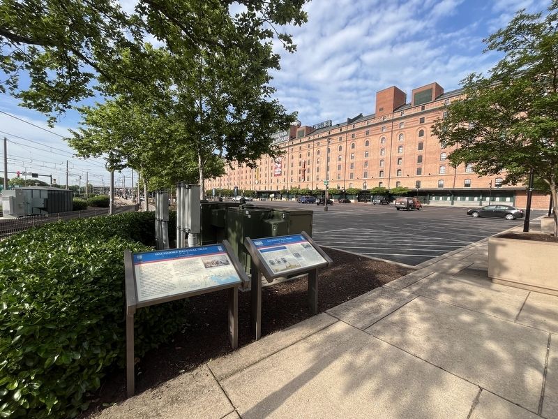
| 101 ► Maryland, Baltimore, Stadium Area — Baltimore Riot Trail — Last Shots at Camden Station — Baltimore - A Divided City — |
| On South Howard Street just south of West Camden Street, on the right when traveling south. | |||
| 102 ► Maryland, Baltimore, Stadium Area — Carl A.J. Wright — Chairman, Maryland Stadium Authority — 2003 - 2005 — |
| On West Camden Street at South Eutaw Street, on the right when traveling east on West Camden Street. | |||
| 103 ► Maryland, Baltimore, Stadium Area — Great Railroad Strike of 1877 — |
| Near Howard Street south of West Camden Street, on the right when traveling south. | |||
| 104 ► Maryland, Baltimore, Stadium Area — Maryland Stadium Complex at Ostend and Warner Streets — Gwynns Falls Trail — |
| On West Ostend Street at Warner Street on West Ostend Street. | |||
| 105 ► Maryland, Baltimore, Stadium Area — Richard H. Trainor — |
| Near S. Howard Street near W. Conway Street. | |||
| 106 ► Maryland, Baltimore County, Bentley Springs — Bentley Springs — |
| Near Bentley Road, 0.8 miles east of Kauffman Road, on the right when traveling east. | |||
| 107 ► Maryland, Baltimore County, Brooklandville — Rockland — |
| On Ruxton Road (Maryland Route 133) at Falls Road (Maryland Route 25), on the left on Ruxton Road. | |||
| 108 ► Maryland, Baltimore County, Catonsville — Bringing Trade to Baltimore — |
| Near Washington Boulevard (U.S. 1) at South Street. | |||
| 109 ► Maryland, Baltimore County, Catonsville — Building America's First Railroad — |
| Near Washington Boulevard (U.S. 1) at South Street. | |||
| 110 ► Maryland, Baltimore County, Catonsville — Catonsville — From Stagecoaches to Horseless Carriages — The Historic National Road - The Road That Built The Nation — |
| On Frederick Road (Maryland Route 144), on the right when traveling west. | |||
| 111 ► Maryland, Baltimore County, Catonsville — Patapsco Superlative: — "The Premiere Flour" — |
| Near Washington Boulevard (U.S. 1) at South Street. | |||
| 112 ► Maryland, Baltimore County, Catonsville — The Streetcar Era in Catonsville — 1880-1963 — |
| On Frederick Road (Maryland Route 144), on the right when traveling west. | |||
| 113 ► Maryland, Baltimore County, Cockeysville — Gilmor's Raid — Capturing Cockeysville — Early's 1864 Attack on Washington — |
| Near Paper Mill Road (Maryland Route 145) 0.3 miles east of Arrowwood Road, on the left when traveling east. | |||
| 114 ► Maryland, Baltimore County, Cockeysville — North Central Railroad Trail — |
| Near Paper Mill Road (Maryland Route 145) 1.2 miles east of York Road (Maryland Route 45), on the left when traveling east. | |||
| 115 ► Maryland, Baltimore County, Cockeysville — Phoenix — |
| Near Phoenix Road, 1 mile north of Paper Mill Road (Maryland Route 145), on the left when traveling north. | |||
| 116 ► Maryland, Baltimore County, Cockeysville — White Marble Block — |
| 117 ► Maryland, Baltimore County, Dundalk — Dundalk, Maryland — Founded 1894 — |
| On Dundalk Avenue at Dunhill Road, on the right when traveling south on Dundalk Avenue. | |||
| 118 ► Maryland, Baltimore County, Edgemere — The Trolley Station at Bayshore Park — 1906-1947 — Trolleys Helped Build Our Parks — |
| On Bay Shore Road, on the right when traveling west. | |||
| 119 ► Maryland, Baltimore County, Ellicott City — Ellicott’s Mills — |
| On Frederick Road (Maryland Route 144) at Oella Avenue, on the right when traveling west on Frederick Road. | |||
| 120 ► Maryland, Baltimore County, Freeland — Freeland — |
| On Freeland Road north of Railroad Avenue, on the left when traveling north. | |||
| 121 ► Maryland, Baltimore County, Glyndon — Glyndon — 1871–1971 — |
| On Butler Road (Route 128) at Central Avenue, on the left on Butler Road. | |||
| 122 ► Maryland, Baltimore County, Glyndon — Glyndon Station — |
| On Railroad Avenue south of Butler Road, on the right when traveling south. | |||
| 123 ► Maryland, Baltimore County, Glyndon — Railroad Ave — Community Well, Pump House, and Watering Trough — |
| On Railroad Ave., on the right when traveling east. | |||
| 124 ► Maryland, Baltimore County, Halethorpe — The Relay House — |
| On Viaduct Avenue at Soouth Rolling Road, on the left when traveling north on Viaduct Avenue. | |||
| 125 ► Maryland, Baltimore County, Long Green — Maj. Gen. Isaac Ridgeway Trimble, C.S.A. — |
| On Dulaney Valley Road at Ravenshurst Circle, on the right when traveling south on Dulaney Valley Road. | |||
| 126 ► Maryland, Baltimore County, Lutherville-Timonium — Baltimore & Susquehanna Railroad Marble Track Bed — |
| On Greenspring Drive. | |||
| 127 ► Maryland, Baltimore County, Lutherville-Timonium — History of The Greenspring Quarry — |
| On Quarry Lake Drive at Travertine Drive, on the left when traveling west on Quarry Lake Drive. | |||
| 128 ► Maryland, Baltimore County, Lutherville-Timonium — Jones Falls Watershed — |
| Near Ridgely Rd. | |||
| 129 ► Maryland, Baltimore County, Oella — "Just One Nickel and I Could Ride" — ... in the Patapsco Heritage Area — |
| On Oella Avenue just north of Frederick Road (Maryland Route 144), on the left when traveling south. | |||
| 130 ► Maryland, Baltimore County, Oella — Edges of Earth's Crust Collided Here — ... in the Patapsco Heritage Area — |
| Near Westchester Avenue, 0.1 miles east of Frederick Road (Maryland Route 144), on the left when traveling east. | |||
| 131 ► Maryland, Baltimore County, Overlea — Overlea Waiting Station — |
| Near Belair Road (U.S. 1) at West Overlea Road, on the right. | |||
| 132 ► Maryland, Baltimore County, Parkton — Parkton — |
| On Torrey C. Brown Rail Trail, 0.1 miles north of Frederick Road, on the left when traveling north. | |||
| 133 ► Maryland, Baltimore County, Parkton — Parkton, MD Track Chart — Circa 1930 — |
| Near Dairy Road, 0.4 miles west of York Road (Maryland Route 45), on the left when traveling west. | |||
| 134 ► Maryland, Baltimore County, Parkton — Torrey C. Brown Rail Trail — …where fun comes naturally — |
| On Torrey C. Brown Rail Trail at York Road, on the left when traveling south on Torrey C. Brown Rail Trail. | |||
| 135 ► Maryland, Baltimore County, Parkton — Torrey C. Brown Rail Trail — |
| On Torrey C. Brown Rail Trail at Dairy Road, on the right when traveling north on Torrey C. Brown Rail Trail. | |||
| 136 ► Maryland, Baltimore County, Pikesville — Sudbrook Park — |
| On Upland Road at Cliveden Road on Upland Road. | |||
| 137 ► Maryland, Baltimore County, Relay — A Rural Vacation Spot — |
| Near Washington Boulevard (U.S. 1) at South Street. | |||
| 138 ► Maryland, Baltimore County, Relay — Masterpiece of the Early B&O Railroad — |
| Near Washington Boulevard (U.S. 1) at South Street. | |||
| 139 ► Maryland, Baltimore County, Relay — Relay — |
| On S. Rolling Road, 0.1 miles south of Francis Avenue, on the right when traveling south. | |||
| 140 ► Maryland, Baltimore County, Relay — The Thomas Viaduct — |
| Near Railroad Avenue near Viaduct Avenue. | |||
| 141 ► Maryland, Baltimore County, Sparks Glencoe — Sparks — |
| On Sparks Road, 0.6 miles east of York Road (Maryland Route 45), on the right when traveling east. | |||
| 142 ► Maryland, Baltimore County, Timonium — Baltimore and Susquehanna Railroad Marble Track Bed — |
| Near Greenspring Drive, on the right when traveling north. | |||
| 143 ► Maryland, Baltimore County, Towson — Thoroughbreds at Hampton — Hampton National Historic Site — |
| Near Hampton Lane, 0.1 miles west of Gypsy Lane, on the left when traveling west. | |||
| 144 ► Maryland, Calvert County, Chesapeake Beach — Bald Eagle — |
| Near Mears Avenue just east of Bayside Road (Maryland Route 261), on the right when traveling west. | |||
| 145 ► Maryland, Calvert County, Chesapeake Beach — Birds — Chesapeake Beach Railway Trail — |
| On Chesapeake Beach Railway Trail, 0.2 miles east of Delores Court, on the left when traveling east. | |||
| 146 ► Maryland, Calvert County, Chesapeake Beach — Chesapeake Beach Railway — 1897-1935 — |
| On Mears Avenue at Bayside Road (Maryland Route 261), in the median on Mears Avenue. | |||
| 147 ► Maryland, Calvert County, Chesapeake Beach — Chesapeake Beach Railway — |
| Near Mears Avenue just east of C Street, on the right when traveling east. | |||
| 148 ► Maryland, Calvert County, Chesapeake Beach — Chesapeake Beach Railway Station — |
| Near Mears Avenue at "C" Street. | |||
| 149 ► Maryland, Calvert County, Chesapeake Beach — Fishing Creek Aquatic Life — |
| On Harbor Road, 0.3 miles east of Delores Court, on the right when traveling east. | |||
| 150 ► Maryland, Calvert County, Chesapeake Beach — Railroad Artifacts At The Museum — Chesapeake Beach Railway — |
| Near Mears Avenue, 0.1 miles east of C Street, on the right when traveling east. | |||
| 151 ► Maryland, Calvert County, Chesapeake Beach — Railroad Bed — |
| On Mears Avenue just east of Bayside Road (Maryland Route 261), on the right when traveling west. | |||
| 152 ► Maryland, Calvert County, Chesapeake Beach — Railroad Bed — Chesapeake Beach Railway Trail — |
| On Chesapeake Beach Railway Trail, 0.3 miles west of Delores Court. | |||
| 153 ► Maryland, Calvert County, Chesapeake Beach — The Belvedere Hotel — Chesapeake Beach Historic Heritage Trail — |
| On The Boardwalk at 17th Street on The Boardwalk. | |||
| 154 ► Maryland, Calvert County, Chesapeake Beach — The Chesapeake Beach Railway — Chesapeake Beach Historic Heritage Trail — |
| On Mears Avenue at C Street on Mears Avenue. | |||
| 155 ► Maryland, Calvert County, Chesapeake Beach — Tree Canopy — Chesapeake Beach Railway Trail — |
| On Chesapeake Beach Railway Trail, 0.1 miles south of Delores Court, on the right when traveling west. | |||
| 156 ► Maryland, Calvert County, Chesapeake Beach — Watershed — Chesapeake Beach Railway Trail — |
| On Chesapeake Beach Railway Trail, 0.1 miles west of Delores Court, on the left when traveling west. | |||
| 157 ► Maryland, Calvert County, Chesapeake Beach — Wetland Plants & Insects — Chesapeake Beach Railway Trail — |
| On Chesapeake Beach Railway Trail, on the left when traveling east. | |||
| 158 ► Maryland, Calvert County, North Beach — Beach & Pier — Picturing the Past — |
| On Bay Avenue at 3rd Street, on the right when traveling north on Bay Avenue. | |||
| 159 ► Maryland, Calvert County, North Beach — Early Businesses — Picturing the Past — |
| On 4th Street at Dayton Avenue, on the left when traveling east on 4th Street. | |||
| 160 ► Maryland, Calvert County, North Beach — North Beach Boardwalk — |
| On Bay Avenue just north of 2nd Street, on the right when traveling north. | |||
| 161 ► Maryland, Calvert County, North Beach — The Town of North Beach — |
| On Bay Avenue close to 2nd Street, on the right when traveling north. | |||
| 162 ► Maryland, Calvert County, Solomons — Marine Railway Gears — |
| On Solomons Island Road, South. | |||
| 163 ► Maryland, Caroline County, Denton — Hubs of Activity — Terminals, Wharves and Landings on the Choptank |
| On River Landing Road, 0.4 miles north of New Bridge Road (Maryland Route 328), on the right when traveling north. Reported unreadable. | |||
| 164 ► Maryland, Caroline County, Ridgely — Ridgely Memorial Park — Early History — 1919 - 1938 — |
| On West Belle Street west of Central Avenue (Maryland Route 312), on the right when traveling west. | |||
| 165 ► Maryland, Caroline County, Ridgely — Ridgely Railroad Station — |
| On West Belle Street at North Maryland Avenue, on the right when traveling west on West Belle Street. | |||
| 166 ► Maryland, Caroline County, Ridgely — Ridgely, MD 1888 - 1917 — A Period of Broad Growth — |
| On West Belle Road at Cow Barn Road, on the left when traveling west on West Belle Road. | |||
| 167 ► Maryland, Caroline County, Ridgely — Saulsbury House - Fifer Hospital - Ridgely House — 1934 - 1943 — "The only such institution Caroline County has ever possessed" — |
| On Central Avenue (Maryland Route 312) at East Belle Street, on the right when traveling south on Central Avenue. | |||
| 168 ► Maryland, Caroline County, Ridgely — Town of Ridgely Flag — |
| On Central Avenue (Maryland Route 312) just south of East Railroad Street, on the left when traveling south. | |||
| 169 ► Maryland, Carroll County, Eldersburg — History of the Freedom Community — |
| On Buttercup Road south of Raincliffe Road, on the left when traveling south. | |||
| 170 ► Maryland, Carroll County, Mount Airy — Mount Airy — Visitor Services — |
| On South Main Street (Route 808) just south of Center Street, on the left when traveling north. | |||
| 171 ► Maryland, Carroll County, Mount Airy — Mount Airy — History — |
| On South Main Street (Maryland Route 808) just south of Center Street, on the left when traveling north. | |||
| 172 ► Maryland, Carroll County, Mount Airy — Mount Airy — Under the Barrels — Gettysburg Campaign — |
| On South Main Street (Maryland Route 808), on the right when traveling north. | |||
| 173 ► Maryland, Carroll County, Mount Airy — Railway Express Agency Baggage Wagon — circa 1930 — |
| On North Main Street (Maryland Route 808) just north of Center Street, on the right when traveling north. | |||
| 174 ► Maryland, Carroll County, Mount Airy — Runkles Mill and The Mt. Airy Milling Company — Historic Downtown Mount Airy — |
| On Main Street (Maryland Route 808) south of Prospect Road, on the right when traveling south. | |||
| 175 ► Maryland, Carroll County, Mount Airy — The Gillis Building — 1957 — Historic Downtown Mount Airy — |
| On South Main Street (Maryland Route 808) just north of Center Street, on the right when traveling north. | |||
| 176 ► Maryland, Carroll County, Mount Airy — The Mount Airy Rail Yard — Historic Downtown Mount Airy — |
| On Main Street (Maryland Route 808) south of Prospect Road, on the right when traveling south. | |||
| 177 ► Maryland, Carroll County, Mount Airy — The Mount Airy Station — Built in 1875 and Enlarged in 1882 — Historic Downtown Mount Airy — |
| On North Main Street (Maryland Route 808) north of Center Street, on the right when traveling north. | |||
| 178 ► Maryland, Carroll County, Sykesville — Baldwin's Station — Honoring the B&O railroad's premier architect — |
| On Main Street (Maryland Route 851) at Baldwin Drive, on the right when traveling south on Main Street. | |||
| 179 ► Maryland, Carroll County, Sykesville — Baltimore & Ohio Railroad Station — |
| On W. Main Street, on the right when traveling south. | |||
| 180 ► Maryland, Carroll County, Sykesville — Hood’s Mill — |
| On Old Washington Road (Maryland Route 97) 0.2 miles south of Eden Mill Road, on the right when traveling south. | |||
| 181 ► Maryland, Carroll County, Taneytown — Everything from Bags of Flour to the President's Shoes — |
| On East Baltimore Street at Reindollar Street, on the right when traveling east on East Baltimore Street. | |||
| 182 ► Maryland, Carroll County, Union Bridge — Union Bridge — Reynolds’ Last Journey — Gettysburg Campaign — |
| On Main Street, on the left when traveling north. | |||
| 183 ► Maryland, Carroll County, Westminster — History Is Also Now — |
| On East Main Street south of Longwell Avenue, on the left when traveling south. | |||
| 184 ► Maryland, Carroll County, Westminster — Westminster Depot — Pressed into Service — Gettysburg Campaign — |
| On Liberty Street (Maryland Route 27) at West Main Street (Maryland Route 32), on the right when traveling north on Liberty Street. | |||
| 185 ► Maryland, Cecil County, Earleville — Bohemia — Formerly Milligan Hall — |
| On Augustine Herman Highway (Maryland Route 213) 0.8 miles south of Glebe Road, on the left when traveling south. | |||
| 186 ► Maryland, Cecil County, Elkton — New Castle and Frenchtown Railroad — 1832–1853 — |
| On Augustine Herman Highway (Maryland Route 213) at Lewis Shore Road, on the right when traveling south on Augustine Herman Highway. | |||
| 187 ► Maryland, Cecil County, Perry Point — The War Effort at Home: Perry Point Ammonium Nitrate Plant — Perry Point Village — |
| On 3rd Street at Avenue A, on the left when traveling east on 3rd Street. | |||
| 188 ► Maryland, Cecil County, Perryville — Perryville — One Week After the War Began — |
| On Broad Street (Maryland Route 7) at Roundhouse Drive, on the right when traveling west on Broad Street. | |||
| 189 ► Maryland, Cecil County, Perryville — Railroad History — |
| On Roundhouse Drive just south of Smith Lane, on the right when traveling north. | |||
| 190 ► Maryland, Charles County, Indian Head — Navy Railroad — Historical Role in Our Nation’s Defense — Indian Head Rail Trail — |
| On Indian Head Rail Trail east of Mattingly Street. | |||
| 191 ► Maryland, Charles County, Indian Head — Railroad at Naval Proving Ground — Indian Head Rail Trail — |
| Near Mattingly Avenue, 0.2 miles south of Indian Head Highway (Maryland Route 210), on the left when traveling south. | |||
| 192 ► Maryland, Charles County, Indian Head — The Story — Indian Head Rail Trail — |
| Near Livingston Road (Maryland Route 224) 0.5 miles east of Hawthorne Road (Maryland Route 225), on the left when traveling east. | |||
| 193 ► Maryland, Charles County, La Plata — La Plata Train Museum — Town of La Plata, Maryland — |
| Near Kent Avenue north of Charles Street (Maryland Route 6), on the left when traveling north. | |||
| 194 ► Maryland, Charles County, White Plains — Navy Railroad — Historical Role in our Nation’s Defense — Indian Head Rail Trail — |
| Near Theodore Green Boulevard, 0.4 miles west of Crain Highway (U.S. 301), on the right when traveling west. | |||
| 195 ► Maryland, Frederick County, Ballenger Creek — A Bold Plan — Monocacy National Battlefield — National Park Service, U.S. Department of the Interior — |
| Near Urbana Pike (Maryland Route 355) 0.5 miles south of New Technology Way, on the right when traveling north. | |||
| 196 ► Maryland, Frederick County, Ballenger Creek — A Crossroads of History — Monocacy National Battlefield — National Park Service, U.S. Department of the Interior — |
| Near Urbana Pike (Maryland Route 355) 1.4 miles south of New Technology Way, on the right when traveling north. | |||
| 197 ► Maryland, Frederick County, Brunswick — Berlin — Chesapeake and Ohio Canal National Historical Park — National Park Service, U.S. Department of the Interior |
| On South Maple Avenue, on the left when traveling west. Reported damaged. | |||
| 198 ► Maryland, Frederick County, Brunswick — Brunswick — Chesapeake and Ohio Canal National Historical Park — National Park Service, U.S. Department of the Interior — |
| On South Maple Avenue south of East Potomac Street, on the right when traveling south. | |||
| 199 ► Maryland, Frederick County, Brunswick — Brunswick — Canal Towns — |
| On Maple Avenue at Railroad Square, on the right when traveling south on Maple Avenue. | |||
| 200 ► Maryland, Frederick County, Brunswick — From Dirt Path to Main Street — Brunswick — |
| On Maple Avenue at Potomac Street, on the left when traveling south on Maple Avenue. | |||
428 entries matched your criteria. Entries 101 through 200 are listed above. ⊲ Previous 100 — Next 100 ⊳