By Tim Fillmon, March 24, 2020
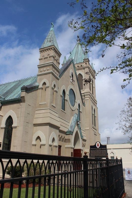
Pensacola's Catholic Presence Marker looking north
| On North Palafox Street (U.S. 29) south of West Chase Street, on the right when traveling south. |
| On North Palafox Street at West Garden Street (Business U.S. 98), on the right when traveling south on North Palafox Street. |
| On West Government Street at South Spring Street, on the right when traveling west on West Government Street. |
| Near North Palafox Street at West Chase Street. |
| On Fort Pickens Road, 1.2 miles west of Via de Luna Drive (State Road 399), on the left when traveling west. |
| On 5th Street at Avenue E (U.S. 98), on the right when traveling north on 5th Street. |
| On 6th Street south of Chestnut Street (State Road 98), on the right when traveling north. |
| On Franklin Street just west of North Madison Street (County Road 65), on the right when traveling west. |
| On Old Philadelphia Church Road (County Road 272) 0.2 miles west of Attapulgus Highway (County Road 65), on the right when traveling west. |
| On West King Street at North Adams Street (State Road 267), on the right when traveling west on West King Street. |
| On South Main Street (U.S. 129) just south of Southeast 1st Avenue, on the right when traveling north. |
| On Eighth Street, 0.1 miles east of Monument Avenue (U.S. 98), on the right when traveling east. |
| On Central Avenue SE at 5th Street SE, on the right when traveling north on Central Avenue SE. |
| On Citrus Way (County Road 491) south of Ponce de Leon Boulevard (U.S. 98), on the right when traveling south. |
| Near Cortez Boulevard (State Road 50) at Hope Hill Road, on the right when traveling east. |
| On Broad Street (U.S. 41) at Stromberg Avenue, on the right when traveling north on Broad Street. |
| On Jim Rodgers Avenue at Robert Britt Street, on the right when traveling south on Jim Rodgers Avenue. |
| On West Dr Martin Luther King Jr Boulevard east of South Howard Street, on the left when traveling west. |
| On Kennedy Boulevard at Morgan Street, on the right when traveling west on Kennedy Boulevard. |
| On North Albany Avenue at West Spruce Street, on the right when traveling north on North Albany Avenue. |
| On North Franklin Street (Business U.S. 41) at East Fortune Street, on the right when traveling north on North Franklin Street. |
| On Bayshore Blvd near West Barcelona Street, on the right when traveling south. |
| On West Swann Avenue near South Lincoln Avenue, on the right when traveling west. |
| On Bayshore Boulevard, on the right when traveling south. |
| On East Tyler Street east of North Florida Avenue, on the right when traveling west. |
| On Bayshore Boulevard just north of Beach Place, on the right when traveling north. |
| On North Perry Avenue at West Adalee Streeet, on the right when traveling south on North Perry Avenue. |
| On North Nebraska Avenue at East 11th Avenue, on the right when traveling north on North Nebraska Avenue. |
| On North Nebraska Avenue at East Estelle Street, on the right when traveling north on North Nebraska Avenue. |
| On North Franklin Street at East Zack Street, on the right when traveling south on North Franklin Street. |
| On East Street, on the right when traveling north. |
| On East 7th Avenue (La Séptima) west of North 24th Street. |
| On North Morgan Street, 0.1 miles north of East Harrison Street, on the right when traveling north. |
| Near East 11th Avenue at Angel Oliva Senior Street, on the right when traveling east. |
| Near East Harrison Street. |
| On North Florida Avenue (U.S. 41) at East Twiggs Street when traveling east on North Florida Avenue. |
| On Madison Street near North Marion Street, on the left when traveling east. |
| On N. 20th Street, on the left when traveling north. |
| On Florida Avenue (Business U.S. 41) north of East Emily Street, on the right when traveling north. |
| On North Governor Street at East Scott Street, on the right when traveling north on North Governor Street. |
| On North Jefferson Street south of East Laurel Street, on the left when traveling south. |
| On North Riverhills Drive just north of North Glen Arven Avenue, on the right when traveling north. |
| On North Riverhills Drive north of North Glen Arven Avenue, on the right when traveling north. Reported missing. |
| On North Broadway Street at Oregon Avenue, on the right when traveling north on North Broadway Street. |
| On North Hickory Street at Pennsylvania Avenue (County Road 512), on the left when traveling north on North Hickory Street. |
| On 85th Street (County Road 510) at 64th Avenue, on the left when traveling west on 85th Street. |
| Near Lovedale Road (Florida Route 69A) at Dale Circle, on the right when traveling east. |
| On State Road 2 at Fernwood Street, on the right when traveling east on State Road 2. |
| On Messer Road west of State Road 69, on the right when traveling west. |
| On Bryan Street (State Road 71) at Smith Street, on the right when traveling north on Bryan Street. |
| On Lafayette Street (U.S. 90) at Jefferson Street (State Road 73), on the right when traveling east on Lafayette Street. |
| On Jefferson Street (State Road 166) at Clinton Street, on the right when traveling north on Jefferson Street. |
| On Caledonia Street at Clinton Street, on the right when traveling south on Caledonia Street. |
| On Jackson Street at St John Street, on the left when traveling east on Jackson Street. |
| On Lafayette Street (U.S. 90) at Wynn Street, on the right when traveling west on Lafayette Street. |
| On Lafayette Street (U.S. 90) at Wynn Street, on the right when traveling west on Lafayette Street. |
| On Walnut Street at North Olive street, on the left when traveling east on Walnut Street. |
| On Boston Highway (County Road 149) 1.2 miles north of Fulford Road, on the left when traveling north. |
| On Methodist Church Road, 0.1 miles east of Waukeenah Highway (County Road 259), on the right when traveling east. |
| Near Ferran Park Drive at East McDonald Avenue, on the right when traveling south. |
| On Spring Lake Road at Marjorie Street on Spring Lake Road. |
| On West 3rd Street just east of Gilchrist Avenue, on the left when traveling east. |
| On 4th Street West at Gilchrist Avenue, on the right when traveling west on 4th Street West. |
| Near Corkscrew Road, 0.2 miles west of U.S. 41. |
| On Veterans Memorial Drive (Florida Route 59) 0.1 miles south of Moccasin Gap Road (Florida Route 142), on the left when traveling south. |
| Near W Testennessee Street at Mission Road. |
| On Martin Luther King Jr Boulevard south of West Georgia Street, on the right when traveling south. |
| On South Martin Luther King Jr Boulevard at FAMU Way, on the right when traveling south on South Martin Luther King Jr Boulevard. |
| On Pisgah Church Road, 0.2 miles east of Centerville Road (County Road 151), on the right when traveling east. |
| Near West Tennessee Street at Mission Road. |
| On West Tennessee Street at Mission Road on West Tennessee Street. |
| Near South Gadsden Street south of East Gaines Street, on the left when traveling south. |
| Near W. Tennessee Street at Mission Road. |
| On Spanish Mission Court, 0.2 miles north of Buck Lake Road, on the left when traveling north. |
| On South Martin Luther King Boulevard, 0.1 miles south of West Palmer Avenue, on the right when traveling south. |
| On E. Park Avenue at S. Monroe Street, in the median on E. Park Avenue. |
| On W. Park Avenue at W. Duval Street on W. Park Avenue. |
| On West Park Avenue near North Duval Street, on the right when traveling west. |
| On West Virginia Street at North Martin Luther King Jr Boulevard, on the right when traveling west on West Virginia Street. |
| On West Georgia Street at North Macomb Street (Old Bainbridge Road), on the left when traveling east on West Georgia Street. |
| On West Georgia Street just west of North Copeland Street, on the left when traveling west. |
| On West Carolina Street west of North Martin Luther King Jr. Boulevard, on the left when traveling west. |
| On North Martin Luther King Jr Boulevard south of West Georgia Street, on the right when traveling south. |
| On North Monroe Street (U.S. 27) at East Brevard Street, on the right when traveling north on North Monroe Street. |
| On Piedmont Drive, 0.2 miles north of Middlebrooks Circle, on the right when traveling north. |
| On State Road 24, on the right when traveling north. |
| On Ferrel Street at Roberts Street, on the right when traveling north on Ferrel Street. |
| On Northwest 140th Street at Northwest Heron Drive, on the left when traveling north on Northwest 140th Street. |
| On U.S. 90 at Northeast Macedonia Church Road, on the right when traveling west on U.S. 90. |
| On West Pinckney Street at South Orange Street, on the right when traveling west on West Pinckney Street. |
| On West Base Street (U.S. 90), on the right when traveling east. |
| Near Northwest 205th Street at Northwest 140th Street. |
| On Northeast Horry Avenue at Marion Street, on the right when traveling north on Northeast Horry Avenue. |
| On 15th Street East at 4th Avenue East, on the right when traveling north on 15th Street East. |
| On 15th Street West at Manatee Avenue West (State Road 64), on the right when traveling south on 15th Street West. |
| Near Desoto Memorial Highway (75th Street NW), 0.2 miles north of 24th Avenue NW. |
| On 9th Avenue Northwest at 86th Street Court Northwest, on the right when traveling west on 9th Avenue Northwest. |
| Near Manatee Avenue East at 14th Street East. |
| On Bradenton-Arcadia Road (Florida Route 64) at Verna Bethany Road, on the right when traveling east on Bradenton-Arcadia Road. |
459 entries matched your criteria. Entries 101 through 200 are listed above.
⊲ Previous 100 —
Next 100 ⊳