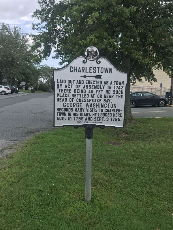
Laid out and erected as a town by Act of Assembly in 1742 “there being as yet no such place settled at, or near the head of Chesapeake Bay".
George Washington
records many visits to Charlestown in his diary. He lodged here Aug. 10, . . . — — Map (db m144413) HM
Member of Council of Safety and courageous officer of the Maryland Line in Revolutionary War, native of Pennsylvania, Princeton graduate (1767) and lawyer. He settled in brick house near this site after his marriage in 1771 to Margaret Jane Peale. . . . — — Map (db m144223) HM
Stone wharf and warehouse were built here by Decree of General Assembly in 1744. Remains of wharf can be seen. Officers' chests left behind by two Companies of Royal American Regiment quartered in winter of 1756-1757 were auctioned by town . . . — — Map (db m144287) HM
Granted 1662 as 4000 acres in the “farr remote, then unknown wilderness” to Augustine Herman, native of Bohemia, for “making a mapp of this province” regranted 1663 as 6000 acres erected a manor in 1676.
Not open . . . — — Map (db m144305) HM
Obtained in 1684 from
Augustine Herman
by the religious sect called Labadists. Here they led an austere form of communistic life but disintegrated about
1698. — — Map (db m1566) HM
Byway Destinations
Few places portray the intimate connections between land and water better than Maryland's Eastern Shore.
Each place has different stories to tell—present in the wetlands, wharves, fields, homes, . . . — — Map (db m189392) HM
First called “Mannour Chappel” a chapel of ease of North Sassafras Parish. Established in Bohemia Manor in compliance with an act of the Maryland Assembly, 1692. Erected as a separate parish in 1744. — — Map (db m1565) HM
This Tablet is in Commemoration of Richard Stockton and Dr. Benjamin Rush signers of the Declaration of Independence and students of West Nottingham Academy. Stockton from 1743 to 1748 - Rush from 1751 to 1756. — — Map (db m145627) HM
Founded 1744 by by Samuel Finley, Presbyterian Minister and a native of County Armagh, Ireland. He remained in charge of the academy and church until 1761 when he was chosen President of the College of New Jersey, now Princeton University. — — Map (db m145626) HM
A Susquehannock Indian fort located at this point was an important factor in the boundary line controversy between Lord Baltimore and William Penn in 1683. — — Map (db m145866) HM
Near Pilot, two and one-half miles northwest of this point, lies the site of a Susquehanna fording used by Indians before the coming of the white man. By 1695, a barge provided ferry service to the colonists. The Conowingo Lake now covers the . . . — — Map (db m127912) HM
Home of George Milligan (1720–1783), Scotch trader. Purchased from his son, Robert, by Louis McLane (1784–1857) who represented Delaware in the United States House and Senate, was Minister to Great Britain, Secretary of the Treasury, . . . — — Map (db m144538) HM
Ancestral home of the De Veazie (Veazey) family; patented to John Veazey ca. 1670. His descendant, Colonel Thomas Ward Veazey, defended Duffy’s Fort, Fredericktown, from the British fleet May 5, 1813, and served as Governor of Maryland, . . . — — Map (db m156563) HM
Granted to Samuel Brocus, whose daughter Susannah married, circa 1700, Edward Veazey. Their son, Colonel John Veazey, Sr., was Chief Military Officer of Cecil County and Justice and Judge for 22 years. His eldest son, Edward, was High Sheriff of . . . — — Map (db m155766) HM
Land originally granted to Phillip Calvert, Chancellor of Maryland, and wife, Anne, in 1658. Richard Low, gentleman of Virginia, purchased tract known as "Hazelmore" and adjacent land "The Grove" in 1665. Bought by Abraham Wild, trader and mariner . . . — — Map (db m144250) HM
The Sassafras River, stretching before you, provides a window into four centuries of history at Mount Harmon. Any number of historic events occurred within view of this spot.
European Exploration & Settlement Captain John Smith, the first . . . — — Map (db m156917) HM
Originally owned by Godfrey Harmon, then by James Paul Heath; subsequent to 1760 the home of James Louttit, Sr. and Jr., and Sidney George, Jr., Patriots. Vestrymen of St. Stephen’s Church, and contributors, 1782, to the original endowment of . . . — — Map (db m144248) HM
Welcome to Mount Harmon Plantation, one of Maryland’s premier historic sites. Comprising 200-acres of pristine open space, Mount Harmon features a restored 18th century manor house and plantation kitchen, a formal boxwood garden, a rare tobacco . . . — — Map (db m156564) HM
Mount Harmon Plantation at World's End. A National Trust Historic House. The gift of Mrs. Harry Clark Boden IV in memory of James Louttit Sr. and his wife, Mary George who acquired the property in 1760 — — Map (db m156566) HM
Welcome to Mount Harmon Plantation, one of Maryland's premier historic sites. Comprising 200-acres of pristine open space, Mount Harmon features a restored 18th century manor house and plantation kitchen, a formal boxwood garden, a rare tobacco . . . — — Map (db m156881) HM
Established by Act of Assembly in 1692. The first vestry met January 10, 1693 in the Court House at Ordinary Point. The Parish Church was “dedicated to the honor of Saint Stephen”, March 25, 1706. Rebuilt 1737, 1823 and 1873. — — Map (db m1701) HM
[left plaque]
This memorial preserves the site
of the original vestry house 1731-1737
[center plaque]
This columnbarium given to
the glory of God and
in loving memory of
Delphine S. and Michael Luyn
2002 . . . — — Map (db m155805) HM
Plantation Life In the colonial era Mount Harmon was a working plantation. A community of people lived at Mount Harmon during the 18th century including the landowners, indentured servants, slaves, and tradespeople. Inventories from the Heath . . . — — Map (db m156567) HM
Founded 1704 by Rev. Thomas Mansell, S.J., one of the earliest permanent Catholic establishments in the English Colonies.
Bohemia Academy Founded 1745 by Rev. Thomas Pulton, S.J. attended by Charles Carroll of Carrollton, a signed of the . . . — — Map (db m1572) HM
Home of the Lusbys in the early 1700’s. Ruth Lusby and Commodore Jacob Jones married in 1821, made the Anchorage their home and enlarged it in 1835. Jones served on the “Philadelphia” when it ran aground at Tripoli and commanded the . . . — — Map (db m145440) HM
The 305 acre farm of William Ward. He gave a tract called “North Levell” on which stands St. Stephen’s Church. His descendant, Henry Veazey Ward, was Consul General for the Republic of Chile. Another, Juliana Veazey Ward, married Dr. . . . — — Map (db m144247) HM
A tract of 6,000 acres laid out in 1683 by George Talbot (then surveyor-general of Maryland) for Edwin O’Dwire and 15 other Irishmen. Its northern boundary extended into what is now the State of Pennsylvania. — — Map (db m1763) HM
Home of Henry Hollingsworth, merchant, legislator and colonel of Elk Battalion of Militia in Revolutionary Way as Commissary for the Eastern Shore. He obtained supplies for the Americans and French allies embarking near here in 1781 on voyage down . . . — — Map (db m154171) HM
Established about 1710 on Lot No. 35 of “The Nottingham Lots” by Andrew Job who secured it from William Penn. Job’s son, Thomas married Elizabeth Maxwell, niece of Daniel Defoe who wrote “Robinson Crusoe.” — — Map (db m146176) HM
About 1750 Zebulon Hollingsworth built the approximately 30 x 30 foot left hand section as a brick two story dwelling. In the mid-1800s it was gutted by fire and rebuilt as three stories with a low pitched roof. Also the two story right hand side . . . — — Map (db m152141) HM
Founded 1720 in North Milford Hundred, Cecil County, Maryland. First called New Erection on the Branches of Elk River, then Elk River Church, Great Elk, upper Elk and, since 1793, Rock. Present church erected 1761 remodeled in 1844 and 1900. — — Map (db m1764) HM
This is the location of the Jon Steelman Trading Post,
which fell into disrepair and was replaced with the building
you see now, It was originally used to trade goods with the
Native Americans. In later years this site was owned and
operated . . . — — Map (db m152165) HM
Part of Friendship Tract and home of Robert Alexander, delegate to the Provincial Convention of 1774 and to the Continental Convention of 1776. On August 25, 1777, he was host to Washington here and three days later offered allegiance to British . . . — — Map (db m154176) HM
Valentine Hollingsworth and 2nd wife, Anne Calvert, came to this country in 1682 about the same time as William Penn. He was the father of 11 children and lived in northern Delaware in the area now called Brandywine Hundred.
Son Henry . . . — — Map (db m96587) HM
Discovered and explored by Capt. John Smith 1607–1609 who named it Tockwough River after the tribe of Indians who inhabited its banks. Tockwough was the original Indian name for Sassafras, a root from which they made a form of bread. — — Map (db m155544) HM
Explore the landscapes of the early 1600s along the Captain John Smith Chesapeake National Historic Trail. Learn about the thriving American Indian communities John Smith encountered and imagine the bountiful Chesapeake he observed. Experience the . . . — — Map (db m144819) HM
Built circa 1860, the bridge is one of the few covered ones left in Maryland and the only one on public ground in Cecil County. The area to the East has been the site of several mills, the earliest Samuel Gilpin’s flour mill circa 1735. . . . — — Map (db m1692) HM
George Talbot of Susquehanna Manor renamed North East River, “The Little Shannon.” The iron forges of the Principio Company were located here. Saint Mary Ann’s Parish Church [is] one of the oldest in Cecil County. Russell, one of the . . . — — Map (db m162624) HM
The building, erected 1742, is one of the oldest in Cecil County. The cornerstone bears the initials of the Rector and Vestrymen at that time. Communion vessels, a bible and a book of common prayer presented 1718 by Queen Anne of England still are . . . — — Map (db m226356) HM
To present log wing, believed built in 1735, George Gale added fieldstone section c. 1781. Further additions to house were made in 19th century. Gale, born in Somerset County in 1756, served in Continental Army during Revolutionary War. Was member . . . — — Map (db m127921) HM
Old Post Road
Established 1666
Lower Susquehanna Ferry
established 1695
Rodgers’ Tavern
where
George Washington
frequently stopped
between
1781–1798 — — Map (db m145429) HM
John and Elizabeth Rodgers owned and operated the mid-18th century Rodgers Tavern here plus a tavern in Havre de Grace. They ran a ferry business between the two. The hostelry here was a popular stop on the Old Post Road.
Their famous . . . — — Map (db m145747) HM
Known also as New Connaught Manor, or New Ireland, this manor of 32,000 acres was one of the largest in Maryland. It was granted 1680, to George Talbot (a cousin of Charles Calvert, Third Lord of Baltimore) of Castle Rooney, Ireland, in return for . . . — — Map (db m137541) HM
A leading iron producer during the Colonial period, Principio held Maryland’s first blast furnace, operating 1725, and first refinery forge, constructed 1728. After the American Revolution, Principio made cannons and other ordnance until the . . . — — Map (db m1481) HM
Not only does the Lower Susquehanna River have an impressive natural history, but a rich cultural history as well. From where you stand the famous explorer John Smith made it only a little farther up the river in his schooner. A fascinating group . . . — — Map (db m146988) HM
Owned by John Steel, this grist mill was in successful operation as early as 1731. At the same period a ferry was operated about one-half mile downstream at a crossing known as Upper Ferry. — — Map (db m129861) HM
To St. Mary Anne’s Church, North Elk Parish, North East, Maryland. Built in 1733, the oldest remaining gravestone in 1968 records the death of Thomas Shepherd, August 28, 1742. — — Map (db m92330) HM
In 1608 Captain John Smith ascended the Susquehannah River until stopped by the rocks. On his map he calls this point “Smyths Fales” marking it by a + which he explains as meaning “hath bin discovered what beyond is by relation". — — Map (db m188592) HM
First mill on this site built by Jeremiah Brown, Sr., in 1734.
Partially rebuilt in 1892 by Howard Brown and again reconstructed in 1971.
Listed on the National Register of Historic Places in 1987. — — Map (db m227876) HM
37 lots of approximately 500 acres each given by William Penn to his colonists in 1702 although they lay in Maryland and were part of George Talbot’s “Susquehanna Manor” of 32,000 acres granted him in 1680 by Lord Baltimore. — — Map (db m1760) HM
Founded 1744 by by Samuel Finley, Presbyterian Minister and a native of County Armagh, Ireland. He remained in charge of the academy and church until 1761 when he was chosen President of the College of New Jersey, now Princeton University. — — Map (db m145628) HM
Patented 5th June, 1685, to Major Peter Sayer, a prominent Catholic. Later acquired by the Heath Family. On 14th May, 1773, George Washington “din’d and lodg’d at Mr. DL. Heath’s” taking his stepson Jackie Custis to King’s College, N.Y. . . . — — Map (db m65392) HM
This replica of the Maryland Colonists’ Wrought Iron Cross of 1634 stands directly over the south foundation wall of the original house-chapel-academy building (circa 1720-1745) — — Map (db m69828) HM
Visited Warwick Feby. 1756, March 1756. “Din’d and lodg’d at Mr. D’L Heath’s May 1773. Passed through Sept. 9 and Oct. 28, 1774. Breakfasted March 23, 1791 and again in September 1793. — — Map (db m152183) HM
The inventor of the steam boat was born 1743 two miles north of this point in “Middle Neck”
George Washington
showed much interest in Rumsey’s experiments and made him superintendent of “The Potomac Company.” — — Map (db m1574) HM
Founded 1704 by Rev. Thomas Mansell, S.J., one of the earliest permanent Catholic establishments in the English Colonies.
Bohemia Academy Founded 1745 by Rev. Thomas Pulton, S.J. attended by Charles Carroll of Carrollton, a signed of the . . . — — Map (db m244190) HM
[unreadable] Emphasis is on promoting and keeping the area as it looked in George Washington's day. [unreadable]
[Aside:]
Piscataway Park lies on the Maryland side of the Potomac River about 20 miles south of Washington, DC, . . . — — Map (db m154695) HM
Rich Hill was the home of wealthy landowners, enslaved African Americans and tenant farmers. From the early 18th century through the 20th century, the land was used to produce tobacco, corn and dairy products and to raise sheep, pigs, chickens, . . . — — Map (db m186734) HM
)
1666
Hugh Thomas receives a 600 acre patent to "Rich Hill." )
1666—1714
Beginnings )
1714—1807
Brown Family Era )
(Image of Dr. Gustavus Brown) )
Scottish immigrant Dr. Gustavus Brown builds the house.
1729 . . . — — Map (db m129049) HM
Founded in 1683 as Benedict-Leonardtown. Here a vessel was constructed for Geo. Washington in 1760. In August, 1814, British troops under Gen. Ross landed near here for their march on the City of Washington. — — Map (db m28315) HM
Built circa 1768 by merchant and tobacco farmer George Maxwell, Maxwell Hall features massive twin chimneys and foundation stones of English chert. Local tradition holds that in the War of 1812, the British invasion force took possession of Maxwell . . . — — Map (db m28317) HM
Although you see a modern agricultural landscape, the land once known as "Dorsey Farm" and now Serenity Farm, has a history including Native American settlements, tobacco plantations, and military encampments.
Since 10,000 B.C.
Native Americans . . . — — Map (db m137561) HM
Granted, 1674, to William Boarman Esq. with royal courts, perquisites, profits of courts and other privileges and immunities belonging to manors in England. By proprietary patent Lord Baltimore granted the prerogatives of Court Baron and all things . . . — — Map (db m24214) HM
This is the site of Saint Charles Roman Catholic Church. The parish began as a “Station Chapel” in the nearby home of the Charles Pye Family. Priests from St. Thomas Manor House in Port Tobacco came by on horseback to minister to the people. Saint . . . — — Map (db m6738) HM
George Maxwell and Maxwell's Seat
George Maxwell, a Scottish immigrant, was present in Charles County, MD by 1745. He was a successful Chesapeake merchant with many business ventures and partnerships. Maxwell's Seat was purchased from Charles . . . — — Map (db m128738) HM
The widow Eilbeck, mentioned in Washington’s diary, lived here. Her daughter, Ann Eilbeck, married Col. George Mason of Gunston Hall, Virginia. Araby built about 1700. — — Map (db m128784) HM
One of the original thirty parishes established by an act of the General Assembly of Maryland on June the 2nd 1692. A log church was first erected on this site as reported by the vestry to the Governor in 1694. Existing church was constructed in . . . — — Map (db m128786) HM
First Carmel in U.S. Founded October 15, 1790, by four Carmelites from Belgium three of them natives of Maryland. Nuns moved to Baltimore Sept. 13, 1831. The restorers of Mt. Carmel in Md Recoverd site March 27, 1935. Restored buildings 1937. — — Map (db m6228) HM
Job Chandler, first Charles County settler, built the oldest part of this house, 1639-1650, aided by the Potopaco Indians. Later it was the birthplace of Archbishop Leonard Neale, one of six brothers, all Catholic priests, and one sister, a nun. . . . — — Map (db m6741) HM
Parish church of Port Tobacco Parish, one of the 30 Church of England parishes established, 1692, by act of the provincial assembly, supported by a yearly poll tax of 40 pounds of tobacco. In 1904 the edifice was moved stone by stone from Port . . . — — Map (db m1073) HM
Charles County was created by the Maryland General Assembly in 1658. In 1674 the first Charles County Courthouse was built near here. In the area known as Moore's Lodge, a prison, ordinary (tavern), and race track also were located there. In 1727 . . . — — Map (db m81196) HM
Friendship House was built in the mid 1700s on a site overlooking Nanjemoy Creek in western Charles County by a member of the Dent family. The "Friendship" Dents were actively involved in their community, serving in prominent positions in county . . . — — Map (db m131659) HM
11.8 miles West near Ironsides, MD. Oldest church in Charles County. Served by thirty rectors through 257 years. Present building erected 1732. Visited by George Washington 1771. Restored by Governor Smallwood 1791. — — Map (db m36840) HM
Dr. James Craik, friend and family physician of Gen Washington, built this place, La Grange, about 1765 and lived here until his removal to Alexandria, VA., 1783. — — Map (db m6734) HM
Built by Wm. Marshall in 1690 on land obtained from the Piscataway Indians. Maryland landing of Posey ferry used by Washington. Mt. Vernon in sight from river shore. — — Map (db m128798) HM
Documents and Artifacts
In the 19th century, outbuildings would have stood before you, behind the main house to your left. An old well, which provided water for the house, is located in the distance.
Historical archeologists use both . . . — — Map (db m129137) HM
Friendship House was built in the mid 1700s on a site overlooking Nanjemoy Creek in western Charles County by a member of the Dent family. The "Friendship" Dents were actively involved in their community, serving in prominent positions in . . . — — Map (db m129308) HM
Organized in 1793
United with the Maryland Baptist Union Association (Now Baptist Convention of Maryland) in 1837
"In 1790 four men from Virginia crossed the Potomac River and started preaching the Gospel in Nanjemoy the Sanctuary which . . . — — Map (db m135469) HM
Diverse Habitats
Groundwater seeps from the hillside here at Douglas Point, creating wetlands called "spring seeps." These boggy areas contain a distinct set of plant species, including bayberries, orchids, fringe trees and magnolias. Other . . . — — Map (db m129207) HM
Two miles southwest Washington owned 600 acres of land bought in 1775 and retained until his death. In 1786 he visited this property accompanied by Gen. Smallwood. — — Map (db m6231) HM
February, 1766, Washington's schooner ran aground off this point. From his diary of August 25th, 1768, "Hauling seine upon the bar off Cedar Point for sheepshead but catched none." — — Map (db m116346) HM
Known originally as Piccawaxen, the parish was re-named William and Mary under the Establishment Act of 1692.
Christ Church, in existence in 1690, enlarged in 1750, is otherwise unchanged except for post civil war repairs.
The boyhood . . . — — Map (db m128806) HM
Captain John Smith Chesapeake National Historic Trail
“Passing along the coast, searching every inlet, and bay, fit for harbours and habitations…”
Captain Johns Smith, describing his explorations of the Chesapeake region in 1608. . . . — — Map (db m129116) HM
Welcome to the Chesapeake region, a place that celebrates the natural and cultural heritage of the Chesapeake Bay and its rivers. Discover our proud traditions and precious resources at Chesapeake Bay Gateways.
The Chesapeake Bay Gateways . . . — — Map (db m129114) HM
Part of large tract reserved as public land by Cecilius Calvert, Lord Baltimore. Warrant issued 1667 to John Harrison for 600 acres of which 250 assigned to Thomas and Andrew Baker, called Harrison's gift. Colonel William Dent purchased in 1692. . . . — — Map (db m81195) HM
Near present bridge was Laidler's Landing, which George Lee deeded to John Laidler in 1760. On main route to Fredericksburg and Williamsburg, it was also called Ledler's and Laidlaw's in George Washington's diary. To the south is Cedar Point, where . . . — — Map (db m176425) HM
Captain John Smith Chesapeake National Historic Trail
This unique trail is designed for you to experience by boat. It is America’s first waterway national historic trail and includes more than 3,000 miles explored by Captain John Smith.
The . . . — — Map (db m129104) HM
(2000 acres with Court Leet and
Court Baron) Petented to
Captain James Neale
Member of the Council and Commissioner of his Lordship's Treasury 1643. House built 1661. (Since destroyed). — — Map (db m24541) HM
The eighteenth century merchant who died in 1804 is buried here. He willed his modest wealth to establish free schools for the education of poor children in this section of Charles County where he worked as a peddler and storekeeper for many years. . . . — — Map (db m6234) HM
Born 1723 on "Coates Retirement" Plantation. Held the office of Charles County Justice, 1749-1764. Appointed 1760 to commission on Pennsylvania and Delaware boundary dispute, resulting in the Mason-Dixon boundary settlement. Moved to Annapolis by . . . — — Map (db m128614) HM
Captain John Smith Chesapeake National Historic Trail
“Passing along the coast, searching every inlet, and bay, fit for harbours and habitations…”
Captain Johns Smith, describing his explorations of the Chesapeake region . . . — — Map (db m120538) HM
This park is dedicated to Thomas Stone, one of the four Maryland signers of the Declaration of Independence and is a great place to learn more about our nation's history. It's also a great place to learn more about nature or just hang with friends . . . — — Map (db m120509) HM
John Hanson
1715 - 1785
President of the United States
In Congress Assembled
1781 - 1782
was born at Mulberry Grove
April 14, 1715
Erected by the VASA Order of America. — — Map (db m94218) HM
The Indian village of Potobac, visited in 1608 by Capt. John Smith, occupied this site. County Seat of Charles County, 1658 - 1895. Washington visited here frequently. Site of St. Columba Lodge No. 11 A. F.& A. M., chartered April 18, 1793. — — Map (db m128824) HM
On this ground, two cultures — Indian and European — confronted one another. Here a commercial town and government center grew, declined, grew again, and declined again. Residents raised supplies for the Continental Army and, . . . — — Map (db m142892) HM
951 entries matched your criteria. Entries 301 through 400 are listed above. ⊲ Previous 100 — Next 100 ⊳