After filtering for Oregon, 165 entries match your criteria. The first 100 are listed. ⊳
Roads & Vehicles Topic
By Barry Swackhamer, June 29, 2017
Baker Marker
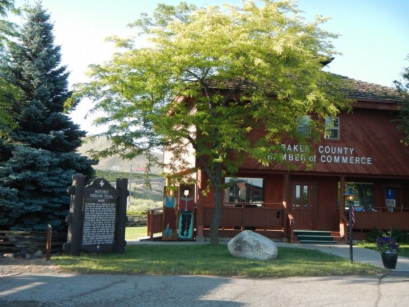
| 1 ► Oregon, Baker County, Baker City — Baker — Historic Oregon Trail — |
| Near Campbell Street near Sunridge Lane, on the right when traveling west. | |||
| 2 ► Oregon, Baker County, Baker City — Old Oregon Trail — 1843 — |
| On Auburn Avenue at Bridge Street, on the right when traveling east on Auburn Avenue. | |||
| 3 ► Oregon, Baker County, Baker City — Oregon Trail Memorial — 1843 - 1943 — |
| On Oregon Route 86 near Ruckles Creek Road, on the left when traveling west. | |||
| 4 ► Oregon, Baker County, Baker City — Ruts of the Oregon Trail — |
| Near Oregon Route 86 near Oregon Trail, on the right when traveling west. | |||
| 5 ► Oregon, Baker County, Baker City — The Lone Tree of the Oregon Trail — |
| 6 ► Oregon, Baker County, Baker City — The Lure of Gold — Oregon Trail — Oregon History — |
| On Oregon Route 86 near Oregon Trail, on the right when traveling west. | |||
| 7 ► Oregon, Baker County, Baker City — The Oregon Trail — Route of Wagon Trains — from 1843 to the 1860's — |
| Near Campbell Street near Sunridge Lane, on the right when traveling west. | |||
| 8 ► Oregon, Baker County, Baker City — The Wagon Encampment — |
| 9 ► Oregon, Baker County, Durkee — Durkee — Historic Oregon Trail — |
| On Old U.S. 30 at Oxman Ranch Road, on the left when traveling west on Old U.S. 30. | |||
| 10 ► Oregon, Baker County, Haines — Baker Valley Rest Area Oregon Trail Kiosk — |
| On Interstate 84 at milepost 293 near Medical Springs Highway (Chandler Lane) (Oregon Route 203), on the right when traveling west. | |||
| 11 ► Oregon, Baker County, Huntington — Farewell Bend — Historic Oregon Trail — |
| Near Oregon Trail Boulevard (Business U.S. 30) near Frontage Road, on the right when traveling north. | |||
| 12 ► Oregon, Baker County, Huntington — Farewell Bend Oregon Trail Kiosk — |
| Near Huntington Highway (Business U.S. 30) near Interstate 84, on the right when traveling north. | |||
| 13 ► Oregon, Baker County, Huntington — Remnants of the Oregon Trail — |
| On Lockett Road near Vietnam Veterans Memorial Highway (Interstate 84), on the right when traveling south. | |||
| 14 ► Oregon, Baker County, Weatherby — Weatherby Oregon Trail Kiosk — |
| Near Interstate 84 near Gate Road/Sisley Creek Road, on the right when traveling north. | |||
| 15 ► Oregon, Benton County, Corvallis — Avery Park Applegate Trail Kiosk — Southern Route to Oregon — |
| On SW Avery Park Drive, on the left when traveling east. | |||
| 16 ► Oregon, Benton County, Corvallis — Madison Avenue — A Place For People — |
| On SW Madison Ave, on the left when traveling north. | |||
| 17 ► Oregon, Benton County, Monroe — Applegate Trail — |
| On Dawson Rd, on the right when traveling east. | |||
| 18 ► Oregon, Benton County, Monroe — The Applegate Trail — Southern Route to Oregon — |
| On Pacific Hwy (U.S. 99) at Main Street, on the right when traveling south on Pacific Hwy. | |||
| 19 ► Oregon, Clackamas County, Government Camp — "Disparite Bad Beyond Discription" — Hardships of the Trail — |
| On Old Barlow Road near Barlow Road (Forest Road NF-3530), on the left when traveling east. | |||
| 20 ► Oregon, Clackamas County, Government Camp — "Sumate Prairie" — from an emigrant's journal original spelling — |
| On East Perry Vickers Road near East Chimney Rock Road, on the left when traveling south. | |||
| 21 ► Oregon, Clackamas County, Government Camp — Barlow Road — |
| On Barlow Road at Forest Road NF-3530, on the right when traveling east on Barlow Road. | |||
| 22 ► Oregon, Clackamas County, Government Camp — Government Camp — |
| On Government Camp Loop near East Wyeast Trail, on the right when traveling west. | |||
| 23 ► Oregon, Clackamas County, Government Camp — Government Camp — |
| On Government Camp Loop near 2nd Street, on the left when traveling west. | |||
| 24 ► Oregon, Clackamas County, Government Camp — Samuel Kimbrough Barlow — Susannah Lee Barlow — |
| On Government Camp Loop at 2nd Street (East Little Trail), on the right when traveling west on Government Camp Loop. | |||
| 25 ► Oregon, Clackamas County, Oregon City — End of the Oregon Trail — |
| Near Washington Street near Abernethy Road, on the right when traveling north. | |||
| 26 ► Oregon, Clackamas County, Oregon City — End of the Oregon Trail — 1845-46 — |
| Near Washington Street near Abernethy Road, on the right when traveling north. | |||
| 27 ► Oregon, Clackamas County, Oregon City — Medorem Crawford — Wagon Master — |
| Near Washington Street near Abernethy Road, on the right when traveling north. | |||
| 28 ► Oregon, Clackamas County, Oregon City — Old Oregon Trail — 1846 — |
| Near Washington Street near Abernethy Road, on the right when traveling north. | |||
| 29 ► Oregon, Clackamas County, Oregon City — To The Banks Of The Willamette — |
| Near Washington Street near Abernethy Road, on the right when traveling north. | |||
| 30 ► Oregon, Clackamas County, Oregon City — Wagons — Homes Away From Home — |
| Near Washington Street near Abernethy Road when traveling north. | |||
| 31 ► Oregon, Clackamas County, Rhododendron — Laurel Hill — Historic Oregon Trail. — |
| On Mt. Hood Highway (U.S. 26), on the left when traveling west. | |||
| 32 ► Oregon, Clackamas County, Rhododendron — The Oregon Trail — 1845 — |
| On East Arlie Mitchell Road near Mt. Hood Highway (U.S. 26), on the left when traveling west. | |||
| 33 ► Oregon, Coos County, Coos Bay — Coos Bay Waters to Coquille Waters Trail — 1850-1874 — |
| On Oregon Route 42 north of Confusion Hill Road, on the right when traveling north. | |||
| 34 ► Oregon, Coos County, Coos Bay — The Changing Waterfront — (left panel) — |
| On Oregon Coast Highway (U.S. 101) north of Anderson Avenue, on the right when traveling north. | |||
| 35 ► Oregon, Coos County, Coos Bay — Transportation — (center panel) — |
| On Oregon Coast Highway (U.S. 101) north of Anderson Avenue, on the right when traveling north. | |||
| 36 ► Oregon, Coos County, Coos Bay — Transportation — (right panel) — |
| On Oregon Coast Highway (U.S. 101) north of Anderson Avenue, on the right when traveling north. | |||
| 37 ► Oregon, Deschutes County, Sisters — Time Traveler — |
| Near McKenzie Highway (Oregon Route 126) 1.6 miles south of U.S. 20, on the right when traveling south. | |||
| 38 ► Oregon, Douglas County, Canyonville — Canyonville Applegate Trail Kiosk — |
| On Southwest 5th Street at South East Canyon Street, on the right when traveling east on Southwest 5th Street. | |||
| 39 ► Oregon, Douglas County, Oakland — Applegate Trail - Oakland — Southern Route to Oregon — |
| On NE 1st Street at SE Maple Street, on the left when traveling north on NE 1st Street. | |||
| 40 ► Oregon, Gilliam County, Arlington — Arlington Oregon Trail Kiosk — |
| On Beech Street at Locust Street, on the right when traveling west on Beech Street. | |||
| 41 ► Oregon, Grant County, Dayville — On the Road of History — |
| Near State Highway 19 near U.S. 26, on the left when traveling north. | |||
| 42 ► Oregon, Hood River County, Cascade Locks — Cascade Falls Portage — |
| Near Southwest Cascade Avenue near Wa Na Pa Street. | |||
| 43 ► Oregon, Hood River County, Hood River — DeWitt Motors — 1920 — City of Hood River Downtown Historic District — |
| On Oak Street (U.S. 30) near 2nd Street, on the left when traveling west. | |||
| 44 ► Oregon, Hood River County, Hood River — Hood River — From Steamboats to Sailboards — |
| On East Port Marina Drive north of Interstate 84 when traveling north. | |||
| 45 ► Oregon, Jackson County, Ashland — A-74 — Applegate Trail - A Pretty Location — |
| On East Main Street, on the right when traveling west. | |||
| 46 ► Oregon, Jackson County, Ashland — A-75 — Applegate Trail - Ashland Creek — |
| On E Hersey Street, on the right when traveling west. | |||
| 47 ► Oregon, Jackson County, Ashland — Barrow Station — |
| On Old Highway 99 South near Meadow Oaks Drive, on the left when traveling north. | |||
| 48 ► Oregon, Jackson County, Ashland — Greensprings — |
| On Greensprings Hwy (U.S. 66). | |||
| 49 ► Oregon, Jackson County, Ashland — Historic Applegate Trail 1846 - 1869 — |
| On Green Springs Highway (U.S. 66), on the right when traveling south. | |||
| 50 ► Oregon, Jackson County, Ashland — Siskiyou Mountain Wagon Road — |
| On Old Siskiyou Highway, on the right when traveling south. | |||
| 51 ► Oregon, Jackson County, Ashland — Siskiyou Mountain Wagon Road — |
| On Mt Ashland Ski Rd, on the right when traveling north. | |||
| 52 ► Oregon, Jackson County, Ashland — Siskiyou Mountain Wagon Road — |
| On Old Siskiyou Highway, on the left when traveling south. | |||
| 53 ► Oregon, Jackson County, Central Point — A-81 — Applegate Trail - We Took Breakfast — |
| On Old Stage Road at Taylor Road, on the right when traveling north on Old Stage Road. | |||
| 54 ► Oregon, Jackson County, Central Point — The Old Stage Road — |
| On Old Stage Road, on the right when traveling north. | |||
| 55 ► Oregon, Jackson County, Gold Hill — A-83 — Applegate Trail - Fort Birdseye — |
| On Rogue River Highway (U.S. 99), on the left when traveling west. | |||
| 56 ► Oregon, Jackson County, Gold Hill — Valley of the Rogue Applegate Trail Kiosk — |
| Near Interstate 5 at milepost 458, on the right when traveling north. | |||
| 57 ► Oregon, Jackson County, Jacksonville — A-80 — Applegate Trail - Jacksonville — |
| On Old Stage Road, on the right when traveling north. | |||
| 58 ► Oregon, Jackson County, Medford — A-78 — Applegate Trail - A Fine Prairie — |
| On Mace Road. | |||
| 59 ► Oregon, Jackson County, Medford — A-77 — Applegate Trail - Down Bear Creek — |
| On South Pacific Hwy (U.S. 99), on the right when traveling north. | |||
| 60 ► Oregon, Jackson County, Medford — A-79 — Applegate Trail - Towards Jacksonville — |
| On South Stage Road, on the left. | |||
| 61 ► Oregon, Jackson County, Medford — Medford Auto Company Building — Historic Renovation Award 2008 — |
| On North Riverside Avenue (U.S. 99), on the right when traveling north. | |||
| 62 ► Oregon, Jackson County, Pinehurst — Crossing the Siskiyous — |
| Near Green Springs Highway (Oregon Route 66), on the right when traveling west. | |||
| 63 ► Oregon, Jackson County, Pinehurst — Historic Applegate Trail — Tub Springs — |
| On Green Springs Highway (Oregon Route 66), on the right when traveling west. | |||
| 64 ► Oregon, Jackson County, Pinehurst — The Applegate Trail — Tub Springs — |
| Near Green Springs Highway (Oregon Route 66), on the right when traveling west. | |||
| 65 ► Oregon, Jackson County, Talent — A-76 — Applegate Trail - Bear Creek — |
| On Talent Avenue, on the left when traveling west. | |||
| 66 ► Oregon, Jefferson County, Terrebonne — Oregon Scenic Highways — |
| Near U.S. 97. | |||
| 67 ► Oregon, Josephine County, Grants Pass — The 1846 Applegate Trail — Southern Route to Oregon — |
| Near Interstate 5 at milepost 62 near Merlin Road, on the right when traveling north. | |||
| 68 ► Oregon, Josephine County, Wolf Creek — "Grave Creek" — How it got its name — |
| Near Sunny Valley Loop near Placer Road (Route 34-5-10), on the right when traveling north. | |||
| 69 ► Oregon, Josephine County, Wolf Creek — A-90 — Applegate Trail - Grave Creek — |
| On Sunny Valley Loop, on the left when traveling north. | |||
| 70 ► Oregon, Josephine County, Wolf Creek — Canyon Creek — Oregon History — |
| On I-5 Frontage Road at Ritchie Road, on the right when traveling north on I-5 Frontage Road. | |||
| 71 ► Oregon, Josephine County, Wolf Creek — Early Traveler Accommodations — |
| On Old State Highway 99 South near Front Street, on the left when traveling north. | |||
| 72 ► Oregon, Josephine County, Wolf Creek — Feeble, Hungry, and Haggard — |
| On Old State Highway 99 South at Front Street, on the left when traveling north on Old State Highway 99 South. | |||
| 73 ► Oregon, Josephine County, Wolf Creek — The Applegate Trail — |
| Near Sunny Valley Loop near Placer Road (Route 34-5-10), on the right when traveling north. | |||
| 74 ► Oregon, Josephine County, Wolf Creek — The Applegate Trail — Southern Route to Oregon — |
| On Old State Highway 99 South at Front Street, on the left when traveling north on Old State Highway 99 South. | |||
| 75 ► Oregon, Klamath County, Keno — Applegate Trail — |
| On Green Springs Highway (Oregon Route 66 at milepost 44) at Toby Grade Road, on the right when traveling west on Green Springs Highway. | |||
| 76 ► Oregon, Klamath County, Keno — Chase Stage Station — (1875–1909) — |
| On Topsy Grade Road, on the left when traveling south. | |||
| 77 ► Oregon, Klamath County, Keno — A-56 — Cooper Stage - Station Site — |
| On Freight Road Lane. | |||
| 78 ► Oregon, Klamath County, Keno — Freight and Stage Road — |
| On Mule Hill Rd / Pokegama Rd at Green Springs Highway (Highway 66), on the left when traveling west on Mule Hill Rd / Pokegama Rd. | |||
| 79 ► Oregon, Klamath County, Keno — New Pokegama - 1903-1909 — |
| 80 ► Oregon, Klamath County, Keno — A-57 — Spencer Creek Crossing / Camp Day — |
| On Unnamed Road, 0.3 miles Keno Access Road. | |||
| 81 ► Oregon, Klamath County, Keno — The Applegate Trail — Southern Route to Oregon — |
| 82 ► Oregon, Klamath County, Keno — Topsy Grade — Stage Coach and Freight Road — |
| On an un-named dirt road south of Green Springs Highway (Oregon Route 66) when traveling south. | |||
| 83 ► Oregon, Klamath County, Kirk — A Sordid Wild West Story — The History of Military Road — |
| On Military Crossing Road (County Route 677) at Silver Lake Road (County Route 676), on the left when traveling north on Military Crossing Road. | |||
| 84 ► Oregon, Klamath County, Klamath Falls — This Marks the Road to Topsy Grade — |
| On Main Street. | |||
| 85 ► Oregon, Klamath County, Malin — Applegate Trail — |
| Near 4th Street. | |||
| 86 ► Oregon, Klamath County, Malin — Lindsey Applegate — |
| 87 ► Oregon, Klamath County, Merrill — The Applegate Trail — Southern Route to Oregon — |
| On Malone Rd, on the right when traveling south. | |||
| 88 ► Oregon, Klamath County, Worden — Applegate Trail — Klamath County — |
| Near U.S. 97, on the right when traveling south. | |||
| 89 ► Oregon, Klamath County, Worden — Western International History — Applegate Trail — |
| On U.S. 97. | |||
| 90 ► Oregon, Lake County, Lakeview — Chandler State Park — |
| Near Fremont Highway (U.S. 395) south of Forest Road 3630, on the left when traveling north. | |||
| 91 ► Oregon, Lake County, New Pine Creek — The Applegate Trail — Southern Route to Oregon — Goose Lake Recreation Site — |
| On State Line Road, on the right when traveling west. | |||
| 92 ► Oregon, Lane County, Blue River — Dee Wright Observatory — |
| Near Old McKenzie Highway (Oregon Route 242) 22 miles east of Oregon Route 126, on the left when traveling east. | |||
| 93 ► Oregon, Lane County, Blue River — Old Wagon Road — |
| On Old McKenzie Highway (Oregon Route 242) 22 miles east of Oregon Route 126, on the left when traveling east. | |||
| 94 ► Oregon, Lane County, Blue River — Scott Road — |
| On McKenzie Highway (Oregon Route 242) west of Forest Road 260, on the right when traveling west. | |||
| 95 ► Oregon, Lane County, Cottage Grove — A Trail by Any Other Name — |
| On North River Road near West Main Street, on the right when traveling north. | |||
| 96 ► Oregon, Lane County, Cottage Grove — Crossing the Calapooya Mountains — |
| On North River Road near West Main Street, on the right when traveling north. | |||
| 97 ► Oregon, Lane County, Cottage Grove — River Road — Historic Trail to Modern Highway — |
| On North River Road near West Main Street, on the right when traveling north. | |||
| 98 ► Oregon, Lane County, Cottage Grove — The Applegate Trail - Southern Route to Oregon — Cottage Grove — |
| On North River Road near West Main Street, on the right when traveling north. | |||
| 99 ► Oregon, Lane County, Cottage Grove — The Changing Trail to Oregon — |
| On North River Road near West Main Street, on the right when traveling north. | |||
| 100 ► Oregon, Lane County, Eugene — The Applegate Trail — Southern Route to Oregon — |
| On Cheshire Ave at N Lincoln St, on the right when traveling west on Cheshire Ave. | |||
165 entries matched your criteria. The first 100 are listed above. The final 65 ⊳