4971 entries match your criteria. Entries 401 through 500 are listed.⊲ Previous 100 — Next 100 ⊳
Exploration Topic
By Douglass Halvorsen, June 29, 2020
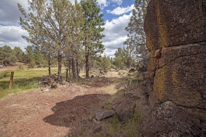
South Road - Applegate Trail Marker
401 ► California, Modoc County, Davis Creek — A-37 — South Road - Applegate Trail —  |
| On Crowder Flat Rd (Forest Road 73), on the right when traveling south. | |||
| 402 ► California, Modoc County, Davis Creek — A-39 — South Road - Blazed Pine Tree — California Trail — |
| On Mowitz Rd (Forest Road 46N10), on the right when traveling south. | |||
| 403 ► California, Modoc County, Davis Creek — A-35 — South Road - Devil's Garden — California Trail — |
| On FS 46N02 at FS 46N05A, on the right when traveling south on FS 46N02. | |||
| 404 ► California, Modoc County, Davis Creek — A-36 — South Road - Fletcher Creek — California Trail — |
| Near no nearby street. | |||
| 405 ► California, Modoc County, Davis Creek — A-34 — South Road - McGinty Creek — California Trail — |
| Near no nearby street. | |||
| 406 ► California, Modoc County, Fort Bidwell — A-28A — Applegate Trail - Fandango Pass Ascent — California Trail — |
| On Fandango Pass Road (County Route 9) 2.5 miles north of Surprise Valley Road, on the right when traveling north. | |||
| 407 ► California, Modoc County, Fort Bidwell — A-28B — Applegate Trail - Fandango Pass Descent — California Trail — |
| On Fandango Pass Road 3.8 miles north of Surprise Valley Road, on the left when traveling north. | |||
| 408 ► California, Modoc County, Fort Bidwell — A-30 — Applegate Trail - Through the Forest — California Trail — |
| On Forest Road 30 2 miles south of County Route 133C, on the left when traveling south. | |||
| 409 ► California, Modoc County, Newell — A-40 — Applegate Trail - Pothole Spring — California Trail — |
| On 46N19. | |||
| 410 ► California, Modoc County, Newell — Burnett Cutoff — Associated With the California Trail National Historic Trail System — |
| On California Route 139 4.4 miles north of Clear Lake Road, on the right when traveling north. | |||
| 411 ► California, Modoc County, Newell — BC-1 — Burnett Cutoff - At Klamath [Tule] Lake — |
| On Old Alturas Highway (County Route 114) 1.1 miles north of County Route 101, on the left when traveling north. | |||
| 412 ► California, Modoc County, Newell — BC-3 — Burnett Cutoff - Over a Prairie — |
| On Route 46N23 0.1 miles east of Route 139, on the left when traveling east. | |||
| 413 ► California, Modoc County, Perez — BC-5 — Burnett Cutoff - Across Barren Ground — |
| Near Clear Lake Road, on the right when traveling west. | |||
| 414 ► California, Mono County, Bridgeport — 995 — Fremont’s Trail 1844 — |
| On Three Flags Highway (U.S. 395), on the right when traveling south. | |||
| 415 ► California, Mono County, Lee Vining — Lee Vining — |
| On Three Flags Highway (State Highway 395) at 4th Street, on the right when traveling south on Three Flags Highway. | |||
| 416 ► California, Mono County, Mammoth Lakes — Owens Valley — |
| On Three Flags Highway (State Highway 395), on the right when traveling south. | |||
| 417 ► California, Monterey County, Big Sur — Pioneers: Homesteading the Sur — Roughing It — |
| On Cabrilla Highway (State Highway 1 at milepost 37), on the right when traveling south. | |||
| 418 ► California, Monterey County, Bradley — De Anza Trek Reinactment — |
| Near Nacimiento Road at California Boulevard, on the left when traveling west. | |||
| 419 ► California, Monterey County, Carmel-by-the-Sea — Lt. Colonel Juan Bautista De Anza — |
| On Rio Road, on the right when traveling north. | |||
| 420 ► California, Monterey County, Carmel-by-the-Sea — Portola Crespi Cross — |
| Near Calle La Cruz at Ribera Road. | |||
| 421 ► California, Monterey County, Gonzales — The Mustard Seed Trail — One Voice Murals Project — |
| On 4th Street, on the left when traveling east. | |||
| 422 ► California, Monterey County, Jolon — De Anza Expedition 1775 - 1776 — (Mission San Antonio de Padua) — |
| Near Mission Road 6.2 miles Jolon Road (County Route G14). | |||
| 423 ► California, Monterey County, King City — De Anza Expedition 1775-1776 — |
| On San Lorenzo Park Road, on the right when traveling north. | |||
| 424 ► California, Monterey County, Monterey — 400th Anniversary of the Naming of Monterey Bay by Gen. Sebastián Vizcaíno — 16 December 1602 – 16 December 2002 — |
| Near Monterey Peninsula Recreation Trail, on the right when traveling north. | |||
| 425 ► California, Monterey County, Monterey — Captain Don Gaspar de Portola — |
| Near Alvarado Street at Del Monte Avenue, on the left when traveling north. | |||
| 426 ► California, Monterey County, Monterey — De Anza Expedition — |
| On Church Street east of Figueroa Street, on the right when traveling east. | |||
| 427 ► California, Monterey County, Monterey — 128 — Don Gaspar de Portolá — |
| On Pacific Street south of Artillary Street, on the right when traveling south. | |||
| 428 ► California, Monterey County, Monterey — Juan Bautista de Anza — 1734 – 1788 — |
| On Fremont Street at Camino El Estero, on the right when traveling east on Fremont Street. | |||
| 429 ► California, Monterey County, Monterey — Junipero Oak — |
| Near Church Streeet east of Figueroa Street, on the right when traveling east. | |||
| 430 ► California, Monterey County, Monterey — Monterey Harbor — |
| On Monterey Bay Coastal Trail. | |||
| 431 ► California, Monterey County, Pacific Grove — Crespi Pond — Named for Fray Juan Crespi — 1721-1782 — |
| On Ocean View Boulevard west of Asilomar Drive, on the right when traveling west. | |||
| 432 ► California, Monterey County, Pajaro — The Portolá Expedition — |
| On San Juan Road (County Road G11) at Porter Drive, on the left when traveling south on San Juan Road. | |||
| 433 ► California, Monterey County, Pebble Beach — Cypress Point Lookout — Do you see snow or trees? — |
| On Sunset Point, on the left when traveling south. | |||
| 434 ► California, Monterey County, Seaside — Portola-Crespi Monument — |
| Near Sand Dunes Drive. | |||
| 435 ► California, Monterey County, Soledad — The De Anza Expedition in Soledad — |
| Near Fort Romie Road east of Mission Road. | |||
| 436 ► California, Napa County, Calistoga — Welcome to the Calistoga Depot — |
| On Lincoln Avenue, on the right when traveling north. | |||
| 437 ► California, Napa County, Napa — James Clyman--Trapper and Explorer — |
| Near Coombsville Road. | |||
| 438 ► California, Nevada County, Truckee — Chief Truckee — |
| Near Brockway Road, on the left when traveling east. | |||
| 439 ► California, Nevada County, Truckee — Donner Camp Site — |
| Near State Highway 89 3.5 miles north of Interstate 80, on the right when traveling north. | |||
| 440 ► California, Nevada County, Truckee — Donner Pass — Who Passed This Way — |
| On Donner Pass Road (Old Highway 40). | |||
| 441 ► California, Nevada County, Truckee — First Wagons Across the Sierras — |
| On Donner Pass Road (Old Highway 40) at South Shore Drive, on the left when traveling west on Donner Pass Road. | |||
| 442 ► California, Orange County, Brea — Don Gaspar de Portolá — "Don Gaspor Portola" — |
| On Brea Boulevard 0.5 miles north of Central Boulevard, on the right when traveling north. | |||
| 443 ► California, Orange County, Buena Park — Old Betsy — |
| Near Beach Boulevard, on the left when traveling north. | |||
| 444 ► California, Orange County, Corona del Mar — El Camino Real — |
| On Pacific Coast Highway (U.S. 1) at Marguerite Avenue, on the right when traveling south on Pacific Coast Highway. | |||
| 445 ► California, Orange County, Costa Mesa — Apollo 11 — July 20, 1969 — Astronaut - Neil Armstrong — |
| Near Nevada Street at California Street. | |||
| 446 ► California, Orange County, Cypress — Challenger Crew — |
| Near Orange Avenue. | |||
| 447 ► California, Orange County, Dana Point — Dana Point — |
| On Pacific Coast Highway (California Route 1) at Del Obispo Street, on the right when traveling west on Pacific Coast Highway. | |||
| 448 ► California, Orange County, Dana Point — Dana Point's Early Years — Life Before the Highway — |
| On Pacific Coast Highway (California Route 1) west of Doheny Park Road, on the right when traveling west. | |||
| 449 ► California, Orange County, Dana Point — Harbor/Pilgrim — |
| Near El Camino Capistrano at Street of the Violet Lantern, on the left when traveling west. | |||
| 450 ► California, Orange County, Fullerton — El Camino Real — |
| On East Wilshire Avenue at North Pomona Avenue, on the right when traveling east on East Wilshire Avenue. | |||
| 451 ► California, Orange County, Lake Forest — Coast Live Oak - Historical Legend — |
| Near Serrano Road at Winding Way, on the right when traveling north. | |||
| 452 ► California, Orange County, Las Flores — Oso Parkway Bridge — Historical Marker — |
| On Oso Parkway, on the right when traveling west. | |||
| 453 ► California, Orange County, Las Flores — Oso Parkway Bridge — Historical Marker — |
| On Oso Parkway, on the right when traveling east. | |||
| 454 ► California, Orange County, Mission Viejo — California's Mustard Seed Trail — |
| Near Civic Center just west of Marguerite Parkway, on the right when traveling west. | |||
| 455 ► California, Orange County, Newport Beach — Castaways Park — Newport Landing - 1870s — |
| Near Dover Drive just south of Cliff Drive, on the right when traveling north. | |||
| 456 ► California, Orange County, Orange — Campsite of Anza — |
| On North Cottonwood Street. | |||
| 457 ► California, Orange County, Orange — 204 — Old Santa Ana — |
| On North Orange Olive Road at East Lincoln Avenue, on the right when traveling south on North Orange Olive Road. | |||
| 458 ► California, Orange County, San Clemente — San Clemente Island & Catalina Island — |
| Near San Clemente Pier 0.1 miles west of San Clemente Pedestrian Beach Trail, in the median. | |||
| 459 ► California, Orange County, San Juan Capistrano — Don Gaspar de Portola Building — |
| Near Rancho Viejo Road 0.1 miles north of Ortega Hwy ( Route 74). | |||
| 460 ► California, Orange County, San Juan Capistrano — Don Jose Antonio Yorba Building — |
| Near Rancho Viejo Road north of Ortega Highway ( Route 74), on the right when traveling south. | |||
| 461 ► California, Orange County, San Juan Capistrano — El Camino Real — |
| On El Camino Real just north of Ortega Highway, on the right when traveling north. | |||
| 462 ► California, Orange County, San Juan Capistrano — Feliciano Rios Building — |
| Near Rancho Viejo Road north of Ortega Highway ( Route 74), on the right when traveling south. | |||
| 463 ► California, Orange County, San Juan Capistrano — Jose Francisco Ortega Building — |
| Near Rancho Viejo Road north of Ganado Road, on the right when traveling south. | |||
| 464 ► California, Orange County, San Juan Capistrano — Mission Yard & Reservoir Site — |
| On El Camino Real just north of Acjachema Street, on the right when traveling north. | |||
| 465 ► California, Orange County, San Juan Capistrano — Old Mission Cemetery — |
| Near Avenida Los Cerritos north of Ortega Highway ( Route 74), on the right when traveling north. | |||
| 466 ► California, Orange County, San Juan Capistrano — Sergeant Jose Francisco Ortega — |
| On Del Obispo Street 0.1 miles south of Ortega Highway, on the right when traveling north. | |||
| 467 ► California, Orange County, Trabuco Canyon — O'Neill Park — |
| On Trabuco Canyon Road (County Route S19) 0.7 miles west of Trabaco Oaks Drive, on the left when traveling west. | |||
| 468 ► California, Plumas County, Beckwourth — James P. Beckwourth — |
| On Rocky Point Road. | |||
| 469 ► California, Plumas County, Beckwourth — Sierra Valley History — |
| Near Feather River Highway, on the left when traveling east. | |||
| 470 ► California, Riverside County, Anza — 103 — De Anza Camp — San Carlos Pass — |
| Near Coyote Canyon Road at Mangalar Road. | |||
| 471 ► California, Riverside County, Riverside — De Anza Trail — 1774 — |
| On Industrial Avenue. | |||
| 472 ► California, Riverside County, Riverside, Downtown Riverside — Fr. Junipero Serra — |
| On Mount Rubidoux Drive. | |||
| 473 ► California, Riverside County, Riverside, Downtown Riverside — 73 — The De Anza Statue and Newman Park — 1940 — |
| On Magnolia Avenue at 14th Street on Magnolia Avenue. | |||
| 474 ► California, Riverside County, Rubidoux — 787 — De Anza Crossing of the Santa Ana River — California Registered Landmark No. 787 — 1775 and 1776 — |
| Near Moraga Avenue, on the right when traveling south. | |||
| 475 ► California, Riverside County, Thousand Palms — John Guthrie McCallum — |
| Near Thousand Palms Canyon Road. | |||
| 476 ► California, Riverside County, Whitewater — RIV-003 — Whitewater — |
| Near Interstate 10, on the right when traveling west. | |||
| 477 ► California, Sacramento County, Elk Grove — Alexander Hamilton Willard — 1777-1865 — |
| On Franklin Boulevard at Hood Franklin Road, on the left when traveling north on Franklin Boulevard. | |||
| 478 ► California, Sacramento County, Elk Grove — Alexander Hamilton Willard — 1777-1865 — |
| On Franklin Boulevard at Hood Franklin Road, on the left when traveling north on Franklin Boulevard. | |||
| 479 ► California, Sacramento County, Elk Grove — The Lewis & Clark Expediton — |
| Near Franklin Boulevard at Hood Franklin Road, on the left when traveling north. | |||
| 480 ► California, Sacramento County, Franklin — 657 — Alexander Hamilton Willard — |
| Near Franklin Hood Road. | |||
| 481 ► California, Sacramento County, Gold River — 746 — The Coloma Road |
| Near Nimbus Flat. Reported missing. | |||
| 482 ► California, Sacramento County, Sacramento, Central Business District — Father Junipero Serra — 1713 – 1784 |
| Near L Street. Reported permanently removed. | |||
| 483 ► California, Sacramento County, Sacramento, Old Sacramento — Early Explorers — |
| Near K Street at Interstate 5, on the right when traveling east. | |||
| 484 ► California, Sacramento County, Sacramento, Old Sacramento — The Arrival of Sutter — |
| Near K Street at Interstate 5, on the right when traveling east. | |||
| 485 ► California, Sacramento County, Sacramento, Old Sacramento — The Gold Rush Begins — |
| Near K Street at Interstate 5, on the right when traveling east. | |||
| 486 ► California, Sacramento County, Sacramento, Southern Pacific/Richards — John Sutter Landing — |
| On Jibboom Street at Jedediah Smith Recreation Trail, on the right when traveling north on Jibboom Street. | |||
| 487 ► California, Sacramento County, Walnut Grove — Sacramento River Exploration — |
| On Market Street near Bridge Street, on the right when traveling north. | |||
| 488 ► California, San Benito County, San Juan Bautista — A Changing World — Juan Bautista de Anza National Historic Trail — |
| Near Old Stage Road near Salinas Grade Road. | |||
| 489 ► California, San Benito County, San Juan Bautista — De Anza Expedition 1775 – 1776 — |
| On Second Street, on the right when traveling north. | |||
| 490 ► California, San Benito County, San Juan Bautista — El Camino Real — California’s Royal Road — |
| On 2nd Street north of Washington Street, on the right when traveling north. | |||
| 491 ► California, San Benito County, San Juan Bautista — El Camino Real Bell |
| On Second Street at Mariposa Street, on the right when traveling south on Second Street. Reported missing. | |||
| 492 ► California, San Benito County, San Juan Bautista — Fremont Peak — |
| On San Juan Canyon Road (County Route G1). | |||
| 493 ► California, San Benito County, San Juan Bautista — Fremont Peak Memorial — |
| Near San Juan Grade Road. | |||
| 494 ► California, San Benito County, San Juan Bautista — 181 — John Charles Fremont — 1813 – 1890 — |
| Near San Juan Canyon Road. | |||
| 495 ► California, San Benito County, San Juan Bautista — 195 — Mission San Juan Bautista — |
| On Second Street at Mariposa Street on Second Street. | |||
| 496 ► California, San Bernardino County, Afton Canyon — Bonnie Keebler Harris Grave — |
| Near Powerline Road. | |||
| 497 ► California, San Bernardino County, Baker — 622 — Harry Wade Exit Route — |
| On Death Valley Road (California Route 127 at milepost 29.8) at Saratoga Springs Road, on the left when traveling north on Death Valley Road. | |||
| 498 ► California, San Bernardino County, Barstow — Amiel Weeks Whipple — 1817-1863 — |
| On East Main Street (Business Interstate 15), on the right when traveling east. | |||
| 499 ► California, San Bernardino County, Barstow — Father Garces — 1738-1781 — |
| On East Main Street / National Trails Highway (Business Interstate 15), on the right when traveling east. | |||
| 500 ► California, San Bernardino County, Barstow — Fort Irwin — |
| On Fort Irwin Road 27 miles north of Interstate 15, in the median. | |||
4971 entries matched your criteria. Entries 401 through 500 are listed above. ⊲ Previous 100 — Next 100 ⊳