They were an order that inscribed upon their banners, “Visit the sick, relieve the distressed, and bury the dead.”
“To the benevolent – If there is any of that commodity called charity in this community, we earnestly . . . — — Map (db m12489) HM
On River Road (County Road E13) at Levee Road, on the right when traveling north on River Road.
Charles “Chuck” Tison and his wife Betty moved to Walnut Grove in 1956 where they raised four children who all attended local schools. In 1969 the couple formed the Ti-Gas Company, a LP Gas sales & service distributor which is still a . . . — — Map (db m37402) HM
Near 3rd Street near Monterey Street, on the left when traveling south.
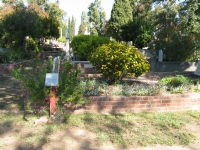
Jim Jack was known as China Jim, the Mustard King. In the 1880’s he gathered mustard seed from the grain fields in the San Juan Valley. Jim Jack, “the big-hearted Chinaman” had that rarest of gifts, the gift of giving. — — Map (db m62721) HM
On Rim of the World Highway (State Highway 18), on the right when traveling east.
In 1932, during the Great Depression, California launched a large public works project to aid recovery. A major component was the construction of masonry walls, parapets and fountains along the historic "Rim of the World" highway. This work, widely . . . — — Map (db m51261) HM
Near Lenwood Road, on the right when traveling east.
On August 29, 2023, this location was dedicated to
Susie De Ridder, TA Citizen Driver. Susie grew up in a trucking
family and would often accompany her Dad on trucking trips as a
young girl. She noticed from a very young age the lack of . . . — — Map (db m240867) HM
On Pomona Rincon Road north of Euclid (California Route 83).
This reservoir, now demolished, was built for Fenton Mercer Slaughter in 1894. It was located about one-quarter mile north of this adobe. — — Map (db m249) HM
Near Mill Creek Road, 0.1 miles east of Bryant Street, on the right when traveling east.
Commemorating enrollees, CCC Co’s. 541, 1341, 1941, 1943, and Forest Service - Military - Civilian personnel, CCC Camp Mill Creek F150, FD150.
This plaque acknowledges the many
accomplishments of all concerned.
History . . . — — Map (db m197571) HM
Near Vine Street at 4th Street, on the right when traveling east.
Albert K. Smiley, a leader of the city's library movement, donated this building and park to the citizens of Redlands in 1898. Through his generosity, Redlands was given one of California's few privately funded libraries of that era. In 1906, he . . . — — Map (db m51029) HM
On Utah Trail at National Park Drive, on the right when traveling south on Utah Trail.
Her tireless efforts to establish Joshua Tree National Monument contributed to a heightened appreciation, not only of the Joshua Tree, but of the total desert environment. — — Map (db m116863) HM
Near Euclid Avenue, 0.1 miles south of Arrow Route, on the right when traveling north.
1913 saw the era of the Carnegie library grants by Andrew Carnegie. Through his program a city could request grant money to fund the building of a library, and the books inside. The only proviso was that the city requesting the library would also . . . — — Map (db m150014) HM
Between 1937 and 1940, these adobe and wood buildings were built by actor Leo Carrillo as a retreat, working ranch, and tribute to old California culture and architecture. The Leo Carrillo Ranch, with its Flying "LC" brand, originally covered 2,538 . . . — — Map (db m51105) HM
Dedicated on Washington's birthday, February 22, 1894, this building was given to the townspeople of Nuevo (as Ramona was then known) by a rancher and financier Augustus Barnett and his wife Martha. Feeling that the local schoolhouse was not a . . . — — Map (db m82350) HM
On El Prado east of Cabrillo Parkway, on the right when traveling west.
This is the first building constructed in Balboa Park by the Panama-California Exposition Corporation. Located just outside the west entrance to the exposition, it was to be a temporary building serving as headquarters for planning, administration, . . . — — Map (db m209510) HM
A fine example of early 20th century folk art, the three ring menagerie figures on this merry go-round were hand-carved in 1910 at the Herschell-Spillman factory in North Tonawanda, New York. The carousel incorporates colorful paintings, a military . . . — — Map (db m208959) HM
Extending from Sixth Avenue to Highway 163 and from the north to south boundaries of the park, the West Mesa remains Balboa Park's most recognizable example of the design style perfected by American landscape pioneer Frederick Law Olmsted. Samuel . . . — — Map (db m209219) HM
On San Diego Avenue at Twiggs Street, on the right when traveling south on San Diego Avenue.
Don Jose Antonio Aguirre built his adobe mansion on this site on or just prior to 1868. Because the Casa de Aguirre was one of the first houses in Old Town, the Aguirre – Antonio, his wife Rosaria and their many children – are considered . . . — — Map (db m11648) HM
On Pan American Rd East, on the right when traveling north.
This is the largest outdoor Organ in the World, as of 2016. It was built by the Austin Organ Company of Hartford, Connecticut and is capable of playing the full range of Organ masterworks. Installed in Balboa Park for the 1915 Panama-California . . . — — Map (db m209018) HM
The Botanical Building is widely acclaimed as the most photo- graphed spot in San Diego. Alfred D. Robinson, a founder and President of the San Diego Floral Society, suggested the construction of a lath house for the 1915 Panama California . . . — — Map (db m209497) HM
On March 31, 1933, President Franklin D. Roosevelt signed into law an act creating the Emergency Conservation Work Program, better known as the Civilian Conservation Corps (CCC). This program became one of the most popular and successful of . . . — — Map (db m192107) HM
On Sunday, May 5, 1918, 13 lives were lost here, including 11 soldiers and sailors stationed at Camp Kearny North Island and Point Loma. The rip currents were caused by unusual conditions of tides near the entrance to Mission Bay. Police Lifeguard . . . — — Map (db m212933) HM
On Ocean Front Walk, on the left when traveling south.
One spring afternoon in 1913, thousands of sunbathers were enjoying the waters off San Diego when a powerful rip current suddenly swept more than sixty people out to sea. Despite heroic
attempts by police, thirteen people drowned. This tragic . . . — — Map (db m240990) HM
Apostle of liberty, humanitarian, Unitarian minister, who in the Civil War bound California to the Union and led her to excel all other states in support of the United States Sanitary Commission, predecessor to the American Red Cross. His statue, . . . — — Map (db m91855) HM
On Market Street at Noe Street, on the right when traveling west on Market Street.
American physician and political
radical who fought for peace, an
eight-hour workday, women's suffrage
and their right to birth control — — Map (db m187158) HM
This Golden Gate Ferry Terminal is dedicated to Stephan C. Leonoudakis in recognition of his pivotal role in initiating the legislation that returned passenger ferry service to San Francisco Bay while a member of the board of directors of the Golden . . . — — Map (db m240255) HM
On Clay Street at Leidesdorff Street on Clay Street.
Near this site occurred
the incident which led to the formation of
The San Francisco
Society for the Prevention
of Cruelty to Animals
on April 8, 1868
———————————
James Sloan Hutchinson, a pioneer banker witnessing nearby an act . . . — — Map (db m33538) HM
On Jefferson Street west of Taylor Street, on the left when traveling west.
This is the site of the original Dimaggios' Restaurant founded by the five DiMaggio brothers in 1937. Tom, the oldest of the 9 children of Sicilian immigrant parents, ran it until the youngest, Dominic Paul DiMaggio, took on the responsibilities in . . . — — Map (db m115951) HM
On Hagiwara Tea Garden Drive south of Bowl Drive, on the right when traveling south.
Bronze
Gift of M. H. de Young 53696
Gustave Doré created this vase for French winemakers who exhibited it at the 1878 Paris World's Fair. Decorating the colossal wine vessel are cupids, satyrs, and bacchantes associated with Bacchus, the Roman . . . — — Map (db m232775) HM
Dante, "Mr. Baseball" as Joe DiMaggio referred to him. He was a family man. He was a source of love, compassion, understanding, and inspiration. He openly shared those qualities with everyone he met, the look in his eyes, the smile on his face . . . — — Map (db m198390) HM
On Randolph Street near Head Street, on the right when traveling east.
On August 16, 1878, Mr. J. Granville contracted with the Spring Valley Water Works to provide water for his family, a lodger, a cow, and irrigation; his home was duly recorded as containing 500 sq. ft. In May of 1883, the water line water line was . . . — — Map (db m102431) HM
Frank J. Portman, president of the Frank Portman Company and our Restoration Project contractor was called to God one week before our celebration to mark the completion of the Old Mission Dolores Restoration Project. From the inception of the . . . — — Map (db m72505) HM
On this site the work of
The Salvation Army
on the Pacific Coast
was started by Major Alfred Wells
July 22nd, 1883
San Francisco
July 21st, 1939 — — Map (db m40816) HM
On The Embarcadero near Battery Street, on the right when traveling south.
It was westering and westering. And then the old men came to edge of the continent and saw they could go no further, they broke down and wept. Down and out on the waterfront in Frisco. The end of the line. Out of work. Out of food. And out of hope. . . . — — Map (db m70843) HM
On Lok House
Dedicated Oct. 10, 1980
This congregate housing facility for the elderly stands on the site of the former St. Francis Day Home, operated by the Sisters of the Holy Family from 1893 to 1976. — — Map (db m177080) HM
You are standing on section twelve of San Francisco's great seawall that was built between the years 1878 and 1924. Known as the Bulkhead, this continuous and massive embankment of stone was designed to hold back the bay, creating the curving . . . — — Map (db m92939) HM
Golden Gate National Recreation Area
Lands End
In 1881, Adolph Sutro built the parapet – a raised promontory encircled by an elaborate stone wall – as a viewing platform. Taking advantage of its added height and popularity with visitors, Sutro . . . — — Map (db m210717) HM
On Turk Street at Jones Street, on the left when traveling east on Turk Street.
Acquired by Tenderloin Neighborhood Development Corporation in 2000.
This building is listed in the National Register of Historic Places. — — Map (db m90144) HM
On Castro Street near Market Street, on the left when traveling north.
Pioneer social reformer, activist for women's rights and world peace, public philosopher, author, first American woman to receive the Nobel Peace Prize. — — Map (db m99816) HM
On Market Street near 16th Street, on the right when traveling east.
Sylvia Rivera
(1951-2002)
Gay liberation and transgender rights
advocate, a founding member of the
Gay Liberation Front, Gay Activist
Alliance and Street Transvestite
Action Revolutionaries — — Map (db m237822) HM
On Powell Street, on the right when traveling north.
1839 Jean Vioget laid out the first plan of Yerba Buena (later San Francisco), showing the Union Square site as a future park.
1847 Jasper O’Farrell created a second, more accurate plan for the blocks of San Francisco, designating . . . — — Map (db m71915) HM
On West Pine Street at North Lee Avenue, on the right when traveling west on West Pine Street.
On May 20, 1988 this unique 1923 Roman style building was placed on the National Register of Historic Places.
In celebration we honor those women of vision who in 1906 started this club, first known as the Lodi Improvement Club. Their efforts . . . — — Map (db m91787) HM
On North Pilgrim Street north of East Lindsay Street, on the right when traveling north.
This structure, inspired by Mission and Colonial styles, was the first permanent facility of the Children’s Home of Stockton, founded in 1882 by the Ladies Aid Society. Edgar B. Brown, architect for the Hotel Stockton, donated the design. Ground was . . . — — Map (db m221145) HM
“Greater love hath no man than this, that a man lay down his life for another.”
John 15:13
This memorial is dedicated to honor all Stockton firefighters that gave their lives in the line of duty. — — Map (db m15970) HM
On Park Street at North American Street, on the right when traveling east on Park Street.
Inventor of the Caterpillar tractor and long time president of the Holt Manufacturing Company, Benjamin Holt, resided here until his death in 1920. The Holt family made this house available to the Boy Scouts of America, and in April 1956 it was . . . — — Map (db m221146) HM
On East Weber Avenue east of South El Dorado Street, on the right when traveling east.
Charles M. Weber | 1849
The site of the first courthouse building in San Joaquin County was donated by Captain Charles M. Weber, a German immigrant and founder of Stockton.
Captain Weber acquired over 48,000 acres through a Mexican land . . . — — Map (db m221058) HM
On 11th Street (California Route 205) east of Corral Hollow Road, on the right when traveling west.
THIS FIRE STATION DEDICATED MARCH 22, 2005 TO BOTH FATHER AND SON INSTRUMENTAL TO THE HISTORY OF THE TRACY FIRE DEPARTMENT.
Tom Eagan born July 8, 1878 joined the Tracy Fire Department in 1910 the year Tracy was first incorporated. Tom joined the . . . — — Map (db m214466) HM
On Grant Line Road (County Route J4) at Parker Avenue, on the right when traveling west on Grant Line Road.
THIS FIRE STATION DEDICATED JANUARY 27, 2007 TO FIRE CHIEF DAN WATROUS WHO WAS INSTRUMENTAL IN SHAPING THE HISTORY OF THE TRACY FIRE DEPARTMENT
Dan Watrous grew up in Tracy graduating from Tracy High School in 1954. In 1958, he became a . . . — — Map (db m214458) HM
On Skyline Boulevard west of Crystal Springs Road when traveling south.
Crystal Springs Dam continues to provide the critical link in the delivery of water to the people of the San Francisco Peninsula. Centennial Observation held on this spot by joint resolution of the
San Mateo County Board of Supervisors
Tom . . . — — Map (db m18447) HM
On Warren Street near Standish Street, on the right when traveling north.
Mezes Park was donated to the public in 1854 by Simon Mezes, founder of the Town of Mezesville which became Redwood City in 1867. Originally named Park Square, the public space was bordered by B Street (now Warren Street) on the Southwest, C Street . . . — — Map (db m208147) HM
Near Broadway Street, on the right when traveling east.
Left Side - English
She donated 59,000 acres of land for the benefit of all people.
Right Side - Spanish
Donadora de 59,000 acres par beneficio de la comunidad — — Map (db m62575) HM
On Grand Avenue east of Spruce Avenue, on the right when traveling west.
The South San Francisco Women's Club was first formed
as the Women's Improvement Club, April 12, 1905.
Marianne Martin was elected president. The purpose of
the Club was to help promote the education, moral and
social well-being of the City. The . . . — — Map (db m176734) HM
Near Cañada Road near Edgewood Road, on the right when traveling east.
Here on October 28, 1934, an eager audience celebrated the roar of Hetch Hetchy water as it rushed to the Peninsula for the first time. An adequate supply of high-quality drinking water was finally a reality for the Bay Area. — — Map (db m92635) HM
Across this bridge lies California's eleventh mission and a glimpse of life during the 1820's. The Civilian Conservation Corps restored the buildings and grounds between 1934 - 1941. We hope you enjoy your visit to the past. — — Map (db m11116) HM
On South Broadway north of Jones Street, on the right when traveling north.
Site of Santa Maria's first water works. Purchased from Reuben Hart in 1916 and serving the City of Santa Maria until June 1966. — — Map (db m161394) HM
Near Civic Center Drive near North Central Avenue.
The Campbell Volunteer Fire Department officially began in 1912. Keeping track of ladders was a problem and the need for a fire station became apparent. An ad placed in the newspaper urged "all parties to leave ladders belonging to fire dept. in . . . — — Map (db m24251) HM
World War II Veteran who served in the Pacific Theater
As President of Campbell Rotary, Rick led Campbell Rotary in funding & development of many civic projects
This plaque is a testimony to his patriotic service, high character and endearing . . . — — Map (db m205556) HM WM
Near Gourmet Alley north of 6th Street when traveling north.
Gymkhana 1929-1956
Many activities including parades and rodeos in a ‘Wild West Theme’ attracted visitors who filled the 5,000 seat bleachers.
Beginning in 1967, “Bonanza Days” continued the celebrations with a grand parade and a week of . . . — — Map (db m218879) HM
The first Adams school was built in 1859 on land donated by John Hicks Adams, a local sheriff. The school burned down around 1915 and a new one was built on the site shortly thereafter. This single story school served the local Adams School . . . — — Map (db m198221) HM
On East Main Street near Pageant Way, on the right when traveling east.
In 1899 this fire bell was cast in bronze in San Francisco by W.T. Garrett Company and weighs 2500 pounds. It was originally installed atop a 60 foot wooden tower which ironically burned down in the Great Fire of 1901. It was then reinstalled . . . — — Map (db m196042) HM
Near Bear Creek Road, on the right when traveling north.
In the rapidly urbanizing Silicon Valley, open space is precious. Your voice and your vote help protect the regional greenbelt that provides us all with clean air and water, climate change resilience, and nearby opportunities to unplug and connect . . . — — Map (db m203020) HM
On Sycamore Drive near Yvonne Drive, on the left when traveling west.
This school site was donated by Bernard S. Machado on June 5, 1895 for the children of Paradise Valley. Charles Smith completed construction of a one-room school and classes began in the fall of 1895. A second room was added in 1910 to accommodate . . . — — Map (db m212710) HM
On Hawthorne Avenue at Alma Street, on the right when traveling north on Hawthorne Avenue.
This tower well symbolizes what is best about a forward thinking, progressive city government that chose local ownership of essential utility services. Due to the foresight of town leaders such as Stanford Engineering professors Charles "Daddy" Marx . . . — — Map (db m91257) HM
On Arastradero Road at Clemo Avenue, on the right when traveling west on Arastradero Road.
From 1907 to 1925 this bell was used to summon the volunteer firemen of the town of Mayfield. First used at College Avenue and El Camino Real. The bell was transferred to the town hall at El Camino Real and California Avenue in 1921. When Mayfield . . . — — Map (db m91031) HM
At New Almaden
During the Depression (1933-1942) and after most mining activity had ceased, New Almaden once again gave jobs, hope and future to young men through a program created by Franklin D. Roosevelt called the Civilian . . . — — Map (db m52778) HM
The Civilian Conservation Corps, established in 1933 by the Federal Government for nine years became one of the most constructive national service programs. CCC Companies: 1917-V, 1235, 3341, 3325, 739, 4500 occupied this camp between 1933 and 1939. . . . — — Map (db m52774) HM
On South 11th Street, on the right when traveling south.
In December 1894, nine women met to form the San Jose Woman's Club . Supporting temperance and suffrage, the members also promoted education, community improvements and the arts. The club was opened to women of all creeds and nationalities. Today, . . . — — Map (db m108410) HM
Near Phelan Avenue east of Senter Road, on the left when traveling east.
Hanford Lennox Gordon was born in 1846 and over his lifetime held a variety of positions as attorney, and officer for the Union Army during the Civil War, a farmer, and a rancher.
Hanford and his wife, Mary, moved to San José from Minnesota in . . . — — Map (db m227093) HM
Arts, civic, cultural, historical and indigenous groups benefited from the personal service of this sixth-generation Californian.
The life of this descendent of Santa Clara’s first physician, H.H. Warburton, and the Spanish colonist Alviso, . . . — — Map (db m52935) HM
On Washington Street south of Fremont Street, on the left when traveling south.
First home of State Senator Frederich Christian Franck, 1826-1902. Came from Baveria in 1855. He was a civic leader & town trustee for eight consecutive years; member of the volunteer fire department from 1856, and elected Chief Engineer 1875-1881. . . . — — Map (db m52905) HM
On Mansion Park Drive east of Lick Mill Boulevard, on the right when traveling east.
James Lick was born in Pennsylvania in 1796. Lick came to San Francisco in 1848 after a successful career as a piano builder in South America. Shrewd real estate investments at the time of the Gold Rush made Lick the richest man in California by . . . — — Map (db m220214) HM
This sundial stood in front
of Sunnyvale's first City Hall,
built in 1929.
It is one of three vintage
artifacts, including the Bell
and Cornerstone, from that
City Hall building. — — Map (db m155135) HM
On Center Street near Laurel Street, on the right when traveling south.
Historic Landmark
1930
London Nelson Community Center
William Weeks, Architect
Laurel Street School, 1931-1974
Louden Nelson Center, 1979-2021
Santa Cruz Museum of Art & History — — Map (db m205572) HM
On Mission Street, on the left when traveling west.
In Honor of
Louden Nelson
1800 – 1860
An ex-slave who left his estate to Santa Cruz Schools. He believed in education for all people. — — Map (db m203235) HM
Saint Joseph Marello (1844-1895)
Bishop of Acqui and founder of the Oblates of Saint Joseph
Fortis of Suavis Sculpture by Thomas Marsh, March 19, 1997
Born in Turin, Italy, Joseph Marello lived as a zealous priest in the city of Asti. There . . . — — Map (db m112986) HM
On River Street east of Front Street, on the right when traveling north.
This plaque commemorates the individuals listed below for their devotion and countless hours of time given to the San Lorenzo Park Redevelopment Project. The federally assisted project, commenced in 1956, was one of the most successful in the . . . — — Map (db m212373) HM
On Ocean Street, on the left when traveling north.
Founded in 1862, and continuously operated , by the Santa Cruz Lodge #96, Independent Order of Odd Fellows. The park has grown from a modest size lot to over 30 acres of well maintained grounds. The park has had endowment care since the turn of the . . . — — Map (db m203153) HM
On 9th Avenue at East Cliff Drive, on the right when traveling north on 9th Avenue.
This land given to the state of California as a park in 1955 by Arnold Merritt Baldwin in memory of his beloved parents. Fred Douglas Baldwin and Mary Augusta Baldwin, who pioneered in Santa Cruz County in the late 1860’s. — — Map (db m208513) HM
On Water Street at North Pacific Avenue, on the right when traveling west on Water Street.
Marker One:
Dedicated July 4, 1976 in celebration of the Bicentennial of the founding of our country. Originally erected by the Independent Order of Odd Fellows in 1900, the Town Clock was created and later restored in a legacy of freedom, . . . — — Map (db m212371) HM
On East Center Street at Ferry Street on East Center Street.
Originally constructed in 1903 on this site as a two-story building, the Anderson Fire Station was completed for a cost of $90 for used lumber and nails.
Initial firefighting equipment included twelve buckets, four axes, three sections of hose . . . — — Map (db m70345) HM
On State Highway 299, on the right when traveling east.
This facility is dedicated to the men and women,
who battled the 1992 Fountain Fire,
and those who have worked and are working
to restore this forest to a healthy and productive part
of the local ecosystem.
During the dangerous salvage . . . — — Map (db m13741) HM
Near Lake Road north of California Highway 89 S, on the right.
The Civilian Conservation Corps (CCC) was established in 1933 under President Franklin D. Roosevelt’s New Deal program.
During the years of the Great Depression, when the stock market crash and ensuing business closures left many Americans . . . — — Map (db m96652) HM
For just six short years Sims was the location of a bustling Civilian Conservation Corps (CCC) camp...
With its wooded valley and beautiful river setting, Sims was a haven to the boys from Company 978 who came from the busy cities of San . . . — — Map (db m69843) HM
It took a bit of grit and determination for the Forest Service and Civilian Conservation Corps (CCC) crew to build this sturdy bridge...
Raymond Huber, who supervised the project remembers... “I was given a pickup and a plan of a 160-foot . . . — — Map (db m69821) HM
On California Route 89, 1 mile east of California Route 44, on the right when traveling east.
He laid the foundation of the National Park Service, defining and establishing the policies under which its areas shall be developed and conserved unimpaired for future generations. There will never come an end to the good that he has done. — — Map (db m71149) HM
On Lassen Peak Highway (Scenic California Route 89) 13 miles north of California Route 36, on the right when traveling north.
Today we take this park road for granted, but in 1916 when Lassen Volcanic National Park was established, the park's scenic features, expansive views, and volcanic landscapes could be reached only by horseback or on foot. In 1925, through the vision . . . — — Map (db m165932) HM
President Franklin Delano Roosevelt established the Civilian Conservation Corps on March 31, 1933, to provide employment for America's youth and promote the nation's economic recovery. The CCC's work involved conservation projects on forest, park . . . — — Map (db m547) HM
On Hill Road near East West Rod, on the left when traveling north.
1935-1942
Civilian Conservation Corps
This camp was built and staffed by the CCC, an organization that was established during the Great Depression by President Franklin Roosevelt to reduce unemployment and to preserve the nation's . . . — — Map (db m88000) HM
Architect and driving force behind the modernization of Highway 780, the first State Capitol Building, the Benicia State Park, First Street Development, the Benicia City Water System, and the Benicia Industrial Park.
He gave his vision, his . . . — — Map (db m25895) HM
The Ulatis Book Club initiated an early effort in 1905 to obtain a Carnegie Library Building Fund Grant. This effort was taken over in 1910 by the Saturday Club, which campaigned to establish a library district under the jurisdiction of the . . . — — Map (db m16845) HM
On Farragut Avenue east of Santa Clara Street, on the right when traveling east.
This c.1880 Eastlake Cottage was originally located at 815 Marin Street. The house was a gift from Senator Luther E. Gibson to the Vallejo Architectural Heritage Foundation. The foundation moved and restored the house with funds from the City of . . . — — Map (db m217854) HM
The Children's Bell Tower is dedicated to children everywhere. It was inspired by the death of seven-year old Nicholas Green of Bodega Bay who was shot by highway robbers while on vacation with his parents in Italy, on September 29, 1994.
All . . . — — Map (db m87570) HM
Near Armstrong Woods Road, 2.5 miles north of River Road (Highway 116).
James B. Armstrong
Colonel James B. Armstrong came to California from Ohio in 1874 as a land investor. He purchased land in these forests, eventually developing a deep appreciation for the redwoods. Witnessing the alarming rate of . . . — — Map (db m107311) HM
On Main Street near Kern Street, on the right when traveling south.
In 1913 the Women’s Improvement Club applied for a grant from the Andrew Carnegie Foundation to build a library. In 1918 the Newman free library joined the Stanislaus County Library system. The library was built in 1919 following WWI for $7,600, . . . — — Map (db m208312) HM
On Plaza Circle at North Del Puerto Avenue, on the left on Plaza Circle.
For generous contributions of time, land and facilities to the City of Patterson, citizens of Patterson recognizes these direct contributions as monuments to Jack Patterson’s heritage to the City of Patterson.
Contributions
1.Historical Building . . . — — Map (db m208523) HM
6879 entries matched your criteria. Entries 301 through 400 are listed above. ⊲ Previous 100 — Next 100 ⊳