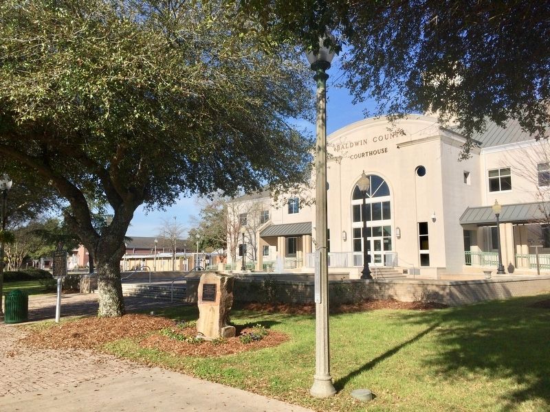
On Courthouse Square (U.S. 31) at Hand Avenue, on the left when traveling east on Courthouse Square.
Bottle Creek Site has been designated a National Historic Landmark. This site possesses national significance in commemorating the history of the United States of America. — — Map (db m100849) HM
On Franklin Street north of Washington Avenue, on the right when traveling north.
This foundation is all that remains of Baldwin County’s first courthouse.
Authorized in 1820 but not constructed until circa 1833, the two-story brick building contained a jail on the bottom floor with office space on the upper floor. . . . — — Map (db m131830) HM
When workers began excavating the lake for Choccolocco Park, they
uncovered several large charcoal-filled ditches that formed circles.
Archaeologists investigated these features and determined that these
were the remains of 19th century charcoal . . . — — Map (db m144947) HM
The people living during the Paleoindian period experienced a
world very different from that we know today. These people
lived during the last ice age when large mammals still roamed
North America. Archaeologists sometimes refer to these . . . — — Map (db m144948) HM
The stone mound here once sat on nearby Signal Mountain and is now
understood to be part of a much larger cultural landscape. Working with
the Muscogee (Creek) Nation and the people of the Arbeka (Abihka)
Ceremonial Ground, archaeologist Robert . . . — — Map (db m144927) HM
Centered around Boiling Spring, the Choccolocco Creek Archaeological Complex once consisted of at least three earthen mounds, a large stone mound, and a large snake effigy (representation) also made of stone. The largest earthen mound once stood . . . — — Map (db m144926) HM
Woodland period people established permanent communities
within a climate and forest that was very similar to that
experienced by today's residents of the Choccolocco Valley. By
AD 100, the residents had started constructing the earthen
mound . . . — — Map (db m144977) HM
Near Reservation Road 1 mile east of Alabama Route 133, on the left when traveling east.
Natural and Cultural Preservation
TVA is fully committed to protecting our natural and cultural resources. And nowhere is that more evident than right here at Wilson Dam.
Here, the 25-acre Old First quarters Small Wild Area showcases the . . . — — Map (db m106189)
On State Road 22 at County Route 9, on the right when traveling west on State Road 22. Reported missing.
Site of Alabama's first permanent capital 1820-26. County seat Dallas County, 1820-66. Prison for Union soldiers during the War Between the States 1863-65. Indians were the first inhabitants over 4000 years ago. Their large fortified village could . . . — — Map (db m75779) HM
Near Second North Street east of Vine Street, on the left when traveling east.
The Cahaba River is the longest free-flowing stretch of river in Alabama. It
is 194 miles long and drains an area of
1,870 square miles. Recognized as one of
"Alabama's Ten Natural Wonders," the
Cahaba River has received attention . . . — — Map (db m274548) HM
In 1858, the railroad company graded away an Indian mound that stood here. A brick warehouse was built in its place. From 1863 - 1865 the Confederate government used this warehouse to hold captured Federal Soldiers. You are standing on a pile of . . . — — Map (db m22666) HM
On Vine Street at Capitol Avenue, on the right when traveling north on Vine Street.
Between AD 1500 and 1600, the
indigenous inhabitants of the area around
the confluence of the Cahaba and
Alabama Rivers built a flat-topped mound
measuring about ½ acre in size. The
mound was the central feature of a
semicircular village . . . — — Map (db m150834) HM
Near Mound State Parkway 1.5 miles west of Alabama Route 69.
Imagine a clan chief 800 years
ago standing exactly where
you are. It's possible he would
see something resembling this
artist's rendering. Larger
mounds, like this one, dotted
the plaza's perimeter, serving
as elevated platforms for . . . — — Map (db m144752) HM
Near River Bank Road 0.3 miles west of Mound Parkway, on the right when traveling west.
The mound in front of you probably once served as a platform for the principal chief's house. The noble who lived there was an extremely important political and religious figure. It is likely that this chief claimed to have divine relationships with . . . — — Map (db m144808) HM
On Mound Parkway at State Highway 69, on the right when traveling west on Mound Parkway.
Site of a prehistoric Native American political and ceremonial center from about A. D. 1100-1500 that, at its height in the 13th century, was America’s largest community north of Mexico. Between 1,000 and 3,000 people lived in this town fortified . . . — — Map (db m30700) HM
On Mound Parkway 0.6 miles west of Alabama Route 69, on the right when traveling west.
I do not think in the Southern States there is a group of Mounds to compare to Moundville, in the arrangement and state of preservation of the mounds.
- Clarence B. Moore, amateur archaeologist, 1910
Spanning more than . . . — — Map (db m144745) HM
On Mound Parkway 0.6 miles west of Alabama Route 69, on the right when traveling north.
Welcome to Moundville Archaeological Park, the best preserved site of its kind in
North America. At its height, Moundville was the largest and most powerful political
and religious center in the Southeast. Nobles at Moundville ruled over thousands . . . — — Map (db m144759) HM
On River Bank Road 0.3 miles west of Mound Parkway, on the right when traveling west.
The mounds you see here were built in a very orderly arrangement over the course of about 100 years. Surrounding them was an immense wall constructed from tens of thousands of logs. How did the rulers harness the manpower and allegiance of the . . . — — Map (db m144774) HM
Near River Bank Road 0.9 miles west of Mound Parkway.
Rival Mississippian chiefdoms constantly threatened one another. Warfare was a way of life for most men. By proving their valor militarily, warriors probably increased their overall status as they were promoted up through the ranks. One theory . . . — — Map (db m144815) HM
Near River Bank Road, on the right when traveling south.
The Civilian Conservation Corps was born during the turmoil of the Great Depression. Hundreds of thousands of young men were out of work, and wasteful exploitation of the environment had devoured millions of acres across America. In 1933, as part of . . . — — Map (db m144813) HM
On Alabama Avenue north of 19th Street N, on the right when traveling north.
The Bessemer Site was the largest
indigenous mound site in what is now
Jefferson County, and it once dominated
a large territory in what became
north-central Alabama. Occupied from
about AD 1150 to 1250 during the early
Mississippian period, . . . — — Map (db m144908) HM
On South Court Street north of Canal Street, on the right when traveling south.
The Florence Indian Mound was the heart of a largely indigenous cultural center that existed along this section of the Tennessee River Valley centuries ago. A map was drawn by E. G. Squier and Edwin Davis in 1848 showed the mound as originally . . . — — Map (db m191412) HM
On South Court Street. Reported permanently removed.
This is the highest domiciliary mound in the Tennessee Valley. It was probably built between 100 B.C. and 400 A.D. by a prehistoric people of the ancient Woodland Culture. Such mounds served as bases for ceremonial temples or chief's houses. This . . . — — Map (db m251806) HM
On South Court Street at Canal Street, on the right when traveling south on South Court Street.
The Florence Mound was built in layers, or stages, between ca. AD 0 to 400. At 43 Feet, it is the tallest earthwork in the Tennessee River Valley. An earthen wall nearly 12 feet in height encircled the mound.
There is no indication houses or other . . . — — Map (db m251805) HM
Copena Indians built this mound with baskets of dirt some 2000 years ago. The Copena name was derived from their use of copper and galena (lead ore) found in their burials along with gorgets and celts. The mounds were a burial site with the dead . . . — — Map (db m84315) HM
This burial mound is one of hundreds constructed during the Middle Woodland period between 100 BC and AD 500 by native people who shared burial practices with other similar cultural groups extending from the Gulf and Atlantic coasts to Canada. . . . — — Map (db m154232) HM
Site of residence built 1890 by
Col. James and Lucy O'Shaughnessy.
Demolished 1920s.
State Archaeological Site #MS1, 1995.
The two-story Victorian house had four chimneys,
gas lights, water lines, and indoor plumbing.
Col. J. O'Shaughnessy . . . — — Map (db m283187) HM
Site of residence built 1835 by
Col. Robert and Eliza Fearn
later owned by J. O'Shaughnessy.
Burned 1890.
State Archaeological Site #MS2, 1995.
The Jeffersonian Style one and a half story house
had Doric columns and one chimney.
Candles for . . . — — Map (db m283179) HM
On Old Indian Mound Road 0.2 miles east of U.S. 278, on the left when traveling east.
The cluster of three mounds known as the
Hamilton Mounds site is the largest
indigenous mound site in Marion County,
Alabama. The site includes three mounds
along the Buttahatchee River: a large
mound with a two-tiered summit, another
smaller . . . — — Map (db m174428) HM
On Snow Point Road north of Jackson Rd, on the right when traveling north.
Promoting Your Prosperity
From the beginning, TVA was charged with giving the people of the Tennessee Valley region a better
opportunity to prosper. Today that means delivering low-cost electricity and bringing good jobs to the
region. TVA . . . — — Map (db m281061) HM
On Iberville Drive north of Cadillac Avenue, on the left when traveling north.
This park and bird refuge dates from the Mississippian Period (AD 1100 to 1550). Native Americans, who roasted oysters and fished in adjacent Dauphin Island Bay, visited the shell mounds for centuries. From excavations carried out in 1990, . . . — — Map (db m122350) HM
On Alabama Route 41 at milepost 72 at Tinela Road, on the right when traveling north on Alabama Route 41.
Bell's Landing
Bell's Landing, located 1.5 miles southwest of this site, was a busy river port for nearly a century. The Bell family, early settlers, chose the high bluff on the east side of the Alabama River because it was safe from . . . — — Map (db m313752) HM
On North Bainbridge Street at Dexter Avenue, on the right when traveling south on North Bainbridge Street.
Alabama Bicentennial Park
Alabama Bicentennial Park commemorates Alabama's
200th anniversary of statehood. The park's bronze relief
sculptures present sixteen moments from Alabama history,
complemented by narratives that provide historical . . . — — Map (db m182565) HM
Near Alabama 165 (Alabama Route 165) 2.3 miles south of Nuckols Road.
While several written historical accounts of life among the Creeks inform our understanding of their culture, many details of daily life can only be corroborated or verify through archaeology.
Foodways
One of the most important aspects . . . — — Map (db m309619) HM
On Interstate 20, on the right when traveling east.
1492 — Columbus visits Caribbean islands
1519 — Pineda visits Mobile area
1528 — Narvaez reaches Mobile area
1540 — De Soto explores Alabama
1559 — De Luna retraces De Soto's route in Alabama
1702 — . . . — — Map (db m294532) HM
On 4th Avenue west of C Street, on the right when traveling west.
Attempting to know what came before our time is like considering the stars. History stretches out behind us for a very, very long time. The Athabaskans referred to it as Suk Du, "the time of long ago". All of Alaska's first people created stories . . . — — Map (db m260155) HM
On West 4th Avenue at E Street, on the left when traveling east on West 4th Avenue.
The Raven whispers to the Bear, "I really enjoy
watching you fish for salmon in Ship Creek".
The Bear's large smile and tummy,
indicated that he loves it too!
This sculpture is dedicated to the
fun loving spirit of all Alaskans. . . . — — Map (db m254240)
Athabascans were highly nomadic, traveling in small groups to fish, hunt, and trap.
Athabascan territory, the largest area of all the Alaska Native peoples, was home to 11 different linguistic groups who lived along five major riverways: the . . . — — Map (db m72795) HM
Raven is the Creator in many Alaska Native and American Indian legends. Elements from my different legends are incorporated into this sculpture including "Raven Stealing the Stars, Sun, and Moon." The human figures in the claws symbolize icons used . . . — — Map (db m72793) HM
For generations the Inuit people of Northern Canada, Greenland, and Alaska have constructed these rock monuments for hunting and navigational purposes. Our inuksuk is a giant version based on similar monuments found throughout the Arctic. . . . — — Map (db m287075) HM
The first people of interior Alaska arrived hundreds of generations ago…They moved slowly across the low-lying land known as Beringia, or the Bering Land Bridge.
Jean S. Agner, Professor of Anthropology, University of Alaska, . . . — — Map (db m255394) HM
High above river valleys, at overlooks like this, Denali’s first human visitors watch for mammoth, giant bison, and caribou. Ridge tops made the best game launching platforms; herds tend to follow sheltered stream corridors.
Hunters had to . . . — — Map (db m69724) HM
On Parks Highway 1 mile Old Parks Hwy, on the right when traveling north.
Alaska Native place names have echoed from the hills since time immemorial and hold key elements for maintaining Alaska native connection to sacred sites, traditional resources, and cultural practices.
The Alaska Native people who live and . . . — — Map (db m284333) HM
Archaeology is the field of anthropology that deals with the study of historic and prehistoric human activity. Within that branch, the subfield of historical archaeology combines information from artifacts, written records, and oral history to . . . — — Map (db m256347) HM
[Totem pole effigies, top to bottom]
• CLAN HAT WITH KILLER WHALE
• CLAN MEMBER
• KILLER WHALE
• EAGLE
• BEAR
The Kaagwaantaan, who are of the Eagle moiety, are identified
as the Wolf clan. They migrated northward from the . . . — — Map (db m257970) HM
On Dock Street at Mill Street, on the right when traveling west on Dock Street. Reported missing.
Totem poles are carved to honor deceased ancestors, record history, social events, and oral tradition. They were never worshipped as religious objects.
This totem, carved by Israel Shotridge and raised in 1989, is a replica of the Chief . . . — — Map (db m79703) HM
Totem poles are carved to honor deceased ancestors record history, social events, and oral tradition. They were never worshipped as religious objects.
This totem is the second replication of the Chief Kyan Totem Pole. The original pole was . . . — — Map (db m70746) HM
Near Totem Bight Road south of North Tongass Highway, on the right when traveling south.
By the 1800's the Tlingit and Haida Indians of Southeast Alaska had developed a very sophisticated and highly stratified society. This clan house, in a natural setting similar to historic Tlingit and Haida villages, along with the surrounding . . . — — Map (db m307819) HM
Near Harbor Road 0.1 miles west of O'Connell Bridge (Route F-99), on the right when traveling west.
Blacksmiths and artisans who once lived and toiled on this hill were highly skilled workers of diverse ethnicities. Artifacts found here tell their forgotten story.
Under Your Feet
In 1997, archaeologists discovered Russian workshops . . . — — Map (db m181266) HM
On State Street just north of 12th Avenue, on the left when traveling north.
* Lkóot Aaní (Chilkoot)Lkóot Aaní is the name of the area from Haines to Skagway, and the name originates from Lkóot Áa ("The Lake that Puked" [Chilkoot Lake]), where a massive rock . . . — — Map (db m248858) HM
Near Mummy Cave Overlook Road 1.5 miles east of North Rim Highway (Indian Route 64).
Discovery of two well-preserved mummies led members of an 1880 archeological expedition to call this site Mummy Cave. The traditional Navajo name for this impressive setting is Tséyaa Kini — House Under Rock. Anasazi lived here for nearly a . . . — — Map (db m170537) HM
Near Sliding House Overlook Road 1.6 miles north of South Rim Highway (Indian Route 7).
The Navajo know this prehistoric Anasazi village site as Kináázhoozhí, which means Sliding House. It is an apt description. The dwellings were constructed upon a steeply sloping ledge, and even the ingenious Anasazi builders were unable to keep many . . . — — Map (db m285791) HM
Step up to the railing ahead and you will see one of the park’s largest concentrations of petroglyphs. It is called Newspaper Rock for the more than 650 images pecked, carved, or incised in the boulders below. This unique site is part of a larger . . . — — Map (db m269681) HM
On Lehner Road 2 miles north of Palominas Road & State Highway 92, on the left when traveling east.
At this location in 1952, a large bone bed was discovered containing the remains of extinct mammoth, tapir, bison and horse. Found with the bones were the weapons and tools of the Indians who had killed and butchered these animals. The bones and . . . — — Map (db m43633) HM
On Lomaki Road 0.4 miles north of Loop Road (Local Route 545), on the right when traveling north.
Eight hundred years ago, a savannah-like grassland covered much of this high desert with abundant grasses. The residents would have collected and burned much of the nearby fuel, necessitating long walks to adjacent areas to gather wood. Sparse . . . — — Map (db m60105) HM
]Panel 1:]
Between 1100 and 1200, more people lived in this area than ever before, or since. Located along routes linking large populations to the northeast and south, villages here were well situated for trade. As people, goods, and ideas . . . — — Map (db m60079) HM
Box Canyon and Lomaki ruins are a short 15-minute walk from here, along the edges of ancient earthcracks. The 1/4-mile trail will take you back in time over 800 years to the remnants of this once-thriving community. You will see the few native . . . — — Map (db m60114) HM
A Village
You are entering the “Citadel,” a ruin from the late 1100s. Research has not been completed so it is important that we leave things as they are. Will there be extra storage spaces found, possible evidence for the . . . — — Map (db m60089) HM
The Box Canyon ruins are typical of many pueblos found in this region. Early inhabitants constructed walls of nearby sandstone and limestone, and used local soils to cement the stones together. The flat roofs were built of timbers laid side-by-side, . . . — — Map (db m60094) HM
This area seems quiet and lonely today - but not 800 years ago. This valley was used for farming and hunting by the people living in Citadel, Nalakihu, and other nearby pueblos, all inhabited at about the same time. (You can see the ruins of at . . . — — Map (db m41716) HM
Plaza
An open area in the pueblo near the rim of the earthcrack is known as the plaza. In pueblos, the plaza was the center for many daily activities including grinding corn, making pottery, working obsidian into arrowheads, processing other . . . — — Map (db m60110) HM
Volcanic activity to the south produced giant fissures or earthcracks throughout the Wupatki area in the Kaibab Limestone. This formation covers most of the western half of Wupatki National Monument. The Sinagua and Anasazi Indians who inhabited . . . — — Map (db m60098) HM
Nalakihu - A modern Hopi name, "House Outside the Village"
Farmers lived here about 800 years ago. (Roof beams gave tree ring dates in the late 1100s.) The way the walls join show this small pueblo was not built all at once, but was added onto. . . . — — Map (db m41713) HM
The distant San Francisco Peaks would have looked much like they do today. To the east, however, Sunset Crater Volcano would still have been belching black smoke and cinders when the Sinagua and Anasazi lived here. The thick layer of cinders over . . . — — Map (db m60107) HM
Ballcourts were common in southern Arizona from A.D. 750 to 1200, but relatively rare here in the northern part of the state. This suggests that the people of Wupatki intermingled with their southern Arizona neighbors - the Hohokam - who may have . . . — — Map (db m41696) HM
This blowhole - a crevice in the earth's crust that appears to breathe - is one of several found in the Wupatki area. It connects to an underground passage - size, depth, and complexity unknown - called an earthcrack. Earthcracks resulted from . . . — — Map (db m41701) HM
The Citadel
It was a remarkable achievement, to use primitive mortar and local stones to build the walls above you straight up from the edge of the top of the rock. “The Citadel” is the modern name given to this ruin because . . . — — Map (db m60087) HM
Farming then did not mean vast fields like we use today. Anasazi and Sinagua people modified these small terraces to grow hand-tended corn, cotton, beans, and squash. We know the climate was about what it is now, very dry for farming. The terraces . . . — — Map (db m41715) HM
Wukoki, a modern Hopi word for “Big House” was once home for two or three prehistoric Indian families. The inhabitants are believed to have been of the Kayenta Anasazi culture, judging from the types of artifacts found during excavation . . . — — Map (db m60078) HM
One thousand years ago, wood smoke curled up from a farming village on the riverside delta below you, named Unkar Delta. Many such villages have dotted Grand Canyon's bottomlands since ancient times. Corn, beans, squash, and cotton grew between . . . — — Map (db m250578) HM
Cohonina and ancestral Pueblo (Kayenta Anasazi) people lived in this area in prehistoric time. The ancestral Puebloans built Tusayan about AD 1185. A visit to the museum and a short walk through the remains of the village will furnish a glimpse of . . . — — Map (db m39631) HM
Allow about 30 minutes to tour Tusayan Ruin. The 0.1 mile loop trail through the main ruin is paved and wheelchair-accessible; the side loop to a prehistoric farming site is not. Signs along the way explain the site's features. An interpretive . . . — — Map (db m39633) HM
Near Grand Canyon Highway (Arizona Route 67) 43 miles south of U.S. 89A.
Built more than 900 years before the Grand Canyon Lodge, the foundations of this small, two-room dwelling provide a glimpse of the kinds of lodging used by ancestral Puebloan farmers of the North Rim. These native farmers built field houses like . . . — — Map (db m163577) HM
They dominate the horizon, rising 12,633 feet (3851 m) to Arizona's highest point. Visible for miles from all directions, they stand guard over a land which has long sustained people in spirit and natural resources. All of the region's Native . . . — — Map (db m41664) HM
This was a community of relatives and neighbors. Its members worked together to haul water, hunt animals, and gather plants. They likely assisted each other with large fields on the rims. They shared walls and resources, joy and sorrow, success . . . — — Map (db m61366) HM
Puebloan traditions reach far back in time and are the basis for the social organization portrayed here. What responsibilities might you have had in this community, given your age and gender?
[Captions:]
Hopi men plant and . . . — — Map (db m61350) HM
Overhanging ledges protected rooms from snow and rain, and shaded them during summer months. Thick walls of stone and mud insulated them from harsh winds and retained essential heat in winter.
Small doors were covered with animal skins, mats, . . . — — Map (db m61365) HM
Despite all it had to offer, in time Walnut Canyon became a difficult place for farmers to live. Drier, colder conditions meant crop failures. More people and diminished resources meant nutritional stress, disease, and conflict.
However, these . . . — — Map (db m61370) HM
Time has worn away details that once made these rooms complete. Still, bits of evidence tell us people devised ways to make their homes comfortable, durable, and suitable for changing circumstances.
Rooms were added as families grew or storage . . . — — Map (db m61341) HM
Most rooms in this community did not house people. Archeologists think many rooms, like the one to your left, were used to store tools, food, and water. Residents could have stored a 100-day water supply without much difficulty, given large . . . — — Map (db m61347) HM
For each room tucked into this rock alcove, nature provided the back wall, floor, and leak-proof ceiling; no excavation was needed. Builders simply laid up unshaped blocks of limestone for side walls, enclosed the front, and opened their doorway . . . — — Map (db m61340) HM
"It is very dusty work to dig for relics....We dug for an hour or more, and found...cornstalks, corncobs in abundance, beans, gourds, nuts, reeds, arrows, bowstrings,...coarse cloth, a child's sandal, a measuring stick with notches at regular . . . — — Map (db m61368) HM
Near North Horne Avenue 0.4 miles south of East McKellips Road.
Approximately 300 B.C. Prehistoric Indians entered the Salt River Valley. They developed an extensive canal system and raised corn, beans, squash, agave and cotton.
Over 500 miles of Hohokam canal have been recorded in the Salt River . . . — — Map (db m49877) HM
On Kingman Wash Access Road 7 miles north of U.S. 93, on the right when traveling west.
The Native American cultures of the Southwest are as diverse as they are ancient; many of their unique traditions have been practiced for thousands of years.
Most of the Indian tribes of the Southwest were displaced from their homeland by . . . — — Map (db m254653) HM
It is not known if the prehistoric Indians of the canyons used this plant, but both Navajos and Hopis make medicine from it, to cure stomach-ache. The Navajos use it to cure colds and headache. — — Map (db m144404) HM
As with the narrowleaf yucca, all parts of this plant provided something for the Indians. They ate the fruit, and shredded and twisted the leaves into cord and rope. Soap comes from the crushed roots and is used as a shampoo in Navajo and Hopi . . . — — Map (db m144395) HM
Generations of Hopis have long travelled far from their arid, mesa-top homes to collect fir boughs and branches. Navajos also traded cut boughs to the Hopis in exchange for corn. Each culture requires fir neck-wreaths for the dancers of certain . . . — — Map (db m144406) HM
The most common oak in Navajoland has a hard, durable wood, which is still used for ax handles, weaving battens, and cradleboard hoops. The leafy branches are favored for shade ramadas in the summer. Solutions of root bark are used to dye wool and . . . — — Map (db m144405) HM
The Navajo Indians resourcefully met the demands of desert dwelling when they came up with this comfortable and sturdy forked-stick hogan — so called because its chief structural support is made up of three poles with their forked ends . . . — — Map (db m144378) HM
When protected from overgrazing, this bunchgrass thrives on the high desert. It was once a nutritious food source for the Hopi Indians.
While Navajos also depended on rice grass, other foods that were easier to prepare eventually replaced it. . . . — — Map (db m144391) HM
Who Was Here? Descendants of the Hopi people who built this place call it Talastima, a Hopi word for "Place of the Blue Corn Tassels." They call their ancient relatives “Hisatsinom.” Zuni, also pueblo builders, know . . . — — Map (db m144402) HM
The nut of this little tree, eaten raw or roasted, is a favorite wild food of the Southwestern Indians. Prehistoric Indians used the pitch to fasten stone arrowheads and knives to wooden shafts and handles, and to repair broken pots. Navajos made . . . — — Map (db m144399) HM
This Is The Place The Ancestral Puebloans often chose south-facing alcoves like this one for their cliff villages; here are all the basic necessities of life. Benefits of winter sun and summer shade, shelter from the elements, and springwater . . . — — Map (db m144400) HM
Hopi Indians burn rabbit brush kindling with three other wood fuels in their ceremonial kivas. Slender, flexible stems are woven into basketry. Green dye comes from the inner bark, while early autumn flowers yield a yellow dye. The Hopis once . . . — — Map (db m144448) HM
Follow the easy one-mile (1.6 km) round-trip trail to a point overlooking Betatakin Ruin—multi-level cliff-village home to a community of 13th-century Anasazi farmers.
On the way there and back, you’ll be walking through pygmy . . . — — Map (db m71519) HM
Serviceberry is one of the enduring "life medicines" of the Navajos, which insure their survival, health, and harmony. It is gathered to treat nausea, stomach problems, animal bites, and recovery from childbirth. It is also valued as a medicine in . . . — — Map (db m144449) HM
This miniature forked-stick hogan without a smoke hole is actually a highly effective bath — an ancient solution to the problem of keeping clean in a land where water is scarce.
Here’s how it works: Stones are heated in a fire, then . . . — — Map (db m71517) HM
This trail leads through vegetation typical of the plateaus of northern Arizona. Although the trees are small, they make up a true forest – the pinyon pine-juniper forest. The stunted trees and plants here may seem an unlikely source of food, . . . — — Map (db m144397) HM
Hidden away in Tsegi Canyon’s wilderness of bare rock, sand, and sparse vegetation are surprising pockets of luxuriant growth. Betatakin Canyon—home to a village of prehistoric cliff-dwellings farmers—is one of these oases. Fir Canyon, . . . — — Map (db m71514) HM
This tree had many uses. Many of the roof beams in Betatakin are juniper. Fires were started with juniper fire-drills, the shredded bark was used for tinder, and the wood was used for fuel. The shredded bark also served as diaper pads, was braided . . . — — Map (db m144396) HM
4166 entries matched your criteria. The first 100 are listed above. Next 100 ⊳