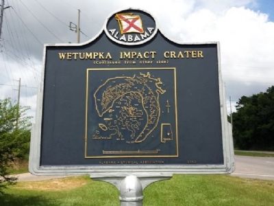
The ridges located here are the remnants of a six-mile diameter circular feature created some 85 million years ago by an estimated 1,000-foot diameter asteroid. The area at the time of impact was a shallow sea. The ridges consist of a variety of . . . — — Map (db m67939) HM
The Matanuska River valley in which you are standing is a structural trough formed by the collision of the North American and North Pacific
tectonic plates during the Jurassic and Cretaceous Periods (200-65 million years before present, MYBP), a . . . — — Map (db m254978) HM
These pieces of petrified wood were found at the Wishbone Hill
escarpment, just north of here. Fossilized plant types document there
were warm, subtropical temperatures in this region 55 million years ago.
The petrified forests in this area . . . — — Map (db m255202) HM
Just like visiting a grocery store, park paleontologists have a “wish list” of fossils that they would like to find. Petrified Forest's wish list included a bonebed of metoposaurid amphibians, the large, flat-headed amphibians that were one of . . . — — Map (db m286551) HM
In the summer of 1921, heiress and explorer
Annie Montague Alexander and her research partner
Louise Kellogg set off into the badlands in front of
you. Intrigued by fossils discovered by John Muir
fifteen years earlier, Annie and Louise . . . — — Map (db m286363) HM
Most people have never heard of a caecilian, but they are one of the most fascinating groups of animals alive today. They are one of the living groups of amphibians along with frogs, toads, salamanders, and newts. Caecilians spend nearly all their . . . — — Map (db m286544) HM
Nowhere else has so large and beautiful and in every way wonderful [a] section of the ancient…forests been discovered, and, after it is cared for by the Nation and made easily accessible, it will, I am sure, become one of the most . . . — — Map (db m269682) HM
The colorful mesas, buttes, and badlands before you compose a natural work of art--the Painted Desert.
Wind and running water cut these features from the Chinle Formation deposited over 200 million years ago when this area was a vast inland . . . — — Map (db m72925) HM
Think of a word to describe the semi-arid grassland in front of you. Is it lush, green, or forested? No, but those would be accurate descriptions for this land during the Triassic Period. At that time, this area resided on the supercontinent Pangea . . . — — Map (db m269588)
The imprints were made by a one ton, twenty foot long, meat-eating dinosaur. The slab of sandstone came from a nearby side canyon.
When Dilophosaurus tracked through the silt 170 million years ago, this was a different landscape. Shallow streams . . . — — Map (db m40326) HM
These tracks were made by a three-toed dinosaur known as a Saurischia therapod. It lived here about 170 million years ago during the Jurassic era when the environment was tropical. The footprints are raised natural sandstone castings of the . . . — — Map (db m40321) HM
Centuries of scouring floodwaters washed out the arroyo, or gully, beneath this 110-foot (34 meter) petrified log to form Agate Bridge. The stone log, harder than the sandstone around it, resisted erosion and remained suspended as the softer rock . . . — — Map (db m68872) HM
In the valley below, a group of highly mobile Native Americans set up their base camp next to a modest playa lake some 13,000 years ago. From this temporary encampment, they refurbished their stone tool kits and restocked their food supply and . . . — — Map (db m285544) HM
The maze of canyonlands stretching before you is the continuing work of millions of years of powerful and pervasive geological forces.
Water scours and down-cuts channels in the soft sandstone plateau. The process is augmented by forces of . . . — — Map (db m71515) HM
Footprints of a small dinosaur that walked on his hind legs. About 180 million years ago, he left a lasting signature by walking through the mud. The print then filled with sediment, and both print and cast (upside-down here) eventually turned to . . . — — Map (db m71516) HM
This miniature forked-stick hogan without a smoke hole is actually a highly effective bath — an ancient solution to the problem of keeping clean in a land where water is scarce.
Here’s how it works: Stones are heated in a fire, then . . . — — Map (db m71517) HM
Hidden away in Tsegi Canyon’s wilderness of bare rock, sand, and sparse vegetation are surprising pockets of luxuriant growth. Betatakin Canyon—home to a village of prehistoric cliff-dwellings farmers—is one of these oases. Fir Canyon, . . . — — Map (db m71514) HM
Exploring the geologic story here connects you with Petit Jean Mountain
Lepidodendron
One of the dominant tree-like plants of
either the Carboniferous Period (359-299
million years ago) or the late
Pennsylvanian Period (323-299 . . . — — Map (db m233678) HM
Some of the large land mammals of the Irvingtonian continued into the Rancheolabrean (late Pleistocene). Their extinction defines the end of the Pleistocene. Changing climate due to an emerging coastline destroyed most of their habitat. Smaller . . . — — Map (db m212690) HM
After a large earthquake in 1868 on the Hayward Fault, Dr. Lorenzo Gordon Yates, a dentist, discovered fossils on what is now Osgood Road in the Irvington District. Many were identified as extinct Pleistocene horses, camelids, and mammoths. In . . . — — Map (db m212655) HM
Tens of thousands of fossils, were excavated in what is now Sabercat Historical Park and nearby locations. This discovery was documented by Dr. Don Savage from the University of California, Berkeley. Because of this remarkable unearthing, that . . . — — Map (db m212658) HM
Welcome to the fossils of Sabercat.
Throughout the last Ice Age, mammoths, saber-toothed cats and other large animals lived here. Most of these animals are now extinct, but they left behind a treasure trove of fossils.
Local students, . . . — — Map (db m212644) HM
Sea level during the last glacial period was about 400 feet lower than it is today. Ice sheets and glaciers held more of the Earth’s water, and cooler oceans contracted, taking up less space. During the Rancholabrean Age, California’s coastline . . . — — Map (db m212691) HM
Welcome to the fossils of Sabercat.
Throughout the last Ice age, mammoths, saber-toothed cats and other large land mammals lived here. Most of these animals are now extinct, but they left behind a treasure trove of fossils.
Local . . . — — Map (db m218207) HM
Welcome to the fossils of Sabercat.
Throughout the last Ice Age, mammoth, saber-toothed cats and other large land mammals lived here. Most of these animals are now extinct, but they left behind a treasure trove of fossils.
Local . . . — — Map (db m218267) HM
Within a three-foot thick sandstone bed, seen on both sides of the trail, is a layer of rock containing fossil Turritella aedificata snails. Note the slender tapered shape that has led to calling them “Tower Shells.” They are also . . . — — Map (db m200818) HM
The Blackhawk Ranch fossil quarry is located south of Rock City on the lower slopes of Mount Diablo. During the Late Miocene, approximately 9-10 million years ago, this region was a rolling lowland. It represented the first evidence of emergence . . . — — Map (db m93648) HM
"Big Diamond", a circus elephant, expired near here in 1927. His skinned hulk was buried. Years later, his bones were unearthed and speculation arose about a
Humboldt Mastodon until investigators were enlightened
by people who'd seen the . . . — — Map (db m22274) HM
Located one-eighth mile west of here is an
ancient asphaltum seepage in which hundreds
of Pleistocene Age (15,000-50,000 years ago)
birds, insects, and animals were trapped.
The skeletal remains found in the pit include
giant condors, giant . . . — — Map (db m168958) HM
Once common across the globe, cycads are now
threatened or endangered in the wild. Explore our
diverse collection and learn about these impressive plants.
Age of Cycads
The Jurassic Period is famous for its fantastically large . . . — — Map (db m198164) HM
Did you know that you are standing a thousand feet above a large underground oil field? This oil seeps to the surface as sticky asphalt. Plants and unwary animals have been getting trapped in this treacherous goo for tens of thousands of years. . . . — — Map (db m292182) HM
Chester Stock, Ph.D., January 28, 1892 - December 7, 1950. Paleontologist. Chief Curator of Science - Los Angeles County Museum, Chairman of the Division of Geological Sciences - California Institute of Technology who, encouraged by the foresight . . . — — Map (db m51436) HM
This tar trapped lots of meat-eaters, like dire wolves and saber-toothed cats, because they couldn't resist this temptation. Scientists think the sight and smell of other animals stuck in tar attracted carnivores. Carnivores might tear off a trapped . . . — — Map (db m292031) HM
This tar trapped lost of meat-eaters, like dire wolves and saber-toothed cats, because they couldn't resist this temptation. Scientists think the sight and smell of other animals stuck in tar attracted carnivores. Carnivores might tear off a trapped . . . — — Map (db m292179) HM
How did these different types of fossils end up in a tar pit together?
For thousands of years, crude oil has been naturally rising up to the surface here forming shallow puddles of sticky goo called asphalt seeps.
Tar pits are . . . — — Map (db m291248) HM
Deep Down
Deep pit yields mammoth find
Pit 9 was far bigger than it now appears. Workers dug down 35 feet to find all its fossils. They pulled over 10,000 fossils from this one pit, including bones from 27 individual Columbian . . . — — Map (db m292139) HM
The Columbian mammoth sculptures installed here
at the Lake Pit in 1968 reflect the interpretation of
sculptor Howard Ball. Fossil studies and research at
the Tar Pits Museum have since revealed more about
how these mammoths lived and died. . . . — — Map (db m253597) HM
Buried Oil Makes Great Goo
This lake is actually a pit left over from asphalt mining operations in the
late 1800s. At that time, La Brea tar was mined to seal roofs and roads. The
pit has since collected rain and groundwater, . . . — — Map (db m253664) HM
Life and Death in Long Ago L.A.
This peaceful park was perilous for animals who walked here 20,000 years ago. La Brea's goo made this unsafe ground for both predator and prey. Six-foot-tall, 2,000-pound sloths got stuck here and died. So did . . . — — Map (db m292154) HM
A few inches of La Brea's tar took down huge ground sloths and scores of other animals. It could take you down too, if you're not careful. The tar works like fly paper: the harder an animal struggles, the more stuck it gets.
Tread Lightly . . . — — Map (db m292177) HM
When excavators unearthed giant leg bones in Pit 9 from 1914 to 1915, they made a major find. Most of La Brea's Columbian mammoth and American mastodon fossils came from this pit.
Hidden Trap
See how the leaves and twigs conceal the . . . — — Map (db m292138) HM
Tar Entraps Mighty Mammoths
Looks can be deceiving. This small tar-filled pit was once a major dig that produced hundreds of La Brea's biggest fossils: Columbian mammoth bones. Twelve-foot-tall, 11-ton Columbian mammoths were the largest, . . . — — Map (db m292152) HM
Did you know you are standing above a large underground oil
field? This oil seeps to the surface as sticky asphalt. Plants and
unwary animals have been getting trapped in this treacherous
goo for thousands of years. Being stuck in the La Brea Tar . . . — — Map (db m292033) HM
Inside this fence are three old pits that were dug from 1913 to 1915. Because asphalt oozes, stops and bubbles up someplace new, these three pits contained fossils from different time periods. Animals that died within a few feet of where you are . . . — — Map (db m292020) HM
These three pits are time capsules that give us clues to what lived and died in Ice Age L.A. Fossils found here include La Brea's biggest fossil (a tree), it's biggest bird (teratorn), and dire wolves by the dozen.
Loads of Fossils . . . — — Map (db m292028) HM
These big crates contain our most recent fossil finds-millions of them.
We are digging through the crates and making new discoveries every
day. Millions of new fossils from Project 23 (named for the 23 crates) are
helping us reconstruct the . . . — — Map (db m292036) HM
Who are you?
We are full time Museum staff with earth science and paleontology backgrounds. We are fascinated by fossils - and we're assisted by dozens of equally fascinated volunteers. - Karin Rice, excavator
What are you . . . — — Map (db m292159) HM
This site possesses exceptional value as an illustration of the nation's natural heritage and contributes to a better understanding of man's environment.
1963, National Park Service - United States Department of the Interior — — Map (db m291250) HM
La Brea's unique tar seeps make each pit
here a different Ice Age time capsule. This is
because the tar oozes up in different places
at different times. While one seep stops,
another one starts up not far away. The types
of plants and . . . — — Map (db m292024) HM
Each wooden crate before you contains fossils. These fossils were found a few hundred yards from here during parking lot constuction for the Los Angeles County Museum of Art (LACMA). We open these crates one-by-one to excavate the fossils. With each . . . — — Map (db m292038) HM
Columbian mammoths lived right here during the last ice age. We call it the Ice Age because thick sheets covered parts of the globe and cooled the planet. Even parts that weren't ice covered like Los Angeles were cooler than now. We study fossils . . . — — Map (db m291256) HM
Marked this day March 20 1976, as a California Historical Spanish Colonial Landmark “In 1776 Portola encamped at the springs, part of the Rancho San Vicente - Santa Monica, known as the: 1. Junipero Serra Springs; 2. El Berrendo; 3. San Gregorio; . . . — — Map (db m122157) HM
The hills where you stand are a part of one of the world's geological wonders, The San Andreas Rift - A great fault and earthquake zone.
Because of the movements along this fault zone, the pink and tan colored Punchbowl rocks seen below . . . — — Map (db m115197)
This is the first tree discovered by Charles Evans (Petrified Charley) in 1870. Robert Louis Stevenson wrote about this tree and his encounter with Petrified Charley in his book the “Silverado Squatters”. This tree is named in honor of their . . . — — Map (db m248026) HM
This skull of Mixocetus baleen whale was discovered during grading of this plaza. It is the second example of the species known to science. The first was found in Los Angles in 1931.
Mixocetus was one of the largest marine animals to inhabit . . . — — Map (db m188542) HM
This prehistoric giant ground sloth represents the Ice Age
animals that flourished here 40,000 years ago. In 1905, sloth
bones and teeth were recovered from this site with the fossils of bison, horses, camels, mammoths, dire wolves . . . — — Map (db m292677) HM
Before you are the white limestone remains of an 18,000,000 year old tropical shell reef. Formed in a shallow bay, it contains fossils of scallops, clams, and tube worms. Mudstones of the same age, found nearby, held fossil whales and shark teeth. . . . — — Map (db m101952) HM
Side 1
10 Million Years Ago
You are standing on what once was the bottom of a deep ocean basin. Over millions of years, geological upheaval raised the coastal plain and caused dramatic changes in the shoreline.
Mixocetus was . . . — — Map (db m195044) HM
The City Seal was designed shortly following incorporation and tells the story of the rich history of Laguna Niguel, from its pre-historic beginnings, to the modern and vibrant family-oriented community of the present.
Each of the seven . . . — — Map (db m299668) HM
The main exhibit displays a fossil right whale skull in profile. It was recovered from the marine siltstone member of the Capistrano Formation (3.5 to 5 million years old) in the 1970's right here in Mission Viejo. It is a fossil skull from the . . . — — Map (db m72036) HM
History
The Oso Creek Trail started in April 1997 as a community collaboration where volunteers gather in late spring to celebrate the Earth and the arts in Mission Viejo. The trail is nestled along the riparian corridor of the Oso Creek . . . — — Map (db m227360) HM
Originally dedicated on June 4, 1977 by the Mission Viejo Cultural and Heritage Association.
The Fossil was unearthed in the southern part of the city in 1976, and is a partial skull of a Baleen whale belonging to the Bowhead or right whale . . . — — Map (db m72035) HM
This fossil-rich sandstone was found locally from within the Topanga Formation, which was deposited during the Miocene epoch. The fossils and sandstone were deposited in a shallow sea that once occupied this area. Fossils include clams, scallops, . . . — — Map (db m188903) HM
The dry lake bed before you was once part of ancient Lake Mojave. During the last ice age, a cooler and wetter climate produced the Mojave River. It flowed inland about 150 miles from the San Bernardino Mountains, until its waters became trapped . . . — — Map (db m83467) HM
San Francisco was an ancient river valley were creatures who grazed and browsed and stalked their prey, left their bones. (text on the horizontal surface)
20,000 years ago you could have walked to the Farallon Islands... . . . — — Map (db m92829) HM
Fossilized bones were discovered on this site in 2017 during earthwork grading operations for the Stanford Redwood City campus. The bones were found at substantial depth below the ground surface. They were determined to be from the Pleistocene . . . — — Map (db m206827) HM
The Petrified Forest, dating from the Eocene Period, is the only known example of a petrified forest in California. Its size, scope and variety of petrification is unique in the world. Opalized wood, obsidian, quartz crystal, petrified coral and . . . — — Map (db m102520) HM
The petrified forest, dating from the Eocene Period, is the only known example of a petrified forest in California. Its size, scope and variety of petrification is unique in the world. Opalized wood, obsidian, quartz crystal, petrified coral and . . . — — Map (db m175865) HM
To Commemorate
... The discovery of the petrified forest by "Petrified Charlie" in the year 1870.
... The meeting with Robert Louis Stevenson immortalized in the book, "Silverado Squatters."
... All those others whose lives were devoted to . . . — — Map (db m102524) HM
Dinosaur Freeway Geology of John Martin Reservoir
is part of the Dakota sandstone
formations which extend from Denver,
Colorado to Tucumcari, New Mexico.
In the Cretaceous period the region
was bordered with lakes, swamps . . . — — Map (db m181091) HM
Along the western boundary of the Academy, the Rampart Range consists primarily of Pikes Peak granite that was formed more than one billion years ago. These ancient rocks did not become prominent until the early Cenozoic Era (about 50 million . . . — — Map (db m158341) HM
Across Fourmile Creek from where you stand was the site of a major dinosaur excavation.
In 1954, Edwin Delfs, a zoology student at Yale University, joined the Cleveland Museum of Natural History on a fossil-hunting expedition throughout Colorado . . . — — Map (db m252011) HM
Look for the red and green rock layers around you. This is the
Morrison Formation that extends for 600,000 square miles
throughout the Western United States. The majority of the
formation is covered by other rock layers. The few areas . . . — — Map (db m252006) HM
Each year, tens of millions of people
marvel at the dinosaurs from the Garden
Park Fossil Area in museums across the
country. In the early and mid-1900s,
museums were in search of large
dinosaurs to become the centerpieces of
their new . . . — — Map (db m252004) HM
With just a little help from a geologist, you can see what can't be seen — and travel through time for millions of years. These rocks reveal long-gone river valleys, open oceans, and enormous volcanoes.
Roll back the clock and geology shows . . . — — Map (db m158870) HM
Dinosaur bones were deposited here on the inside of a meander by a
fast-flowing stream. This deposit known as a “point bar” grew by the addition
of sand, causing growth of the point bar towards the outer bank and
downstream. Larger, . . . — — Map (db m125104) HM
The downward bulges in the rock layers are most likely
dinosaur tracks viewed in cross section. When dinosaurs walked in soft sand
they sank in, pushing down and distorting the layers beneath their feet.
The tracks later filled in with more . . . — — Map (db m125156) HM
The tan sandstone of the Dakota Group form the crest of Dinosaur Ridge and were deposited
more than 100 million years ago during Cretaceous time along the western shore of the Western
Interior Seaway. At that time, only low hills existed to the . . . — — Map (db m125322) HM
First noted by Matt Mossbrucker and later described by Dr. Martin Lockley,
this theropod (a carnivorous dinosaur) track was part of the top layer of sandstone at
the Bone Site, 50 yards to the north. During road construction in 1937, this . . . — — Map (db m125150) HM
Based on Late Cretaceous fossil evidence found along this trail, this area was a delta with lakes, streams and a mosaic of swamps, scrubby forests, palm tree thickets and small open areas. Impressions of logs, leaves and palm fronds suggest a . . . — — Map (db m111418) HM
Birds are descendants of theropod (meat-eating) dinosaurs and their tracks look similar:
three long narrow toes with claw marks. However, bird tracks are generally smaller than most
theropod tracks.
This print is wider than long and the . . . — — Map (db m114062) HM
Large palm fronds show that the climate was much warmer than that of today. Other plant and tree types found here, such as extinct relatives of sycamore, walnut, paddle-leafed ginger and an ancient relative of the avocado, lost their leaves . . . — — Map (db m114059) HM
Triceratops: 30 feet long, 6-12 ton Herbivore
Several tracks of Triceratops or a closely related horned dinosaur were discovered in this area. Among
horned dinosaurs, Triceratops is the most likely track maker because many of its bones have . . . — — Map (db m114058) HM
Designated a Colorado Natural Area in 2002, the Dakota Hogback/Dinosaur Ridge Natural Area in Jefferson County is a crown jewel of statewide, national and international importance. The Dakota Hogback/Dinosaur Ridge Natural Area exemplifies all the . . . — — Map (db m80464) HM
You are looking out over the edges of tilted and eroded layers of sandstone and shale that lie upon much older rocks in the mountains behind you. If the eroded layers were restored to where you stand they would be more than two miles thick. The . . . — — Map (db m57932) HM
Morrison Fossil Area has been designated a National Natural Landmark This site possesses exceptional value as an illustration of the Nation's natural heritage and contributes to a better understanding of the environment 1973 National . . . — — Map (db m155600) HM
Erected through the cooperation of Federal, State and local governments by Works Progress Administration. Dedicated to the enrichment of human lives. A record of permanent achievement. — — Map (db m155601) HM
In 1937 the City and County of Denver built Alameda Parkway as the main route to Red Rocks Park. The construction exposed dinosaur tracks, but for many years geologists and members of the public observed them without studying them in detail. In . . . — — Map (db m155602) HM
Today the Purgatoire River rolls through a rugged, arid landscape in a deeply carved
canyon—but imagine a lush conifer forest and verdant ferns right where you're standing!
Learning from the Layers
The layers of rock at the . . . — — Map (db m181056) HM
A famous discovery was made right here along the Purgatoire River! During the Jurassic Period, hundreds of dinosaurs once inhabited this area when it was a vast lake. As they plodded through the mud along the lakeshore, the dinosaurs left behind . . . — — Map (db m181254) HM
From the air, you can see
the tracks of two sauropod
dinosaurs walking side by side
along the ancient lakeshore. The
discovery that some types of
dinosaurs lived in large herds like
modern animals happened because
of parallel tracks . . . — — Map (db m181013) HM
Does the shape of Independence Monument help tell the park's erosional story? It depends on your viewpoint. From here the monolith appears to be shaped like a tower, but the sideview shows that it is the remaining piece of a rock wall between . . . — — Map (db m159647) HM
About the Diamond
The Dinosaur Diamond Prehistoric Highway (Dinosaur Diamond) is located in eastern Utah and western Colorado. Three-quarters of the 512-mile loop are within Utah. The segment within Colorado was designated the Dinosaur . . . — — Map (db m159772) HM
This family circle of fossilized redwood stumps grew out of the single trunk of an older parent tree. The three trunks are ancient clones, or genetically identical copies, of that parent tree. Modern coastal redwoods also reproduce by stump . . . — — Map (db m240610) HM
The Rocky Mountain region was much warmer 34 million years ago. The Florissant valley was forested with towering redwoods, false cypresses, pines, mixed hardwoods, and ferns surrounded by drier slopes with scrublands, shrubs, and low trees. . . . — — Map (db m158385) HM
Within a few steps is the transition from a dry meadow into a cooler forest of Douglas-fir, spruce, and common juniper. The moisture content is higher here. Though you're looking south, you are standing on a north-facing slope. North-facing slopes . . . — — Map (db m158502) HM
Women's stories figure prominently in the early frontier days of Florissant.
Charlotte Hill homesteaded here in the late 1800s. Married at age 13, she raised seven children, ranched with her husband, and pursued her avocation of collecting fossils. . . . — — Map (db m240616) HM
Standing here 34 million years ago you would probably recognize a number of plants and insects. But the year-round mild climate in the Rockies would be a surprise, as would the mammals of the time. The warm temperate forest was diverse, with . . . — — Map (db m158429) HM
As outcrops of shale weather, they separate into paper-thin sheets, exposing fossils on their surfaces. Within these delicate pages, a chapter of Earth's history unfolds.
Size played a key role in determining what was preserved at Florissant. The . . . — — Map (db m158439) HM
433 entries matched your criteria. The first 100 are listed above. Next 100 ⊳