Early Plymouth colonists called Barrington "The Garden of the Colony" for its beautiful location on Narragansett Bay and the Providence River, its numerous streams and meadows, and its fertile soil.
- from Bicknell, A History . . . — — Map (db m223012) HM
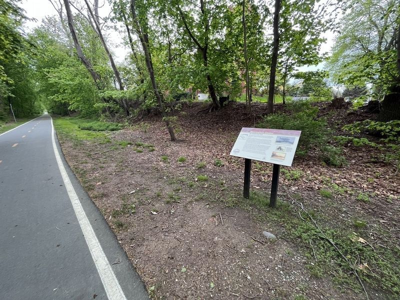
"When workers were building the Barrington Bridge in 1914, my grandmother, Maria Balia, who lived nearby would serve them drinks that she kept cold in her well. The workers used to go to her house every day and sit under the grape . . . — — Map (db m222998) HM
Finney's Distillery was discovered during demolition of the structure of the original Bank of Bristol (shown below, center). For nearly thirty-five years, two hundred gallons of rum were made each day. The rum was placed in barrels called . . . — — Map (db m222816) HM
In 1675, after King Philip's War, the lands known as Mount Hope were ceded to Plymouth Colony. Plymouth sold the area that became the Town of Bristol and its deep water harbor to four proprietors, who laid out streets relative to the waterfront. . . . — — Map (db m222772) HM
Today, Bristol's waterfront embodies the town's many successful efforts to repurpose its maritime-related resources and structures. The creation of the Bristol Waterfront Historic District in 1975 encouraged residents to work actively towards . . . — — Map (db m222783) HM
With the collapse of the DeWolf empire in 1825, Bristol's golden years came to an abrupt halt. Although the maritime economy would eventually rebound, it would never reach the plateau it had known prior to 1825. By the 1830s, new pressures on . . . — — Map (db m222828) HM
In Bristol's early years, the waterfront was an important means of transportation. In addition to ships engaged in the trans-Atlantic merchant trade, smaller boats ferried people and goods around both Narraganset Bay, and beyond to cities like . . . — — Map (db m222836) HM
After the Civil war, Bristol's economy shifted to the production of rubber goods. In 1865, August O. Bourn established the National Rubber Company on Wood Street and began manufacturing rubber using vulcanizing technology, which had been recently . . . — — Map (db m222849) HM
Flood awareness is important to Bristol's community of residents, businesses and visitors. These historic photos depict the destruction to the town from the 1938 and 1954 Hurricanes.
❶ The D'Wolf Inn stood on this . . . — — Map (db m222764) HM
Flood awareness is important to Bristol's community of residents, businesses and visitors. These historic photos depict the destruction to the town from the 1938 Hurricane.
In 1818 James DeWolf and his brother built the DeWolf Warehouse. The DeWolf family engaged in numerous sea-related enterprises that included the slave trade, rum distilleries, privateering, merchant marine, insurance, banking and Cuban sugar and . . . — — Map (db m222814) HM
This Federal Style mansion designed by Russel Warren was built by George DeWolf in 1810. Money received from the trading of enslaved people funded its construction. The DeWolf family financed 88 slaving voyages accounting for 60 percent of all . . . — — Map (db m222899) HM
Dedicated to the following employees who entered the Armed Forces of our country
Margaret Black •
W. Steven Burns •
Harold Connery •
Francis Connery •
Norman Cologne •
J. Raymond Dugan •
Harris Fonseca •
Carmelo Ficarra • . . . — — Map (db m222950) WM
"Loafers' Corner"
The
Easterbrooks-Paull Block
1899
has been placed on the
National Register
of Historic Places
by the United States
Department of the Interior — — Map (db m222909) HM
The Herreshoff Manufacturing Company was started here in 1863 by John B. Herreshoff with his brother Nathanael G. Herreshoff as designer.
The Company designed and built many famous vessels including Seagoing Torpedo Boat No. 1 U.S.S. Cushing . . . — — Map (db m222724) HM
Rhode Island was the center of the American transatlantic slave trade, accounting for the majority of American slave voyages from 1700 until 1808.
More than 110,000 Africans were forcibly taken from their homeland on Rhode Island ships and . . . — — Map (db m150887) HM
Washington St. so called since 1835. In colonial days, known as Ferry Lane; later, as King St. On the corner opposite stood Burr’s Tavern, which in Revolutionary times played host to Washington; Jefferson, De Lafayette, De Castellux, Putnam and . . . — — Map (db m66344) HM
Homestead OverviewIn 1770, this house was built by 27 year-old Quaker and iron-master, Nathanael Greene. The building is a well-preserved 18th Century structure of simple, yet refined design. The iron forge, which was located on the Pawtuxet . . . — — Map (db m83326) HM
The village of Summit was called Perry’s Hollow in the 18th century.
Located on a ridge between the Flat River and the Moosup River Watersheds, the name “Summit” signified a high point along the adjacent railroad line.
Summit developed when the . . . — — Map (db m107453) HM
Erected by Varnum Continentals 1914 on the second site of Rhode Island Central Bank, first bank in East Greenwich 1840-1857
To the memory of
James Mitchell Varnum
of East Greenwich
Brig. Gen. Continental Army 1777-1779 • . . . — — Map (db m223025) HM WM
In 1829, Congress appropriated $1,250 for a 600-pound fog bell for Beavertail. Prior to that time the keeper fired a cannon on foggy nights. That same year a fog bell house was built adjacent to the tower.
Beavertail has probably seen more . . . — — Map (db m88667) HM
1678
Town of Jamestown is incorporated. There are about 150 residents.
1705
Jamestown Town Council orders that a Watch House be built at "Beaver Tail."
1712
Jamestown Town Council . . . — — Map (db m88673) HM
The first assistant keeper at Beavertail Light was hired about 1859. It appears that the early assistant keepers shared part of the keeper's quarters or lived in one of the outbuildings on site.
In 1898, the U.S. Lighthouse Board added this . . . — — Map (db m88631) HM
The current tower was built in 1856 to replace a deteriorating 1753 structure.
The granite tower rises to a height of 40.9 feet and measures 10 feet on each side. It is constructed of 27 rows of granite blocks, weighing a total of 180 tons. . . . — — Map (db m88666) HM
Although most lighthouse keepers were married, at many small lighthouses they lived a solitary life while their families remained on the mainland. Beavertail, being on Conanicut Island, allowed the keepers and their family to live at the site. . . . — — Map (db m88672) HM
What resembles a submarine on the surface just over a mile southwest of this point is all that remains of the Whale Rock Lighthouse.
Whale Rock is a flat ledge about a half acre in size, yet it claimed at least eight ships and six lives . . . — — Map (db m88648) HM
This was the home of Mr. Smith until his death in 1886. As a Real Estate Broker he helped to develop the land along Bellevue Avenue.
This property has been
placed on the
National Register
of Historic Places
by the United States . . . — — Map (db m223109) HM
Clarke Cooke
House
circa 1780
This property has been
placed on the
National Register
of Historic Places
by the United States
Department of the Interior — — Map (db m223200) HM
Home of the artist Michel Felice Corne who introduced the tomato into this country.
Michele Felice Cornè House
2 Corne Street
has been placed on the
National Register
of Historic Places
by the United States
Department . . . — — Map (db m223150) HM
Mary Ferrazzoli (1928-1994) was the visionary leader who founded the Friends of the Waterfront in 1982. She vigorously championed public access and stood firmly opposed to the commercial overdevelopment of the Newport waterfront blocking public . . . — — Map (db m189622) HM
Newport's location is a fisherman's dream. Easy access to Narragansett Bay and "out front" (the open Atlantic Ocean), puts hundreds of delicious species within reach of this well-protected harbor.
With origins dating back to the 17th . . . — — Map (db m223224) HM
Pelham Street runs along the southern edge of colonial Newport and is the location of houses built in the 18th and 19th centuries. It is named for the Pelham family of Newport which is related to the British Prime Minister Henry Pelham. In 1810, . . . — — Map (db m223154) HM
Perry Mill
built in 1835
has been placed on the
National Register
of Historic Places
by the United States
Department of the Interior — — Map (db m223191) HM
Queen Anne Square lies within the area of some of Newport's earliest settlement. Prominent at the head of the park lies Trinity Church, a Newport icon and one of Newport's oldest congregations. Formed in 1698 as an Anglican congregation of . . . — — Map (db m223215) HM
18th century, Newport was a major hub for the northern 'triangle slave trade'. Enslaved Africans, traded for rum, arrived and departed from Bowen's Wharf, in sailing ships and labored as dock workers, shipbuilders, sailors, caulkers, sailmakers, . . . — — Map (db m223202) HM
The 1940s brought enormous change to houses on this block of Bellevue Avenue as Gilded Age glamour faded due to demolitions, fire, and acquisition of many properties for use by schools. Increasing income and real estate taxes and a changing . . . — — Map (db m48598) HM
This property has been
placed on the
National Register
of Historic Places
by the United States
Department of the Interior
Built 1855 — — Map (db m223169) HM
Demolition threatened The Elms and the surrounding summer houses in the 1960s, a critical period when the architectural landmarks of Bellevue Avenue were on the verge of complete destruction. In 1962, The Preservation Society of Newport County . . . — — Map (db m107353) HM
The Hammetts Bell was manufactured in 1872 by Vanduzen & Tift at its Buckey Bell Foundry in Cincinnati, and likely hung in a church steeple. The company made thousands of bells until it closed in the early 1950's, and has the distinction of founding . . . — — Map (db m223196) HM
Washington Square, originally called the Mall and later the Parade, is ringed by buildings constructed over two centuries. The Square reflects Newport’s transformation from a rudimentary outpost to one of the five major trading posts in colonial . . . — — Map (db m48545) HM
Banking on the Riverbank's Value
This house exists because of Wilbur Kelly, who owned the land and a small mill just up the canal. In his younger years, Wilbur Kelly had worked as a ship captain in a fleet owned by Brown and Ives. Later, he . . . — — Map (db m195922) HM
Kelly’s Mill Left An Impression
Do you see a rectangular footprint in front of you? It marks the site where the Kelly Mill stood. Starting in the early 1800s, the mill used water from the Blackstone River to power its spinning machines. . . . — — Map (db m195921) HM
The Mercantile Center
The two brick and stone buildings in front of you played an important role in the planned mill village of Slatersville. Known as the Commercial Blocks they were built by the Slater Company for the use of their workers. . . . — — Map (db m197767) HM
Just six years after building Slater Mill, Samuel Slater's partners, William Almy and Obadiah Brown, bought another mill on their own. They even copied some of Slater's machine designs for their mill.
This annoyed Slater so much that he . . . — — Map (db m151663) HM
Tradition holds that Ebenezer Jenks built the house in front of you in the mid-1700s. He was the grandson of Pawtucket's first settler, Joseph Jenks, Jr.
By the end of the 1700s, Sylvanus Brown, a mechanic owned the place. He welcomed Samuel . . . — — Map (db m151660) HM
Samuel Slater came here from England in 1789. He had just finished a seven-year apprenticeship at an English cotton mill, which gave him great knowledge of the water-powered spinning process developed over the previous two decades.
With the . . . — — Map (db m151668) HM
In commemoration of the 150th anniversary of the First Successful Cotton Mill in America this tablet was presented to the Old Slater Mill Association, present owners of this historic building in honor of the textile pioneer whose name they . . . — — Map (db m1613) HM
Control of waterpower meant control of economic, political, and social power.
A mill developer's first "power grab" was to build a walled dam. This created a pond that stored water to power the mill.
Other villagers didn't willingly . . . — — Map (db m151665) HM
David Wilkinson and his father built this mill together, finishing it in 1811. It made sense to build it next to Slater Mill. When Slater married Wilkinson's sister, Hannah, the families grew even closer and shared several ventures.
At . . . — — Map (db m151661) HM
Samuel Slater (1768-1835) opened this water-powered cotton spinning factory in 1793. Slater had left England in 1789 with working knowledge of mechanical yarn-making, and in Pawtucket he discovered artisans with the skills necessary for starting . . . — — Map (db m118316) HM
The American Industrial Revolution began right here. In 1793, Samuel Slater teamed up with investors and local artisans. Together, they built a first for the United States—a successful cotton spinning mill that was run by water power. . . . — — Map (db m151657) HM
Slater Mill was America's first successful water-powered cotton spinning mill. For a small fee, tour the mill and learn how Samuel Slater and local craftsmen created machines that spun cotton into thread. Explore the Wilkinson machine shop and see a . . . — — Map (db m151659) HM
The American Industrial Revolution began at Slater Mill. Here, in 1793, Samuel Slater, with Providence investors and Pawtucket artisans, built the first water-powered, cotton spinning factory in the United States. Beginning with this wooden mill, . . . — — Map (db m118324) HM
Sylvanus Brown lived in this cottage from 1784 to 1824. Brown's proven pattern-making and carpentry skills earned him a place at Samuel Slater's side. Brown had also built water-powered mills and visited European mill sites. Between 1789 and . . . — — Map (db m118327) HM
The birthplace of the cotton manufacturing industry in America. Here in 1793 Samuel Slater, Moses Brown, and William Almy established the first successful cotton factory in the United States. — — Map (db m1612) HM
When Samuel Slater first came here, the village had everything he needed to succeed. Pawtucket Falls provided ample waterpower. That energy was already powering local machine shops. Those shops were run by skilled mechanics who could assist with . . . — — Map (db m151670) HM
David Wilkinson (1771-1852), a blacksmith from Smithfield, Rhode Island, moved to Pawtucket in the early 1780s. Wilkinson invented new machines, including a steamboat, which he demonstrated in Pawtucket in 1792 (15 years before Robert Fulton's . . . — — Map (db m118248) HM
The water flowing through the millrace below you was brought here to do work. It was diverted from the Blackstone River on your right and will flow back into it downstream. Wilkinson Mill, the stone building on your left, shared this raceway with . . . — — Map (db m151667) HM
Controlling water power during the early years of the Industrial Revolution also meant gaining control of political, economic, and social power. Re-engineering water courses in this area often brought lawsuits and anger. In August 1792, four . . . — — Map (db m118317) HM
By the end of the Revolutionary War, the center of town had moved to several blocks south of this point. From 1820 to 1850 the Blackstone Canal and Providence and Worcester Railroad were built along the western edge of this plot, and Canal Street . . . — — Map (db m106872) HM
Providence’s Downtown was not always located in its present location across the river.
The first town center was located along the Moshassock River and North Main Street near St. John’s Episcopal Church.
The second Downtown was located around . . . — — Map (db m107762) HM
Providence has changed dramatically since its founding in 1636, from the early settlement enriched by farmland, to the town competing with Newport for trade, to the thriving capital it is today. This evolution can be evaluated through a case . . . — — Map (db m151732) HM
Near this spot lived Gabriel Bernon a Huguenot Refugee
Born Larochelle France April 6, 1644
Died Providence February 1, 1736
Merchant Colonizer Churchman — — Map (db m56148) HM
With the vision and efforts of local merchant and watch maker Isaac Hale, this property was acquired and donated to the city in 1867 for a small public park where "generations of Providence residents might look out with increasing pride upon the . . . — — Map (db m223299) HM
The home of John Brown Reflecting the wealth and position gained from his lucrative career as a slave trader, privateer, China trade merchant and Patriot. — — Map (db m56014) HM
Lippitt House
has been designated a
National
Historic Landmark
This site possesses national significance
in commemorating the history of the
United States of America
1976
National Park Service
United States . . . — — Map (db m151683) HM
Views from this hilltop have attracted visitors for centuries. In the 1860's, they were the inspiration for local merchant and neighbor, Isaac Hale to raise funds for the purchase and donation of the land to the city for a public park. In the . . . — — Map (db m223301) HM
In the decade before the Revolutionary War, the British were enforcing revenue laws by stationing maritime law enforcement vessels in Newport Harbor and Narragansett Bay. In 1769, Newport citizens burned the British sloop in protest of violations . . . — — Map (db m151735) HM
Market Square and the Weybossett Bridge became the head of navigation in the Old Harbor with the construction of a fixed type bridge in 1816. Ships docked along the northern portion of South Water Street (now Memorial Park) and were serviced from . . . — — Map (db m151741) HM
The first bridge across the Providence River was 40 years old by this time. The first wharf was built behind Towne Street (later named South Main Street). The center of town was established in what is now called Moshassuck Square. — — Map (db m222679) HM
The First Baptist Church in America relocated to its present site. Market House and University Hall were five years old. "Weybosset" Bridge had been rebuilt and a ferry boat operated from Cowpen Point. Many more wharfs appeared behind Towne Street . . . — — Map (db m222711) HM
Wharfs began to develop on the west side of the river. Shipping and commerce caused the center of town to move south and across the river.
The merchant fleet had grown to 120 ships and surpassed Newport's. John Brown's East India trade fleet . . . — — Map (db m222710) HM
A second bridge spanned the river. A causeway across the northern part of the Cove created a turning basin for the new Blackstone Canal. More wharfs and quays appeared on the west side of the river. The wharfs on the east side, destroyed by the . . . — — Map (db m222684) HM
In 1843, Weybosset Bridge was widened. The Blackstone Canal could not compete with the railroads and was abandoned after only 20 years of use. By 1847, the railroads were firmly established and the shipping industry began to decline. A cove basin . . . — — Map (db m222686) HM
1846 Great Salt Cove is partially filled, beginning the transformation from water to land transportation in what is now Kennedy Plaza.
1848 Union Passenger Rail Station is completed and Exchange Place is christened. . . . — — Map (db m222718) HM
In the 18th century the west side of the Providence River, now Downtown Providence and the Financial District, was known as the Weybosset Side after the name of its first street. With the dawn of the 19th century, development surged on the . . . — — Map (db m151701) HM
In 1959, Annye came to Providence from Montgomery, Alabama. She'd answered an advertisement in the newspaper, placed by an East Side widower who was looking for a live-in caretaker for his children.
On this spring evening, ready to have her . . . — — Map (db m151645) HM
As a young child, my love for cooking was born from my favorite babysitter, Julia Child. This would begin the love I have for cooking and the restaurant business to this day.
At 15 years old I found myself washing dishes at a popular late . . . — — Map (db m222627) HM
This area was historically important for its role in maritime commerce and whaling from the 1780s through the 1890s. Waterfront shipping activities continued as late as the 1930s. The land you are standing on now is entirely manmade and was once . . . — — Map (db m222626) HM
In 1830, the area around you was bustling with activity that dramatically changed the landscape of the Blackstone Valley. The Blackstone Canal, across Canal Street from where you stand, was an economic lifeline. The canal linked Providence's . . . — — Map (db m122505) HM
Look around you. Along the west side of Empire Street, where you can see a small park and office building today, you would have found the center of Providence's Chinese community, who settled in tenements here in the 1890s.
Although Chinese . . . — — Map (db m223032) HM
The area that would become Providence's West Side, including Central Wharf, was former tidal marshlands on the west side of the Providence River. Native Americans used the area as hunting and fishing grounds before Roger Williams' arrival in . . . — — Map (db m222612) HM
Originally the U.S. Custom House
Constructed 1856
Ammi B. Young, Architect
Entered on the National Register of Historic Places, April 13, 1972. This property makes a significant architectural contribution to the nation's cultural . . . — — Map (db m222616) HM
The site of an 18th century seaport village where seafaring merchants participated in the African slave trade. In the 20th century this port was used by Cape Verdeans who came to live in America. — — Map (db m233864) HM
1600s
Imagine you are here in 1636, when Providence looked very different.
Providence Harbor was full of ships, an active hub for fishing and trade. It played an important role as the city grew.
1700s
In the 1700s, the . . . — — Map (db m151649) HM
Rise of the Gangways
1704-1844
Providence was transformed in the 1700s from a rural hamlet to a seaport busily trading with other colonies, England, the West Indies and Africa. Tall masted ships docked as far north as Hall's Wharf (now . . . — — Map (db m151724) HM
The Steeple Street Complex was built in three main stages between 1827 and 1847 during a key period in Providence's growth into a leading commercial and industrial city. When Joseph Congdon and Randall Green built the first section, 3 Steeple, to . . . — — Map (db m56171) HM
Has Been Designated a National Historic Landmark
this site posses National significance in commemorating the history of the United States of America
An important example of modern monolithic granite construction, this is one of the most . . . — — Map (db m44926) HM
153 entries matched your criteria. The first 100 are listed above. The final 53 ⊳