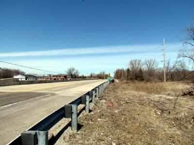
Near U.S. 231 at County Road 1700N. Reported missing.
In December, 1679, Robert Cavalier, Sieur de La Salle, with thirty men crossed northwestern Indiana by way of the Kankakee River in an attempt to find a water route to the Pacific Ocean. — — Map (db m64157) HM
Fountain Park has been the site of annual Chautauqua sessions since 1895. The Chautauqua continues to promote traditional values and religious, social and educaitonal activities upon which it was founded. — — Map (db m3806) HM
On East Michigan Street at North Ohio Street on East Michigan Street.
Built 1897 by Challenge Wind and Feed Mill Company of Batavia, Illinois. Rare tower and wood tank structure is an original example of nineteenth century public water utility facility, construction methods, and technology. Tower has limestone . . . — — Map (db m1513) HM
On West Clark Street, on the right when traveling east.
Building donated by Rensselaer Trinity United Methodist Church & moved to this location in 2003 by the Historical Society & Retired Iron Club of Jasper County. Converted to a blacksmith shop & dedicated to all the oldtime blacksmiths & welders of . . . — — Map (db m240752) HM
On West Washington Street (U.S. 231), on the right when traveling west.
General Robert H. Milroy, 1816–1890, was appointed colonel of the 9th Indiana Infantry, later promoted to brigadier and major general. He saw extensive action in western Virginia. After the war he served as Indian agent in State of Washington. — — Map (db m2312) HM
On Washington Street (U.S. 231) at Front Street, on the left when traveling west on Washington Street.
Born February 17, 1892 in Rensselaer; became part of New York Tin Pan Alley music scene. Wrote for Broadway musicals such hits as "Second Hand Rose" (Grant Clarke, lyrics) for Fanny Brice (1921 Ziegfeld Follies) and "Zing! Went the Strings of . . . — — Map (db m27712) HM
On West Clark Street, on the left when traveling east.
In memory of all those who, lose their lives and to the brave men and women who gave their lives to save so many others on September 11, 2001. Their courage and love of our country will be a source of strength and comfort to our great nation, God . . . — — Map (db m240944) WM
On Van Rensselaer Street, on the right when traveling north.
Incorporated as a municipal
steam power plant in 1898.
Changed to diesel power in 1925.
Remodeled and enlarged in 1939.
Chas S Chamberlin • Superintendent
Louis C Ramp • Asst Superintendent
J W Moore & Son • Consulting Engineers . . . — — Map (db m27808) HM
On South College Avenue (U.S. 231) at East Drexel Parkway on South College Avenue.
Erected by the Bureau of Catholic Indian Missions with funds from Katharine Drexel and operated by the Society of the Precious Blood with federal funds, 60 Indian boys from distant reservations were annually trained here. — — Map (db m2311) HM
On West Clark Street, on the right when traveling east.
First Responder and Military Memorial
Eagle Scout Project by Dylan Jay Perry
Troop 152 Rensselaer, Indiana
Dedicated June 5, 2021 — — Map (db m240745) WM
On West Clark Street, on the right when traveling east.
Outhouse built by WPA during Depression costing buyer $5.00. Commonly called "Roosevelt Privies." Donated by Edward Kosta Jr. Family to Fair Grounds in 2013 — — Map (db m240749) HM
On West Clark Street, on the right when traveling east.
Owned by Mrs. Vera Randolph, Parr Postmaster from 1938 to 1968, when the post office closed. Donated to the Jasper County Historical Society in 1969 by Dale Brunton and moved to the Jasper County Fairgrounds. — — Map (db m240750) HM
On West Clark Street, on the right when traveling east.
Built ca. 1870 in Barkley Township by Mark Quick. In 1901, Thomas Walters bought the farm. The cabin had four additional rooms which were later separated and the cabin was used as a lambing shed. In 1929, Paul J. Hall, Sr., bought the farm. The . . . — — Map (db m240746) HM
On County Road N400E 0.3 miles south of State Road 10, on the right when traveling north.
You are standing in what was once the southern Grand Kankakee Marsh. Three hundred years ago, depending upon the season, your knees may well have been wet.
In pre-settlement times, the Kankakee River was inseparable from its wetlands. Known . . . — — Map (db m302186) HM
Near Constitution Avenue west of East Lakeshore Drive, on the right when traveling west.
Lassen's resort enterprise begins with steam. In 1896, Christian Lassen began his boating service with a single steamboat taking tourists on trips around the lake. By 1904, the boating operation had grown to a fleet with six more boats and brother, . . . — — Map (db m305424) HM
Near Constitution Avenue north of East Lakeshore Drive, on the right when traveling west.
As James Hervey Ball explained in 1884, the native peoples "could not well have declined the inducement to have resorted here for council, pleasure, rest and food."
The French recorded the earliest historic groups in the area surrounding Cedar . . . — — Map (db m305417) HM
On South Main Street, on the right when traveling south.
The Crown Point Public Library opened in February, 1908 at this location. Andrew Carnegie donated $12,000 for construction of the community would commit to contributing annually to library maintenance. The Carnegie Building was adjoined by the new . . . — — Map (db m241002) HM
On South Main Street north of East Walnut Street, on the right when traveling north.
The Old Sheriff's House and Jail was built in 1882. The home is a Second Empire-style house with a Mansard roof, the only such style in Crown Point.
The jail was expanded twice. The renovations were completed in 1910 and 1928, extending the . . . — — Map (db m288916) HM
On South Main Street at West Joliet Street, on the right when traveling north on South Main Street.
This Neoclassical-style building at 138 S. Main St. was constructed with Southern Indiana Limestone in 1922. People's State Bank operated at this location from 1922 until several years into the Great Depression, closing in 1937.
Although the . . . — — Map (db m288662) HM
The Old Courthouse has been, since its erection in 1878, a landmark in Lake County, Indiana. Construction of the central portion, including the clock tower, began with 500,000 hand-kilned bricks from the Henry Wise Brickyard in Crown Point, . . . — — Map (db m27806) HM
On North Main Street at East Goldsborough Street, on the right when traveling north on North Main Street.
Dedicated by the citizens of Crown Point in memory of all who served their Country that Freedom shall not perish from this Earth — — Map (db m43408) HM
On West Joliet Street, on the right when traveling east.
This Italianate-style building was built by William W. Cheshire in 1873. Originally, there were storefronts on the street level with an all-purpose room on the second floor. The Masonic Lodge had a meeting room, as did the Odd Fellows. It was used . . . — — Map (db m287798) HM
On North Court Street at West Clark Street, on the left when traveling north on North Court Street.
The Crown Theatre at 19 N. Court St. started as an independent movie house known as The Palace Theater in 1926. The theater was later renamed to Crown Theatre. The Crown Theatre closed in 2012. Prior to its movie house days, the building was a . . . — — Map (db m287732) HM
On South Main Street, on the left when traveling north.
The Lake County Courthouse, affectionately known as "The Grand Old Lady," is in the design tradition of Romanesque and Georgian styles. The original structure was built in 1878.
There were two additions to the original building: two-and-a-half . . . — — Map (db m287616) HM
On South Main Street, on the right when traveling north.
The Lake County Sheriff's house and jail were built in the Second Empire style. The house was a residence for the Lake County Sheriff. The jail was 50x120 feet with six cells. The building was enlarged in 1926, and the residence was converted to . . . — — Map (db m241003) HM
On North Court Street, on the left when traveling north.
Site of the home of
Solon Robinson
Founder of
Crown Point
First center of religious,
educational, social and
civic activities of
Lake County
1834 — — Map (db m287321) HM
On Joliet Street (Route 30) 0.1 miles east of Hart Street, on the right when traveling east.
Austin F. Bement poses with his Packard, parked alongside of the "Ideal Section" in Dyer, Indiana, which runs from approximately Calumet Avenue in Dyer to Janice Drive in Schererville. Mr. Bement was Secretary of the Lincoln Highway Association. . . . — — Map (db m254706) HM
On Joliet Street (Road 30) west of Northwinds Drive, on the right when traveling east.
Pioneer Indian trail originally connecting Rock Island and Detroit. Indians and early settlers traversed this route including Black Hawk (1767-1838), Chief of the Sauk Indians. Trail now alternates between US 30 and 330 across Lake County. — — Map (db m204911) HM
On Joliet Street (U.S. 30) west of Northwinds Drive, on the left when traveling west.
A model stretch of object-lesson road built by the Lincoln Highway Association with the co-operation and financial aid of the federal government, the State of Indiana, and Lake County, Indiana, with funds contributed by the United States . . . — — Map (db m256673) HM
On Joliet Street (U.S. 30) west of Northwinds Drive, on the right when traveling east.
Ideal Section
During the first few years of its existence, the Lincoln Highway Association (LHA) worked feverishly to promote the idea of a transcontinental highway. The excitement and enthusiasm of Americans for better roads became well . . . — — Map (db m213124) HM
On Joliet Street (U.S. 30) west of Northwinds Drive, on the left when traveling west.
Out of the Mud
The idea that America needed better roads did not originate with the invention of the automobile but with bicyclists known as "wheelmen. "Challenged by rutted roads of gravel and dirt and faced with antagonism from horsemen, . . . — — Map (db m256601) HM
On US-30, Lincoln Highway, Joliet Street (U.S. 30), on the right when traveling east.
The Lincoln Highway. United States' first transcontinental highway, constructed 1913-1928, from New York City to San Francisco. Dedicated to the memory of Abraham Lincoln. Conceived by Carl G. Fisher to encourage building "good roads." . . . — — Map (db m213119) HM
On Madison Street north of Madison Lane, on the right when traveling north.
U.S. Representative Katie Hall, standing second from left, witnesses along with other national dignitaries as Ronald Reagan, 40th President of the United States of America, signs federal legislation establishing a national holiday honoring the . . . — — Map (db m241793) HM
On West 6th Avenue at Washington Street, on the left when traveling east on West 6th Avenue.
In the early 1900s, immigrants, white migrants, and black southerners came to Gary for work in the steel industry. Rev. William G. Seaman founded City Church downtown in 1926 to serve as a Christianizing influence on the diverse population. The . . . — — Map (db m200385) HM
On East Dunes Highway (U.S. 12) at East 6th Avenue, on the right when traveling east on East Dunes Highway.
Dedicated to the memory of the men and women whose love for this nation enabled them to make the supreme sacrifice of life itself in its defense. — — Map (db m226841) WM
On West 15th Avenue at Madison Street, on the right when traveling west on West 15th Avenue.
Froebel opened here, 1912, as many European immigrants and southern blacks moved to Gary for jobs in steel mills. An experiment in progressive education, it served students of diverse backgrounds and the local community. Despite early status as . . . — — Map (db m200372) HM
On West 25th Avenue, on the right when traveling west.
As Gary grew in the early 1900s, African American students were segregated within white schools or overcrowded into small, separate schools. To compensate, officials transferred some Black students to Emerson High School in 1927. After over 600 . . . — — Map (db m200382) HM
On East 4th Avenue (U.S. 12/20) at Broadway, on the left when traveling east on East 4th Avenue.
Gateway Park
This park, along with City Hall and the County Court Building, was envisioned by the Gary Commerce Club as a "front door" to the city. The City and the Gary Public Transportation Corporation (GPTC) used federal transportation . . . — — Map (db m240904) HM
On Colfax Street at King Street, on the right when traveling south on Colfax Street.
The Hagenbeck-Wallace Circus. The Hagenbeck-Wallace Circus, organized in 1907, became one of the largest and most recognized shows to tour the united States. Resembling a small city, by 1918, it featured over twenty tents, 1000 workers and . . . — — Map (db m238554) HM
On Harrison Street, on the right when traveling north.
Small block, top
This memorial honors American veterans of all wars who have shared a common goal - to valiantly protect our country's freedom.
The memory of their heroism, sacrifice, loyalty, and valor will live on . . . — — Map (db m200607) WM
On West 35th Avenue at Washington Street, on the right when traveling west on West 35th Avenue.
By 1921, Indiana University offered courses in Lake County, later establishing extension centers in the Calumet Region. As manufacturing jobs in the area drew Black Americans from the South and European and Latino immigrants. IU offered . . . — — Map (db m244325) HM
On Jackson Street at West 23rd Street, on the left when traveling north on Jackson Street.
Whereas; Michael Jackson was born on August 29, 1958 in Gary, Indiana. He was the seventh of nine children and is recognized as one of Gary's favorite sons, and Whereas; Michael Jackson was an American recording artist, world's greatest . . . — — Map (db m241000) HM
On Jackson Street south of West 23rd Avenue, on the right when traveling south.
In Loving Memory Of
Michael J. Jackson
(1958 - 2009)
"You gave us a lifetime of love"
The Jackson Family
Parents: Joseph & Katherine
Brothers: Jackie, Jermaine, Marlon, Randy, Tito
Sisters: Janet, LaToya, Rebbie . . . — — Map (db m200431) HM
On Madison Street south of West 19th Avenue, on the left when traveling south.
Representative Katie Hall (1938-2012). Democratic leader Katie Hall was born in rural Mississippi and moved to Indiana in 1960. She taught in Gary before serving in the Indiana General Assembly, 1974-82. Hall became the first African American . . . — — Map (db m241795) HM
On Ellsworth Street at Ellsworth Street, on the left when traveling south on Ellsworth Street.
In need of their own place to worship in the segregated city of Gary, a group of Black professionals helped establish St. Augustine's Episcopal Mission in 1927. In the late 1930s and 1940s, Benedictine monks, assigned by the Episcopal Diocese of . . . — — Map (db m298694) HM
On Taft St at W. 10th Ave, on the right when traveling north on Taft St.
St. John's Church, the oldest surviving institution in Gary and north of the Little Calumet River, began with the work of the Rev. Henry Wunder in the early 1860's. He regularly came from Chicago by horse and buggy. Baptism records date from 1863; . . . — — Map (db m200365) HM
On East Massachusetts Street at West 15th Avenue, on the right when traveling east on East Massachusetts Street.
Stewart House was organized during depression of 1921 to provide social services for Gary’s black community. A vital neighborhood center for unemployed WWI veterans and southern blacks who migrated for jobs in steel mills, it helped thousands . . . — — Map (db m200378) HM
Near Broadway (Indiana Route 53) at East 34th Avenue, on the right when traveling south.
In 1955, the city of Gary donated land for the site of a new Indiana University campus, the Gary Extension Center. The first building, Gary Main, opened in 1959. The Indiana limestone structure housed all campus facilities: classrooms, science . . . — — Map (db m293669) HM
Genesis Plaza - Omri Amrany's The Fusion Centennial Sculpture The 40' sculpture, often called "The Steelworkers' Monument," was completed and dedicated in 2006 and installed to mark Gary's centennial,. — — Map (db m240999) HM
On East 4th Avenue (U.S. 12/20) at Broadway, on the right when traveling west on East 4th Avenue.
During the 1920's, the population of Gary would double. In order to attract and keep good leadership. U.S. Steel needed quality housing available for its managers. Plans were soon conceived for a 68-unit apartment building near the heart of . . . — — Map (db m226732) HM
On East 4th Avenue (U.S. 12/20) at Broadway, on the right when traveling west on East 4th Avenue.
Gary's first Methodist Church was established in 1906. In October of 1916, Dr. William Gran Seaman became pastor. Seaman relished his role in the growing congregation, but he had bigger dreams; he wanted to build a new church to serve the . . . — — Map (db m227755) HM
On East 4th Avenue north of Broadway, on the right when traveling east.
Gary City Hall - Bryant Baker's Elbert H. Gary Statue
The bronze statue was sculpted and erected in 1927. Elbert Gary was the key founder of U.S. Steel, bringing together J.P. Morgan, Andrew Carnegie, and Charles . . . — — Map (db m241907) HM
On East 4th Avenue (U.S. 12/20) at Broadway, on the right when traveling west on East 4th Avenue.
Gary School Superintendent William Wirt used the Ralph Waldo Emerson School to be the first to use his new Work-Study-Play system of education, a "Whole Child" philosophy. This philosophy drew international attention to Emerson.
The building . . . — — Map (db m227754) HM
Architect Philip Brooks Maher's Gary City Hall Building
City Hall was completed in 1927 by Philip Maher after his father and original architect George W. Maher's death. George drafted a Prairie-style design while . . . — — Map (db m241909) HM
On Broadway at 5th Avenue, on the right when traveling north on Broadway. Reported damaged.
The founding of Gary in 1906 occurred at a time when electric street cars were booming in cities across the country. Provisions were made in the original layout of Gary for electric passenger car rail lines to be placed down the middle of major . . . — — Map (db m241910) HM
This house was the first permanent structure built in Gary, and was the home of Gary's first town hall, polling place, post office, and high school. In 1981 the house was placed on the National Register of Historic Places, and restored in 1982 . . . — — Map (db m253237) HM
On East 4th Avenue (U.S. 12/20) at Broadway, on the right when traveling west on East 4th Avenue.
Gary Public Library (GPL) was organized on March 30, 1908 when its first library board met, and Ora L. Wildermuth, Gary Public Library's founder, moved "that we have a Public Library and that the Board proceed to arrange for the same." The . . . — — Map (db m254713) HM
On East 4th Avenue (U.S. 12/20) at Broadway ( Route 53), on the right when traveling west on East 4th Avenue.
In 1906, a two-level building was erected on the corner of Sth Avenue and Broadway and became the Gary State Bank which operated in the building above until it was razed in 1925 to make way for a new high-rise building.
On East 4th Avenue (U.S. 12/20) at Broadway, on the right when traveling west on East 4th Avenue.
At first, Horace Mann consisted of two portable trailers near the street on the large property. The first class consisted of 45 students who had previously attended Jefferson School. Demand for the west side school was greater than initially . . . — — Map (db m248460) HM
On East 4th Avenue (U.S. 12/20) at Broadway, on the right when traveling west on East 4th Avenue.
Shortly after the city's founding by U.S. Steel in 1906, the Gary Heat, Light, and Water Company constructed the utilities necessary for tens of thousands of new residents and businesses. The company hired civil engineer John W. Alvord of . . . — — Map (db m226733) HM
On Broadway at 5th Avenue, on the right when traveling north on Broadway.
500 Broadway - Jason Bord's Lake Wind Sand Composition Sculpture
This piece, installed in 2018, was part of a public art contest supported by the City of Gary, Legacy Foundation, and the Knight Foundation. The . . . — — Map (db m241912) HM
On Massachusetts Street, on the right when traveling north.
Gary City Hall - Gary Tillery's Mayor Richard G. Hatcher Statue
This statue honors Mayor Hatcher, one of the first two black mayors to be elected in major cities in the U.S. The bronze statue celebrates this . . . — — Map (db m241908) HM
On East 4th Avenue (U.S. 12/20) at Broadway, on the right when traveling west on East 4th Avenue.
Gary Public Schools Memorial Auditorium was built in 1927 to honor Gary residents who died in World War I. It was part of an emerging movement to build structures of significant public utility rather than traditional monuments.
On Massachusetts Street south of East 4th Street (U.S. 20), on the left when traveling north.
In 1967, Mayor Richard Gordon Hatcher became the first elected African American mayor of a major US city. A civil rights luminary, Mayor Hatcher served as advisor to Presidents Lyndon B. Johnson and Jimmy Carter on issues of civil rights and urban . . . — — Map (db m236263) HM
On Broadway north of Interstate 90, on the right when traveling north.
Built in 1910, just four years after the city was founded, the station is located between the elevated lines of the Norfolk Southern and CSX Railroads. The station transported the thousands of workers who came from around the country to work in . . . — — Map (db m236260) HM
On Oak Avenue 1 mile west of Montgomery Street, on the right when traveling west.
The glider you see above you and to your left was designed by Octave Chanute, whose statue you see on your right. In June of 1896 (ten years before Gary, Indiana was founded), Chanute, a leading civil engineer, came across Lake Michigan from . . . — — Map (db m227829) HM
This is to certify that Gary Bathing Beach Aquatorium was placed on the National Register of Historic Places on the 25th day of November 1994 by the United States Department of the Interior in cooperation with the Indiana Department of Natural . . . — — Map (db m226861) HM
Near Oak Avenue west of Montgomery Street, on the right when traveling west.
In 13,000 BC the shoreline of Lake Michigan was several miles south of this marker, at what is now Ridge Road. As the lake receded over the centuries the shoreline inched north to where you are standing. In 1675 Jesuit explorer Father Marquette . . . — — Map (db m236264) HM
On Marquette Drive at Oak Avenue, on the left when traveling east on Marquette Drive.
A French Jesuit Priest. One of the earliest Christian teachers of the American Indians landed here AD 1673 in company with the French explorer Louis Joliet. — — Map (db m226864) HM
On Oak Avenue at North Grand Boulevard, on the left when traveling south on Oak Avenue.
Marquette Pavilion, built in 1924, is an example of prairie-style architecture.
Can you find these features that are emblematic of this style?
• Strong geometry and massing
• Horizontal and vertical lines
• Brick or stucco exteriors . . . — — Map (db m227758) HM
On Oak Avenue west of Montgomery Street, on the right when traveling west.
Octave Chanute arrived at Miller Beach, Gary, Indiana on June 22, 1896 to perform gliding flight experiments in the dunes just west of this site. Over 700 successful flights provided him with significant aerodynamic data.
Chanute willingly . . . — — Map (db m227760) HM
On Oak Avenue west of Montgomery Street, on the right when traveling west.
Octave Chanute, a French-born engineer, is celebrated for his pioneering aviation experiments here on the dunes of Lake Michigan. He was an innovator for railroads as well.
He designed wood and iron trestle bridges for some of the most . . . — — Map (db m227830) HM
On Oak Avenue 1 mile west of Montgomery Street, on the right when traveling west.
Made the first successful flights in heavier-than-air craft from these dunes in 1896. This glacial boulder dedicated to his memory in 1936. — — Map (db m236259) HM
On Oak Avenue 1 mile west of Montgomery Street, on the right when traveling west.
The figure of Octave Chanute is pointing toward the dune where, in July of 1896, he conducted his famous experiments with gliders. These experiments had a dramatic impact on the history of aviation. The publicity generated by the experiments . . . — — Map (db m227824) HM
Near Oak Avenue north of Marquette Drive, on the right when traveling south.
For decades people have enjoyed strolling the bridges to Patterson Island. The small island located in the Grand Calumet Lagoon was enhanced for access during the Great Depression through the Works Progress Administration (WPA). . . . — — Map (db m226859) WM
Near Oak Avenue west of Montgomery Street, on the right when traveling west.
Of the estimated 1,500 shipwrecks in Lake Michigan, there are 14(*) within Indiana waters. Two lie offshore of Gary. They are identified only as "Unknown 5" and "Unknown 6."
"Unknown 5 and 6" have been identified by archeologists as barges . . . — — Map (db m226863) HM
On Oak Avenue west of Montgomery Street, on the right when traveling west.
World's largest freshwater sand dunes in the world line the southern shores of Lake Michigan.
5th largest lake in the world and largest lake in Indiana.
Over 3,500 ships and planes lay at the bottom of Lake Michigan.
You are . . . — — Map (db m226866) HM
Near North Lake Street north of East 3rd Avenue, on the right when traveling north.
The Water Tower of Northwest Indiana Water Company has been a fixture on the Gary skyline since the birth of the city. The concrete structure is 150 feet tall and encloses an elevated, 290,000 gallon capacity, cylindrical steel tank. Originally, the . . . — — Map (db m249547) HM
On Oak Avenue 0.2 miles west of Montgomery Street, on the right when traveling west.
In 1941 the American military did not want the Tuskegee Airmen to fly. By May 8, 1945, the end of World War II in Europe, only the Nazis felt that way.
The heroics of the Tuskegee Airmen led to President Truman's 1948 order ending racial . . . — — Map (db m227759) HM WM
On East Avenue A at South Broad Street, on the right when traveling east on East Avenue A.
The EJ&E interlocking tower stood as a sentinel for more than 75 years, controlling rail and automotive traffic on Broad Street. Improvements in technology and the development of satellites replaced the need for such a building and it was phased . . . — — Map (db m200787) HM
On East Avenue A at South Broad Street, on the right when traveling east on East Avenue A.
This small Grand Trunk combination depot was one of three railroad stations that once stood in Griffith. Eleven tracks then crossed Broad Street, representing five railroads - the Michigan Central, the Grand Trunk, the Erie, the Elgin, Joliet and . . . — — Map (db m200793) HM
On North Broad Street at Columbia Avenue, on the right when traveling south on North Broad Street.
Racing Hall of Famer Ray Nichels attended Franklin School, which now houses the Griffith Historical Society. In 1954 Ray and his wife Eleanor established Nichels Engineering, eventually becoming one of auto racing's elite race car building and . . . — — Map (db m226579) HM
Near Corinne Drive north of Kennedy Avenue, on the left when traveling north.
These 8000 lb. pillars are mock-ups for the Lake County Interstate Visitor Information Center's 56' high, 3 ft. thick, 5 million pound, "Dune Wall". It took 90 trucks to transport the cement.
The mock-ups were created in order to evaluate the . . . — — Map (db m293054) HM
Near Corinne Drive north of Kennedy Avenue, on the left when traveling north.
These 3 pillars are placed in remembrance of the Hammond Optimist Club. The Hammond Optimist Club was formed in 1937. The Club purchased this 34 acre site in 1955 and operated "Optimist Park" until 1996. The Hammond Optimist's ongoing charitable . . . — — Map (db m293053) HM
On Kenwood Street at Howard Avenue, on the right when traveling east on Kenwood Street.
Mt. Zion Missionary Baptist Church became a center for religious, political, social, and civic life for Hammond's African American community. Established by black members ca. 1919, the small congregation grew under long-serving pastor Rev. . . . — — Map (db m267379) HM
On Kennedy Avenue north of 81st Street, on the right when traveling north.
The CommuniTree Partnership is a collaboration of community, industry and government agencies with a goal of creating a healthier and more diverse tree population in Northwest Indiana. The Partnership launched a grant program in the Spring of 2017 . . . — — Map (db m293014) HM
On Kleinman Rd 0.1 miles south of Ridge Rd (Business U.S. 6), on the left when traveling south.
Dutch immigrants after 1850 began moving to this area because of its similarities to their homeland. They helped to locate ditches to drain water from the extensive marshes, leaving rich land to expand successful horticultural activities. — — Map (db m64160) HM
347 entries matched your criteria. The first 100 are listed above. Next 100 ⊳