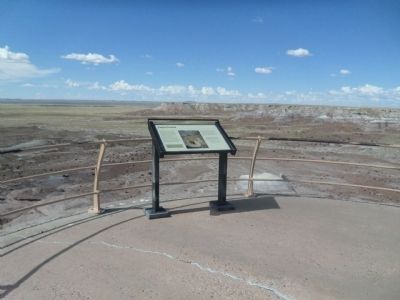
Near Jasper Forest Road, on the left when traveling west. Reported permanently removed.
The petrified wood strewn in the valley below was once encased in the bluffs around you. When erosional forces removed the softer rocks, the petrified wood tumbled and accumulated on the valley floor. Once filled with fallen logs, Jasper Forest . . . — — Map (db m269587) HM
On Blue Mesa Scenic Road 2.5 miles east of Petrified Forest Road, on the right when traveling east.
Just like visiting a grocery store, park paleontologists have a “wish list” of fossils that they would like to find. Petrified Forest's wish list included a bonebed of metoposaurid amphibians, the large, flat-headed amphibians that were one of . . . — — Map (db m286551) HM
On Petrified Forest Road 1.6 miles north of Blue Mesa Scenic Road, on the right when traveling north.
In the summer of 1921, heiress and explorer
Annie Montague Alexander and her research partner
Louise Kellogg set off into the badlands in front of
you. Intrigued by fossils discovered by John Muir
fifteen years earlier, Annie and Louise . . . — — Map (db m286363) HM
On Puerco Loop east of Petrified Forest Road, on the left when traveling south.
In this vast, nearly treeless landscape, it may sound strange to call the Civilian Conservation Corps (CCC) Roosevelt's Tree Army, but it has meaning here. President Franklin D. Roosevelt created the CCC in 1933 as part of his New Deal program for . . . — — Map (db m286291) HM
Near Petrified Forest Road, on the right when traveling north.
Across the Puerco River, the tracks of the Burlington Northern Santa Fe Railroad stretch for miles to the east and to the west. With no landforms or forests to block your view, you can see very long trains from beginning to end. More than 60 . . . — — Map (db m119934) HM
On Blue Mesa Scenic Road 2.5 miles east of Petrified Forest Road, on the right when traveling north.
Most people have never heard of a caecilian, but they are one of the most fascinating groups of animals alive today. They are one of the living groups of amphibians along with frogs, toads, salamanders, and newts. Caecilians spend nearly all their . . . — — Map (db m286544) HM
Nowhere else has so large and beautiful and in every way wonderful [a] section of the ancient…forests been discovered, and, after it is cared for by the Nation and made easily accessible, it will, I am sure, become one of the most . . . — — Map (db m269682) HM
Near Park Road, on the right when traveling north.
Geologists call eroded landscapes such as the Painted Desert "badlands." Summer thunderstorms and winter snowmelt carve the shale and sandstone into mazes of sharp ridges, steep hillsides, and deep V-shaped gullies. Practically waterless, badlands . . . — — Map (db m72923) HM
On Park Road, on the right when traveling west. Reported missing.
The colorful mesas, buttes, and badlands before you compose a natural work of art--the Painted Desert.
Wind and running water cut these features from the Chinle Formation deposited over 200 million years ago when this area was a vast inland . . . — — Map (db m72925) HM
Near Mummy Cave Overlook Road 1.5 miles east of North Rim Highway (Indian Route 64).
Discovery of two well-preserved mummies led members of an 1880 archeological expedition to call this site Mummy Cave. The traditional Navajo name for this impressive setting is Tséyaa Kini — House Under Rock. Anasazi lived here for nearly a . . . — — Map (db m170537) HM
Near Sliding House Overlook Road 1.6 miles north of South Rim Highway (Indian Route 7).
The Navajo know this prehistoric Anasazi village site as Kináázhoozhí, which means Sliding House. It is an apt description. The dwellings were constructed upon a steeply sloping ledge, and even the ingenious Anasazi builders were unable to keep many . . . — — Map (db m285791) HM
Near Mummy Cave Overlook Road 1.5 miles east of North Rim Highway (Indian Route 64).
Spanish soldiers may have fired from this very site during the infamous “massacre” of 1805. Their Navajo targets were huddled in the alcove below and to the left. Spanish accounts describe a day-long battle against Indians “…entrenched in an . . . — — Map (db m285844) HM
On School Bus Road at West Central Avenue (Arizona Route 260), on the right when traveling south on School Bus Road.
Once owned & often visited by film legend John Wayne, the ranch with the prominent white show barn came to fame in the 1940s as the Milky Way Hereford Ranch, owned by the Mars Candy Family. — — Map (db m36611) HM
On West 26 Bar Road 0.4 miles west of School Bus Road, on the right when traveling west.
This stone chimney is all that remains of a one room country school house that served pioneer Amity pop. 119 from the early 1880's until closing in April 1930. The Amity Cemetery & Amity Ditch are the only other remains of this early Mormon . . . — — Map (db m36614) HM
On Main Street 0.1 miles north of West 6th Street, on the right when traveling north.
An early 1900s adobe home built by the son of Eagar's first Mormon Bishop. Crosby, a major sheep & cattle rancher, was a railroad contractor who in 1917 laid the track for the Santa Fe Railroad north of here. — — Map (db m36626) HM
On School Bus Road at West Central Avenue (Arizona Route 260), on the left when traveling south on School Bus Road.
Below among the large cottonwood trees are the historic hdqtrs of Fred T. Colter's Cross Bar Ranch. Originally homesteaded in 1881 by Texan Micajah Phelps, Colter built the ranch into one of the largest cattle operations in Northeastern AZ. — — Map (db m36609) HM
On Main Street at West 2nd Street, on the left when traveling north on Main Street.
After the original frame school house burned in 1930, this building served Eagar's children for 53 years. Mothers prepared hot lunch across the street creating Eagar's own depression era "soup lines" at 5 cents a cup for the children. — — Map (db m36628) HM
On North Main Street, on the left when traveling north.
Completed in 1912 by J.P. LeSueur manager of the Eagar ACMI, this frame house with a skin of pressed metal wall sheathing is best known as home to one of the Colter Bros. important Round Valley Ranchers. — — Map (db m36643) HM
On East Central Avenue 0 miles east of Main Street, on the right when traveling east.
Built in the early 1900s by one of Eagar's prominent civic, religious & business leaders, this barn was constructed with wooden pegs & retains remarkable architectural integrity. The 2-story brick farmhouse no longer stands. — — Map (db m36640) HM
Built c.1892, this adobe structure once housed the Eagar School & later a bootlegger's still. Jepson purchased & enlarged the home in 1925 & moved his family from Alpine so his daughters could attend Round Valley High School. — — Map (db m36627) HM
On South Harless Street at West 8th Street, on the left when traveling north on South Harless Street.
On July 24, 1900, the Peter P. Rencher family arrived from Texas in four wagons & set about building their place in Eagar. Completed in 1913, this 5 bedroom, red brick Colonial Revival home was the crown jewel of their labors. — — Map (db m36618) HM
On South River Road 0.1 miles south of West Central Avenue, on the left when traveling south.
In 1878, this notorious outlaw gang clashed over dividing their loot. A heated gunfight occurred in the saddle of this hill and it is said that at least seven died. Here lie their last known remains. — — Map (db m36607) HM
On North Main Street at East 3rd Avenue, on the right when traveling north on North Main Street.
This handsome example of Colonial Revival architecture was home to the manager of Round Valley's ACMIs. His wife, the area's first registered nurse, boarded expectant mothers & teachers from the high school. — — Map (db m36645) HM
Welcome Hubbell Trading Post, established in 1878, is the oldest continually operated trading post on the Navajo reservation. J.L. Hubbell, whose family operated the trading post for nearly 90 years, was known among the Navajo as trustworthy and . . . — — Map (db m250806) HM
U.S. Route 66 (US 66 or Route 66), also known as the Will Rogers Highway, the Main Street of America or the Mother Road, was one of the original highways within the U.S. Highway System. US 66 was established on Nov. 11, 1926, with road signs erected . . . — — Map (db m184319) HM
On Grant Road south of Interstate 40, on the right when traveling south.
Take a quick scan of Arizona's history since statehood and you'll find many economic shifts, some in response to local booms and busts, others the result of national and global changes. In the 1920s, Arizona's five economic bedrocks were given the . . . — — Map (db m272265) HM
In November of 1776 a party of Spanish explorers and Indian guides passed through this area on their way to the Zuni Mission in what is now New Mexico. Franciscan Fathers, Francisco Atanasio Dominquez and Silvestre Velez De Escalante, had embarked . . . — — Map (db m36577) HM
On Interstate 40 at milepost 325, on the right when traveling east.
December 29, 1863 Arizona's Territorial officials took the oath of office during a snowstorm. Governor John N. Goodwin and other officials arriving from the east by wagon train, took their oaths of office and raised the U.S. flag "to establish a . . . — — Map (db m36334) HM
On Petrified Forest Road 1 mile north of U.S. Route 66 (Interstate 40), on the right when traveling north.
As you look out over the Painted Desert, you are only seeing a small portion of it. The Painted Desert extends over 7,500 square miles (19,425 km²) across northeastern Arizona. Because Petrified Forest National Park lies at its heart, the entire . . . — — Map (db m163185) HM
Native Americans' familiarity with local plants, minerals, rocks, and animals has helped sustain their cultures and make their homes in this beautiful-and challenging-landscape for more than 13,000 years.
Stones & Petrified Wood
The . . . — — Map (db m255956) HM
Strong lines, flat roofs, smooth, unadorned wall surfaces, and asymmetrical facades are the main characteristics of the International Style of architectural design. In the United States, Richard Neutra was a top architect on this style. In a daring . . . — — Map (db m255934) HM
Like the geologic layers of the Painted Desert, the lives of its residents layer upon each other in the form of rock art, structures, and artifacts. Ongoing research uncovers such dramatic evidence, constructing a timeline of continuous occupation . . . — — Map (db m255984) HM
What does silence sound like? Where do you go if there are no footsteps to follow? How does it feel to be in a place where day and night are the only times that matter? How does it feel to be totally immersed in nature?
The answers to . . . — — Map (db m255959) HM
On Petrified Forest Road at Old U.S. Route 66, on the right when traveling south on Petrified Forest Road.
Petrified Forest is the only National Park in the country with a portion of Historic Route 66 within its boundaries. You are currently standing where the Mother Road used to be, with the line of telephone poles paralleling its alignment through the . . . — — Map (db m163277) HM
Near Newspaper Spur, on the right when traveling west. Reported permanently removed.
More than 650 images adorn the boulders below – one of the largest concentrations of petroglyphs in the park.
People who farmed the Puerco River Valley 650 to 2,000 years ago pecked these petroglyphs onto the rocks, leaving a legacy etched in . . . — — Map (db m269591) HM
Near Petrified Forest Road 2 miles north of U.S. Route 66 (Interstate 40), on the right when traveling north.
Below you lies a black basalt which forms the rim of the plateau on which you stand. This hard basalt, called the Bidahochi Formation, was deposited by local volcanoes between 16 and five million years ago, and forms a protective cap over the soft, . . . — — Map (db m163270) HM
As a traveler to this spot, you are in good company. The Painted Desert offers a rich story of travelers, traders, and migrants passing near this location through the centuries. This natural travel corridor skirts the Rocky Mountains and other . . . — — Map (db m255985) HM
On Petrified Forest Road, on the left when traveling north. Reported missing.
You are standing near old Route 66. The line of the roadbed and the telephone poles in front of you mark the path of the famous "Main Street of America" as it passed through Petrified Forest National Park. From Chicago to Los Angeles, this heavily . . . — — Map (db m68904) HM
Enjoy the tranquility of the grassland as the trail leads you to scenic Tawa Point. The Tawa rail is a perfect place to stretch your legs after a long road trip
In Hopi ideology, Tawa refers to the Sun Spirit, the creator of the World. The . . . — — Map (db m255941) HM
Enjoy the tranquility of the grassland as the trail leads you to scenic Tawa Point. The Tawa rail is a perfect place to stretch your legs after a long road trip
In Hopi ideology, Tawa refers to the Sun Spirit, the creator of the World. The . . . — — Map (db m255948) HM
Iowa Congressman John Fletcher Lacey strongly advocated the protection of public lands and the resources within them. Lacey is most prominently known by his namesake of the Lacey Act of 1900, which protected both plants and wildlife. However, he . . . — — Map (db m255987) HM
From its perch on the Painted Desert rim, this building has seen many changes. First built by Herbert Lore in the early 1920s, it was made with the resource most abundant in the area: petrified wood! Look above the double doors and you will see a . . . — — Map (db m255958) HM
You have made a good decision to exit the interstate and visit Petrified Forest National Park. Beyond lies a 28 mile (45 km) road through the heart of the park, showcasing the Painted Desert, the world's largest and most colorful concentration of . . . — — Map (db m255927) HM
Think of a word to describe the semi-arid grassland in front of you. Is it lush, green, or forested? No, but those would be accurate descriptions for this land during the Triassic Period. At that time, this area resided on the supercontinent Pangea . . . — — Map (db m269588)
Step up to the railing ahead and you will see one of the park’s largest concentrations of petroglyphs. It is called Newspaper Rock for the more than 650 images pecked, carved, or incised in the boulders below. This unique site is part of a larger . . . — — Map (db m269681) HM
On East Main Street at South Papago Street, on the right when traveling east on East Main Street.
Built of adobe in 1901 with a cast iron front shipped from St. Louis, the ACMI was a branch of the Mormon Cooperative Store system for 17 yrs. It later served the community as a saloon, variety store & furniture emporium. — — Map (db m36652) HM
On Apache Street at Supai, on the left when traveling east on Apache Street.
Gregorio Baca bought this house from G. Becker in 1907 for his bride, Chona Ortega. It's walls are 16" thick adobe. The wealthy Bacas & Ortegas ran large herds of cattle & sheep on vast tracts of land in Concho, St. Johns & The R.V. area. — — Map (db m36383) HM
On Apache Street at Silva Lane, on the left when traveling east on Apache Street.
Part of the Spanish migration from northern New Mexico to Round Valley, Faustin Baldonado & his son Pedro bought this adobe home w/1 foot thick walls in the 1890's. Originally a cantina, Pedro added rooms when he married in 1900. — — Map (db m36382) HM
On East Main Street, on the right when traveling west.
The oldest continuously operated Ford dealership west of the Mississippi began in the west building in 1910. A pathfinding auto trip blazed the first "ocean to ocean highway" through here. — — Map (db m36379) HM
On West Airport Road at North Becker Lake Road, on the right when traveling west on West Airport Road.
In 1899, 14 year old Bertha Wahl was murdered here by a shepherd. Just south of here was the original Becker Store. Beyond lie the graves of the Becker family. Due west stood Henry Springer's Mercantile. — — Map (db m36647) HM
On East 4th Avenue at North Eagar Street, on the left when traveling west on East 4th Avenue.
H.T. Brawley, teacher and principal of R.V.H.S. began construction on this house in approximately 1925. The unfinished shell sold to the M.J. Wiltbank Family in 1935. M.J. & son Clive completed the home. Through the years teachers, newlyweds & . . . — — Map (db m36595) HM
On West Main Street (U.S. 180/191), on the right when traveling west.
Built c.1915 & originally called the Apache Theatre, this adobe movie house once showed silent flickers with a hand-cranked projector. Renamed the El Rio in 1937, Round Valley's first theatre is still operating with its original popcorn machine. — — Map (db m36381) HM
On U.S. 60 at milepost 392, on the right when traveling east.
Due south rises the 3rd tallest peak in AZ, revered by conservationist, Aldo Leopold Escudilla was home to Ike Clanton of OK Corral fame & Arizona's last grizzly bear. In fall, the north slope is golden with Aspen covering the 23,000 acre fire of . . . — — Map (db m36592) HM
On South Mountain Avenue (Business U.S. 180), on the right when traveling south.
On Dec. 25, 1886, James Hale was gunned down here in front of the Brighton Saloon. His accused was never brought to trial. In 1894 this site, then called Hunter's Hall, held the first Presbyterian services in the Round Valley. — — Map (db m36651) HM
On East Main Street, on the left when traveling west.
This 10 foot high, 5 ton statue cast by St. Louis sculptor August Leimbach is one of 12 identical monuments to the bold spirit of the pioneers erected in 1928-29 along the National Old Trails Road from Maryland to California. — — Map (db m36380) HM
On South River Road 0.3 miles south of West 4th Avenue, on the right when traveling west.
Just west on the river, W.R Milligan built the first grist mill & sawmill in Round Valley, later a brick kiln was added. Subsequent owners included the Udall Bros. & J.P. Rothlisberger who built the barn just ahead. — — Map (db m158475) HM
On North Papago Street 0.2 miles north of Apache Street, on the right when traveling north.
These log structures built by Thompson, a Danish convert to Mormonism, are Round Valley's oldest surviving buildings (1879). The cabin hosted the first Mormon services in Springerville. — — Map (db m36385) HM
On Apache Street at Supai, on the right when traveling east on Apache Street.
Begun as missions in the late 1800s, Community Presbyterian Church here, and St. Peter's, a block east, moved into these permanent homes built respectively of brick (1918) & adobe (1928). — — Map (db m36384) HM
On East Maricopa Drive 1.3 miles west of Gutierrez Street, on the left when traveling west.
Second cousin to famed "Texas John Slaughter", Peter Slaughter & his rough trailhands brought the first Texas cattle to the White Mountains c. 1881 and built his P Lazy S Ranch on the Black River. Pete is buried here with 3 sons & extended family. — — Map (db m228567) HM
On East Main Street 0.2 miles east of South Mountain Avenue, on the right when traveling east.
This bronze school bell summoned children until 1950. This 2 room adobe with high pitched roof & bell tower was added onto with brick, altering the entry & roof in 1927 & again in 1950. The school served the community 99 years. — — Map (db m36653) HM
On East Main Street (U.S. 191) east of South Mountain Avenue, on the right when traveling west.
1914 Honor roll 1918
Died
in the service of
their country
Richard W. Judd
born Dec 17, 1895 died April 12, 1918
Sidney Severens
born March 24, 1891 died June 7 1918
John H. Slaughter
born April 2, 1889 died October 27, 1918 . . . — — Map (db m195841) WM
On East Mohave Street at South Zuni Street, on the left when traveling west on East Mohave Street.
This park contains buildings restored by the White Mtn. Historical Society. They preserve early settler, Hispanic, & Native American cultures, along with farming, forestry and ranching heritage. — — Map (db m36594) HM
On South Mountain Avenue, on the right when traveling north.
Built during the great depression using native stone & W.P.A. labor, this twenty-bed facility finally opened in 1939 when a doctor agreed to come to Round Valley to finish, lease & run the hospital for 10 years. — — Map (db m36649) HM
On U.S. 191 at Arizona Route 81, on the right when traveling north on U.S. 191.
The original dam at this site was destroyed in the spring floods of April, 1915. With the loss of eight lives and severe damage to farmlands. It was rebuilt with loans from the state of Arizona. — — Map (db m136234) HM
On North Washington Street (U.S. 180 at milepost 368.7), on the right when traveling west.
The old "Bowery" was the first place of worship used by the members of the Latter Day Saints Church who came to St. Johns in 1879-1880. The Assembly Hall, located on the northwest corner of the public square was erected in 1882. It was built of logs . . . — — Map (db m36586) HM
The line separating the territories of New Mexico and Arizona was established as 32 degrees of longitude west of the Washington Meridian by Congressional Act of February 24, 1863, signed by President Abraham Lincoln.
The Washington Meridian . . . — — Map (db m36625) HM
Near BIA Route 100 (Route 100) 0.8 miles east of Route 12 (Arizona Route 264) when traveling north.
About the Navajo Code Talkers
During World War II the Japanese possessed the ability to break almost any American military code. Over 400 Navajos, with 29 being the original Navajo Code Talkers, stepped forward and developed the most . . . — — Map (db m51537) HM
Near Parking Lot BIA 100 MP 0 (Route 100 Connector Road) 0.8 miles east of Route 12 N (Arizona Highway 263).
In Remembrance of Our Warriors
Who Made the Ultimate Sacrifice and/or
Missing in Action,
They will never be forgotten
and to us they will always be young in our thoughts.
Nelson Lewis • Walter Nelson • Willie A. Notah • Edie . . . — — Map (db m27911) HM
Near South San Pedro Street north of East 5th Street.
These doors and windows were used to build a jail on the Northwest corner of Huachuca & 5th Street during April – May 1938. Needing jail material, Benson obtained approval to remove cell doors & windows from the no longer used jail in Courtland, . . . — — Map (db m48508) HM
On East 7th Street at South Gila Street, on the right when traveling east on East 7th Street.
This land was deeded to the City of Benson as a cemetery by the Pacific Improvement Company, the California based land company of the Southern Pacific Railroad, in March 1929.
Burial plots were sold to residents by the City of Benson and the . . . — — Map (db m48512) HM
Near Dragoon Springs on October 12, 1872, General O.O. Howard and Cochise, Chief of the Chiricahua Apache Indians, ratified a peace treaty ending years of warfare between that tribe and the white settlers. Cochise's stronghold was hidden deep in the . . . — — Map (db m27877) HM
On Naco Road east of Ok Street, on the right when traveling west.
Bisbee architect F. C. Hurst designed this building in 1906. Hurst had also designed the Bisbee Central School in 1905.
Designed as a combination city hall and fire station, the design was titled "City Fire Hall Building". The original . . . — — Map (db m195860) HM
On State Highway 80 1 mile east of Main Street, on the right when traveling east.
We Salute All Our Valiant Warriors Who Made The Supreme Sacrifice In Defending Our Freedom In World War II
Manuel Abasta, Jr. •
Frank L. Adams •
John Aira, Jr. •
Robert Bell •
Arthur Benko •
Josiah Bond •
Theodore R. Bozarth •
French . . . — — Map (db m249679) WM
Treasures of the Queen Mine
Malachite • Bisbee Blue Turquoise • Azurite
Bisbee Background
The discovery of ore in the Mule Mountains in 1877 began what was to become one of the world's largest copper producing centers. By 1905 over . . . — — Map (db m269193) HM
On Review Alley at Howell Avenue, on the left when traveling north on Review Alley.
In the early 1900's the rough edges of Bisbee's mining camps could be found here in notorious Brewery Gulch with its dozens of saloons, gambling halls and crib houses. The street got its name from a common activity in Bisbee's early days, . . . — — Map (db m28278) HM
On Arizona Street, on the right when traveling north. Reported missing.
The Calumet and Arizona Mining Company developed a new town site in this area in 1905 to ensure the continued success of its mining interests. Using the "City Beautiful" model, the new town site – Warren – provided affordable housing. In 1909 this . . . — — Map (db m48574) HM
On Arizona Route 92 0.5 miles north of Mason Addition Road, on the right when traveling north.
The City of Bisbee honors by this memorial her warriors who died in defense of the principles of American Democracy against enemies of freedom in World War I, World War II, the Korean War and the War in Vietnam that their patriotic sacrifice will be . . . — — Map (db m28279) WM
The extent of the power and influence of the copper mining industry in Bisbee's early history is evident here in the Copper Queen Plaza. The buildings were built by the Copper Queen Consolidated Mining Company, later to become Phelps Dodge . . . — — Map (db m28276) HM
On Arizona Route 80 at milepost 341, 0.2 miles west of Main Street, on the right when traveling west. Reported missing.
.......On this site in the year of 1877, Sgt. Jack Dunn,
with a detail of the Tenth U.S. Cavalry pursuing renegade Apaches, discovered rich out croppings of copper & silver ore. The discovery led to the staking of the first mining claim & the . . . — — Map (db m48561) HM
On State Highway 80 1 mile east of Main Street, on the right when traveling east.
The pit was created bit by bit over a period of almost 60 years, through three mining phases:
1. The Sacramento Pit (mined 1917-1929)
2. The Lavender Pit (mined 1950s-1970s)
3. The Holbrook Extension (mined late 1960s-1970s)
Mining . . . — — Map (db m249681) HM
On North Old Divide Road 0.5 miles east of Route 80, on the right when traveling east.
Front of obelisk
Road Constructed by
Prison Labor 1913-14
Board of Control
Geo. W.P. Hunt Governor
C. Callaghan Auditor
U.R. Osburn Member
R.E. Sims Supt of Prison
Lamar Orb
State Engineer
Right side of obelisk . . . — — Map (db m48552) HM
This building was the general office for the Bisbee operations of Phelps Dodge Corporation from 1895 to 1961.
In 1971 it was given to the City of Bisbee by Phelps Dodge and was designated as a National Historic Site by the National Park . . . — — Map (db m28275) HM
Rich copper mines transformed Bisbee from a rough camp in the late 1800's to one of the largest and most cultured cities between St. Louis and San Francisco by the early 1900's. From the time of the discovery of rich surface deposits in 1877 until . . . — — Map (db m148689) HM
On Arizona Route 80 at milepost 343, on the right when traveling east.
This open pit mine is named
The Lavender Pit
In honor of
Harrison M. Lavender
1890 – 1952
Who as vice president and general manager of Phelps Dodge Corporation conceived and carried out this plan for making the . . . — — Map (db m28281) HM
On Arizona Street at Ruppe Avenue, on the right when traveling south on Arizona Street.
Originally constructed of wood in 1908, the Warren Ball Park is the oldest in the state of Arizona and stands as testimony to Bisbee's rich heritage. The Warren Company, a subsidiary of the Calumet & Arizona and Pittsburgh & Superior Mining . . . — — Map (db m48573) HM
On State Highway 80 1 mile east of Main Street, on the right when traveling east.
You are looking at the Lavender Pit copper mine. Open-pit mining at Bisbee began in 1917 and ended in 1974. The pit is 4,000 feet wide (north to south), 5,000 feet long, and 850 feet deep at its maximum.
Concentrator
Large, circular . . . — — Map (db m249705) HM
On Main Street at Tombstone Canyon, on the right when traveling south on Main Street.
Invited by State Suffrage Assn, Laura G. Cannon spoke to crowd of working men here Sept. 26, 1912. AZ women won right to vote that November. — — Map (db m249433) HM
On State Highway 80 1 mile east of Main Street, on the right when traveling east.
We needed copper! America's Industrial Revolution, the Age of Electricity, and the Information Revolution wouldn't have happened without it. Copper is a superb conductor of electricity. Every house, every car, every electronic gizmo from . . . — — Map (db m249684) HM
On Apache Pass Road 6 miles east of Route 181, on the left when traveling east.
The Road Below
We started through Apache Pass, over awful roads, up hill and down. We had to tie the wagon wheels with ropes and then in some places, the men had to stand on the wheels to keep them from turning over. Every man who could . . . — — Map (db m101004) HM
On Apache Pass Road 13 miles south of Business Interstate 10, on the left when traveling west.
There are two markers on a single kiosk
Apache Pass is a low divide separating the massive Chiricahua Mountains from the Dos Cabezas Mountains. This landscape formed a rugged corridor through which people and goods were moved. The Pass . . . — — Map (db m100810) HM
Near Fort Bowie Trail 1.2 miles south of Apache Pass Road.
Pottery fragments found around Apache Spring suggest it was used by prehistoric Mogollon Indians before the Apache arrived. Journals of early Spanish explorers described Apache trails radiating from the spring. The Butterfield Trail was constructed . . . — — Map (db m100823) HM
After the events on the afternoon of February 4th, Bascom ordered the command to move toward, and fortify, the stage station. According to Sergeant Daniel Robinson:
“Our wagons were placed end to end, forming a semicircle, covering one . . . — — Map (db m100815) HM
Near Fort Bowie Trail 1.5 miles south of Apache Pass Road.
This massive adobe structure was among the earliest built at the new fort. By the mid-1880s, it had a shingled and pitched roof, attractive porches, kerosene lamps, and landscaping. The kitchen was behind the barracks; the mess hall adjacent.
. . . — — Map (db m100998) HM
Palatable food during the fort's early days was a constant problem; the soil was poor quality, lacking nutrients, and other sources of fresh food were distant. Though neighboring ranches supplied some vegetables and meats, they were still a day's . . . — — Map (db m100956) HM
On West Fifth Street, on the left when traveling west.
[Side 1: In English :]
September 4-8, 1986, Arizonans marked the return of the Chiricahua Ex-Prisoners of War and their descendants in ceremonies that completed a spiritual circle. We remembered and reflected on the clash between . . . — — Map (db m42513) HM
1848 entries matched your criteria. The first 100 are listed above. Next 100 ⊳