437 entries match your criteria. The first 100 are listed. ⊳
U.S. Route 66 Historical Markers
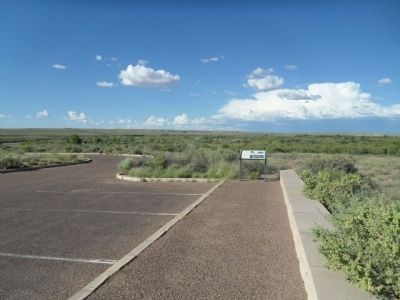
By Denise Boose, September 2, 2013
Santa Fe Railroad Marker
1 ► Arizona, Apache County, Adamana — Santa Fe Railroad — Petrified Forest National Park — National Park Service, U.S. Department of the Interior —  |
| Near Petrified Forest Road, on the right when traveling north. | |||
| 2 ► Arizona, Apache County, Lupton — Arizona Highways — Sunset Point Rest Area — |
| Near Interstate 40 at milepost 359. | |||
| 3 ► Arizona, Apache County, Petrified Forest National Park — Highway of Dreams — |
| On Petrified Forest Road at Old U.S. Route 66, on the right when traveling south on Petrified Forest Road. | |||
| 4 ► Arizona, Apache County, Petrified Forest National Park — Route 66 |
| On Petrified Forest Road, on the left when traveling north. Reported missing. | |||
| 5 ► Arizona, Coconino County, Flagstaff — Downtowner — 1921 - 1935 — |
| On South San Francisco Street, on the left when traveling south. | |||
| 6 ► Arizona, Coconino County, Flagstaff — Museum Club — Route 66 Roadside Attraction — Flagstaff, Arizona — |
| On East Route 66 (U.S. 180) west of Fanning Drive, on the right when traveling west. | |||
| 7 ► Arizona, Coconino County, Flagstaff — Route 66 Trail — |
| On East Route 66 at Mall Way, on the right when traveling west on East Route 66. | |||
| 8 ► Arizona, Coconino County, Flagstaff — The Mother Road — |
| On Route 66, on the right when traveling east. | |||
| 9 ► Arizona, Coconino County, Flagstaff — The Mother Road — Heading West — |
| On U.S. 89, on the right when traveling east. | |||
| 10 ► Arizona, Coconino County, Flagstaff — The Museum Club — Flagstaff's Historic Route 66 Landmark — |
| On East Route 66 (U.S. 180) 0.1 miles east of North Park Drive, on the left when traveling east. | |||
| 11 ► Arizona, Coconino County, Flagstaff, Southside — Route 66 Trail — |
| On Route 66, on the right when traveling east. | |||
| 12 ► Arizona, Coconino County, Williams — Adam's Grocery — |
| On Bill Williams Avenue / Route 66 west of North 1st Street, on the right when traveling east. | |||
| 13 ► Arizona, Coconino County, Williams — DelSue Motor Inn — |
| On East Bill Williams Avenue (U.S. 66) east of South Taber Street, on the right when traveling east. | |||
| 14 ► Arizona, Coconino County, Williams — Last Town Bypassed By I-40 — |
| On West Route 66 (Route 66), on the left when traveling east. | |||
| 15 ► Arizona, Coconino County, Williams — Pollock Building — |
| On Grand Canyon Avenue / West Route 66 east of North 3rd Street, on the left when traveling east. | |||
| 16 ► Arizona, Coconino County, Williams — Route 66 — Gateway to the Grand Canyon — |
| On East Bill Williams Avenue (Old U.S. 66) west of North Pine Street, on the right when traveling west. | |||
| 17 ► Arizona, Coconino County, Williams — Welcome to Williams — Gateway to the Grand Canyon — |
| Near West Railroad Avenue west of North Grand Canyon Boulevard. | |||
| 18 ► Arizona, Coconino County, Williams — Williams, Arizona — |
| On Grand Canyon Avenue at North Pine Street, on the right when traveling east on Grand Canyon Avenue. | |||
| 19 ► Arizona, Coconino County, Winslow — Meteor City Trading Post, Winslow, Arizona — Route 66 Roadside Attraction |
| On Interstate 40 Frontage Road west of Dennison T I, on the left when traveling west. Reported missing. | |||
| 20 ► Arizona, Mohave County, Golden Valley — Cool Springs Station — |
| On Oatman Highway (County Route 10), on the right when traveling west. | |||
| 21 ► Arizona, Mohave County, Kingman — The Powerhouse, Kingman, Arizona — Route 66 Roadside Attraction — |
| On West Andy Devine Avenue (Old U.S. 66) west of North 1st Street, on the left when traveling west. | |||
| 22 ► Arizona, Mohave County, Oatman — Durlin Hotel — |
| On Oatman-Topock Highway, on the right when traveling north. | |||
| 23 ► Arizona, Mohave County, Oatman — Gold Mining Ghost Town, Oatman, Arizona — Route 66 Roadside Attraction — |
| On Oatman Highway (Old U.S. 66) at Rock Hound Hill Road on Oatman Highway. | |||
| 24 ► Arizona, Mohave County, Oatman — Oatman — Arizona Territory — "The Ghost Town that refuses to die!" — |
| On Main Street, on the right when traveling north. | |||
| 25 ► Arizona, Mohave County, Oatman — Roads for Adventure — |
| On Oatman Highway (County Road 10) 9 miles east of Oatman, on the right when traveling west. | |||
| 26 ► Arizona, Mohave County, Peach Springs — Dallas Quasula Sr. — October 28, 1932 - August 27, 2010 — |
| On Historic Route 66 (Arizona Route 66) at Diamond Creek Road, on the right when traveling west on Historic Route 66. | |||
| 27 ► Arizona, Mohave County, Peach Springs — Historic John Osterman Gas Station |
| On Historical Route 66 (U.S. 66 at milepost 127), at Diamond Creek Road (U.S. 66), on the right when traveling east on Historical Route 66. Reported missing. | |||
| 28 ► Arizona, Mohave County, Peach Springs — Historic Peach Springs Trading Post — |
| On Historic Route 66 (U.S. 66 at milepost 127), 0.1 miles west of Diamond Creek Road, on the right when traveling west. | |||
| 29 ► Arizona, Navajo County, Winslow — La Posada Hotel, Winslow, Arizona — Route 66 Roadside Attraction — |
| On East 2nd Street (Business Interstate 40) east of Route 87, on the right when traveling east. | |||
| 30 ► Arizona, Navajo County, Winslow — Standin’ on the Corner Park, Winslow, Arizona — Route 66 Roadside Attraction — |
| On North Kinsley Avenue at West 2nd Street (Business Interstate 40), on the right when traveling south on North Kinsley Avenue. | |||
| 31 ► Arizona, Navajo County, Winslow — The Winslow Bridge — |
| On 2nd Street (Arizona Route 66), on the left when traveling east. | |||
| 32 ► Arizona, Yavapai County, Ash Fork — Ash Fork — Founded 1882 — |
| On Lewis Avenue (Business Route 40) at 5th Street, on the right when traveling west on Lewis Avenue. | |||
| 33 ► Arizona, Yavapai County, Ash Fork — Ash Fork Maintenance Camp #1 — |
| Near West Old Route 66. | |||
| 34 ► Arizona, Yavapai County, Ash Fork — Ash Fork, Arizona / The Coming of Route “66” — |
| On Lewis Avenue (Business Route 40) at 5th Street when traveling west on Lewis Avenue. | |||
| 35 ► Arizona, Yavapai County, Peach Springs — Grand Canyon Caverns, Peach Springs, Arizona — Route 66 Roadside Attraction — |
| On Grand Canyon Caverns Road, on the right when traveling west. | |||
| 36 ► Arizona, Yavapai County, Seligman — Delgadillo's Snow Cap — Route 66 Roadside Attraction |
| On Old State Highway 66. Reported permanently removed. | |||
| 37 ► Arizona, Yavapai County, Seligman — Delgadillo's Snow Cap, Seligman, Arizona — Route 66 Roadside Attraction — |
| On West Old Highway 66 (Old U.S. 66) at Lamport Street, on the right when traveling east on West Old Highway 66. | |||
| 38 ► California, Los Angeles County, Duarte — The Trails Restaurant — |
| On East Huntington Drive (Old U.S. 66) west of Waterfall Way, on the right when traveling west. | |||
| 39 ► California, Los Angeles County, Los Angeles, Downtown Los Angeles — Original Terminus of Route 66 — Route 66 Roadside Attraction — 7th and Broadway, Los Angeles — |
| On Broadway at 7th Street, on the right when traveling south on Broadway. | |||
| 40 ► California, Los Angeles County, Los Angeles, Highland Park — Route 66 & Chicken Boy — |
| On Figueroa Street north of Avenue 55, on the right when traveling north. | |||
| 41 ► California, Los Angeles County, Santa Monica — Will Rogers Highway — Main Street of America — Route 66 — |
| On Ocean Avenue at Santa Monica Boulevard, on the right when traveling east on Ocean Avenue. | |||
| 42 ► California, Los Angeles County, South Pasadena — 3 — Oaklawn Bridge & Waiting Station — Route 66 Roadside Attraction — South Pasadena, California — |
| On Fair Oaks Avenue at Oaklawn Avenue, on the right when traveling south on Fair Oaks Avenue. | |||
| 43 ► California, Los Angeles County, South Pasadena — Rialto Theatre — |
| On Fair Oaks Avenue 0.1 miles south of Mission Street, on the right when traveling south. | |||
| 44 ► California, San Bernardino County, Amboy — Albert Okura — 12/03/51 - 1/27/23 — The Man who Saved Amboy — |
| On National Trails Highway (Route 66) near Amboy Road, on the right when traveling east. | |||
| 45 ► California, San Bernardino County, Amboy — 126 — Amboy and Roy's Café — Route 66 — |
| On National Trails Highway - Historic Route 66 near Old Amboy Road, on the right when traveling west. | |||
| 46 ► California, San Bernardino County, Amboy — 69 — Old Route 66 — |
| On National Trails Highway at Cadiz Road, on the right when traveling west on National Trails Highway. | |||
| 47 ► California, San Bernardino County, Amboy — The Story of Route 66 — |
| On National Trails Highway (Old Route 66) 16.5 miles east of Amboy, CA., on the right when traveling east. | |||
| 48 ► California, San Bernardino County, Barstow — Barstow Route 66 — |
| On East Main Street, on the right when traveling west. | |||
| 49 ► California, San Bernardino County, Barstow — Barstow, California — Route 66 Roadside Attraction — |
| On North 1st Avenue west of Lawrence Dale Drive, on the left when traveling south. | |||
| 50 ► California, San Bernardino County, Barstow — General Beale Uses Camels — |
| On Cozy Avenue at 2nd Avenue, on the right when traveling west on Cozy Avenue. | |||
| 51 ► California, San Bernardino County, Barstow — History of MCLB Barstow & U.S. Route 66 — |
| On East Main Street east of Interstate 40, on the left when traveling east. | |||
| 52 ► California, San Bernardino County, Barstow — Marine Corps Logistic Base — Established 1942 — |
| On East Main Street at E Main St and N Seventh Ave, on the right when traveling west on East Main Street. | |||
| 53 ► California, San Bernardino County, Barstow — Old National Trails Hwy — |
| On East Main Street (Business Interstate 15), on the right when traveling east. | |||
| 54 ► California, San Bernardino County, Chambless — Road Runner’s Retreat — Route 66 Roadside Service Areas — |
| On National Trails Highway (U.S. 66) 1 mile east of Kelbaker Road, on the right when traveling east. | |||
| 55 ► California, San Bernardino County, Goffs — 65 — Goffs Schoolhouse — 1914 — |
| On Lanfair Road 0.1 miles north of Goffs Road, on the left when traveling north. | |||
| 56 ► California, San Bernardino County, Helendale — America’s Main Street — Route 66 — |
| On National Trails Highway at Vista Road, on the left when traveling north on National Trails Highway. | |||
| 57 ► California, San Bernardino County, Hesperia — 13 — Rolar’s “66” Gas Station — 1940’s — |
| On Mariposa Road 0.2 miles north of Joshua Street, on the left when traveling north. | |||
| 58 ► California, San Bernardino County, Keenbrook — 146 — Blue Cut — |
| On Cajon Boulevard, on the right when traveling east. | |||
| 59 ► California, San Bernardino County, Needles — Historic Route 66 — in the Heart of Mojave — |
| On 5 Mile Road west of Interstate 40, on the left when traveling west. | |||
| 60 ► California, San Bernardino County, Needles — Needles El Garces Train Station, Needles, California — Route 66 Roadside Attraction — |
| On Quinn Court at G Street, on the right when traveling west on Quinn Court. | |||
| 61 ► California, San Bernardino County, Newberry Springs — Bagdad Café — Newberry Springs, California — Route 66 Roadside Attraction — |
| On National Trails Highway 2 miles west of Fort Cady Road, on the right when traveling west. | |||
| 62 ► California, San Bernardino County, Newberry Springs — 143 — Newberry Springs — |
| On National Trails Highway, on the right when traveling west. | |||
| 63 ► California, San Bernardino County, Phelan — Camp Cajon — |
| On Wagon Train Road (Old U.S. 66) 0.5 miles south of California Route 138, on the right when traveling south. | |||
| 64 ► California, San Bernardino County, Phelan — Camp Cajon Monument — Historic Site — |
| On Wagon Train Road 0.5 miles south of Highway 138, on the right when traveling south. | |||
| 65 ► California, San Bernardino County, Phelan — 576 — Santa Fe and Salt Lake Trail — 1849 — |
| On Wagon Train Road 0.5 miles south of California Route 138, on the right when traveling south. | |||
| 66 ► California, San Bernardino County, Rancho Cucamonga — Cucamonga Service Station — |
| On Foothill Boulevard just west of Archibald Avenue, on the right when traveling west. | |||
| 67 ► California, San Bernardino County, Rancho Cucamonga — 490 — Cucamonga Winery — |
| On Foothill Boulevard (Route 66) at Vineyard Avenue, on the right when traveling west on Foothill Boulevard. | |||
| 68 ► California, San Bernardino County, Rancho Cucamonga — El Camino Real Bells — |
| On Foothill Boulevard (Route 66) 0.2 miles east of Hellman Avenue, on the right when traveling west. | |||
| 69 ► California, San Bernardino County, Rancho Cucamonga — Historic Pavement — Route 66 — |
| On Foothill Boulevard east of Baker Avenue, on the left when traveling east. | |||
| 70 ► California, San Bernardino County, Rancho Cucamonga — Magic Lamp Inn — Route 66 Roadside Attraction — |
| On Foothill Boulevard 0.1 miles east of Grove Avenue, on the right when traveling east. | |||
| 71 ► California, San Bernardino County, Rancho Cucamonga — Red Hill — City of Rancho Cucamonga Historic Point of Interest — |
| On Foothill Boulevard (Route 66) at Vineyard Avenue, on the right when traveling west on Foothill Boulevard. | |||
| 72 ► California, San Bernardino County, San Bernardino — First McDonalds, San Bernardino, California — Route 66 Roadside Attraction — |
| On North E Street near West 14th Street, on the right when traveling south. | |||
| 73 ► California, San Bernardino County, San Bernardino — La Plaza Park, San Bernardino, California — Route 66 Roadside Attraction |
| On North Mount Vernon Avenue (Old U.S. 66), on the right when traveling north. Reported missing. | |||
| 74 ► California, San Bernardino County, San Bernardino — Mitla Café — Route 66 Roadside Attraction — San Bernardino, California — |
| On North Mount Vernon Avenue (Old U.S. 66) north of West 6th Street, on the right when traveling south. | |||
| 75 ► California, San Bernardino County, San Bernardino — Route 66 — |
| Near North E Street south of West 14th Street. | |||
| 76 ► California, San Bernardino County, San Bernardino — World’s First McDonald’s — |
| On North E Street at West 14th Street, on the left when traveling north on North E Street. | |||
| 77 ► California, San Bernardino County, San Bernardino, Sbhs — Site of Original McDonald's — |
| On North E Street. | |||
| 78 ► California, San Bernardino County, Victorville — California Route 66 Museum, Victorville, California — Route 66 Roadside Attraction — |
| On D Street (Business Interstate 15) east of 5th Street, on the right when traveling east. | |||
| 79 ► California, San Bernardino County, Victorville — 142 — Emma Jean's — |
| On National Trails Highway (County Route 66) 1.3 miles north of Interstate 15, on the left when traveling north. | |||
| 80 ► Illinois, Cook County, Berwyn — A Road Well Traveled — The Ogden Avenue Corridor — |
| On Ogden Avenue at Elmwood Avenue, on the right when traveling east on Ogden Avenue. | |||
| 81 ► Illinois, Cook County, Berwyn — Automobile Love Affair — A Traveling Showroom — |
| On Ogden Avenue at Clarence Avenue, on the right when traveling west on Ogden Avenue. | |||
| 82 ► Illinois, Cook County, Berwyn — Berwyn Car Spindle — Artwork Along Route 66 — |
| On Ogden Avenue (Old U.S. 66) at Lombard Avenue, on the right when traveling east on Ogden Avenue. | |||
| 83 ► Illinois, Cook County, Berwyn — Berwyn, Illinois — Welcome to Route 66 Illinois — |
| On Ogden Avenue west of South Lombard Avenue, on the right when traveling west. | |||
| 84 ► Illinois, Cook County, Berwyn — Cigars and Stripes — Route 66 Artwork — |
| On Ogden Avenue (Old U.S. 66) west of Wesley Avenue, on the right when traveling west. | |||
| 85 ► Illinois, Cook County, Berwyn — Cruising the Strip — Route 66 on Ogden Avenue — |
| On Ogden Avenue at Wenonah Avenue, on the right when traveling west on Ogden Avenue. | |||
| 86 ► Illinois, Cook County, Berwyn — Eating on the Run — Fast Food on Ogden Avenue — |
| On Ogden Avenue at Maple Avenue, on the right when traveling east on Ogden Avenue. | |||
| 87 ► Illinois, Cook County, Chicago, Illinois Medical District — Route 66 Landmark / Punto de Referencia de la Ruta 66 — Tri-Taylor — Local Neighborhood Impact / Impacto en el Vecindario Local — |
| On West Ogden Avenue at South Damen Avenue on West Ogden Avenue. | |||
| 88 ► Illinois, Cook County, Chicago, North Lawndale — Route 66 Landmark / Punto de Referencia de la Ruta 66 — Douglass Park — Local Neighborhood Impact / Impacto en el Vecindario Local — |
| On West Ogden Avenue (U.S. 66) at South Albany Avenue, on the right when traveling west on West Ogden Avenue. | |||
| 89 ► Illinois, Cook County, Chicago, North Lawndale — Route 66 Landmark / Punto de Referencia de la Ruta 66 — North Lawndale — Local Neighborhood Impact / Impacto en el Vecindario Local — |
| On West Ogden Avenue (U.S. 66) at South Hamlin Avenue, on the left when traveling west on West Ogden Avenue. | |||
| 90 ► Illinois, Cook County, Chicago, The Loop District — Chicago Route 66 / Ruta 66 de Chicago — Start of the Trail / Inicio de la Ruta — History of Route 66 / Historia de la Ruta 66 — |
| On South Michigan Avenue at East Adams Street (U.S. 66), on the right when traveling south on South Michigan Avenue. | |||
| 91 ► Illinois, Cook County, Chicago, The Loop District — Field Building — Graham, Anderson, Probst & White, architects; 1928-34 — Chicago Landmark — |
| On South La Salle Street at West Adams Street (U.S. 66), on the right when traveling north on South La Salle Street. | |||
| 92 ► Illinois, Cook County, Chicago, West Loop — Lou Mitchell's Restaurant & Bakery, Chicago, Illinois — Route 66 Roadside Attraction |
| On West Jackson Boulevard east of North Jefferson Street, on the right when traveling east. Reported permanently removed. | |||
| 93 ► Illinois, Cook County, Countryside — 1925 Erie "Type B" Steam Shovel — |
| On Joliet Road (Old U.S. 66) 0.2 miles west of La Grange Road (U.S. 12/20/45), on the right when traveling east. | |||
| 94 ► Illinois, Cook County, Countryside — This was "Countryside" — Farms and Quarries — |
| On Joliet Road west of South LaGrange Road (U.S. 45), on the right when traveling north. | |||
| 95 ► Illinois, DuPage County, Willowbrook — Dell Rhea's Chicken Basket — 66 Roadside Attraction — |
| On North Frontage Road south of S Quincy Road, on the right when traveling east. | |||
| 96 ► Illinois, DuPage County, Willowbrook — Get Your "Chicks" on Rte 66 — The Chicken Basket — |
| On North Frontage Road south of South Quincy Street, on the right when traveling east. | |||
| 97 ► Illinois, Grundy County, Gardner — In Appreciation — |
| On East Mazon Street at North Center Street on East Mazon Street. | |||
| 98 ► Illinois, Livingston County, Cayuga — Meramec Caverns Barn — 66 Roadside Attraction — |
| Near North 1810 East Road (Old U.S. 66). | |||
| 99 ► Illinois, Livingston County, Dwight — A Well Connected Village — Historic Dwight — |
| On Prairie Avenue at Chippewa Street on Prairie Avenue. | |||
| 100 ► Illinois, Livingston County, Dwight — Ambler-Becker Texaco Station, Dwight, Illinois — Route 66 Roadside Attraction |
| On West Waupansie Street (Old U.S. 66) at West Mazon Street (Illinois Route 17), on the right when traveling north on West Waupansie Street. Reported permanently removed. | |||
437 entries matched your criteria. The first 100 are listed above. Next 100 ⊳