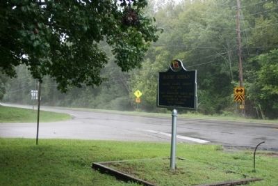
By Tim Carr, July 30, 2010
Blount Springs Marker
| On U.S. 31 at County Road 7, on the right when traveling north on U.S. 31. |
| On Local Road 26 at Dunn Lane, on the right when traveling east on Local Road 26. |
| On Main Street (U.S. 231) at Lee Street West, on the left when traveling north on Main Street. |
| On Lee Street (County Road 26), on the right when traveling west. |
| On College Street at Church Street, on the right when traveling north on College Street. |
| On Local Road 26 at Dunn Lane, on the right when traveling east on Local Road 26. |
| On Main Street (U.S. 231) 0.1 miles east of Bailey Street, on the right when traveling south. |
| On Main Street (U.S. 231) north of Bailey Street, on the right when traveling south. Reported permanently removed. |
| Near Main Street South (U.S. 231) at Lee Street, on the right when traveling south. |
| On Dallas Loop Road 0.1 miles north of Alabama Highway 79, on the left when traveling north. |
| On County Route 27 at Fred Young Road, on the right when traveling south on County Route 27. |
| On State Highway 79 at Hornet Drive, on the right when traveling south on State Highway 79. |
| On Town Hall Road, on the left when traveling east. |
| On Alabama Route 160 at Nectar Bridge Road, on the right when traveling north on Alabama Route 160. |
| On County Route 20, on the left when traveling north. |
| On County Road 36 0.1 miles north of New Home Church Road, on the right when traveling north. |
| On Second Avenue East (US Highway 231) at 4th Street North, on the right when traveling west on Second Avenue East (US Highway 231). |
| On 6th Street South (U.S. 231) at Champion Road, on the right on 6th Street South. |
| On 2nd Street South 0.2 miles south of Highway 75, on the right when traveling south. |
| On Sand Valley Road 0.3 miles north of U.S. 231, on the left when traveling north. |
| On Ingram Avenue East at 2nd Street South, on the right when traveling east on Ingram Avenue East. |
| On Alabama Route 75, on the left when traveling north. |
| On County Road 251 0.1 miles north of County Road 714, on the right when traveling north. |
| On County Road 251 0.1 miles north of County Road 714, on the left when traveling north. |
| On County Road 251 0.1 miles north of County Road 714, on the right when traveling north. |
| On Alabama Route 273 at County Route 275, on the right when traveling south on Alabama Route 273. |
| On State Highway 9 0.1 miles west of Route 35, on the right when traveling west. |
| On Old Alabama Route 9 west of Sewell Ferry Road, on the right when traveling west. |
| On County Road 92 0.3 miles east of County Road 585 when traveling east. |
| On Cedar Bluff Road at West Main Street (Business U.S. 411), on the right on Cedar Bluff Road. |
| On Cedar Bluff Road (State Road 283) north of West Main Street (Business U.S. 411), in the median. |
| On East Main Street (Business U.S. 411) at Cedar Bluff Road, on the left when traveling east on East Main Street. |
| On East Main Street (Business U.S. 411) at Iris Drive, on the right when traveling west on East Main Street. |
| On Cedar Bluff Road (State Road 283) north of West Main Street (Business U.S. 411), in the median. |
| On College Street (Route 20) 0.1 miles south of South River Road, on the right when traveling north. |
| On Jackson Drive east of Bay Springs Road, on the left when traveling east. |
| On South River Street south of 2nd Street, on the left when traveling south. |
| On West Main Street (Business U.S. 411) at Tol Street, on the right when traveling west on West Main Street. |
| On County Road (County Route 43), on the right. |
| On East Main Street (Business U.S. 411) at Cedar Bluff Road, on the left when traveling east on East Main Street. |
| On West Main Street at Watson Drive, on the right when traveling west on West Main Street. |
| On East Main Street (Business U.S. 411) at Iris Drive, on the right when traveling east on East Main Street. |
| On College Street (County Route 20) 0.1 miles south of South River Road, on the right when traveling north. |
| On West Main Street (Business U.S. 411) at College Street, on the left when traveling west on West Main Street. Reported missing. |
| On County Route 15 south of County Route 830, on the right when traveling south. |
| On County Route 99 at County Route 95, on the right when traveling north on County Route 99. |
| On County Road 97 0.2 miles north of Main Street (State Route 68), on the left when traveling north. |
| On Riverside Lane at Canyon Drive ( Route 35), on the left when traveling west on Riverside Lane. |
| On Shinbone Valley Road (County Road 127) 0.8 miles north of Jamestown Rd (County Route 15), on the right when traveling south. |
| Near County Road 41 near County Road 99. |
| On State Highway 273 at County Road 81, on the left when traveling north on State Highway 273. |
| On Canyon Drive (Alabama Route 35) at Main Street ( Route 68), on the right when traveling south on Canyon Drive. |
| On Alabama Route 273 near County Road 81, on the left when traveling north. |
| On Main Street (Alabama Route 68) at College Street, on the left when traveling north on Main Street. |
| On County Road 15 at State Route 35, on the right when traveling north on County Road 15. |
| On U.S. 411 at John L Foster Drive (County Highway 20), on the right when traveling north on U.S. 411. |
| On Industrial Boulevard (Alabama Route 68) at Lokey Street on Industrial Boulevard. Reported missing. |
| On County Route 48 0.2 miles south of County Route 600, on the left when traveling south. |
| On Blue Pond Road (State Highway 273) at County Road 365, on the right when traveling south on Blue Pond Road. |
| On Sand Rock Avenue at Wildcat Street, on the left when traveling north on Sand Rock Avenue. |
| On County Route 33 at County Route 29, on the left when traveling south on County Route 33. |
| On County Route 8 at Highway 9, on the right when traveling east on County Route 8. |
| Near County Route 587 at Troy Lane, on the right when traveling south. |
| On County Route 29 at County Route 45, on the right when traveling north on County Route 29. |
| On County Route 8 3 miles east of County Route 45, on the left when traveling east. |
| On County Road 29 at County Road 27, on the left when traveling east on County Road 29. |
| On County Road 29 at County Road 8, on the right when traveling north on County Road 29. |
| On Old Lee Highway (County Road 20) at Garner Lane, on the right when traveling west on Old Lee Highway. |
| Near Natchez Trace Parkway (at milepost 327.3), 1.4 miles east of N Pike (County Route 21), on the left when traveling east. |
| Near Cedar Lane (County Road 15) 0.7 miles south of U.S. 72, on the right when traveling east. |
| Near Natchez Trace Access Road (at milepost 327.3), 0.4 miles west of Natchez Trace Parkway, on the right when traveling west. |
| On Middle School Road north of Old Lee Highway (County Road 20), on the left when traveling north. |
| Near Natchez Trace Parkway (at milepost 327.3), 1.4 miles east of N Pike (County Route 21), on the left when traveling east. |
| On Mulberry Lane 0.4 miles east of Moody Lane, on the left when traveling east. |
| Near Natchez Trace Parkway (at milepost 327.3), 1 mile north of N. Pike (County Road 21). |
| On Park Road 0.4 miles north of Natchez Trace Parkway, on the left when traveling east. |
| Near Natchez Trace Parkway (at milepost 327.3), 1 mile north of N. Pike (County Road 21). |
| On Main Street close to 1st Street, on the right when traveling north. |
| Near Natchez Trace Access Road (at milepost 320.3), 0.4 miles north of Natchez Trace Parkway (U.S. 72), on the left when traveling north. |
| On Mhoontown Road 1.1 miles east of North Pike, on the right when traveling north. |
| Near Natchez Trace Parkway (at milepost 327.3), 1.6 miles east of N Pike (County Route 21), on the left when traveling east. |
| On Natchez Trace Access Road (at milepost 320.3), 0.4 miles north of Natchez Trace Parkway. |
| Near Natchez Trace Parkway (at milepost 327.3), 1.3 miles east of N Pike (County Route 21), on the left when traveling east. |
| Near Natchez Trace Parkway (at milepost 327.3), 2.7 miles east of N Pike (County Route 21), on the left when traveling east. |
| Near Natchez Trace Parkway (at milepost 327.3), 1.6 miles N Pike (County Route 21), on the left when traveling east. |
| On Mt. Pleasant Road (County Road 66) 0.3 miles east of County Line Road (County Road 48), on the right when traveling east. |
| On LaGrange College Road south of Route 157, on the right when traveling north. |
| Near LaGrange College Road 0.9 miles west of Route 157. |
| On Main Street at King Street (Old Route 20), on the right when traveling north on Main Street. |
| On Old Highway 20 south of King's Lane, on the right when traveling north. |
| On Main Street at 1st Street, on the left when traveling south on Main Street. |
| On Main Street at King Street, on the right when traveling north on Main Street. |
| On Main Street 0.1 miles south of 1st Street, on the right when traveling south. |
| On Old Highway 20 at County Line Rd, on the left when traveling south on Old Highway 20. |
| On Lagrange College Road. |
| On Jimmy Hughes Street at 1st Street, on the right when traveling west on Jimmy Hughes Street. |
| On County Line Road (Alabama Route 99) 0.2 miles north of Bethel Cemetery Road, on the left when traveling north. |
| On Shaw Road 0.2 miles 6th Street, on the left when traveling north. |
| On Old Hwy 20 east of Morgan Drive, on the right when traveling east. |
1371 entries matched your criteria. The first 100 are listed above.
Next 100 ⊳
