1851 entries match your criteria. The first 100 are listed. ⊳
Historical Markers and War Memorials in Arizona
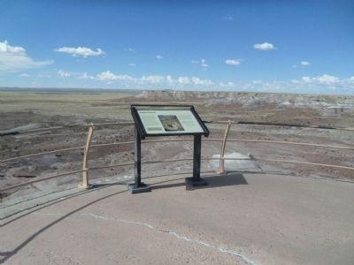
By Denise Boose, September 2, 2013
Jasper Forest Marker
| 1 ► Arizona, Apache County, Adamana — Jasper Forest |
| Near Jasper Forest Road, on the left when traveling west. Reported permanently removed. | |||
2 ► Arizona, Apache County, Adamana — Metoposaur Genesis Supreme — Petrified Forest — National Park Service, U.S. Department of the Interior —  |
| On Blue Mesa Scenic Road 2.5 miles east of Petrified Forest Road, on the right when traveling east. | |||
| 3 ► Arizona, Apache County, Adamana — Pioneers of Paleontology — Petrified Forest — National Park Service, U.S. Department of the Interior — |
| On Petrified Forest Road 1.6 miles north of Blue Mesa Scenic Road, on the right when traveling north. | |||
| 4 ► Arizona, Apache County, Adamana — Roosevelt's Tree Army: The CCC — |
| On Puerco Loop east of Petrified Forest Road, on the left when traveling south. | |||
| 5 ► Arizona, Apache County, Adamana — Santa Fe Railroad — Petrified Forest National Park — National Park Service, U.S. Department of the Interior — |
| Near Petrified Forest Road, on the right when traveling north. | |||
| 6 ► Arizona, Apache County, Adamana — The Funky Worm — |
| On Blue Mesa Scenic Road 2.5 miles east of Petrified Forest Road, on the right when traveling north. | |||
| 7 ► Arizona, Apache County, Adamana, Petrified Forest National Park — First Impressions — Petrified Forest — National Park Service, U.S. Department of the Interior — |
| On Jasper Forest Road. | |||
| 8 ► Arizona, Apache County, Alpine — The Old Bushvalley Fort — |
| On U.S. 180 at milepost 427.7, on the left when traveling west. | |||
| 9 ► Arizona, Apache County, Chambers — Badlands — |
| Near Park Road, on the right when traveling north. | |||
| 10 ► Arizona, Apache County, Chambers — Painted Desert / Finding Fossils |
| On Park Road, on the right when traveling west. Reported missing. | |||
| 11 ► Arizona, Apache County, Chinle — House Under Rock — |
| Near Mummy Cave Overlook Road 1.5 miles east of North Rim Highway (Indian Route 64). | |||
| 12 ► Arizona, Apache County, Chinle — Sliding House Ruins — |
| Near Sliding House Overlook Road 1.6 miles north of South Rim Highway (Indian Route 7). | |||
| 13 ► Arizona, Apache County, Chinle — The Place Where Two Fell Off — |
| Near Mummy Cave Overlook Road 1.5 miles east of North Rim Highway (Indian Route 64). | |||
| 14 ► Arizona, Apache County, Eagar — 8 — 26 Bar Hereford Ranch — |
| On School Bus Road at West Central Avenue (Arizona Route 260), on the right when traveling south on School Bus Road. | |||
| 15 ► Arizona, Apache County, Eagar — 9 — Amity School — |
| On West 26 Bar Road 0.4 miles west of School Bus Road, on the right when traveling west. | |||
| 16 ► Arizona, Apache County, Eagar — 11 — Benjamin B. Crosby Home — |
| On Main Street 0.1 miles north of West 6th Street, on the right when traveling north. | |||
| 17 ► Arizona, Apache County, Eagar — 7 — Colter Ranch — |
| On School Bus Road at West Central Avenue (Arizona Route 260), on the left when traveling south on School Bus Road. | |||
| 18 ► Arizona, Apache County, Eagar — 13 — Eagar Elementary School — |
| On Main Street at West 2nd Street, on the left when traveling north on Main Street. | |||
| 19 ► Arizona, Apache County, Eagar — 15 — Harry Colter Home — |
| On North Main Street, on the left when traveling north. | |||
| 20 ► Arizona, Apache County, Eagar — 14 — Joseph Udall Barn — |
| On East Central Avenue 0 miles east of Main Street, on the right when traveling east. | |||
| 21 ► Arizona, Apache County, Eagar — 12 — Oscar Jepson Home — |
| On Main Street, on the left when traveling north. | |||
| 22 ► Arizona, Apache County, Eagar — 10 — Rencher Home — |
| On South Harless Street at West 8th Street, on the left when traveling north on South Harless Street. | |||
| 23 ► Arizona, Apache County, Eagar — 6 — Snyder-Cavanaugh Shoot Out — |
| On South River Road 0.1 miles south of West Central Avenue, on the left when traveling south. | |||
| 24 ► Arizona, Apache County, Eagar — 16 — William LeSueur Home — 1913 — |
| On North Main Street at East 3rd Avenue, on the right when traveling north on North Main Street. | |||
| 25 ► Arizona, Apache County, Ganado — Hubbell Trading Post National Historical Site — |
| On U.S. 191 west of Park Access Road. | |||
| 26 ► Arizona, Apache County, Lupton — Arizona Highways — Sunset Point Rest Area — |
| Near Interstate 40 at milepost 359. | |||
| 27 ► Arizona, Apache County, Lupton — Arizona's Most Abundant Resources — |
| On Grant Road south of Interstate 40, on the right when traveling south. | |||
| 28 ► Arizona, Apache County, Lupton — In Memory of Max Ortega — 1905-1979 — |
| Near Interstate 40 at milepost 359. | |||
| 29 ► Arizona, Apache County, Lupton — One Days Ride to Zuni — |
| Near Interstate 40 at milepost 359. | |||
| 30 ► Arizona, Apache County, Navajo — At Navajo Springs — |
| On Interstate 40 at milepost 325, on the right when traveling east. | |||
| 31 ► Arizona, Apache County, Petrified Forest National Park — A Painted Park — Petrified Forest National Park — |
| On Petrified Forest Road 1 mile north of U.S. Route 66 (Interstate 40), on the right when traveling north. | |||
| 32 ► Arizona, Apache County, Petrified Forest National Park — At Home in the Painted Desert — |
| On Park Road. | |||
| 33 ► Arizona, Apache County, Petrified Forest National Park — At the Oasis — |
| On Park Road. | |||
| 34 ► Arizona, Apache County, Petrified Forest National Park — Enduring Abode — |
| On Petrified Forest Road. | |||
| 35 ► Arizona, Apache County, Petrified Forest National Park — Get Lost — |
| On Park Road. | |||
| 36 ► Arizona, Apache County, Petrified Forest National Park — Highway of Dreams — |
| On Petrified Forest Road at Old U.S. Route 66, on the right when traveling south on Petrified Forest Road. | |||
| 37 ► Arizona, Apache County, Petrified Forest National Park — Newspaper Rock — Petrified Forest National Park — National Park Service, U.S. Department of the Interior |
| Near Newspaper Spur, on the right when traveling west. Reported permanently removed. | |||
| 38 ► Arizona, Apache County, Petrified Forest National Park — Over the Edge — Petrified Forest National Park — |
| Near Petrified Forest Road 2 miles north of U.S. Route 66 (Interstate 40), on the right when traveling north. | |||
| 39 ► Arizona, Apache County, Petrified Forest National Park — Path of Least Resistance — |
| On Petrified Forest Road. | |||
| 40 ► Arizona, Apache County, Petrified Forest National Park — Route 66 |
| On Petrified Forest Road, on the left when traveling north. Reported missing. | |||
| 41 ► Arizona, Apache County, Petrified Forest National Park — Tawa Trail — |
| On Park Road. | |||
| 42 ► Arizona, Apache County, Petrified Forest National Park — Tawa Trail — |
| On Rim Trail. | |||
| 43 ► Arizona, Apache County, Petrified Forest National Park — The Petrified Forest of the World — |
| On Petrified Forest Road. | |||
| 44 ► Arizona, Apache County, Petrified Forest National Park — The Stone Tree House — |
| On Park Road. | |||
| 45 ► Arizona, Apache County, Petrified Forest National Park — Welcome — Petrified Forest National Park — |
| On Park Road. | |||
| 46 ► Arizona, Apache County, Petrified Forest National Park — When Crystal Forest Was a Forest — Petrified Forest — National Park Service, U.S. Department of the Interior — |
| On Crystal Forest Trail. | |||
| 47 ► Arizona, Apache County, Petrified Forest National Park — Work of Generations — Petrified Forest — National Park Service, U.S. Department of the Interior — |
| On Newspaper Rock Walkway. | |||
| 48 ► Arizona, Apache County, Springerville — 25 — Arizona Cooperative Mercantile Institution — |
| On East Main Street at South Papago Street, on the right when traveling east on East Main Street. | |||
| 49 ► Arizona, Apache County, Springerville — 22 — Baca Home — |
| On Apache Street at Supai, on the left when traveling east on Apache Street. | |||
| 50 ► Arizona, Apache County, Springerville — 21 — Baldonado Home — |
| On Apache Street at Silva Lane, on the left when traveling east on Apache Street. | |||
| 51 ► Arizona, Apache County, Springerville — 27 — Becker's Transcontinental Garage — 1910 — |
| On East Main Street, on the right when traveling west. | |||
| 52 ► Arizona, Apache County, Springerville — 17 — Bertha Wahl Shooting — |
| On West Airport Road at North Becker Lake Road, on the right when traveling west on West Airport Road. | |||
| 53 ► Arizona, Apache County, Springerville — 4 — Brawley Boarding House — |
| On East 4th Avenue at North Eagar Street, on the left when traveling west on East 4th Avenue. | |||
| 54 ► Arizona, Apache County, Springerville — 20 — El Rio Theatre — |
| On West Main Street (U.S. 180/191), on the right when traveling west. | |||
| 55 ► Arizona, Apache County, Springerville — 1 — Escudilla Mountain — |
| On U.S. 60 at milepost 392, on the right when traveling east. | |||
| 56 ► Arizona, Apache County, Springerville — 19 — James Hale Shooting — |
| On South Mountain Avenue (Business U.S. 180), on the right when traveling south. | |||
| 57 ► Arizona, Apache County, Springerville — 28 — Madonna of the Trail — |
| On East Main Street, on the left when traveling west. | |||
| 58 ► Arizona, Apache County, Springerville — 5 — Old Grist Mill Site — 1876 — |
| On South River Road 0.3 miles south of West 4th Avenue, on the right when traveling west. | |||
| 59 ► Arizona, Apache County, Springerville — 24 — Peter Thompson Home & Blacksmith Shop — |
| On North Papago Street 0.2 miles north of Apache Street, on the right when traveling north. | |||
| 60 ► Arizona, Apache County, Springerville — 23 — Presbyterian & Catholic Churchs — |
| On Apache Street at Supai, on the right when traveling east on Apache Street. | |||
| 61 ► Arizona, Apache County, Springerville — 2 — Slaughter Family Cemetary — |
| On East Maricopa Drive 1.3 miles west of Gutierrez Street, on the left when traveling west. | |||
| 62 ► Arizona, Apache County, Springerville — 26 — Springerville Schoolhouse — 1884-1983 — |
| On East Main Street 0.2 miles east of South Mountain Avenue, on the right when traveling east. | |||
| 63 ► Arizona, Apache County, Springerville — Springerville World War I Memorial — |
| On East Main Street (U.S. 191) east of South Mountain Avenue, on the right when traveling west. | |||
| 64 ► Arizona, Apache County, Springerville — 3 — White Mountain Historical Park — |
| On East Mohave Street at South Zuni Street, on the left when traveling west on East Mohave Street. | |||
| 65 ► Arizona, Apache County, Springerville — 18 — White Mountain Hospital — |
| On South Mountain Avenue, on the right when traveling north. | |||
| 66 ► Arizona, Apache County, St. Johns — Lyman Dam — On The Colorado River — |
| On U.S. 191 at Arizona Route 81, on the right when traveling north on U.S. 191. | |||
| 67 ► Arizona, Apache County, St. Johns — 194 — Pioneer Public Buildings — |
| On North Washington Street (U.S. 180 at milepost 368.7), on the right when traveling west. | |||
| 68 ► Arizona, Apache County, Teec Nos Pos — Arizona — (Four Corners) — |
| Near 4 Corners Road 0.5 miles west of U.S. 160. | |||
| 69 ► Arizona, Apache County, Window Rock — About the Navajo Code Talkers — |
| Near BIA Route 100 (Route 100) 0.8 miles east of Route 12 (Arizona Route 264) when traveling north. | |||
| 70 ► Arizona, Apache County, Window Rock — In Remembrance of Our Warriors / Navajo Warrior Memorial — |
| Near Parking Lot BIA 100 MP 0 (Route 100 Connector Road) 0.8 miles east of Route 12 N (Arizona Highway 263). | |||
| 71 ► Arizona, Cochise County, Benson — Benson Jail — 1938 - 2006 — |
| Near South San Pedro Street north of East 5th Street. | |||
| 72 ► Arizona, Cochise County, Benson — Benson Pioneer Cemetery — Known as "7th Street Cemetery" — 1881-1975 — |
| On East 7th Street at South Gila Street, on the right when traveling east on East 7th Street. | |||
| 73 ► Arizona, Cochise County, Benson — Four miles southeast at Council Rocks — Apache peace treaty with Cochise was ratified in 1872 — |
| Near Interstate 10 at milepost 320. | |||
| 74 ► Arizona, Cochise County, Benson — Mormon Battalion — LDS Church — |
| On 4th Street (Business U.S. 10) near Ocotillo Avenue, on the right when traveling west. | |||
| 75 ► Arizona, Cochise County, Bisbee — Bisbee City Fire Hall — |
| On Naco Road east of Ok Street, on the right when traveling west. | |||
| 76 ► Arizona, Cochise County, Bisbee — Bisbee World War II Memorial — 1941-1945 — |
| On State Highway 80 1 mile east of Main Street, on the right when traveling east. | |||
| 77 ► Arizona, Cochise County, Bisbee — Bisbee: Queen of the Copper Camps — |
| On State Highway 80. | |||
| 78 ► Arizona, Cochise County, Bisbee — Brewery Gulch — |
| On Review Alley at Howell Avenue, on the left when traveling north on Review Alley. | |||
| 79 ► Arizona, Cochise County, Bisbee — Calumet and Arizona Mining Company Office Building |
| On Arizona Street, on the right when traveling north. Reported missing. | |||
| 80 ► Arizona, Cochise County, Bisbee — City of Bisbee Warrior Memorial — |
| On Arizona Route 92 0.5 miles north of Mason Addition Road, on the right when traveling north. | |||
| 81 ► Arizona, Cochise County, Bisbee — Copper Queen Plaza — |
| On Main Street, on the right when traveling west. | |||
| 82 ► Arizona, Cochise County, Bisbee — Discovery of Ore |
| On Arizona Route 80 at milepost 341, 0.2 miles west of Main Street, on the right when traveling west. Reported missing. | |||
| 83 ► Arizona, Cochise County, Bisbee — How the Pit was Made — |
| On State Highway 80 1 mile east of Main Street, on the right when traveling east. | |||
| 84 ► Arizona, Cochise County, Bisbee — Mule Pass — |
| On North Old Divide Road 0.5 miles east of Route 80, on the right when traveling east. | |||
| 85 ► Arizona, Cochise County, Bisbee — Phelps Dodge General Office Building — |
| On Main Street, on the right when traveling east. | |||
| 86 ► Arizona, Cochise County, Bisbee — The Importance of Copper Mining — |
| Near North Dart Road. | |||
| 87 ► Arizona, Cochise County, Bisbee — The Lavender Pit — |
| On Arizona Route 80 at milepost 343, on the right when traveling east. | |||
| 88 ► Arizona, Cochise County, Bisbee — The Warren Ball Park — |
| On Arizona Street at Ruppe Avenue, on the right when traveling south on Arizona Street. | |||
| 89 ► Arizona, Cochise County, Bisbee — United States Border Station — Naco, Arizona — |
| On South Naco Highway at West Hogan Street, on the left when traveling south on South Naco Highway. | |||
| 90 ► Arizona, Cochise County, Bisbee — Viewing the Pit — |
| On State Highway 80 1 mile east of Main Street, on the right when traveling east. | |||
| 91 ► Arizona, Cochise County, Bisbee — 54 — Votes for Women — Road to the 19th Amendment — National Votes for Women Trail — |
| On Main Street at Tombstone Canyon, on the right when traveling south on Main Street. | |||
| 92 ► Arizona, Cochise County, Bisbee — Walter Douglas House — Architect: Henry C. Trost — |
| Near Cole Avenue north of E Vista. | |||
| 93 ► Arizona, Cochise County, Bisbee — Why dig the Pit? — |
| On State Highway 80 1 mile east of Main Street, on the right when traveling east. | |||
| 94 ► Arizona, Cochise County, Bowie — Apache Pass — |
| On Apache Pass Road 6 miles east of Route 181, on the left when traveling east. | |||
| 95 ► Arizona, Cochise County, Bowie — Apache Pass - A Corridor Through Time — Fort Bowie National Historic Site — |
| On Apache Pass Road 13 miles south of Business Interstate 10, on the left when traveling west. | |||
| 96 ► Arizona, Cochise County, Bowie — Apache Spring — |
| Near Fort Bowie Trail 1.2 miles south of Apache Pass Road. | |||
| 97 ► Arizona, Cochise County, Bowie — Bascom-Cochise Meeting Site — |
| Near Fort Bowie Trail 0.6 miles Apache Pass Road. | |||
| 98 ► Arizona, Cochise County, Bowie — Cavalry Barracks — |
| Near Fort Bowie Trail 1.5 miles south of Apache Pass Road. | |||
| 99 ► Arizona, Cochise County, Bowie — Cavalry Mess Hall and Kitchen — |
| Near Fort Bowie Trail 1.5 miles Apache Pass Road. | |||
| 100 ► Arizona, Cochise County, Bowie — Centennial of Chiricahua Apache/U.S. Cessation of Hostilities / Chiricahua - Centennial — 1886 / — |
| On West Fifth Street, on the left when traveling west. | |||
1851 entries matched your criteria. The first 100 are listed above. Next 100 ⊳