By Sandra Hughes, December 6, 2009
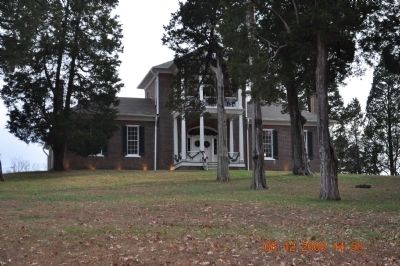
Belle Mont Mansion
GEOGRAPHIC SORT WITH USA FIRST Geographic Sort Title Sort Marker Number Sort Marker Number Sort N Marker Number Sort T Publication Order Sort Publication Order Sort A Erected Year Sort Most Viewed Sort Most Recent-Interest Sort Most Recently Changed Sort SEE FAQ #33 FOR DESCRIPTIONS
On State Road 22 at County Route 9, on the right when traveling west on State Road 22. Reported missing.
On County Road 293 at County Road 52, on the right when traveling south on County Road 293.
On 5th Avenue Northeast (U.S. 431) at Cleveland Avenue, on the right when traveling south on 5th Avenue Northeast.
On Rainbow Drive (U.S. 411) east of Peteet Street, on the right when traveling east.
On Eastern Valley Road south of Elrie Boulevard, on the right when traveling south.
On Eastern Valley Road (County Road 18) 0.1 miles north of Rosser Loop Drive, on the left when traveling north.
On 4th Avenue North at Richard Arrington Jr. Boulevard South, on the right when traveling west on 4th Avenue North.
On Allison-Bonnett Memorial Drive at Tin Mill Road, on the right when traveling west on Allison-Bonnett Memorial Drive.
On Eastern Valley Road (County Road 18) at Vintage Lane, on the left when traveling west on Eastern Valley Road.
On Williams Avenue SE at Greene Street SE, on the right when traveling east on Williams Avenue SE.
On U.S. 43, 0.2 miles north of Richie Road, on the right when traveling north.
On Bienville Boulevard at Lackland Street, on the right when traveling east on Bienville Boulevard.
On North Royal Street at St Michael Street, on the right when traveling north on North Royal Street.
On North Conception Street, 0.1 miles north of St Michael Street, on the right when traveling north.
Paid Advertisement
On Government Street (U.S. 98) at South Jackson Street, on the right when traveling west on Government Street.
On Walden Road north of White Drive (Arkansas Route 25), on the left when traveling north.
Near State Highway 362, 1.8 miles east of U.S. 49.
On Graham Avenue at Spring Street, on the right when traveling west on Graham Avenue.
On Mill Street at Santa Barbara Street, on the right when traveling south on Mill Street.
Near North Church Street south of East 7th Street, on the right when traveling south.
On Reservoir Road Northwest east of Wisconsin Avenue Northwest, on the left when traveling east.
Near Southeast 15th Street (Camp Ranch Road), 0.4 miles south of Southeast 41st Avenue when traveling south.
On Northeast Cholokka Boulevard at NE Bay Avenue, on the right when traveling north on Northeast Cholokka Boulevard.
On University Drive near West Kennedy Boulevard.
Near Mango Road at State Road A1A, on the left when traveling east.
On First Street (State Road 80) south of Jackson Street, on the left when traveling south.
Near Periwinkle Way, 1.7 miles east of Causeway Boulevard.
Near West Tennessee Street at Mission Road.
On West Call Street, 0.1 miles east of North Macomb Street, on the left when traveling east.
Paid Advertisement
Near Manatee Avenue East (State Road 64) at 14th Street East.
On SE Ocean Boulevard (State Road A1A) at SE Denver Avenue, on the right when traveling east on SE Ocean Boulevard.
On Overseas Highway (at milepost 79), on the right when traveling south.
On Dixie Avenue, 0.1 miles north of North Booth Street, on the left when traveling north.
On Centre Street near North 4th Street, on the right when traveling west.
On County Road 44A, 0.6 miles west of State Road 44, on the right when traveling west.
On North Main Street (U.S. 301) at East Wonders Street, on the right when traveling south on North Main Street.
On Cemetery Avenue, 0.2 miles east of East Campus Drive, on the right when traveling east.
On South Jackson Street, 0.1 miles north of Baldwin Street, on the right when traveling north.
On North Wayne St. near West Thomas St. when traveling north.
On Mulberry Street (Georgia Route 49) at 2nd Street Lane, on the right when traveling east on Mulberry Street.
On Habersham Street at East Broughton Street, on the right when traveling south on Habersham Street.
On Carriage Lane north of Lake Jodeco Road, on the left when traveling south.
On West Mimosa Drive at Jonesboro Road (Georgia Route 54), on the right when traveling west on West Mimosa Drive.
Near North Marietta Parkway Northwest (Georgia Route 5) at Polk Street Northwest, on the right when traveling north.
Paid Advertisement
On North Marietta Parkway (Georgia Route 120A) at Polk Street NW, on the right when traveling north on North Marietta Parkway.
On Highway 92 (Georgia Route 92) at New Hope Road, on the right when traveling north on Highway 92.
On Paces Ferry Road at Mount Paran Road, on the right when traveling east on Paces Ferry Road.
On North Broad Street (Georgia Route 93) just south of 3rd Avenue Northeast, on the right when traveling south.
On East Main Street at McDonough Street, on the right when traveling south on East Main Street.
On Etheridge Road just south of Carruth Road (Johnson Mill Road), on the left when traveling south.
On South Broad Street just north of Smith Avenue (Business U.S. 84), on the right when traveling north.
On Lodge Boulevard, on the right when traveling west.
On South Main Street north of Birger Street, on the right when traveling west.
Near North 3100 East Road south of County Route 850N.
Near Kaskaskia Street (County Route 6) west of Shawneetown Trail (County Route 3).
On East St. Louis Street (U.S. 50), on the right when traveling east.
On North Main Street north of Madison Street, on the left when traveling north.
On Liberty Trail at E. 8th Street, on the right when traveling north on Liberty Trail.
On Lincoln Avenue west of U.S. 41, on the left when traveling west.
On Local Road N800W close to State Route 16, on the right when traveling north.
Paid Advertisement
On Waterfall Road, on the right when traveling east.
Near North Broadway Street south of East Broad Street, on the left when traveling south.
Near Lafayette Street south of Laurel Street, on the left when traveling south.
Near Oxford Avenue, 0.1 miles south of East Parker Boulevard, on the left when traveling south.
On North Oak Hills Parkway, 0.1 miles west of Bluebonnet Boulevard, on the right when traveling east.
On Sycamore Street at Bank Street, on the right when traveling west on Sycamore Street.
On High Street at College Street (Louisiana Highway 952), on the left when traveling west on High Street.
On 2nd Street north of Bossier Street, on the right when traveling north.
On Chartres Street near Ursuline Street.
On Jackson Street near Grammont Street, on the right when traveling north.
On West Main Street south of St. Mary Street, on the right when traveling south.
Near Highway 1052 north of Camp Moore Road, on the left when traveling north.
Near Londontown Road, 1.3 miles east of Mayo Road (Route 253).
Near Davidsonville Road (Maryland Route 424) north of Pleasant Meadow Road, on the right when traveling north.
Near Bayside Beach Road, 2.3 miles east of Fort Smallwood Road (Maryland Route 173).
Paid Advertisement
On Charles Street just south of East Saratoga Street, on the right when traveling north.
On Greenway Drive at Abacco Lane, on the right when traveling east on Greenway Drive.
On Old Frederick Road (Maryland Route 99), on the right when traveling west.
Near North Main Street (U.S. 23) north of West Cedar Street, on the right when traveling south.
On West Nepessing Street at North Court Street, on the right when traveling east on West Nepessing Street.
On Hutchins Landing Road, 0.2 miles east of Hillside Plantation Road, on the right when traveling east.
On College Street near Chinquepin Street, on the right when traveling north.
Near Beach Boulevard (U.S. 90) at Porter Avenue.
On Muddy Bayou Road, 0.1 miles north of Rodney Road, on the right when traveling north.
On Delaware Avenue at South 6th Street, on the left when traveling west on Delaware Avenue.
On West 2nd Street at Main Street, on the right when traveling west on West 2nd Street.
On Prince Street near Courtland Street.
On High Street south of West Pearl Street, on the right when traveling south.
On High Street, on the left when traveling north.
On N Central Avenue at E 1st Avenue, on the right when traveling north on N Central Avenue.
On Merrick Road at Cedar Shore Drive, on the right when traveling east on Merrick Road.
Paid Advertisement
On Main Street (New York State Route 25A) south of Nassau Road, on the right when traveling north.
Near Festival Park at Anasias Dare Street.
On East Lexington Avenue at Terrell Drive, on the left when traveling east on East Lexington Avenue.
On Water Street south of 3rd Street, on the right when traveling south.
On South Front Street near West Main Street (Ohio Route 133), on the right when traveling south.
175 entries matched your criteria. The first 100 are listed above.
The final 75 ⊳