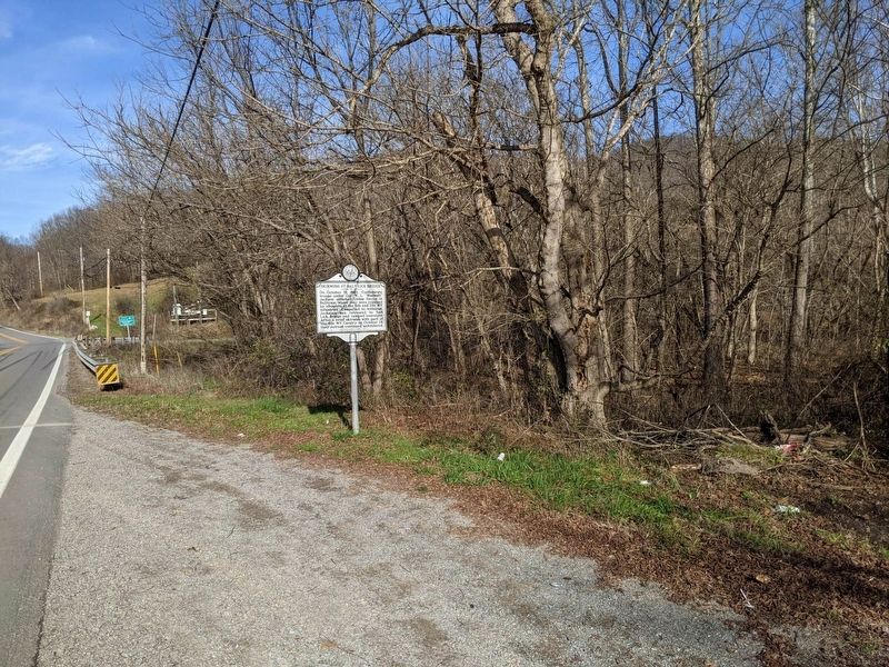
On Gauley Turnpike (U.S. 19) at Corley Caress Road, on the right when traveling north on Gauley Turnpike.
On October 13, 1863, Confederate troops under Col. W. L. "Mudwall" Jackson attacked Union forces at Bulltown, where they were repulsed by elements of the 6th and 11th WV infantries. Compelled to withdraw, Jackson’s men retreated to Salt Lick Bridge . . . — — Map (db m161248) HM
On Airport Road (West Virginia Route 15) at Braxton County Cemetery Road, on the right when traveling north on Airport Road.
James H. Payne • Donald D. Workman • Billie Jack Miller • Howard M. Simmons • Edward Lane • Paul Dale Karickhoff • Ronald V. Wood • Lilburn Helmick • Billie B. Helmick • James William Thompson • Ernest L. Davis • Floyd Earl Rhodes • James Hugh . . . — — Map (db m308997) WM
On the hill in front of you are two fortifications that Union Gen. George B. McClellan ordered constructed late in1861. They guarded the wooden covered bridge located here on the Weston and Gauley Bridge Turnpike. In October 1863, Capt. William H. . . . — — Map (db m58727) HM
The coal-and-wood house, a rectangular building constructed of rough saw-mill lumber, stood here. After the introduction of gas heating, the building was used for general storage.
Bulltown families traditionally gathered wood for their stoves in . . . — — Map (db m229228) HM
In time the Cunninghams built a granary, barns, coal-and-wood house, outhouse, and chicken house, in addition to the main house, to form a traditional central West Virginia subsistence farm. It was on the Cunningham farmstead, in 1861, that Union . . . — — Map (db m229231) HM
Named for Henry Cunningham, the Cunningham House was owned by the Cunningham family from the time it was built in the early nineteenth century until 1976, when it was purchased by the U. S. Army Corps of Engineers.
The original building was a . . . — — Map (db m229232) HM
The food cellar served as a combination refrigerator and extended pantry. Because most families grew most of their own food, they needed a large storage area.
Meats and fruits, vegetables and other harvested foods were canned, pickled, or dried . . . — — Map (db m229233) HM
The McCauley Barn was built in the nineteeth century. The original structure was rectangular and had, as it has now, a loft and a gable roof.
D. W. "Joe" McCauley purchased the barn in 1928 and, in 1933, added a three-stall horse shed along the . . . — — Map (db m229234) HM
The main purpose of the spring house, which was built over a natural spring, was to provide a family with fresh, sanitary drinking water. The water was either pumped or dipped by hand, as needed.
The spring house was also a source of . . . — — Map (db m229229) HM
On Main Street east of 3rd Street, on the right when traveling east.
In Memorium
Brigadier General
James Kemp McLaughlin
1918-2019
Braxton County Native
WWII Veteran 1941-1945
Piloted 39 Combat Missions
8th Air Force
Founder & Commander
W.Va. Air National Guard
1947-1977 . . . — — Map (db m281226) WM
On Main Street 0.1 miles east of Camden Avenue ( Route 4), on the right when traveling east.
On December 29, 1861, Confederate partisans attacked a company of the 1st West Virginia Cavalry at Sutton. After ammunition ran low, the Federals left with part of the Confederate force in pursuit. When the Confederates returned, they found the town . . . — — Map (db m173334) HM
On Main Street (County Highway 19/40), on the right when traveling east.
The scenic Elk River now flows peacefully before you, but in 1861, the conflict raged here. That year, Col. Erastus B. Tyler's 7th Ohio constructed earthworks near this location to protect an important suspension bridge. About 100 men of Capt. . . . — — Map (db m208238) HM
Panel 1
How Did Braxton County Get Its Name?
Ten years after Sutton was incorporated, Braxton County was formed in 1836. The new county was named after Carter Braxton, a signer of the Declaration of Independence. The Town of Sutton . . . — — Map (db m173346) HM
On Main Street west of 3rd Street, on the right when traveling west.
Honoring Revolutionary War Soldiers and Patriots buried in Braxton County.
Andrew Skidmore, 1750-1827 • Charles Francis Boggs Jr., 1754-1837 • Jacob Fisher 1763-1846 • Peter Shields, 1755-1832 • John Dobbins 1747-1833 • Patrick Murphy, . . . — — Map (db m179591) WM
On Main Street east of 3rd Street, on the right when traveling east.
(Preface):
On April 20, 1863, Confederate Gens. William E. "Grumble" Jones and John D. Imboden began a raid from Virginia through present-day West Virginia against the Baltimore and Ohio Railroad. Taking separate routes, they . . . — — Map (db m281228) HM
On Main Street at Camden Avenue ( Highway 4), on the right when traveling east on Main Street. Reported permanently removed.
In 1861, Col. Erastus B. Tyler’s 7th Ohio Infantry constructed earthworks near Suttonville to protect the suspension bridge across the Elk River. Later in the year, Capt. Weston Rowand’s Co. K, 1st Virginia Cavalry (US), about a hundred men, . . . — — Map (db m58728) HM
On Main Street at 3rd Street, on the right when traveling east on Main Street. Reported permanently removed.
(Preface) On April 20, 1863, Confederate Gens. William E. “Grumble” Jones and John D. Imboden began a raid from Virginia through present-day West Virginia against the Baltimore and Ohio Railroad. Taking separate routes, they later . . . — — Map (db m252259) HM
On Main Street west of 3rd Street, on the right when traveling west.
Boggs, Clarence H. • Brown, Solomon • Buckner, Thomas • Carr, Benjamin H. • Clayton, Harry • Clowser, David • Conley, John P. • Craft, John E. • Criss, Guy Harley • Cutlip, William I, • Dobbins, Thomas • Dulin, Edwin L. • Exline, Oscar • Fisher, . . . — — Map (db m179590) WM
On Old Turnpike Road (Local Route 19/40) at Centralia Road (Local Route 17), on the right when traveling north on Old Turnpike Road.
The geographic center of the irregular-shaped state of West Virginia is near this point, according to accepted methods of locating centers of geographic areas. It was also West Virginia's center of population in 1860. — — Map (db m173331) HM
On Jennings Randolph Highway (Interstate 79) at Lakeside Drive North on Jennings Randolph Highway.
Dedicated to all men and women wounded in all our wars.
My stone is red for
the blood they shed.
The medal I bear
is my country's way
to show they care.
If I could be seen
by all mankind
maybe peace will
come . . . — — Map (db m309177) WM
On Hackers Creek Road (County Route 7) 0.7 miles north of Berlin Road, on the right when traveling north.
John Hacker (1743-1824) erected his
pioneer cabin about one mile west
of here in 1769. He was the first
white settler in Lewis County, and
in the watershed of the creek which
bears his name. He served under
General George Rogers Clark in . . . — — Map (db m173833) HM
On Copley Road (County Route 17) at Cove Lick Road (County Route 18), on the right when traveling west on Copley Road.
West Virginia’s largest producing
oil well was tapped on the Copley
farm by the South Penn Oil Company
in September 1900. Workers could
not contain the initial flow of
4,800 barrels a day, and a large
volume of oil spilled into Sand
Fork. . . . — — Map (db m174499) HM
On Gauley Turnpike (U.S. 19) at Wildcat Road, on the right when traveling north on Gauley Turnpike.
Two miles east is the site of Fort Pickens where Capt. Morgan Darnall's Company A, 10th West Virginia Infantry, Vols. enrolled and built fort, 1861-62; mustered into Union Army by Capt. Bainbridge on March 13, 1862. Burned, 1864. — — Map (db m161262) HM
On Gauley Turnpike (U.S. 19) 0.2 miles north of Rabbit Hill Road, on the right when traveling north.
Lewis County
Formed from Harrison in 1816. It was named for Colonel Charles Lewis, who was killed in 1774 at Battle of Point Pleasant. It was home of Jesse Hughes, frontier scout, and the boyhood home of General Thomas J. "Stonewall" . . . — — Map (db m161257) HM
On Oil Creek Road (County Route 23) 0.2 miles west of U.S. 19, on the left when traveling west.
In October 1861, military recruits
and Union guerrillas under William
Pierson entered Jacksonville and
took three men, murdering two, one
the brother of Wheeling delegate
George Arnold. Another man was shot
at home. Gov. Pierpont offered . . . — — Map (db m174494) HM
On Main Street (U.S. 19) at Depot Street, on the right when traveling north on Main Street.
Two miles east stands the Old Harmony Church, built in 1819. In this church in 1829, John Mitchell and David Smith organized the first Methodist Protestant Church. Mitchell was its first pastor. Near the churchyard is his grave. — — Map (db m78396) HM
On Main Street (U.S. 19) at High Street (County Route 8), on the right when traveling north on Main Street.
The Broad Run Baptist Church was organized in 1804. (2 Mi.W.) In its cemetery are buried many early settlers. Here is grave of Gen. Jos. A. Lightburn of the Union Army. After the War between the States, he became a Baptist minister. — — Map (db m78394) HM
On Main Street (U.S. 19) 0.1 miles north of High Street (County Route 8), on the left when traveling north. Reported missing.
Hacker's Creek At mouth of Jesse's Run was home of Jesse Hughes, Indian fighter and scout. About 1770, John Hacker settled here. Near by is scene of Cozad and other border massacres. Several Indian villages and burying grounds were . . . — — Map (db m78395) HM
On Good Hope Pike (U.S. 19) 0.2 miles south of Vens Run Road, on the right when traveling south.
Harrison County
Formed, 1784, from Monongalia. It included all or parts of 17 other counties. Named for Benjamin Harrison, signer of Declaration of Independence and the governor of Virginia, 1781-84. Birthplace of Thomas J. "Stonewall" . . . — — Map (db m231225) HM
Fort Pickens
120 yds., northeast, Co. A 10th W. Va. Inf., built Fort Pickens for headquarters and defense. Company raised by Capt. Morgan A. Darnall; mustered into U. S. service March 13, 1862. In several battles down to Appomattox. . . . — — Map (db m37049) HM
Near Jennings Randolph Highway (Interstate 79) 3 miles south of U.S. 19, on the right when traveling south.
Dedicated to all men and women wounded in all our wars.
My stone is red for
The blood they shed
The medal I bear
Is my Country's way
To show they care.
If I could be seen
By all mankind
Maybe peace will
Come in . . . — — Map (db m178495) WM
Near State Park Road 1.1 miles north of U.S. 19, on the left when traveling north.
The Stonewall Dam is located on the West Fork River, three miles south of the county seat at Weston, West Virginia and 73 miles upstream from the river's mouth. From its source in Lewis and Upshur Counties, the West Fork River flows northward for . . . — — Map (db m281310) HM
On Old Mill Road (County Route 1) 2.9 miles north of 2nd Street (U.S. 119), on the left when traveling north.
In the Butcher Cemetery are the graves of many pioneer settlers, dating back more than 100 years. Here lies Paulser Butcher. Of seven Butcher brothers in the Revolution with Washington, four were killed in action. — — Map (db m173810) HM
On U.S. 19 0.2 miles south of Walkersville Road, on the right when traveling south.
Here was born Jonathan M. Bennett, (1816-1887). First auditor of Virginia and a leader in the two Virginias. Near here was born Johnson Newlon Camden (1828-1908), U. S. Senator, railroad builder and industrial leader. — — Map (db m161267) HM
Near Jackson Mill Road (County Road 10) 0.3 miles west of Sycamore Lick Road (County Road 10), on the right when traveling west.
Mill ponds have been the subject of song and romance. Blaker's Mill Pond provides the water for operating Blaker's Mill. While the mill is operating, water is pumped from the West Fork (of the Monongahela) River at the rate of around 2000 gallons . . . — — Map (db m197722) HM
On Arnold Street at Reservoir Street, on the right when traveling south on Arnold Street.
In 1820, only two years after the founding of Weston as the governmental seat of Lewis County, the town's first true cemetery, a one-acre plot, was established on the hillside above the south end of Center Avenue, 15 South Center Ave.
In . . . — — Map (db m197777) HM
Near Jackson Mill Road (County Route 10) 2.6 miles north of U.S. 19, on the right when traveling west.
The blacksmith shop was a vital place for the early 19th century community. The shop was needed at Jackson's Mill not only to shoe horses, but to make repairs in the gristmill. A blacksmith's work included the maintenance of wagons, carriages and . . . — — Map (db m197617) HM
Near Jackson Mill Road (County Route 10) 2.6 miles north of U.S. 19, on the right when traveling west.
Soon after moving to Greenbrier County (West) Virginia in 1794, Jacob and Mary Hackman erected a gristmill at the confluence of Mill Creek and Muddy Creek. The Hackman Mill opened for business in 1796, producing cornmeal for the local population. . . . — — Map (db m197604) HM
The core of this large frame house is believed to have
been built in 1879. Owner and local attorney
William W. Brannon sold the home in 1901 which led to
John and Maude McGuires acquisition of the property in
that year. In 1908 the McGuires . . . — — Map (db m204094) HM
Near Skin Creek Road (County Route 30) 0.5 miles south of Interstate 79, on the right when traveling south.
This location overlooks the former village of Brownsville. A railroad construction camp on the farm of A. A. Brown became an important shipping point for lumber from Skin Creek.
In 1891 it became known as Brownsville and had a store, post . . . — — Map (db m281244) HM
Near Jackson Mill Road (County Route 10) 2.6 miles north of U.S. 19, on the right when traveling west.
Cummins Jackson was born in 1802, the eldest son of Edward and Elizabeth Brake Jackson. Cummins worked at and, at times, ran the family's gristmill as a boy. At the death of his father, he gained possession of the mill and adjacent property. Over . . . — — Map (db m197602) HM
On South Main Avenue, on the right when traveling north.
The first nickelodeon in the United States opened in 1905
in Pennsylvania. Weston was not too far behind, with The
Fairyland Theatre opening in 1907, the second nickelodeon
to open in Weston. The term nickelodeon came from the
price of . . . — — Map (db m204104) HM
In the 1770s Henry Flesher claimed 400 acres at the mouth of Stone Coal Creek. He built his cabin home on the land that became Preston Lewis County. In 1817, Preston became Fleshersville and then in 1819 it was named Weston. His barn was near where . . . — — Map (db m161272) HM
On South Main Avenue (U.S. 19) south of 2nd Street (U.S. 119), on the right when traveling south.
Constructed in 1879, two years after the original structure burned this is the oldest business building in Weston. Originally built as a joint venture between jeweler Er Ralston and attorney Matthew Edmiston, this location has been home to a wide . . . — — Map (db m197731) HM
Near Jacksons Mill Road (County Route 10) 0.2 miles west of Sycamore Lick Road, on the right when traveling west. Reported missing.
Three generations of Jacksons operated mills here, beginning with Col. Edward Jackson before 1800. Jackson’s Mill included saw and gristmills, carpenter shop, blacksmith forge, slave quarters, barns and other outbuildings, and a general store on . . . — — Map (db m58720) HM
On Jacksons Mill Road (County Route 10) 2.6 miles north of U.S. 19, on the right when traveling west.
In 1831, this became the home of six-year-old Thomas Jonathan Jackson (1824-1863) and his four-year old sister, Laura Ann Jackson (1826-1911). Their father, Jonathan Jackson, had died in poverty in 1826. In 1830, their mother married Blake G. . . . — — Map (db m173734) HM
On Main Avenue (U.S. 19) 0.3 miles north of East 6th Street, on the left when traveling north.
Boyhood home of Gen.Thomas J.
“Stonewall” Jackson (4 Mi. W.).
The first mill was built about
1808 by his grandfather, Col.
Edward Jackson, who became a
leader in border affairs. It
is now the site of the W. Va.
4-H Camp for Boys and Girls. — — Map (db m173825) HM
On Jackson's Mill Road (County Route 12) at U.S. 19, on the right when traveling north on Jackson's Mill Road.
Jackson’s Mill Boyhood home (2 Mi. W.) of Gen. Thomas J. “Stonewall” Jackson. First mill was built about 1808 by grandfather, Col. Edward Jackson, a leader in border affairs. Now site of the West Virginia 4-H Camp for Boys and Girls.
. . . — — Map (db m173735) HM
On Jacksons Mill Road (County Route 10), on the left when traveling west.
Site of boyhood home of Gen. Thomas J. "Stonewall" Jackson. The first mill was built about 1808 by his grandfather, Col. Edward Jackson, who became a leader in border affairs. It is now the site of the W. Va. 4-H Camp for Boys and Girls. — — Map (db m56626) HM
Near Jackson Mill Road (County Route 10) 2.6 miles north of U.S. 19, on the right when traveling west.
Edward Jackson, "Stonewall's" grandfather, came to the West Fork valley with his family in 1801 and built a log gristmill at a bend on the east side of the West Fork River sometime within the next few years. Milling was an important industry in . . . — — Map (db m197619) HM
On Center Avenue 0.1 miles north of East 3rd Street (U.S. 119), on the left when traveling north.
1. Raymond L. Armentrout
10/18/1950 - 02/23/1971
SSGT US Army
2. Joseph M. Brady
08/25/1945 - 02/05/1967
PFC US Army
3. Earl E. Brown
08/49/1939 - 01/29/1966
SSGT US Army
4. Michael S. Garrett
10/25/1948 - 03/04/1969 . . . — — Map (db m197964) WM
On Court Avenue north of Bank Street, on the right when traveling north.
In memory of
Honorable Louis Bennett
deceased August 2, 1918 and only son Lieutenant Louis Bennett, Jr.
killed in action in World War
August 24, 1918
This property, presented by
Mrs. Sallie Maxwell Bennett
was dedicated August . . . — — Map (db m266967) HM WM
On North River Avenue, on the right when traveling west.
In Memory
Of The Men
Lewis County
Who Gave Their
Lives In The
Great War
1917 - 1919
James C. Allen •
Darral Aulman •
Louis Bennett Jr. •
Edward T. Bonnett •
Solomon H. Brown •
Louis Glen Burrell •
Wirt Butcher •
Fred . . . — — Map (db m204101) WM
Home of Jonathan M. Bennett built 1875 and used as family home until 1922. Given by Mrs. Louis Bennett to county as public library to honor her husband and son. J.M. Bennett (1816 ~ 87) was active in state political and local business affairs in . . . — — Map (db m64089) HM
On Jacksons Mill Road (County Route 10) 2.6 miles north of U.S. 19, on the right when traveling west.
In 1845, William Rohrbough built the front half of what is now known as the Mary Conrad Cabin on a tract of land in southern Lewis County. The land had originally been patented by George Jackson, brother to Colonel Edward Jackson of Jackson's . . . — — Map (db m254309) HM
Near Jackson Mill Road (County Route 10) 2.6 miles north of U.S. 19, on the right when traveling west.
Pioneer cabin built by Henry McWhorter a Revolutionary soldier, in 1793, at McWhorter's Mill, now Jane Lew and used as home, church, school, and postoffice, was moved to its present site and presented to the state by his descendants August 14, . . . — — Map (db m197580) HM
On Arnold Street at Reservoir Street, on the right when traveling south on Arnold Street.
In addition to Alexander Scott Withers, prominent Watsonian's interred here are Daniel Stringer, a co-founder of Weston, owner of the first grist mill in the town, and twice elected to Congress; Weeden Hoffman, one of Weston's first merchants, . . . — — Map (db m197757) HM
Near Jackson Mill Road (County Route 10) 2.6 miles north of U.S. 19, on the right when traveling west.
The sawmill shed, located 30 feet upstream from the Jackson gristmill, was a long one-story structure - with a sloping roof.
The Jackson sawmill played a significant role in the growth of this region. It was the first sawmill in the area, . . . — — Map (db m197669) HM
On East 3rd Street (U.S. 33) just north of Brown Avenue, on the right when traveling west.
Early on June 30, 1861, John List
of Wheeling, under commission from
Gov. Pierpont and with the help of
the 7th Ohio Infantry, took charge
of about $30,000 in gold held at
the Weston branch of the Exchange
Bank of VA. Pierpont feared that
the . . . — — Map (db m173838) HM
On Main Avenue at 1st Street, on the right when traveling north on Main Avenue.
Conditions of living a life in the woods created men who gave up wearing breeches. They instead wore loose hunting shirts of linsey woolsey, coarse linen, or dressed deerskins, increased length of their leggings and fastened them to their belts . . . — — Map (db m204483) HM
On North River Avenue, on the right when traveling east.
Established by act of Virginia Assembly 1824
First Bridge of wood on stone piers built 1829
Second bridge wood and covered built 1847
Third bridge iron built 1890
Fourth bridge concrete built 1922 — — Map (db m204100) HM
On Center Avenue (U.S. 19) at Bank Street, on the left when traveling north on Center Avenue.
The Exchange Bank of Virginia located at 133 Center Ave was the first bank in Weston and only the fifth bank in Western Virginia from 1853 to 1875.
During the civil war the bank held $30,000 in gold that was intended to pay for the . . . — — Map (db m197542) HM
Near Jackson Mill Road (County Route 10) 2.6 miles north of U.S. 19, on the right when traveling west.
The heritage garden here at Jackson's Mill exhibits a garden similar to the type that was used during the early to mid-1800s. The garden was one of the most important parts of any farmstead and would normally be planted before homesteaders built . . . — — Map (db m197815) HM
On North River Avenue, on the right when traveling east.
Before the river was bridged, and later when an existing one
was closed for repairs, local citizens and travelers crossed the
river just a short distance upstream, at today's location of the
4th street bridge, which was more often than not . . . — — Map (db m204099) HM
On South Main Avenue (U.S. 19) at Bank Street, on the right when traveling south on South Main Avenue.
Originally the site of the Patrick Tierney Hotel built in 1855 and burned in 1896. His daughter Sally built the current structure circa 1910 and since electrical services was unreliable it was plumbed for gas.
The first tenant was B. . . . — — Map (db m197572) HM
On Asylum Drive at South River Avenue, on the right when traveling north on Asylum Drive.
When the Civil War began in 1861, the one-story wing on the far left of the building in front of you was all that stood here at the Trans-Allegheny Lunatic Asylum. The foundation of the main building had been completed; it was used to stable horses . . . — — Map (db m58721) HM
On Center Avenue north of East 3rd Street (U.S. 119), on the left when traveling north.
This memorial is dedicated to all West Virginia
POWs and MIAs that have not made it home.
Thank you for your service to protect our
freedoms. God bless you and your family. — — Map (db m197945) WM
On East 3rd Street (U.S. 33/119) at Center Avenue (U.S. 119), on the left when traveling west on East 3rd Street.
The flag poles are in honor of the brave men and women of the Armed Forces and Gary St. Clair, Scoutmaster of Troop 105 for 37 years. — — Map (db m197672) WM
On Jacksons Mill Road (County Route 10) 2.6 miles north of U.S. 19, on the right when traveling west.
Thomas’ grandparents, Edward and Elizabeth Brake Jackson, settled on this land in 1801 and soon constructed a log cabin and a gristmill. When Edward died, his son, Cummins, took possession of the property and the lucrative family business including . . . — — Map (db m173807) HM
On North River Avenue, on the right when traveling east.
Weston Interesting Facts
Weston was founded in 1818 as Preston; the name was changed to
Fleshersville soon after, and then to Weston in 1819. The city was
incorporated in 1846.
Weston is a city in Lewis County, West Virginia, United . . . — — Map (db m204102) HM
On West 2nd Street, on the right when traveling west.
Hale's Emporium, owned by Presley Hale, clothing
provider, and ardent Unionist. Consequently, Confederate
raiders frequently relieved Mr. Hale of his inventory during
the Civil War.
Numerous attempts were made to bring rail to Weston
since . . . — — Map (db m204103) HM
On Center Avenue (U.S. 19) at Bank Street, on the right when traveling north on Center Avenue.
Established, 1818, on farm of Henry Flesher, Revolutionary War veteran, first settler. He was attacked by Indians in 1784, but made his escape. Here is grave of Alexander Scott Withers, who told the story of "Border Warfare." — — Map (db m155500) HM
On Center Street south of East 4th Street, on the left when traveling north.
Built in 1882, the Weston Colored School was the fourth school erected with public funds for black children in West Virginia. It served the African-American community until desegregation in 1954. Later uses included a vocational agriculture . . . — — Map (db m197511) HM
On Center Avenue north of East 3rd Street (U.S. 119), on the left when traveling north.
According to law then in place for the education of children of color, it was not until 1880 that Weston had a sufficient number of African-American children to support the requisite segregated classrooms. The third such building constructed in . . . — — Map (db m197829) HM
On Center Avenue (U.S. 19) at 1st Street, on the right when traveling north on Center Avenue. Reported permanently removed.
(preface) On April 20, 1863, Confederate Gens. William E. "Grumble" Jones and John D. Imboden began a raid from Virginia through present-day West Virginia on the Baltimore and Ohio Railroad. Taking separate routes, they later . . . — — Map (db m262729) HM
On Center Avenue (U.S. 19) at First Street, on the right when traveling north on Center Avenue.
On April 20, 1863, Confederate Gens. Willam E "Grumble" Jones and John D. Imboden began a raid from Virginia through present-day West Virginia on the Baltimore and Ohio Railroad Taking separate routes, they later reported that they marched . . . — — Map (db m262730) HM
On West 2nd Street (U.S. 33) east of Depot Street, on the left when traveling west.
Authorized as a western asylum by the state of Virginia in 1858. Construction was started in 1860, completed by the new State, and opened in 1864 as a hospital for mentally ill. This is the largest hand-cut stone building in America. — — Map (db m12115) HM
On West 2nd Street (U.S. 33) at South River Road on West 2nd Street.
The oldest State institution in West Virginia was authorized by an act of General Assembly of Virginia, March 22, 1858. The War Between the States delayed construction. It was not opened for patients until October 22, 1864. — — Map (db m12121) HM
On Bank Street at Center Avenue (U.S. 19), on the left when traveling east on Bank Street.
Now the law offices of Hunter Bennett, this was the first permanent location of Weston's first bank. It was here that the federal troops "robbed" the bank at the start of the Civil War of $27,000 of funds deposited by the Commonwealth of Virginia . . . — — Map (db m197539) HM
On Center Avenue (U.S. 19) at South Main Avenue (U.S. 19), on the left when traveling north on Center Avenue.
In the old Arnold Cemetery on the hill are the graves of Alexander Scott Withers, born 10-12-1792, died 1-23-1865 and his wife, Melinda F., born 6-1-1793, died 9-15-1854. He was the author of “Chronicles of Border Warfare.” — — Map (db m197513) HM
On Pike Street / Monumental Road (County Route 21) at Buffalo Road (Local Route 250/32), on the right when traveling north on Pike Street / Monumental Road.
This covered bridge, built in 1853 by Eli and Lemuel Chenoweth, West Virginia’s pioneer bridge builders, is an excellent example of a modified Burr Truss and is in substantially original condition. The bridge was saved from destruction during Jones’ . . . — — Map (db m75051) HM
On Pike Street (County Route 250/32) at Mohawk Street, on the left when traveling north on Pike Street.
In honor of those who served our country and in cherished memory of those who gave their last full measure of devotion at sea in home and foreign lands
There is no more fitting tribute to the glory of these, our sons and daughters, than the . . . — — Map (db m178989) WM
Near City View Terrace at State Street (County Road 64/13), on the left when traveling north.
Dedicated to the recipients of the
Nations oldest military decoration
"The Purple Heart"
In honor of all who lost their lives or were wounded in combat in any war
All gave some
Some gave all — — Map (db m179204) WM
On Jefferson Street at Washington Street, on the right when traveling south on Jefferson Street.
On April 20, 1863, Confederate Gens. William E. “Grumble” Jones and John D. Imboden began a raid from Virginia through present-day West Virginia against the Baltimore and Ohio Railroad. Taking separate routes, they later reported . . . — — Map (db m21232) HM
On Pennsylvania Avenue (U.S. 19) north of Maple Avenue, on the right when traveling north.
Alpheus F. Haymond Attorney Alpheus Haymond voted
against secession as a delegate to the Virginia Convention of 1861 but served the Confederacy during the war. Postwar "test oaths” kept him from practicing law in WV until the . . . — — Map (db m164774) HM
On Madison Street at Cleveland Avenue, on the left when traveling south on Madison Street.
(Preface):
On April 20, 1863, Confederate Gens. William E. “Grumble” Jones and John D. Imboden began a raid from Virginia through present-day West Virginia against the Baltimore and Ohio Railroad. Taking separate routes, they later . . . — — Map (db m21205) HM
On Benoni Avenue 0.1 miles south of Locust Avenue (U.S. 19), on the right when traveling south.
(Preface):
On April 20, 1863, Confederate Gens. William E. "Grumble" Jones and John D. Imboden began a raid from Virginia through present-day West Virginia on the Baltimore and Ohio Railroad. Taking separate routes, they later reported . . . — — Map (db m306235) HM
On Everest Drive just north of Merchant Street ( Route 73), on the left when traveling east.
On April 20, 1863, Confederate Gens. William E. “Grumble” Jones and John D. Imboden began a raid from Virginia through present-day West Virginia against the Baltimore and Ohio Railroad. Taking separate routes, they later reported . . . — — Map (db m21136) HM
756 entries matched your criteria. Entries 101 through 200 are listed above. ⊲ Previous 100 — Next 100 ⊳