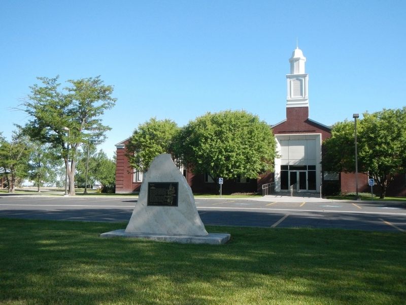
On West 2000 South (Burton Oil Road) near South 4000 West(Burton Loop Road), on the right when traveling west.
Settlement named in honor of Robert T. Burton, who laid out the townsite in 1882. Early settlers cleared the sagebrush, dug canals, ditches, planted crops, and built modest homes. A branch of the Church of Jesus Christ of Latter-Day Saints was . . . — — Map (db m140643) HM
Near State Highway 33 at South 550 West, on the right when traveling west.
Jenny Leigh, an Eastern Shoshone Indian of Chief Washakie's People, was born in 1849. She first married a French-Canadian trapper, who was later killed and despoiled of his furs by an Indian in Jackson Hole Country.
She later married . . . — — Map (db m276486) HM
On East 1st North at North Millhollow Road, on the right when traveling west on East 1st North.
In the summer of 1883, William F. Rigby purchased, dismantled and moved by oxen a mill to the new community of Rexburg, establishing the only mill in southern Idaho. The mill was reconstructed on the west side of Third East, between Second and Third . . . — — Map (db m42052) HM
On South 2nd East near East 1st South, on the right when traveling south.
The first settlers arrived in the spring of 1883. These settlers were willing to neglect their own home building long enough to build a community meetinghouse.
A log building, thirty by sixth feet, built at a cost of $8500, was erected on this . . . — — Map (db m140640) HM
On East 2nd South near College Avenue, on the right when traveling west.
On November 12, 1888, five years after settlement of Snake River Valley, Bannock Stake Academy opened with 60 students ranging from 6 to 24 years of age. School was held in the first ward L.D.S. chapel during the first years. In 1898 it became a . . . — — Map (db m140637) HM
On East 1st North at North 2nd East (State Highway 33), on the right when traveling east on East 1st North.
A tithing barn was built on this property in the summer of 1885, two years after the first settlers arrived in Rexburg. The barn was built of 1x10 inch rough lumber and put together with wooden pegs. It was sixty feet long and thirty feet wide. The . . . — — Map (db m140588) HM
Near North Salem Road near Salem Church Road, on the right when traveling south.
A few fur trappers, led by Andrew Henry, arrived along the Snake River in 1810. They built log shelters about five miles downstream from St. Anthony and established Henry's Fort. Other trappers who spent time in the area included men from the . . . — — Map (db m140740) HM
On Park Avenue at Center Street, on the right when traveling south on Park Avenue.
In August 1903, Mark Austin negotiated the purchase of a section of land here, the south half to be used as this town site and the north half, about 1/2 mile northeast, to be used for a sugar beet factory for the Fremont County Sugar Company. By . . . — — Map (db m140742) HM
On East Baseline Road near North 200 East, on the right when traveling east.
Near this spot, a ferry was established in 1886 by George Montgomery and Andrew Smith. Charges were fifty cents for man and horse; seventy five cents for team and wagon. Only means of crossing Snake River between Starrh's Ferry and American Falls, a . . . — — Map (db m138487) HM
On West 4900 South, on the right when traveling south.
The Price family located on the present site of Samaria Feb. 10, 1868. A branch of the Church fo Jesus Christ of Latter-Day Saints was organized Nov. 18, 1868, Thomas S. Thomas, President. Irrigation water was obtained from John Thorpe's Spring. A . . . — — Map (db m140127) HM
Near Main Street south of Boise Avenue, on the right when traveling south.
When gold was discovered in Jordan Creek-in 1863 people from all over the world came to seek their fortune. Many came from the East along the Mormon Trail, branching off to follow the stage and freight trail from Kellon, Utah to Idaho, then . . . — — Map (db m240527) HM
On West Ash Street near West Park Avenue, on the left when traveling west.
In 1810-18 Francois Payette, Donald McKenzie, John Day, Jack Weiser, a Mr. Whitman and others, named this valley and river "Payette." In 1862 David Bivens' stage station was erected and Nathan Falk's store was opened in 1876. William E. Smythe, of . . . — — Map (db m119315) HM
On East Cedar Street near East Center Street, on the left when traveling south.
The first pioneer families from Utah came here in 1879 and were met by a Spanish prospector, Guadelupe Valdez. Rockland was named for Rock Creek, which runs the full length of this valley. It was one of the early settlements of Idaho. The first . . . — — Map (db m140357) HM
On Scenic State Highway 33 at East Wallace Avenue, on the right when traveling north on State Highway 33Scenic . Reported missing.
Who accompanied Lewis & Clark through the Northwest in 1803-6, was the first white man to enter Teton Valley (Pierre’s Hole) in 1807 and discovered Teton Pass, Jackson Hole and the wonders of Yellowstone Park. Later called “Colter’s Hell.” He . . . — — Map (db m276453) HM
On Stricker Cabin Road near East 3200 North (Pumpland Road), on the right when traveling east.
Original building was erected by James Bascom in 1878. The first trading post west of Fort Hall. Station for Pony Express and Ben Halliday (sic, Holladay) Stage Line. The largest artery of wagon travel in United States passed here on old Oregon . . . — — Map (db m125408) HM
Under the Homestead Act of 1880, John Lingren acquired this land, cleared the sagebrush, raised vegetables and dairy products, started a nursery, planted hundred of fruit, evergreen, shade and ornamental trees. It became Idaho Falls' first amusement . . . — — Map (db m124383) HM
Near East Washington Avenue near Las Vegas Boulevard North.
John Steele, one of the original L. D. S. missionaries, secured a mail grant for the Las Vegas Mission. The documents to establish the Post Office, and, appointing William Bringhurst Postmaster, were brought from Salt Lake City by Benjamin H Hulse, . . . — — Map (db m29294) HM
Near East Washington Avenue near Las Vegas Boulevard North.
In 1855 Pres. Brigham Young appointed a company of men under the leadership of William Bringhurst to establish a colony at Las Vegas. The company left Salt Lake May 10 and arrived at Las Vegas June 14, 1855 and camped near this site. William . . . — — Map (db m234578) HM
In 1869 Heleman Pratt, Wm. D. Kartchner and other L.D.S. Church members came to Overton; built adobe homes; planted vineyards and crops. In 1871 double taxation forced an exodus from Muddy Valley. Local investors acquired the land, resold to . . . — — Map (db m241359) HM
In 1864 Brigham Young called for settlers to colonize the Muddy (now Moapa) Valley. On January 8, 1865, eleven men and three women arrived and began the first settlement at St. Thomas, now covered by the waters of Lake Mead. Later other settlements . . . — — Map (db m145959) HM
Near Jacks Valley Road/Main Street (Nevada Route 206) at Genoa Lane.
In 1851 Col. John Reese, with a little band of eighteen men crossed the great deserts and built the first trading post in Nevada, “Mormon Station”. Later came more members of the Mormon Faith who settled and established the town of Genoa. Among . . . — — Map (db m20686) HM
Near Un-named Dirt Road 17 miles east of Interstate 80, on the right when traveling east.
Located about 500 feet south of this marker.
Established July 27, 1867 by Captain S.R. Smith, built by the 200 soldiers under his command and named in honor of General H.W. Halleck, commanding the Division of the Pacific. The first buildings were . . . — — Map (db m89506) HM
On Main Street (Nevada Route 318) at 1st South, on the right when traveling north on Main Street.
In 1882, Congress passed the Edmunds Act causing L.D.S. Church property to be confiscated, including cattle which the receiver leased to Nichols and Parsons. Later the law was repealed and church property returned. The lessees could not fully repay . . . — — Map (db m1301) HM
On Locke Avenue 0 miles north of Apache Street, on the left when traveling north.
First settled 1876 to 1878 by families of William and Marion B. Hendrickson, Charles and Milton Virden, Orville Pyle, A.F. Miller and William Lock. The first school-house was built in 1879; the Methodist Episcopal Church in 1886. William Lock . . . — — Map (db m22805) HM
On Brigham Street (County Route 6100) west of County Route 6337, on the right when traveling east.
Among early settlers on this site were the families of Wm. Simpson, A.D. Arthur and Frank Coolidge, Ager and James K.P. Pipkin, Hugh Curry, W.L. Kennedy and others. James B. Ashcroft was called by L.D.S. Church as bishop in 1997. He supervised . . . — — Map (db m240549) HM
On Parkdale Drive at Rogue River Hwy (U.S. 66) on Parkdale Drive.
On this site in 1916, the Oregon Utah Sugar Company erected a large beet factory. C.W. Nibley, director of the company and presiding bishop of The Church of Jesus Christ of Latter-day Saints (Mormons/L.D.S.), oversaw the project. Nibley's sons, . . . — — Map (db m112529) HM
The community of Nibley briefly flourished at the turn of the century. This pioneer community, 11 miles east of La Grande, was in the midst of what are now fields. Charles W. Nibley, George Stoddard, and
M.L. Causey organized the Oregon Land . . . — — Map (db m240529) HM
On N Avenue at Fourth Street, on the right when traveling west on N Avenue.
La Grande was founded in 1861 on this site. The first chapel of the Church of Jesus Christ of Latter Day Saints was erected (1901) it was a frame building 34 x 60 ft. costing $2,100. A brick tabernacle was
built in 1907 and the chapel became a . . . — — Map (db m240531) HM
The leaders of The Church of Jesus-Christ of Latter-Day Saints were looking to Mexico as a possible colonization site. By the spring of 1875, nearly 100 pages of selected passages from the Book of Mormon had been translated into Spanish for . . . — — Map (db m38069) HM
On West 1100 South, on the right when traveling west.
No. 255
Erected 1959
The Grist Mill
Minersville was settled in 1859 for the purpose of opening lead mines. Nelson S. Hollingshead built a grist hill on this site in 1871. It was operated by water diverted from the Minersville . . . — — Map (db m240540) HM
On South Main Street south of Center Street, on the right when traveling south.
On this site in 1865-66 a tabernacle was erected by the pioneers. Built of local brick, lumber and stone. It was of pioneer architecture with a large assembly hall, gallery, full basement, a tower and large bell. This building was used for church . . . — — Map (db m75614) HM
On East Center Street at South 100 East Street, on the right when traveling east on East Center Street.
Beaver Territorial Courthouse is considered one of the finest examples of Pioneer architecture. The architect, K.A. Kletting, designed the building in the Queen Ann style with Victorian overtones. The courthouse was constructed under the direction . . . — — Map (db m75581) HM
On Utah Route 153, on the left when traveling east.
In 1872-73 a two and two-thirds mile square, protective military reservation was established following the request of C.M. Hawley, Associate Justice, Utah Territory. Built of native rock and lumber, it received 250 troops Sept. 7, 1873, Major John . . . — — Map (db m75578) HM
On South Main Street, on the right when traveling north.
Near this site, Feb. 6, 1856, in zero weather, Beaver pioneers made their first camp. Prior to this, the land had been rejected as unfit for cultivation, but the amount of water available gave courage. At a mass meeting in Parowan some of the more . . . — — Map (db m75615) HM
On North 400 East Street south of East 400 North Street, on the right when traveling north.
Dedicated to the memory of the valiant pioneers who erected the first woolen mills in Southern Utah in 1870. It was a busy mecca, with wagons coming and going from all over the State with their goods to trade. — — Map (db m75576) HM
On North 400 East Street south of East 400 North Street, on the right when traveling north.
On this site in 1870, in a three story building, 60 x 120 feet, the first Woolen Mills in Southern Utah operated. Machinery was brought here from New England by railroad and wagon. John Ashworth and others schooled in England in the art of wool . . . — — Map (db m75577) HM
Near Utah Route 161 1 mile north of Interstate 70.
Completed April 12, 1867, by direction of Brigham Young, with L.D.S. Church funds, as a travelers way station and refuge from Indians. Ira N. Hinckley built and maintained it as a hostelry and residence until 1877. A well within the fort provided . . . — — Map (db m75519) HM
On Ely Highway (Utah Route 21), on the left when traveling north.
A typical mining town at the foot of the San Francisco Mountain was fed by the fabulously rich Horn Silver Mine. By 1885 over $60,000,000 in zinc, copper, lead, silver, and gold were hauled away by mule train and the Utah Central Railroad. Water was . . . — — Map (db m78264) HM
In 1860 Samuel Edwards, George Horton, William Richards and David Miller with their
families came from Parowan and Cedar City and settled on Dry Creek. Soon others followed. Homes were built of logs, rock, and adobe. The meadows were covered with . . . — — Map (db m274195) HM
The Milford stamp or A.G. Campbell mill was erected in the fall of 1873 at a cost of $45,000. It was designed to work the ores of the Old Hickory Mine. In 1873-74 the mill ran successfully for five months. They used a 60 horse power engine, two . . . — — Map (db m240533) HM
On North 4600 West, on the right when traveling east.
In 1866 a group of Mormon Scandinavians were called by the Latter-day Saint Church to establish this settlement and develop an irrigation project from the waters of the Malad River. Their first homes were dugouts built in the west bank of the Bear . . . — — Map (db m276901) HM
On West 5900 North, on the right when traveling west.
In 1866 a group of Scandinavian Latter-day Saints entered the area that would become Bear River City. Their first homes were dugouts on the west bank of the Bear River. These dugouts were roofed with poles, willows, straw, and dirt. The fall of 1867 . . . — — Map (db m276902) HM
On North 4600 West, on the right when traveling east.
In commemoration of the founders of this community who made their first homes in the banks of the Bear River in the winter of 1866. To the residents of the old fort and all other pioneers who resided in Bear River City and came to Utah prior to May . . . — — Map (db m278592) HM
On West 5800 North Street at 4800 W, on the right when traveling west on West 5800 North Street.
A house, built in the fort in 1867, first served this community as a school, William Crosley
teacher, night classes were held for adults. A tithing granary was also used for school purposes. In 1885 one large room, built of rock was constructed and . . . — — Map (db m276904) HM
On West Beaver Dam Road, on the left when traveling west.
The Box Elder Cooperative Association was established in 1867 -68 by Lorenzo Snow, under direction of Brigham Young. In 1871 a dairy, said to be the first in Utah, was built south of Beaver Dam, near a cold water spring, Christian Hansen, operator. . . . — — Map (db m44467) HM
The Knudsen cabin, built by Porter Squires for Wilhelm and Laura Amelia Knudsen in 1855, was one of the first permanent structures in Brigham City. Located on the corner of First East and First South, the original cabin was 14' x 18'. It had a loft . . . — — Map (db m240501) HM
On North 4050 West at 2350 North (Montana Street), on the right when traveling north on North 4050 West.
On this site the Corinne Opera House, for many years the largest recreation center in Utah outside of Salt Lake City, was erected in 1879. Built of red pine lumber with square nails, the leading stock companies, California bound on the new railroad, . . . — — Map (db m105258) HM
On North 4000 West (Sixth) at 2350 North (Montana), on the left when traveling north on North 4000 West (Sixth).
In 1870 the first U.S. Government weather station in Utah was erected on this site by the War Department Signal Service, U.S. Army Division of Telegrams and Reports, for the benefit of commerce. The observer was William W. McElroy. The station was . . . — — Map (db m105253) HM
On Elm Grove Dr. south of W 2400 S, on the right when traveling north.
Three Mile Creek, later named Perry, originated in 1853 with the arrival in the Three Mile Creek Valley of the William Plummer Tippetts family and Lorenzo and May Perry. They were soon joined by William Walker, Thomas C. Young, Alex Perry, and . . . — — Map (db m240481) HM
On North 5200 West north of W 10000 N, on the right when traveling north.
A natural ford on Bear River, first used by Indians, trappers and explorers, was selected
by John Hailey in 1863, as the crossing point for his new stagecoach road, from Salt Lake
City, Utah to Boise, Idaho. Unknown hands carved "Boise Ford 1853" . . . — — Map (db m276908) HM
On S 100 W at South Street, on the right when traveling north on S 100 W.
Settled March 31, 1851 by five families followed by six families in the fall. It was first called North Willow Creek and changed to Willard in 1857. The fort was built in 1853 to 1855, constructed of dirt and rock. The first grist mill was begun . . . — — Map (db m240488) HM
When the Willard Central School was constructed in 1902, a bell tower with a large brass bell was installed on the roof toward the front of the building. The bell was rung fifteen minutes before school began and again at noon. Students vied for . . . — — Map (db m240487) HM
On North Main Street at W 300 N, on the right when traveling north on North Main Street.
The Willard Pioneer Cemetery's first burial was August 1854 with the death of five-day-old John Memorial, Jr., son of John Memorial (Memory) and Samantha Wells
McCrary. This site, selected by Willard's first settlers, is located one block east . . . — — Map (db m240482) HM
On West Center Street at 100 W, on the right when traveling east on West Center Street.
This tithing granary was built about 1905 and is on the National Register of
Historic Places as one of only a few well-preserved tithing buildings in Utah. The successful "in-kind" tithing system of The Church of Jesus Christ of Latter-day Saints . . . — — Map (db m276939) HM
On West Center Street, on the right when traveling east.
In honor of the noble men and women who pioneered Poverty Flat, later named Lewiston, for its first bishop William H. Lewis. First settlers arrived July 8, 1870. — — Map (db m276427) HM
On West 2000 South, on the right when traveling west.
This cabin was used as a family home from 1876 to 1956. It was the home of George and Hannah Wheeler and their ten children. George Walton Wheeler headed west in 1854 with his father, Levi, bringing the first steam engine and sawmill west of the . . . — — Map (db m276785) HM
On South 300 West, on the right when traveling east.
In 1880, Gustave Lundberg and Christian Garff planing mill operators, set up a direct current electric light plant, probably the first in Utah. It was a small Thompson Houston machine with a capacity of fifty arcs providing five lights for
Logan . . . — — Map (db m277248) HM
In 1866,the pioneers gathered the stones in this base, from the river channel and bench lands surrounding Logan, for the purpose of building a fort wall around
the tabernacle square. Time proved that a fort was not necessary and the stones
were . . . — — Map (db m277279) HM
In 1860 two grist mills were built and operated in this valley. One at Wellsville by Daniel P. Hill and the other at Millville by Esias Edwards and Leroy Kent. The first burrstones obtained from Black Rock, Utah proved to be too soft for grinding so . . . — — Map (db m44471) HM
The first settlers came to Logan in 1859. With several deaths in 1860, a burial ground was designated at 7th East and 5th North, which was used for six or seven
years. As the settlement expanded, it was necessary to move the remains to a better . . . — — Map (db m277282) HM
On W 100 N at N 100 W, on the right when traveling east on W 100 N.
This original log home was first constructed as a part of the Mendon Fort in 1859. It was owned by Ole Peder (Peter) Sorensen (from Denmark), one of the first settlers of Mendon.
The two rows of 25 log homes in the fort were built close . . . — — Map (db m277148) HM
On West Main Street at S 100 W, on the right when traveling east on West Main Street.
Located three and one half miles north of this marker the first storage reservoir in Utah was begun in 1871 and completed in enlarged form in 1886. After going out three times length of dam, 127 feet, height 28 feet, made of earth and rocks, cost . . . — — Map (db m276937) HM
On West 3200 South west of South 600 West, on the right when traveling west.
In July, 1855, the first settlers in Cache Valley, 23 men and 2 women under the leadership of Martin Ensign and Bryant Stringham came to Willow Valley with about 2000 cattle, established Elk Horn Ranch near some fine springs, located about one mile . . . — — Map (db m149769) HM
On South 200 West (U.S. 91 at milepost 40) near West Main Street, on the right when traveling north.
In July 1859 under the leadership of John Bair, (interpreter and guide) sixteen families settled here, built log cabins and dugouts between City Creek and Brower Springs. The following Spring other families arrived and a permanent fort was built for . . . — — Map (db m105497) HM
On 400 East north of E 500 S, on the right when traveling south.
Originally called "Dry Town" then later named River Heights, this town overlooks the Logan River. The first settlers, arriving here in 1883, were the families of Anders Anderson, Mathias Lundberg, Hyrum Merrill, Christian Hansen, Knut Hansen, Peter . . . — — Map (db m277247) HM
On West Center Street, on the right when traveling east.
Near this location on the south side of Summit Creek, the first pioneers from Salt Lake, led by John P. Wright, began the settlement Smithfield. The land was surveyed and lots
assigned. By May 10, 1859, they commenced to plow, plant crops and . . . — — Map (db m276794) HM
On U.S. 6 at Route 123, on the right when traveling north on U.S. 6.
Early settlers in Whitmore Canyon, later called Sunnyside, were Jefferson Tidwell, his family and a brother John, who grazed cattle in the area prior to building their home in 1897. They located a vein of coal, sold it to the Utah Fuel Company for . . . — — Map (db m148001) HM
On East Main Street at North 200 East, on the right when traveling west on East Main Street.
The settlement of Price began in 1877 when Caleb B. Rhodes and Abraham Powell arrived here. Two years later a number of Later Day Saints and their families strengthened the settlement. A branch of the church was organized in 1881 and in 1882 George . . . — — Map (db m148009) HM
The Albert Grames cabin, built in 1891, stood originally on a site two miles northwest of here. In 1904 Grames bought land in Price, dismantled his cabin, and used the logs to build this somewhat larger structure. The cabin is unique in that it was . . . — — Map (db m148119) HM
We hold in sacred memory those sturdy and brave pioneer women, who left their homes in the Eastern United States or sailed from the foreign lands; that trekked across hills, plains, and mountains, forded streams and rivers, birthed and buried loved . . . — — Map (db m148118) HM
On Main Street at 100 East, on the left when traveling west on Main Street.
In 1877 Jefferson Tidwell was called by Brigham Young to find a location for settlement east of the Wasatch Mountains. By 1879 the first pioneers came, built homes, later irrigated their farms with Price River water. This log cabin, built by Robert . . . — — Map (db m148004) HM
On South Main Street at East Center Street, on the left when traveling south on South Main Street.
One of the oldest L.D.S. chapels. Finest at time of erection. Augustus Farnham architect. Site dedicated Feb. 11, 1857 by Elder Lorenzo Snow. Grain was stored in stone foundation when Johnston's army advanced. The walls are of adobe. Roof timbers . . . — — Map (db m192433) HM
On South 500 West, on the right when traveling south.
This small private cemetery, once known as Nathan's Burial Ground, is the final resting place of the early pioneer settler Daniel Wood and many of his relatives. It is one of the oldest burial plots in Davis County.
Daniel Wood emigrated . . . — — Map (db m245931) HM
On Orchard Drive at Mill Street, on the right when traveling north on Orchard Drive.
This site was surveyed August 1, 1852 and the mill (largest of it's time in Utah) was dedicated May 6, 1853.
Built on rock foundation with solid adobe walls trimmed with red sandstone, this Burr mill operated until 1892, when roller mills . . . — — Map (db m125132) HM
On East Center Street, on the left when traveling west.
This building was originally a stage coach station built and operated in 1866 by William Reeves for the Wells Fargo Company which had control of the Overland Route. After the Utah Central R. R. was completed in 1870, it was abandoned. Mr. Reeves . . . — — Map (db m246345) HM
On Center Street, on the right when traveling east.
Clearfield was first known as Sand Ridge where dry farming began in 1869. First settlers, Richard and Emily Hamblin, built a small dugout with dirt floor and thatched roof of sagebrush and dirt in 1877. Drinking water was hauled from Layton. After . . . — — Map (db m274695) HM
In 1870, the Wm. J. Hill, Chauncey Hadlock families built homes in this area. Culinary water was brought from Weber River in barrels until the Fife Community Irrigation Ditch was finished. D. P. Davis, first school teacher, charged $5.00 per child. . . . — — Map (db m273274) HM
On North South 25 East (Rock Mill Lane), on the right when traveling north.
The Richards Grist Mill, originally known as the
Rock Grist Mill, was owned and operated by S. W. Richards & Co. It was designed and built by Utah millwright Frederick Kesler at the direction of LDS Church President Brigham Young. James Leithead . . . — — Map (db m245980) HM
In 1847 Hector C. Haight settled in North Cottonwood, now Farmington, followed by
others and a ward of the Church of Jesus Christ of Latter-day Saints was organized
1849, Joseph L. Robinson, Bishop. In 1861 this cabin, built for Charles W. . . . — — Map (db m246363) HM
On North Main Street, on the right when traveling south.
Primary Association Organized
The L.D.S. Primary Association, conceived by Aurelia Spencer Rogers, to foster cultural
physical and spiritual activity in children, was organized in this building Aug. 11, 1878.
Aurelia S. Rogers, . . . — — Map (db m246364) HM
On South 200 West at West Center Street, on the right when traveling south on South 200 West.
The Kay's Ward Meetinghouse served residents of north Davis County for nearly 90 years as a center of religious and social life. Early pioneers gathered here to learn from Prophets, Apostles, and other lecturers, while plays, concerts, dances, and . . . — — Map (db m273068) HM
On Main Street (Utah Route 273) south of E 100 N, on the right when traveling north.
Built in 1854 by John Weinel a native of Germany who came to Utah about 1853, the mill was the “overshot” water powered type & was erected on Webb’s Creek ¼ mile N.E. of this site. Native stones were used for the walls and pines for it’s . . . — — Map (db m123714) HM
On West Gentile Street, on the right when traveling east.
Education was a priority to early pioneers. In 1857 Layton settlers built Adams School. The log structure was 20 X 32 feet, with a thatched roof, dirt floor, and a brick fireplace. The teacher was paid in produce, bacon, or flour.
School . . . — — Map (db m273248) HM
On Main Street north of West Gentile Street, on the right when traveling north.
The Layton area was originally part of Kaysville City, and all mail was delivered to Kaysville for pickup at the Kaysville Post Office. In 1882 the Farmer's Union Store was established. Local residents made arrangements to receive their
mail at . . . — — Map (db m273228) HM
On South Main Street, on the right when traveling south.
On this spot stood the Layton Stage Coach Station on the Utah Idaho Montana (Virginia City) trail. It was established in 1857 by Ben Holladay, and carried mail and passengers between Salt Lake and points north and west. Isaac Brown was the keeper. . . . — — Map (db m154484) HM
As pioneer settlers spread out onto the rangelands of Kaysville along the two branches of Kays Creek, those in the north, who made their living dry farming
and stock raising, separated from Kaysville to form their own town. It was named Layton, . . . — — Map (db m273252) HM
On South Main Street, on the right when traveling south.
In the early 1880's a one-room school was built on this site: a triangle of land between Onion Street and Highway 91. It was constructed of lime-cement and rock and measured 16 feet by 25 feet. There were six windows three on the north side and . . . — — Map (db m274171) HM
On South 1375 East, on the right when traveling north.
November 1851 Hyrum and John Bybee with their families located below the mouth of Weber Canyon. Robert Watts, Robert Nelson Watts, Ebenezer C. Cherry, Levi Hammond, James Heath, Cyrus Canfield, George W. Hickerson, Mark Hall and others came in 1852. . . . — — Map (db m273285) HM
On South 475 East, on the right when traveling north.
This monument was placed here to commemorate a three day, little known battle that occurred 13, 14 and 15 June 1862
The Kington (Kingston) Fort, a 645 foot by 645 foot enclosure was built on this site in 1853 to protect the early . . . — — Map (db m273282) HM
About 1872 the first soil was plowed in this community and in 1876-77 homes were erected. The people attended church services in Kaysville and Farmington prior to 1882 when Pres. Wm. R. Smith of Davis stake organized a branch of the L.D.S. church . . . — — Map (db m123767) HM
On Bluff Road 0.3 miles north of 2700 South, on the right when traveling north.
The Old Emigrant Road started at Salt Lake City, Utah, and ended at the City of the Rocks, Idaho, where it formed a junction with the California Trail. This road was also known as Bluff Road, Old Traveled Road, and the Salt Lake Cutoff. It was . . . — — Map (db m124032) HM
Near North 800 West, on the right when traveling south.
From 1860 to 1877 the Church of Jesus Christ of Latter-Day Saints held their services in school-houses. In 1872 Joseph C. Fackrell deeded the land upon which the first one-room adobe church was erected, donated labor and produce providing the means. . . . — — Map (db m273056) HM
On West 1500 South, on the right when traveling east.
In 1848, Eric G.M. Hogan and family settled in South Bountiful. In 1858, he built this cabin of native logs for wife, Ingeborg. The slab roof was fastened with wooden pegs. A ladder in corner served an upper room. Hannah joined the family in 1862, . . . — — Map (db m273076) HM
On West 1500 South, on the right when traveling east.
In the early summer of 1849 the first known death occurred in Sessions Settlement and this plot was selected as a cemetery. Nearly a score of people including pioneers, Indians, and a California emigrant (whose headstone is on opposite side of . . . — — Map (db m274698) HM
On South 12000 West south of W 1500 S, on the right when traveling south.
After 1861 this area was an Indian reservation until opened for settlement in 1905. Homesteaders arrived cleared land, dug ditches planted crops and built cabins. Home erected by David Richardson, moved here, became the first post office; Rhoda . . . — — Map (db m277138) HM
On West Main Street (U.S. 40) at N 100 West Street, on the right when traveling west on West Main Street.
Explorers, trappers and traders were here before Brigham Young sent a group, in 1861, to prepare the way for Mormon colonization. But in October 1861 the U.S. Government set apart Uintah Valley for Indian Reservation. In 1905 a portion was opened . . . — — Map (db m44051) HM
Near U.S. 40/191 at West East River Road, on the right when traveling west.
In commemoration of the Catholic Priest, Father Escalante, who in 1776 came into Utah. He crossed the Green River at Jensen and camped two days at that place. His diary shows that he camped at the junction of the Strawberry and Duchesne rivers one . . . — — Map (db m72764) HM
On East Main Street 0.1 miles west of South 100 East, on the right when traveling east.
In 1866-7, U. S. Army made road to Price and Bridge across Duchesne River. At this point Henderson’s Indian Trading Post, Caldwell’s Stage Station and a blacksmith shop were erected. 1905, Army surveyed townsite named for H. P. Myton, Supt. Indian . . . — — Map (db m72760) HM
On West 9000 North, on the right when traveling east.
The first white settlers came to Neola in 1906. By 1912 a log school house had been erected which served for many years for all public meetings. The bell displayed on this monument was purchased by donation in 1916 and placed on the building to call . . . — — Map (db m277133) HM
On U.S. Highway 40 at S 400 W, on the right when traveling north on U.S. Highway 40.
In 1905 William H. Smart, Uintah Stake President, Church of Jesus Christ of Latter-day Saints, supervised the colonization of reservation homesteaders. Ephraim Lambert was appointed bishop. Dry Gulch Irrigation Co. organized, R.S. Collett, President . . . — — Map (db m277137) HM
546 entries matched your criteria. Entries 101 through 200 are listed above. ⊲ Previous 100 — Next 100 ⊳