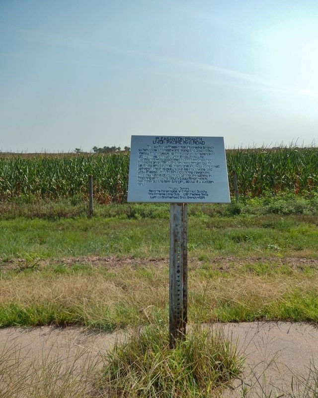
The ill-fated Pleasanton Nebraska branch extended southwestward along the South Loup Valley from Boelus to Pleasanton, a distance of 22.42 miles. Construction from Boelus to Nantasket was completed in 1887 and reached Pleasanton in 1890. The line . . . — — Map (db m181793) HM
On the South Loup River southwest of here was the site of the U.S. Army’s Post South Loup Fork. This small outpost of Fort Kearney was established in May 1865 by Company “E”, Seventh Iowa Cavalry, under the command of Capt. James B. David and . . . — — Map (db m181699) HM
This boulder is dedicated to the early pioneers of the community of Shelton, in recognition of their heroic services in establishing and protecting this town and in risking their lives that Shelton might be secure.
[Lower plaque] . . . — — Map (db m45283) HM
In April 1860 Joseph E. Johnson, a Mormon, established a road ranche at Wood River Center, today’s Shelton, and began publishing The Huntsman’s Echo, the first newspaper in Nebraska west of Omaha. He had earlier edited papers in Council Bluffs, . . . — — Map (db m45423) HM
The first settlers of Lyons came in the summer
of 1866. The fertile soil of the Logan Valley, combined
with the commercial promise provided by access
to the railroad after 1881, assured the life of the
town. Incorporated in 1884, the village was . . . — — Map (db m269772) HM
Val Peterson was born July 18, 1903, in the Oakland Swedish Lutheran Church parsonage, where his grandfather R.N. Swanberg was the pastor. Returning to live in Oakland at age fourteen, Peterson kept busy with school activities and various jobs, . . . — — Map (db m266055) HM
The Aron Arlington family arrived as the area's first Euroamerican settlers in 1857, later moving near Decatur.
Norwegian John Oak and his wife, Inger Askwig Oak, came to the Logan valley in 1866, occupying the abandoned Arlington cabin. As . . . — — Map (db m266049) HM
Logan Creek was named for Logan Fontenelle, a chief of the Omaha tribe killed by Oglala Sioux in 1855. The first recorded settlers in this area were the Aaron Arlington family, 1857, who settled at the site of present Oakland, and John Oak, 1862, . . . — — Map (db m266046) HM
In the summer of 1866 John Oak (namesake of Oakland) assisted Swedish immigrant families to take up homesteads here in the Logan Creek Valley. Among the first settlers were Victor Colson and his family. He is said to have broken the first sod in . . . — — Map (db m266100) HM
Old block house was built by U.S. War Department on this site in 1855 to protect white colony from Indians.
Crowning achievement of the pioneers was a gold medal award for best agricultural display at World's Fair 1893 in . . . — — Map (db m28077) HM
Tekamah, county seat of Burt County, was laid out
on October 7, 1854, by a group of settlers led by
Benjamin R. Folsom. They chose this location for
its abundant water, timber, stone, and the rich soil
of the Missouri River Valley. The site was . . . — — Map (db m269773) HM
Restored on Armed Forces Day May 19, 2001 by the Great Plains Society of Military Historiansto honor all of Butler County Veterans — — Map (db m265995) WM
H. L. Boston Edith Boston Proskovec A. C. (Prof) Hurlbert and families Portrait Photographers from 1893-1973 ——— Norton Law Offices 1978-1991 — — Map (db m265997) HM
Nebraska Historic Site David City Park Municipal Auditorium This property is listed in The National Register of Historic Places — — Map (db m265996) HM
Dedicated to the veterans of the World War 1917-1918 This memorial made possible by the generosity of W. A. Wells Contributors Kregger Post 125 and Auxiliary, American Legion High School and civic minded persons of David City, Nebraska . . . — — Map (db m265999) HM
The north side of the square has always been a bustling part of the downtown. In 1895, at the east end, the City National Bank is highlighted as a prominent financial institution. Other businesses include E.E. Stevens Drug Store, Mike Tilma's . . . — — Map (db m255089) HM
With the faith and courage of their forefathers who made possible the freedom of these United States The Boy Scouts of America dedicate this copy of the Statue of Liberty as a pledge of everlasting fidelity and loyalty 40th Anniversary . . . — — Map (db m181434) HM
The original Schweser's store, founded by George Schweser, was
constructed in 1886. George became a prominent businessman in the area,
and his sons later joined the company.
The People's Banner in 1895 described the Schweser's Store as the . . . — — Map (db m255095) HM
Moses Shinn and his son Dick began operating Shinn's Ferry across the Platte in 1859. The original site was near Savannah, the first Butler County seat, and a short distance from the present Schuyler bridge. Just above this location the Platte was . . . — — Map (db m39143) HM
Built by the druggist Thorton B. Myers, the T.B. Myers building is at the
northwest corner of the downtown square. His drug store occupied this location until 1900 when he sold it to J.B. Davis, as shown in this 1904 photograph. Other businesses . . . — — Map (db m255086) HM
Butler County was organized in 1868.
The site of Savannah,
the first county seat (1869-72) was located one half mile west and two and one half miles north of this point.
Shinn’s Ferry, established in 1858 directly north of this point proved . . . — — Map (db m236151) HM
The Thorpe Opera House, built in 1889 by William B. Thorpe, served as a cultural center and a hometown stage for Thorpe's daughter, Estelle. The three-story brick building featured a beautifully designed interior with walnut stained chairs, . . . — — Map (db m255072) HM
The photograph shows the west side of 4th street in the block northwest of the courthouse square in 1913. Past businesses at this location included a jewelry store, a cobbler, a tailor, and the Lincoln Pure Butter Company. To the right is the . . . — — Map (db m255078) HM
From 1050-1400 the lower Platte and Missouri River valleys were home to prehistoric Indian farmers. These people lived in small villages and isolated farmsteads, cultivated corn and beans, and hunted game. The Indians built square-shaped houses . . . — — Map (db m298136) HM
"Love is more like a light that you carry .... that is what love is to a woman - a lantern in her hand," says Abbie Deal the courageous heroine in Bess Streeter Aldrich's novel about the pioneers who with dreams and hard work forged this great . . . — — Map (db m82510) HM
This Property
is listed in the
National Register
of Historic Places
By the United States
Department of the Interior
Blake Building 305 Main Street 1883 ca
John Blake, proprietor of a local saloon, erected this building. The . . . — — Map (db m78059) HM
This Property
is listed in the
National Register
of Historic Places
By the United States
Department of the Interior
Budweiser Building 1888
Anheuser-Busch Brewing Co built for $20,000 to house a saloon and liquor business. . . . — — Map (db m78051) HM
Two markers, to the left and right of the front entrance.
Has been placed on the
National Register
of Historic Places
By the United States
Department of the Interior
1985
This Property
is listed in the
. . . — — Map (db m78049) HM
When the outbreak of war between the states became imminent in the spring of 1861, the citizens of Plattsmouth were quick to respond to the impending crisis. Without waiting for President Lincoln's call for volunteers, Dr. Robert R. Livingston . . . — — Map (db m78024) HM
This Property
is listed in the
National Register
of Historic Places
By the United States
Department of the Interior
Drew/Weckbach 317, 321, 325 Main Street 1881 & 1886
Joseph V. Weckbach came to Plattsmouth in 1865. After . . . — — Map (db m78056) HM
This Property
is listed in the
National Register
of Historic Places
By the United States
Department of the Interior
Excelsior Building 313 Main Street 1884
Three business owners, in succession, J.C. & R. Peterson, brothers, . . . — — Map (db m78058) HM
This Property
is listed in the
National Register
of Historic Places
By the United States
Department of the Interior
Plattsmouth Bridge 1930
The bridge was built to replace the ferry service that had started in 1848. It was . . . — — Map (db m78061) HM
This Property
is listed in the
National Register
of Historic Places
By the United States
Department of the Interior
Vienna Bakery 329 Main Street 1881
Built by William Stadelman, First occupant was a bakery run by William . . . — — Map (db m78054) HM
This Property
is listed in the
National Register
of Historic Places
By the United States
Department of the Interior
Wetenkamp Building 337 Main Street 1890
Many businesses occupied this site. Among them were various stores, . . . — — Map (db m78053) HM
This building was constructed by community effort in 1871 of native limestone as the Congregational Church and served in that capacity until a new brick church was constructed 1887-1890. The nearby stone parsonage, first occupied in 1867, was sold . . . — — Map (db m82521) HM
During their exploration of the Missouri and Columbia Rivers, Lewis and Clark held councils with Ponca, Omaha, and Sioux Indians inhabiting this region. The council with the Sioux occurred August 28-31, 1804 at Calumet Bluff now the southern . . . — — Map (db m101395) HM
On August 27, 1804, the Lewis and Clark Expedition set up its camp for four days downstream from Calumet Bluff. The explorers came across three American Indian boys who told them of a large Yankton Sioux camp nearby.
Knowing that President . . . — — Map (db m101392) HM
You are within sight and sound of a Midwestern dream come true - the Meridian Highway.
In 1911 a group of Kansans and Nebraskans drafted a plan for a highway paralleling the sixth principal meridian through America's heartland from Canada . . . — — Map (db m101393) HM
This scenic overlook provides a clear view of the valley of the Missouri River,
the longest waterway in North America. To the west is the Gavins Point Dam and
the Lewis and Clark Recreation Area. The dam was built to harness the fury of
the . . . — — Map (db m101391) HM
The Missouri, the continent's longest river, figures prominently in the unfolding of America's saga. Flowing nearby in its 2,341 - mile course from the Rocky Mountains to the Mississippi, the Big Muddy is not only loaded with sediment but . . . — — Map (db m101394) HM
Much of the early history of Cedar County involves the Indian inhabitants, the Ponca, Omaha, and Sioux. Several prehistoric and historic Indian villages were located in the region. In 1804, Lewis and Clark ascended the Missouri River near here . . . — — Map (db m181311) HM
This marker, dedicated on the 100th anniversary of Hartington High School, June 25, 1988, is in honor of two graduates who became governors of Nebraska. Dwight Burney, born in 1892, graduated from Hartington High School in 1910. Burney attended . . . — — Map (db m181317) HM
Arthur, Age 16 years
Hannar, “ 14 “
Andrew, “ 9 “
William “ 8 “
Loren, “ 4 “
_________________________________
Massacred by Yankton
and Santee Sioux Indians
July 24, 1863
between 9 and 10 o’clock a. m. . . . — — Map (db m292955) HM
Champion, on the Frenchman River (Creek), is the site of probably the oldest functioning water-powered mill in Nebraska. Preliminary construction on the mill was begun in the fall of 1886. The work was completed and the mill placed in operation by . . . — — Map (db m79376) HM
Near this spot stood the Rowley sod house. Built in 1875 it was the first habitation in Chase County. On October 3, 1878, while on his way home to protect his family, Rowley was killed by Cheyenne Indians during the epic trek of Dull Knife’s Band . . . — — Map (db m177410) HM
The first ranch in this area was set up on the Niobrara River about five miles south of here in 1877. E. S. Newman established his ranch to sell cattle to the government for delivery to the Indians at the Pine Ridge Agency to the north.
The . . . — — Map (db m9622) HM
This natural valley extending east and west across the Sandhills became known as Survey Valley after the Burlington and Missouri River Railroad surveyed a prospective line from O’Neill to Alliance in 1887. No rails were ever laid. On January 19, . . . — — Map (db m178711) HM
This arched cantilever truss bridge, connected in the center with a single pin, is the only one of its kind in the United States. It was built in 1932 by the Department of Public Works and named by the local citizenry in honor of Governor Charles . . . — — Map (db m70625) HM
Oldest High School Bldg. in Nebraska
———————————————
A living memorial
in memory of
Maxine Allard
for her dedication to the
education of our children — — Map (db m312421) HM
This land was donated to the
CITY OF VALENTINE in 1986
by Frank & Harriet Colburn and is
hereby named
COLBURN PARK
and it[s] purpose being for the use
of the elderly citizens &
various civic organizations of
Valentine & the . . . — — Map (db m312403) HM
Spread out along the North Loup River west of here, DeWitty, later known as Audacious, was the largest and longest-lasting African American settlement in rural Nebraska. The settlers, including former slaves who had fled to Canada before the . . . — — Map (db m312383) HM
When a Sioux Indian reservation was established north of here in Dakota Territory in 1878, early settlers in the region grew fearful of attack. They requested military protection, and in 1880 Fort Niobrara was built a few miles east of present-day . . . — — Map (db m77753) HM
For Those That Served
In The
Korean War
January 1, 1947
January 27, 1961
[Armed Services Emblems]
[★ - Killed in Action or Died in Service]
Adams, Donald E. • Adams, Jack B. • Adams, Merle D. • Ahrens, . . . — — Map (db m312570) HM
For Those That Served
In The
Vietnam War
January 28, 1961
May 7, 1975
[Armed Service Emblems]
[★ - Killed in Action or Died in Service]
Aeschliman, Darwin W. •
Aeschliman, Richard L. •
Ahrens, Dennis . . . — — Map (db m312609) WM
Dedicated to the memory of All Area Veterans.
Inscribed here are the names of those veterans
from this area who made the supreme sacrifice
in defense of the freedoms we all cherish
[Dedicated] November 11, 1984
World War I . . . — — Map (db m312531) HM
Honoring those from Cherry Co[unty]
who served in the Second World War
Dedicated June 28, 2003
Carl G. Abercrombie •
Donald L. Abraham •
Ruth Ahlf •
Leonard H. Alder •
Donald J. Allard •
Walter W. Allard •
Albert Allen • . . . — — Map (db m312633) HM
In honor and memory of those
who served in the World War
World War Veterans
[★ Killed or Died in Service]
[Column 1]
Adams, Harvey •
Adams, John Phillip •
Adair, Carl Geoffrey •
Albrechtsen, Kai •
Allard, Carl Allen . . . — — Map (db m312448) WM
At 10:45 a.m. on February 5, 1944, 1st Lt. John B. Beatty of Sandusky, OH, and 2d Lt. Earnest W. Fanslau of Mantua, NJ took to the air from the Ainsworth Army Air Field in two P-47 "Thunderbolt" fighter planes for an instrument training flight. Lt. . . . — — Map (db m77754) HM
On August 9, 1949, the first successful oil well in western Nebraska came in for 225 barrels of oil per day at a total depth of 4,429 feet. Marathon Oil Co. completed the discovery well, Mary Egging No.1, located four miles east and two miles . . . — — Map (db m223425) HM
On June 1, 1926, George A. Coulter completed one of the first four irrigation wells in Cheyenne County, among the earliest in western Nebraska, on his farm just south of here. He and his son, James, dug the first twenty-two feet by hand. Charles . . . — — Map (db m231142) HM
Potter began as a small Union Pacific Railroad settlement and depot midway between Kimball and Sidney. The station house was built by Union Pacific in 1870 and, as the only building in the settlement, also served as the post office and school. Its . . . — — Map (db m231144) HM
Thar’s gold in them thar hills! The Black Hills Gold Rush 1874: Two scientists attached to the Custer Expedition uncover gold in sacred Sioux land in South Dakota—and the Black Hills Gold Rush is on. During the Allison . . . — — Map (db m257339) HM
Cheyenne County was organized in 1870 from lands ceded by the Cheyenne, Arapaho, and Dakota Sioux Indians. In the panhandle of Nebraska, it is part of the Cheyenne tableland portion of the Great Plains. Some fifteen miles west of Sidney lies the . . . — — Map (db m231054) HM
Sidney Barracks, when established in 1867, was a temporary camp with one permanent structure, a blockhouse located to the north. In 1869 the Fort was relocated at this site and in 1870 the name was officially changed to Fort Sidney. The primary . . . — — Map (db m76864) HM
Eight plaques mounted on a single monument are located at Hickory Square. The plaques are presented left to right.
Early Day Cheyenne County
The history of Nebraska and Cheyenne County correlate to the push westward of the . . . — — Map (db m76866) HM
In memory of the founders, riders, stock tenders, station keepers, superintendents and anyone connected with the day to day operation of the Central Overland California and Pikes Peak Express Co. — — Map (db m255114) HM
A distinct group of prehistoric hunter-gatherers known to archeologists as the Oxbow Complex once occupied the northern High Plains from western Nebraska to southern Canada. About 2500 B.C. a band of Oxbow people interred two of their own near . . . — — Map (db m231081) HM
Known throughout the Old West
as "The Bad Man's Cemetery"
Excavated & relocated in 1922
211 bodies removed
Sidney's original cemetery
www.sidneyboothill.com — — Map (db m252485) HM
Pole Creek Original Station
Apr. 3, 1860 - Nov. 20, 1861.
Reverse
In the fall of 1859 a new
route from the South Platte
to the North Platte River
for the Oregon-California
Trail followed Lodgepole
Creek to here and then . . . — — Map (db m252482) HM
The Purple Heart medal was originated by General George Washington on August 7, 1782 for distinguished valor and is now awarded only to members of the armed forces of the United States who have been wounded in combat against an armed enemy. . . . — — Map (db m231068) HM
In 1867 an Army tent camp was established near here to provide protection for Union Pacific Railroad construction crews. Three years later it became Fort Sidney, the nucleus for the town of Sidney, county seat of Cheyenne County. The rush to the . . . — — Map (db m231061) HM
Gold was discovered in the Black Hills in August, 1874. By the spring of 1876, the Army had stopped enforcing a treaty which reserved the hills for the Sioux Indians. Miners soon began to pour into the gold regions. From 1875 to 1881, the . . . — — Map (db m231079) HM
Sioux Army Depot was established on 23 March 1942 as Sioux Ordnance Depot. It was the only U.S. Army Ammunition Depot in Nebraska during World War II, the Korean War, and the Vietnam War. The depot was initially under the command of the U.S. Army . . . — — Map (db m76863) HM
The town of Clay Center was laid out in the summer of 1879. An election on November 4, 1879, confirmed Clay Center as the location for the Clay County seat, following months of heated competition with rivals Sutton and Harvard. W. D. Young erected . . . — — Map (db m287737) HM
Placed in the National Register of Historic Places Nov. 29, 2001 Architect: R.W. Grant Builder: T.J. Fowler Cornerstone: July 7, 1913 — — Map (db m287769) HM
The original Spring Ranche, located two miles south of here on the north side of the Little Blue River, was founded about 1863. James Bainter, the first permanent settler, operated a store and inn for travelers along the Oregon-California Trail. . . . — — Map (db m287728) HM
Tracks of the Burlington and Missouri River Railroad reached Harvard on December 20, 1871. The town was surveyed in March 1872 and platted on a section of land pre-empted by Newman W. Brass, George Van Gilder, Elijah J. Stone, and Levi W. Mosher. . . . — — Map (db m251240) HM
Harvard Army Air Field, located two miles northeast, was one of eleven army air forces training fields in Nebraska during World War II. The 1,759-acre base included runways, hangars, barracks, and fuel and munitions storage. Construction began in . . . — — Map (db m251249) HM
The jail was inadvertently sold to Robert Pinckney, 16, in a delinquent tax sale in 1943. When the city refused to buy back the jail, sparking a legal battle that earned national publicity, Pinckney put the jail up for auction at a West Coast war . . . — — Map (db m287727) HM
Harvard’s first library in 1885 was a traveling one established in Church’s Drugstore, and moved to other buildings until Mayor George H. Thomas appointed a committee in 1914 to contact the Carnegie Foundation. Citizens pledged $3,175.25 and . . . — — Map (db m251252) HM
As eight B-17F “Flying Fortresses” returned to Harvard AAF after training exercises on August 28, 1943, three collided. One crash-landed and two were demolished. Fourteen airmen died, including co-pilot Carl Hansen, whose parachute failed. . . . — — Map (db m251244) HM
The congregation organized in May 1881, building a church that fall on Oak Street east of the Harvard Courier building. The first service was in March 1882, with consecration by Bishop Robert Clarkson, Missionary District of the Platte. Five . . . — — Map (db m251260) HM
This stone remains from the pillar at the entrance of the Woodmen Hall building. The pillar and steps of Woodmen Hall were hauled on a flat wagon that was pulled by mules from Kansas.
Woodmen Hall was built by George Herzog in 1893. Erected . . . — — Map (db m287730) HM
The first permanent settler in the town of Sutton was Luther French, who arrived in 1870. He and his seven children lived near here in a dugout on the bank of School Creek. This dugout had a tunnel to the creek bank and the inside entrance could be . . . — — Map (db m78007) HM
Twenty-two German families from the Russian villages of Worms and Rohrbach arrived in Sutton in September 1873, the first of many German Russians to settle in Nebraska. The immigrants were descendants of ethnic Germans who began colonizing the Volga . . . — — Map (db m251263) HM
On March 27, 1879, George G. Meade Post 19, Grand Army of the Republic, Department of Nebraska, was founded in Sutton by twenty former Union soldiers. The G.A.R. was a national fraternal organization created to provide for the welfare of Union . . . — — Map (db m78006) HM WM
By the early 1600s, the ancestors of the Pawnee Nation began consolidating into a few large communities. Each was home to hundreds, if not thousands, of people. Some of these were built along nearby Shell Creek. These Shell Creek cities may have . . . — — Map (db m179394) HM
Bancroft was the home of John G. Neihardt between
1900 and 1920. Here he wrote all of his short stories
and lyric poetry including A Bundle of Myrrh, The
Splendid Wayfaring, and the Quest and began his epic
poem A Cycle of . . . — — Map (db m159850) HM
John Gneisenau Neihardt (1881-1973), teacher, philosopher, and Nebraska Poet Laureate, moved to Bancroft in 1900. Here he first became acquainted with Indians, married, and began his major work, A Cycle of the West, a five-part epic poem . . . — — Map (db m161558) HM
The building was erected on this site in
the 1890s for August Hartman and used as a
residence by various owners until 1964. Poet
John G. Neihardt rented the building from
1911 through 1920 for a study. Here he wrote
his lyrics, prose, and part . . . — — Map (db m161556) HM
Transported on a 107 foot tractor-trailer
to present location on Sept. 12. 1996 from
the Army National Guard base at Mead, NE.
Dedicated Nov. 11. 1996
In memory of all who served — — Map (db m161559) HM WM
Anselmo began as a railroad town along the Burlington and Missouri River Railroad. The Burlington needed a stop for water, coal, and switching facilities. It built a depot, and the town itself was platted in November 1886. A Lincoln Land Company . . . — — Map (db m223426) HM
1400 entries matched your criteria. Entries 101 through 200 are listed above. ⊲ Previous 100 — Next 100 ⊳