638 entries match your criteria. Entries 201 through 300 are listed.⊲ Previous 100 — Next 100 ⊳
Works Progress Administration (WPA) projects Historical Markers
Markers related to public works built through or associated with the Works Progress Administration (later called the Works Projects Administration), or WPA, the Great Depression-era U.S. Federal government agency which provided jobs for millions of Americans.
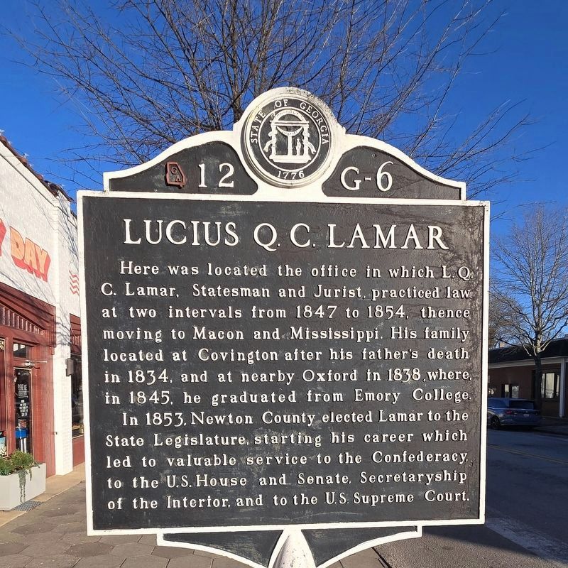
On Floyd Street 0 miles east of Church Street (Georgia Route 36), on the right when traveling west.
Here was located the office in which L.Q.C. Lamar, Statesman and Jurist, practiced law at two intervals from 1847 to 1854, thence moving to Macon and Mississippi. His family located at Covington after his father's death in 1834, and at nearby Oxford . . . — — Map (db m289766) HM
On Dallas-Acworth Highway (Georgia Route 381) at Bobo Road, on the left when traveling west on Dallas-Acworth Highway.
Dedicated to the Northern and the Southern men who gave their all for cherished principles; undivided Union and States’ Rights; in the battle fought here in May, 1864. — — Map (db m20841) HM
On West Church Street 0 miles west of Anderson Avenue, on the left when traveling east.
Here on the Indian Path that connected two Indian Trails, from Hartford to Fort Hawkins and from Barnard’s Crossing to the Old Creek Agency, James Abbington Everett established, in the 1820’s, the Indian Trading Post around which Fort Valley arose. . . . — — Map (db m53096) HM
On Georgia Route 136 1 mile north of Connector Route 136 Connector Road, on the left when traveling north. Reported missing.
The road running west of here down Talking Rock Creek to the site of Coosawatee Old Town is a portion of the Old Federal Road opened through the Cherokee Nation, in 1805, by Georgia and Tennessee. It follows the course of a trail shown on a map of . . . — — Map (db m51211) HM
On Commerce Street (Georgia Route 26) at North Lumpkin Street, on the right when traveling east on Commerce Street.
Slosheye Trail was used by the Indians and white traders as an artery of travel as early as 1750 and extended from Hawkinsville on the Ocmulgee River to Drayton on the Flint River. This ancient trail passed through Hawkinsville over the present . . . — — Map (db m40328) HM
On South Jefferson Avenue (Business U.S. 129/441) at West Sumter St, on the right when traveling south on South Jefferson Avenue.
Birthplace of
Lucius Quintus Cincinnatus Lamar
Born September 17, 1825
Putnam County Georgia
Commissioner of the Confederate
Government to Europe, Senator of
the United States, Secretary of the
Interior and Associate Justice . . . — — Map (db m264146) HM
On DeLaigle Avenue at 2nd Street, on the left when traveling north on DeLaigle Avenue.
In 1808, Nicholas de L' Aigle, a French
refugee, established brick yards 1/4 mile
south which furnished Augusta with building
brick for 75 years. River clay was "pugged"
to the right constency in a cylindrical vat
by a stone turned with . . . — — Map (db m38190) HM
On Independence Drive near near 13th Street (U.S. 1), on the left when traveling west.
Residence George Walton 1792 - 1804
Signer of
The Declaration of Independence
Delegate to Continental Congress
Representative & Senator
Chief Justice and Twice Governor
of Georgia
W.P.A. 1936 D.A.R. — — Map (db m33201) HM
On Walton Way near 3rd Street, on the right when traveling east.
In 1808, Nicholas de L Aigle, a French refugee established brick yards 1/4 mile south which furnished Augusta with building bricks for 75 years. River clay was "pugged" to the right consistency in a cylindrical vat by a stone turned with mule-power, . . . — — Map (db m273550) HM
On Old Atlanta Road (Old Georgia Route 41) 0.1 miles north of Caruso Road, on the right when traveling north. Reported missing.
Near this site was the home of Captain John McIntosh Kell, Executive Officer of the Confederate cruisers Alabama and Sumter. After entering the United States Navy at the age of 17, he served in the Mexican War and in 1853 on Perry’s expedition to . . . — — Map (db m53584) HM
On Old Atlanta Road 0 miles south of Minter Road, on the left when traveling south.
Near this site was the home of Captain John McIntosh Kell, Executive Officer of the Confederate cruisers Alabama and Sumter. After entering the United States Navy at the age of 17, he served in the Mexican War and in 1853 on Perry’s expedition to . . . — — Map (db m11704) HM
On Omaha Road (Route 39) 1 mile north of Canyon Road (Route 39C), on the left when traveling south.
On this site was fought the battle of Shepherd's Plantation between Creek Indians and pioneer settlers aided by volunteer soldiers stationed at Forts Ingersol, Jones and McCreary under Major Henry W. Jernigan and Captain Hamilton Garmany.
On a . . . — — Map (db m46361) HM
On Young Harris Highway (U.S. 76) at Trackrock Gap Road, on the right when traveling east on Young Harris Highway. Reported missing.
The high rounded peak to the south with lookout tower is Brasstown Bald or Mount Enotah, the highest mountain in Georgia 4,748 feet above sea level. Its Indian name, Itseyi, means “place of fresh green” and refers to its grassy instead . . . — — Map (db m32613) HM
On Young Harris Highway (U.S. 76) at Trackrock Gap Road, on the right when traveling east on Young Harris Highway. Reported missing.
The road leading south crosses Trackrock Gap, two miles from here. Soapstone boulders in the gap are covered with tracks, symbols, and patterns carved in the rocks by primitive man. The gap was called by the Cherokee Datsu nalasgun'yi, "where there . . . — — Map (db m14150) HM
On South Cherokee Road (Georgia Route 11) at Hightower Trail, on the right when traveling south on South Cherokee Road.
This road is a portion of Hightower Trail, old Indian path to Etowah River, which ran from High Shoals of the Appalachee westward to Shallow Ford on the Chattahoochee. It formed a boundary between Cherokee lands to the north and Creek lands to the . . . — — Map (db m33434) HM
On North Broad Street (U.S. 129) at East Main Street (U.S. 280), on the left when traveling south on North Broad Street.
Hernando de Soto discovered Ocmulgee River at or near Abbeville on April 3, 1540. “Here,” says the chronicler Biedma, “we found a river that had a course not southwardly, like the rest we had passed, but eastward to the sea.” Next day the Altamaha . . . — — Map (db m40106) HM
The Assembly Hall was built in 1941 to house the Department of Music. Campus and community patrons attended numerous concerts over the years in the main hall, which still houses the J.W. Cunningham Memorial Organ donated by Laura Moore Cunningham . . . — — Map (db m266702) HM
On North 13th Street, on the left when traveling north.
North Junior High was constructed on “Lemp’s Triangle,” a vacant lot that had been previously used as a ball field by local children. The school was designed by the firm of Tourtelotte and Hummel, and built by J. O. Jordan and Son. Constructed in . . . — — Map (db m267028) HM
On West Fort Street at North 13th Street, on the right when traveling north on West Fort Street.
President Franklin Roosevelt’s tour of the American West in 1937 included a stop in Boise. The tour provided the president opportunities to promote New Deal public works and job stimulus programs and see first-hand how they benefitted American . . . — — Map (db m267016) HM
Near South Arthur Avenue at Center Street, on the right when traveling south.
Northwest: Carlson (or Spaulding) Building, across Center Street, was built in 1919 in a Sullivanesque style. Its appearance has been altered by remodeling of the first-floor storefronts and removal of the original tin cornice. The Pocatello . . . — — Map (db m267795) HM
On Martin Luther King Junior Way (East Terry Street) just west of East Oak Street, on the right when traveling west.
Constructed by the Works Progress Administration in cooperation with the State Board of Education, the State Department of Vocational Education, the National Youth Administration and the Southern Branch of the University of Idaho Commenced 1936 . . . — — Map (db m305500) HM
On Highland Avenue south of 127th Street, on the right when traveling south.
In the early days of Blue Island's history, the need for a public burial ground was evident. The Blue Island Cemetery Association organized and managed this plot of land as a cemetery until 1898, when the city passed an ordinance prohibiting burial . . . — — Map (db m274454) HM
Near Midway Plaisance east of South Stony Island Avenue, on the right when traveling east. Reported permanently removed.
The Garden of the Phoenix symbolizes the mutual respect and friendship that Japan and the United States initiated more than 120 years ago. In 1893, here on Jackson Park's Wooded Island, the Japanese Government built the Ho-oh-den (Phoenix Temple) . . . — — Map (db m257852) HM
Near South Stony Island Avenue near South Cornell Avenue.
The Osaka Garden symbolizes the mutual respect and friendship that Japan and the United States initiated more than 130 years ago. In 1893, here on Jackson Park's Wooded Island, the Japanese government built the Hooden (Ho-oh-den) as its pavilion for . . . — — Map (db m314455) HM
Near North Cannon Drive 0.1 miles south of West Fullerton Parkway, on the right when traveling south.
“Water has cut deeply into prairie soil. The clays and gravels of the Middle West are merely a thread on stone floors. In this loam, oak trees grass and corn take root.”
Alfred Caldwell, 1943
A peaceful oasis . . . — — Map (db m47844) HM
On West Fullerton Parkway at North Cannon Drive, on the right when traveling east on West Fullerton Parkway.
Alfred Caldwell Lily Pool
has been designated a
National Historic Landmark
This site is a premier example of the Prairie style of landscape architecture. Alfred Caldwell, a landscape designer, architect, teacher and poet, . . . — — Map (db m47846) HM
On North Central Avenue near West Irving Park Road (Illinois Route 19).
Portage was created in 1913 in an area that had few parks since its annexation to Chicago in 1889. Members of local civic organizations argued that parks would enhance property values and improve the neighborhood. Their efforts resulted in the . . . — — Map (db m242949) HM
Portage was created in 1913 in an area that had few parks since its annexation to Chicago in 1889. Members of local civic organizations argued that parks would enhance property values and improve the neighborhood. Their efforts resulted in the . . . — — Map (db m242950) HM
On North Long Avenue at West Irving Park Road (Illinois Route 19), on the right when traveling south on North Long Avenue.
Portage was created in 1913 in an area that had few parks since its annexation to Chicago in 1889. Members of local civic organizations argued that parks would enhance property values and improve the neighborhood. Their efforts resulted in the . . . — — Map (db m248209) HM
On West Sherwin Avenue 0.1 miles west of Sheridan Avenue, on the right when traveling east.
A pioneer of children's television, Burr Tillstrom's earliest puppet shows were put on in the window of his boyhood home for the neighborhood children.
Graduating from Senn High School in 1935, Tillstrom turned down a college scholarship to be . . . — — Map (db m243039) HM
On Main Street west of Fremont Street, on the right when traveling east.
Built in 1893 of “Athens marble" at a cost of $13,319 during the administration of Mayor John McCarthy, and has since served as the seat of municipal government. Originally, a wood frame bell tower stood between the gables. The building housed . . . — — Map (db m295717) HM
Near Riverwalk Drive at Barrypoint Road, on the right when traveling south.
Developed over 150 years ago, the site of the Hofmann dam has contributed to the development of Chicago and its surrounding suburbs. Before Chicago was incorporated, a small village named Lyons developed just 12 miles west. Home of Portage Creek, a . . . — — Map (db m225297) HM
July 1832
General Winfield Scott camped near this spring on way to Blackhawk War.
June 7, 1834
Election of Jean Babtiste Beaubien as 1st Colonel of Militia of Cook County, known as 60th Illinois Militia. In celebration of the . . . — — Map (db m236101) HM
On Pine Avenue at Longcommon Avenue, on the right when traveling east on Pine Avenue.
About the poster: The Federal Arts Project (1935 - 1943) provided employment for artists during the Great Depression and was one of the first U.S. Government programs to support the arts. Poster makers in the program used wood block, silkscreen and . . . — — Map (db m233520) HM
On Main Street west of Chicago Avenue, on the right when traveling south.
Works Progress Administration Three Span Concrete T-Beam Bridge — Third Bridge at Main Street
1931–2005
Designed by D. E. McGrath and F. A. Roseman
Built entirely by residents of Naperville
2005–
Two Span Post-Tensioned Concrete Bridge . . . — — Map (db m257108) HM
On North 27th Street north of Caroline Street, on the left when traveling north.
During the 1930s this country suffered through a severe depression, not only of the economy but of the spirit of the
people as unemployment and poverty engulfed the land. After the prosperous 1920s many middle class people lost their
incomes, . . . — — Map (db m262026) HM
On Mill Street near River Street, on the left when traveling east.
In the 1840's, Montgomery's founder Daniel S. Gray dug a mill race that went through the center of what is now Montgomery Park. He then built a dam across the river south of Taylor Street using stone that had been excavated. In those early days of . . . — — Map (db m271419) HM
On Southwest Jefferson Avenue at Main Street, on the right when traveling south on Southwest Jefferson Avenue.
Peace and Harvest were designed by Mary Anderson Clark as a Works Project Administration (WPA) art project. In 1938, a committee, chaired by Mrs. Julia Proctor White, commissioned Mary Anderson Clark to sculpt the eight-foot limestone . . . — — Map (db m253069) HM
On North Newton Street (U.S. 231) just north of West Schuetter Road, on the left when traveling north.
Increased crime during the Great Depression demanded an expanded police presence and faster communication technology. In response, the Motor Vehicle Police (established in 1921) was reorganized as the Indiana State Police in 1933. The new division . . . — — Map (db m238483) HM
Near Pacific Street west of N. Elkhart Avenue. Reported unreadable.
Island Park
The island formed by the confluence of the Elkhart and St. Joseph Rivers could be said to be the birthplace of our community. According to folklore, the Native Americans living in the area named the Elkhart River, . . . — — Map (db m200294) HM
Near Park Road 0.1 miles north of East 28th Street, on the right when traveling north.
Col. James E. Roberts was an industrial leader and prominent citizen of Fayette County. He moved to Connersville during the Civil War era and entered the retail hardware business. In 1874 he purchased interest in a local furniture factory and for . . . — — Map (db m152022) HM
Near East 28th Street just south of Park Road, on the right when traveling east.
The Great Depression
Money was scarce during the depression and everyone looked for ways to stretch their dollars. Roberts Park is an excellent example of how resourceful communities were in that day. The Administration Building, for example, . . . — — Map (db m152019) HM
On West 5th Street west of North College Street, on the right when traveling west.
Built 1934 for "Boy Scouts" by W.P.A. - Local Workers Guy Smith - Project Mgr., Logs - Walter Marshall Farm, Bricks - Veedersbrg Paving. — — Map (db m34089) HM
On West Clark Street, on the right when traveling east.
Outhouse built by WPA during Depression costing buyer $5.00. Commonly called "Roosevelt Privies." Donated by Edward Kosta Jr. Family to Fair Grounds in 2013 — — Map (db m240749) HM
On West Vaughn Drive east of Elm Street, on the right when traveling east.
Flood of 1937Although Madisonians are used to the ups and downs of the river, 1937 marked the year of the worst recorded flood in Ohio River history, enveloping the city below First Street. The high water mark is indicated on the . . . — — Map (db m181338) HM
On Indiana Route 7 at Muscatatuck Park Entrance Road, on the left when traveling north on Indiana Route 7. Reported missing.
Opened 1921 as Indiana's fourth state park for its natural beauty and recreation potential. Named Vinegar Mills State Park after stone-cutting mill in park. Renamed Muscatatuck State Park 1922. Stone shelters and stairways, fire tower, trails, . . . — — Map (db m45877) HM
Near Oak Avenue north of Marquette Drive, on the right when traveling south.
For decades people have enjoyed strolling the bridges to Patterson Island. The small island located in the Grand Calumet Lagoon was enhanced for access during the Great Depression through the Works Progress Administration (WPA). . . . — — Map (db m226859) WM
On 23rd Street west of P Street, on the right when traveling west.
(Side One)
Lawrence County Hospital Association was organized July 15, 1903 to build, maintain, and manage a hospital in Bedford. Opened first building 1904. State, district, and local Works Progress Administration officials and city and . . . — — Map (db m74128) HM
On West State Street at South Main Street, on the left when traveling west on West State Street.
Postal records indicate, that the earliest mail delivery was carried by horse back in 1824, this station was known as Madison Court House. Later, with the completion of what is now known as State Road 38 mail delivery was made at . . . — — Map (db m164186) HM
On Alabama Street just north of East North Street, on the right when traveling north.
Social reformer Roberta West Nicholson moved to Indianapolis ca. 1925. She co-founded the Indiana Birth Control League in 1932, renamed Planned Parenthood. As state representative, Nicholson sponsored a 1935 “Heart Balm Bill” that outlawed suing . . . — — Map (db m210951) HM
On South 1st Street at Clark Street, on the left when traveling south on South 1st Street.
James Lankford settled in the Rockport area in 1808, moving his wife and daughter into a cave under the bluff overlooking the Ohio River. Other settlers moved into the lowland that became downtown Rockport (originally dubbed Hanging Rock). By . . . — — Map (db m47615) HM
On W. Mishawaka Ave at Charlotte St, on the left when traveling west on W. Mishawaka Ave.
Mishawaka's oldest park, circa 1860s; given to city (1881) by members of Battell family. Features include Civil War soldiers monument (1884); neoclassical copper-domed, brick and limestone bandshell commemorating WWI (1927); exceptional Works . . . — — Map (db m61835) HM
On Muskhogen Trail 0.2 miles south of Pollack Avenue, on the right.
WPA workers were the first to help with excavations.
In April, 1939, 20 WPA (Works Progress Administration) workers reported to the Angel Site. They were part of a Depression-era job corps funded by the government.
For the next three . . . — — Map (db m227030) HM
On Market Street (U.S. 71) just south of Southside Street, on the left when traveling south.
…Near the crossroads of the nation, our parks and trails, attractions and celebrations, quality health care and good schools, makes Audubon a fine place to live, raise children, work and play. John James Audubon Clock A 21-foot clock of John . . . — — Map (db m239499) HM
On Leroy Street just north of Broadway Street, on the left when traveling north.
John James Audubon Stained Glass Clock A 21-foot-tall clock with Audubon and his dog Zephyr, artistically created of stained glass. It has exact Universal time and is lighted at night. It was commissioned by the Audubon Masonic Association. The . . . — — Map (db m239589) HM
Near A Avenue at West 1st Street, on the right when traveling north.
Prior to bridges, anyone living north of Vinton had to cross the Red Cedar by boat to “come to town.” A ferry was established June, 1852 to help with cargo. The county judge established the rates for passage: Foot passenger 5¢; man, horse & vehicle . . . — — Map (db m239636) HM
Near West North 1st Street south of West 2nd Avenue North, on the right when traveling north.
This suspension cable swinging bridge was built at the site of the "Old Mill Dam" in 1937. Labor for the construction was furnished by the Works Progress Administration (WPA), part of Franklin D. Roosevelt's "New Deal" Program. The bridge was . . . — — Map (db m233861) HM
On 3rd Avenue at Park Street, on the left when traveling east on 3rd Avenue.
Harry Hopkins 1890-1946 Government Harry Hopkins held important positions in the federal government under President Franklin D. Roosevelt. Hopkins was born in Sioux City but moved with his family to Grinnell as a child. He . . . — — Map (db m293694) HM
On South Main Street just south of West 5th Street, on the right when traveling south.
There is plenty to do while visiting Galena, aside from Cars
on the Route, starting right here in Howard "Pappy Litch
Memorial Park. Named for a local historian, the park was
once a federal weigh station. This official Route 66 . . . — — Map (db m161631) HM
On North Pine Street, on the right when traveling north.
Franklin D. Roosevelt's New Deal and Works Progress Administration was the basis for the construction of Abilene's swimming pool, stadium, rose garden, and other buildings located in this park. This park project under the WPA was one of thirty such . . . — — Map (db m49551) HM
On 9th Street at Vermont Street, on the right when traveling west on 9th Street.
Constructed 1903-1904
This Carnegie Library housed the
Lawrence Public Library 1904-1972
Designed by George A. Berlinghof
in the Beaux Arts style
Rear addition was a 1937 Works Progress
Administration project
Andrew Carnegie . . . — — Map (db m54570) HM
On Sheridan Street at Pershing Street, on the right when traveling south on Sheridan Street.
Three barracks were completed in 1867, two built of stone and one of adobe. For about eighteen months, until the permanent buildings were finished, the men lived in seventy dugouts at the river bank. Each dugout accommodated four men, had bunks . . . — — Map (db m65425) HM
On Washington Avenue just west of 2nd Street, on the right when traveling west.
"One of the main things we did at (Nico)Demus was skate and dance at the Hall at Christmas. Oh man, old young tried to skate." Bernard Bates, Nicodemus descendant
Construction of the Township Hall gave Nicodemus a community . . . — — Map (db m154729) HM
On Athletic Park Drive 0.1 miles north of Fischer Field (football stadium), on the right when traveling west.
The "Mennonite Settler," designed and sculpted by artist Max Nixon (1915-2000), was dedicated by the City of Newton September 10, 1942. Funding came from citizens of Newton, the Junior Chamber of Commerce, and the U.S. Works Progress Administration . . . — — Map (db m53494) HM
On Lakeshore Drive, on the left when traveling west.
Marion County Park & Lake is the result of two FDR New Deal programs that were born during the 1930s depression. The Civilian Conservation Corps and Works Progress Administration's goals were to put men to work and conserve our natural resources. . . . — — Map (db m60994) HM
On 9th Avenue west of Main Street, on the left when traveling west.
Constructed by
The United States Government
Works Progress Administration
August 1938 – October 1939
First Night Game September 29, 1939
Caney 39 Altoona 0
Stadium Dedication October 27, 1939
Caney 19 Sedan 0 . . . — — Map (db m57877) HM
[Historical excerpts from marker]
Osborne, Established 1871 (Side A)
Architecture
Architectural Gems Galore
Osborne has two buildings listed on both the National Register of Historic Places. The Classic-styled Carnegie Research . . . — — Map (db m54300) HM
Outhouses, sometimes referred to as "backhouses" or "privies", were once a common sight across America. Made from a variety of materials and from various designs, outhouses functioned as restrooms for those who did not have indoor plumbing. Usually . . . — — Map (db m40094) HM
On 19th Street at N Street, on the left when traveling east on 19th Street.
After the stock market crash of 1929, millions of Americans lost their jobs and those still working saw their wages reduced. Drought and dust storms in the Great Plains left many farm families in despair. Congress quickly drafted new federal . . . — — Map (db m79902) HM
Under Pres. Roosevelt’s New Deal, $6500 was allocated to the WPA to build a new schoolhouse. It was completed in June 1938. Ten years later, building was deeded to the American Legion. Post was named Austin Collins in honor of a local boy who died . . . — — Map (db m88961) HM
Near Mill Street (Route 1) at Cushing Street (U.S. 1).
Originally designed and built 1892 by John A. Roebling's Sons Co. for mill workers to cross the river from new housing in Topsham to the Cabot Mill in Brunswick. The bridge has served generations of citizens of all ages between Brunswick and . . . — — Map (db m51968) HM
Near Shore Road south of Littlejohn Road, on the right when traveling north.
The Militia Storehouse was built in 1915 by the Quartermaster Corps and was assigned to the Maine National Guard. The concrete building was used by the 240th Coast Artillery Regiment for storage of tents, bunks, and other equipment required during . . . — — Map (db m186107) HM
Near Shore Road south of Littlejohn Road, on the right when traveling north.
The Militia Storehouse was built in 1915 by the Quartermaster Corps and was assigned to the Maine National Guard. The concrete building was used by the 240th Coast Artillery Regiment for storage of tents, bunks, and other equipment required during . . . — — Map (db m186111) HM
On Main Street (Maine Route 73) near Myrtle Street, on the right when traveling north.
[Historical Excerpt Transcribed]
General Information
The Rockland Harbor Trail is easy to follow. Allow you and your imagination enjoy the Harbor sights along the way. The trail is approximately 5.5. mile[s] from beginning to end, . . . — — Map (db m52340) HM
On High Street just north of Wright Street, on the right when traveling north.
The Belfast Ladies Improvement Society lobbied the city council in April of 1904 to establish a seaside park for the benefit of the public. The purchase price of the 15 acre lot was $3,000 and, once secured, prominent Boston . . . — — Map (db m59392) HM
Look up and you will see the remnants of a small stone lodge on the hill above the trail! It was likely built during the 1930s by the Works Project Administration under Pres. Franklin D. Roosevelt. In its early years, the lodge was a gathering place . . . — — Map (db m307328) HM
Near Safari Place 0.2 miles north of Beechwood Drive, on the right when traveling north.
The iron-barred cages and stone dens in the Main Valley were constructed during the 1930s through President Franklin D. Roosevelt's Work Progress Administration (WPA). They are relics of the Victorian era of zoo-going when the goal was to . . . — — Map (db m189036) HM
Near Constellation Plaza 0.3 miles east of Wallace Street, on the right when traveling east.
While the British attack lasted 25 hours, nature's assault of rain, snow, freezing and thawing continues every day.
Erosion represents a breach in the fort's defenses against the elements. Once the grass dies and the earth is exposed, it . . . — — Map (db m145546) HM
Near Dwight D. Eisenhower Highway (Interstate 70) south of Baltimore National Pike (U.S. 40), on the right when traveling east.
Maryland's Appalachian Region Offers Visitors Natural Splendor And Outdoor Adventure, Plus Countless Opportunities To Explore The Region's Rich Heritage—all Just A Few Miles Off Interstate 70.
Maryland Byways, like the Historic National . . . — — Map (db m116525) HM
Maryland's Appalachian Region Offers Visitors Natural Splendor And Outdoor Adventure, Plus Countless Opportunities To Explore The Region's Rich Heritage—all Just A Few Miles Off Interstate 70.
Maryland Byways, like the Historic National . . . — — Map (db m196240) HM
The Chapin House.
This Queen Anne style house, completed in 1884, was the Henry A. Chapin family home until 1902. In 1932, when the City of Niles bought the property at auction for $300, the Chapin children stipulated that it be used only for . . . — — Map (db m1706) HM
On Gratiot Street (U.S. 41) at 3rd Street, on the right when traveling east on Gratiot Street.
The influx of miners and speculators caused concern about the lack of law and order in the region. So in March 1844, Secretary of War, William Wilkins, dispatched two companies of infantry to build and occupy a fort, that bears his name, one mile . . . — — Map (db m152892) HM
On West 1st Street at Pine Street, on the right when traveling west on West 1st Street.
Grettenberger Field was constructed in 1935-1936, in the midst of the Great Depression, under the federal Works Progress Administration (WPA) jobs creation program. It originally included a grandstand, ice skating rink, and football field. Baseball . . . — — Map (db m179819) HM
638 entries matched your criteria. Entries 201 through 300 are listed above. ⊲ Previous 100 — Next 100 ⊳