On Memorial Boulevard (U.S. 119) at Pittsburgh Street, on the left when traveling south on Memorial Boulevard.
Dedicated to the Veterans of all wars. Their devotion, sacrifices and ideals have assured our liberties.
[left plaque]:
This memorial presented by the Connellsville Sesqui-Centennial Association 1956. Dedicated November 11, 1958. . . . — — Map (db m76719) WM
On South Pittsburgh Street just north of East Morton Avenue, on the right when traveling north.
The stately homes in the 500 block of South Pittsburgh Street reflect the wealth in Connellsville in the late 19th and early 20th centuries. The Doctor Echard House, built in 1888, and the Southside Hospital, built in 1909, reflect an unusual . . . — — Map (db m216997) HM
On North Arch Street at East Orchard Alley, on the left when traveling north on North Arch Street.
Founding of Connellsville and City Hall Zachariah Connell secured a charter for a town on March 21, 1793. He saw this as a natural stopping place for immigrants and travelers to build rafts and float down the river. He named . . . — — Map (db m217090) HM
On South Pittsburgh Street just north of Baldwin Avenue, on the right when traveling north.
Carnegie Library Carnegie Free Library, a magnificent building, was built in 1903 with funding donated by Andrew Carnegie. It is of Ohio buff stone and is in the Italian Renaissance style. There is an auditorium on the second . . . — — Map (db m217192) HM
On West Crawford Avenue (Pennsylvania Route 711) just west of Pittsburgh Street, on the right when traveling west.
Brimstone Corner In 1845, Thomas Ewing conducted a general store on the corner where present day Crawford Avenue and Pittsburgh Street intersect in downtown Connellsville. The political discussion in the general store was so . . . — — Map (db m217193) HM
On North 7th Street at Torrance Avenue, on the left when traveling north on North 7th Street.
Our beautiful Youghiogheny River, "Meandering and Contrary River" from Delaware (Algonquin) language, attracted the first people into our region. Native Americans followed such animals as buffalo and deer into this most inviting of hunting . . . — — Map (db m231973) HM
On North 7th Street north of West Crawford Avenue ( Route 711), on the left when traveling north.
Former P & LE Train Station
The Former Pittsburgh & Lake Erie Train Station is one of two remaining train stations of the six that were originally located in Connellsville. This is the only original passenger station still standing. This . . . — — Map (db m232417) HM
On South Pittsburgh Street at East Fairview Avenue, on the right when traveling north on South Pittsburgh Street.
Motion picture pioneer, born in Connellsville. Developed concepts of film editing, screenplay, and other cinematic techniques. In early 20th century, he was America's leading director; his most famous film was "The Great Train Robbery," 1903. — — Map (db m41784) HM
On University Drive (U.S. 119) 0.1 miles south of Cellurale Drive, on the right when traveling north.
Christopher Gist, the Ohio Company surveyor who went to Fort LeBoeuf with Washington, settled here in 1753. In 1754, Washington halted his campaign here and retreated to Fort Necessity. Pursuing French destroyed the plantation. — — Map (db m59677) HM
On Snyder Street (Pennsylvania Route 711) at Robbins Street, on the left when traveling east on Snyder Street.
Project Pride
Restoration of retaining wall of
Hill Grove Cemetery
1961 to 1964
Material and equipment furnished by donations
of civic minded people of Connellsville Area
Labor furnished by Connellsville
Carpenters Union Local . . . — — Map (db m232166) HM
On University Drive (U.S. 119) 0.2 miles south of Cellulare Drive, on the right when traveling north.
The Georgian manor on the hill was built 1802 by Isaac Meason. Veteran of the Revolution, Meason was a pioneer ironmaster. In 1817 at Plumsock he built one of the first rolling mills. — — Map (db m59679) HM
On North 7th Street at Torrance Avenue, on the left when traveling north on North 7th Street.
Major General Edward Braddock and his army on the way to capture Fort Duquesne, at the forks of the Ohio River, crossed the Youghiogheny River at Stewart's Crossing (now Connellsville.) The army camped in this area from June 28-30, 1755. During . . . — — Map (db m231974) HM
On South Pittsburgh Street at East Green Street, on the left when traveling south on South Pittsburgh Street.
To honor the five brothers who served their country during WW II
T/Sgt Frederick J •
M/Sgt Charles J •
Capt Edgar K •
M/Sgt Isaac H •
S/Sgt John W — — Map (db m232449) WM
On North Arch Street just north of East Orchard Alley, on the right when traveling north.
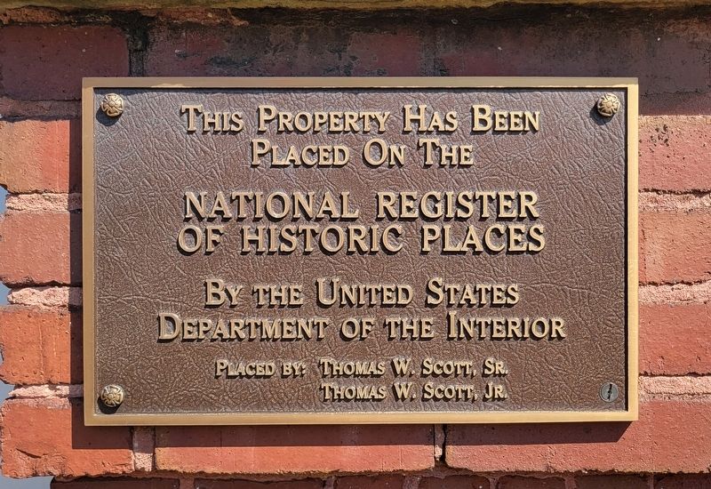
This Property Has Been Placed On The National Register of Historic Places By the United States Department of the Interior Placed by: C. J. Franklin Ellis Postmaster 1951 to 1972 — — Map (db m195496) HM
On Water Street at West Peach Street on Water Street.
From 1944 until 1946, about 800 women of all ages met 600,000 troops who passed through the B&O Railroad station. From offices here, volunteers furnished food and drink 24 hours a day and chauffeured personnel to their homes. — — Map (db m41800) HM
On Main Street (Pennsylvania Route 819) north of Railroad Street ( Route 819), on the left when traveling north.
Erected by the Citizens of Dawson and Lower Tyrone Township
In honor of the men and women who served their country during the Korean, Vietnam, and Cold War eras
1945-1991
Legend
K = Korean Era
V = Vietnam Era
C = Cold War Era . . . — — Map (db m210288) WM
On Main Street (Pennsylvania Route 819) north of Railroad Street ( Route 819), on the left when traveling north.
Erected by the Citizens of Dawson and Lower Tyrone Township, Pa., in honor of the men who served their country in
1917 - the World War - 1919.
- Dawson -
Arison, Herman •
Baum, W. Farber •
Brallier, James LeRoy •
Brown, Henry • . . . — — Map (db m208117) WM
On Main Street (Pennsylvania Route 819) north of Railroad Street ( Route 819), on the left when traveling north.
Erected in thankfulness to God and in honor of the men and women of Dawson and Lower Tyrone Township who served in World War II 1941-1947
Ansell, Claude R. •
Ansell, George F. •
Austin, Donald C. •
Baird, Joseph B. •
Baird, Quentin • . . . — — Map (db m210289) WM
On Main Street (Pennsylvania Route 819) at 2nd Street, on the right when traveling north on Main Street.
William R. Baker •
Frank W. Black •
Arthur Brown •
James Brown •
J. William Brown •
William Warren Brown •
Howard Vincent Bowers •
James C. Cavalcant •
Brice Colbert •
Lewis Colbert •
Scott Colbert •
Frank Conti •
Mike Conti • . . . — — Map (db m207962) WM
On Bridge Street at West Railroad Street, on the right when traveling north on Bridge Street.
ASM International
The Materials Information Society
Has Designated
Beehive Coke Ovens
A Historical Landmark
"Beehive ovens marked a major advance in manufacturing coke, allowing the mass production of Iron . . . — — Map (db m228422) HM
Coal was mined in this region and transformed into coke in beehive ovens. Almost pure carbon, coke burns hotter than coal and was crucial to the success of Pittsburgh's steel making.
One of the largest coking complexes was Adelaide, founded by . . . — — Map (db m76723) HM
On Woodvale Street south of Ranch Road, on the left when traveling south.
In honor of those men and women from the Dunbar Pennsylvania area who served in the Armed Forces of the United States of America during the Korean War.
June 27, 1950 - January 31, 1955
Brewer, Donald •
Bryner, Walter J. •
Cromwell, . . . — — Map (db m228743) WM
On Woodvale Street south of Ranch Road, on the left when traveling south.
In honor of those men and women from the Dunbar Pennsylvania area who served in the Armed Forces of the United States of America during the Korean War.
June 27, 1950 - January 31, 1955
Alexander, Paul J. •
☆Anderson, Harry W. . . . — — Map (db m228921) WM
On Woodvale Street south of Ranch Road, on the left when traveling south.
In commemoration of those men and women of Dunbar who served their country during the Vietnam War.
August 5, 1964 - May 7, 1975
PFC Lawrence George "Larry" Eans
1st Plt. Co. B, 1st Engineer BN
Combat Engineers, U.S. Marine Corps . . . — — Map (db m228702) HM
This Finial was the uppermost element of the building known as Number One, Poultry, in the heart of the City of London. The building was constructed in 1870 to a design by the Victorian architect John Belcher Jr., in the Venetian-Gothic style. A . . . — — Map (db m62144) HM
On Bridge Street at West Railroad Street, on the right when traveling north on Bridge Street.
A mile west of here on June 16, 1890, 31 miners were killed by an explosion of gas at the Hill Farm Mine owned by the Dunbar Furnace Company. The explosion was one of the most deadly in the history of the coke region. Two of the bodies were . . . — — Map (db m228407) HM
On Woodvale Street south of Ranch Road, on the left when traveling south.
In honor of those from the vicinity of Dunbar Pennsylvania who served in the Armed Forces of the United States of America in World War I
Addis Emmet M. •
Addis Robert H. •
Ainsley Harry •
Anderson Ralph B. •
Arthur Robert A. •
Augustine . . . — — Map (db m228441) WM
On Woodvale Street south of Ranch Road, on the left when traveling south.
In honor of those from the vicinity of Dunbar Pennsylvania who served in the Armed Forces of the United States of America in World War II
(Panel 1):
Ainsley Harry Lee •
Ainsley James Roger •
Albright Howard •
Aldrige Alfred Robert . . . — — Map (db m232595) WM
The K6 was designed by the architect Sir Giles Gilbert Scott, as a result of a commission from the Post Office, to celebrate the Jubilee of King George V in 1935. It arrived on the streets a year later.The K6 was made of cast iron, and it was . . . — — Map (db m62142) HM
I. N. and Bernardine Hagan House "Kentuck Knob" has been designated a National Historic Landmark This site possesses National significance in commemorating the history of the United States of America Constructed of native stone, tidewater cypress, . . . — — Map (db m62141) HM
On Bridge Street at West Railroad Street, on the right when traveling north on Bridge Street.
The Sheepskin Trail, named so by railroaders, is a 32-mile branch of the Youghiogheny River Trail and part of the Great Allegheny Passage. This trail adjoins YRT at Wheeler Bottom and enters the Borough of Dunbar.
Dunbar, originally called . . . — — Map (db m228359) HM
The remains of the beehive coke ovens, that are visible on both sides of the Youghiogheny River, are some of the first in what became known as the "Connellsville Coke Region", with over 35,000 ovens in operation.
Coke, a hard, porous residue with . . . — — Map (db m76694) HM
On Brown Street at Jones Street, on the left when traveling north on Brown Street.
In honor and in memory of all men and women of the Everson Area who served our country during time of war and peace
Killed In Action
Eugene Albright •
Frank Banaszak •
Michael Banko •
Stanley Banko •
Stanley Bodziony •
Bruno . . . — — Map (db m228281) WM
Near Graff Street north of Shipley Street, on the left when traveling north.
With the vision of universal freedom for all mankind this tree is dedicated to
Col. Patrick M. Fallon
and all prisoners of war and missing in action
1974 — — Map (db m228303) WM
Near Dry Knob Road (Pennsylvania Route 3014) east of Kissinger Road, on the right when traveling east.
World War II Veteran
Technician Fifth Grade, U.S. Army,
Medical Detachment
328th Infantry Regiment,
26th Infantry Division
Congressional Medal of Honor Recipient
The highest award for Valor in action against an enemy force . . . — — Map (db m179182) HM WM
On North Morgantown Street (Pennsylvania Route 857) north of South Oak Street, on the right when traveling north.
Dedicated in Honor of the 100th anniversary of S S. Cyril & Methodius Church, Fairchance, Pa. 1910 - 2010
Crosslet Pattern: Symbolizes the Word of God taken to the four corners of the world thus honoring our patron saints who translated the Holy . . . — — Map (db m178349) HM
On West Church Street east of South Morgantown Street (County Route 857), on the right when traveling east.
Dedicated to the courageous men and women from Fairchance Borough who served under the flag of the United States of America during times of war and peace — — Map (db m175167) WM
On Georges Fairchance Road (Pennsylvania Route 857) south of Old Wynn Road, on the right when traveling north.
Abbott George •
Allen Edward •
Bacha Mike •
Bacha Steve •
Balabon Edward •
Beaman Douglas •
Besse Robert •
Blake Lester •
Brangard Edward •
Brooks Hugh •
Brooks Martha •
Cole Elmer •
Cole Frank •
Cole Harry . . . — — Map (db m245042) WM
Near National Pike (U.S. 40) 1.2 miles east of Fayette Springs Road.
Maj. Gen. Edward Braddock—commander-in-chief of British forces in North America—traveled over the road trace below on June 25, 1755. Marching north with his 2,400-man army, the 60-year-old Braddock was under orders to capture Fort Duquesne and . . . — — Map (db m339) HM
On National Pike (U.S. 40) 1.2 miles east of Fayette Springs Road.
Gen. Edward Braddock was buried here in 1755, after his disastrous defeat and death. The site of his original grave, the new grave to which his remains were moved in 1804, and a trace of the Braddock Road may be seen here. — — Map (db m310) HM
On National Pike (U.S. 40) 1.2 miles east of Fayette Springs Road.
Here lieth the remains of Major General Edward Braddock who, in command of the 44th and 48th regiments of English Regulars, was mortally wounded in an engagement with the French and Indians under the command of Captain M. de Beaujeu at the Battle . . . — — Map (db m304) HM
Near National Pike (U.S. 40) 1.2 miles east of Fayette Springs Road.
This tablet marks the spot where Major-General Edward Braddock was buried, July 14th, 1755,
His remains were removed in 1804 to the site of the present monument. — — Map (db m166925) HM
Near Washington Parkway 0.4 miles south of Washington Pike (U.S. 40), on the right when traveling west.
From the earthworks and stream banks behind you, the British fired back at the French and Indians. A steady rain dampened the gun powder and fouled muskets. Lying in water-filled trenches, the British soldiers' ammunition and morale began to . . . — — Map (db m152698) HM
Near Washington Parkway 0.4 miles south of National Pike (U.S. 40), on the right when traveling west.
Here, in a rare meadow among the frontier forests, British soldiers began raising a small stockade in May of 1754. Lt. Col. George Washington and 40 Virginia militia had skirmished with a small French detachment nearby on May 28; now Washington . . . — — Map (db m201461) HM
On Washington Parkway 0.2 miles south of National Pike (U.S. 40), on the right when traveling west.
By 1933, the fourth year of the Great Depression, America's unemployment rate stood at twenty-five percent. To alleviate this and other economic issues, newly elected President Franklin Delano Roosevelt initiated his New Deal reforms. The best . . . — — Map (db m152695) HM
Near Washington Parkway 0.3 miles south of National Pike (U.S. 40), on the right when traveling west.
Do you measure up in Washington's Army?
These are the British troops who defended the frontier during the Battle of Fort Necessity, July 3, 1754.
Are you dressed for the campaign?
These are the French troops and American Indian . . . — — Map (db m152694) HM
Near National Pike (U.S. 40) 1.2 miles east of Fayette Springs Road.
Before the Europeans, only Indian trails led through virgin forests that once stretched beyond the horizon. About 1750 Nemacolin, a Delaware Indian, blazed a trail past here for the Ohio Company. Four years later, Virginia militia under Lt. Col. . . . — — Map (db m333) HM
On National Pike (U.S. 40) west of the entrance to Fort Necessity Nat. Battlefield, on the right when traveling east.
Fort Necessity was located about 400 yards to the south in the Great Meadows. Built and commanded, 1754 by Lieutenant Colonel George Washington, aged 22. Here, after 9 hours engagement with M. Coulon de Villiers in command of 900 French regulars . . . — — Map (db m341) HM
On this “charming field for an encounter” George Washington built Fort Necessity in May-June 1754 as defense against an approaching French force. The battle fought here July 3 brought on the French and Indian War for control of the continent. Burnt . . . — — Map (db m105634) WM
On National Road (U.S. 40) 0.3 miles east of Elliotsville Road, on the right when traveling east.
Colonel George Washington on June 29, 1754 began a fort here. July 4 he surrendered to a superior force of French. Fort Necessity Park includes the historic area and the reconstructed fort. — — Map (db m201437) HM
On Washington Parkway 0.2 miles south of National Pike (U.S. 40), on the right when traveling south.
George Washington's only surrender took place here on July 3, 1754. After an eight to nine hour battle on a rainy day, he capitulated to a sizable force of French soldiers and their Indian allies, led by Jumonville's older brother de Villiers. . . . — — Map (db m152675) HM
Near National Pike (U.S. 40) west of the entrance to Fort Necessity Battlefield, on the left when traveling west.
This tavern once bustled with activity. Judge Nathaniel Ewing of Uniontown built it about 1830, then sold in in 1840 to James Sampey, who ran the tavern with his family. Mount Washington Tavern was a stage stop for the Good Intent Stage Line, one of . . . — — Map (db m347) HM
On National Pike (U.S. 40) west of Farmington-Ohiopyle Road ( Route 381), on the left when traveling west.
Organized March 24, 1842, the first congregation of this church worshipped in a log building which is preserved as the thirty feet square sanctuary of the existing structure. The church is located only one-half mile east of Fort Necessity on the . . . — — Map (db m348) HM
On National Pike (U.S. 40) 2 miles west of Farmington-Ohiopyle Road ( Route 381), on the right when traveling west.
Our first national road; fathered by Albert Gallatin. Begun in 1811 at Cumberland, Md.; completed to Wheeling in 1818. Toll road under State control, 1835-1905. Rebuilt, it is present U.S. Route 40. — — Map (db m340) HM
Near National Pike (U.S. 40) 1.2 miles east of Fayette Springs Road.
On June 25, 1755, the largest army assembled in North America up to that time passed this spot. British Maj. Gen. Edward Braddock led the first 1,400 soldiers of his 2,400-man army along a 12-foot-wide road. Lt. Col. Thomas Dunbar lagged behind . . . — — Map (db m338) HM
Near Washington Parkway 0.4 miles south of National Pike (U.S. 40), on the right when traveling west.
Soon after 8:00 p.m. on July 3, 1754, the British crossed this meadow to discuss the surrender terms being offered by the French under Captain Louis Coulon de Villiers. The timing was fortunate for the British as about half of their 400 soldiers . . . — — Map (db m201438) HM
Near Washington Parkway 0.4 miles west of National Pike (U.S. 40), on the right when traveling west.
July 3, 1754 dawned gray and drizzly. Mid-morning about 700 French and Indians approached from the far end of the meadow toward fewer than 400 British soldiers in and around Fort Necessity. French Captain Louis Coulon de Villiers saw the British . . . — — Map (db m152699) HM
On National Pike (U.S. 40) west of the Fort Necessity National Park entrance, on the left when traveling west.
This tablet marks the site of The Great Meadows where Lt. Col. George Washington fought his first battle and made his first and last surrender, July 3-4, 1754. — — Map (db m502) HM
Near Washington Parkway east of National Pike (U.S. 40), on the right when traveling east.
“Up to this time the colonies have been acting as entirely separate and independent states.” From message of Governor James Glenn to the South Carolina Assembly, March 5, 1754.
The Great Meadows Campaign . . . — — Map (db m201457) HM
Near National Pike (U.S. 40) west of the entrance to Fort Necessity Battlefield, on the left when traveling west.
This "National Road" connected east and west in the 1800s. George Washington proposed a route to join the western frontier to the eastern seaboard in the late 1700s. His idea was later promoted by Albert Gallatin, Secretary of the Treasury under . . . — — Map (db m342) HM
Near National Pike (U.S. 40) 1.2 miles east of Fayette Springs Road.
This tablet marks a well preserved scar of the Old Braddock Trail, one of the most historic pioneer highways in all America.
Here, Nemacolin and his associates blazed the trail that became a National Highway.
Here, passed the laden pack . . . — — Map (db m33439) HM
On National Pike (U.S. 40) west of Dinner Bell Ohiopyle Road ( Route 2011), on the right when traveling west.
William Behrends — The Polo Player. The bronze Polo Player is the work of William Behrends, one of the nation's foremost sculptors. Educated both in the U.S.A. and Europe, Behrends has won some of the nation's top sculpture awards. His . . . — — Map (db m503) HM
On Washington Parkway 0.8 miles south of National Pike (U.S. 40), on the right when traveling south.
Portions of this trail system pass through the Great Meadows where George Washington and his troops fought a large French and Indian force on July 3, 1754.
The Braddock Road Trace is the remnant of the road built by Washington in 1754 and . . . — — Map (db m152678) HM
On Main Street (Pennsylvania Route 201) at Cook Street, on the left when traveling north on Main Street.
Dedicated to the men and women of Fayette City who served their Country during World Wars I and II
World War I ● 1914 - 1918
Anderson, John •
Baldwin, John R. •
Barker, Harvey B. •
Beattie, John •
☆ . . . — — Map (db m245354) WM
On Footedale Road (Pennsylvania Route 3023) east of First Street (Local Route 604), on the right when traveling west.
Born in Footdale, German Township, Fayette County, PA
We are proud of Ernie Davis - a Hometown Legend who, in 1961, won the first Heisman Trophy for Syracuse University and was notably the first African-American to win the Heisman. Davis was . . . — — Map (db m245335) HM
On Pennsylvania Route 3023 0.2 miles west of 1st Street, on the left when traveling west.
Baden Sr, Robert •
Biena, Edward •
Bilko, Paul •
Bilko, Rudy •
Bohatch, Andy •
Bohatch, Archie •
Bohatch, George •
Bohatch, John •
Bohatch, Steve •
Brooks, Carl Merle •
Brooks, Robert •
Conroy, William •
Cupka, . . . — — Map (db m245066) WM
On National Pike (Route 40) east of Twin Hills Road, on the right when traveling east.
Our first national road; fathered by Albert Gallatin. Begun in 1811 at Cumberland, Md.; completed to Wheeling in 1818. Toll road under State control, 1835-1905. Rebuilt, it is present U.S. Route 40. — — Map (db m256) HM
On Haydentown Hill Road west of Georges Fairchance Road ( Route 857), on the left when traveling north.
Baranek, Fred •
Barko, Johnny •
Beatty, William •
Bell, James •
Blaney, Leland •
Bradee, Francis •
Bradee, Harry •
Bradee, Percy •
Bradee, Russell •
Bradee, Wilson •
Brady, Fred •
Carr, Cloyd •
Chipps, Alvie •
Chipps, Ernest . . . — — Map (db m232179) WM
Near Jumonville Road (Pennsylvania Route 2021) 0.2 miles north of Old Braddock Road when traveling north.
Ann Murphy Cottage honors the name of the widow Ann Murphy (1731-1814) one of the most influential and devoted among the founders of Methodism in Uniontown and vicinity. Active with her husband in organizing Methodist societies in Maryland, she . . . — — Map (db m231510) HM
On National Pike (U.S. 40) at Jumonville Road ( Route 2021), on the right when traveling west on National Pike.
General Braddock’s tenth camp, June 26, 1755, on the march to Fort Duquesne, was at the Half King’s Rock, one mile NE of here. The Rock was named for Washington’s friend Tanacharisson, the Iroquois viceroy (half king) of the Ohio Indians. Washington . . . — — Map (db m507) HM
As Lt. Col. George Washington approached this glen on May 28, 1754, he knew the French position and numbers - but he did not know their intentions. Were the French troops here "diplomats," proclaiming the French desire for friendship? Or, were they . . . — — Map (db m207453) HM
On Old Braddock Road 0.1 miles east of Jumonville Road (County Route 2021), on the right when traveling east.
Passing by this wayside are the remnants of the Braddock Road, constructed in the late spring of 1755 by men of General Edward Braddock's army of 2,400 British and colonial soldiers marching to capture Fort Duquesne, the French fort at present . . . — — Map (db m229257) HM
On Buttermilk Lane south of Walnut Avenue, on the right when traveling south.
(Left Panel):
Fayette County
1965
Hicks, William D. 35 Smock •
Widener, Michael E. 21 Connellsville •
Franklin, Robert O. 33 Dawson
1966
Lewis, Gary F. 18 Uledi •
Evans, Joseph G. Jr. 20 Uniontown • . . . — — Map (db m229302) WM
Near Jumonville Road (Pennsylvania Route 2021) 0.2 miles north of Old Braddock Road, on the right when traveling north.
Thorton Fleming Lodge perpetuates the memory of the life and labors of the Reverend Thorton Fleming (1764-1846). Fleming was the chief leader of Methodism in this region during the first quarter of the nineteenth century. His ministry of forty . . . — — Map (db m231556) HM
Near Jumonville Road (County Road 2021), on the right when traveling north.
The 15-minute skirmish fought here on May 28, 1754, had long-term consequences. One month later, 600 French soldiers and 100 Indians under Captain Louis Coulon de Villiers -- Jumonville's brother -- left Fort Duquesne "to avenge ourselves..." On . . . — — Map (db m282200) HM
Near Jumonville Road (Pennsylvania Route 2021) 0.2 miles north of Old Braddock Road, on the right when traveling north.
Harry Whyel is revered as the donor of the property which made possible the Jumonville Training Center.
In December, 1922, Mr. Whyel became sole owner of the former Orphans School property. On June 10, 1941, he presented the deed for the 179 . . . — — Map (db m231628) HM
On National Pike (U.S. 40) 0.8 miles west of Jumonville Road ( Route 2021), on the right when traveling west.
For thousands of years, people have used this year-round water source. They filled skins, canteens, whiskey jugs, and radiators; they watered horses and shared stories. From long-ago hunters tracking game to travelers on US Route 40, history . . . — — Map (db m198687) HM
On National Pike (U.S. 40) 0.8 miles west of Jumonville Road ( Route 2021), on the right when traveling west.
1: Historic Summit Inn Resort
Developed in 1907 by some of Uniontown's wealthiest citizens, the Historic Summit Inn is one of America's last remaining "Grand Porch Hotels" and is listed on the National Register of Historic Places. Owned and . . . — — Map (db m198586) HM
On National Pike (Business U.S. 40) at Furnace Road, on the left when traveling north on National Pike.
The Village of Hopwood proudly salutes all servicemen and servicewomen from Hopwood, PA. who proudly served America in time of war and time of peace. We all live in a better America because of your service. Thank you and God bless you. — — Map (db m224415) WM
On Old Braddock Road 0.1 miles east of Jumonville Road (County Route 2021), on the right when traveling east.
At sunrise on May 28, 1754, young Colonel George Washington and Seneca Chief Tanacharison ("The Half King") led a combined force of 40 Virginia militia and Iroquois warriors in an attack against 33 French soldiers camped along the large ledge of . . . — — Map (db m229288) HM
Near Jumonville Road (County Route 2021), on the right when traveling north.
The 1/2-mile loop trail ahead leads to a secluded ravine, thick with trees and boulders. Considered serene today, this wilderness landscape covered most of North America in the mid-1700s. At that time, France and England both claimed the Upper Ohio . . . — — Map (db m207431) HM
On National Pike (Business U.S. 40) at Hopwood-Fairchance Road, on the right when traveling east on National Pike.
From the creation of the National Road in 1806 until the advent of the railroads in the 1850s, thousands of travellers crossed Chestnut Ridge between the East and Midwest. Founded in 1791, Hopwood was a major resting stop for traffic in both . . . — — Map (db m41796) HM
1329 entries matched your criteria. Entries 301 through 400 are listed above. ⊲ Previous 100 — Next 100 ⊳