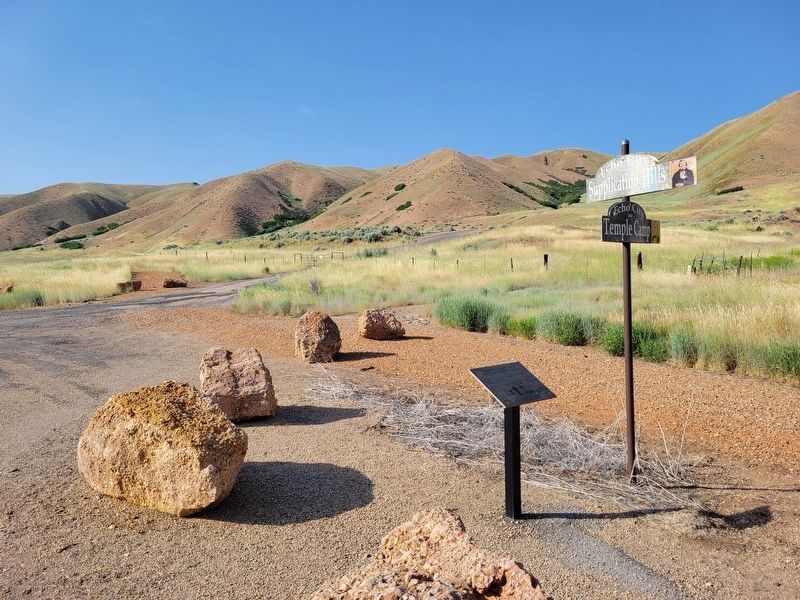
On South Echo Road, on the right when traveling north.
On Saturday, July 17, 1847, Brigham Young and the main group of pioneers left their camp a mile up Echo Canyon and due to Brigham's illness, traveled only 2-1/2 miles. Their camp of July 17-18, was .4 mile west of this marker on the east bank of . . . — — Map (db m277800) HM
On West Center Street at S 100 W, on the right when traveling east on West Center Street.
Erected in 1866-67 for protection against hostile Indians. Was 30 rods square with walls 16 feet high built of logs that formed the back walls of the houses, with gates in the east and west walls. There were about 47 families who lived in this fort . . . — — Map (db m276067) HM
On North Main Street, on the right when traveling north.
Echo, five miles east of Henefer, was settled in 1861 when Elias Asper and others built
homes near a railroad mail station and blacksmith shop previously located. In 1871
Wm. L. Turpin hired Benjamin Lamb to build a three story gristmill of red . . . — — Map (db m276652) HM
On Old Highway 30, on the left when traveling north.
The first known overland travelers to cross the Weber River, at a point .4-mile directly in front of this marker, were the Harlan-Young, Lienhard, and Donner-Reed parties of 1846. It was at this crossing that Lansford Hastings left a note telling . . . — — Map (db m277803) HM
On West 2200 South, on the right when traveling west.
Before settlement, Indians had summer camp here as feed for cattle, sheep and horses was plentiful. Their carvings in caves can be seen near here. In 1870 Nathan Neibour homesteaded land here and built a cabin. He received a patent to the land in . . . — — Map (db m276065) HM
On East Center Street, on the right when traveling east.
This valley settled by Thomas Rhodes in 1858, was a summer paradise for Indians who came to hunt fish and gather wild fruit and sego bulbs. The Weber River Indian trail skirted the east foothills to Weber Canyon crossed the river at the Old Kamas . . . — — Map (db m276049) HM
In the spring of 1849, Samuel Comstock Snyder joined Parley P. Pratt in cutting a road up "Big Canyon" and saw for the first time the mountain plateau which the pioneers named "Parley's Park." The road became the "Golden Pass," a toll road for Wells . . . — — Map (db m276056) HM
At this site, the first settlers entered Park City. George C. Snyder, his wife Rhoda and their three children had cleared their way through the forest to arrive at their destination on May 25, 1872. On July 4, 1872, a celebration was held, a U.S. . . . — — Map (db m276054) HM
In 1861 a fort was built on a nearby creek, moved in 1866 to Sage Bottom, sometimes called Woodenshoe, one mile south of Peoa. Houses of split logs and clay were placed close together with a church in the center. Drinking water was obtained from a . . . — — Map (db m276051) HM
On West Clark Street, on the right when traveling east.
This monument marks the site of the Grantsville Fort built in 1853 as protection against the Indians. The fort was thirty rods square with walls twelve feet high five feet thick at the base and eighteen inches thick at the top. The north wall was . . . — — Map (db m301552) HM
On West 520 South at 50 W, on the right when traveling south on West 520 South.
In honor of the early settlers of Tooele County who made their first camp on this spot of ground September 18, 1849
Judson and Sarah Tolman, child Nancy
Josiah and Henrietta Call, child Cyril
Samuel and Sarah Meacham
October 1849
Cyrus . . . — — Map (db m303074) HM
On West Vine Street at South Main Street, on the right when traveling east on West Vine Street.
The first Tooele church was
erected in 1869 by the early
pioneers who settled in Tooele.
Bishop John Rowberry was in charge of
construction; George Atkin was
superintendent of work; and Richard and William
Kennington, Dave Adamson, John . . . — — Map (db m303263) HM
On East Vine Street east of North Main Street, on the right when traveling west.
Erected in 1867 as a county court house. Active in construction were James Hammond, William Broad, Isaac Lee, W.C. Gollaher, John Gillespie, George Atkin and John Gordon. The building was used for court house, city hall and amusement center until . . . — — Map (db m303252) HM
Near East Vine Street east of North Main Street, on the right when traveling west.
In 1855 this cabin, one of the first in Tooele, was begun on Main Street by Zachariah Edwards, finished for their home 1856 by Andrew & Ann Gowans, and Hugh & Betsy Bowans where they lived together for a few months. Henry & Georgina Dolling lived . . . — — Map (db m303256) HM
On South 100 East, on the left when traveling west.
Our Honored Dead
1914-1918
Carfield Daniels ·
Willard C. Cowans ·
Eugene B. Isgreen ·
John A. Hogan ·
George A. Greenly ·
George W. Goins ·
Grant Lyman ·
Frank Peterson ·
Angleo Santralla ·
Earl P. Brown ·
Lear E. . . . — — Map (db m303062) WM
On South Main Street, on the right when traveling north.
Pioneers of Tooele and Rush Valley were
buried here between 1850-1867. A sno plots were
sold, families were required to dig the grave
and use the next burial space. Several bodies
were moved to the new cemetery. These remain:
Adams, . . . — — Map (db m303249) HM
On East 900 South, on the right when traveling north.
August 20, 1888, two companies of Colored Infantry commanded by Major F. W. Benteen and four companies of infantry under Captain Duncan arrived at this site to control the activities of Indians. There were three bands of Utes-uncompahcres, . . . — — Map (db m277135) HM
On U.S. 191 at White Rocks Highway, on the right when traveling east on U.S. 191.
The first yearlong abode of white men in what is now Utah, was Antoine Robidoux's Indian and fur trading post (Fort Wintey or Uintah), which was built 8 miles north of here in 1832. It was on the trail from Taos, New Mexico to the Pacific northwest, . . . — — Map (db m277134) HM
On 6500 South Street, on the right when traveling east.
Riverdale (Jensen) was settled by pioneers in 1877. Four years later, the first school was held in Riverdale in 1881. Miss Lydia Maria Chatwin (native born pioneer of 1868) was the first school teacher; she was 13 years old. Her father was an . . . — — Map (db m276947) HM
On U.S. 40 at South 10500 East, on the left when traveling east on U.S. 40.
The first boat (framed together with wooden pegs) used for passengers and baggage was built and operated by Lars Jensen 2 ½ miles downstream from 1881 to 1909.
It was replaced by a cable ferry for wagons in 1885, and a larger boat in . . . — — Map (db m114450) HM
On Utah 121 west of North Canal Road, on the right when traveling west.
In August 1905 the Uintah Indian Reservation was opened to white settlers who came and built
homes. They organized Whiterocks Irrigation Company, built a canal and raised crops. In 1908 a
Post Office and store was built at Taft, one mile south of . . . — — Map (db m277129) HM
On North 1500 West, on the right when traveling north.
In 1861, President Abraham Lincoln established by proclamation the Uintah Indian Agency. Brigham Young held the office of Supt. Indian Affairs. Lieut. Pardon Dodds, civil war veteran, came to Utah Sept. 7, 1866 and in 1867 was appointed first Indian . . . — — Map (db m277103) HM
On South 500 West, on the right when traveling south.
This rock building was erected in 1887 by Uintah Stake of the L.D.S. Church on ground
contributed by Jeremiah Hatch Sr. for $1.00. Men hauled rock from which Harley Mowery
and John Jacob Slaugh, experienced stone masons, constructed this office. . . . — — Map (db m277097) HM
On West Main Street (U.S. 40) at North 100 West, on the right when traveling west on West Main Street.
Jeremiah Hatch came to Ashley Valley in 1878 as an Indian agent. Following the Meeker, Colorado massacre of 1879 he was instructed to build a fort as protection for white settlers. Their cabins, with cedar post buttresses between, formed part of . . . — — Map (db m114422) HM
On North 2500 West north of 1000 Street N, on the right when traveling south.
Fort Thornburgh Military Reserve was located one half mile west and one mile north of this
marker and named in honor of Major J. N. Thornburgh who was killed in the Meeker Massacre in 1879. During the summer of 1881 the military troops were . . . — — Map (db m277128) HM
On West 2000 North, on the right when traveling east.
Ashley Valley, settled in 1873, had its first postoffice in this structure, built in 1879 by Wilbur C. Britt, the first postmaster. Logs hauled from nearby forests were put together with wooden pegs and square nails to erect one large room. A . . . — — Map (db m277100) HM
On Main Street (U.S. 40) at South Vernal Avenue (U.S. 191), on the right when traveling east on Main Street.
September 1886 Samuel R. Bennion was sent here to establish a banking institution called the 'Ashley Co-op.' In 1903 the first pioneer bank was opened for business. In 1916 W.H. Coltharp erected this building with Salt Lake City brick. A full car . . . — — Map (db m114421) HM
On South 1500 East, on the right when traveling south.
In 1893 Ephraim H. Roberts, a war veteran, built a pottery here. He and his sons made churns, jars, jugs, and flower pots, which were exchanged for produce. Five hundred samples of clay were tried before a suitable one was found. Lead for glazing . . . — — Map (db m276951) HM
On West 1500 North at N 2500 W, on the right when traveling east on West 1500 North.
In 1860 Wm. G. (Bill) Reynolds and Moroni Taylor cut and faced two rough stone burrs which were set up in the "Old Fort" for mill purposes. They were turned by a horse attached to a sweep, later these burrs were used to grind feed for livestock. In . . . — — Map (db m277126) HM
On South 500 West at W 200 S, on the right when traveling south on South 500 West.
The Uintah Stake Tabernacle was built from 1898-1907 under the direction of Uintah Stake President Samuel R. Bennion and counselors Reuben S. Collett and James P. Hacking. The architect was T. T. Davies with William Cook as the builder. Fathers and . . . — — Map (db m276981) HM
This site marks the center of Mountainville, settled 1850 by a few families led by Wm. W. Wordworth. Others came and built a fort wall which gave protection for 15 years. First log meetinghouse was built Dec. 1851. Morris Phelps ran a sawmill. . . . — — Map (db m224154) HM
On North Main Street north of Center Street, on the right when traveling north.
Construction started on this second public building in 1857 and this building was dedicated by President Brigham Young in 1863. The dimensions of this structure are 21′ x 32′, with the foundation walls 28″ thick and the walls above . . . — — Map (db m224153) HM
On Pioneer Drive at Alpine City Cemetery Road, on the right when traveling east on Pioneer Drive.
Three rods north of this site the settlers built their first meeting and school house in 1851, a small log structure with roof of split logs and dirt, log benches and a fireplace of granite. Charles S. Peterson, Roswell Stevens and Morris Phelps, . . . — — Map (db m224155) HM
On South Main Street south of Center Street, on the right when traveling north.
Eight rods W. of this marker was the S.W. corner of a fort erected for protection from the Indians in the Walker War. The walls enclosed three separate squares: in 1853, an 8 ft. mud wall built around a 33 r. sq. was named Fort Wordsworth; in 1854, . . . — — Map (db m224159) HM
On South Main Street at Center Street, on the right when traveling north on South Main Street.
Alpine’s first settlers arrived in September 1850. By 1869, with a population of 208, it became necessary to erect a large, rock church on this site. It had a round, stained-glass window and a two-story vestry. A silver-toned bell was placed in the . . . — — Map (db m224158) HM
Near 200 North Street west of North 200 East Street.
Construction on the old red schoolhouse started in the spring of 1899 and was completed in 1901 at a cost of $3,789.12. In 1882 school trustees petitioned Alpine City to purchase the land to build the schoolhouse and paid $5.00 for it. Sand for . . . — — Map (db m224156) HM
On East Main Street west of South 100 East, on the right when traveling east.
The Territorial Legislature, February, 1866, authorized the levy of a tax for the support of schools within each district, pursuant to this act, Mayor Leonard E. Harrington called a meeting and the majority of citizens of American Fork approved . . . — — Map (db m149845) HM
On South 100 East south of East Main Street, on the right when traveling south.
In 1852 Mormon Pioneers who had settled on the American Fork creek received orders to build a fort for protection from Indians. Most cabins were moved into an enclosure 80x74 rods, covering 37 acres. By 1855 each of the families built a wall 12x6 . . . — — Map (db m149844) HM
On East 300 North at North 100 East, on the right when traveling west on East 300 North.
This spot served as burial ground for pioneers of American Fork from about 1852 to 1868. When death came to the village, bodies were prepared for burial and graves dug by friends and relatives. Some Indians were buried here.
Listed on the . . . — — Map (db m149972) HM
Near Church Street north of East Main Street (U.S. 89), on the left when traveling north.
The bell atop this City Hall has a long history in American Fork. It was originally purchased for $211.17 in 1887, and was placed in the tower of the old City Hall at Main and Center Streets. Sorrow, joy, disaster, emergency and other messages were . . . — — Map (db m149989) HM
On Utah Route 68 north of U.S. 6, on the right when traveling north.
Elberta was originally established in the early 1900's as two seperate settlements Elberta and also Verda, four miles south of this location. The surrounding 15,000 acres were purchased in 1892 by Gilbert Payton and Ernest Rigdon with visions of a . . . — — Map (db m75305) HM
On U.S. 89 0.8 miles north of Indianola Road, on the right when traveling north.
In the spring of 1865 John Given with his wife Eliza and their four children, John Jr., Mary, Anna, and Martha, settled in the meadow land about 110 feet west of here. They built a cabin and willow shanty. Charles Brown and Charles W. Leah were . . . — — Map (db m139785) HM
On U.S. 6 west of South 12000 West Street, on the right when traveling west.
As early Latter-day Saint pioneers came to the Goshen Valley, they settled in areas then known as Sandtown, The Bend, and The Fort. Later, President Brigham Young urged the settlers to form the township of Goshen and predicted that a new highway . . . — — Map (db m75304) HM
On West State Street west of North Center Street, on the right when traveling west.
In February, 1851 this plot of ground along the north side of state road and west of dry creek was dedicated as a cemetery for the city of Lehi; when John Griggs White, aged 75 years, was buried. This land was government owned; later it was a home . . . — — Map (db m150062) HM
On West Main Street, on the right when traveling west.
The Lehi Hotel is the oldest standing Adobe Hotel between Salt Lake City and Denver. As early as 1853, Joseph Johnson Smith operated a blacksmith and wagon shop on this site, which was inside the western wall of Lehi Fort. John Woodhouse expanded . . . — — Map (db m149974) HM
On North 200 West, on the right when traveling south.
n 1881, this building was constructed as the Lehi First Ward Relief Society Hall. It was used as a gathering place for meetings and to display and sell homemade goods. The adobe building was completed in 1883. Funds for materials came from bake . . . — — Map (db m150061) HM
On Mill Pond Road at Pioneer Crossing, on the right when traveling south on Mill Pond Road.
The Lehi factory of the Utah Sugar Company, of the Church of Jesus Christ of Latter-day Saints, occupies a pre-eminent place among early sugar mills in America. As historian Leonard Arrington has written: “It was the first sugar-beet factory . . . — — Map (db m149976) HM
On West Maple Street, on the right when traveling east.
Matilda Wells Streeper donated one acre of land at this site for the building of a meeting house. A grove of trees was left on the lot to beautify the grounds. On August 26, 1888, Apostle Francis M. Lyman of The Church of Latter-day Saints organized . . . — — Map (db m148622) HM
On East 800 South, on the right when traveling east.
Timpanogos Ward of The Church of Jesus Christ of Latter-day Saints was organized November 8, 1885, at a meeting held in the log schoolhouse presided over by Presiding Bishop William B. Preston, his counselor Robert T. Burton, and Provo Stake . . . — — Map (db m149450) HM
On East 800 North (Utah Route 52) at North 1100 East Street, on the right when traveling west on East 800 North.
Absence of water was an obstacle to the early growth and development of the level, elevated ground north of Provo known as Provo Bench. Landowners found the area’s rocky soil suitable for growing fruit trees. However, watering the trees required . . . — — Map (db m223828) HM
Payson, first settled in 1850, was incorporated January 21, 1852 with David Crockett as mayor. In 1870, during the administration of Mayor Orrawell Simons 1866-75, a City Hall, Payson's first brick building, was erected 377 feet west and 14 feet . . . — — Map (db m148814) HM
On South 500 West 0.1 miles north of West 100 South, on the right when traveling north.
Payson was settled Oct. 20, 1850, when a group of Mormons consisting of James Pace, John C. Searle, Andrew J. Stewart with their families, and two boys, Allison Hill and Nathaniel Haws, arrived at the northwestern extremity of the city. The creek on . . . — — Map (db m148795) HM
This Pioneer Millstone designates the centennial of Payson City, founded Oct. 20, 1850, by Mormon settlers. Near this monument on Peteetneet Creek was erected the first public building, a log cabin used as a school, church and fort. A sawmill and . . . — — Map (db m148813) HM
On South 100 East, on the right when traveling north.
In 1872 Archibald Gardner built the first flour mill in Pleasant Grove which he sold, in 1876, to David Adamson who installed these grinding stones. They were run by waterwheel also a steam engine when water was low. Grain was ground into fine flour . . . — — Map (db m149578) HM
On South 100 East, on the right when traveling north.
This building is one of the oldest schools and community centers now standing. The west wing built about 1864, from adobes salvaged from first and second school houses of 1852-53. Planned by Henry Greenhalgh. Center and east rooms added about . . . — — Map (db m149580) HM
On East 200 South, on the right when traveling west.
Early in the year of 1849, an Indian party confronted some Mormon settlers and took their cattle. The Indians and cattle were later found camped by a stream and a battle erupted. Three Indians were killed, and the area became known as Battle . . . — — Map (db m149581) HM
On West Center Street at 300 West, on the right when traveling west on West Center Street.
In October 1875, President Brigham Young executed a deed of trust to establish an academy. First classes were held in January 1876, Warren N. Dusenberry, Principal. Karl G. Maeser became Principal April 1876 to 1892. First school held on this site . . . — — Map (db m149027) HM
On North 500 West, on the right when traveling north.
In 1856 this ground was dedicated as a site for Utah Stake Tabernacle. Construction commenced in 1863. Edifice was three stories high, 81 feet long, 47 feet wide, belfry 80 feet. Built of adobe with rock foundation 7 feet at base, 4 feet at top. A . . . — — Map (db m149446) HM
On North 2050 West 0.1 miles north of West Center Street, on the right when traveling north.
The original settlement at Provo (Fort Utah) was established March 12, 1849 by President John S. Higbee, with Isaac Higbee and Dimick B. Huntington, counselors, and about 30 families or 150 persons, sent from Salt Lake City by President Brigham . . . — — Map (db m149025) HM
In 1853, the original four blocks of this cemetery became the final burial ground for Provo Pioneers who were first buried in Fort Field, Grandview and Temple Hill and later moved to this cemetery. Some residents preferred to leave their dead . . . — — Map (db m149101) HM
On Columbia Lane, on the right when traveling west.
During the years between 1860 and 1879 this plot of ground was used as a burial place for the pioneers. It was the junction where three farms joined. A child of Joseph Thompson was the first person interred, but as the owners objected to their land . . . — — Map (db m149449) HM
On North 100 West, on the right when traveling south.
In 1870-72, four rods north of this site, Provo Woolen Factory was built at a cost of $155,000. Main building was stone, 65 x 145 ft., 4 stories high; another was 33 x 134 ft., 2 1/2 stories. A county court house built on this block in 1867 and John . . . — — Map (db m149098) HM
On South 100 West, on the right when traveling south.
In 1868 William D. Startup brought across the plains the tools of candymaking: scales, iron edging bars, drop machine, shears and hooks. After pursuing his profession in Salt Lake City, he moved to Provo and built the first candy factory in 1875. . . . — — Map (db m149100) HM
On North 500 West at West 100 North, on the right when traveling south on North 500 West.
Henry Larkin Southworth’s large two-story Octagon House and Store were built on this site in the early 1850’s. John Henry Smith, young son of Apostle George A. Smith, hauled the oversized adobe brick to build the two-feet-thick walls. Artisans, . . . — — Map (db m149030) HM
On West Center Street at South Airport Dike Road, on the left when traveling west on West Center Street.
Settlers of the Utah Lake area, attracted by its sandy beaches, built resorts which provided dancing, boating, swimming and picnicking. The earliest sites and their proprietors were “Woodbury Park” Pleasant Grove 1880, B.W. Driggs Jr., . . . — — Map (db m149023) HM
On West 1230 North Street, on the right when traveling west.
85 feet north, 145 feet east of this site John Mills and his son, Martin W. built a sawmill in 1855. First logs were sawed July 13, 1856. In the late 50’s they erected a grist mill which was a square frame two-story building. The first corn was . . . — — Map (db m301641) HM
On South 300 West, on the right when traveling north.
This monument marks the site of Pond Town Fort. In 1851 David Fairbanks and David Crockett located land adjacent to a small stream at the head of Salem Lake and built a dam. In 1856 Eli Ashcraft, Royal Durfrey, Silas Hillman, Aquilla Hopper, Jacob . . . — — Map (db m101962) HM
On South 300 West, on the right when traveling north.
This log cabin was used as the first Post Office in Salem. It was built on the east bank of the Salem Pond by George Killiam, who served as postmaster from March 1, 1872 to 1877. Harry Nelson then purchased the cabin, moved it to the southeast part . . . — — Map (db m148766) HM
On Grand Army of the Republic Highway west of 100 East Street, on the right when traveling west.
In 1882, on this site, a Relief Society building was erected under the leadership of Elizabeth J. Stickney, President. It was a one room structure, 20 x 30 feet in size, built of red clay brick made by Joseph Chatwin. The interior was furnished with . . . — — Map (db m75295) HM
On Grand Army of the Republic Highway west of 100 East Street, on the right when traveling west.
The town of Santaquin was settled in the spring of 1851. At that time it was called Summit Creek, as it was located on a ridge between Utah and Juab counties. Due to Indian hostilities in 1853, the settlers were forced to leave their homes and move . . . — — Map (db m75296) HM
On 400 S 800 at East Canyon Road, on the right when traveling east on 400 S 800.
Leif Eiriksson, an Icelander, discovered America in 1000 A.D. Eight centuries later 1855-1860 sixteen pioneers from Iceland established in Spanish Fork the first permanent Icelandic settlement in the United States. They were: Samuel Bjarnson & Wife . . . — — Map (db m101330) HM
On West 6400 South 1 mile west of South 1050 West, on the right when traveling west.
In 1862 a fort was erected one mile and a quarter north from this spot, on the west bank of the Spanish Fork River. It was a square and covered one acre of ground. The walls were four feet thick at the base and tapered to about two and a half feet . . . — — Map (db m148721) HM
Near West 300 North, on the right when traveling west.
In 1872 a group of young men organized a debating & public speaking society with Geo. H. Brimhall, President. They erected this building. Samuel Brockbank had charge of getting logs & construction: John F. Gay, carpenter: Nicholas Smith, timekeeper. . . . — — Map (db m148727) HM
On South Main Street, on the right when traveling north.
Spanish Fork had its beginning in two sites, the upper settlement in 1850-51, located in the southeast river bottoms, the other at Palmyra, 1851. Fearful of Indian trouble, settlers built an adobe fort between the two places in 1854, located two . . . — — Map (db m148740) HM
On South 1450 West 0.3 miles south of West 5000 South, on the right when traveling south.
Palmyra‘s First Amusement Hall
To the north of the little one-room schoolhouse, the people of Palmyra began building the lumber Amusement Hall on February 10, 1900. It took exactly one month to complete the building, and a dance was held in . . . — — Map (db m148720) HM
On 1530 East at 1900 South, on the right when traveling south on 1530 East.
Pioneers were buried here between 1851 and 1866 when this cemetery was abandoned, James Higinson was sexton. The bodies of those who remain here are Sarah Holt Tindral, John Hardison Redd, Elizabeth Hancock Redd, Mary Gardner Sweeten, Helen Whytock . . . — — Map (db m148619) HM
On East River Bottom Road at South 200 East, on the right when traveling east on East River Bottom Road.
Spanish Fork was settled in 1857. The first flour mill was built by Archibald Gardner in 1858-59. The water for the mill came from the Spanish Fork River. The stream was enlarged to give sufficient power to run the mill. This mill was constructed of . . . — — Map (db m148763) HM
On 1530 East at 1900 South, on the right when traveling south on 1530 East.
Utah South Center Company Daughters of Utah Pioneers, in conjunction with the City of Spanish Fork, community donors, and volunteers have reclaimed and restored this hallowed ground in remembrance of the pioneers who persevered through uncommon . . . — — Map (db m148620) HM
On West 7300 South, on the right when traveling west.
The Spanish Fork Indian Farm Reservation Comprising 20 square miles and extending from this state highway and the Spanish Fork River to Utah Lake, was set apart in 1854 by Brigham Young, Utah Supt. of U.S. Indian Affairs. Joseph E. Beck was . . . — — Map (db m148765) HM
On South State Street 0.2 miles south of West 12400 South, on the left when traveling south.
In 1859, James Pace and James Butler built large adobe home on this site, purchased by Joseph E. Johnson, 1861. He and brothers Benjamin F. and George W. operated many industries: drug stores, fruit-tree nursery, trunk factory, sorghum mill, . . . — — Map (db m148896) HM
On North Main Street, on the right when traveling north.
In 1851, Jacob Houtz, James Porter, and Edward Hall built and operated a flour mill near here. Norton Jacobs, the first miller, made and installed the machinery.
in 1860, Jacob Houtz and William Bringhurst built a woolen mill one third mile . . . — — Map (db m148672) HM
On South Main Street, on the right when traveling north.
The Mapleton Ward Relief Society Hall was built in 1888 on Hans Peter
Jensen's property at 195 East Maple Street in Mapleton. The building
was 15- by 20 feet, with two doors, two windows, and a tin roof. The
interior of the Relief Society Hall . . . — — Map (db m301638) HM
On North 200 West at West 200 North, on the right when traveling north on North 200 West.
On September 18, 1850, the first pioneers arrived in Springville and camped on this lot. Covered with tall grasses and supplied with plenty of spring water, bordered on the east by lofty mountains, on the west by the sparkling waters of Utah Lake, . . . — — Map (db m148671) HM
On Hobble Creek Canyon Road 0.3 miles east of Grindstone Drive, on the right when traveling east.
Joseph and Elizabeth Potter Kelly, Springville Pioneers of 1852 homesteaded 160 acres in Hobble Creek Canyon which remained in the Kelly family for 79 years (three generations).
This was an old Ute Indian camping ground, and here the Pioneer . . . — — Map (db m148666) HM
On South Main near E 100 South, on the right when traveling north.
The White Meeting House stood on this site from 1856-1927. It was built just six years after the settlement of Springville, constructed of adobe, and first used as a school. Once the city was divided into four wards, the school was remodeled and . . . — — Map (db m267539) HM
On 3600 West at W 3600 S, on the right when traveling north on 3600 West.
In 1859 George Noakes and William Manning and families came to Provo Valley and settled near Noakes Spring (2 blocks north and 2 blocks west) where they built the first homes. Other settlers soon followed and a church and school were erected. George . . . — — Map (db m275971) HM
On North Main Street at West Center Street, on the right when traveling south on North Main Street.
Beautiful Provo Valley named from river and once Chief Walker's hunting ground, was colonized 1859-60 by 18 families called by Brigham Young. 1864 Indian troubles forced pioneers to build fort at Heber. Bishop Jos. S. Murdock friendly with the . . . — — Map (db m275976) HM
On Center Creek Road, on the right when traveling west.
One half mile east and one fourth mile northeast from this spot is a pioneer cemetery, given to Center Creek L.D.S. Ward by William Blake, an early settler. It was used for several years for burials of Center and Lake Creek pioneers. Among those . . . — — Map (db m275974) HM
On North Main Street, on the right when traveling north.
In 1858 a group of men came from Provo, surveyed the valley into 20 acre plots and selected the town sight of Heber. The following winter twenty families stayed here. As protection from the Indians they built a fort 1 block south and 1 block west . . . — — Map (db m276050) HM
In 1875 William Van Wagoner and his brother John Sr., built this lime kiln. They operated it for many years. Lime rock was quarried by blasting it into chunks. Twenty-five tons of rock produced 8 tons of lime. Three days and three nights of 12-hour . . . — — Map (db m275966) HM
On West Main Street, on the right when traveling west.
When this valley was settled, in 1859, two colonies were established on the west side of Provo River, a lower and upper settlement, the latter called Mound City. In 1866 Indian depredations caused the formation of the Wasatch County Military . . . — — Map (db m275953) HM
On Lime Canyon Drive at Homestead Drive, in the median on Lime Canyon Drive.
One and one half miles northwest is Mound City Cemetery, the first burial place of this community, used from 1859 until 1869. The following people were buried there: Robert & Margaret Wright; Dr. John Gerber & Sarah Gerber; Julia Gerber Jacobs & . . . — — Map (db m275935) HM
On West Main Street at Center Street, on the right when traveling south on West Main Street.
Enterprise is a continuation of Hebron located on Shoal Creek, a short distance up the mountain. In 1862 Charles and John Pulsipher and others brought their families to the village. In May 1892 Orson W. Huntsman made a plan to impound the flood . . . — — Map (db m263077) HM
On Redbluff Drive 0.1 miles east of Old Hwy 91, on the right when traveling east.
Harrisburg
The town of Harrisburg was founded by Moses Harris in 1859. By 1868, twenty-five families had made their homes in this little valley along Quail Creek, located three miles south of Leeds and twelve miles northeast of St. George. . . . — — Map (db m59644) HM
In 1863 settlers of the upper Virgin River whose lands were being washed away made preliminary surveys for irrigating and occupying these lands. Erastus Snow, David H.
Cannon and Nephi Johnson came down the hill over an old Indian trail, with a . . . — — Map (db m59405) HM
On South Main Street at West 100 South, on the right when traveling north on South Main Street.
In 1881 Thomas Judd, promoter, with others completed an 840 foot tunnel and 1 1/4 mile canal to bring water from the Rio Virgin for the cultivation of this valley. Excavations opened a large crystal cave of stalactite and stalagmites.
In 1903, . . . — — Map (db m59448) HM
On West 500 North, on the right when traveling east.
In December of 1888, Thomas P. Cottam and Thomas Judd made a preliminary survey to determine the probable cost of a canal. Early in 1889, Isaac C. MacFarlane made a working survey, and work was started as soon as his survey was completed.
In June . . . — — Map (db m59451) HM
On Utah Route 144 4 miles west of Interstate 15, on the right when traveling west.
Fort Harmony was designated as the training site of the Iron County division of the Utah Militia. In 1857 the Militia was divided into 13 districts. The southern group consisted of all counties south of Beaver and was known as the Iron County . . . — — Map (db m75622) HM
On West Center Street 0.1 miles west of Main Street, on the left when traveling west.
In 1852 Elisha H. Groves, John D. Lee and others built a fort on Ash Creek, called Harmony. The fort was abandoned in 1854 and a new site located called Fort Harmony. Following disastrous floods in 1862 settlers again moved and established . . . — — Map (db m59471) HM
On North Centre Street at North Diagonal Street, on the right when traveling west on North Centre Street.
In 1856 Rufus C. Allen, Samuel F. Atwood, Lorenzo Roundy, Richard S. Robinson, Amos G. Thornton, Prime T. Coleman, Benjamin Knell, Robert Dixon and David W. Tullis settled Pinto. Their families came later. Red sandstone church was built in 1886. . . . — — Map (db m272033) HM