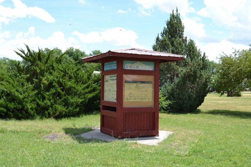
Near S. Main Street (U.S. 287) at 6th Street, on the right when traveling north.
"There really is a Place Called Baca County;
I think she’s mighty fine;
She was good enough for my dad’s kids;
Likewise she’ll do for mine;
Her sunrises are all colors;
Her sunsets are all the same;
The only thing she needs more . . . — — Map (db m106474) HM
On Main Street (U.S. 287) north of East 8th Avenue, on the right when traveling north.
The Cimarron Cutoff and Granada Road were branches of the Santa Fe Trail from Missouri to Santa Fe. The Aubrey and Penrose were other trails. From 1866-97 thousands of Texas cattle were driven to Montana on the XIT and National Cattle trails. — — Map (db m120040) HM
Near County Road Ff.5 5 miles east of Colorado State Highway 101 and Bent County Road FF.
On November 15, 1806, Zebulon Montgomery Pike saw the mountain later named for him. His view was from the hills close to the Arkansas River in this vicinity.
From Pike's journal—
“When our small party arrived on the hill, they with one . . . — — Map (db m268907) HM
Dinosaur Freeway Geology of John Martin Reservoir
is part of the Dakota sandstone
formations which extend from Denver,
Colorado to Tucumcari, New Mexico.
In the Cretaceous period the region
was bordered with lakes, swamps . . . — — Map (db m181091) HM
On Colorado Route 101 0.6 miles south of County Road 10.75, on the right when traveling north.
This tablet is the
property of the State of Colorado
—
Boggsville
Established in 1866.
Named for Thomas O. Boggs,
first settler on this site.
Home of Kit Carson and
John W. Prowers, noted . . . — — Map (db m119664) HM
Near Colorado Route 101 1 mile south of County Road 10.75.
"...On crossing the river [Purgatoire] we found a large well-filled ranch...which had only just been built by two enterprising Yankees.:"
–William Bell, railroad surveyor, 1867
Boggsville was established in the early . . . — — Map (db m120701) HM
Near Carson Avenue (Colorado Route 101) north of 8th Street, on the right when traveling north.
This region was once buffalo hunting grounds for the Cheyenne, Apache, Arapaho, Kiowa and Comanche. Tribes followed the buffalo throughout the plains and controlled the land. During this time, everything south of the Arkansas river was Mexico and . . . — — Map (db m120709) HM
Near Colorado Route 101 1 mile south of County Road 10.75, on the left when traveling south.
The Arkansas River Valley is a historical frontier in both the American and European sense. Americans view the frontier as unsettled or a sparsely settled area lands on the edge of "civilization." To Europeans, frontiers are boundaries or borders . . . — — Map (db m120698) HM
On U.S. 40 0.3 miles east of County Road 60, on the right when traveling west.
Colorado’s National Guard regiment the 157th Infantry, served in World War II with the famed 45th (Thunderbird) Division. It saw 511 days of combat in Sicily, Italy, France and Germany. It made four amphibious landings, in Sicily, at Salerno and . . . — — Map (db m287893) HM
On South 1st Street East near West 1st Street North, on the right when traveling west.
The Eastern Colorado Historical Society dedicates the replica of this bandstand to the people whose donations made it possible. It is also dedicated to the memory of old fashioned Saturday nights, and to the musicians and bandleaders, especially . . . — — Map (db m287897) HM
On South 2nd Street West just east of West 5th Street South, on the right when traveling east.
Cheyenne County pays tribute to all men and women who served honorably in the Armed Forces to preserve America’s freedom. “All Gave Some Some Gave All” “Freedom is not free” — — Map (db m287898) WM
On U.S. 40 just east of West 6th Street South, on the right when traveling east.
The Mountain State reaches across the Great Plains to welcome you. This is the Smoky Hills Trail, a short cut found in 1860 from the Missouri River to the Pikes Peak and Cherry Creek gold diggings. On this route to the mountains wagon trains and . . . — — Map (db m287901) HM
On U.S. 40 at milepost 463.5, on the left when traveling east.
Smoky Hill Trail
The Smoky Hill Trail was the most direct route to Denver and the goldfields of the central Rockies. Immigrants heading west through central Kansas followed the Kansas River, then headed up its Smoky Hill River branch into . . . — — Map (db m77898) HM
On U.S. 287 at milepost 130, on the right when traveling west.
Named for the great western scout, guide, trapper, and Indian fighter. Located on famous trails – at the junction of the Smoky Hill stagecoach route and the Texas – Montana, Potter and Bacon, and Chisum cattle trails. On the old Kansas . . . — — Map (db m88444) HM
On State Highway 59 south of County Route CC, on the right when traveling south.
The Texas-Montana, Bacon and Potter, and J.S. Chisum trails converged in this vicinity. Over these routes great herds of Texas Longhorns, scions of hardy stock from Spain, moved northward. Big Springs, 2.4 miles west, was an important cattle . . . — — Map (db m87888) HM
On Route 287 at milepost 130, on the right when traveling west.
In many American small towns, the railroad depot was the portal to the rest of the world. More than any other public building, the depot touched the lives of all people in the town. Everything important to the existence of the town came and went . . . — — Map (db m77890) HM
On Broadway at State Route 96, on the right when traveling north on Broadway.
Times of Thriving, Times of Striving
Fertile soil and plenty of irrigation water
set the stage for farms that thrived for
forty years, beginning in 1919. The area
around Crowley was bursting with
orchards, vegetable farms, an . . . — — Map (db m119634) HM
On Colorado Route 96 at Broadway, on the right when traveling west on Colorado Route 96.
Crowley Communities
If the dry summers of the late 1920s spelled trouble for Crowley County, the Dust Bowl of the 1930s spelled disaster. Many farmers simply packed up and left, and their acreage reverted to grasslands and became cattle . . . — — Map (db m120745) HM
On East Main Street, on the right when traveling south.
A visit to Elizabeth’s Main Street reveals some older building still used for day-to-day business, but it might surprise you to learn that many of these stores have been features of the Elizabeth scene for far more than a century!
Start at . . . — — Map (db m45757) HM
On Main Street at East Broadway Street, on the left when traveling north on Main Street.
Established in 1884 by Dan Cort, the first business in the building was the Cort-Hames Mercantile, one of the oldest firms in Elbert County. The building was originally located across the street on the northwest corner of Broadway and Main St. An . . . — — Map (db m289661) HM
On Main Street at East Broadway Street, on the left when traveling south on Main Street.
This building was constructed in 1907 to house First National Bank. Mr. Lee Ramsey was the bank president until early 1930's when the bank closed because of the Great Depression. For many years the building served as a storage space for medical and . . . — — Map (db m289662) HM
On East Main Street, on the right when traveling south.
The Denver & New Orleans Railroad was established in 1881. It was intended that the railroad would extend south from Denver, ultimately connecting with other railroads in Texas to establish a connection to New Orleans. Construction of the line . . . — — Map (db m45758) HM
On Main Street just south of East Kiowa Avenue (State Highway 86), on the left when traveling south.
Built before 1880, this building originally faced east towards the railroad tracks. It became the Elizabeth Hotel in 1882 and catered to tourists and railroad crew members. It changed to the Arlington hotel in the early 1900's to include a . . . — — Map (db m203888) HM
On Comanche Street (State Highway 86) just east of Arapahoe Street, on the left when traveling east.
[south side]TRIBUTE TO THE MEN AND WOMEN OF ELBERT COUNTY WHO HAVE SERVED IN THE MILITARY OF THE UNITED STATES OF AMERICA Thank you for your service! You took an oath and did your duty and America remains free. So, please, . . . — — Map (db m289197) WM
On Colorado Street (County Route 86), on the right when traveling west.
Frontier Communication.
Kiowa was originally named after its postmaster, Henry Wendling. Such identifications were common among Colorado’s frontier hamlets, where the post office often was the town. Widely dispersed settlers would congregate . . . — — Map (db m45754) HM
Erected by Pioneer Women of Colorado 1939 A.D. in memory of pioneers massacred by Indians. 1864 A.D. Hungate, Nathan W. and Ellen and Children Laura V., Florence V. 1868 A.D. Dietemann, Henrietta and son John, Louis Alma, Joseph Bledsoe — — Map (db m45748) HM
On Comanche Steet (State Highway 86) just east of Arapahoe Street, on the left when traveling east.
Kiowa Creek, which runs through Kiowa (Peaceful) Valley, begins 20 miles south of here at the Platte River - Arkansas River Divide and winds north to the South Platte River. This valley contains petrified wood from ancient forests, fossils of . . . — — Map (db m289198) HM
On Colorado Street (County Road 86) west of Pawnee Street, on the right when traveling west.
Trail Under Siege Indians of Colorado’s High Plains
Kiowa and Comanche Indians migrated to these prairies in the 1700s, followed by Cheyennes and Arapahos in the early 1800s. The region’s vast grasslands, thick bison herds, and brisk fur . . . — — Map (db m275518) HM
On Ben Street west of Judy Street, on the left when traveling west.
In the 1940s, farmers were able to
draw water from the vast
underground Ogallala Aquifer using
deep water wells. This created
opportunities for production of new
"thirstier" crops and improved
nourishment of plants which in turn
brought . . . — — Map (db m251706) HM
On Ben Street east of Judy Street, on the right when traveling east.
As the Dust Bowl settled down in the
1940s, a new storm was brewing for
the Nation. This storm created what
many have called the "Greatest
Generation" and threw virtually the
entire world into chaos. No one was
left untouched, including . . . — — Map (db m251704) HM
Dedicated to All American veterans. This monument is dedicate to all Americans who have served in the United States Military. The names here are but a few. May we never forget the sacrifices that have been made. “In Honor of Those who served”. VFW . . . — — Map (db m45565) WM
On Ben Street west of Judy Street, on the left when traveling west.
Corn planting in the 1930s or 1940s.
No-till corn planting in the 2010s;
note the difference in soil
disruption.
The wheat threshing machine
separated the wheat berry from the
plant. Cut wheat was hauled from
neighboring fields to the . . . — — Map (db m251707) HM
Kit Carson County Carousel has been designated a National Historic Landmark. This site possesses national significance in commemorating the history of the United States of America, 1987, National Park Service, United States Department of the . . . — — Map (db m45747) HM
On Ben Street west of Mike Lounge Drive, on the left when traveling west.
The Parmer Park before you is the
cherished product of a community
effort that was first considered in
September of 2009 when the
Burlington Rotary Club approached
the Burlington City Council with the
suggestion of refurbishing . . . — — Map (db m251695) HM
On North 15th Street at Colorado Avenue, on the left when traveling north on North 15th Street.
The Kit Carson County Carousel is a three row stationary machine (the animals do not go up and down). The 46 animals, 4 chariots and 45 oil paintings are all in original paint. The carousel's lion, tiger, dog and hippocampus along with goats, . . . — — Map (db m200983) HM
On Ben Street west of Tony Street, on the left when traveling west.
The Great American Dust Bowl lasted
from 1930 until 1939 and was really
the "perfect storm" that had an
impact on generations of families
throughout the mid-west. "Suitcase
farmers" from all over the country
came to the plains where land . . . — — Map (db m251702) HM
On Ben Street west of Mike Lounge Drive, on the left when traveling west.
When the early settlers arrived in
eastern Colorado around the middle
of the nineteenth century, they
found Native Americans occupying
the plains The eastern plains were
home to the Arapahoe and Cheyenne
tribes occasional visits . . . — — Map (db m251696) HM
As the Native Americans and buffalo
disappeared from the Great Plains,
vast herds of cattle took their place.
The open range provided excellent
native grass for the cattle to forage
on. Without fences to confine them,
the herds would range . . . — — Map (db m251699) HM
On Ben Street west of Judy Street, on the left when traveling west.
The forces of nature have been
creating energy since the beginning
of time. People of each era seem to
find their own new ways to make use
of God's mysterious powers.
Traditional windmills were the
fastest way to pull water from . . . — — Map (db m251750) HM
On Ben Street west of Judy Street, on the left when traveling west.
Approximately 230 feet below where
you are standing is a geological
formation called the Ogallala
Aquifer. This underground water
basin is located beneath portions of
eight states. The volume of water
varies depending on rainfall and
usage . . . — — Map (db m251712) HM
On Ben Street at Tony Street, on the left when traveling west on Ben Street.
The present day City of Burlington
was established in 1888 as towns
were needed along the Rock Island
Railroad track during its
construction. Burlington was in the
works to become a junction town;
however plans for additional railroad
lines . . . — — Map (db m251700) HM
Near East 2nd Street, on the right when traveling west.
Dedicated to the loving memory of those who lost their lives in the September 15, 1951 Flagler Day Air Show
Halford Milton Asher • Bebe Lee Mc Eathron
James Jefferson Brandenburg • Gordon Alexander Mc Eathron
Donald James Brandenburg • . . . — — Map (db m250410) HM
Near Forest Road 2185 east of Rourke Road (County Highway 25).
This replica is an exact copy of a large dinosaur bone unearthed in 2008 from a quarry located in Picket Wire Canyonlands. Apatosaurus is among the most massive land animals ever to exist. A member of the long-necked, plant-eating dinosaur is called . . . — — Map (db m184919) HM
Near Forest Road 2185 east of Rourke Road (County Highway 25).
This Catholic church and cemetery are important components of the small Hispanic community in Picket Wire Canyonlands dating from the late 1870s through 1890s. In 1889, Damacio Lopez, the original owner, sold this land to Reverend Bishop Mattz of . . . — — Map (db m182455) HM
Near Forest Road 2185 east of Rourke Road (County Highway 25).
Farmhand to Cattle Baron Eugene Rourke was born on St. Patrick's Day in 1849 in Wicklow County, Ireland. The younger of 10 children, Eugene and his
family immigrated to La Salle, Illinois in 1852. Tragically, his
parents died . . . — — Map (db m181884) HM
Today the Purgatoire River rolls through a rugged, arid landscape in a deeply carved
canyon—but imagine a lush conifer forest and verdant ferns right where you're standing!
Learning from the Layers
The layers of rock at the . . . — — Map (db m181056) HM
Near Forest Road 2185 east of Rourke Road (County Highway 25).
The Rourke Ranch Historic District, listed on the National
Register of Historic Places in 2000, is a striking example of a late
19th century cattle ranching enterprise. The ranch played a significant role in the settlement and . . . — — Map (db m181947) HM
A famous discovery was made right here along the Purgatoire River! During the Jurassic Period, hundreds of dinosaurs once inhabited this area when it was a vast lake. As they plodded through the mud along the lakeshore, the dinosaurs left behind . . . — — Map (db m181254) HM
From the air, you can see
the tracks of two sauropod
dinosaurs walking side by side
along the ancient lakeshore. The
discovery that some types of
dinosaurs lived in large herds like
modern animals happened because
of parallel tracks . . . — — Map (db m181013) HM
A day of festivity was followed by one of the darkest in American Labor history.
The state militia was on guard
Because tensions between the strikers and the company had been steadily escalating, the state militia was stationed on . . . — — Map (db m100513) HM
On County Highway 44 at County Highway 61.5, on the right when traveling west on County Highway 44.
Most miners lived in company-owned towns like Berwind.
The miners often lived in company-owned towns near the mines where they worked.
Because of their isolated location, miners were forced to buy provisions at company stores, live in . . . — — Map (db m193636) HM
On County Highway 44 at County Highway 61.5, on the right when traveling west on County Highway 44.
Excavations of the Ludlow tent cellars permitted archaeologists to contribute to the historical record.
The cellars provided the most comprehensive snapshot of daily life in the tent colony.
The goals of archaeology at Ludlow were to . . . — — Map (db m193557) HM
On County Highway 44 at County Highway 61.5, on the right when traveling west on County Highway 44.
The legacy of those who fought and died in the strike is evident in workplace rights enjoyed today.
Miners lost the strike but paved the way for labor reform.
The coalfield strike ended in December, 1914, when the UMWA was forced to . . . — — Map (db m193556) HM
On County Highway 44 at County Highway 61.5, on the right when traveling west on County Highway 44.
Between 1997 and 2002 archaeologists studied the living conditions of miners in southern Colorado.
Archaeologists carried out excavations at the Berwind coal camp and the Ludlow tent colony - two sites from the 1913-1914 Colorado coalfield . . . — — Map (db m193558) HM
On County Highway 44 at County Highway 61.5, on the right when traveling west on County Highway 44.
Even though conditions were harsh, colonists forged friendships and a sense of community.
Approximately 1200 people lived in 200 tents made of canvas and wood.
Based on excavations, tents averaged 10 x 14 feet in size and were . . . — — Map (db m193627) HM
On County Highway 44 at County Highway 61.5, on the right when traveling west on County Highway 44.
The following statements are from people who were involved with the tragedy. They come from official records and oral histories.
"They used to scrub by hand, go fetch the water a mile [or] two, [at] 3:00 in the morning. We used to make . . . — — Map (db m193570) HM
On April 20, 1914, the State Militia unleashed an un-warranted attack on striking coal miners and their families living in a tent colony at this site. Eleven children and two women suffocated in a cellar beneath a tent when flames engulfed the . . . — — Map (db m100509) HM
On County Highway 44 at County Highway 61.5, on the right when traveling west on County Highway 44.
History often neglects or omits the 1913-1914 Colorado coalfield strike and massacre
Looking onto this prairie, you see one of several places where coal miners lived during the strike.
Miners demanded better wages, an eight-hour work . . . — — Map (db m193668) HM
On County Highway 44 at County Highway 61.5, on the right when traveling west on County Highway 44.
The United Mine Workers of America has fought for workers rights at home and abroad.
The UMWA accepts all mine workers regardless of race, religion or national origin.
The UMWA was founded in Columbus, Ohio, on January 22, 1890. It . . . — — Map (db m193590) HM
On U.S. 350 at milepost 15, on the right when traveling north.
On the morning of 21 August 1944, two B-24 Liberator Bombers collided in mid-air and plunged to earth killing eighteen men.
Crew of 42-51517
Lt. Horace M. Jenkins, Cheyenne, WY
Capt. Royal J. Brock, Columbus, OH
Lt. Clair A.Clark, . . . — — Map (db m77885) HM WM
On U.S. 350 at milepost 15, on the right when traveling north.
Trail of Commerce
The heavily laden freight wagons traveled in parallel columns to minimize dust and for convenience when circling the wagons at night or when danger threatened. A circle of wagons provided a fine defensive position. But the . . . — — Map (db m77883) HM
On U.S. 350 at milepost 15, on the right when traveling north.
Bent's Ranch on the Purgatoire River
In the fall of 1846, William Bent, supervising partner of Bent's Fort, selected a site on the Purgatoire River, about five miles downstream from here, to create one of Colorado's first farming-ranching . . . — — Map (db m77886) HM
On East Main Street (Business Interstate 25) at North Commercial Street, on the right when traveling west on East Main Street.
Before homesteaders began farming the plains, before barbed wire sliced the prairies into neat squares, and before windmills spiked the horizon, huge open-range ranching operations controlled thousands of square miles of grasslands. Enormous herds . . . — — Map (db m280698) HM
On West Main Street (U.S. 160) at North Beech Street, on the right when traveling west on West Main Street.
In the late 1860s, directly across the street stood the Colorado Hotel, a two-story adobe building fronted by a wooden arcade. It was the station for the Denver Santa Fe Stage Line and, for several days, the refuge of some 60 Anglo town residents . . . — — Map (db m100505) HM
At a time when the military banned women, former slave Cathay Williams disguised herself as a man and enlisted in the all-Black 38th Infantry in 1866. She served honorably as Pvt. "William Cathay" for nearly two years. Ready to give up army life, . . . — — Map (db m135774) HM
On West Main Street (U.S. 160) at North Convent Street, on the right when traveling west on West Main Street.
South West Side (front)
Coal Miners' Memorial
Southern Colorado Miners Memorial 1996
Ben Johnson - Artist
Thomas S. Espinoza •
Charles Dintelman •
Mike Butero •
Paul Butero, Sr. •
Jasper Butero, . . . — — Map (db m100504) HM
On West Main Street (Business Interstate 25) just west of North Commercial Street, on the left when traveling east.
Established in 1973, this National Historic District encompasses about 40 irregularly shaped city blocks in the Heart of Trinidad. The first log cabins and adobe houses were built here in 1861. Most of the existing buildings were constructed . . . — — Map (db m282383) HM
On South Chestnut Street just south of East First Street, on the right when traveling north.
Erected through the cooperation of Federal, State and local governments by Works Progress Administration. Dedicated to the enrichment of human lives. A record of permanent achievement. — — Map (db m282499) HM
On North Commercial Street just south of Church Street, on the right when traveling north.
From this spot in August 1846, you could have watched a U. S. Military Force invading the Republic of Mexico. The U.S. Army of the West was already well into Mexican territory, for the International Boundary was then the Arkansas River, about 80 . . . — — Map (db m281896) HM
On North Commercial Street at West Plum Street, on the right when traveling south on North Commercial Street.
Commercial Street, which you are now facing, is a paved-over wagon trail that was here before the town was built. It was one path of the Mountain Route of the famed Santa Fe Trail. Thousands of ox-drawn freight wagons rumbled past here from 1821 . . . — — Map (db m281682) HM
On Interstate 25 at milepost 0, on the right when traveling north.
"Raton" is Spanish for "Mouse".
On mountain branch Santa Fe Trail.
Crossed by Kearny's Army of the
west in the Mexican war and by
first regiment, Colorado Volunteers
in the civil war. "Uncle Dick"
Wooten's toll road built 1865.
Railroad . . . — — Map (db m77853) HM
On East First Street at South Maple Street, on the left when traveling west on East First Street.
With the faith and courage of their forefathers who made possible the freedom of these United States, the Boy Scouts of America dedicate this replica of the Statue of Liberty as a pledge of everlasting fidelity and loyalty.
40th . . . — — Map (db m280496) HM
Near Interstate 25 Frontage Road when traveling north.
Panel 1
Road to Santa Fe
"...for it begins upon the outside line of the outside State (Missouri) and runs directly toward the setting sun..." - Sen. Thomas Hart Benton, following the Santa Fe Trail survey, 1825
For . . . — — Map (db m97715) HM
This monument
marks the route of the
Santa Fe Trail
1822 - 1879
placed by the
Daughters of the
American Revolution
and the
State of Colorado
It also commemorates
the faithful work of
Harriett Parker Campbell . . . — — Map (db m77856) HM
On South Maple Street at East 3rd Street, on the left when traveling north on South Maple Street.
Jews have been part of Trinidad's social, economic and political life since first arriving as traders along the Sante Fe Trail. Maurice and Isaac Wise opened a store on Main Street in 1867. The Jaffa Brothers' Trading Company was established in . . . — — Map (db m135690) HM
On East Main Street (Business Interstate 25) just west of North Commercial Street, on the right when traveling west.
Trinidad is uniquely blessed to have over 100 years of its history preserved in photographs taken by a father-son team of camera artists, Oliver and Glenn Aultman, ably assisted by their wife and mother, Jennie. Through the years, their camera . . . — — Map (db m282473) HM
On North Commercial Street just south of West Plumb Street, on the left when traveling north.
The two-story building across the street, with ornate lintels above its windows and a pressed-tin cornice, was built in 1883 by one of Trinidad's most famous citizens, Casimiro Barela. Known as the Perpetual Senator because he served in the state . . . — — Map (db m280697) HM
On West Main Street (U.S. 160) at North Convent Street, on the right when traveling west on West Main Street.
For centuries, miners have been taking canary birds down into their mines to warn them of potential disaster. If a tunnel or shaft collapses or is blocked, thereby diminishing the oxygen supply, the canary will be the first to react, usually dying, . . . — — Map (db m100501) HM
On East Main Street (Business Interstate 25) at North Maple Street, on the right when traveling west on East Main Street.
The first stage line began running past this spot in early 1861, before Trinidad developed. Stages carrying passengers and mail took about two weeks between Independence, Missouri, and Santa Fe. Trinidad's first stage stop, located directly across . . . — — Map (db m280687) HM
On Purgatoire Drive west of North Animas Street, on the left when traveling east.
Engine 638 was manufactured in 1906 and put into service with the Colorado & Southern R.R. for service at Trinidad for hauling coal, cattle, agricultural products and general merchandise.
Later the engine saw service in other areas of . . . — — Map (db m116849) HM
Near El Moro Road (at milepost 18) at Linden Avenue (County Road 71.1).
Panel 1
The Ludlow Massacre
By April 1914, the striking coal miners encamped at Ludlow (ten miles northwest of here) had nothing to lose but their lives. Poor, powerless, largely immigrant, they had held out for . . . — — Map (db m97716) HM
On Broom Street at State Street, on the left when traveling west on Broom Street.
One of the oldest churches in Colorado, and the first of the Protestant faith to be established in this community, was founded by E. J. Rice, pioneer Methodist preacher from Kansas, in October of 1869. The first edifice was erected on what is now . . . — — Map (db m280700) HM
On North Commercial Street just north of Church Street, on the right when traveling south.
The flat-topped mountain visible between the buildings, looking south on Commercial Street, was an important landmark for wagon trains on the Mountain Route of the Santa Fe Trail. This landmark guided them to the foot of Raton Pass over which . . . — — Map (db m280781) HM
On West Main Street at North Commercial Street, on the right when traveling west on West Main Street.
This memorial is the
Property of the State of Colorado
The Santa Fe Trail
1840 - 1878
Two roads or forks of the Mountain Branch
of the Santa Fe Trail-Bent's Old Fort to
Taos and Santa Fe-joined . . . — — Map (db m104912) HM
On El Moro Road at County Highway 71.1 on El Moro Road.
The Santa Fe Trail was a major trade route to and from Santa Fe, New Mexico between 1821 and 1880. Wagon ruts, visible from the highway, evidence the thousands of caravans that traversed the route during its 59-year period of use. The Santa Fe Trail . . . — — Map (db m191749) HM
3465 entries matched your criteria. The first 100 are listed above. Next 100 ⊳