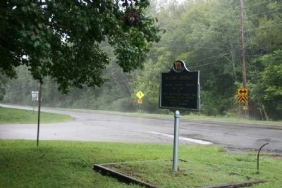
Nathan Bedford Forrest attacked Col. Streight’s column as it crossed Locust’s swift waters, causing the Federals to make tremendous exertions to complete the movement, contributing thereby to Streight’s eventual surrender of his entire command to . . . — — Map (db m28320) HM
1820-1889 seat of Blount County, a county older than the State.
Named for Tennessee Governor W. G. Blount who sent Andrew Jackson to aid Alabama settlers in Creek Indian War, 1812-1814.
Indian Chief Bear Meat lived here at crossing of . . . — — Map (db m156445) HM
1813: Colonel John Coffee and 800 Tennessee Volunteers see Bear Meat Cabin Cherokee Settlement near Blountsville
1816: Town settles around square
1820: Newly named Blountsville becomes county seat
1827: Town incorporated with Trustee System . . . — — Map (db m49176) HM
First minister assigned to Alabama Territory by Tennessee Conference. Preached first sermon two blocks west at Bear Meat Cabin (present Blountsville) April 18, 1818. He later organized churches in Shelby, St. Clair, Jefferson, Tuscaloosa and Cotaco . . . — — Map (db m27991) HM
Three prowling Union soldiers invaded home of sister-in-law of Celia and Winnie Mae Murphree taking food, drink; killing two colts.
When soldiers fell asleep, these two young girls took rifles, marched soldiers to headquarters of General . . . — — Map (db m83226) HM
In late April 1863, Union colonel Abel D. Streight set out on a raid
from Eastpoint. Mississippi, to Rome, Georgia, charged with disrupting
crucial Confederate supply lines. Streight crossed into north Alabama
with 1,700 men. including members . . . — — Map (db m295685) HM
Gen. N.B. Forrest (CSA) captured wagon train and supplies of Col. Streight's raiders (USA).
Forrest continued his relentless pursuit eastward toward final capture of Streight. — — Map (db m295687) HM
The Dallas Community in Blount County was settled in the mid-1800s
after the Second Creek War (1836-1837). Settlers built general
merchandise stores, a blacksmith shop, a Methodist Church, and
a cemetery later known as Bethlehem Cemetery. Local . . . — — Map (db m307414) HM
Four school sites have been located in this community known as Morton’s Center, Hew Hope, and Poplar Springs now Holly Springs. The first at Morton’s Center was taught in 1882 by George W. Burttram. The first school at New Hope was taught by . . . — — Map (db m145410) HM
Member Constitutional Convention 1819
First Senator of Blount County
Brigadier General,
Alabama Militia
County road and court
systems organized
at his house 1820. — — Map (db m32484) HM
While traveling south with his troops, General Andrew Jackson camped at the fork of the river in 1813. General Jackson carved his name in a locust tree naming this area Locust Fork. In 1817, the Hanby family came from Virginia and settled in this . . . — — Map (db m50125) HM
Planter, trader, historian, geologist, surveyor. Gathered authentic data from early settlers and Indians for his history of Blount County published in 1855. Made original survey of Blount County. — — Map (db m50123) HM
Antioch (an'~te~ok') was an ancient Biblical city and a chief center of early Christianity. Today, many churches and cemeteries throughout the United States use the name. Once called Glover's Graveyard, the earliest recorded burial is 1794. Antioch . . . — — Map (db m128071) HM
William M. Bailey (born 1859 in Cherokee Co.; died 1909 in Blount Co.) settled 40 acres on what became Co. Rd 36 to the west and New Home Church Rd to the east in 1893. He brought three small sons from Cherokee Co. after the death of his first wife . . . — — Map (db m42599) HM
Created Feb. 7, 1818 by Alabama Territorial Legislature from lands ceded by the Creek Indian Nation. Named for the Tennessee Governor W. G. Blount, who sent militia under Andrew Jackson to punish the Creeks for Fort Mims massacre. Jackson fought and . . . — — Map (db m24353) HM
John Hanby came in 1817 and found a rich seam of brown iron ore. Named Champion in 1882 when Henry DeBardeleben and James Sloss bought land and brought L&N Railroad causing county seat to be moved from Blountsville to Oneonta in 1889. Most ore was . . . — — Map (db m28362) HM
Starting in 1889, the Louisville and Nashville Railroad, also known as the Birmingham Mineral Railroad, began railroad freight and passenger
service to Oneonta with the completion of the rail line from Boyles Railroad Yard near Birmingham to the . . . — — Map (db m38894) HM
Near this site once stood a school built for African American children erected in 1925 at a cost of $2,800. Funding for the two-classroom, wooden structure came from area residents, along with public funds and $700 from the philanthropic foundation . . . — — Map (db m282167) HM
The origin and development of Oneonta was due to the coming of the Birmingham Mineral Railroad, a part of the Louisville & Nashville Railroad. Because of the presence of iron ore, limestone and coal in the area, there was always a great potential . . . — — Map (db m156406) HM
In 1864, traveling in an ox cart, Dr. Robert M. Moore left his family in Walton County, Georgia, and journeyed to Blount County, Alabama. Finding fertile land, he returned to Walton County and persuaded his wife to move to Blount County with him. In . . . — — Map (db m49251) HM
Dedicated to the memory
of all our servicemen
who were in the
Revolutionary War 1775-1783
War with Great Britain 1812-1814
Indian wars - various 1813-1837
War with Mexico 1846-1848
War Between the States 1861-1865
Spanish-American . . . — — Map (db m156266) WM
The Confederate States of America in 1862 commissioned the Noble Brothers of Rome, Georgia to erect a cold blast furnace to produce needed pig iron for the war effort.
The skilled labor was detailed from Confederate army personnel. It is . . . — — Map (db m83267) HM
Built in late 1862 by the Noble brothers, Cornwall Furnace was named for a similar blast iron furnace in James Noble's home state of Pennsylvania. The pig iron ingots produced from this facility were taken to the Noble Foundry in Rome where they . . . — — Map (db m156264) HM
The furnace was constructed 1862-1863 by the Nobles Brothers Foundry from Rome, GA using financing from the Confederate States of America. Slave labor was used to dig a half mile canal upstream to the Chattooga River, which powered the airblast. A . . . — — Map (db m156261) HM
Gen. Hood, commanding the Dept. of Tennessee and Georgia for the Confederate Army, made his headquarters in this house on Oct. 19, 1864 on his retreat from Atlanta to Tennessee via Gadsden. His army numbered approximately 40,000 troops. — — Map (db m116615) HM
This general area is believed to be the site of the Indian village of Costa visited by DeSoto July 2, 1540. The very old cedar trees may have been here at that time. They are some of the largest in the Southeast. These cedars are among the . . . — — Map (db m114988) HM
Constructed around 1875 by John Seaborn Watt for his bride, Emma Chastillette Williamson, this fine example of Victorian architecture was originally located near Yancey's Bend prior to the construction of Weiss Lake. The site was going to be . . . — — Map (db m137844) HM
Area 575 square miles. Aborigines inhabited area 4000 B.C. Cherokee and Creek Historic Indians about 1300-May 1838. Hernando De Soto-First white man July 1540. First white settlers about 1810 from VA, NC, SC, GA, and Tenn. Formed Cherokee Cession . . . — — Map (db m133321) HM
The current courthouse is the fourth to be built on this site. The first courthouse, constructed of brick in 1849, burned in 1882. A second brick courthouse was built that year and it only lasted 13 years before it burned in 1895. The third brick . . . — — Map (db m114838) HM
In November 1958, Col. Robert E. Mann and a small group of interested residents organized the Cherokee County Historical Society in Cedar Bluff with a goal to initiate the preservation of the history of Cherokee County. Over the following years, the . . . — — Map (db m261855) HM
In honor of those men and women who fought for the
cause of freedom and in memory of those who paid the
ultimate price and or did not make it back home
World War I • World War II • Korea • Vietnam • Desert Storm
This war memorial . . . — — Map (db m197522) WM
This area had long been home to the Cherokee Indians and the first white settlers did not arrive until the early 1800's. On December 29, 1835, the Cherokees signed a controversial treaty surrendering their lands here to the U.S. Government. A short . . . — — Map (db m114840) HM
Final resting place of Chief Pathkiller (B. 1749 - D. 1827) who served as principal chief of the Cherokee Nation. Many prominent early settlers are also interred here including newspaper editor and publisher, Confederate infantry captain and . . . — — Map (db m114282) HM
Hatcher School was created as a result of the dreams and sacrifices of the people of the community. Black children in Centre had to travel to Cedar Bluff to attend school. The State purchased land and citizens of the community provided funding and . . . — — Map (db m133323) HM
This house was built in 1846 by George Walden soon after the town of Centre was laid out. The house was occupied by Judge Wm. Lafayette Whitlock who was a lawyer, delegate to the 1861 Secession Convention and judge of the 12th judicial district. . . . — — Map (db m120047) HM
Inventor of the early typewriter—the pterotye. Born in 1831, Union Dist., S.C., died in 1905, grave 2 miles west. While registered in chancery and later editor of the National Democrat near this siteabout 1860, developed his first writing . . . — — Map (db m115571) HM
The McClung brothers, J.B. and Thomas, homesteaded land on Johhny's Creek in the 1800s. The two brothers harnessed power from water that flowed over the falls to operate a sawmill and grist mill. The McClung's two mills and blacksmith shop played . . . — — Map (db m212844) HM
Jordan Big Store
has been placed on the
Alabama Register of
Landmarks & Heritage
by the Alabama
Historical Commission
August 10, 2017 — — Map (db m114746) HM
Mose Hampton bought his freedom prior to the Civil War. He was a builder, assisted in laying out and surveying the town of Centre, a minister in the Episcopal Methodist North, and an inventor. Mr. Hampton owned land in the vicinity of this marker on . . . — — Map (db m120046) HM
Dedicated on November 19, 1948 has been listed in the Alabama Register of Landmarks and Heritage by the Alabama Historical Commission June 27, 2019 — — Map (db m181355) HM
Cherokee Chief Pathkiller owned a ferry across the Coosa River at this location in the early 1820's. His home was a short distance on the east side of the river. Upon Pathkiller's death in 1827, John Ride, a prominent Cherokee gained a majority . . . — — Map (db m114281) HM
One mile south was an important Indian Council site from about 1707. Named for noted chief, the "Turkey". Here in October 1816, a council of Cherokees, Creeks, and Chickasaws met to settle boundaries and ratify a peace treaty. General Andrew . . . — — Map (db m262314) HM
Born in Lockhart, Alabama in 1915, Tarzan played alongside Bear Bryant on the University of Alabama's 1934 National Championship Team and was honored as an All-American in 1936. He went on to play for the New York Giants, winning a NFL Championship . . . — — Map (db m115273) HM
One hundred feet east was one site where "The Trail of Tears" began. On May 23, 1838 the Indians of this general area, who had been held in a chestnut log stockade after being gathered by the U.S. Army, began their long trek to Oklahoma.
The . . . — — Map (db m114398) HM
In 1820 the Cherokee Nation divided its territory into eight districts with land in Alabama, Georgia, North Carolina, and Tennessee. The village of Chattooga was chosen as base for the Alabama district, and a small log cabin near here served as . . . — — Map (db m259809) HM
The river originates in Lafayette in Walker County, Georgia, flows through Chattooga County, Georgia and then enters Cherokee County before emptying into Weiss Lake. Prior to the construction of the lake, the Chattooga River converged with the Coosa . . . — — Map (db m137513) HM
In 1902, a coal mine was opened at Lake Lahusage in neighboring DeKalb County. The mined coal was carried by a "dinky line" to the brow of Lookout Mountain at Five Points in Cherokee County. The TAG railroad built a spur line about 2½ miles in . . . — — Map (db m202239) HM
Col. Charles Rattray served in the 57th Ill. Infantry. He served in Sherman's command at Gaylesville in October 1864. He fell in love with Theodora McWhorter and promised to return and marry her when the war ended. He was a man of his word. His . . . — — Map (db m202257) HM
David was born 4 of 12 children, served in combat in Vietnam, was wounded and is a highly decorated war veteran. David is a best selling author, a veteran advocate, and State Commander of the American Legion. He is a former college instructor and . . . — — Map (db m114742) HM
Post Office est. in 1836. During the Civil War, the main body of U.S. General William Tecumseh Sherman's Army camped around the town in October 1864. A private home served as his headquarters. Despite pleas from citizens, his troops burned the mill . . . — — Map (db m114532) HM
Cherokee County established - 1836
Area Cherokee Indians relocated - 1838
Taff Community established - 1842
Community named in honor of Taff family - 1842
Union and Confederate soldiers occupied the area - 1864
Taff post office established . . . — — Map (db m114743) HM
Maj. Gen. W.T. Sherman commanding the Union Military Div. of the Mississippi at Summerville, GA., on Oct. 19, 1864 moved the Army of the Tennessee, the Army of the Ohio, and the Army of the Cumberland to Gaylesville. The Armies with attachments . . . — — Map (db m202456) HM
In February 1937, W.P. Brown & Sons Lumber Co. signed a contract with Alabama Power for an estimated 20,000,000 feet of saw timber. The south end of Brown's property is located 1,000 feet back of this marker and extended northward ¾ mile. Brown . . . — — Map (db m114741) HM
On October 23, 1864, U.S. troops under Brig. Gen. W.L. Elliot, Chief of U.S. Calvary, Dept. of the Cumberland, advanced upon Maj. Gen. Joseph Wheeler's Confederate forces positioned on King's Hill. The C.S. troop's fell back to another line of . . . — — Map (db m115399) HM
The town's name was derived from the name of the Henslee Family which were early settlers in the community. A post office was established in 1837. The Rome & Decatur Railroad (later Southern Railway) began rail service through the town in 1888. . . . — — Map (db m261856) HM
(side 1)
Put into blast by noted Southern ironmaster Moses Stroup in 1852, the Round Mountain Furnace was the fourth oldest blast furnace in Alabama. It was the first furnace to make use of red fossiliferous iron ore.
Driven by steam . . . — — Map (db m139401) HM
Completed in 1891 as the Chattanooga Southern Railway, the line ran 91.7 miles from Chattanooga to Gadsden. It was re-organized as the TA&G in 1911. From 1922 until 1951, the "scooter" motor car handled passenger service on the line. The railroad . . . — — Map (db m114744) HM
The town was named for the characteristics of local rocks. A post office was established in 1855 and closed in 1903. The Sand Rock High School Wildcats won the Class 1A football championship in 1985 and the Class 2A State softball championship in . . . — — Map (db m116616) HM
In 1835, pioneering families migrated from Morgan County, Georgia to Cherokee County, AL, settling in the Ambersonville area, later renamed Spring Garden. These families were members of Carmel Presbyterian Church in Morgan County and brought their . . . — — Map (db m132792) HM
On the night of May 2, 1863, John H. Wisdom passed through Spring Garden on his way to warn Rome, Ga. about approaching U.S. Troops. Wisdom, originally from Rome, Ga., lived near Gadsden which was part of Cherokee Co. at that time. Upon learning . . . — — Map (db m133475) HM
Last fighting between armies of Hood and Sherman. Here Ferguson turned back Kilpatrick's larger force.
These two armies had fought all summer from Chattanooga to Atlanta, west to here.
To split South, Sherman turned, led Union forces . . . — — Map (db m132782) HM
Put into blast on June 1, 1874, the furnace would change ownership two times prior to being purchased by the Bass Foundry and Machine Co. of Fort Wayne, Indiana in 1880. A rail spur was built from the furnace to Selma, Rome and Dalton Railroad at . . . — — Map (db m114842) HM
Located 500 yards southeast of this marker. Incorporated in 1888, Bluffton was promoted as a future iron center of the South, due to large iron ore deposits and four furnaces within a four mile radius. The town soon boomed due to an influx of . . . — — Map (db m140001) HM
Was originally named Ambersonville after one of the early families that settled the community. A post office was established in 1842 as Liberty and changed to Spring Garden in 1844. The Selma, Rome and Dalton Railroad began rail service through the . . . — — Map (db m114959) HM
During the late 1920s and early 1930s the Spring Garden School "on the hill across the road" was a two-story wooden structure. Grades one through nine were taught in two rooms upstairs and two rooms downstairs. In 1936, a new brick building was . . . — — Map (db m202242) HM
Bullet - marked tombstones in this cemetery show evidence of a brisk skirmish here Oct. 26, 1863, when Gen. P.J. Osterhaus's first division of Sherman's Corps came under fire from Gen. S.D. Lee's Confederate troops. CSA artillery on a hill near a . . . — — Map (db m83329) HM
During the early 1800s, a slave-owning planter class including George Colbert’s family, emerged among the Chickasaw.
George’s success stemmed from a variety of endeavors. He fought with the Americans against the Shawnee and Creeks, traveled to . . . — — Map (db m107261) HM
Here, near the bubbling waters of Buzzard Roost Spring, Levi Colbert (Itawamba Minko, “Bench Chief”) built one of the many inns—called stands—along the Natchez Trace.
But it was Colbert’s negotiating and language skills . . . — — Map (db m107265) HM
Cherokee High School began here in 1921 as a grammar school with two teachers in a new frame building. The building was erected by African Americans using a Julius Rosenwald Grant with additional funds from the local community. The county school . . . — — Map (db m192084) HM
George Colbert's stand sat atop the ridge before you. As one of many inns that dotted the Trace between Nashville and Natchez, it provided travelers with food and lodging.
With a Scottish father and Chickasaw mother, George Colbert used his . . . — — Map (db m107260) HM
was moved by Benjamin Smith from Pontotoc, Miss. in 1825 to this site, known as Bennkhinnah, where it remained until 1837. Bennkhinnah Post Office, established at the Agency in 1829, was renamed Newport in 1837. In 1856 with D. C. Oates as . . . — — Map (db m156992) HM
This scene would have occurred far below the surface of the lake you see now. From 1802 to 1819, George Colbert operated a ferry across the quarter-mile breadth of the powerful Tennessee River. The ferry carried mail, militia, settlers, Indians and . . . — — Map (db m84705) HM
George Colbert operated a ferry across the Tennessee River from 1800 to 1819. His stand or inn offered travelers a warm meal and shelter during their journey on the Old Trace. Colbert looked after his own well-being and once charged Andrew Jackson . . . — — Map (db m69630) HM
This monument is to memorialize Chickasaw Chief George Colbert who operated a river ferry, traveler’s stand, and had a home on this Natchez Trace site. Colbert Co. AL was named in his honor. — — Map (db m84706) HM
Side 1 By 1805, half-blood Chickasaw leaders George and Levi Colbert were operating inns and a river ferry nearby on the Natchez Trace. The Chickasaw Indian Agency was moved to Agency Creek, now Malone Creek, (3.8 miles east) in 1825. Caney . . . — — Map (db m41132) HM
Levi Colbert, a Chickasaw Chief, operated a stand near here that served Old Trace travelers in the early 1800's. Adjacent to this area was a spring which provided an abundant water supply. — — Map (db m84708) HM
Chickasaw Indian removal began in July 1837. This removal allowed white settlers to establish residence in Colbert County. One example of this is the Mhoon family who migrated from Halifax County, North Carolina in June 1837. They built their . . . — — Map (db m244515) HM
In the early 1800s, ferries like the one George Colbert ran near here on the Tennessee River linked segments of the Natchez Trace. Ferries carried people across the river—for a fee. Post riders, Kaintucks, military troops, casual travelers, . . . — — Map (db m107258) HM
Inns, or stands, provided occasional shelter for travelers along the Natchez Trace. These stands offered flood to eat and food for thought: local news, information, and ideas. The ever-changing mix of diverse populations—whites, American . . . — — Map (db m107263) HM
Frontier America once walked along the Natchez Trace.
The Chickasaw and Choctaw used the Trace for transportation and trade. After 1801, with tribal permission, post riders who rode the Trace connected isolated settlements in Mississippi and . . . — — Map (db m107257) HM
The Natchez Trace Parkway is designed to encourage leisurely exploration of the history and beauty of Old Southwest. Here are a few pointers to make your trip more enjoyable.
Regulations and Safety
Obey posted speed limits. Be alert for . . . — — Map (db m107254)
Alabama’s Winter Waterfowl
The Tennessee River Valley is the winter home for thousands of waterfowl. These birds migrate from across the northern US and Canada down through the center of the continent to the Tennessee River.
Careful . . . — — Map (db m107253) HM
Old Brick Church began in 1820 as the Mt. Pleasant Cumberland Presbyterian Church and met in a frame building which burned in 1824. The present building has undergone few changes since its construction in 1828 when the congregation was officially . . . — — Map (db m147370) HM
In the early 1820s, wealthy landowners in the Leighton, Alabama, area established a village on the crest of the mountain to the southwest of this site. This community eventually had about 400 inhabitants and became known as LaGrange. In the 1820s, . . . — — Map (db m141747) HM WM
(side 1)
After LaGrange College moved to Florence in January 1855, a group of LaGrange citizens organized a college in the vacant buildings under the old name. Rev. Felix Johnson was elected president. To increase the patronage, a . . . — — Map (db m278612) HM
FrontByler Road
Pioneer's settled path to new lands, agriculture, transport and commerce that began in Northwest Alabama.
140 mile corridor/route designated on December 19th, 1819 by the State Legislature. This was . . . — — Map (db m205287) HM
A strong Union column from Corinth commanded by Brig. Gen.
Grenville M. Dodge invaded the Tennessee Valley in April, 1863 to
create a diversion while a brigade mounted on mules and
commanded by Col. Abel D. Streight tried to march . . . — — Map (db m278606) HM
Frank R. King was born in Leighton on October 30, 1859, the son of Hartwell Richard and Mary Henderson (Smith) King. He grew up on a farm and attended common schools in Leighton and Trinity. King attended the University of Alabama from 1875 to 1876. . . . — — Map (db m236488) HM
Side 1
Leighton developed at the intersection of the Byler Road (1819) and
the Tuscumbia - Courtland Stage Road (1820), where the Jeffers/Gregg
Tavern served the needs of travelers as early as 1810. Leighton was
named for William . . . — — Map (db m153259) HM
Side 1
The region's rich history of Methodism predates the creation of
Colbert County. Local Methodists helped raise $10,000 to persuade
the Tennessee Methodist Conference to build LaGrange College (4
miles SW), which opened in 1830. . . . — — Map (db m153325) HM
This is the site of LaGrange College Chartered in 1830 by act of the Legislature of Alabama An Institution of High Order for men attended chiefly by students from the southern states.
The college was burned April 28, 1863 by Federal Cavalry . . . — — Map (db m141745) HM
Leighton Training School, an African American school
located near the Byler Road, operated as a Type 6
Rosenwald School - a type of school funded by Sears
Roebuck President Julius Rosenwald for African
American children across the South in the . . . — — Map (db m304745) HM
The church was organized as Bethel Missionary Baptist Church on June 26, 1819, with Elder Theophilous Skinner serving as pastor. The church predates the creation of the state of Alabama by nearly 6 months. Bethel’s original was across County Line . . . — — Map (db m213754) HM
Baldy Shaw purchased this property from the state of Alabama in 1830. In 1844, he constructed this home. Over the years, various property owners made changes and addition to the Shaw Home and its outbuildings. The canning building is directly north . . . — — Map (db m209816) HM
The town of Leighton was named in honor of the Reverend William Leigh, son and grandson of Revolutionary War veterans. He was born in Amelia County Virginia, Oct 4, 1790 and moved to Alabama about 1823. Leigh settled nearby at “Jeffers Cross . . . — — Map (db m278611) HM
(side 1)
Capt. Benjamin F. Little, a former Confederate soldier, opened a store here after the railroad from Tuscumbia to Russellville was built in 1887. A train station and several houses were soon erected. A rail spur provided access to . . . — — Map (db m68954) HM
1362 entries matched your criteria. The first 100 are listed above. Next 100 ⊳