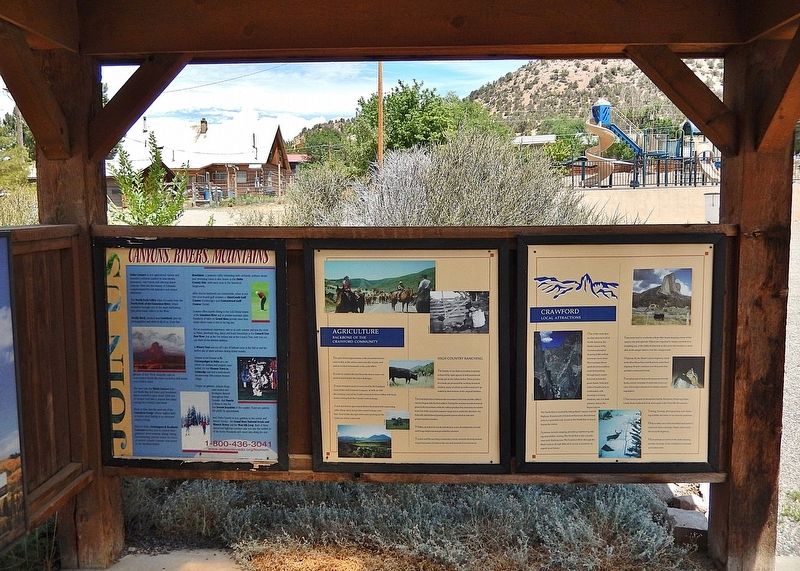
The agricultural opportunities of this beautiful area became reality as the settlers came into this country and staked out their homesteads in the early 1880's. In order to redeem the land from the desert, water was needed and found in the major . . . — — Map (db m291596) HM
As one author put it, “Crawford is a unique cow town, one of the last of its kind in the West.” The boardwalk, old church and adjoining cemetery add western flavor to this center of cattle and sheep ranching. Prior to WWII several of the most . . . — — Map (db m291598) HM
Crawford State Park includes Crawford Reservoir and the immediate surrounding land. This area was initially developed and operated as a recreation area for the public by the National Park Service in 1964. In 1967, the U.S. Bureau of Reclamation . . . — — Map (db m291599) HM
North Fork Harvests Early pioneers recognized that the mild climate of the Hotchkiss/Paonia area, also known as the North Fork Valley, could support quality fruit production, and in 1882 the first orchards were planted. In 1902 the Denver & Rio . . . — — Map (db m291597) HM
Commerce at the confluence began with fur trade — beaver fur pelts snagged by trappers working out of Antoine Robidoux's Fort Uncompahgre trading post. Beaver, fox, coyote, muskrat, and other furs continued to be trapped and traded in the environs . . . — — Map (db m290983) HM
Original storefront approx 25’ wide. Owners through the years: 1894-1910 • F. P. Hunt 1911-1924 • Stockham Bros. 1925-1978 • L. Schmidt & Sons 1978-1988 • Mathews True Value 1989-1994 • Graham True Value 1995- • Remodeled into Columbine Mall . . . — — Map (db m290996) HM
From Delta's first school, 1884 to 1963. This bell hangs under the Lincoln School cupola, which never had a bell because the two schools were located so close. — — Map (db m159565) HM
Built by Wm. R. Gale
Original location -
West side of alley facing East 3rd St.
between Main & Palmer
Moved in 1974 by
Delta County Historical Society — — Map (db m159566) HM
This property has been
placed on the
National Register
of Historic Places
by the United States
Department of the Interior
———————————
United Methodist
Historic . . . — — Map (db m159573) HM
One of the many trading posts built by
Antoine (Anton French) Robidoux,
First built around 1828 at the juncture of the
Grand (Gunnison) and Uncompahgre Rivers
then a territory of Mexico and Ute Indian country
on the well traveled "Old . . . — — Map (db m120059) HM
Antoine Robidoux and Fort Uncompahgre The Story of a Western Colorado Fur Trader / By Ken Reyher, 1998 Fort Uncompahgre was constructed in 1828 by Antoine Robidoux, a trader based out of Mexican Santa Fe. The post was situated about two miles . . . — — Map (db m290981) HM
Born: Arkansas May 18, 1883 To Crawford, Colorado, March 19, 1916
Died: January 22, 1969
Married: Sallie L Noble, Oct 10 1906
Three daughters: Annie Laura, Martha, Leslie Janie
Several abiding interests formed the structure . . . — — Map (db m159571) HM
In Memory of
David Lee Mangum
1947 - 2012
David L. Mangum loved music. As organist for the Delta Presbyterian Church, he brought music to the ears of thousands. In the greater Delta community, he was visible everywhere, offering his time . . . — — Map (db m159568) HM
Follow the Trail It is 1829, eight years after Mexico gained independence from Spain. New Mexican traders travel overland to establish new commercial relations with frontier settlements in California. They carried locally produced merchandise . . . — — Map (db m290975) HM
This bell was used
on the Robert E. Lee
steamboat on the Mississippi
River between New Orleans and
Memphis, Tennessee after the
Civil War — — Map (db m159570) HM
1896 Locally called Anna Dora Opera House for the names of owners' daughters. The upstairs area had a platform and oil lamps for a stage which was used for H.S. graduations, operatic and theatrical events. Social gatherings took place and . . . — — Map (db m290995) HM
Here stood the Farmers and Merchants Bank of which Andrew Trew Blachly was co-founder and cashier. Across Main Street was the Simpson Hardware Store. On September 7, 1893 the bank was held up by the notorious McCarty Gang. Blachly although covered . . . — — Map (db m159552) HM
The Delta Bank Robbery On or about August 20, 1893, the McCarty Gang arrived in the Delta area and set up camp in Escalante Canyon. Tom McCarty, his brother Bill, and Bill's 20 year old son, Fred, had probably departed from the . . . — — Map (db m290986) HM
Architectural Details From afar, tipis display a very symmetrical form, but on closer inspection, their actual "tilted cone" shape comes into view. Steepest in the rear, the tipi wall slopes more gradually on the front side toward the doorway, . . . — — Map (db m290970) HM
The ancient tree was once part of a grove of native cottonwoods under which the local Ute Indians would camp and hold council prior to 1881. An Indian trail passed nearby. It has been identified as the Ute Council Tree since 1930, when the local . . . — — Map (db m290967) HM
The Utes called themselves the “People of the Shining Mountains” and at one time all Colorado was their homeland At one time, this was the land of the Ute, distant cousins of the Shoshones. Historically, the Utes were nomadic and moved . . . — — Map (db m290982) HM
This ancient tree was once part of a grove of native cottonwoods under which the local Ute Indians would camp and hold council prior to 1881. An Indian trail passed nearby. It has been identified as the Ute Council Tree since 1930, when the local . . . — — Map (db m119897) HM
Western Slope Agriculture
According to an 1888 U.S. Department of Agriculture report, western Colorado's thin soils, high altitude, and lack of rainfall rendered the region totally unfit for cultivation. The document’s author apparently . . . — — Map (db m120123) HM
In 1975, the North Fork Historical Society erected six markers along the route of the Dominguez-Escalante Expedition through upper Delta County. These handsomely-routed wood signs designate the route as the “Escalante-Dominguez Expedition.” Indeed, . . . — — Map (db m291397) HM
Purchased in 1897 for the princely sum of $22.90 from the Sears Roebuck Co., this 425 lb. bell adorned the first school in Hotchkiss. It was located where the Town Hall is located today. Later it was moved to the next school built in 1910, . . . — — Map (db m283686) HM
When Kathleen Wheeler arrived in Hotchkiss in 1940, she saw the need for a recreational facility for youth to gather. The American Legion deeded five lots for a community building to honor veterans — especially those who had sacrificed their lives . . . — — Map (db m283573) HM
Hotchkiss Methodist Episcopal Church has been placed on the National Register of Historic Places by the United States Department of the Interior — — Map (db m291399) HM
[1996 Original — E Clampus Vitus marker] In the mid 1930's, this building was constructed for President Franklin D. Roosevelt's Civilian Conservation Corps at Trickle Park on Grand Mesa near Grand Junction, Co. At the . . . — — Map (db m283598) HM
North Fork Harvests Early pioneers recognized that the mild climate of the Hotchkiss/Paonia area, also known as the North Fork Valley, could support quality fruit production, and in 1882 the first orchards were planted. In 1902 the Denver & Rio . . . — — Map (db m186965) HM
On July 29, 1776, ten men set forth on an expedition from Santa Fe, New Mexico, to look for a route to Monterey, California. Father Francisco Domínguez was the leader of the expedition and Father Silvestre Escalante kept the diary. With Indian . . . — — Map (db m291592) HM
224 Grand Ave. The annual 4th of July celebration, Cherry Days, was started by the Paonia Lions Club in 1946 as a community celebration. The first fundraiser was for lights for the Dan Lawrence football field. This picture taken in the 1950s . . . — — Map (db m291398) HM
Ancestral Puebloans
Beginning around A.D. 600, Ancestral Puebloans built Colorado's first permanent towns in the canyon country south of here. Hundreds of these settlements sprawled across the desert, with an overall population possibly . . . — — Map (db m160128) HM
The World War I veterans who claimed homesteads near here in the [illegible] had never fought an enemy quite as intractable as sagebrush. Clearing the land of it required decades of backbreaking hand-to-hand combat. But the army of farmers . . . — — Map (db m160121) HM
[Text blocks, counter-clockwise from top left, read]
• The Unaweep/Tabeguache Scenic and Historic Byway is a remarkable tour through western Colorado's remote canyon country. Copper, radium, vanadium, and uranium all enticed miners . . . — — Map (db m160155) HM
Wishing to erect a suitable memorial in honor of those valiant men, living and dead, who served our country in World War I, World War II and the Korean Conflict, and recognizing the need in Dove Creek and the surrounding area for a modern and . . . — — Map (db m290598) HM
As goes sagebrush, so goes the Gunnison sage grouse. These highly adapted birds rely on this shrubby vegetation for food, camoflage, and nesting material. Sagebrush rangeland also provides the setting for the species' highly unusual . . . — — Map (db m160150) HM
Dedicated to the valiant men
of Dolores County, Colorado
who served their country
and died for the cause of freedom
Duty, Honor, County, Well Done
Be Thou At Peace
World War No. 2
Troy Young • Clarence Barlett
Dick . . . — — Map (db m160119) WM
Why East?
The purpose of Fathers Dominguez and Escalante's journey through this region in 1776 was to find a route to Spanish missions in Monterey. During the first 2½ weeks of the expedition, the Fathers' route took them to the northwest, . . . — — Map (db m160107) HM
An official project commemorating Colorado's 100th year of Statehood and the United States' 200th Year of Independence. Endorsed by the Colorado Centennial-Bicentennial Commission Joe M. Lacy, Chairman Richard D. Lamm, Governor — — Map (db m282996) HM
The Rico area was originally inhabited by natives including the Utes. In the 1700’s Spanish explorers were in the area. In 1833, trappers like W. Walton of the St. Louis Fur Co., came and reported remains of Spanish smelters. Mining began about . . . — — Map (db m118655) HM
R. C. Darling discovered the mine property in March 1878, within the Pioneer Mining District near the confluence of Silver Creek and the Dolores River. Two years later R. C. Darling returned from Santa Fe, New Mexico and filed the Atlantic Cable . . . — — Map (db m282997) HM
The need for a cemetery in Rico came about with the murder of Julius “Frenchy” Burgen on August 31, 1879, by George “The Kid” McGoldric. Rico’s earliest recorded mine fatality was on February 3, 1881, when Fred Herman was overcome by bad air in . . . — — Map (db m282998) HM
On March 15, 1887, excavation for a three-story brick and stone building began on lots at 802 Grand Avenue for the First National Bank building. At the time, The Glenwood Echo newspaper reported that the First National Bank offices would occupy . . . — — Map (db m120089) HM
In 1888, through the ingenuity of developer and engineer Walter B. Devereux, the City of Glenwood Springs was provided with electric lights.
Devereux had been a local leader for the development of hydroelectric power. By 1886, he . . . — — Map (db m120543) HM
From Vision to Reality
Glenwood Canyon has been a critical link in the nation's ground transportation network ever since the completion of the Denver & Rio Grande Railroad in 1887. Later, Taylor State Road, a continuous wagon road between . . . — — Map (db m120263) HM
In the 1930's, America was mired in a deep economic depression. As part of his New Deal program, President Franklin Roosevelt implemented government programs designed to create employment and to stabilize the national economy.
One . . . — — Map (db m120550) HM
The Citizens National Bank Building stands as Glenwood Springs landmark.
The Citizens Building and Improvement Company was founded in 1910. Construction of the Citizens National Bank Building began in January, 1913. The building was completed . . . — — Map (db m120085) HM
"It all started with an empty file folder," recalled David Delaplane. In 1962, Delaplane was settling in to his new office as manager of the Glenwood Springs Chamber of Commerce.
He came across a folder titled "Education Committee" . . . — — Map (db m120846) HM
World War II brought sweeping social changes to Glenwood Springs as tourism, its prime industry, declined. The Hotel Colorado, the Glenwood Hot Springs Pool, and the Vapor Cave saw marked declines in patronage during these years. . . . — — Map (db m120554) HM
In the late 1800's to the early 1900's, saloons, restaurants, and rooming houses occupied this block. In 1904, Frank Walter constructed two buildings - one three-story - in the block. Walter leased the ground floor of the three-story building (406 . . . — — Map (db m120084) HM
The commercial building at 824-826 Grand Avenue was constructed in 1888. The brick building was initially occupied by a hardware store and an agricultural implement shop on the first floor, furnished rooms on the second floor, and a tin shop in the . . . — — Map (db m120102) HM
Sovereign Grand Lodge of Independent Order of Odd Fellows (I.O.O.F) working hard to establish their own permanent meeting place.
After being in many different locations in the downtown, the began construction of their new lodge in 1898. The . . . — — Map (db m120086) HM
Expansion to Hydroelectric
Devereux's dreams for Glenwood Springs' growth were so successful that the demands for his electrical power grew quickly. The years 1887 and 1888 saw the design and construction of the current building, the . . . — — Map (db m120133) HM
Beginning in the 1870's Italians came in great numbers to Colorado. The Roaring Fork Valley's Italian immigrants performed the hard, dirty work wanted by no one else. Most were coal miners who worked the mines at Sunlight, Spring Gulch and . . . — — Map (db m120548) HM
Glenwood's Oldest Established Cemetery
Linwood Cemetery is Glenwood Springs' oldest existing cemetery and is known by several other names; Pioneer, Hill, Glenwood and Doc Holiday's. The name Linwood has been used since the cemetery's . . . — — Map (db m191017) HM
This current address has incorporated numbers 827 and 829 Grand Avenue. The earliest maps show buildings on this site since 1888, but the year 1913 has J.F. McCoy constructing his building. In 1917, the State of Colorado purchased the building for . . . — — Map (db m120087) HM
What is a Potter's Field?
As you stand in the central plaza of Linwood Cemetery, the path ahead to the east takes you to the Potter's Field section of Glenwood Springs' oldest established burial ground. A Potter's Field is the section of a . . . — — Map (db m191234) HM
This site - Lot 9 Block 45 - housed what in later years would be known as the Rex Hotel. Glenwood Springs founder Isaac Cooper first owned the property, but between 1887 to 1892, ownership changed hands several times. During this time, several small . . . — — Map (db m120082) HM
In 1906 Henry Bosco had a whole liquor and Coca-Cola bottling business operating in the basement of a saloon at 414 Seventh Street. Within a few years, Henry purchased the building that housed his business and the adjacent lot to the east. In 1915, . . . — — Map (db m120083) HM
The Vision
The year was 1886. Walter Devereux, a wealthy silver mining venture capitalist from Aspen, turned his vision downvalley to Glenwood Springs to develop the next world
class resort. The area's climate, rich land, rivers and free . . . — — Map (db m120130) HM
The original building at this site was built in 1883 and was called the Hotel Colorado. It was quickly found too small for its needs and plans were made to replace it.
In 1884, Isaac Cooper, William Gelder, and Joseph Enzensperger made plans . . . — — Map (db m120095) HM
The growing town of Glenwood Springs needed pure water, piped into homes and businesses, despite the effort and the cost.
In February 1887, the Board of Trustees advertised statewide for construction bids to build a town water . . . — — Map (db m120535) HM
A blinding snowstorm reduced Engineer Hartenberg's vision as he guided the D & RGW passenger train No. 1 through Glenwood Canyon. It was 11:30 the night of February 1, 1899, as the train passed Shoshone headed for Glenwood Springs. . . . — — Map (db m120545) HM
The Roaring Fork Valley's coal fields sparked a war of expansion between two railroads: the Denver and the Rio Grande Railroad and the Colorado Midland Railroad. In 1886 the Colorado Midland proposed building a line to Aspen.
Knowing that . . . — — Map (db m120532) HM
In 1893, this two-story building served as a general merchandise establishment. Daniel Barry operated his business here until 1897. Cohn, Doll & Co (later Doll Bros. and Smith) operated a dry goods and general merchandise store here, followed by the . . . — — Map (db m120103) HM
In the early days of New Castle, horses were at the center of all activity. The building before you was where that activity happened. C.H. Noren & Son, who rented horses and rigs for hauling, operated the livery business. Later Levi Strauss and A . . . — — Map (db m120105) HM
The Jolley Trail is named after a longtime New Castle family that ran sheep and lived on the land this trail traverses today.
In 1919 the Jolley Brothers — Herb, Malcolm (Mack), Henry and Lee — who were some of the first sheepmen . . . — — Map (db m120108) HM
This memorial is placed in honor of the men who lost their lives in the coal mines of New Castle.
Vulcan Mine - February 18, 1896
Thomas Addison·Gabriel Gleese·Angelo Petrico
Alphonz Baldis·John Gumbard·Phillip Preola
Peter . . . — — Map (db m120120) HM
The Independent Order of Odd Fellows insignia still appears on the façade of this building, built in 1990. As with many early buildings, the ground floor was used for commercial purposes. Here the ground floor was occupied by a saloon, later by J.W. . . . — — Map (db m120119) HM
St. John's is New Castle's oldest existing church. The cornerstone of the building was laid on
November 2, 1908 and the first service was held on Easter Sunday, April 11, 1909. There has been very little change to the exterior of the building . . . — — Map (db m120107) HM
In 1905, Colorado state senator Edward T. Taylor said, "I hope that someday our road will be a portion of a grand boulevard stretching across the nation." Taylor referred to the 12.5-mile gorge known as Glenwood Canyon. Today, the canyon road is the . . . — — Map (db m120136) HM
Glenwood Canyon inspired the finest hour in American rail travel. During World War II a railroad official rode through here in the cab of a diesel freight locomotive. The view from the panoramic windshield so impressed him that he began steps to rig . . . — — Map (db m120140) HM
Community Legacy Located at the crossroads between the rugged mountain ranges and the mesas and plateaus of Colorado's Western Slope, the region surrounding Battlement Mesa and Parachute was once the seasonal campground of the Ute . . . — — Map (db m252137) HM
The Battlement Creek Fire of 1976 started on Sunday, July 11 after a severe lightning storm came through the Parachute and Morrisania communities late in the afternoon. Lightning was concentrated in and around the Eames Orchard area of Morrisania . . . — — Map (db m252111) HM
The Robbery
On June 7, 1904, an outlaw named Harvey Logan attempted one of the west's last train robberies near here. Also known as Kid Curry, Logan was a member of Butch Cassidy's notorious "Hole in the Wall" gang.
When the westbound . . . — — Map (db m67922) HM
Rifle
During the U.S. Geological Survey of 1876, A.C. Peale wrote the word "rifle" on his map to mark the location of a misplaced firearm. The gun was never found, but the name stuck. Founded in 1882, Rifle attracted a steady flow of . . . — — Map (db m120749) HM
The rocks that make up this landscape formed in environments that are very similar to ones we can observe on the earth's surface today as well as ones that occur beneath the surface where tectonic plates collide to form mountain ranges.
Kayenta . . . — — Map (db m159711) HM
While this might look like a glacial U-shaped valley, it is not. It is a canyon formed by flowing water. The story is one of different rocks responding to erosion in different ways.
Hanging Canyon
Notice how the profile of this canyon . . . — — Map (db m159762) HM
[Left side historical photo captions read]
With his climbing partner Rae Kennedy, and photographer Whipple Chester, John Otto became the first person to summit Independence Monument.
Otto had been in the area five years by then. When he arrived . . . — — Map (db m159662) HM
He laid the foundation of the National Park Service defining and establishing the policies under which its areas shall be developed and conserved unimpaired for future generations. There will never come an end to the good that he has done. — — Map (db m159637) HM
Take the short stroll to a spectacular and unique viewpoint to discover more about the Monument's geology and high flying birds.
Bird Habitat
The airspace above the protected canyons is the domain for a diverse variety of birds.
The Oldest . . . — — Map (db m159709) HM
Does the shape of Independence Monument help tell the park's erosional story? It depends on your viewpoint. From here the monolith appears to be shaped like a tower, but the sideview shows that it is the remaining piece of a rock wall between . . . — — Map (db m159647) HM
Erosion produces unusual shapes on the landscape. As the protective Kayenta Formation layers erode from the ridge before you, the softer Wingate Formation beneath it is exposed and responds in a unique way. Early visitors throught these shapes . . . — — Map (db m159759) HM
Twenty-three mile Rim Rock Drive was built almost entirely by using picks, shovels, and sheer muscle to remove massive rock and debris. The engineering skill of the workers can be seen today in the tunnels and stonework. With construction came a . . . — — Map (db m159715) HM
With around 20 switchbacks, this old road was once called the "crookedest road in the world." In 1961, the Serpents Trail was converted to a hiking trail, quickly becoming a local favorite. The scenic path curves back and forth through Wingate . . . — — Map (db m159612) HM
Reportedly, in October 1899 Butch Cassidy and several members of the Wild Bunch, also known as the Hole-in-the-wall Gang, travelled through Grand Valley.
From 1889 to 1904 this band of desperadoes thrilled local citizens and terrified many . . . — — Map (db m104504) HM
About the Diamond
The Dinosaur Diamond Prehistoric Highway (Dinosaur Diamond) is located in eastern Utah and western Colorado. Three-quarters of the 512-mile loop are within Utah. The segment within Colorado was designated the Dinosaur . . . — — Map (db m159772) HM
A Brief History
Fruita was founded in 1884 by William E. Pabor as a fruit growing colony. Pabor's early efforts to create a commercially viable fruit industry between California and the upper Midwestern states led to the Grand Valley . . . — — Map (db m159775) HM
243 entries matched your criteria. The first 100 are listed above. Next 100 ⊳